Arctic Ocean’s salinity balance at risk, new model shows
DOE/LOS ALAMOS NATIONAL LABORATORY

LOS ALAMOS, N.M., February 24, 2021–The Beaufort Sea, the Arctic Ocean’s largest freshwater reservoir, has increased its freshwater content by 40 percent over the last two decades, putting global climate patterns at risk. A rapid release of this freshwater into the Atlantic Ocean could wreak havoc on the delicate climate balance that dictates global climate.
“A freshwater release of this size into the subpolar North Atlantic could impact a critical circulation pattern, called the Atlantic Meridional Overturning Circulation, which has a significant influence on northern-hemisphere climate,” said Wilbert Weijer, a Los Alamos National Laboratory author on the project.
A joint modeling study by Los Alamos researchers and collaborators from the University of Washington and NOAA dove into the mechanics surrounding this scenario. The team initially studied a previous release event that occurred between 1983 and 1995, and using virtual dye tracers and numerical modeling, the researchers simulated the ocean circulation and followed the spread of the freshwater release.
“People have already spent a lot of time studying why the Beaufort Sea freshwater has gotten so high in the past few decades,” said lead author Jiaxu Zhang, who began the work during her post-doctoral fellowship at Los Alamos National Laboratory in the Center for Nonlinear Studies. She is now at UW’s Cooperative Institute for Climate, Ocean and Ecosystem Studies. “But they rarely care where the freshwater goes, and we think that’s a much more important problem.”
The study was the most detailed and sophisticated of its kind, lending numerical insights into the decrease of salinity in specific ocean areas as well as the routes of freshwater release. The experiment unexpectedly showed that most of the freshwater reaches the North Atlantic (the Labrador Sea) through a narrow set of passages between Canada and Greenland, called the Canadian Archipelago.
The traditional view had mostly considered liquid freshwater transport in the form of sea ice via the Fram Strait (a passage between Greenland and Svalbard). The freshwater release was shown to significantly reduce the salinities in the Labrador Sea–a freshening of 0.2 practical salinity units (psu) on the western shelves and 0.4 psu locally in the Labrador Current.
However, the modeled release was based on freshwater volumes of the past, from the 1990s. Now, that volume is significantly greater, more than 23,300 cubic kilometers, owing to an unusually persistent circulation pattern called the Beaufort Gyre and to unprecedented sea ice decline. If this very large volume of freshwater is released into the North Atlantic, the impacts could be correspondingly very large as well. The exact impact is still unknown. “Our study of the previous release event offers a picture into the potential impacts of a future, larger release,” Weijer said.
The model used in the study was also partly developed at Los Alamos. It is the Energy Exascale Earth System Model version 0 (E3SMv0), which incorporates LANL’s Parallel Ocean Program (POP) and its powerful sea ice model, CICE.
“This work is a great example of Los Alamos’s innovative ocean modeling approaches; and it also demonstrates the Laboratory’s leadership in high-latitude climate science through projects such as the High-Latitude Application and Testing of Earth Systems Models (HiLAT-RASM),” Weijer said.
###
The paper: “Labrador Sea freshening linked to Beaufort Gyre freshwater release.” Nature Communications. Jiaxu Zhang, Wilbert Weijer, Michael Steele, Wei Cheng, Tarun Verma, and Milena Veneziani. DOI 10.1038/s41467-021-21470-3
The funding: This research was funded by the U.S. DOE Office of Science, a LANL LDRD award, a CNLS postdoc fellowship award, and the NOAA.
About Los Alamos National Laboratory
Los Alamos National Laboratory, a multidisciplinary research institution engaged in strategic science on behalf of national security, is managed by Triad, a public service oriented, national security science organization equally owned by its three founding members: Battelle Memorial Institute (Battelle), the Texas A&M University System (TAMUS), and the Regents of the University of California (UC) for the Department of Energy’s National Nuclear Security Administration.
Los Alamos enhances national security by ensuring the safety and reliability of the U.S. nuclear stockpile, developing technologies to reduce threats from weapons of mass destruction, and solving problems related to energy, environment, infrastructure, health, and global security concerns.
LA-UR-21-21767
But since the ice volume has stabilized and now likely growing, “no problem found”
?
We are not out of dire consequences or straits…… since havoc could still be wreaked….according to Professor Zhang. Cold waters run deep….and the dreaded fresh water runs deeper….and all the time the ice is getting thinner…better sound all alarms, no?
It’s late and I am no expert in the best of times, but isn’t salt water denser and runs deeper than fresh water? Or am I missing /sarc?
Yes, go to the Dead Sea and you will see that you can float easily. Cameras at the botom of the Gulf of Mexico reveal brine pools and streams….sort of whitish in color….just very high concentrations of salt water.
Of course, most of the time since we came out of the last glacial period the Arctic had substantially less ice than today. I like to think that we are just reverting to the mean.
“and all the time the ice is getting thinner…”
Bare face lie. Someone should look at Arctic ice extent/volume/thickness since 2012. Essentially no trend.
2012-2013 was a 65% INCREASE in ice volume in October ( the closed month of data to the late Sept ice min. ).
so “all the time ” NO ! What he is probably referring to is fitting a linear regression to all the data since 1978 to present and getting a negative slope. That is not getting thinner “all the time”. That is reducing the entire record of over 40 years of daily data down to a single scalar quantity: one number. What is the point of the billions spent on data collection if our “scientists” are going to reduce everything to a trivial and uninformative single number.
They also fail to mention that fresh water freezes at 0° Celsius (32° fahrenheit).
Arctic temperatures should have frozen all of that fresh water solid.
Interesting that this type of event was once billed as the beginning of an ice age. I don’t see where they’ve said that global warming could cause the return of glaciation.
I’m sure they’ve said it somewhere. You name it they’ve said it. Notice too that any change is always bad. Funny that..
Yup. Like the comment that it might be “…putting global climate patterns at risk.”
At risk of what, a reasonable person might ask? Well, they don’t really know, do they, But they know it must be bad.
But probably not as bad as a “virtual dye tracer”, whatever that may be. I’m almost frightened to ask. Having made up the imaginary results by computer, are they now making up the results of individual experiments to justify the pre-existing conclusions?
According to the ice cores we always re-glaciate when CO2 is at its highest.
Well energy only leaves the planet via radiation, and CO2 is a radiative gas.
Could the sine wave be turning back to a global cooling scare?
This type of event happened every 7 years or so when the AMO was negative. ( Correlation only?) It will certainly happen again, and when it does there is no guarantee, or even likelihood that all or most of the water will exit the arctic before it reverses.
Everything is dramatically expressed these days.
AMO should be NAO for North Atlantic Oscillation.
The main task of sea ice is to prevent the arctic ocean from losing heat to the atmosphere. So less sea ice will mean a colder arctic ocean.
The question is if the summer sun can compensate the lost heat in winter? How deep can the sun’s energy penetrate the surface of the arctic ocean ? Back radiation from CO2 can certainly not .
The thinner atmosphere over the arctic zones is no help for the heat to escape to space.
My experience of swimming on the coast of Northern Norway, above the Arctic Circle, is that even after many days of constant 24 hour sunshine and 30degC temps, the sea, even very close to land, remains barely above freezing!
Not very scientific, but then, I’m an engineer.
Sea ice doesn’t have a “task”. Ice is ice. We needn’t personify it. That is what the alarmists do. Arctic scientists have a somewhat sordid love affair with ice.
Ice is kind of nice in a tall, cold drink on a Texas summer day though.
Actually, less sea ice can warm the air in the arctic, as sea water is warmer than the ice. However, because artic air is also very dry, that heat in the atmosphere can escape to space fairly easily.
As the water cools, it sinks. When the water sinks, warmer water from places south get pulled in. Further warming the arctic.
The end result is that the loss of sea ice in the arctic means an increase in the flow of heat to the arctic, which means the planet as a whole cools.
The reflectivity of the Arctic Ocean varies from about 10% to 100%, with the proportion of sunlight entering the open water being (100% – reflectivity%), i.e. 90% to 0%. However, because of the cosine law, the sunlight is weak, being comparable to to the early-morning hours in the mid-latitudes. Most of the sunlight is absorbed in the upper part of the water.
A more direct answer to your question is that it was once tropical in the Arctic. Despite all open water, it eventually became cold enough for pack ice to form. So, it all depends on the specific conditions to predict what will likely happen.
The WOI (word of interest) here is that funny “could” in the title…
They made a movie that proved that global warming could cause a return of glaciation.
Hollywood would never lie to us. Would they?
Texas froze over because of global warming. (Sarc).
“If this very large volume of freshwater is released into the North Atlantic, the impacts could be correspondingly very large as well. The exact impact is still unknown.“
Equally, it could be very small. It may be beneficial or it may be detrimental.
Essentially, they have no idea.
However the tone of concern that permeates the quotes looks like the classic “more research is needed – give us more money – quickly!”
I think it should be “some research is needed”. This “study” used virtual dye tracers and numerical modelling. No research done yet.
Yes, it fits the definition of a Scientific Wild Ass Guess, SWAG.
I’m guessing why fresh water is prevalent in the upper layer of the arctic ocean.
Salt is rejected from frozen water. If you melt sea ice, you will get fresh water.
The corollary is that the water beneath the fresh water/ice is more saline.
My wild ass guess is that the overall salinity of arctic waters is not much different than other ocean water.
From the I would never have guessed department:
So, low salinity water flows in from the Pacific and tempers the climate in the Atlantic. It doesn’t sound like fresh water flowing into the Atlantic from the Arctic is much of a problem.
It also looks like my guess about the overall salinity of arctic waters is wrong. On the other hand, the top layer of arctic water is described as a fresh water lens, so it’s quite stratified. Another paper describes the fresh water layer as 50 – 150 m thick, which is quite a bit more than I would have guessed.
The sea ice which covers the Beaufort Gyre in the winter is 4m+-. I think the “fresh water layer” isn’t really fresh water, but brackish but less saline when the ice melts. It’s all a relative thing.
The Chickahomony River comes into the James River estuary near where it opens into the southern Chesapeake Bay and the Atlantic. You can fish for fresh water species like bass and blue gill on the surface and drop crab pots and catch blue crabs, which are salt water lovers in the same spot, so stratification is definitely a possibility.
“The sea ice which covers the Beaufort Gyre in the winter is 4m+-.”
Don’t know where you saw that, but it’s now more like 1-2m according to the Naval Research Laboratory. Probably none over 3m in the entire basin these days.
 ?ssl=1
That was meant to be a link from this page: https://wattsupwiththat.com/reference-pages/sea-ice-page/
No wonder they call you l’dodo !!
Beaufort Gyre is about where the red circle is .
Small amount of 1.5m
Mostly 2.5 – 4.5m
.
Is it IGNORANCE or just A DESPERATE NEED TO LIE that makes you comment ?
Straight for the insults, how persausive.
So let’s get this straight. There is less ice, therefore less fresh water. But as it melts, it creates MORE fresh water?
Poor l’dodo, most of the Beaufort Gyre even in that indistinct low-resolution map is still in the 2-2.5 m with areas reaching 3.5 and bit of red.. which is 4m
Why show you are totally CLUELESS even of the region you are yapping mindlessly about.
Hilarious, that even your own information PROVES YOU WRONG. l’dodo !
Is it IGNORANCE, or was it just plain bad luck that you were born without even 2 brain cells to create a spark !
What fact is ’til today, Feb 15th was the day with maximum extent of 14,594
The data seems not bo be accurate since Feb, 19th, they have problemsto fix these possible errors.
http://nsidc.org/data/seaice_index/images/daily_images/N_stddev_timeseries.png
Yep, 19th, somethings gone wrong with NSIDC
no data or junk data.
You have a larger scale map; no wonder you can’t distinguish the relatively smaller thicker ice areas
He also had data which refuted your point.
Not surprised that you missed it.
FACTS mean nothing to loy-dodo.
To what do you attribute the differences in the maps?
Those above are model based Clyde. This one is a merging of data from two satellites.
https://forum.arctic-sea-ice.net/index.php?action=dlattach;topic=3299.0;attach=293033;image
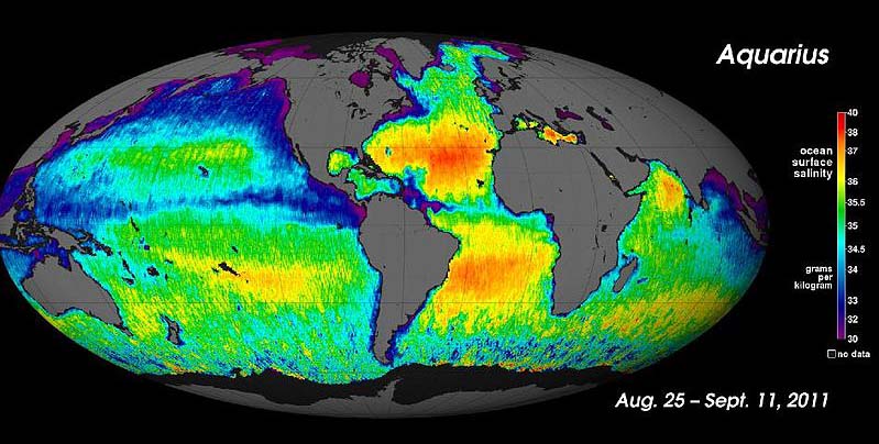
This seems to be another instance of ‘scientists’ being loose with definitions, to scare the public. That is, they are calling, what is at best, brackish water, freshwater. It appears that the water has about 99% of the salinity of ‘typical’ ocean water. Therefore, it should probably be referred to as low-salinity water. My Rule of Thumb is that when researchers choose to use words that are inappropriate and do not properly describe the situation, it is because there are ‘skating on thin ice.’
“Total salinity in the open ocean averages 33-37 ppt (equivalent to psu or practical salinity units as referred to in the article-R) , but it can vary significantly in different locations. But since the major ion proportions are constant, the regional salinity differences must be due more to water input and removal rather than the addition or removal of ions. Fresh water input comes through processes like precipitation, runoff from land, and melting ice. Fresh water removal primarily comes from evaporation and freezing (when seawater freezes, the resulting ice is mostly fresh water and the salts are excluded, making the remaining water even saltier). So differences in rates of precipitation, evaporation, river discharge, and ice formation play a significant role in regional salinity variations.” https://rwu.pressbooks.pub/webboceanography/chapter/5-3-salinity-patterns/
The article says “The freshwater release was shown to significantly reduce the salinities in the Labrador Sea–a freshening of 0.2 practical salinity units (psu) on the western shelves and 0.4 psu locally in the Labrador Current.”
The Gyre has an ion concentration of +/-30psu.
What the authors are describing is a seasonal freshening of 0.2psu from melting ice followed by a seasonal re-concentration of 0.2psu from freezing of ice. In other words a seasonal oscillation.
Hair on fire. Send moar mony$.
If the rotation of the BG reverses it is understood that considerable colder water will enter the Atlantic. It has happened many many times.
The inflowing Atlantic realitively warm water is isolated from the sea surface, and also the underside of the sea ice, by an intervening layer of lighter, colder, fresher Arctic water.
The water from the Atlantic is saltier than the water of the Arctic (more ice = less salty water), and thus the incoming water is denser and will flow northward into the Arctic Basin underneath the surface water. It is also good to remember that water at 39 F is denser just due to T, saltier intensifies and broadens the density brackets of water warmer then the cold layer just below the ice.
The Atlantic Water (AW) flows into the Arctic Ocean between 40 and 200 meters deep. At the middle of this flow, the water is about 4°C warmer than the overlying, colder, relatively fresh water. This drastic change in temperature in the vertical water column is called a “thermocline,” and acts a barrier for upward heat flow. In this case, the thermocline also acts as a “halocline” – a dustinct change in saltiness of the water layers. This layering phenomenon is called stratification. Thus, because the warm AW influx is warmer and saltier, the water remains stratified in the absence of turbulent vertical mixing, and the heat is not released to the surface ocean, sea ice, or atmosphere and climate! The ice is an insulator as well.
The freezing point of salt water is 28.8 °F, and the waters below the surface of the ice remain just above this temperature.
The waters of the Arctic Ocean can be divided into three subsections: Arctic Surface Water (0 to 656 feet); Atlantic Water (650 to 2,950 feet); and Arctic Deep Water (2,950 feet down to the sea floor). Average temperatures of the Arctic Surface Water range from 28.6 °F to 30.2 °F, Except where the warm Atlantic currents flow into the Arctic. the Atlantic Water has an average temperature of 37.4 °F, and Arctic Deep Water has a temperature range of between 30.6 °F to 35.6 °F.
No matter what happens to whatever it is blamed on Global Warming and therefore CO2. How does anyone take any of this seriously? Climate changes – stuff WILL happen – adapt.
” adapt.”
I’m sure if we fly really fast in against the spin of the Earth we may be able to return to the good old days of the pre-industrial when nothing changed and everything was good.
I thought Dr Mann declared that the MO did not exist?
These salinity anomalies are a regular feature of that region it seems with about one per decade recorded since 1960 but their climate change interpretation is something new.
https://tambonthongchai.com/2020/02/11/agw-salinity-anomaly/
A change of 0.2 to 0.4 PSU in an ocean area of 35PSU doesn’t seem large to me. It’s also seasonal and not permanent.
GIGO? So there is less sea ice, and freshwater is increased. Since sea ice is presumably less saline than the oceans, due to precipitation on it, that should mean LESS fresh water in the future, right? Or did the model NOT account for that? Sorry, but I am not properly frightened yet, and see no reason for this to be considered an emergency. Even if it was, what can be done about it? OH I KNOW!!! CREATE ANOTHER MODEL!!!
This current interglacial period we are in has lasted thousands of years longer than the average of the last half million year’s brief warm cycles. I would not bet even a bacon double cheeseburger that the current century will end … “warmer”.
This study came outta Los Alamos ?!?
These dudes and dudettes need to get back to making bombs.
Seems to me that’s exactly what they did. 🙂
My rule of thumb is, if a headline contains a weasel word like “might”, “may”, “could”, or the like, it can safely be ignored.
Yeah, it might could be possible that I may win the lottery three times in a row … but the odds aren’t great.
w.
As should papers submitted to the journals.
Maybe create a weasel word index for any paper submitted?
A new scientific discipline: The calculus of weasel words.
I have planned such project. Really.
You will most likely find something if you’re looking for it.
Yes. It happens a lot in matters of anti-pesticide/herbicide campaigning, I call it Lab-Coat-For-Hire.
Particularly if you build it into the model you simulate your “findings” with !!
Dunno, since did not bother to read this,paper. We do know that spring freshwater melt changes the Arctic, a lot. We do know that Arctic winter snow pile up contributing to spring melt depends on lows coming into the Arctic, since otherwise is too cold and dry. But we dunno why that weather occurs. Oceans, or unicorns? Nor how that weather might become climate.
Last 20 years>’
Sounds like it covers the warm phase of the AMO.
Uprecedented ice loss? How about 8k-6k bp when ice was only seasonal
“the researchers simulated the ocean circulation and followed the spread of the freshwater release.”
Mathematical onanism. If they don’t stop it, they will go blind.
I call “Bullshit!!” on this claim of a sea which is really just a salt water ocean like all our oceans.
Unless our oceans are only 10 meters deep (which only happens in climate model fantasy-land are they that thiccccccc), then a couple meters of less saline water on the top will get mixed with wind and currents. It’s a Total BS rent-seeking claim to “investigate further” with OPM and ride the climate gravy train.
No, it does not easily mix much. The ice shields it from the wind. It is less dense. The inflowing Atlantic water is warmer and denser. Water max density is 39 F Freezing T of Sea ice is 28.2
However it is nothing new, has happened for thousands of years, and it is very unlikely that all this relatively colder water will suddenly be dumped into the Atlantic if the BG reverses rotation.
“could wreak havoc”
–
You can’t go wrong with a qualifier like “could”.
The Paper says “could”.
Automatic fail.
WOW, seems the Arctic must have been mostly fresh water for most of the Holocene. !! 😉
Current sea ice level is WELL ABOVE what it has been for most of the last 10,000 years
Old story.
New technology allows to measure new things.
To get new grants, one has to sell the results.
The more dangerous and desastrous the results could be, the more money they get.
Here’s a more accessible version of the information:
Atlantic Ocean circulation at weakest in a millennium, say scientists | Environment | The Guardian
“The Atlantic Ocean circulation that underpins the Gulf Stream, the weather system that brings warm and mild weather to Europe, is at its weakest in more than a millennium, and climate breakdown is the probable cause, according to new data.
Further weakening of the Atlantic Meridional Overturning Circulation (AMOC) could result in more storms battering the UK, more intense winters and an increase in damaging heatwaves and droughts across Europe.
Scientists predict that the AMOC will weaken further if global heating continues, and could reduce by about 34% to 45% by the end of this century, which could bring us close to a “tipping point” at which the system could become irrevocably unstable. A weakened Gulf Stream would also raise sea levels on the Atlantic coast of the US, with potentially disastrous consequences.”
The Guardian, now that thar is funny.
When they get to the point that they are willing to say “will” instead of “could,” I’ll take them more seriously.
and while we are talking about the arctic…
Arctic ice loss forces polar bears to use four times as much energy to survive – study | Arctic | The Guardian
Did they interview all the polar bears or just the weaker looking ones?
Once again, the Guardian.
Can you still get to your fridge?
MORE ABSOLUTE BS from the griff ameoba.
Because PB’s don’t have to travel so far to get food, they use LESS energy
You do realise that they survived well during the whole of the Holocene, when Arctic sea ice was MUCH LESS than it currently is.
STOP DENYING CLIMATE CHANGE, griff,
Engage that single cell in your addled brain, just for once.
Wait! I thought there was a shortage of fresh water. Canada is missing out on a lucrative export.