By Julius Sanks
A good way to distinguish between a reasonable climate discussion and fear-mongering is to examine the data. Fear-mongering will contain incomplete data, or none at all. The person mongering fear expects us to take the claim on faith. But we don’t have to. Sometimes it is ridiculously easy to check the claim.
A case in point is a recent article titled “How map of Britain will change in next 80 years as towns and cities fall into the sea” [sic] by Sam Elliott-Gibbs. Note the headline emotionally and deceptively implies they will “fall,” but the text goes on to discuss sea level rise based on air temperature. The article cites Climate Central to claim large areas of England will be under water by the year 2100. The only evidence provided is a couple of maps built on Climate Central’s interactive mapping tool. Climate Central uses topographic data to forecast flooding based on sea level, and blames sea level rise on climate change.
Climate Central bases its sea rise forecast on material that is mostly speculative. It cites the IPCC and a NOAA report. The NOAA report is actually a group effort involving several government agencies, none of which, except NASA, are directly involved in atmospheric science. The NOAA contribution comes from the National Ocean Service, not the atmospheric side. These sources extrapolate sea level rise from 2020 into the future.
But sea level change is something we can check and compare with Climate Central’s claims. We have used radar aboard satellites to measure sea level quite accurately since 1992, when the TOPEX/POSEIDON satellite was launched. That was the first time we could collect worldwide data. All earlier information is based on point, not worldwide, sources.
According to Climate Central, Peterborough, England will be on the coast in the year 2100. The town is 8 meters above current sea level, so that is how much the ocean must rise. Will it?

Climate Central claims the red area will be under water in 2100. 80 years of ocean rise? Probably not. Source: Climate Central.
According to NOAA’s Laboratory for Satellite Altimetry — unsurprisingly, not one of Climate Central’s sources — sea level rise is quite linear. The actual rate is 3.1 ± 0.4 millimeters per year. At that rate, it would take 2,580 years for the ocean to reach Peterborough. The ocean would have to rise 100 millimeters per year — more than 30 times faster than it actually does — to soak the town in 2100. It is worth noting the NOAA report does not predict anything near an 8 meter rise in 80 years. Its worst, and therefore least likely, case is 1 to 2 meters.

30 years of actual sea level rise. The colored bars indicate service lives of four satellites used to get the data. JASON-3 remains operational. Source: Laboratory for Satellite Altimetry.
Climate Central needs more than a fancy interactive map to make a convincing case sea level will change that drastically.
Julius Sanks is an engineer with experience developing weather satellites and weather forecasting systems for the US Air Force and NOAA.
It is not going to rise a lot, as long as Antarctica refuses to warm and/or melt. Meanwhile Gavin Schmidt is kindly asking to find more melting..
https://agupubs.onlinelibrary.wiley.com/doi/10.1029/2019GL086892
That is opposed to a reality with some 150Gt/yr at best, and other research suggesting the Antarctic is not melting at all. Of course the reason for his implicit request is that he wants to explain the lack of warming in the southern ocean. If there was plenty of meltwater, that could do the trick, he thinks. It only needs to be found.
Anyway, the problem is far more severe. It is not just about no warming at the very south, the whole “global” warming is totally assymetric and this is a bit in contradiction with a GHG driven warming, which should be global. And once we consider the alledged cooling by aerosols (or pollution) in mid NH latitudes, it only gets worse.
So that is why this assymetry needs to be addressed. It threatens the whole GW theory..
https://greenhousedefect.com/contrails/aerosols-in-climate-science
Good point. If we can’t do science, we can project something that’s not happening, call it “plausible,” and pretend we’re doing science. Then, in our “plain language summary” we take out all the weasel words so most people won’t notice that we’re ignoring real-world evidence. From Gavin Schmidt et. al.’s Abstract:
“Here we demonstrate that the addition of a plausible increase in Antarctic meltwater to a coupled climate model can produce a closer match to a wide range of climate trends.”
First of all there’s only one planet, so there is only one climate trend, not “a wide range” of trends. Second, “addition of a plausible increase” to anything, not supported by actual data, is so far removed from real science as to be laughable.
That’s how it is done. I guess they call it “the golden rule”. LOL
First build a theory, then fudge the data to support it.
“a range of between 300 and 800 Gt/yr”
Doesn’t seem very scientific to have such a huge range. Real science is when a physicist says the mass of a proton is 1.67262192 × 10⁻²⁷ kilograms.
Maybe Denver should be called the Mile and 10 Centimeter High City.
If I remember correctly, you have to go half way up the City Hall steps in order to get to a mile high.
It’s engraved on one of the steps of the Colorado State Capitol Building. Perfectly centered too.
When sea level rises 8 m., Denver will not be a mile high anymore.
With an uncertainty of several standard deviations for the proton. One is lucky to see one sigma on most climatology data. Schmidt’s estimates only have one significant figure, not nine.
“assymetry”
Is this a porn site now?
asymmetry.. sorry!
🙂
Measuring ass is what weight-watchers do. Most have so much ass, there is not much chance of any “porn” happening.
“It threatens the whole GW theory.”
I don’t think it qualifies as a theory – probably not even a hypothesis.
I’m not even sure it qualifies as a hypothesis
More like a wild ass guess
Given there is:
1. No data making AGW even plausible, much less, likely.
AND
2. There is anti-data dis-proving AGW,

you are correct.
That change with latitude reminds me of how the amplitude of the seasonal CO2 varies. That is, it helps reinforce the hypothesis that warming is driving CO2 buildup in the atmosphere.
It’s a travesty that we can’t account for the lack of water at the moment.
It’s probably “black water” and “black heat”. If it explains the Big Bang, then it must explain Climate Change.
Oh good. We’re still doomed.
For the last 50 years, and counting.
No no. More money will correct doomism. Send yours in today.
It will only potentially prevent doom. Only a perpetual and continuously increasing stream of funding can provide a reasonable assurance of preventing doom.
Did you intend to have you email address showing publicly?
Whether or not sea level is measured correctly by satellites is questionable. The world’s tide gauges when corrected for elevation changes of the gauges themselves, show sea level rising at about 1.6 mm/yr. Geologic studies of peat bog and river sediments show an average sea level rise of about the same as tide gauges do but over the span of the past 6,000 years. Both of these measurements are about half that of NOAA satellite measurements. I have never seen an explanation of this difference. Also, neither measurement technology explains why sea level is changing. Is it ocean temperature? Is it melting ice? Is it change in the volume of the ocean basins as continents drift about and subsea volcanos discharge lava on to the ocean floor? And what of the accuracy and precision of both measurement systems. I can understand a physical level gauge measuring to within +/- 1 mm or less but how can a satellite a couple hundred miles away with a position known only to within a few feet measure the undulating frothy ocean surface with such accuracy? Many puzzlements remain.
According to NOAA, the best technology tidal gauges have an uncertainty of +/- 2.5 cm (not mm) if I remember correctly. Older measurements of marks on a stick in the water are no doubt less accurate.
Satellite sea level measurements have a specified uncertainty of about +/- 4.5 cm, about because more recent satellite measurements are supposedly less uncertain by a mm or 2 (with a claimed resolution of +/- 5 cm?).
There are many issues with measuring sea levels, both ground based and satellite, one of the biggest is the fact that the seas aren’t smooth. Even calm seas have waves and ripples. There are methods for limiting this distortion, but those methods introduce their own brand of uncertainties.
There is also the fact that even small breezes can push water around. Low pressure areas suck water in, while high pressure areas push water away. Over longer periods there are changes in the volume of the ocean basins, as others have noted.
One constant with almost all climate scientists is there tendency to put unscientifically low confidence intervals on the numbers they produce. They like to pretend that they have figured out what all the sources of error are and that their methods for dealing with these errors are perfect.
Tide gauges are not just floats on a stick. The gauges are typically cylinders with a small opening at the bottom to let water in and out slowly to dampen wave motion. Keeping the opening clear is one of the many maintenance actions required to keep them working.
And that tiny little reading (1.6mm) is 2 things (you know both of them)
Urban xxxx IslandsSoil ErosionThey are both the exact same thing – in almost every sense.
Consider the city first in that, when it rains, cities are impervious.
Thus all rainwater goes straights into drains – of all variations/meanings/variations ##
Because of the lack of porosity, these drains fill/empty very quickly and they all ‘drain’ into a river which in turn drains into the sea/ocean.
As will happen, rainstorms will coincide with when the tide might happen to be incoming – at which point the irresistible force meets the immovable object in the mouth/estuary/delta of whichever river,
A minor tsunami of water coming down the river meets the real tsunami that is the tide and the result will be: A Mountain of Water in the river’s estuary and close to shore.
And if a tide gauge happens to be there it will record the event
And and if the event happens regularly, as it will with impervious cityscapes, the tide record will average those events to ‘see’ rising sea level.
And and and if the city is forever getting larger (6 new Londons are being created annually somewhere around the globe) – the torrent coming down the river will be getting forever larger and the resulting tidal mountain also larger.
Exactly the same applies to soil erosion: Farmers are rendering their fields ever more porous and less absorbent.
Or, crime of crimes, creating situations where the water never even soaks into the land and simply races off the surface – as it does in the city
And there waiting, ready to confirm their bias and adjust the data, are the climate scientists watching the affected tide gauges.
And THAT is where the observed sea level rise is coming from and so neatly explains why some places see no rise what so ever.
Scary innit – raises the spectre that the sea is maybe not rising after all.
A lot like the gas gas effect – a warming atmosphere is a cooling Earth.
Stax up dunnit?
Ooh aaah awww, look at the map – I haz found The Fame and Fortune
(Bitcoin not accepted but all other forms of adoration, financial and otherwise, are most welcome)
See the map where it says ‘Wisbech’
Now imagine you ‘dotted’ the b as you would the letter i
I iz where the dot would be.
I’ll be OK from the flood and we now understand thanks to Modern Science and all its wonders, where Knut went wrong with his tidal experiment.
Because yours truly, unlike Knut: yours truly haz ‘Ye Solare Panelles’ on ye roofe.
Not just a pretty face 😀
edit to do my ##
The UK Governemnet is already onto this and, no surprises, A New Tax is in the offing,
They are going to tax householders who have ‘paved’ or impermeable driveways, parking spaces or whatever.
They know that what I’ve explained actually does happen – although aiming at their own laziness and incompetence by continuing to allow housebuilders to combine surface-water drainage with foul-water
Peta, As will happen, rainstorms will coincide with when the tide might happen to be incoming
Which bring up the Presidio gage in San Fran.
SAN FRANCISCO ? / TIDES OF HISTORY / Presidio gauge has measured the bay’s rise and fall for 150 years
Over the years, the gauges also showed a gradual rise in the sea level — eight inches in 150 years. However, there was also a period of 38 years, ending in 1913, when the sea level declined.
The San Francisco gauge also measured other phenomena — such as the effect of the El Niño condition on water levels. The highest tide ever recorded was on Jan. 27, 1983</b>, when the surface of the water at the Golden Gate reached 8.78 feet above mean sea level, or zero. The lowest tide was on Dec. 17, 1933, with minus 2.9 feet. The 1983 high tide accompanied a downpour associated with the El Niño condition; the lowest accompanied a period of the exact opposite condition. The normal tidal range is about 5.8 feet, more when the moon is full. The tide also affects the currents in the bay, which are strongest in the Golden Gate, and in the San Pablo and Carquinez straits.
Reading between the lines also tell us, There hasn’t been the conditions since 1983 to set a new high tide record or all the reading since then have been less and it is 8″ total against a twice daily change of 68″..
Wisbech was inundated by the sea in 1236 as I’m sure you know and the castle was destroyed in the process. Wisbech used to be on the estuary of the river Ouse but due to silt build up caused the coastline to move north. Following flooding in 1978 new flood walls and flood gates were built (and have since been raised), in 2013 very high tides came very close to breaching the flood defences.
Stay safe.
Lest we forget, in the whole scheme of things, sea level is pretty much CONSTANT at present…
You are right.
In my opinion the best accuracy in the sea level measurements is made by the tide gauges when they are fitted with a GPS beacon that enables to correct their records with the the vertical component of the ground which they are installed on.
An averaging of these GPS corrected tide gauges throughout the world gives a sea level rise less than 2 mm/year, almost half that given by the satellites records. And no perceptible acceleration of the rise is oberved on the time.
Obviously there is a problem of credibility since the IPPC uses only these last ones because, that’s easy to understand, they are scarier.
Indeed we have no use of the satellites observations if their measurements are made in the middle of the Atlantic or Pacific oceans: What worries the seaside populations is the sea rise on their shores.
There is also the issue of the elevation and velocity of the satellite has to be estimated based on a gravity model over the open ocean, and there is an issue of not only the accuracy of that model, but the spatial resolution, which would affect the average calculation.
“We have used radar aboard satellites to measure sea
level quite accurately since 1992″
Ha ha ha ha ha ha ha ha ha ha ha ha! Pull my other leg!
A case in point is a recent article titled “How map of
Britain will change in next 80 years as towns and
cities fall into the sea”
The Permanent Service for Mean Sea Level (PSMSL)
lists 70 tide gauges for Great Britain most of which go
back farther than 1992 and more to the point, the data
hasn’t been manipulated by Dr. R Steve Nerem over
the last 30 years in such a way to enhance the rate of
sea level rise and most recently to claim acceleration.
Follow the link to Colorado University’s Sea Level
Research Group C-SLRG .
__________________________________________
Let’s see if this will post right up with 3 links (-;
If I remember correctly Southern England was supposed to have palm trees by now.
Palm trees grow quite happily in Cornwall and Devon and have for quite some time!
Those arent ‘ slender tropical’ palm trees, they are temperate zone palms, Nikau palms from New Zealand
We’ve had 100s of palm trees in Anglesey for years;
3 in our garden + Bird of Paradise plants, Cordylines, Red Hot Pokers ….
But may lose some this winter
University of Colorado.
When alarmists are talking about sea level rise they talk about rise induced by man, what mans burning of fossil fuels is responsible for – which is none!
Yes, there’s no evidence humans have anything to do with sea level rise other than lying about it to promote a political agenda.
Exactly! The whole climate thing is a scam to separate the sheeple from their money into the pockets of the politicians and similar grifters.
See my discussion of Climate Central’s shenanigans from earlier this year: https://cliscep.com/2022/01/15/drowning-by-numbers/
Nice!
Tide gauges on the east coast of England show sea level rise of about 1.5mm/yr, and a deceleration since 1950:
The problems with the work of the University of Colorado over the last 30 years is the use of an inappropriate method, namely quadratic curve fitting, over a too short a time scale, namely 30 years. As a consequence, excessive “accelerations” have been shown.
The first point was covered in my essay
https://wattsupwiththat.com/2022/05/14/sea-level-rise-acceleration-an-alternative-hypothesis/
where it was shown that a small 20-to-30-year cyclic variation of about 4 mm amplitude could equally produce similar “accelerations”.
A second essay
https://wattsupwiththat.com/2022/06/28/sea-level-rise-acceleration-an-alternative-hypothesis-part-2/
showed that in the field of sea level rises a 30-year period is totally inadequate to give accurate estimates of “acceleration”. In general, 100 years is required.
The question can be asked what could induce a 20-to-30-year variation (which may or may not be continuous into the future) and a possibility is that the satellite cover is only 95% with possibly the missing 5% including most of the Arctic Sea. Any small decadal oscillation interaction with the North Atlantic would be missed. I’m not an ocean expert so any thoughts on this.
Looking at the graph on
https://sealevel.colorado.edu/
I have some comments.
The various pairs of satellites overlap by several years and must be stitched together. The Colorado plot seems to start using the data from each new satellite which can be misleading. The overlaps are generally good except for the Topex/Jason 1 in which the Topex data seems to have “flat lined”. This can be picked up in the NOAA data files. They also seem to be using the Sentinel-6 MF data straight away, ignoring the Jason 3 data, which could be misleading.
We’ve drained them before we can continue draining the Fens. Doh!
https://en.wikipedia.org/wiki/The_Fens
I was up near Whitby a couple of weeks ago and reading these claims I have to ask: just how bonkers are they?
According to the map, Ely will be a small island surrounded by the sea. That’s interesting. “Until the 17th century, the area was an island surrounded by a large area of fenland, a type of swamp.” (Wikipedia.) In fact, the area is known as the Isle of Ely and the parliamentary constituency was called the Isle of Ely until 1983.
Thats from the time in recent history when the sea level was much higher
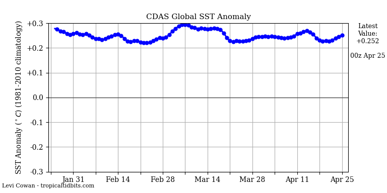
Let’s see what happens to sea surface temperatures as winter progresses in the Northern Hemisphere.
We have 140 years of sea level data at Fort Denison in Sydney harbour. The rate of sea level rise is 0.65 mm pa. Fort Denison is built on very stable sandstone. There is no subsidence or volcanic activity. The rate is a fifth of the claim in the article.
Why the big difference?
Can NOAA data be trusted?
“Can NOAA data be trusted?”
About as much as NASA’s.
And meanwhile. The Greenland Surface Mass Balance (SMB) is growing and appears to be about to exceed two standard deviations above the 30 year mean.
http://polarportal.dk/fileadmin/polarportal/surface/SMB_curves_LA_EN_20221202.png
And then combine that with the record NH snow extent for Astronomical Spring that seems poised to jump considerably in about a week based on the current weather patterns. And what do you get?
From the article: “Sea Level Is Rising – But So What?”
That’s my attitude about it.
There is no evidence human beings have anything to do with sea level rise.
If human beings don’t have anything to do with sea level rise, and there is nothing we can do to stop sea level rise, then “so what” is the attitude to take about it.
Sea level rise is an artificial crisis created by alarmists to scare people into compliance with their climate change goals.
Exactly my thought. At a rate of 2 mm/yr you might need to increase the freeboard by the height of a brick every 50 years. No big deal, we have been able to cope with that for centuries using no technology whatsoever.
Given the UK tidal range, its essentially an irrelevant change.
And if we were anywhere close to the exaggerated predictions (you know, the Al Gore 20 feet by Year 2100 type of predictions) we would see the change after just 10 years going back to the seaside on holiday. I mean, in a decade a two foot rise would be quite obvious.
Non problem.
“Given the UK tidal range”
In the Mersey estuary the tidal range can be over 9 metres
Tidal range at Barry Dock (Bristol Channel ) during normal spring tides there is a range in water level of 36 feet (11 m), and during normal neap tides a range of 19.5 feet (5.9 m), but tides can peak at around 43 feet (13 m)
From what i’ve read the area in the map in this article was bog and marsh in the immediate pre-Roman period.
The area is known as the Fens. Mostly located around the coast of the Wash. The area includes Lincolnshire, Cambridgeshire, Norfolk and a small area of Suffolk. 1,500 square miles (3,900 km2). In 1799 local government officials in Lincolnshire asked engineer John Rennie for advice on dealing with waterlogged lands around the river Witham.
The Great Ouse flood protection scheme saw engineers build a 10.75 mile (17.3km) long ‘relief channel’ running closely parallel to the river. The channel stores diverted flood water. Versions of both the relief and cut-off channels had been proposed by John Rennie in 1810.
Holme Fen in Cambridgeshire, is around 2.75 metres (9 ft 0 in) below sea level. About 30 miles by road, considerably less as the crow flies.
So if the early 19th century engineers could cope I’m sure we can, if we have any cash left from Net Zero which is going to reduce sea level rise by a couple of microns.
“Net Zero which is going to reduce sea level rise by a couple of microns.”
Any evidence to support that?
There can be no EVIDENCE of a potential future situation, only inference.
I remain fascinated by the purported ability to measure a surface constantly in motion, with surface irregularities ranging from millimeters to meters, to an accuracy of +/- 0.4mm with an instrument with an accuracy of +/- 4.5cm. While there are certainly a large number of individual measurements involved, what is being measured is never the same, measurement to measurement.
What happens if a satellite catches a ‘rogue wave?’ Do they throw that out as an outlier?
If they did, it would lower the sea level. 😉
One of the “best” sea level measurement sites is at The Battery in NYC. This is interesting:
https://msc.fema.gov/portal/search?AddressQuery=807%20Garrison%20Ave.%2C%2032456#searchresultsanchor
The continued predictions of major calamity, which have proven to be nothing more than “chicken little” crying the “sky is falling” amazes me that these idiots still have lucrative positions throughout the world. Which has convinced me that there is absolutely nothing to any of the famous and infamous bleating of doom and gloom. Which adds to my long held belief that those folks deserve to be issued placards claiming their postulations, and stood out on street corners in raggy clothing. Obviously, they are certifiably nuts. The letters behind their names have long been a sign that they were good at bullshittery in academia, but useless at anything else.
Just sayin’.
Climate Fact Over Climate Fear
Just this week, Old Dominion University published a study that created maps of sea levels in 2040, 2060 and 2080 and 2100, using data from ODU, and predictions from the National Oceanic and Atmospheric Administration.
Sea levels are expected to be higher by 1½ feet by 2040, 3 feet in 2060 and 4½ feet in 2080.”
Oh, really?
A major ACCELERATION?
That would be bad if true.
Fortunately, there are real scientists with the facts to dispel “Climate Fear” with “Climate Fact”
In our landmark report of 2021, titled Virginia and Climate Change, we concluded the following concerning sea-level rise in the Virginia:
We show the behavior of the gauge record with the lowest regional rise (Washington, D.C.; 1.13ft/100 years), and the largest (Sewell’s Point, VA; 1.55 ft/100 years).
These two records, which are both nearly 100 years long, show a constant rate of rise, from the late 1920s to the present, i.e., NO ACCELERATION
…but attribution requires acceleration.
They have been predicting that sea level rise is about to start accelerating dramatically, any day now, for about 30 years.
As soon as Hydrogen fusion becomes commercially feasible.
In addition to all the other things we don’t know, we don’t have precise figures for how much water is being removed from aquifers, all of that water eventually ends up in the oceans.
If those aquifers are near the shore, they also affect ground based sensors by causing the ground to sink.
For every molecule of methane burned on molecule of CO2 is created and two molecules of H2O are created.
Oil creates less water and coal creates almost none.
CO2 is quickly absorbed by the various biological and geo-chemical sinks, but the water sticks around.
Admittedly, compared to the size of the oceans, this new water is tiny, but it’s there and if they are going to claim sub-millimeter accuracy in their measurements, they will need to account for it.
I don’t know but I suspect that, for the oceans as a whole, the amount of H2O crated by human activity, is less than noise at the sub-millimeter level. Plants, in photosynthesis, Use H2O. The O2 released by photosynthesis comes from H2O, not CO2, no?
Technically there is no sea level rise. Earth’s oceans are currently in stillstand.