New paleo evidence reveals floods in Earth’s past that were hundreds of times larger than anything we’ve seen recently — and had nothing to do with CO₂.
“The past is not dead. It’s not even past.”
— William Faulkner
The media’s appetite for climate catastrophe never seems to get full. Virtually every flood event now comes packaged with breathless declarations of “unprecedented” intensity and grim warnings of fossil-fueled doom. But a new study covered by Phys.org just threw a mammoth-sized monkey wrench into that narrative — quite literally.
Researchers examining paleoflood evidence in the Pacific Northwest have found that ancient deluges during the last Ice Age were not just bigger, they were so massive that they make modern floods look like puddle-jumping. In some cases, peak discharges exceeded 10 million cubic meters per second, compared to just tens of thousands for modern floods — including extreme ones like the 1993 Mississippi River flood.
Let’s be clear: these were natural events, happening 12,000 to 18,000 years ago, long before coal plants, internal combustion engines, or UN climate conferences.
The new study builds on decades of work around the Missoula Floods — a series of truly biblical floods unleashed when glacial ice dams repeatedly failed, releasing the waters of Glacial Lake Missoula across eastern Washington and beyond. These floods:
- Moved boulders the size of houses,
- Left behind giant ripple marks visible from the air,
- Carved out entire canyons and scab-lands,
- Created sediment fans and slackwater deposits hundreds of feet deep.
Modern researchers are now using LiDAR, stratigraphy, and radiocarbon dating to map these features in exquisite detail — and what they’re finding is unmistakable: nature has produced floods on a scale we can barely comprehend, entirely without the help of SUVs, coal power plants, or increased atmospheric CO₂.
Why This Changes the Flood Narrative
🔹 1. “Unprecedented”? Not Even Close.
One of the most abused words in climate reporting is “unprecedented.” We saw it used in the wake of the Pakistan floods in 2022, the German floods of 2021, and countless others. But paleo-hydrological data remind us that extreme floods are not new, and they are not inherently human-caused.
Labeling every modern flood as evidence of climate breakdown, without acknowledging the geological record, is either bad science or bad faith — sometimes both.
🔹 2. Natural Variability Still Reigns Supreme
What this new study really underscores is something skeptics have been saying for years: you cannot meaningfully assess modern extremes without understanding natural variability. The Earth’s climate and hydrologic systems have long been capable of producing massive, abrupt, and destructive events. Pretending otherwise is a political act, not a scientific one.
It’s also worth noting that attribution science — the process by which modelers “link” extreme events to climate change — typically relies on modern observational datasets going back only to the 1950s or so. These models almost never account for long-term geologic-scale extremes, like those revealed in studies like this one. That’s a glaring omission, and one that calls into question the reliability of claims like “climate change made this flood worse.”
Related: Attribution science’s weak foundations
Models Can’t Handle This Scale of Flooding
Let’s be blunt: if a flood today rivaled the scale of the Missoula outbursts, every climate model would be off the charts — and every climate reporter would blame it on carbon emissions. But these floods happened naturally. They were driven by glacial mechanics, not greenhouse gases.
If your climate model cannot reproduce the known history of past megafloods, why should we trust its projections for the year 2100?
Final Thoughts: A Lesson in Humility
This new study serves as a powerful reminder that the natural world is not tame, not linear, and not bound by human carbon cycles. It has produced extremes far beyond what we’ve seen in our brief observational window.
So the next time someone insists that a big flood is proof of man-made climate collapse or crisis, or the doom de jour, send them a link to this study. Then ask them why they’re ignoring the evidence carved into the Earth itself.
And remember: history didn’t start in 1979 — even if most climate narratives do.
Further Reading:
- Missoula Floods – USGS Overview
- LiDAR Mapping of Pleistocene Flood Channels
- WUWT on Extreme Weather Attribution
Want to see more skeptical deep dives like this? Subscribe to wattsupwiththat.com and support independent science journalism that questions the climate narrative – plus get exclusive content available only to subscribers.
When people refer to ‘biblical’ floods they mean the Torah/ Bible and several other and older writings and oral traditions.
They in all likelyhood were quite ancient orally transfered stories about real events.
We know that sealevel rises were quite dramatic when the ice retreated in a short period of time and we also know that has been stabalised over time.
So, one needs to keep this perspective in mind..
Also, the cleansing, religious aspect was a way of dealing with catastrophy and the ‘reason’ behind it, the concept of sin.
We now have the cleansing aspect ( anti hydrocarbons/ Co2) and the sin ( without the positive asopect of hydrocarbons) but without the catastrophy.
Mythology and early religions came to be to explain the inexplicable.
It was easier to conceive of a deity causing things than just unknown.
One aspect of human psychology plays in throughout history.
People cannot accept that things just happen (randomly) without giving up hope.
When people give up hope, you end up with what we have today.
The legend of Cantre’r Gwaelod tells of a Welsh kingdom which lost a large forest due to flooding as a result of the incompetence of the operator of the sea wall floodgates about 5,000 years ago. While this was believed to be a legend remains of the forest were recently uncovered by a storm and can be seen at low spring tides.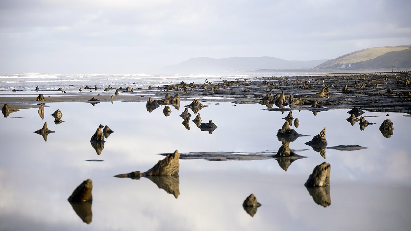 .webp
.webp
The tree stumps at low tide:
Still no evidence of a global flood.
Rather, many local ones spread over ~10 thousand years.
When taken through the lens of Pangaea, it could be seen as a global flood.
That aside, on the flip side there is still no evidence there was no global flood.
Are you saying that Noah was alive hundreds of millions of years ago?
“That aside, on the flip side there is still no evidence there was no global flood.”
You’re kidding, right?
And there is no evidence that there are no unicorns — except an absence of evidence that there are unicorns.
Roughly 71% of the Earth is currently flooded.
Seems pretty global to me.
Not all at once, but as ballynally suggests, numerous traditions from China to the Middle East to Central America contain accounts of great floods, and in those limited perspectives, it may have seemed as if the whole world was involved.
Opening of Bosporus strait with flooding of the Black sea basin was one of the most important catastrophic events behind biblical flood story. Also, a lot of water was coming into this basin from the North with all of the flooded rivers. Of course, rapidly melting glaciers and rising sea levels made sure it was not the only event, but this was probably the most remembered.
Multiple floods. Multiple areas. Multiple tribes.
Likely there were many more than one flood and when people gained mobility and swapped stories, a degree of commonality came to be.
More likely, that their perception of “all world” was limited to what they could see around. So, when everything they could see was flooded, all of their world was flooded to them.
Hell, forget ice age floods, California in 1860 was bad enough.
I think the recent flood of bad state governance will be far more damaging to California.
https://en.wikipedia.org/wiki/Great_Flood_of_1862
Ancient Megafloods Dwarf Today’s Extremes — But You Won’t Hear That on the Evening News
What you will hear…
Met Office warnings as Brits to be hit by a month’s worth of rain in just ONE hour https://www.mirror.co.uk/news/uk-news/met-office-warnings-brits-hit-30528917#google_vignette
A months worth of rainfall recorded in six hours in the East after the hottest June on record https://www.itv.com/news/anglia/2023-07-05/a-months-worth-of-rainfall-recorded-in-just-six-hours
Etc
“unprecedented.”—in modern reporting, this generally means “not in my lifetime”
“unprecedented” also means:
“I can’t be bothered to look it up — and bet that you won’t either”
Also could mean a ‘slow-news day‘. [yawn]
Unprecedented actually means, I need to get your attention do I can get ad clicks.
Sensationalism, pure and simple.
There have been some stupid articles on this website but this may well be the champion.
You are entitled to have a wrong opinion.
But you keep coming back to waste your time here.
Would you care to did your hole a little deeper by explaining why you made your unsupported assertion?
By this logic – if we built a mega-dam and it collapsed causing a huge, devastating flood, that would show that humans can create floods on that scale so support the argument for anthropogenic climate change. Bellman put it better and funnier than me though. MSM is so crap, they don’t even have reporters on the ground, reporting on these huge 10,000 year old floods. lol
Yes, evidence against a false belief is alway a bit of a shame, ain’t it.
Flat Earth anyone?
Why is the evening news not reporting on floods that happened over 10000 years ago? It’s a complete mystery.
Climate Central will not give them such a story and they are too self-absorbed to look beyond their noses.
If you say something is unprecedented, it really should be unprecedented.
Why aren’t people like you complaining that the Misleadia are reporting bullshit when claiming something is unprecedented when there is ample evidence that recent flooding is not unprecedented?
I’ve been saying this for years. And it’s not just in regard to megafloods.
As I have been pointing out that the so-called “hind casting” is simply curve fitting.
Curve fitting does not produce any reliable projections, forecasts, predictions, nada a thing of value.
For example, I can curve fit to 1/4th of a sinewave. That gives no information on the rest and deriving anything from that will be totally wrong.
Tim Flannery is obviously holidaying in Queensland at present-
Bigger than Texas: the true size of Australia’s devastating floods
Meanwhile South Australia is drier than usual at this time of year and wouldn’t mind having some of what Queensland is having. Perhaps Tim could pop in for a day or two.
I was caught in the vast flood in the outback in the early 1970s when the inland seas (and more) reformed as a freshwater lake. But periodic floods are essential in Central Aus . The wildlife needs these periodic floods. Water storage in billabongs, underground caves and the soil is refreshed and refilled (there are an amazing number of water holes in the desert – the Aborigines knew them well. . Fish swim to other fish havens and do their thing woopy-wise so preventing inbreeding. Frogs have a glorious time, croaking and doing what comes naturally and doing their bit to reduce the mosquito and black fly populations..And, when the waters recede, the flower show was stupendous.The only thing that disturbed me was the thousands of snakes that wanted to share my island haven on which I was camped for a month. They also saw me as food. However, I was more cunning and quicker than them, so survived to tell this tale.
Everybody, especially geologists, should see the scabland megaripples, gravel bars with rocks the size of cantaloupes, Dry Falls, and the land Lewis and Clark went through. One of the lesser known and not so obvious is the Sabine River floodplain concluded to have 40X the current flood flow. Probably a study but–Gagliano, S. M. 1990. Late quaternary Deweyville interval superfloods. Trans. Gulf Coast Assoc. Geol. Soc. (Abs.). It took a lot of water to cover the continental shelves. I studied the 1973-75 Mississippi River valley floods in along the Atchafalaya Bay coast. Freshwater fish in the ocean, not a friendly current. Lots of earlier Mississippi River floods.
Comments about great floods are common amongst many religious versions of a “bible” and some are even carved in stone by humans “back then”. So nothing new. Can’t believe all the stories/legends did not have some basis in fact.
As far as enduring a great flood, imagine those tribes living along the Snake river and Columbia drainage when Lake Bonneville “let go”, and that event had no small influence by climate change, as did the whole world then.
Yet the warmists are concerned about an annual millimeter or two sea level rise! Beam me up.
After the floods crossed the scablands, they dropped into the Columbia river in two sets of twin waterfalls. I’ve compared the sets to Niagara Falls at the same scale. North to the left.
Any one of the four waterfalls is bigger than Niagara and Horseshoe Falls combined.
While I agree with the underlying point of precedents being routinely ignored or downplayed in both literature and media, in order for the comparison to be meaningful the precedent needs to be relevant to modern era circumstances. The Missoula example, and many others like it (e.g. glacial lake Agassiz), are unique to the circumstances of retreat of a continental ice sheet. Outside of some remaining alpine areas with current or possible ice dams, or perhaps coastal areas of Greenland, etc. what context does Missoula provide for understanding modern floods?
Anthony and others (esp you ..@twofeathersuk). I refer you to the Ice Age Floods Institute, where you will learn lots more about the Missoula Floods
Interesting, we went through there twice, once at the Columbia Coulee Dam which had a good exhibit on the history. This is one example why real scientists should quit seeking and being rewarded immediate fame and fortune and pay more attention to the science. I lived uphill next to a coulee in Louisiana which flooded once. Survivor of 1927 flood showed me where the coulee met the flood line over 10 miles west of the current Atchafalaya River levee. We’re spoiled and don’t appreciate our ancestors now rolling in their grave producing unprecedented earth tremors.
I seem to recall a few years ago (humor, Jurassic actually) that the Caribbean flowed up to Montana.
Cretaceous Interior Seaway…from the Carribean to the Arctic,
Do not use modern perspectives and knowledge when assessing what our ancient ancestors encountered and how they understood them.
100,000 – 200,000 years ago, the people had a range of 10s to 100s of miles.
A great flood occurs.
“Grandfather, tells us again about the great flood.”
“When it flooded, there was water covering the world as far as we could see.”
“Why did it happen Grandfather?”
“I do not know for sure. Maybe [insert deity name] was mad at us.”
A few generations later…
“Grandfather, tells us again about the great flood.”
“When it flooded, there was water covering the world.”
“Why did it happen Grandfather?”
“[insert deity name] was mad at us.”
Oral retelling of stories is always subject to signal to noise issues. Parts are forgotten. Some backfilling is done. Some embellishing is done. Color commentary is added to make it more interesting. A few Dad Jokes could be inserted, too.
Hence, we end of with folk lore tales (biblical, etc.) of a great world engulfing flood.
Valid points to consider. In context it is likely that many floods occured and remembered prior to the agricultural revolution. And they are important morality stories: prepare for the worst, fear (and please) God , live a virtuous life, take care of your family, clan, tribe and listen to experienced elders. The history of hunger and starvation is ancient. Basic survival instincts.
One should also take note of the various ways people dealt with catastrophies in relation to their beliefs. Polytheistic tribes consider these things very differently than monotheistic ones. If you have One God he is the Almighty. If you are a Hindu you have a multitude of different forces/ gods all playing their part. Natural forces. So did the ‘ancient’ greeks. Their Gods and Titans have internal clashes. They don’t have the problem of explaining catastrophies like the monotheistic religions have ie, why the hell did God do this to us? And that issue never gets (satisfactorily) resolved.
Not mentioned in the above article, but well worth viewing, is the PBS Nova program segment on megafloods (ref: https://www.pbs.org/wgbh/nova/megaflood/ ),
In addition to providing excellent background and computer animations on the Missoula Floods (as discussed in the above article) it goes further in presenting solid evidence that the English Channel between Great Britain and France was the direct result of a historic megaflood on much greater scale than the Missoula Floods.
An absolutely fascinating and scientifically-based TV program . . . highly recommended!
Unless one is willing to buy the DVD, the video doesn’t appear to be available anymore.
I watched the referenced NOVA program last week via over-the-air broadcast by my local PBS TV station. PBS has a habit of offering repeat broadcasts of NOVA programs, especially during summer months.
So, you might want to search for NOVA TV broadcasts in your area to see if the “megafloods” episode reappears.
I don’t know what streamed cable/Internet services may also offer periodic or on-demand replays of NOVA TV programs, but you may want to check that out as well if you can access such.
Very nice Anthony, where I live we would have been 950 feet below the surface of Lake Missoula.
The main point of this article is that a natural event some thousands of years ago (a river basin dammed up by ice, which later broke “suddenly”) could have caused a massive flood capable of moving house-sized boulders, based on geological evidence observed today.
There is no reference in this theory to changes in CO2 concentration in the air, which may or may not have been partially responsible for a warming of the average temperature by 1.1 C, and a sea-level rise of less than 1 foot, over the past century. In order to produce a water flow rate capable of moving house-sized boulders, the events described in this article would have occurred over a period of days or possibly weeks, but in much less than a century.
We also saw rapid, catastrophic changes in the landscape when Mount Saint Helens erupted in 1980 (a year after “history began” /sarc) within a few days, although on a somewhat smaller scale than what is theorized for Lake Missoula.
If the floods of Lake Missoula were due to growth and later breaking of an ice dam across a river, the question becomes what caused the Ice Age, that covered half of North America and Europe under an ice sheet over a mile deep?
In today’s climate, there is not enough evaporation from the oceans to produce a snowpack over the formerly glaciated areas which does not melt entirely during the spring and summer months. We see heavy “lake effect” snow downwind of the Great Lakes, but it is completely melted by May every year.
There was the so-called “Year Without a Summer” in 1816, caused by a large volcanic eruption of Mount Tambora the year before, whose dust cloud obscured the sun for over a year.
Some have theorized that the Ice Age was caused by a time of massive volcanic activity, both on land and under the oceans. The dust clouds over land would have obscured sunlight and caused cooling of the continents, while the undersea eruptions would have heated the oceans, and accelerated evaporation above today’s rates. This warm, humid air would precipitate water on the dust particles over the continents, and high-latitude areas would receive heavy snowfall. If the volcanic activity lasted long enough, there could be a series of “years without a summer” which would promote the growth of glaciers.
After the volcanic activity subsided, and the dust settled, the glaciated areas would once again receive sunlight in the spring and summer. The oceans would gradually cool and reduce the evaporation rate (and snowfall rate over the continents), and the glaciers would melt from south to north, except on Greenland.
Interestingly enough, the biblical account of the flood of Noah’s time states that before the rain began, “the fountains of the great deep were broken up”.
Was this Noah’s way of describing volcanic eruptions?
Food for thought…
Nice post, reflecting a healthy, honest search for objective answers to BIG questions. My response comments below:
Well, no one knows for sure. First, Earth has experience at least five “Ice Ages” (note capitalization) each of which lasted tens to hundreds of millions of years, and then there are “ice ages”, more correctly named as “glacial periods”, that alternate with warmer “interglacial periods”, on a frequency of about one cycle per 100,000 years over the last 10 or so such oscillations.
Scientifically, Earth is currently in an Ice Age (named the Quaternary), which began about 2.6 million years ago and which is defined by ice covering at least one of Earth’s poles year-round for thousands to millions of years. However, within the current Quaternary, Earth has oscillated between glacial intervals—with the northern hemisphere ice glaciers extending as far south as the northern parts of the United States and even into Europe, and the southern hemisphere having the Antarctic ice sheet expanding outwards and onto the surrounding continental shelves—and warmer interglacial intervals. We are currently in an interglacial period, named the Holocene Epoch, where the Earth is relatively warm and glaciers have decreased in their extent (and sea levels have correspondingly risen) since about 12,000 years ago.
The current, best theory for explanation of Ice Ages and higher-frequency glacial/interglacial cycles is Milankovitch cycles that relate to long-term changes in the ephemeris of Earth’s orbit and orientation with respect to the Sun and their various resonances, thereby causing wide swings in the energy Earth receives from the Sun. In addition, the somewhat random-in-time appearance of Ice Ages and their longer time of existence is believed to be directly related to continental drift since Earth’s surface cooled to the point of having large oceans on its surface (see Christopher Scotese’s wonderful animation of continental drift and ice coverage changes over the last 540 million years at https://www.youtube.com/watch?v=bzvOMee9D1o , noting that ice cover is indicated by white in the animations).
IMHO, such Biblical account reflects “species memory” of one of more megafloods that occurred over the last 7 million years or so since hominins first walked on Earth . . . not species memory of volcanic eruptions.
The original IPCC mandate called for them to find a ‘man-mad’ reason for increasing temperature. They were directly forbidden to investigate any possible natural causes. Their ‘mission statement’ was changed several years later to remove any mention of ‘natural causes’.
They’re doing what they are being paid to do, man-made change. Add to that, their “Final Report’ is moderated by politians.
Heads-up: Your link is broken [ 404 Error Page Not Found ]
Attribution science’s weak foundations
PBS’s NOVA has done some shows on this, but I wasn’t able locate any links that are working.
However, for those unfamiliar with the Channeled Scablands, you might find the following link to be interesting reading:
https://www.pbs.org/wgbh/nova/article/megafloods-of-the-ice-age/
I can see a runnable line in the rapid!
Speaking of flood reporting, I noticed a new term (at least new to me) being used in some reports.
“Generational Floods”.
What will they think of next?
I guess that means that every generation thinks they are remarkable every time.
Nick Zenter of Eastern Washington University has a great video on the Missoula Floods.
Bretz’s Spokane Flood & The Missoula Floods
Inputs to the earth’s thermal system vary. The sun’s intensity, or total solar irradiance (TSI), does vary, with the most noticeable pattern being an 11-year (about) cycle related to sunspots, and also on longer timescales. I measured the total radiation flux of individual cycles by integrating the curve, and the variation was much greater than that shown by comparing peaks or troughs. There are also Short-Term Fluctuations, the 88-year (Gleisberg cycle), 208-year (DeVries cycle), and 1,000-year (Eddy cycle). Ultraviolet irradiance (EUV) also varies, with changes of around 1.5% from solar maxima to minima for wavelengths between 200 to 300 nm. Over its lifespan, the Sun’s brightness has increased, and it is expected to continue brightening as it burns hydrogen.
Global warming will eventually turn into global frying.
And there is the completely unknown effects of cosmic ray storms, due either to stars within 80 light years of earth or so exploding, or the breakdown of the magnetosphere during polar reversals (one may be happening now).
Output controlling factors are also important. CO2 makes up such a minor fraction of the atmosphere and it is so easily saturated that its contribution is most likely small. Methane and other gases are also probably also minor contributors. Water is the biggy, but its effect depends on amount, location, height in the atmosphere, and phase. Ice clouds high up reflect sunlight, so have a cooling effect. Low altitude water vapor clouds act as a thermal blanket.
Volcanoes – the Tongan Hunga volcano, which erupted recently, sent 146 teragrams of water, 12 to 53 kilometers into the stratosphere. No wonder the climate was temporarily upset and many countries had warmer and wetter weather. We in New Zealand had rivers of rain and biblical floods descended upon us.
The gases emitted by volcanoes can consist of up to 95% water vapor.
Add to this urban island effects, changes in surface reflectance and other effects and you have an immensely complex, varied and variable, thermal system. Modelers and activist ignore these factors as they are too hard to model. But comparative studies of real DATA can help elucidate what we can expect.
My geology teacher in High School challenged us to bring back granite, I’m the only student in his long career to manage to do it. Why? Granite is not native to our area, all that we have was carried in via the Missoula floods. Had a good laugh because we had a dollar bet on it, he was expecting me to bring him schist and I already knew for a fact we had granite and plenty of it. Every year we had an area we walked to grab the granite rocks (4-12 inch ranch) to toss it in the bushes out of the field.
River is miles away and this was on the side of a hill well above the valley floor. Teacher said likely an iceberg ground to a halt there and melted, dropping it’s load.