Impacts of El Niño to intensify as climate warms, new study finds
Changes to precipitation, temperature, and wildfire risk intensify
WASHINGTON — When an El Niño or its opposite, La Niña, forms in the future, it’s likely to cause more intense impacts over many land regions — amplifying changes to temperature, precipitation, and wildfire risk — due to the warming climate.
These are the findings of a new study led by the National Center for Atmospheric Research (NCAR) and published in Geophysical Research Letters, a journal of the American Geophysical Union.
The researchers found, for example, that the increased wildfire danger in the southwestern United States associated with La Niña events would become more acute. Conversely, the cooler and wetter weather in the same region associated with El Niño events would likely become even cooler and even wetter in the future, enhancing associated flood risks.
“The cycling between El Niño and La Niña is responsible for some of the weather whiplash we get from year to year, particularly in the western U.S.,” said NCAR scientist John Fasullo, who led the study. “What we find when we look at model simulations of the future is that the whiplash is likely to get more severe.”
The study was funded by the National Science Foundation, which is NCAR’s sponsor, and by the U.S. Department of Energy. Study coauthors are Bette Otto-Bliesner, also of NCAR, and Samantha Stevenson, of the University of California, Santa Barbara.
El Niño events are characterized by warmer-than-average sea surface temperatures in the eastern tropical Pacific Ocean. La Niña’s, on the other hand, are defined by cooler-than-average waters in the same region. These phenomena can influence weather patterns globally, with far-reaching consequences, including changes to crop yields, fire risk, and the heating and cooling demands of homes, workplaces, and other buildings.
The impacts of El Niño and La Niña are particularly pronounced over North America’s southern tier, South America, and Australia. For example, El Niño events tend to cause cooler, wetter weather over the southern U.S. but hotter, drier weather across most of Australia and South America.
Climate model simulations have been divided in their portrayal of how climate change will influence the sea surface temperature changes associated with El Niño and La Niña events. For this study, the scientists were able to remove this effect and look at what the impact of individual events of a given magnitude would be.
The research team relied on two extensive sets of simulations, one created using the NCAR-based Community Earth System Model (CESM) and one created using the Geophysical Fluid Dynamics Laboratory Earth System Model. Each model was run dozens of times with slightly different starting conditions. Taken together, the large number of model simulations allowed the scientists to distinguish impacts linked to El Niño and La Niña from those caused by the natural chaos in the climate system.
The scientists looked at how the impacts in the present climate that are tied to a given unit of variability, for example, one degree Celsius of sea surface temperature increase during El Niño or decrease during La Niña, compared to the impacts of that same variation at the end of this century.
In addition to temperature and precipitation, the scientists were able to look at changes to wildfire danger, because CESM includes a wildfire model. This component takes into account the biomass available for burning, along with the influences of temperature and moisture.
The result was that these impacts became more severe in key land regions.
“These simulations show that the continuous rising of global mean temperature will leave regions of the U.S., including California, more vulnerable to severe droughts and widespread wildfires in the future, especially during La Nina years,” said Ming Cai, a program officer in the National Science Foundation’s Division of Atmospheric and Geospace Sciences, which funded the research.
For example, seasonal heat extremes in the southern half of the U.S. during a La Niña like the one that occurred in 2011 would be about 30 percent greater if the La Niña occurred at the end of the century. That warming would be in addition to the expected background warming of the climate system.
“We can’t say from this study whether more or fewer El Niños will form in the future — or whether the El Niños that do form will be stronger or weaker,” Fasullo said. “But we can say that an El Niño that forms in the future is likely to have more influence over our weather than if the same El Niño formed today.”
###
This paper is freely available for 30 days. You can download a PDF copy of the article by clicking on this link:
https://agupubs.onlinelibrary.wiley.com/doi/pdf/10.1029/2018GL079022

This study comes down to an assumption using climate models that don’t confirm anything. There is no way anybody can claim a future scenario without knowing why or how weaker/stronger, more/less ENSO events occur. Just finding this contradiction just confirms propaganda alarmist rubbish.
The Walker circulation being the main mechanism that drives ENSO is controlled by the sun. The pressure gradient caused by solar radiation warming the ocean surface especially during high pressure periods with clear skies. The difference between pressure gradients cause the westerly or easterly flows known as the trade winds.
This circulation requires more energy to drive the La Nina phase because it pushes the ocean waters towards the west fuelling heavy rains and thunderstorms. These require a huge amount of energy and the system can’t continue this process without further external input. Low solar activity leads to lower energy in the system unable to drive the rains and thunderstorms in the west so the circulation weakens leading to El Nino. Continuous periods of low solar activity therefore lead to frequent potentially strong El Nino’s.
Proxies have found historic periods where more strong numerous El Nino’s dominate and frequent strong La Nina’s dominate. What a lot of people don’t realise is that these events occurred during historical times not expected. The numerous strong El Nino’s were found during cold periods with low solar activity and the frequent strong La Nina’s were found during high periods of solar activity.
Therefore when a low solar activity period occurs in future with frequent El Nino’s it will be obvious what the alarmists try and blame it on, but they will be wrong.
ENSO will be neutral during periods of very low solar activity. You wrote that there is no energy in the system.

Meanwhile, the tropical storm is approaching Hawaii. The jet stream accelerated after a strong geomagnetic storm.
http://tropic.ssec.wisc.edu/real-time/mtpw2/product.php?color_type=tpw_nrl_colors&prod=epac×pan=24hrs&anim=html5
This is not El Niño.

Energy drives the circulation so when it weakens, El Nino’s generally form or become more frequent. The ENSO is neutral between lower energy and higher energy periods because the very low solar activity has only recently got going moving towards a minimum and will take longer for its effect to influence. Autumn is always the key season how ENSO may develop for winter, so still little early to judge yet. The weak circulation allows warm surface water to pool as in El Nino because the limited energy driving the circulation in weak phase, prevents ocean upwelling and stronger movement of ocean water westwards.
“The weak circulation allows warm surface water to pool as in El Nino because the limited energy driving the circulation in weak phase.”
Interesting article from Texas Storm Watch on similarities this month to that of 2009. I have seen Joe Bastardi mention the ‘09-10 winter as an analog year. August seems to have unfolded similarity according to the article (see last couple paragraphs). It will be interesting to see how this season’s El Niño plays out… http://texasstormwatch.com/2018/08/almanacs-disagree-on-texas-this-winter.html
What is weak El Nino? The pattern is similar, because in 2009 solar activity was extremely low.

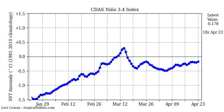
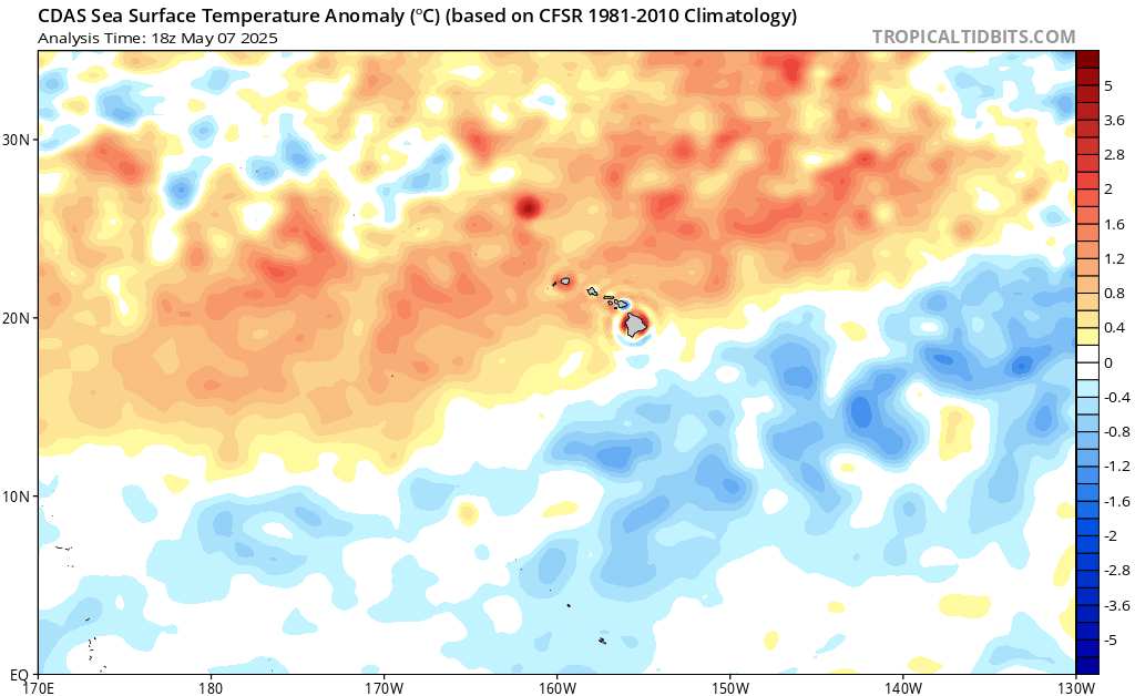
You can see in the graphic that El Niño does not develop.

“allowed the scientists to distinguish impacts linked to El Niño and La Niña from those caused by the natural chaos in the climate system”
What? El Niño and La Niña are PART of the natural chaos in the system.