UPDATE: Live The last radar image from Willis Island added below. The last radar image is truly striking.
Also, see below for the differences between the Australia hurricane scale and the familiar Saffir-Simpson scale used in the USA. They are not equal.
From Australia’s BoM, time to “get outta Dodge” as they say:

Simon at Australian Climate Madness notes this for rebuttal of the inevitable “Yasi caused by global warming” links that will be pushed on the blogs and by the press:
Tropical cyclone Mahina hit on 4 March 1899. It was a Category 5 cyclone, the most powerful of the tropical cyclone severity categories. In addition, Mahina was perhaps one of the most intense cyclones ever observed in the Southern Hemisphere and almost certainly the most intense cyclone ever observed off the East Coast of Australia in living memory. Mahina was named by Government Meteorologist for Queensland Clement Wragge, a pioneer of naming such storms.
Here’s what BoM has to say on their tracking page:
The forecast path shown above is the Bureau’s best estimate of the cyclone’s future movement and intensity. There is always some uncertainty associated with tropical cyclone forecasting and the grey zone indicates the range of likely tracks of the cyclone centre.
Due to the uncertainty in the future movement, the indicated winds will almost certainly extend to regions outside the rings on this map. The extent of the warning and watch zones reflects this.
This product is designed for land-based communities; mariners should read the coastal waters and high seas warnings.
Remarks:
SEVERE TC YASI IS A LARGE AND VERY POWERFUL TROPICAL CYCLONE AND POSES AN EXTREMELY SERIOUS THREAT TO LIFE AND PROPERTY WITHIN THE WARNING AREA, ESPECIALLY BETWEEN CAIRNS AND TOWNSVILLE.
THIS IMPACT IS LIKELY TO BE MORE LIFE THREATENING THAN ANY EXPERIENCED DURING RECENT GENERATIONS.
TC Yasi, CATEGORY 5, will continue to move in a west-southwesterly direction during the day. The cyclone is expected to cross the coast in the Innisfail area at about midnight.
Coastal residents within the warning area, and particularly between Cairns and Ayr are specifically warned of an EXTREMELY DANGEROUS SEA LEVEL RISE [i.e. storm tide] as the cyclone approaches, crosses the coast and moves inland. The sea is likely to steadily rise up to a level which will be VERY DANGEROUSLY above the normal tide, with EXTREMELY DAMAGING WAVES, STRONG CURRENTS and FLOODING of low-lying areas extending some way inland. People living in areas likely to be affected by this flooding should take measures to protect their property as much as possible, and be prepared to follow instructions regarding evacuation of the area if advised to do so by authorities.
DAMAGING WINDS with gusts to 90 km/hr that are currently developing on coastal islands, are forecast to develop about the coast by late morning and about the tropical interior overnight.
Between Cape Tribulation and Ingham these winds will become DESTRUCTIVE with gusts in excess of 125km/hr during the afternoon and early evening and VERY DESTRUCTIVE with gusts up to 300 km/hr between Cairns and Ingham during the evening as the cyclone approaches and crosses the coast. These VERY DESTRUCTIVE winds can also occur on the seaward side of hills to the north of the cyclone and are also forecast to reach the Atherton Tablelands.
Winds are forecast to ease about the east coast during Thursday morning as the cyclone moves inland.
FLOODING RAINS will develop from Cooktown to Sarina during the afternoon and then extend inland overnight.
People between Cape Melville and Sarina, extending inland to Croydon and Richmond should complete preparations quickly and be prepared to shelter in a safe place.
– Boats and outside property should be secured.
– For cyclone preparedness and safety advice, visit Queensland’s Disaster Management Services website (www.disaster.qld.gov.au)
– For emergency assistance call the Queensland State Emergency Service (SES) on 132 500 (for assistance with storm damage, rising flood water, fallen trees on buildings or roof damage).
People about the remaining tropical interior east of Camooweal and north of Winton should consider what action they will need to take if the cyclone threat increases.
– Information is available from your local government
– For cyclone preparedness and safety advice, visit Queensland’s Disaster Management Services website (www.disaster.qld.gov.au)
– For emergency assistance call the Queensland State Emergency Service (SES) on 132 500 (for assistance with storm damage, rising flood water, fallen trees on buildings or roof damage).
Name: Severe Tropical Cyclone Yasi
Details:
| Time (EST) | Intensity Category | Latitude
(decimal deg.) |
Longitude
(decimal deg.) |
Estimated Position
Accuracy (km) |
|
|---|---|---|---|---|---|
| 0hr | 7 am February 2 | 5 | 16.1S | 150.9E | 20 |
| +6hr | 1 pm February 2 | 5 | 16.7S | 149.1E | 45 |
| +12hr | 7 pm February 2 | 5 | 17.2S | 147.5E | 75 |
| +18hr | 1 am February 3 | 4 | 17.8S | 145.8E | 100 |
| +24hr | 7 am February 3 | 2 | 18.5S | 144.1E | 130 |
| +36hr | 7 pm February 3 | 1 | 19.8S | 141.1E | 190 |
| +48hr | 7 am February 4 | tropical low | 20.9S | 138.4E | 250 |
The next Forecast Track Map will be issued by 11:00 am EST Wednesday
===============================================================
UPDATE:
Commenter sHx writes:
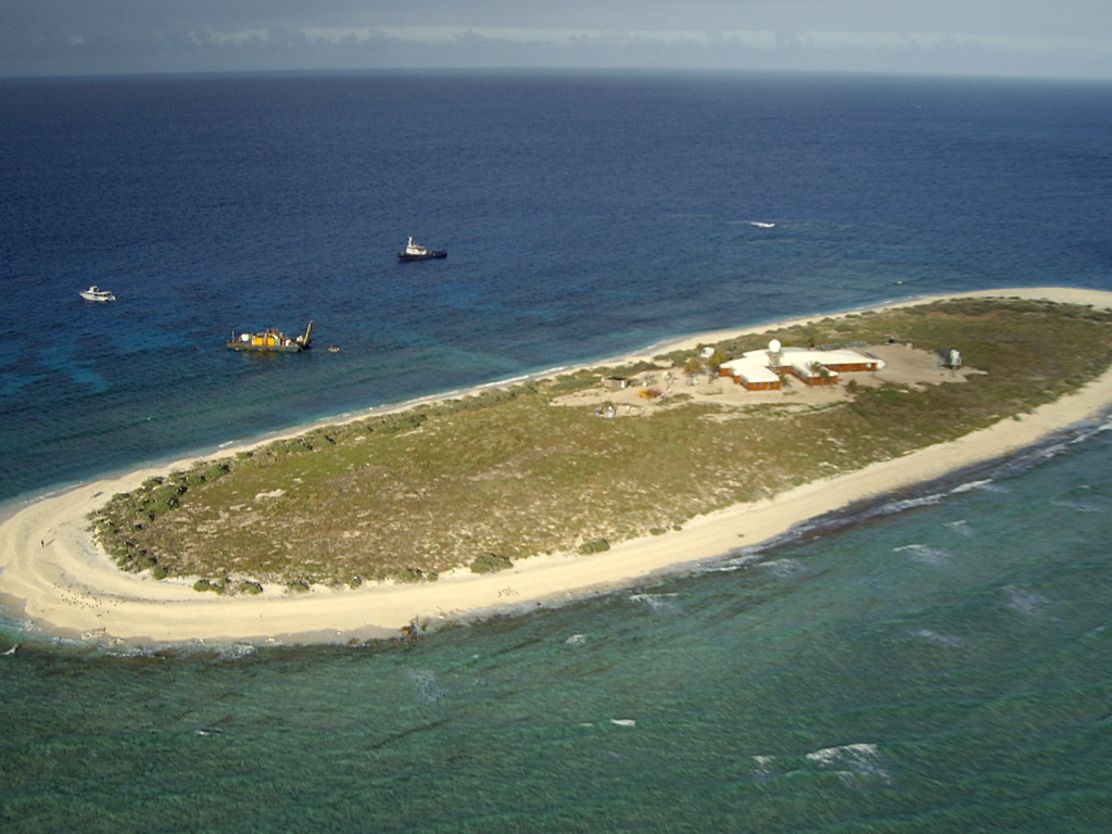
AS of this moment Yasi is right on top of Willis Island. http://en.wikipedia.org/wiki/Willis_Island
Apparently the island has a meteorological post. It even has radar! http://www.bom.gov.au/products/IDR412.loop.shtml

It must be frightening to be that radar operator looking at this, knowing when that eyewall hits you are going to be subject to Cat5 winds and you have a 30meter tall radar tower right next to you, and there’s really no shelter elsewhere on the island and no place to go. I wonder how long we’ll continue to get a signal from the Willis Island’s radar?
UPDATE2: Just about the time I pressed “update” the radar went out, the radar station is offline. The last image from the station is above. We hope for the best for the BoM employees there. The storm surge must be ferocious. Hopefully BoM evacuated them and they left the radar on “auto”. Given the size and composition of the island versus the size of the hurricane, Willis Island may very well be erased by this storm.
===============================================================
Good luck to our friends in Queensland, especially Dr. Bob Carter and Nigel, who helped during my tour in Townsville last year.
===============================================================
UPDATE 3: Hurricane expert Dr. Ryan Maue brings to our attention the differences in tropical cyclone scales. The Saffir-Simpson scale used maximum sustained one-minute winds while the Australian Region scale uses ten-minute averaged sustained winds. The convention to convert is (10-minute)*1.14 = 1-minute sustained (units are knots). This image combined from Wikipedia’s article.

The JTWC advisory intensity at 00Z Feb 2 of 125 knots is a strong Category 4 on the Saffir-Simpson scale. The Australian Bureau of Meteorology reports central pressure of 930 hPa, and backs out Category 5 winds from that. Also, feel free to call Yasi a “willy-willy“.
As I a guest here as well as a AGW supporter of the science I will be very brief:
1. I was born in QLD
2. I lived on a farm as a boy close to Grantham Lockyer Valley – yes that’s one that was flooded by an extraordinary event.
3. My background is in data mining – I.T. some 35 years.
From a poster this was put to me:
“I suggest studying the yearly records of BOM data for FNQ, neither the rain or the frequency of cyclones has changed at all. The extraordinary claims from some representatives of BOM and CSIRO require extraordinary evidence to back them up – and it’s not there.”
No – I have no need to “study” the data – spent three to two years looking at all information before I moved from sceptic to acceptance of AGW laws of physics and its how it affect climate.
One line of evidence referenced here:
Climate change
”Projections (computer models) also indicate that the regions of east Australian cyclone genesis could shift southward by two degrees latitude (approximately 200 km) by 2050, Leslie et al (2007), while the average decay location could be up to 300 km south of the current location. Models estimate that the number of strong cyclones reaching the Australian coastline will increase, and ‘super cyclones’, with an intensity hitherto unrecorded on the Australian east coast, may develop over the next 50 years Leslie et al(2007). From same references already cited FYOI.
The above is just one paper from Leslie – suggest to anyone they follow this thread of this information and look into – you may end up becoming a non-skeptic at the end of the process. Just like the weather channel man who once was a skeptic.
The onus is not on me to prove to you the ultimate strike out.
The onus is on me to show WHETHER ANY of these events were already stated in any science based literature with a link to AGW as a plausible cause WAY before these events.
The onus is on you (your thinking) to show alternatives to these extraordinarily events. Even so you should consider the relevance of the source and the professional background and leave nothing to chance on fringe opinion and quackery science.
A simple statement on tropical cyclones in Qld.
http://www.bom.gov.au/cyclone/about/cyclones-eastern.shtml
“…There have been 207 known impacts from tropical cyclones along the east coast since 1858. Major east coast tropical cyclones impacts include 1890 Cardwell; 1893 Brisbane; 1898 NSW; 1899 Bathurst Bay; 1918 Innisfail; 1918 Mackay; 1927 Cairns and inland areas; 1934 Port Douglas; 1949 Rockhampton; 1954 Gold Coast; 1967 Dinah, Southern Queensland; 1970 Ada, Whitsunday Islands; 1971 Althea, Townsville; 1974 Wanda, Brisbane; and 2006 Larry, Innisfail…”
About the 130km further south reference – note 1954 Gold Coast, 1967 Dinah, 1974 Wanda – please also remember that 1974 Wanda caused the flooding in SEQ in the same year.
And that is not a complete list of cyclones for SEQ (1,800km south of Cairns for non-Australians) – try 1972 in this list.
http://www.windworker.com.au/qldcyclones.htm
“…8-9 January, 1972. CYCLONE BRONWYN. Moved southwards throughout the State causing serious flooding isolating some towns.
11 February, 1972. CYCLONE DAISY. Hit Fraser Island. Over 200 homes damaged at Pialba and other areas. Severe flooding to the Gold Coast where a peak swell height was recorded at 8.3 metres.
2 April, 1972. CYCLONE EMILY. Crossed south of Gladstone. 8 people lost at sea in huge waves.
…”
Or cyclone Zoe in 1974 that crossed at Cooloongatta – you can’t get any further south before you’re in NSW.
Lastly – in case you still think that the 70’s were caused by rising Co2 – try 1864 and 1867 in Brisbane.
Whoever wrote about the storm track moving 130km further south was making a *very* safe bet.
The biggest storm SINCE 1918 !!
….. when we know that there were HUGE amounts of human caused CO2. 😉
Oh Ross, do you have any data on cyclones BEFORE 1899, Please.
“FNQ-formerResident says:
February 1, 2011 at 9:24 pm”
And don’t forget council planners, while beautifying Tawoomba, ignored advice from engineers about increasing the size drains/pipes to use in their flood easments.
Ross Brisbane,
Try reading some history of Australia and it’s weather, the odd hundred years or so of it. Then try to tell us again that it is all our fault with facts. An old Aussie.
“Ross Brisbane says:
February 1, 2011 at 10:45 pm”
How does your acceptance of AGW stand up against statements from authorities which claim the drought in WA is not related to AGW, but the floods in QLD are? If AGW is to be believed, via the emissions of CO2 only, then all events, globally, would be attributed to AGW. It appears this is not the case.
Ross Brisbane you sound excited, veritably LEAPING out of your skin with delight.
You could at least have the decency to wait until it’s all over before favoring us with your expert analysis.
Technical brief issued by BOM at 6:33 UTC.
It would certainly be nice if we had more data about climate history in Australia.
Methinks many towns on the coast may not have been built where that are !
God help us all.
And God help the mothers with little children – may He be with them.
Is this beginning of what’s normal cycles and events?
I respect old timers but please you just stop this and remember and say that little prayer with me.
I hope by a miracle your all correct you folk who don’t seem to accept that the globe is warming and will continue to warm beyond this century. Its cause is DENIED by some of the people of this planet. We still cling to fossils for our quality of life.
And we exonerate the climate records just like those fossils and just prattle it out – its happened before.
When we enter the next four years I wonder – I really do.
God help us all.
Some very pretty graphics to put Yasi in context. Wry amusement at the reporter’s claim that only Australia and Australians are big enough to ride out the storm.
http://www.news.com.au/breaking-news/floodrelief/how-cyclone-yasi-compares-around-the-world/story-fn7ik2te-1225998762870
Poor Ross,
Since you seem unable to reply with data before the 1918 cyclone, seems you are unable to prove that this is anything more than a 1 in 100 year event..
Surely as a “data minor” you can do better than that ??
Keep your eye on the land path of this beast, if it tracks North past Mt Isa and heads North, it could re-form in the Gulf of Carpentaria. It has happened before from a Coral sea cyclone origin http://australiasevereweather.com/tropical_cyclones/bom_2000_2001_australian_region_tropical_cyclones.htm
Ross, you said “The rain intensification is coupled to stronger La Nina events driven by ocean turn over of surface energy heat descending into the cooler depths and the uprising of colder oceanic in a process of climate equilibrium.”
Ross, with all due respect, that is just gibberish.
Then you said “The US for example is experiencing extreme events. The snow represents climate shifting and on the move. That snow and ice got into the atmosphere in the first place by the earth’s climate storing more energy from the sun. Its “solar cells” gathering this extra energy is the minor radiative CO2 forcing”
That is wrong. The snow events, like those of the 60’s and 70’s are due to negative Arctic Oscillation that forced cold air and cold upper lows further south. Other weather factors are involved. The slight warming from CO2 adds energy to the warm sector of the storm which really doesn’t affect it much, nor its creation, nor its track.
The best thing for you to do is put aside your appeals to selected models and read the more general papers about models. They mostly predict more positive AO, not negative, and weaker arctic outbreaks, not stronger. The most general conclusion is that extreme weather is mostly natural and any strengthening of weather events (e.g. strong water cycle) is a negative feedback to the CO2 warming.
A live blog of the approach of Yasi from the ABC. I’m hoping this will be less intense than it’s being reported.
http://www.abc.net.au/news/events/cyclone-yasi/
http://cairnsweathercam.com.au/weather-display-live.php
Professor Jonathan Nott, from the Australasian Palaeohazards Research Unit at James Cook University, said: “We’ve been lulled into a false sense of security in Queensland because we’ve been through a fairly quiet time of cyclones since the 1970s.”
Senator Christine Milne get the idiot award for a Climate Change blame comment , as far as I know shes the first..but others will follow.
ABC radio has online radio if any of you care to listen, people are calling in and reporting, powers out to a lot of spots from this arvo, winds were 100k then, expected to get worse.
Palm Islanders appear to have not evacuated in spite of days of warnings.
R Brisbane…hes a serial pest on any sites that express any agw disbelief.
figures he’d show here sooner or later:-(
Ross from Brisbane, you say you are not cherry picking and I understand the point you were making about Cyclone Mahina being much further north than Yasi and it was two months difference in time therefore the point you seem to have drawn is that this cyclone crossing the coast near Ingham is further south and therefore somehow due to AGW.
Why then did you not look at the 1912 cat 5 cyclone that crossed the coast at Mackay (much further south) on 21 Jan 1912? This would seem to run counter to the single point inference that you have drawn re Mahina.
Ross, I am also from Qld, grew up on a farm near Mackay, and have also been in IT for 33+ years, I don’t see how this gives either me or you special abilities to draw the conclusions that you have other than you are allowing your biases to drive your logic.
Now I am as guilty as you in using a single data point to make a case, except I am not trying to disprove sceptics with my logic, I am trying to see a pattern and unfortunately the data points you have provided in IPCC and other alarmist summaries do not support the points you make.
Regards
Greg from Brisbane
10:50 pm. Looks like one of my favourite areas South Mission Beach will be in the eye of this cyclone. I spent many days at the caravan park there during my “grey nomad” times. Hope all have been evacuated.
See radar here http://www.bom.gov.au/products/IDR192.loop.shtml
@-Faustino aka Genghis Cunn
“Some commenters/researchers are noting the effects of El Nino and La Nina climate cycles that affect weather in Eastern Australia, as well as the impact of the Pacific Decadal Oscillation, and defining 20-30 years cycles of high/lower cyclonic activity. It would appear that such patterns are not obviously related to any global warming. cf Mark Lawson, AFR, 21/1/11.”
Evidence is acumulating, from people other than journalists, that the ENSO cycles are intensifying as global warming increases.
There are also theoretical reasons why it might be expected for these cycles to become more extreme as temperatures rise.
Ross, I’m from Brissie too and I probably have a few years on you.
We’ve been bloody lucky in Qld since we haven’t had many landfalling cyclones since ’74, in fact we’ve had one, Larry. It has to be a mugs bet to say that there is a chance of the number of cyclones increasing.
If you’ve realy been looking at the BoM data then you would be well aware that the number of cyclones has decreased over the entire Australian region compared to the past. If you’ve really looked at the data then you would know that for the period 1976-1986 there was only one year with less than 12 cyclones in the region (1978) yet since 1991 there has only been one year with more than 12 cyclones (1998).
Now if you are so sure that warming will cause more cyclones can you please explain to me why the number dropped during the last warming period? Since say 1985?
Just because you grew up in time of low cyclone activity doesn’t mean the rest of us did too. We remember when cyclone watching was an annual event, not something to worry about every 5 years or so.
Ross Brisbane says:
February 2, 2011 at 12:32 am
God help us all.
And God help the mothers with little children – may He be with them.
Is this beginning of what’s normal cycles and events?
I respect old timers but please you just stop this and remember and say that little prayer with me.
I hope by a miracle your all correct you folk who don’t seem to accept that the globe is warming and will continue to warm beyond this century. Its cause is DENIED by some of the people of this planet. We still cling to fossils for our quality of life.
——————————————————————
I have never “clinged” to a fossil in my life, except in circumstances that are best not aired on WUWT.
Brisbane is a troll, although he/she did force me to look up the versions of the verb clingo, clinguarame, clingo, strangulatum.
Issued at 11:28 PM on Wednesday the 2nd of February 2011
by the Bureau of Meteorology, Brisbane.
Heavy rainfall associated with Severe Tropical Cyclone Yasi is being recorded in
coastal areas between Townsville and Sarina. The heaviest rainfalls have been in
the catchments of the Haughton and Pioneer Rivers and in the catchments of the
Black and Bohle rivers near Townsville.
http://www.bom.gov.au/cgi-bin/wrap_fwo.pl?IDQ20730.html
Google maps show a nickel treatment plant with two large tailings ponds close to the coast between Saunders Beach and Bushland Beach, to the north of the Black & Bohle rivers. What effect will the heavy rainfall have on these ponds?