Jim Steele
Dishonest Climate Fear-mongering headline of the week goes to USA TODAY for posting
Dramatic flooding was rare in Vermont’s capital. Expect it more amid climate change.
Similar catastrophic claims were suggested throughout the click-bait media-verse from the NY Times, the Washington Post, CNN, etc, etc Rarely does the media provide a scientific historical context, preferring to weaponize weather
But if you read the article Climate Variability and Socioeconomic Consequences of Vermont’s Natural Hazards: A Historical Perspective published by the Vermont Historical Society in 2002, you would realize the natural truth of Vermont’s flooding.
The article states: “One of the most pervasive hazards that impinges upon and marks the Vermont landscape is flooding… Rarely does a year elapse without a flooding event of a significant magnitude being reported in at least one of Vermont’s fourteen counties or perhaps statewide, making this the number-one hazard across the state.
Complex topographic barriers such as the Green Mountains and Taconics produces enhanced precipitation totals… Vermont’s steep V-shaped valleys help to constrain the flow, creating remarkable depths of flow at tremendous speeds. As far back as 1853, Zadock Thompson noted these topographic characteristics along the Winooski, Lamoille, and Missisquoi rivers, such that by default, roads could only be constructed along the open valley floors, making them susceptible to flooding damage.
The Great Flood of 1927 resulted from record rainfall totals produced by tropical storm remnants on November 3, following October precipitation totals that were already 50 percent above normal. As this decaying storm tracked directly along the spine of the Green Mountains, streams rose so rapidly that there was little time for warning.
The Winooski River rose 40–45 feet above its normal level, causing an estimated $30 million in economic losses. The Montgomery flood of July 15, 1997 , In the towns of Montgomery, Montgomery Center, Lowell, and Wolcott at least 6 inches of rain fell in less than six hours.
Montpelier is particularly prone to flooding given its location in the Winooski River valley just upstream from the confluence with the Dog River.
Below are pictures: Montpelier Vermont from July 11, 2023 and 1927. In contrast to claims that global warming is causing more floods, the USGS discharge records show not even a hint of an upward trend. And the raging Winooski River in 1927

For more on drought exaggeration, check out the drought page at EveryThingClimate.com.
That flat area alongside a nice little river, is such an inviting place to build 😉
What I’ve read about early New England is that the colonists seldom built along the rivers for 2 reasons. 1) Indians tended to move along the rivers 2) they were fearful of malaria that might be in the wetlands near the rivers.
It wasn’t until they started using water power that they moved close to the rivers.
From the article: “Dishonest Climate Fear-mongering headline of the week goes to USA TODAY for posting
Dramatic flooding was rare in Vermont’s capital. Expect it more amid climate change.”
Here’s why Vermont got an overabudance of rain: The jet stream is so configured that it is bringing the rain right into Vermont.
This Nullschool visualization shows how the jet stream is flowing from west to east across the northern tier of U.S. bringing moisture and storms with it and it curves right up into the northeast U.S. and right into Vermont (marked), focusing the energy and rain in that location.
CO2 has nothing to do with the way the jet stream is configured. CO2 is not the rainmaker, the jet stream is the rainmaker.
https://earth.nullschool.net/#current/wind/isobaric/500hPa/orthographic=-97.98,43.00,464/loc=-69.584,45.772
TOM, we totally agree it has nothing to do with CO2 or global warming. It is a function the confluence of the jet stream and cyclonic circulation over the Atlantic moisture transport into Vermont, plus the orographic forcing of moisture condensation and cold fronts that is then amplified in Vermont’s V-shaped valleys.
I’ve noticed that in the spring and fall (and now in the summer) a lot of moisture moves up the East Coast from the Gulf. And don’t forget the occasional Nor’easter where it cyclones around to the Atlantic and returns with a gift of a lot more moisture. They call that the poor farmer’s manure from blue-green algae laced snow it produces.
My weather station on Wunderground.
Good post, Jim. Inspired some quick further fact checking at the National Weather Service at weather.gov. They have a whole Vermont section on past severe Vermont floods including posted pictures from 1869, 1927, 1938, 1979, and 2011—all before the 2023 ‘climate’ flooding.
I visited Vermont in 1981 and stayed at a friend’s house overlooking the White River. There where many buildings in the local small river towns with high water markers on their walls from the 1979 flood. Some were above my head. Much of the river runs through a normally quite deep gorge but it can rise 20 to 30 feet very quickly in heavy rain storms. My friend reported seeing travel trailers, trees and propane tanks floating by in the 2011 flood which also took out a historic covered bridge.
Media can’t be expected to check the records when they are busy saving the world.
Pay no attention to those facts behind the curtain
A couple of stereo plate views here:
https://www.weather.gov/safety/flood-states-vt
Some of us remember stereo plates. Refresher course here:
https://en.wikipedia.org/wiki/Stereoscopy
When you develop a cataract, over time, you lose your stereoscopic vision, and navigate the 3D world using parallax. But when it’s replaced, the world suddenly bursts once again into stereoscopic, and at first it seems unreal, with an effect similar to viewing the stereo viewers.
I had to take a course in photogrametry in forestry school. We had to map out the forest stands on the several hundred thousand acres of forest surrounding the Quabbin Reservoir which sends water to Boston. We used stereo photos- though they were black and white. I still have the map I made- the prof gave me a grade of 97.
How about those stereo viewers we all had as kids. I always enjoyed those- so much that I’ve thought about buying a stereo camera.
1938 was very bad for western Woke-achusetts- flooding on many streams
then the feds decided to build dams along many of the larger streams
they built some- then came the enviros who said building dams is a terrible thing
Valleys are made by erosion by water. What does that look like? Like flooding we saw last week.
If you live in a place made by water, don’t be surprised by more water than you expected. Just as when you live on a volcano you should be surprised by lava in the living.
Reuters saw the USGS graph.
“Within five years, we’ll eliminate all records of unusual flooding in the 1920s and show a smooth history of increased warming culminating with the catastrophic, civilization-ending floods of 2023,” said Reuters Editor in Chief Alessandra Galloni. “Our overlords demand this. Without them, Reuters would be nothing.”
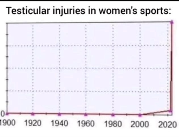
I didn’t grow up where Hockey was a thing. But some grew up where they love Hockey.
I’m not against companies producing hockey sticks for those who love and play the sport.
But those who produce “hockey sticks” for Team Climate (The Cause) that have no more to do with reality than the paper they’re printed on?
How many goals have they missed so far? Have they ever scored even one?
They’ve lost every game but the MSM keeps claiming what a great team they are.
At the risk of a scold from Chas the Mod for repetition, here is a topical hockey stick graph for the modern thinker. Geoff S
Anyone who disagrees with that are NUTS!
They should be tucked away in a padded pouch! 😎
Do we even know the statistical distribution of floods (other than River Nile)?
Sort of. Geologists are used to estimating floods with an expected frequency of 5, 10, 50, 100, and 1,000 years. The expected frequency is a statistical average, there could be consecutive 50 year floods, for example. Things like overbank pseudo-Bouma Cycle sedimentation, valley slope notches, change in vegetation at a similar topographic level, etc are some useful markers, but the whole exercise is a bit of an estimation and not exact. Great to have Jim Steele appear regularly with his great Reality Checks.
Hydrologists use either ARI (Average recurrence Interval) or AEP (Annual Exceedance Probability) derived from records of past streamflow… if they exist.
Trouble is, with only around a maximum of 100 years of data, anywhere, down here in Australia, (often considerably less) anything with an AEP of less than say 2% (1 in 50) has a huge margin attached to it.
Saying something like “1 in 1000 year flood” is very confusing to those who don’t understand that they are actually working with probabilities from very inadequate data.
I remember where I worked there were rooms that had a plaque on the wall with loading limits such as “100 lbs. per square foot”.
At first I puzzled about that. Sounded like if I stood with my feet together I should fall through the floor!
The study of Climate and Weather was much more honest before the invention of Cell Phones to record the present and Google to erase the past.
(“Google”, a figure of speech using a part for the whole.)
They probably didn’t get such wide and rapid distribution as today but fortunately there are quite a few photo going back more than a hundred years.
Great post, Jim Steele. Thank you.
I have family roots in Waterbury VT downstream of Montpelier (i.e. toward Lake Champlain where the Winooski River ends up.)
In this short drone video of the recent flooding in Waterbury, the final scenes show a railroad overpass, which I remember well, and then a street with a cemetery toward the right. That is Winooski Street, where my grandmother and aunt and uncle lived in the late ’60’s.
https://www.youtube.com/watch?v=1gr2LjY6ueU
Glad to see Waterbury may have been drenched, but overall it doesn’t look too bad.
story tip
Totally off-topic, but engendered by news today of yet another SpaceX launch of a block of Starlink satellites.
Key story points:
— as of June 2023, there are a little over 4,000 satellites in the SpaceX-owned and operated Starlink constellation
— the FCC currently has approved deploying up to 15,000 of the satellites
— SpaceX’s long-term goal for Starlink is to have around 42,000 such satellites at a time in low Earth orbit
— some astronomers have major concerns with Starlink satellites due to their anticipated numbers . . . these satellites are relatively bright and move across the sky rapidly . . . they leave long, bright trails on film and digital camera long-exposures meant to study faint objects in the solar system (e.g., asteroids and comets) and objects outside of it (e.g., stars, nebula and galaxies).
(ref for above: https://www.androidauthority.com/starlink-satellites-in-orbit-3337267/ )
Also,
“The planned large number of satellites has been met with criticism from the astronomical community because of concerns over light pollution. Astronomers claim that the number of visible satellites will outnumber visible stars and that their brightness in both optical and radio wavelengths will severely impact scientific observations . . . The International Astronomical Union (IAU), National Radio Astronomy Observatory (NRAO), and Square Kilometre Array Organization (SKAO) have released official statements expressing concern on the matter.”
(ref: https://en.wikipedia.org/wiki/Starlink , under “Impact on Astronomy”)
Elon Musk: the billionaire that polluted all of Earth’s night sky and got away with it while government regulators were asleep at the wheel.
I found this (reprinted) story in less than one minute of searching.
https://vermontdailychronicle.com/great-flood-of-1927-most-destructive-of-20-major-floods/
In 1927, CO2 was about 300 ppm, maybe a bit less.
Jim, thanks for the article. I’ve been following the flooding closely because I lived in Woodstock, Vermont, in 1966 and 1967, while in the Army and stationed at the Cold Regions Research and Engineering Laboratory in Hanover, NH. I spent a lot of my spare time panning for gold in New England, but especially in Vermont. One of the better places was only about 1/2-hour from where I lived. I went back there, to the area around Plymouth, the Summer after Hurricane Irene (2011), to see how things had changed in my favorite locality. There had been a small dam on one branch of the brook, which had filled up with sediment from the late 1800s to the present day. The dam failed during Irene and the larger boulders made it at least 1/4 mile down the creek bed. The flood waters also took all the underbrush and small trees out at least down to the small stone bridge, below the boulders. I discovered, to my surprise, that the foundations to the old cider mill I had read about were still there, revealed after all the brush was removed. However, the brook was choked with sediment and it was difficult to find any gold as it was all sitting on bedrock. I had thought about going back while I am still able to get around. After this latest storm, with all the damage around Ludlow and Plymouth, I’m planning on driving back next Summer just to see how much things have changed with this storm. If I’m lucky, I might even find some gold this time.
Something that you might find interesting is that back in the ’60s, I would frequently observe forest jumping mice, [something like a kangaroo rat] around twilight, in the headlights of my truck while driving home. When I was back there in 2012, I was standing near the brook, when some motion at the edge of my peripheral vision caught my attention. It was an adult forest jumping mouse. I caught it with my hands (and surprisingly didn’t get bit) and understood why it was out in broad daylight. Both eyes were white, apparently opaque cataracts. It appeared to be blind. It jumped out of my hands, landing in the water, and swam across the narrow creek. I caught it again, took some pictures of it, and released it in some dense vegetation where it had cover. I had previously seen red fox in the area. I don’t know how it managed to reach adulthood being blind. I toyed with the idea of keeping it and bringing it back to Ohio as a pet, but then decided to just let Nature run its course. Just as well, because when I read up on it, it apparently specializes in a type of fungus that lives along the creek edge and I wouldn’t have been able to feed it.
Keep up the good writing.
Clyde
Location – north of Rainy Pass -WA, along the Pacific Crest Trail
Camping for a week doing trail work on the PCT we encountered the Western Jumping Mouse (Zapus princeps). Cute and a pain. They could jump to a standard size card-table we used in camp. The mice where I live don’t jump, but they are still a pain.
The Vermont jumping mouse is quite the acrobat too.
Every time I read about “unprecedented”, “record breaking”, etc I wait a couple days then read the always forthcoming links to actual data that blows the claims out of the water
Even in Malta people are talking about climate scariness and how terrible the sun is, and so a previously healthy population where levels of vitamin D where concerned is now largely deficient. We’ve been made afraid of the natural and trained to seek remedies in the man-made, when that’s what’s making us sick (fatty liver disease from all the fake food).
I suspect people in the Med are less likely to get skin cancer. I’m Italian American. I tan very quickly. My last visit to my doctor- he said, “oh, Joe, are you using sun tan lotion? Oh, that’s right- you’re Italian!” First time he ever said anything remotely funny. I know enough to not go out on the first warm sunny day for hours. I build up. But if you live in the Med area it’s warm and sunny most of the year. I’d like to know if my theory is right- that people in the Med area don’t get skin cancer at the same rate as in cold countries. It’s a terrible disease. I know 2 people who died from it. By now, in mid summer, I’m at least as dark as Obama. 🙂
I don’t know about the Med, but Australia has a very high Melanoma rate, including people who work outdoors.
Certainly for the “pale faces” who originated in the British Isles but what about the aborigines?
We actually have quite a large proportion of people of Med (mainly Greek and Italian), Asian or Indian subcontinental origin.
I don’t know if there has been much of an age-stratified breakdown of the incidence in various ethnic backgrounds. Apart from some very isolated areas, most Aborigines have varying degrees of European, Middle Eastern or Asian ancestry.
You would have to think that darker skin would help.
Every river floods. Anyone who doesn’t understand that is severely brain damaged. That’s why every river has a flood plain. Building in a flood plain is stupid unless you prepare for the inevitable flood.
Yep. In the UK so many homes were being built on flood plains that the government had to back a scheme with insurers so that people could get affordable insurance. Local Authorities regularly grant planning permission for such building because it brings in more council tax, even if the Environment Agency advises against. Scheme is called ‘Flood Re’.
Here is the most dramatic headline from Europe this weekend:
Europe’s ‘hottest’ city could ‘turn into a desert’ in next few years due to furnace heat
https://www.express.co.uk/news/world/1790630/Europe-hottest-city-Seville-desert
The young lady journalist could correct her article even using unreliable Wiki.
The city is Seville, Southern Spain.
It is close to North Africa and the Saharah.
Record highs: May 41C, June 45.2C, July 46.6C, August 45.9C, September 44.8C
Notice the pattern in these driest months in a winter rainfall area.
With 20 inches (500mm) of winter rain this area is not going to become a desert.
No journalist should be allowed to write on climate without elemental Geography.
This alarmism is pure hogwash.
Never let a good storm or flood go to waste. Isn’t that right Sen. Schumer?
You can explore VT river gauges here. Some of the gauges list historic crest.
https://water.weather.gov/ahps2/index.php?wfo=btv
I should add that if you scroll down below the map you’ll see the “Waterways” menu.
Pick a waterway and you’ll see a list of gauges on it. Click on one and you’ll see more info including the historic crest (if available).
Here’s the historic crest for Winooski River at Montpelier Vermont.
(Note how recent the Low Water Records are.)
Flood Categories (in feet)
Major Flood Stage:17.5Moderate Flood Stage:16Flood Stage:15Action Stage:11
Historic Crests
(1) 27.10 ft on 11/03/1927
(2) 19.05 ft on 08/29/2011
(3) 17.59 ft on 05/27/2011
(4) 17.55 ft on 06/30/1973
(5) 17.31 ft on 04/07/1912
Show More Historic Crests
(P): Preliminary values subject to further review.
Recent Crests
(1) 19.05 ft on 08/29/2011
(2) 17.59 ft on 05/27/2011
(3) 8.66 ft on 03/30/2003
(4) 10.37 ft on 04/14/2002
(5) 10.54 ft on 05/10/2000
Show More Recent Crests
(P): Preliminary values subject to further review.
Low Water Records
(1) 2.67 ft on 09/22/2020
(2) 2.86 ft on 09/07/2010
(3) 2.88 ft on 09/03/2012
(4) 2.88 ft on 07/22/2018
They should write infomercials. Some use fear rather than the virtues of the product.
This is a screenshot selling an anti-bacterial shower head.
. . . as if all the bacteria that could possibly exist in a shower comes only from water passing through the shower head.
To paraphrase:
Bather, disinfect thyself!
SomeMany use fear rather than facts.Many people are confused about the weather patterns that caused the extreme rainfall over Vermont, causing debates and speculation regards the forces behind the extreme rainfall without knowing the weather pattern..
So lets clear things up. Attached are screenshots from US Weather Service models.
In the top frame the position of the cyclonic storm (ie Low Pressure System was moving up the coast, with the leading/northern edge of the counter clockwise circulation pumping moisture from the Atlantic inland . In these illustrations the lightest blue color represents the greatest amount of moisture. Brown the driest.
The southern edge of the High Pressure system centered off Labrador and its clockwise winds also drives moisture inland. Importantly its location had 2 effects causing extreme rainfall.
1) The High slowed the Low Pressure system’s migration
2) The convergence of those two circulation patterns amplified moisture transport into Vermont where extremes were measured approximately marked by green circle.
The bottom frame show the jet stream at 500 mb for the same time. Coming out of its trough, the upper level winds helped push warm moisture air northward into New England.
Those dynamics drove the peak flow of moisture into Vermont on July 10, which then diminished as the Low moved further north.
Those dynamics have nothing to do with CO2 despite what alarmists insist on !
There is one thing that worries me about this pattern and the water-logged mountains of New England and New York. What if they get a tropical storm anytime soon? What a disaster that would be.
They might actually break the 1927 record which they pretend doesn’t exist?
The mainstream media is disgraceful, there is no reason to believe anything they report.