By Paul Dorian

Overview
Temperatures have already peaked today in Fairbanks, Alaska and are currently right around the zero degree mark and they are very likely to stay below zero during the entire time for at least the next 7 days or so. In fact, low temperatures this weekend are likely to be near 25 degrees below zero in the midst of an on-going intense cold spell that may last right into December. While Alaska is normally quite cold this time of year, these temperatures are well below normal in many cases and also quite a bit different from recent years. Some spots are likely to end up with their coldest November on record.

Details
Some of the recent winter seasons in Alaska have been warmer-than-normal, but this year is getting off to a very different start with persistent intense cold in the 49th state. This is not your typical cold for Alaska and some spots are liable to end up with their coldest month of November ever recorded.

In Fairbanks, temperatures are likely to stay below zero from later Tuesday through at least the next 7 days or so. The normal high temperature in Fairbanks this time of year is +8 degrees (F) and -10 degrees (F) is the normal low and this upcoming weekend could feature temperatures bottoming out at 25 degrees below zero. Another example of the relentless cold comes from King Salmon (Bristol Bay region of southern Alaska) where the average daily temperature has ranged from 15 degrees to 31 degrees below normal for 13 straight days. In fact, it looks quite certain that this will finish up as the coldest November on record in King Salmon as relief is not expected anytime soon. Numerous Alaska towns have experienced record low temperatures this week including Bethel, Cordova and Alyeska with two days in each location and Homer with three days this week of record low temperatures.

Alaska’s biggest city, Anchorage, is not escaping the intense cold with Tuesday’s temperatures in the single digits and likely to peak near the +10 degree (F) mark. The normal high temperature in Anchorage on this date is +26 degrees (F) and the normal overnight low is +15 degrees (F). In fact, temperatures this weekend are likely to bottom out near 15 degrees below zero which is 30 degrees below the normal for this time of year.

One of the likely causes of the intense cold being experienced this month in Alaska is the colder-than-normal water sitting off the west and southern coastlines. This area of colder-than-normal water has been quite persistent in recent months and is quite a dramatic change from recent winters. Last year and in some of the prior winter seasons, the water was quite a bit warmer-than-normal in the northeastern part of the Pacific Ocean – likely playing a big role in some of the recent warmer-than-normal winters in Alaska.
With the persistent and intense cold and the colder-than-normal water temperatures, sea ice has responded accordingly and has grown quite rapidly – in some cases to its greatest extent this early in the season since 2012. For example, “ice-over” in the Chukchi Sea has already exceeded 95% of the basin which is the earliest on this date since 2012 and some four or five weeks earlier than the past 9 years. The Bering Sea ice extent is also off to its fastest start for this early in the winter season since 2012.
Meteorologist Paul Dorian
The cold temperature (to me) indicates a loss of energy upward, and ocean water freezing indicates moving energy from the water to the air.
If the air mass doesn’t move, the cold intensifies. This is the development of a Continental Polar (cP) air mass.
When this air mass does move, I hope it goes east-southeast. Sorry Canadian Prairies & North Dakota, I live in central Washington State. About mid-December, look for that intensely cold air moving someplace where it will be hard not to notice.
This airmass will probably move down the coast instead of Southeast. I’ve already seen a few forecasts and the reasons behind them showing BC, Washington, Oregon and NorCal getting the brunt of this. But then as you say, it is going somewhere ultimately and forecasts are not absolutes.
Is Europe ready to be hit by Arctic air? Very high pressure over Iceland.
It certainly looks that way. Not sure if we’ll get a sustained onslaught of Arctic air or, as in previous years, a flip-flopping between cold and warmer periods as the winds shift round. We’ll just have to see and take what comes.
Another test for the windmills.
Those high-pressure systems can give windmills a double-whammy: They can freeze the windmills, and/or becalm the wndmills.
I wouldn’t want to be depending on windmills to keep me warm.
We don’t have hurricanes in Europe. Otherwise, we would, in Germany, never have been able to produce over 100 TWh out of windmills last year:
The windmill installation process in the US (and also in France) was desastrous.
Heavy frost across the US Midwest as early as tonight.
The cold sits far to the south. … https://earth.nullschool.net/#current/wind/isobaric/500hPa/overlay=temp/orthographic=-93.86,43.17,506/loc=-113.309,34.667
Yes, this is the extent of the polar vortex.
Current temperatures (C).
PDO is plummeting.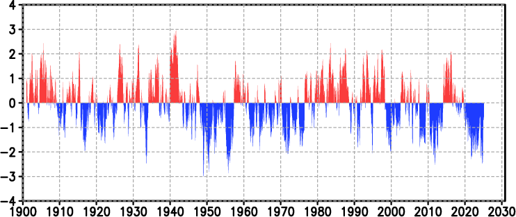
There is no change in the north Pacific circulation and more waves of precipitation are reaching British Columbia, where a total of more than 4 metres of snow could fall in the mountains.
https://www.tropicaltidbits.com/sat/satlooper.php?region=ak&product=ir
Winter at the end of November will begin in Europe with full force. For starters, snowfall in Spain.
http://tropic.ssec.wisc.edu/real-time/mtpw2/product.php?color_type=tpw_nrl_colors&prod=europe×pan=24hrs&anim=html5
There you go, Anthropogenic Global Warming strikes again!
It’s not just this winter. Alaska has experienced colder temperatures over the past two years. This past summer barely broke 70 deg F. I can’t warm up.
I generated anomalies wrt 1981-2010 for GHCN daily Anchorage stations in JJA 2020/1 and obtained
US AK_ANCHORAGE_MERRILL_FLD______ 2021 7 -16.06 (°C)
US AK_ANCHORAGE_MERRILL_FLD______ 2021 8 -14.98
US AK_ANCHORAGE_INTL_AP__________ 2021 7 -14.78
US AK_ANCHORAGE_MERRILL_FLD______ 2020 7 -14.75
US AK_ANCHORAGE_MERRILL_FLD______ 2020 6 -13.82
US AK_ANCHORAGE_INTL_AP__________ 2020 7 -13.69
US AK_ANCHORAGE_MERRILL_FLD______ 2020 8 -13.65
US AK_ANCHORAGE_MERRILL_FLD______ 2021 6 -13.56
US AK_ANCHORAGE_INTL_AP__________ 2021 8 -13.52
US AK_ANCHORAGE_INTL_AP__________ 2020 6 -12.85
US AK_ANCHORAGE_INTL_AP__________ 2020 8 -12.61
US AK_ANCHORAGE_INTL_AP__________ 2021 6 -12.28
Reminds me Andalucia (Spain) in June 2019, where hotspot ‘Moron de la Frontera’ suddenly dropped 20 °C below the 30 year average 🙁
*
And NOAA’s forecast for Alaska within Northern America doesn’t look much better:
https://www.cpc.ncep.noaa.gov/products/CFSv2/htmls/usT2me3Mon.html
Hello La Nina…
But the climate cluckers will just say that global warming is causing colder winters…so you cant win with these knuckleheads.
Back in January 1989 when Alaska’s alltime statewide record low temperature was being threatened (but ended up being safe by 4 degrees F), I heard of that cold wave being a sign of lack of global warming. Since then, I have heard of other Alaska cold waves being pointed out (incorrectly) by global warming skeptics as “evidence” of lack of global warming. And, climate activists point out recent cold waves (mostly incorrectly) as “evidence” that temperature variance is increasing, while temperature variance (at least north of the Tropic of Capricorn) is actually mostly decreasing because the Arctic is warming more than the rest of the world.