Guest opinion: Dr. Tim Ball

You learn right away when studying climate that geothermal heat is ignored as a possible heat source in the climate equation. Textbooks consider the Sun as the sole source of heat. I corrected the omission in the climate portion of a textbook I produced, but it didn’t change the situation. As with everything in climate, knowledge and understanding are in their infancy, as new evidence and limitations are regularly identified. This occurs despite the hindrance of political and financial road blocks created by the Intergovernmental Panel on Climate Change (IPCC) and their proponents. Skeptics continue to prove the science isn’t settled. The IPCC had to limit their research to only human causes of climate change because including natural sources makes that portion inconsequential. The unintended consequence of this decision was confirmation that you cannot determine the human portion if you don’t know the natural portion and its variability. They created their own Catch 22.
The effect of geothermal on global heat energy balance is still generally rejected, but various local effects keep the issue on the radar. These include the recent story on Greenland melt rates and the role of geothermal in Antarctica. They trigger questions about the number of volcanoes active below sea level and briefly resurrect the geothermal issue. The examples presented are almost all related to geothermal heat accelerating glacier melt and restricted to ocean related glaciers, but land-based glaciers are also affected. Usually, this involves increased basal melting and accelerated movement creating “galloping glaciers.”
I developed an interest in the role of geothermal heat as a source affecting oceans and thereby global water and air temperatures while pursuing Soviet submarines in the North Atlantic in the Cold War. Knowledge of the layers of water temperature with depth was essential for the pattern of noise transmission and the efficiency of our electronic capacity to track submarines. I was always amazed at the variation in temperature with depth even in the upper 300 m, especially the number of inversion layers. Later, I worked with the late Roger Pocklington on his transect of water temperatures from Newfoundland to Bermuda and the impact on the cod fisheries.
I became aware of the mid-Atlantic ridge, its length, and proximity to the surface (Figure 1). It is like a giant heating rod constantly pumping heat into the ocean. I am unaware of any calculations of the amount of that heat, but because it is so close to the surface, an impact on surface water temperatures is possible.

Figure 1
There are two issues in play; the total impact of geothermal heat on the ocean temperatures, and the regional impact of specific hot spots, especially around volcanoes. There are insufficient measures of the extent or magnitude of temperature input by conduction or convection through direct contact with magma (average temperature of 1350°C) with bottom water.
It’s hard to find vents and active volcanoes in the deep ocean. To do so, scientists can use a CTD instrument package that measures the conductivity, temperature, and depth in the ocean. Changes in temperature and the cloudiness of the water may be a sign of a hot spring site or erupting underwater volcano.
This also applies to the amount of heat input around the ridges where the crust is thin.
In many places, the magma simply wells up beneath the weakened and thin areas of crust and fills in the cracks and fissures without ever breaking the surface.
In late 2013 an area of warm water known as “The Blob” appeared off the Oregon coast in the northwest Pacific. The media, with the help of climate alarmists, immediately began making links to global warming, El Nino, and weather events such as the drought in Oregon. The obsession and hysteria with human responsibility for all weather and climate changes created by the IPCC eliminate any consideration of natural, that is non-manmade, explanations. Most of the public think El Nino is a new manmade phenomenon.
At the Heartland Climate Conference in Washington DC., last summer, Dennis Groh, a retired professional engineer, approached me with his calculations and explanation for a geothermal source for the Blob. He identified the source of as the Axial Seamount, one of the most detailed and constantly monitored volcanic regions in the world (Figures 2, 3, 4)

Figure 2

Figure 3

Figure 4
Preliminary calculations of the amount of heat produced from the Axial Seamount and contained in the Blob are revealing. The following are Dennis Groh’s calculations of that possibility.
History of events:
1998 January 25-3; 11- day earthquake but most lava moved in the first few days. Lava flow 13m thick, estimated volume 18,000 – 76,000 km 3 NOAA estimate 200 million cubic meters. A rectangular caldera 3 km x 8 km.
April 2011: Volcano subsided by more than 2.4 m. Lava flow 2 km wide and 3 times larger than 1998, so
(3) (0.018 – 0.076 km 3) Density of basalt 3.0 x 10³ Kg/m3
Average temperature of ocean 2°C. Deep ocean temperature @ 3.5% salinity is (0°C – 3°C).
Blob off Oregon (1 -3°C warmer)
1000 miles’ x 1000 miles’ x 300 ft.
5.28e+6 x 5.28e+6 x 3.00e2 ft
27.88 e+6 ft2 x 3.00e2 ft
8368.52e6 ft3
8.363e9 ft3
8.363e9 ft3 of water @ 22°C
p = 62.4lbs/ft3
(8.363e9 ft3 )( 62.4lbs/ft3) = 521.88e9lbs = 5.22e11lbs
(5.22e11lbs)(453.59gms/lb) =2367.21e11 gms
or 2.37e14 gms
Amount of energy required to raise 2.37e14 gms
Heat capacity of water 15°C ~ 4.184 Joules/gm°C (5°C – 60°C 4.20 – 4.18)
1°C (1) 4.184 joules x 2.37e14 = 9.90e14 joules
2°C (2) 4.184 joules x 2.37e14 = 19.81e14 joules 1.98xe15
3°C (3) 4.184 joules x 2.37e14 = 29.71e14 joules 2.97xe15
4°C (4) 4.184 joules x 2.37e14 = 49.58e14 joules 4.96xe16
Assumption no generation of steam phase change.
2015 Axial Volcano subsidence essentially equal to 2011, so assumption estimated volume is the same for lava flow. 99×106 m3
99×106 m3 (magma ®basalt) x (3×10³ Kg/m3) = 297×109 Kg
2.97×10¹¹ Kg of basalt from magma.
(1) Energy to cool magma to melt point from 1300°C ®1200°C
Heat capacity of magma 1.0x 10³ J/Kg°C
(2.97×10¹¹ Kg)(1.0×10³ J/Kg) (1.0×10²C)
[2.97×10¹⁶ Joules] Þ{0.297×10¹⁷ Joules}
(2) Latent heat for crystallization of basalt
(4.0×10⁵ J/Kg)(2.97×1011 Kg) = 11.88 x 10¹⁶
[1.19×10¹⁷ Joules]
(3) Energy to cool basalt from melt point to ocean temperature @ one mile deep
1200°C ® 0°C (assumption @ I mile depth no steam escapes)
heat capacity of basalt 1.4×10³ J/Kg°C
(2.97×10¹¹ Kg)(1.4×10³ J/Kg°C) (1.2×10³ °C) = 4.99×10¹⁷
[4.99×10¹⁷ Joules]
1 +2 + 3 Þ 6.21×10¹⁷ Joules [over 3 days Þ 2.4×10¹² watts @caldera opening ®100,000watts/m2
6.21×10¹⁷ Joules could raise 2.37×10¹⁴ gms of water
(6.21×10¹⁷ Joules) 6,120×1014
4.184/gm°C (2.37×10¹⁴gms) = 9.92×1014 = 626°C
The amount of energy from the magma was far in excess of what was needed to supply the heat necessary to create the “Blob anomaly.” The IPCC omits many variables in their political goal to produce predetermined results. Unfortunately, because of the narrow focus, the IPCC created, even regular climatology and climate science omits, ignores, or doesn’t even now about many factors. Some of this occurs because of the diversion of research funding almost exclusively to proving their anthropogenic global warming (AGW) hypothesis. Every single factor is important to achieve levels of understanding for accurate short and long-term forecasting. In the blame game, the omission of anything that affects the global energy balance that is even half the amount claimed as the human contribution is important. Since the human portion is a minuscule amount, this means that virtually every natural source, including geothermal heat, is critical.
Interesting post.
But a flawed post, Tom, because The Blob formed in the central North Pacific and migrated east. The following animation is from the post here: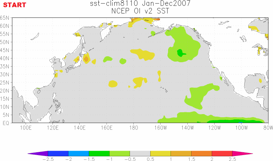
https://bobtisdale.wordpress.com/2016/01/23/the-blob-seems-to-be-disappearing-at-the-surface-but-will-it-reemerge/
As described in the linked post:
We can see that the warm water for The Blob appears to form during the 2010/11 La Niña and that it is then enhanced during the 2011/12 La Niña. That suggests a couple of things: (1) The warm water for The Blob may have first been released by the 2009/10 El Niño and then spun up east of Japan into the Kuroshio-Oyashio Extension (KOE) during the trailing 2010/11 La Niña. Or (2) changes in atmospheric circulation caused by the 2010/11 La Niña caused the warm surface waters to build up along the KOE, which was then enhanced during the 2011/12 La Niña.
Also see Figure 2 from that post. The subsurface data show evidence of surface warming followed by subsurface warming.
Beat me to it Bob. I contacted you back when after checking various earthquake databases as a possible explanations of the central Pacific iteration of the blob as it first emerged. Nothing.
Of course, this does not preclude more than one thing going on. A bunch of stuff congeals as geothermal explanation of SST increase in the area north of Iceland lately.
Different ocean basin different deal? Who knows?
Furthermore, the blob progressed methodically down the left coast before disappearing into the nino amplified waters.
Just throwing stuff out because we are naked apes in dire need of pulling the rabbit out of the hat:
There is a growing database indicating electromagnetic influence or response from tectonic events…
hmm. One should always be aware that correlation is not causation. If the color coding of the animation you provided is proportional to temperature/energy, then energy conservation tells me that a lot of energy “suddenly” appears at the end of that trip towards the coast.
So it can’t explain the formation or migration east but could it in part explain the holding power it has had since taking up residence off the coast? A coincidence?
Thanks Bob. I was just about to post that we need to see one of Bob’s animations on this.
It should be remembered that these are temperature ANOMALIES and do not necesarily represent a flow of warm water migrating across the ocean. This point is missed.
For example, if there is warmer water moving up from CA or simple LESS cooler water coming down from Bering Straights than the “climatological average” for that month, then we see a positive anomaly along the coast. This warm band which runs from Alaska ot California could just be a change in the rate of the major rotating ocean currents.
The clear pattern which your animation shows may indicate on ocean wide oscillation. A slow tide on the themocline. In the same way be 12h tides at the surface the density difference at the thermocline will resonate with variations on annual to inter-annual time-scales.
What I think we are seeing here is a lowering of the thermocline along the west coast and The lowering thermocline draws in warmer surface waters and anomalies go up . Conversely there is
a rise on the eastern and central regions pushing warm water away.
As is the case with coast lines concentrating the usual surface tides with which we are famiIiar, the form of the continental scale coastline here forms a focusing ‘mirror’ . This is why there is a focused blob on the US/Canada side and a much more diffused linear drop on the Asian side.
I have been saying for some time that I think such slow tidal movements on the thermocline are the trigger for El Nino events.
It is probably no coincidence that the recent ‘super’ El Nino happend 18 years after the previous one. These are long term variations in the gravitational forces which the density difference at the thermocline will resonate with.
The density difference between the warmer mixed layer and the deeper more saline water is about 1/1000 of density difference at the surface ( air / water ). This means it will resonate with periodicities 1000 time slower than the primary surface tides of 12h.
anna v:
You cannot evoke conservation of energy unless you have a closed system. Surface water is not a closed system. If the thermoline moves there will be energy changes on the vertical scale too. Neither can you apply energy conservation to ANOMALIES which are difference from a seasonal average and do NOT measure heat content directly.
This is the point I make above many of the changes we see in surface temperature “anomalies” reflect movements of deep water tides. We cannot consider surface anomalies in isolation if we want to understand the cause.
Bob, one should keep in mind that the blob was observable in sst anomaly maps (not temperature) – it is not an area of warm water. It’s just warmer than some multidecadal average. It can be that it was a cold blob in multidecadal average and the cold disapeared lately (and it’s getting colder again). SST maps look different than the anomaly maps.
http://www.esrl.noaa.gov/psd/map/images/sst/sst.daily.gif
Agree Bob, also a complete mixture of units, cubic Km, cubic ft. No wonder NASA lost a satellite due to unit confusion.
AMERICA. PLEASE STICK TO SI UNITS.
I think Anna has a point as the 2014 and 2015 time frame showed great intensification. However there was two years during that time of consistent and intensifying high pressure, being causative of the California drought. This persistent high pressure was called the R.R.R., or ridiculously resilient ridge. During this time solar insolation to the area was also very high.as, of course, the high pressure kept the storm track away. The joules of heat pumped in from above were never quantified AFAICT.
1. So what caused the high pressure (RRR) to be locked in this area?
2. Could the April 2011 volcanic event have been orthogonally causative to the great intensification of surface waters as seen in 2014 and 2015? The energy content of the event appears capable, and energy is certainly indestructible. However, is the timeline for movement of heat from the sea floor in April of 2011 to the surface in 2014 and 2015 reasonable? What is the residence tine of geo thermal heat released at depth in oceans? What is the lateral movement of such heat as it rises? (Sea floor currents are different then surface currents.)
3. We have four major events that may have contributed to the blob, and thus the record SST temperatures. 1. The migration of the high SSTs from the 2010 El Nino, as outlined by Bob T. 2. and 3. The formation of the R.R.R and the loopy Jet stream. 4. The volcanic release of adequate heat in April of 2011. Events in nature do not occur in a vacuum or in isolation. Could all have combined and be orthogonal causation?
While everything I wrote above appears logical, Dennis Groh’s calculations of heat from the volcanic event appear problematic. Perhaps Dr. Ball could invite him to discuss his numbers.
anna v, welcome back. I haven’t seen a comment from you for some time. The animation is of sea surface temperature anomalies.
There are a couple of explanations for the increases of coastal sea surface temperature anomalies in 2014 and 2015. First, The Blob and corresponding ridge of high pressure caused changes in atmospheric circulation that resulted in a decrease in coastal upwelling. Second, after slamming into the coast of South America, the El Niño-related downwelling (warm) Kelvin waves in 2014 and 2015 migrated northward as coastally trapped Kelvin waves. Third, both of the above.
And now for a general reply. When we have data for the geothermal heat released from the ocean floor, blog posts like this will have value. Until that time, they are simply conjecture.
Bob T, do you discount solar insolation over the RRR area due to reduced cloud cover as being partially responsible for the record increase in SST in that area?
Tim as you know, if you wish to provide a consensus, you must eliminate all major doubts.
So, any possibly input of a natural nature that is not quantified and not possible to be quantified as things stand must be ignored, but this isn’t just AGW science, it’s in astrophysics too. Anything that may throw more uncertainty on a hypothesis or theory must be marginalised and played down.
On the marginalised uncertainties.
Natural CO2, the biggest and most important question relating to atmospheric CO2 content, ignored.
Geothermal input into the ocean, ignored.
Effect of solar magnetic influence on the climate, ignored.
Alkalinity inputs and natural carbon sinks (The AO question)
It is worth mentioning, as I have only yesterday on WUWT, the fact that at depths geothermal energy is retained by pressure, as water cannot boil at those depths. This creates an ocean floor blob of waters with high temperatures of 500c give or take, the waters surrounding the vents are heat blooms which amount to undersea radiators. It is not insane to consider the heat will be exchanged with cooler water right up the water column, obviously if water is 500c on the floor, there is potential all the way to the surface for heat transfer, which would reasonably support ideas of a phenomenon like the heat blob.
This issue is entirely unquantified, in fact you really need to research oceanic exploration to find more information on it than you will find in climate science.
Also Tim, the upper column and surface waters would in such a scenario show the most warming given the lower potential for absorbing extra heat, with deeper cooler waters with much more potential for heat dissipation.
This would also support the hypothesis.
You seem to have missed the main point of the post: we’ll never find out what caused the blob, nor how, or whether, it affects climate when climate scientists can only get funding to study AGW, and scientists who study non-anthropic causes are routinely demonized as “deniers” by political pressure groups, and are not defended by their “colleagues”.
Despite many efforts to acquaint WUWT posters with realistic ocean kinematics, the notion persists that migrating “anomalies” necessarily imply correspondingly migrating water masses. The material (Stokes) derivative, which decomposes temporal changes into advective and LOCALLY induced components tells us otherwise. The upshot is that what has been presented here gives no unequivocal indication of the origins of the “blob.”
While it certainly is tempting to speculate about highly intense sea-floor sources of geothermal heat producing strong regional anomalies, their effect should be as transient as the activity of those sources. In other words, they would contribute only high-frequency variability in the climatic record. Meanwhile, speculations about tidal origins are incredible on their face, inasmuch as they produce no heat whatsoever and change only the dimensions of the orbital oscillations of water masses.
“The material (Stokes) derivative, which decomposes temporal changes into advective and LOCALLY induced components tells us otherwise.”
Yes, but only the advective component can bring a large amount of heat from somewhere else. A locally induced component implies a local heat source. That’s my main objection to this speculation, apart from mixing up grams and tons. There is no way that the heat from an underwater volcano could magically reappear without loss in the blob. It has to be advected. And with the advection comes much mixing. The heat would have to warm not just the blob, but everything in between. Even if some special current were to carry the heat directly from the volcano to the blob with little mixing, that wouldn’t suffice. Because if the current hasn’t lost its heat on the way, it can’t transfer it to the blob either. And it can’t just become the blob itself, because mass is conserved. The current will continue and the heat will move on.
Nick Stokes:
In writing “only the advective component can bring a large amount of heat from somewhere else. A locally induced component implies a local heat source” you state the obvious, while missing my essential objection to Bob Tisdale explanation of origins. Of course there has to be convection and attendant heat loss between the sea-floor source and the SST “blob,” but that is NOT the same as surface currents advecting warm waters from far afield.
I see a Heated exchange in the future.
(double pun! Bonus!)
LIKE!!!
You otter be ashamed of yourself.
GRROOOOOAAAANNNNNN
Decades ago, it’s been stated that just four states had earthquakes. Now a day that number is up to seventeen. Perhaps the inner earth is heating up and that is impacting global temps…
I would like to know the date range when you say “Decades” and the 4 States. I’ve studied the subject for 50 years and even then, it was recognized 2/3 of the lower 48 States were at risk for damaging earthquakes. Also checking history books, much has been written about earthquakes felt in North America in pre revolution times.
As of sometime in 1906 earthquakes were known in Alaska, Washington, Oregon, California, Washington, Massachussets, Arkansas, and Missouri. An 1812 quake whose epicenter was in southeast Missouri near New Madrid was intense enough to cause major damage in parts of Missouri, Arkansas, Iowa, Illinois, Indiana, Ohio, Kentucky, Tennessee, ans Mississippi and moderate damage in northern Alabama. A sidewalk was cracked near Washington DC, the quake was easily felt in Ohio and Pennsylvania, and it rang a church bell in Boston. The effects of that quake went far because the rock in the affected area is less damping of seismic waves than the rock of California.
typo last paragraph…
” Unfortunately, because of the narrow focus, the IPCC created, even regular climatology and climate science omits, ignores, or doesn’t even””””now”””” about many factors.”…………”Know”
Tim, I would say you and Dennis just threw a cog in the blobs wheels….
and omit the comma after “focus”
a very interesting post with some insightful observations about the presumption of human causes for everything amid unquantifiable uncertainty in much larger natural flows. if you take the ipcc ar5 carbon budget and insert their own stated but ignored uncertainties in natural flows, anthropogenic contributions become statistically undetectable.
http://papers.ssrn.com/sol3/papers.cfm?abstract_id=2654191
IPCC AR5 knows nothing of the oceans below 2,000 m, nothing of the ocean floors. Active ocean floor volcanism could conceivably explain it all, both heat & CO2. The justification for blaming mankind is that there are no known natural processes, especially if you don’t bother looking which happens when the science is settled.
Found some interesting work by Spencer Weart. He does an excellent job of presenting the skeptic’s arguments and then casually dismisses them. Time and reality have proven his dismissal premature.
Outstanding post, Bob.
I wonder where all that heat went 8<}. Anything about Co2 or other items emitted that would affect 'ocean acidification' of the northwest sea coast?
“or 2.37e14 gms”
This is a ridiculous mish-mash of units. And that is where it goes wrong. The mass of the blob is nowhere near 10^14 grams. It is an area (1000 mile sq) of about 6 million sq km, of 6 * 10^12 sq m, and about 100 m deep. That is about 6*10^14 tonnes (cu m), not gm.
Oops, 3 million sq km. s 3*10^14 tonnes.
It appears that Ball has fumbled once again and cost WUWT another thread.
Yeah. Oops.
I too have noticed that Dr Ball’s post are often a load …
Missed that. Good catch.
You have to keep your eye on the Ball.
You have to use standard US units. ie: how many OLYMPIC SIZED SWIMMING POOLS. Then folks would get it.
Nick, the units are not wrong. Grams were used because that is the coefficient that is available to convert to Joules. What you disagree with is his original volume. Dennis has 8368.52 million cubic feet which is 237 million cubic meters. You suggest the volume is much larger at 3 million square km.
You are talking about the Blob, but Dennis’ calculations are about a specific and much smaller volume immediately around the caldera. What happens when you disperse Dennis’ 626C over the much larger volume?
It appears that Nick has fumbled once again due to his AGW bias
jmr, the calculations are wrong. Dr. Ball (and Dennis Groh) says:
is equal to
That is the source of their error of six orders of magnitude.
I do love watching folks try to defend the indefensible …
w.
Could we put he energy in ‘kitchen’ terms? How much water would that boil away at sea level?
Or, better yet, how many ‘Hiroshimas’?
So a transient phenomenon is caused by vulcanism which is always present somewhere on the “ring of fire”? While this certainly could have contributed to the “Blob”, unless there are copious examples of similar correlated events, it seems highly unlikely this was a major factor.
Slipstick,
” While this certainly could have contributed to the “Blob”, unless there are copious examples of similar correlated events, it seems highly unlikely this was a major factor.”
I flush things more logical than that every day, it seems to me ; )
Indeed John. The Blob was an unusual even, as was the RRR, as was the volcanic event in the post, so nature does not appear inclined to give “copious examples of similar correlated events,” at a sufficient rate within the context of our observational capacity. This makes the comment somewhat illogical.
Good article and worthy of much thought. Minor typo in the 6th line of the last paragraph – now should be know.
Very interesting thermal energy calcs also. The fact that the calculated amount of heat assumed to come from the volcanic activity exceeds by a large number the amount required to cause the blob temperatures observed is a good step. I’d also like to see if any temperatures at depths between the mount and the surface have been observed indicating a thermal plume upwards (Maybe the submariners zipping around in the area would know?)
In order to have warm surface water as observed in the blob the heat has to be transported vertically, Convection is a probable mechanism but it should be evidenced by a thermal plume leading upward and cooling by dilution with surrounding seawater. Evidence of this would ‘seal the deal’.
Might be difficult to raise funds for an investigation that will generate information which runs counter to perceived “wisdom”.
See below my comment where the energy needed to warm a 1,000 mile by 1,000 mile by 300 foot parcel of water by 1 degree C is 9.9E20 joules, not 9.9E14 joules. The error was caused by missing an e6 in the multiplication of 5.28e6 * 5.28 e^ * 3e2, resulting in determining the volume to be 8.36e9 cubic feet when it is 8.36e15 cubic feet.
Seems to me that it might be a good idea to task one of the new UAV’s with doing a close-proximity temperature sweep of the Mid Atlantic Ridge, just zig-zagging back and forth along the length.
I have long been curious about the interaction of undersea volcanoes and the interaction of hot magma with the cold compressed water at the bottom of the oceans. I recall seeing somewhere that the transfer of heat through the very dense water occurs very quickly without warming the very dense ~2 or 3 deg C portion, only warming the less dense water above, in a fashion similar to the transfer of momentum through a line of billiard balls.
It seems logical to me that since the temperature at which pure water under conditions found at the surface is most dense is about 4 deg C, that the water at the bottom of the oceans would be held by pressure at a temperature corresponding too maximum density. It is also interesting that for water at maximum density, its enthalpy increases with pressure.
Might check the water property tables. My recollection is that heat changes enthalpy a lot, pressure not so much.
Nicholas, I would suggest the same to you. The Keenan and Keyes tables are where I got my info.
I think you might be off by a factor of 10^6 on the volume of the blob (and therefore the mass of seawater contained within). In cu-ft, I get a volume of 8.36×10^15 for the blob volume — you have 8.36×10^9. Did I miss something there?
If not then it would appear there is 2.37×10^20 grams of seawater in the blob, and insufficient heat in the magma cooling process to account for even 0.1C of water temp rise. Again, maybe I missed something???
No, neither you nor Nick are missing anything, the original post is indeed out by a factor of one million! So Tim has just proved that the Blob wasn’t caused by vulcanism.
Or not! The proponents of AGW get excited about a change of 0.01ºC, so, in their own terms, 0.1ºC is significant!
“0.1ºC is significant”
On the arithmetic here, it is 0.000626°C.
See this comment above: jmrsudbury April 9, 2016 at 5:07 am. jmrsudbury makes the point that Dennis’s calculations were not about the Blob, but the caldera.
MRW April 10, 2016 at 9:17 am
MRW, the problem is not what Dennis’s calculations are about. The problem is that the calculations are wrong. Dr. Ball (via Dennis Groh) says in the head post that:
is equal to
That is the source of their error of six orders of magnitude.
I do love watching folks try to defend the indefensible …
w.
I have long been curious about the interaction of undersea volcanoes and the interaction of hot magma with the cold compressed water at the bottom of the oceans. I recall seeing somewhere that the transfer of heat through the very dense water occurs very quickly without warming the very dense ~2 or 3 deg C portion, only warming the less dense water above, in a fashion similar to the transfer of momentum through a line of billiard balls.
It seems logical to me that since the temperature at which pure water under conditions found at the surface is most dense is about 4 deg C, that the water at the bottom of the oceans would be held by pressure at a temperature corresponding too maximum density. It is also interesting that for water at maximum density, its enthalpy increases with pressure as its volume decreases very slightly.
The result is that only the upper portion of the water will be warmed.
Interesting post…. For all the money spent and misdirected by the alarmists lots of good useful science sits on the back burner or off the stove all together.
Did you read the above comments? This is not good useful science.
While some here are saying the calculations are not correct, I can’t help but wonder – is the Axial Seamount the only source of geothermal heat in that area?
Should not the last line in this part of the Blob volume calculation:
“Blob off Oregon (1 -3°C warmer)
1000 miles’ x 1000 miles’ x 300 ft.
5.28e+6 x 5.28e+6 x 3.00e2 ft
27.88 e+6 ft2 x 3.00e2 ft”
be
27.88 e+12 ft2 x 3.00e2 ft ; 5,28×5,28=27,88 e+6 +6 = 27,88e+12 x 3.00e2 ?
If that is the case the calc is off by a million.
It would have been so easy to go in to get samples of sea water for chemical analysis. An eruption of any size is going to leave a chemical signature
No money for that I suspect
PS – this looks to be a subduction zone and the large caldera suggests high volume intermediate-silicic volcanism – not basaltic. These are the styles associated with high energy eruptions. Most basaltic events just ooze lava. I would not get too excited about MORs. Look over subduction zones and back arch basins. There is a whoppa running from New Zealand to Tonga. I may post an image when I have time
I was told there wasn’t going to be any math.
http://thumbs.media.smithsonianmag.com//filer/Blobfish-ugly-470.jpg__800x600_q85_crop.jpg
Lava erupts at 1250 C, water at mounds is supercritical at up to 374 C. Mounds over ocean gyres such as Mid Atlantic Mound, Juan de Fuca, and Cost Rican Trench as erupting periodically as it takes x kilojoules energy to overcome y overburden pressure erupted at z rate. Probably works out to once every 10 years. In climatology, hydrothermal trench and mound vent fields never, ever discussed once as periodic cycling mechanisms of heat anomalies in the ocean. ODP Leg 158 TAG mound well studied supercritical mound in the Atlantic. Huge complex. Very extensively documented. Offshore Juan de Fuca been erupting since last summer. They even put a seismometer on it.
I agree that the calculation of volume of the blob is wrong. One mile is 5,280 ft. 5.28e6 is 5,280,000 feet. But If the volume of the blob is smaller, doesn’t that strengthen the case for volcanic warming? Less water, same amount of volcanic heat, means warmer water.
The error, Thomas, is the line that says 1000 mi x 1000 mi * 300 ft =
5.28e+6 ft x 5.28e+6 ft x 3.00e2 ft = 27.88 e+6 ft2 x 3.00e2 ft
it should be:
5.28e+6 ft x 5.28e+6 ft x 3.00e2 ft = 27.88 e+12 ft2 x 3.00e2 ft
The calculations use a 1mi x 1000mi blob. Which can be heated with 1/1000 as much energy.
The calculations dropped an e6 and became correct for a 1 square mile blob.
Michael:
Thanks, I see the error clearly now.
The comments on this site seem to have become more informative than the articles.
Geothermal is probably greatly underestimated. All the heat released during plate tectonics has to go somewhere.
But think about it. The heat released by even a large volcano on land must be only a small fraction in comparison to the heat produced by sunlight over half the entire globe at any given moment. And large volcanos don’t even happen every day. The thermal effect of volcanos seems minuscule is comparison to sunlight.
I rember the past work, when we tried to calculate evaporation and solar radiation, in addition to daylength, latitude, sunshine hours, localised factors change the generalized Sun related standard equations. Among these that are of importance are climate system, general circulation patterns — humidity & wind. That is coast, inland & hill areas on one side, forest & mining; soil type, etc.
Dr. S. Jeevananda Reddy
“I became aware of the mid-Atlantic ridge, its length, and proximity to the surface (Figure 1). It is like a giant heating rod constantly pumping heat into the ocean.”
Above sea level, do mountain ridges generally act like giant cooling fins? Has anyone done any calculations on this – or is it inconsequential?
Calculations have been done without the benefit of corroborating data. The facts of the matter are that all the ocean ridges are unexplained shallow lines of melt without apparent mantle support.
The Iceland plume is a myth. The Hawaiian plume is a myth.
Our estimations of geothermal energy input can easily be off an order of magnitude. Maybe two.