![480px-Antarctica_6400px_from_Blue_Marble[1]](http://wattsupwiththat.files.wordpress.com/2014/05/480px-antarctica_6400px_from_blue_marble1.jpg?quality=83) From Geophysical Research Letters and the University of Leeds:
From Geophysical Research Letters and the University of Leeds:
Three years of observations show that the Antarctic ice sheet is now losing 159 billion tonnes of ice each year — twice as much as when it was last surveyed. See below for some sanity check calculations on why 159 billion tonnes really isn’t much more than a flyspeck in the scheme of things.
===========================================
Antarctica’s ice losses on the rise
Three years of observations show that the Antarctic ice sheet is now losing 159 billion tonnes of ice each year – twice as much as when it was last surveyed.
A team of scientists from the UK Centre for Polar Observation and Modelling, led by researchers at the University of Leeds, have produced the first complete assessment of Antarctic ice sheet elevation change.
They used measurements collected by the European Space Agency’s CryoSat-2 satellite mission, which carries an altimeter specially designed for this task.
In sharp contrast to past altimeter missions, CryoSat-2 surveys virtually all the Antarctic continent, reaching to within 215 kilometres of the South Pole and leading to a fivefold increase in the sampling of coastal regions where today’s ice losses are concentrated.
Overall, the pattern of imbalance continues to be dominated by glaciers thinning in the Amundsen Sea sector of West Antarctica.
However, thanks to the improved capabilities of CryoSat-2, problem areas such as the rugged terrain of the Antarctic Peninsula can now also be surveyed.
On average West Antarctica lost 134 gigatonnes of ice, East Antarctica three gigatonnes, and the Antarctic Peninsula 23 gigatonnes in each year between 2010 and 2013 – a total loss of 159 gigatonnes each year.
The polar ice sheets are a major contributor to global sea level rise and, when combined, the Antarctic losses detected by CryoSat-2 are enough to raise global sea levels by 0.45 millimetres each year alone.
In West Antarctica, ice thinning has been detected in areas that were poorly surveyed by past satellite altimeter missions.
These newly-mapped areas contribute additional losses that bring altimeter observations closer to estimates based on other approaches.
But the average rate of ice thinning in West Antarctica has also increased, and this sector is now losing almost one third (31%) as much ice each year than it did during the five year period (2005-2010) prior to CryoSat-2’s launch.
Lead author Dr Malcolm McMillan from the University of Leeds said: “We find that ice losses continue to be most pronounced along the fast-flowing ice streams of the Amundsen Sea sector, with thinning rates of between 4 and 8 metres per year near to the grounding lines of the Pine Island, Thwaites and Smith Glaciers.”
This sector of Antarctica has long been identified as the most vulnerable to changes in climate and, according to recent assessments, its glaciers may have passed a point of irreversible retreat.
Launched in 2010, CryoSat carries a radar altimeter that can ‘see’ through clouds and in the dark, providing continuous measurements over areas like Antarctica that are prone to bad weather and long periods of darkness.
The radar can measure the surface height variation of ice in fine detail, allowing scientists to record changes in its volume with unprecedented accuracy.
Professor Andrew Shepherd, also of the University of Leeds, who led the study, said: “Thanks to its novel instrument design and to its near-polar orbit, CryoSat allows us to survey coastal and high-latitude regions of Antarctica that were beyond the capability of past altimeter missions, and it seems that these regions are crucial for determining the overall imbalance.”
“Although we are fortunate to now have, in CryoSat-2, a routine capability to monitor the polar ice sheets, the increased thinning we have detected in West Antarctica is a worrying development. It adds concrete evidence that dramatic changes are underway in this part of our planet, which has enough ice to raise global sea levels by more than a metre. The challenge is to use this evidence to test and improve the predictive skill of climate models.”
Professor David Vaughan of the British Antarctic Survey said: “The increasing contribution of Antarctica to sea-level rise is a global issue, and we need to use every technique available to understand where and how much ice is being lost. Through some very clever technical improvements, McMillan and his colleagues have produced the best maps of Antarctic ice-loss we have ever had. Prediction of the rate of future global sea-level rise must be begin with a thorough understanding of current changes in the ice sheets – this study puts us exactly where we need to be.”
Dr Ian Joughin at the University of Washington, author of a recent study simulating future Antarctic ice sheet losses added: “This study does a nice job of revealing the strong thinning along the Amundsen Coast, which is consistent with theory and models indicating this region is in the early stages of collapse.”
The findings from a team of UK researchers at the NERC Centre for Polar Observation and Modelling, are published in the journal Geophysical Research Letters. Professor Vaughan and Dr Joughin were not involved in the study.
Sanity Check:
From Climatesanity: Conversion factors for ice and water mass and volume
If one cubic kilometer of water (i.e., one gigatonne of water) is spread evenly over the entire 361 million square kilomters, the thickness of the new layer of water will be given by:
1 km³ / 361 x 106 km² = 2.78 x 10⁻⁶ meters = 2.78 microns.
Or, in terms of gigatonnes:
1 Gt x (1 km³/Gt) / 361 x 106 km² = 2.78 x 10⁻⁶ meters = 2.78 microns / Gt
That is, one cubic kilometer of water (i.e., one gigatonne of water) will add less than 3 millionths of a meter to the oceans!
From the press release, we are seeing about 159 billion tons/year of ice converted to meltwater (unless it sublimates), so the effect on sea level would be 159/1000 or 0.159 159 x 3 millionths of a meter, or 477 millionths of meter of sea level rise per year from this. (or in other words 0.47 mm which works out to 47mm/century or ~1.85 inches/century)
For another perspective, a gigatonne of water is approximately one cubic kilometer. Frozen as ice, it would be expanded slightly, but for the purposes of perspective lets just say that is negligible. So, the ice loss per year would be 0.159 cubic kilometers.
According to the British Antarctic Survey BEDMAP2 project:
The derived statistics for Bedmap2 show that the volume of ice contained in the Antarctic ice sheet [is] 27 million km3…
Source: http://www.antarctica.ac.uk/bas_research/our_research/az/bedmap2/index.php
And thanks to those helpful kidz at “Skeptical Science”, we have this graphic depicting a cubic kilometer of ice. John Cook writes in 2010:
A visual depiction of how much ice Greenland is losing
One gigatonne is one billion tonnes. To get a picture of how large this is, imagine a block of ice one kilometre high by one kilometer wide by one kilometre deep (okay, the edges are actually 1055 metres long as ice is slightly less dense than water but you get the idea). Borrowing from alien invasion movies, the scale is well illustrated by comparing a gigatonne block of ice to a famous, historical landmark like the Empire State Building:
![empire_state1[1]](http://wattsupwiththat.files.wordpress.com/2014/05/empire_state11.jpg?quality=83)
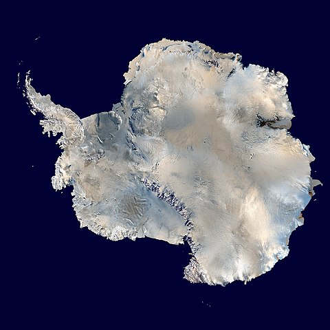
OK there are 14 million square kilometers of ice surface in Antarctica, not counting sea-ice. See if you can spot the tops of the 159 of these square kilometer ice blocks from this satellite view
Now imagine just 0.159 159 of those 1 cubic kilometer ice blocks missing each year. Scary, huh? Damian Carrington at the Guardian thinks so:

And so, the loss of 0.159 159 cubic kilometers of ice per year is apparently headline worthy, because at that rate of loss, it would take 169,811 years to lose all the 27 million cubic kilometers of Antarctic ice.
I’m pretty sure we’ll have gone through a few ice ages by then.
(Update: I made an error in the initial post with units, where I conflated kiloton/gigaton in one step, fixed)
Sea level rise.
http://climate4you.com/images/UnivColorado%20MeanSeaLevelSince1992%20With1yrRunningAverage.gif
http://sealevel.colorado.edu/files/2013_rel8/sl_ns_global.png
This is funny, declining sea level in the same area as the ice looses ? ( Or am i wrong ? )
http://sealevel.colorado.edu/files/current/sl.jpg
The report is right. There’s an error of 1000 in this post, probably because of considering billions to mean a multiplier of 10^12 instead of the american 10^9, or viceversa.
Anyway, 4mm per year is at odds with current sea level change MEASUREMENTS, which are lower than that. Something else must be making the sea level go down to get our current increase rate of only 3.2mm per year. Probably “it’s a travesty” that they cannot explain the missing water lol
Mike Jonas says: May 20, 2014 at 1:59 am
I agree, I’m afraid the post is out by 1000. There’s some confusion above and that doesn’t help but the OED is clear.
http://www.oxforddictionaries.com/words/how-many-is-a-billion
10^12 used to be a UK billion but we’ve mostly adopted the 10^9 US version.
“The radar can measure the surface height variation of ice in fine detail, allowing scientists to record changes in its volume with unprecedented accuracy.”
The so called loss of ice could be due to land subsidence. They should be measuring the surface level of the ice as well as the underlying level of bedrock to assure that there is a loss in the volume of ice. At the moment they are only measuring a gain in air space.
Harry, I think it is the other way around.
Europe, US, 1*10^x
million, million 1*10^6
milliard, billion, 1*10^9
billion, trillion, 1*10^12
And I think we need 159 cubes.
Joel O’Bryan says:
May 20, 2014 at 1:52 am
So, what would a gazillion measure? (Tongue planted firmly in cheek!) 😉 Probably any scary number that hasn’t yet been thought of that counteracts the facts?
So how does this equate to no global warming for 17 years and record sea ice area in Antarctica this year, as recently reported by WUWT?
Just to sum up the maths (because I had to check it anyway!)
1 Gigatonne = 1 km3
So a sea rise of 2.78 micron per 1 km3 melted is correct for the stated ocean area.
So melting 159 km3 would result in a sea rise of 441.7 microns, or 0.4417 mm……
So you are looking at 159 of those blocks …
But even that wonderfully accurate satellite does not really know what the melt rate is, because ice loss measure is complicated by isostatic rebound – as ice is lost, mantle rock moves inwards and upwards to take its place.
……and so computer models are employed. Many revisions of their outputs have occurred.
From Skeptical Science:
Previous predictions of present-day GIA have implied that this process adds 100-200 Gt/yr to the GRACE signal over Antarctica; this must be subtracted from the raw GRACE data to reveal the rate of present-day ice-mass loss. This GIA correction is about as large as, or larger than, expected present-day ice-mass change. If the GIA model were to predict smaller GIA mass change, the GRACE estimate of ice mass change would be smaller by the same amount, so it’s clearly very important to have an accurate GIA model.
To me, …. not so re-assuring that the figures are meaningful.
It takes 1.09 cubic inches to make 1.00 cubic inch of water, so we are saved by 9% less water rise depending exactly on how much lateral expansion is possible instead of just rise.
AndyL says:
May 20, 2014 at 1:43 am
How? Why? Compared to what?
And they can measure that rate of loss – with no margin for error from satellite?
Nylo says: “Probably “it’s a travesty” that they cannot explain the missing water lol”
The missing water is hiding in the deep ocean……
Remember how sea level suddenly rose when the satellite era began?
http://www.thegwpf.org/sea-level-shenanigans/
http://www.john-daly.com/altimetry/topex.htm
Harry
compared to the 2-3mm / year rise we currently have, it’s an increase of 15-25% (rounded up)
“ven then, trying to spot 159 blocks of ice missing in 14 million is like trying to find a gnat’s brain with a magnifying glass – impossible. In the grand scheme of things and in context the numbers are nothing. But the SOP of those with a campaign to push is to use large scary numbers.”
That will take about 88.000 years? And sea level rise of about 38 meters?
?
“Remember how sea level suddenly rose when the satellite era began?
http://www.thegwpf.org/sea-level-shenanigans/
http://www.john-daly.com/altimetry/topex.htm”
I remember UNEP keen on getting those that measure sea level into the UN system, like WMO?
Let’s hope it doesn’t continue to double every 3yrs.
Thier accuracy is approx 0,0008% of the total antarctic mass. NO WAY they can’t measure, calculate, estimate that with that kind of accuracy.
I always go for the so called supplementary information to the paper which is usually free and gives you the detail as to how they did their detailed calcs. Here’s the link to the supplementary pages for this paper (taken by navigating through links from the BBC article):
http://onlinelibrary.wiley.com/store/10.1002/2014GL060111/asset/supinfo/Aux_material01.doc?v=1&s=71ac88fc936c00a2f80a41a3d7570004457788e9
It’s all estimates ladeled on model outputs…ladeled on more estimates.
@Alan the Brit: you are right. They say that the increased resolution has added thinning data for the West Antarctica peninsula and other coastal regions, adding 31% of loss at a stroke and that is what brings the new measurements into line with ‘other methods. In other words, that 31% loss increase was always there and is being used as part of the “doubling”. They hurriedly go on to say but the whole sheet has thinned too but don’t say by how much (the 2cm/yr statement is a back calculation from the 160 Gt loss so isn’t the actual elevation reduction they are referring to). So we are left in the dark as to what the real world increase is over the 2005 to 2010 survey. The info in this paragraph isn’t in the supplementary pages but gleaned from various sources including the BBC article and the abstract.
Can someone here dig out the 2005-10 survey data just to check they are not spinning regarding the simple, raw data doubling as well? If they are, the resulting decrease from 2010-13 may be commensurate with the East Antarctica gains in previous years, in other words, equilibrium.
PS I realise the 31% loss on coastal regions can’t be directly compared with the 100% doubling because it is regarding a sub section of the whole sheet. However, we don’t know how big a sub section it is and the authors acknowledge that the coast is where most of the thinning is. By that logic, the phantom 31% portion of the increase in coastal yearly loss could actually translate to more than 31% of loss for the whole sheet if the elevation of the rest of the sheet is near-stable. That may be the reason they rush to say that the whole sheet is losing ice. I suspect that portion of the loss is minuscule and well inside the vast error bars cited in the abstract. If so, this would leave the phantom 31% as the prime contributor to the claimed doubling. I smell a rat.
AndyL says:
May 20, 2014 at 2:41 am
And??? So what? Where’s the beef?
I love how the WUWT commenters have so quickly done their own “due diligence” “peer review” on this post and pointed out a fundamental math error in the report’s critique by Anthony. Fully a third of them did their own calcs and immediately jumped on the math error. Other commenters focused on how the current Antarctic melt rate is, essentially, non-catastrophic in the overall scheme of things. And the warmists claim we WUWT readers are math-illiterate and uncritical acolytes of a denier cult? Sheesh!
They say that E Antarctica has lost 3Gt. Area of E Antarctica is about 12 million sq km. Over that area, 3Gt has an average depth of 3/12000000km = 3/12mm = 0.25mm. Colour me sceptical.
Can you please check the math?
Wiki gives Antarctic ice mass as 26.5 million cubic km.
Loss is given as 159 billion tonnes a year.
Therefore it would take 167,000 years to melt, assuming the simple division (which one cannot).
Ocean volume is 1.37e9 cubic kilometers
The volume of ice in Antarctica is approximately 25,000,000 km3. The volume of ice in Greenland is approximately 2,500,000 km3. The rest of the land ice is small compared to these two, so it is fair to round up and say the total is about 30,000,000 km3.
The world’s oceans have an area of about 335,000,000 km2. If half of the ice in Antarctica and Greenland were to melt, then the oceans would rise about 45 meters (about 150 feet). All of the ice melting would raise the oceans 90 meters (or 300 feet). This requires that all the 30,000,000 km2 of ice must melt.
How fast is ice actually melting? There are conflicting numbers resulting from various methods of measuring. Velicogna (Science, vol 311, 2006) used time varying gravity measurements from the GRACE satellites estimated that Antarctica was losing 152 km3 of ice per year. In the same journal, Davis (Science, vol 308, 2005) concluded that Antarctica was actually gaining ice.
There are studies that claim faster rates of ice loss in the Antarctic than claimed by Velicogna. For example, Eric Rignot, (Rignot, et. al., “Recent Antarctic ice mass loss from radar interferometry and regional climate modeling,” Nature Geoscience, 2008 [3]) of the California Institute of Technology used satellite interferometric synthetic-aperture radar observations to show that the ice losses in the East Antarctic were zero, while the West Antarctic and the Antarctic Peninsula had combined losses of about 190 gigatonnes per year. This results in a 0.5 mm ocean rise per year, or about 2 inches per century.
Similar conflicting (but small) results hold for Greenland.
At current rates of melting it will take about 200,000 years for all the ice to melt in the Antarctic. This scenario is unlikely because if the pattern of the last 2 million years continues, the next 200,000 years should contain two ice ages, each lasting about 10,000 years. If this conclusion surprises you, even Al Gore’s presentation shows the repeating glacial/interglacial pattern of 100,000/15,000 years during the Quaternary. [The Quaternary Research Association describes the Quaternary as “…characterized by long periods (c.100,000 years) of cold climates interspersed with shorter periods (c.10-15,000 years) of warmer conditions.”]
Ice in water has displaced its weight. Ice expands when it freezes which is why it floats. Therefore ice that melts will neither add nor subtract from the water level. The calculation is simple. Even at 300 Gt per year land ice melt, the oceans will rise a tiny 0.85 mm per year. Too bad for the climate hysterics that they’re never going to see any cities under water.
Note: Davis’s co-authors of the Rignot paper 2005 uses radar altimetry which has an upwards-trending bias in regions of high slopes and rugged terrain, thus resulting in lower than actual mass losses in the WAIS. The Velicogna measurements have been corrected since then with an adjustment for glacial isostatic rebound which is more appropriate, and the result is mass declines. See Allison et al. 2009 for the most comprehensive summary of the ice sheet contributions since some papers that are being cited are outdated. Velicogna’s 2009 paper is a good read and so is Pritchard et al. 2009.
[1] http://www.sciencemag.org/cgi/content/abstract/sci;311/5768/1754?maxtoshow=&HITS=10&hits=10&RESULTFORMAT=&author1=velicogna&andorexacttitleabs=and&andorexactfulltext=and&searchid=1&FIRSTINDEX=0&resourcetype=HWCIT
[2] http://www.sciencemag.org/cgi/content/abstract/sci;308/5730/1898?maxtoshow=&HITS=100&hits=100&RESULTFORMAT=&andorexacttitleabs=and&andorexactfulltext=and&searchid=1&FIRSTINDEX=0&volume=308&resourcetype=HWCIT
[3] http://www.nature.com/ngeo/journal/v1/n2/abs/ngeo102.html#a2
****
When faced with mathematical calculations and data, certain political groups and “green” Eco-zealots scoff at these facts. To those groups I would ask what is more probable; a government looking to generate funds from loosely-based quasi-religious ideas, or all the ice on the Earth melting and drowning everyone?
What is the dynamic ice balance for Antarctica? it collects up say .3 meter =( .3/1000 km) of ice each year via snow etc x 14 m sq km = 4200 cubic km annually so the article is saying that the continent is loosing 4360 cukm or 3.8% more annually over the period of observation, a small increase in precipitation of 3-4 % over a period ,or a minute amount of cooling will change the ice loss to and ice accumulation. The observed change probably falls within a range of natural variability.
The area of the oceans is about 3.6e8 square kilometre. An addition of 360 gigatonne of water raises sealevel by 1mm.
Mr Watts estimate looks about right.