After battling the “dry” tropical air along its route from Haiti, Cuba, Florida, to Louisiana, Isaac has finally become a hurricane with the required 64+ knots 1-minute sustained near-surface winds. Numerical models finally expressed some certainty on a Louisiana coastal landfall, but diverged significantly on intensity. There is also some question about the ability of Isaac to penetrate far inland away from the frictionally convergent swamps. A major flood event is underway.
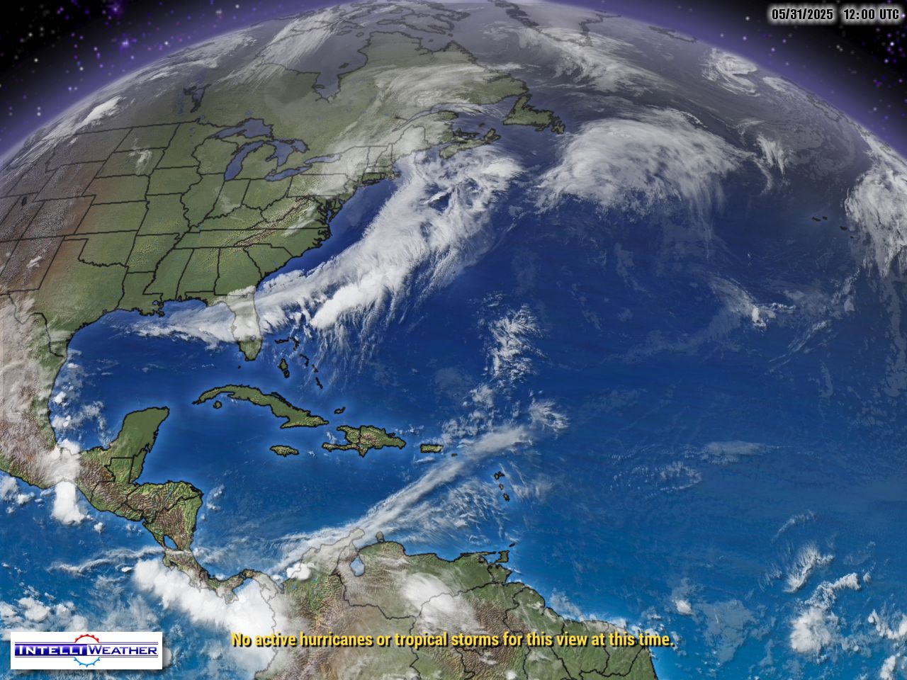
 Click image to animate it over several hours
This tracking map is in high definition (updates every 3-4 hours, click to enlarge)
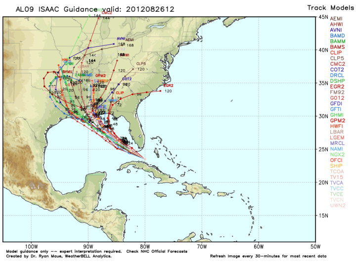
Now WeatherBell’s track map via Ryan Maue: (click to enlarge)
NHC:
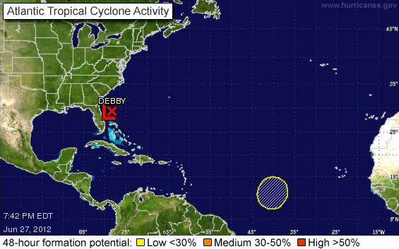
Track map in HiDef – click to enlarge:
More…plus signup for free hurricane bulletins.
http://wattsupwiththat.com/reference-pages/tropical-cyclone/
knothead says:
August 28, 2012 at 2:42 pm
…… Oh, and how many Imperial Gallons of fuel will it take to get there.
===================================================
Fewer than US gallons 😉
Here are some radar screencaps for KLIX , New Orleans, at approx 6PM EDT:
Base velocity .5 deg tilt (lowest sweep) (in kph, for the Brits – for knots, divide by 2, approx):
http://ephemerata.ca/uploads/Isaacbv20120828KLIX.png
Storm total precipitation (mm – haven’t even had to change to the hurricane scale yet, but its early)
http://ephemerata.ca/uploads/Isaacdsp20120828KLIX.png
One hour precipitation rate:(mm)
http://ephemerata.ca/uploads/Isaacohr20120828KLIX.png
Expecting blustery wet weather for the Toronto long week-end.
http://i22.photobucket.com/albums/b331/kevster1346/rainymonday.jpg
An interesting link … Shell Beach buoy readings – just outside Lake Pontchartrain – almost 9′ storm surge looks like …
http://tidesonline.nos.noaa.gov/plotcomp.shtml?station_info=8761305+Shell+Beach,+LA
http://www.ndbc.noaa.gov/station_page.php?station=shbl1
Main page: http://tidesonline.nos.noaa.gov/
http://flhurricane.com/cyclone/wxstatement.php?id=538027\
#538027 (Received by flhurricane at: 4:56 PM 28.Aug.2012)TCDAT4
HURRICANE ISAAC DISCUSSION NUMBER 31
NWS NATIONAL HURRICANE CENTER MIAMI FL AL092012
400 PM CDT TUE AUG 28 2012
SINCE THE LAST RECON FLIGHTS INTO ISAAC...WHEN A BIAS-CORRECTED SFMR
WIND OF 64 KT WAS OBSERVED...THE RADAR AND SATELLITE APPEARANCE HAS
CONTINUED TO BECOME BETTER DEFINED. ON THIS BASIS...THE ESTIMATED
INTENSITY HAS BEEN INCREASED TO 70 KT.
TRENDING THROUGH ALL OF THE WIGGLES AND WOBBLES IN THE AIRCRAFT
FIXES YIELDS A GENERAL NORTHWESTWARD MOTION OF 310/07 KT. ISAAC
REMAINS ON TRACK...AND THERE HAS BEEN NO SIGNIFICANT CHANGE TO THE
EARLY PART OF THE FORECAST. ISSAC IS EXPECTED TO CONTINUE
NORTHWESTWARD TOWARD A WEAKNESS IN THE SUBTROPICAL RIDGE THAT IS
ORIENTED EAST-WEST ALONG 30N LATITUDE. BECAUSE OF THIS WEAKNESS...
THE STEERING FLOW IS FORECAST TO DECREASE OVER THE NEXT 36-48
HOURS...WHICH WILL RESULT IN ISAAC SLOWING DOWN SOME MORE.
AFTERWARDS...THE RIDGE IS FORECAST TO BUILD BACK IN BY ALL OF THE
MODELS...ALBEIT TO VARYING DEGREES...WHICH SHOULD CAUSE THE CYCLONE
TO TURN SLIGHTLY TOWARD THE WEST-NORTHWEST BEFORE IT TURNS
NORTHWARD BY DAY 4...AND THEN MOVE NORTHEASTWARD INTO THE LOWER
GREAT LAKES AND OHIO VALLEY REGIONS BY DAY 5. IN THE LATTER PART OF
THE FORECAST PERIOD THE FORECAST HAS BEEN NUDGED A LITTLE TO THE
LEFT OF THE PREVIOUS TRACK...BUT REMAINS TO THE RIGHT OF THE
CONSENSUS MODELS THAT HAVE RECENTLY HAD A LEFTWARD BIAS.
ALTHOUGH NOT EXPLICITLY FORECAST DUE TO LAND INTERACTION AT 12
HOURS...FAVORABLE WATER TEMPERATURES ALONG WITH AN IMPRESSIVE
UPPER-LEVEL OUTFLOW REGIME SUGGEST THAT ISAAC COULD STRENGTHEN A
LITTLE MORE BEFORE LANDFALL OCCURS. HOWEVER...BECAUSE OF THE
UNUSUALLY LARGE WIND FIELD...RAPID INTENSIFICATION IS NOT EXPECTED.
ISAAC REMAINS A LARGE TROPICAL CYCLONE. A DANGEROUS STORM
SURGE...HEAVY RAINFALL...AND STRONG WINDS EXTEND WELL AWAY FROM THE
CENTER AND ARE EXPECTED TO AFFECT A LARGE PORTION OF THE NORTHERN
GULF COAST. FOR THIS REASON...IT IS IMPORTANT NOT TO FOCUS ON THE
EXACT CENTER LOCATION. THE THREAT OF HEAVY RAINFALL AND FLOODING IS
ALSO EXPECTED TO SPREAD INLAND OVER THE LOWER MISSISSIPPI VALLEY
REGION DURING THE NEXT FEW DAYS.
FORECAST POSITIONS AND MAX WINDS
INIT 28/2100Z 28.7N 89.2W 70 KT 80 MPH
12H 29/0600Z 29.4N 90.0W 70 KT 80 MPH...INLAND
24H 29/1800Z 30.3N 91.0W 55 KT 65 MPH...INLAND
36H 30/0600Z 31.3N 91.9W 35 KT 40 MPH...INLAND
48H 30/1800Z 33.0N 92.5W 30 KT 35 MPH...INLAND
72H 31/1800Z 36.0N 92.5W 20 KT 25 MPH...INLAND
96H 01/1800Z 39.0N 90.5W 15 KT 15 MPH...POST-TROP/REMNT LOW
120H 02/1800Z 41.5N 86.5W 15 KT 15 MPH...POST-TROP/REMNT LOW
$$
FORECASTER STEWART
http://flhurricane.com/cyclone/wxstatement.php?id=538027
Here’s what I use (no sales pitch here, just stating what I use):
Uconeer 3.0 – http://www.katmarsoftware.com/uconeer.htm
The previous version is free and will work for most purposes:
Uconeer 2.4 – http://www.simtel.net/product/view/id/54593.
Or versatile online velocity converter: http://www.conversion.ws/speed.htm
.
A couple other great resources – several diff models w/animations
Tropical Gulf Region WRF, NAM and GFS Models:
http://weathermodels.org/models/wrf_nmm/gulf/pmsl/animation.html
http://weathermodels.org/models/nam/gulf/pmsl/animation.html
http://weathermodels.org/models/gfs/gulf/pmsl/animation.html
As I understand it the WRF model is higher resolution and better at predicting intensity … all models seem to have the eye tuning left before landfall and staying over the warm gulf water longer while the strong “right side” of the eye is in what seems a bad place for New Orleans …
9.2′ now ….
“””””…..Jeanette Collins says:
August 27, 2012 at 8:45 pm
Dp, you have no idea what you are talking about, [snip -policy] In 2005, we had already evacuated once, for Hurricane David, which of course you don’t remember. …..”””
————————————
I don’t recall any evacuation of NOLA for a hurricane David in 2005. They tried to evacuate for Ivan in 2004; thank god it veered away from the city cause the evacuation was a cluster$&@ur momisugly? The only other evacuation attempt for the city was for Gorges in the late 90’s. (which was another cluster$&@ur momisugly!)
george e smith
August 28, 2012 at 2:11 pm
###
My stepdad was a Civil engineer specializing in rivers. He would get pretty uncivle when the topic of NO comes up. Engineers have been screamijng for 50 years that New Orleans can not last. Its sinking like a flat rock in a mud pit. Levies are not going to cut it and river modifcation is a joke. The only real option is to move.
george e smith says:
August 28, 2012 at 2:39 pm
###
Thanks so much for your comment. I was hyperfocusing at work, needed a break, and your humor did the trick!
“””””….._Jim says:
August 28, 2012 at 4:35 pm
george e smith says August 28, 2012 at 2:39 pm
It’s hard to believe that here on the World’s most read Science web site, that there are so many folks who can’t convert knots, to kph or mph.
…
Here’s what I use (no sales pitch here, just stating what I use):…..””””‘
_Jim you completely missed my point; “you didn’t do those conversions; somebody else did it for you. ”
How do you do it on a desert island (Maldisland) with just one central coconut palm, and one shark offshore ?
Like I said, I can’t believe so many people don’t know how to calculate anything !!
Bizarre ho people are comparing that cloud formation to Katrina.
Speaking of wind speeds, a quick look at the weather bouys scattered all over the gulf near LA/MS is pretty revealing. The max I’ve found since landfall began is 54 knots. They must have gathered all the ones showing hurricane force winds into a central location not accessible from where I’ve been looking.
You are setting up a scenario I am unlikely in my lifetime to experience; when I travel, I have a compact circular slide rule buried in my briefcase. As ubiquitous as the web is anymore I don’t find the need to carry a copy of the ITT Reference Data for Engineers anymore either.
Upon further reflection, given your scenario, I can see where knowledge of basic Trig functions might come in handy, but I don’t see that knowing the conversion from Knots to km/hr would have much benefit … also, in a similar situation you probably wouldn’t have ‘assets’ at your disposal that I would have, to wit, 2-way communications via a jerry-rigged ham, Marine or aircraft radio (either HF or VHF) …
.
Could that be because, there never was a ‘hurricane David’ in 2005 *?
.
.
.
Posted a 2nd time in this thread, list of storms in the 2005 Atlantic hurricane season –
http://en.wikipedia.org/wiki/List_of_storms_in_the_2005_Atlantic_hurricane_season
.
* FMS or False Memory Syndrome, often occurring at the suggestion by another.
.
george e smith says:
August 28, 2012 at 5:01 pm
“”How do you do it on a desert island (Maldisland) with just one central coconut palm, and one shark offshore ?””
===================
Ask Gilligan or the professor. Ginger would never have a clue. 😉 But then if you were on a desert island, would it matter?
The federal government should not pay to rebuild ANY of them. The people and businesses who live there should if they want to live there. This is what insurance is for, markets self-regulate stupid behavior by making the consequences of said behavior very expensive.
I live right at the Jersey shore and do not expect the government to bail me out but I know they will. So why waste money on home owners insurance when suckers like you can pay for it? You really do not see how socialized insurance encourages this behavior? I think about everything before I say it. I said nothing about wanting anything to “go away”, I simply do not want to pay for other people’s moronic decisions.
_Jim says:
August 28, 2012 at 6:42 pm
“”Posted a 2nd time in this thread, list of storms in the 2005 Atlantic hurricane season –
http://en.wikipedia.org/wiki/List_of_storms_in_the_2005_Atlantic_hurricane_season“”
===================
Hurricane Irene in 2005 and Hurricane Irene in 2011? That was a long lived bitch of a hurricane. It’s good that Obama tackled her in 2011 and put an end to it. All done from the office of the NHC. Saved Tampa earlier this week and will save New Orleans tonight and the drought stricken mid west later in the week.
Greg, I am surprised you are unaware that government made Katrina a disaster waiting to happen and more government will not fix a problem they caused,
Government and the Katrina Crisis (Walter Block, Ph.D. Professor of Economics)
Well southeast of NO, over the Gulf, there are some gusts to 80 and maybe one to 100. Most major news outlets are reporting sustained 80 (false) and gusts to 100. In NO, there are no hurricane winds at this time.
Well said Poptech. I couldn’t agree more.
george e smith
August 28, 2012 at 2:11 pm
###
My stepdad was a Civil engineer specializing in rivers. He would get pretty uncivle when the topic of NO comes up. Engineers have been screamijng for 50 years that New Orleans can not last. Its sinking like a flat rock in a mud pit. Levies are not going to cut it and river modifcation is a joke. The only real option is to move.
=========================================
Even the alternative energy people are calling for the abandonment of NO…
> Infeasibility of Rebuilding New Orleans
> The river is moving away from the city. The city is sinking because of its
> weight, because no upbuilding by new muck for many decades, because
> of being cut off from the fresh water, because it is sliding off a cliff (the
> Continental Shelf), and because the Oil and Gas Industry is extracting oil
> out from under it. It is a city that for all intents and purposes is now Sea
> domain. Spend the money on developing alternative energy solutions instead.
For the gory details and the history behind it, see…
http://pesn.com/2005/09/23/9600175_Rebuild_Energy_Systems_Not_NewOrleans/
Storm is wobbling on the coast and looks like it’s getting better organized and spreading out. It’s Jogged a bit further west, in our direction. I’ve seen them loop back out before and come back in, but it seems like they usually loop clockwise. This may be just a large eye wobble. Still looks like we’ll be on the weaker west side.
Good, N.O. should be getting through in pretty good shape.
Now head on up toward Kansas and soak the parched, dry lands.
Whatever its classification after the fact (I too see the presidential upside to this being a hurricane rather than a mere tropical storm), Issac is delivering a way too much water to the cities and towns on the gulf coast.
My thoughts go out to the folks who live in the flood zones.
The storm has now come ashore. NHC/NOAA should be using ACTUAL surface windspeed measurements from now on. There are lots of surface based weather stations capable of these measurements. They should supplement guesstimates from fly-throughs. Actual measurements are the only way to test NHC’s surface windspeed estimates. This is something NHC normally does not do when a storm finally reaches landfall. Instead, they make after the fact adjustments much later which never make their way into the media. I hope this blog collects current surface windspeed data and posts it now.