At noon 8/28/11 PST, I’ve discontinued this thread as a “top post” on WUWT.
NOTE: New posts will appear below this one while Irene is in play.
UPDATE: at 5PM EST 8/28 Irene is a tropical storm with sustained winds of 50mph. See updated bulletin 34 below
 New exclusive high definition tracking map added to our Tropical Storm Reference Page.
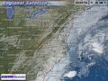
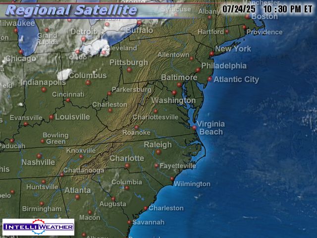
Here’s the latest imagery below, which will automatically update every 30 minutes:
Here is link to Ryan Maue’s FSU model page, which updates GFS, NAM, HWRF, GFDL, NOGAPS, ECMWF, and CMC throughout the day. Example here is the NAM-WRF 4-km high-resolution simulated radar (60-hour forecast): watch the eye size grow and the fronts move by, and the daytime seabreeze showers…

Here’s more, storm tracks and wind probabilities for south Florida and US East Coast:

Track Hurricane Irene on your PC in radar and satellite imagery – click the animation


BULLETIN

TROPICAL STORM IRENE ADVISORY NUMBER  34

NWS NATIONAL HURRICANE CENTER MIAMI FL       AL092011

500 PM EDT SUN AUG 28 2011

...CENTER OF IRENE NEARING NORTHERN NEW ENGLAND...

SUMMARY OF 500 PM EDT...2100 UTC...INFORMATION

----------------------------------------------

LOCATION...42.7N 72.8W

ABOUT 65 MI...100 KM S OF RUTLAND VERMONT

MAXIMUM SUSTAINED WINDS...50 MPH...85 KM/H

PRESENT MOVEMENT...NNE OR 20 DEGREES AT 26 MPH...43 KM/H

MINIMUM CENTRAL PRESSURE...975 MB...28.79 INCHES

WATCHES AND WARNINGS

--------------------

CHANGES IN WATCHES AND WARNINGS WITH THIS ADVISORY...

NONE.

SUMMARY OF WATCHES AND WARNINGS IN EFFECT...

A TROPICAL STORM WARNING IS IN EFFECT FOR...

* CAPE HENLOPEN DELAWARE NORTHWARD TO EASTPORT MAINE...INCLUDING

DELAWARE BAY...NEW YORK CITY...LONG ISLAND...LONG ISLAND SOUND...

COASTAL CONNECTICUT AND RHODE ISLAND...BLOCK ISLAND...MARTHAS

VINEYARD AND NANTUCKET

* UNITED STATES/CANADA BORDER NORTHEASTWARD TO FORT LAWRENCE

INCLUDING GRAND MANAN

* SOUTH COAST OF NOVA SCOTIA FROM FORT LAWRENCE TO PORTERS LAKE

INTERESTS ELSEWHERE IN EASTERN CANADA SHOULD MONITOR THE PROGRESS OF

IRENE.

FOR STORM INFORMATION SPECIFIC TO YOUR AREA IN THE UNITED

STATES...INCLUDING POSSIBLE INLAND WATCHES AND WARNINGS...PLEASE

MONITOR PRODUCTS ISSUED BY YOUR LOCAL NATIONAL WEATHER SERVICE

FORECAST OFFICE. FOR STORM INFORMATION SPECIFIC TO YOUR AREA OUTSIDE

THE UNITED STATES...PLEASE MONITOR PRODUCTS ISSUED BY YOUR NATIONAL

METEOROLOGICAL SERVICE.

DISCUSSION AND 48-HOUR OUTLOOK

------------------------------

AT 500 PM EDT...2100 UTC...THE CENTER OF TROPICAL STORM IRENE WAS

LOCATED NEAR LATITUDE 42.7 NORTH...LONGITUDE 72.8 WEST. IRENE IS

MOVING TOWARD THE NORTH-NORTHEAST NEAR 26 MPH...43 KM/H...AND THIS

MOTION WITH A LITTLE FASTER FORWARD SPEED IS EXPECTED OVER THE NEXT

DAY OR SO.  ON THE FORECAST TRACK...THE CENTER OF IRENE WILL MOVE

OVER EASTERN CANADA TONIGHT AND EARLY MONDAY.

MAXIMUM SUSTAINED WINDS HAVE DECREASED TO NEAR 50 MPH...85 KM/H...

WITH HIGHER GUSTS...MAINLY OVER OR NEAR THE WATER WELL EAST OF THE

CENTER.  IRENE IS FORECAST TO WEAKEN AND BECOME A POST-TROPICAL

CYCLONE BY TONIGHT.

TROPICAL STORM FORCE WINDS EXTEND OUTWARD UP TO 320 MILES...520 KM

FROM THE CENTER.  A WIND GUST OF 67 MPH...108 KM/H...WAS REPORTED

FROM AN UNOFFICIAL SITE NEAR HYANNIS PORT MASSACHUSETTS.

ESTIMATED MINIMUM CENTRAL PRESSURE IS 975 MB...28.79 INCHES.
Lots of people using hindsight to downplay things. Where were you all two days ago?
For those that seem to not understand, the top winds in a hurricane are in the eye wall. Tops winds do not extend very far away from that. So when they say what the top winds are that is only in the eye wall. Now. hurricane force winds can extend out a distance and that is the crucial number. Most of the area that wind in a hurricane never see more than 60 mph. Finally, finally, I have seen a “standing in the storm weather person” actually say what the wind speed is that is blowing them around. Those winds are NOT hurricane force winds.
Here is a list of Atlantic Hurricanes in the 1700’s Must have been Due to the invention of the
Franklin Stove and George Washington’s Hummer…
http://en.wikipedia.org/wiki/List_of_Atlantic_hurricanes_in_the_18th_century
peruse and note the all time records-like the Potomac tides….
Worse than we thought..
John Stover says:
August 27, 2011 at 9:05 am
Yeah, $6.5 million for paperwork, inspections, and bureaucratic overhead, $100K in actual repairs, by the looks of it.
Old people are walking around inside the joint without even a hard hat on. One fat ancient woman walking through the mayhem in open toed shoes. You can’t seriously expect anyone to believe that the damage was more than superficial, can you?
http://www.fredericksburg.com/News/FLS/2011/082011/08272011/648059/index_html/slide_show2?qstart=1
That figure is SO inflated. It isn’t the taxpayers footing the bill either. Don’t be goofy. City buildings are insured just like any other structure. They’ll want it condemned if possible to build a brand new school on the insurance company’s nickel.
@John Stover
Isn’t this just precious?
http://www.virtexco.com/Docs/Richmond/Lousia%20High%20School/IFB.pdf
A July 25th, 2011 request for bids to renovate Lousia County High School. Approximately $7 million in renovations and improvements. Coincidence that county estimates the quake caused $7 million in damages or perhaps someone hoping to capitalize on an earthquake so they can get an insurance company to cover the cost of rennovation. You be the judge.
Seems to me they’re asleep at the NHC.
The 2PM EST update #29A says
NNE OR 15 DEGREES AT 13 MPH. Yet after crossing onto land “west of Cape Lookout” more than 7 hours ago it appears to be centered over East Lake. That’s only 70 miles and more like NE of landfall. Maybe I could do a better job after all!
@ur momisugly Gacooke, don’t think that some of the models allow for the west slant that occurs from land friction/rotation interaction. This appears to be a common cause of missing the actual track.
John Stover says:
August 27, 2011 at 9:05 am
Sorry John, I feel for your damage, but here in Los Angeles, I don’t get out of bed until a 6.0 strikes.
Roger Knights says:
August 27, 2011 at 9:50 am
That’s all very well, because hurricanes are measured based on maximum gusts, right?
Why is Chris Lawrence, reporting for CNN, standing in the water at the end of a pier to report on the storm from Chesapeake Bay?
“Economic Geologist says:
August 27, 2011 at 1:32 pm
Why is Chris Lawrence, reporting for CNN, standing in the water at the end of a pier to report on the storm from Chesapeake Bay?”
Because he is a media whore. Next!
Crap from Scientific American republished by AccuWeather:
“For all of their harbor-side advantages, low-lying coastal cities, such as New York, are particularly vulnerable when it comes to major storms, which are predicted to become more powerful with climate change. New York state has initiated long-term plans to build sea walls and discourage waterside development as a means to decrease future high-water threats, but these preparations are still years and decades away.”
http://www.accuweather.com/blogs/home-garden/earth-you/54316/map-of-flood-risks-and-hurrica.asp
At least the fire in Dismal Swamp is out… pretty sure.
From the NHC 5 PM Discussion: “BECAUSE THE LARGE WIND FIELD WILL TAKE TIME
TO SPIN DOWN…HOWEVER…IRENE IS STILL EXPECTED TO REACH THE NEW
YORK AREA AT OR NEAR HURRICANE STRENGTH.” Spin down? Are hurricanes objects, like tops, with momentum? Or are they constantly propagating collections of (for want of a better word) phenomena that interact to create the thing we call “hurricane.” What are these people talking about?
When Irene began to weaken yesterday as the media, the hurricane center, FEMA and state and local governments all along the east coast were hyping the storm as major hurricane event, I tweeted, “I forecast Kartrina. Irene is no Katrina.” Then I tweeted, “When the Director of FEMA told people to ignore the category of the storm and prepare for the worst, that was stupid. Thousands of scientists have worked to develop the forecasting skill and system to classify hurricanes and give meaningful guidance based on that system, and a high government official dismisses it.”
And then I tweeted ” After scrapping the coast line from Virginia to Long Island, Irene will be a minimum hurricane or even a tropical storm by the time in reaches New York City.” Then I turned off CBS, NBC, ABC, CNN, FOX, MSNBC and told our viewers in San Diego how I felt. The news Producers were upset; I was ruining their crisis coverage. The News Director cheered and said right on, Coleman. I am now watching movies and playing poker and ignoring the silliness as an average hurricane makes landfall in North Carolina and Virgina. I feel so much better.
John Coleman says:
August 27, 2011 at 4:54 pm
Amen to that good sir.
It is a big rainmaker. Though still an awesome event if you happen to be under it … those storms almost feel alive with their power … even if only at tropical storm level
Still, it’s been so hyped that credibility is strained. What happens when a REAL storm hits?
The silly coverage of this weather is just another episode of the Dumbing Down of America. Filling people’s brains with useless information makes the people stupider. It’s as simple as that.
Andrew
I just saw a report from some jerk standing in the surf, doing his best to look as though he was braving the teeth of the storm. Near the end of the shot a elderly woman strolled easily by, looking at him as though he were some kind of fool. Pretty much sums up this whole debacle. I worked briefly as a cameraman for a local TV station way back in the dark ages, and even then the on air personalities were prone to hyperbole and drama, but nothing like what we are witnessing with Irene. Here on the SW coast of BC we regularly get very nasty storms that bring down hundreds if not thousands of trees. We had a couple where the tree-fall count was in the millions. We routinely get 50-100 mm’s or more of rain — combined with gale force and greater winds over very short periods of time. Buildings get damaged and/or destroyed and houses get flooded, but never, repeat, never have we had 24 hour coverage with hundreds of “reporters” tripping over each other and wading out into the water, trying to scare the pants off of everyone. Even the President of the United States is doing his level best to frighten folks.
What on earth are you guys putting in your water?
Sitting here in South Jersey. You should understand the area has had 13 inches of rain in the last 3 weeks, so the gound starts very saturated. In addition we haven’t had a serious wind storm test the trees in the area in a long time. Even if it is a Cat 1, with overly saturated ground, I’m not real confident about the 50+ foot trees on my neighbor’s property.
So far in the last 2 hours we’ve had 4 different National Weather warnings of confirmed area tornadoes, the nearest about 3 miles away in Glassboro. We are supposed to experience the heaviest winds and rains between 3am and 7am, unfortunately the local retention ponds and streams are already over their banks as it has been raining since 9am.
The kids are treating this as a big adventure, forgot this is their first and closest taste of a hurricane in their lifetime.
Thought you might get a kick out of this in the New York Times.
“Seeing Irene as a Harbinger of Climate Change” http://www.nytimes.com/2011/08/28/us/28climate.html
After the past few hurricane seasons as well as this one and Irene, it must be hard to write that stuff with any knowledge or integrity.
Leon Brozyna says:
August 27, 2011 at 5:41 pm
“Still, it’s been so hyped that credibility is strained. What happens when a REAL storm hits?”
Excellent point! While we don’t want to downplay the real dangers associated with heavy rainfall and tropical storm force winds, if people wake up tomorrow and find that it wasn’t a catastrophic storm, then what happens when a real Cat3 or Cat4 comes along? Some will say – “Eh, they said Irene was bad but it was a big dud, so I’m going to ignore the MSM and the forecasters this time…probably wrong again…”. What a disaster that would be.
May not be as bad as it could be, but still a lot of rain up here in the North East!!
RE: TrueNorthist says:
August 27, 2011 at 6:49 pm
“I just saw a report from some jerk standing in the surf, doing his best to look as though he was braving the teeth of the storm. Near the end of the shot a elderly woman strolled easily by, looking at him as though he were some kind of fool…”
Don’t you just hate it when that happens?
They cut out the part where the reporter shakes his fist at the elderly ham, and shrieks, “You f—ing old b—-! That’s the ninth take you’ve ruined! If you pull that stunt one more time I’ll kick your a– from here to Friday!” Then he looks to the camera and wails, “I just want to go home!”
Sounds like you get some awesome storms in your neck of the woods. However the west coast rises fairly steeply from the sea, whereas here in the east, except up in Maine, the land by the sea is flat. A ten foot storm surge is nothing to you. It is just water rising down at the bottom of a cliff. Here it gives these silly reporters a reason to panic, because ten feet of water covers the roofs of single story cottages, and the floods can extend a mile or more inland. There is a very real danger, behind the foolish antics of our media.
Irene is making a mess of certain rules. The pressure is at 951 mb. Check out what the winds should be, using the Staffir Simpson Scale. At that pressure the winds should be 120 mph. The fact they are only 80 mph likely is causing melt-downs, within very expencive computers. In fact my understanding is that Hansen’s computer is saying, “Warning! Warning! Danger! Danger!” in the voice of the robot in the old TV series, “Lost In Space.”
With the pressure at 951 mb, I would say there is still some danger of winds picking up. This baby ain’t over ’til it’s over.
Just had a step change in winds and rain about 30 minutes ago. I was wondering if Irene would visit or not….. Ric Werme, If the leading edge is here now, you’re due in about four-six hours! Last I looked, the eye was supposed to pass over my house about 2 p.m. … and that’s about the time for high tide as well. If the water reaches the road I’ll be impressed.
Several years ago I had a small disaster in the house that required ripping up some flooring. The joists were all rotted… and sitting on cinder blocks sitting on sand. I scraped away some of that sand, expecting to find more sand, and found a concrete pad underneath! The sand the cinder blocks and the joists were resting on was deposited during the hurricane of 1938. Nothing has come close since.
Been watching the NOAA weather stations as the eye approaches (a sea based one in particular. ) Sustained winds are pretty much under 50 mph and trending slightly downwards. Seas are around 20 ft which is big, but far less than what was reported during the 1992 perfect storm.
Watching tide gauges as well. In VA, the larges surge was a little over 4 ft and its not rising. Tide gauges in NJ have started to rise, but the surge is under 2 ft so far.
I believe the majority of damage will be rain induced floods pounding towns in NJ like Wayne and Bound Brook. This storm is looking like a hurricane Floyd type storm.
What I am surprised at is the difficulty of finding actual storm information other than here at WUWT. What I find is information about Obama at the Obama crisis center.