Guest post by Steven Goddard
Global warming has predictably struck again.
White said climate change caused by global warming likely is changing ice conditions and adding to the unpredictability.
Kate White is a civil engineer at the Army Cold Regions Research and Engineering Laboratory in Hanover, N.H., and one of the nation’s leading experts on ice jams.
“I actually think the science around climate change is real. It is potentially devastating. … If you look at the flooding that’s going on right now in North Dakota, and you say to yourself, ‘If you see an increase of 2 degrees, what does that do, in terms of the situation there,’ that indicates the degree to which we have to take this seriously.”
From the Scientific American Blog

River ice generated by global warming in North Dakota
The Red River in Fargo, North Dakota had been expected to crest as high as 43 feet on Saturday, but instead it peaked at less than 41 feet due to freezing springtime temperatures.
The river crested in Fargo at 40.82 feet (12.44 meters) shortly after midnight yesterday, never reaching the 42-foot forecast the weather service expected, which would have put it at the top of some city dikes. The crest broke the record of 40.1 feet set in April 1897.
The river was at 40.27 feet as of 4:15 a.m. local time this morning and was forecast to recede to 38.1 feet as of 1 a.m. on April 5, according to the National Weather Service.
Freezing Temperatures
Temperatures as cold as 7 degrees Fahrenheit froze water running into the river and are responsible for turning back the flood, said David Kellenbenz, a meteorologist with the National Weather Service in Grand Forks, North Dakota, about 80 miles north of Fargo.
The weather service had said earlier that the Red River could crest as high as 43 feet.
In fact, temperatures in North Dakota have been running about 5-10 degrees below normal for the entire winter and spring.
http://www.hprcc.unl.edu/products/maps/acis/hprcc/nd/Last3mTDeptHPRCC-ND.png
http://www.hprcc.unl.edu/products/maps/acis/hprcc/nd/MonthTDeptHPRCC-ND.png
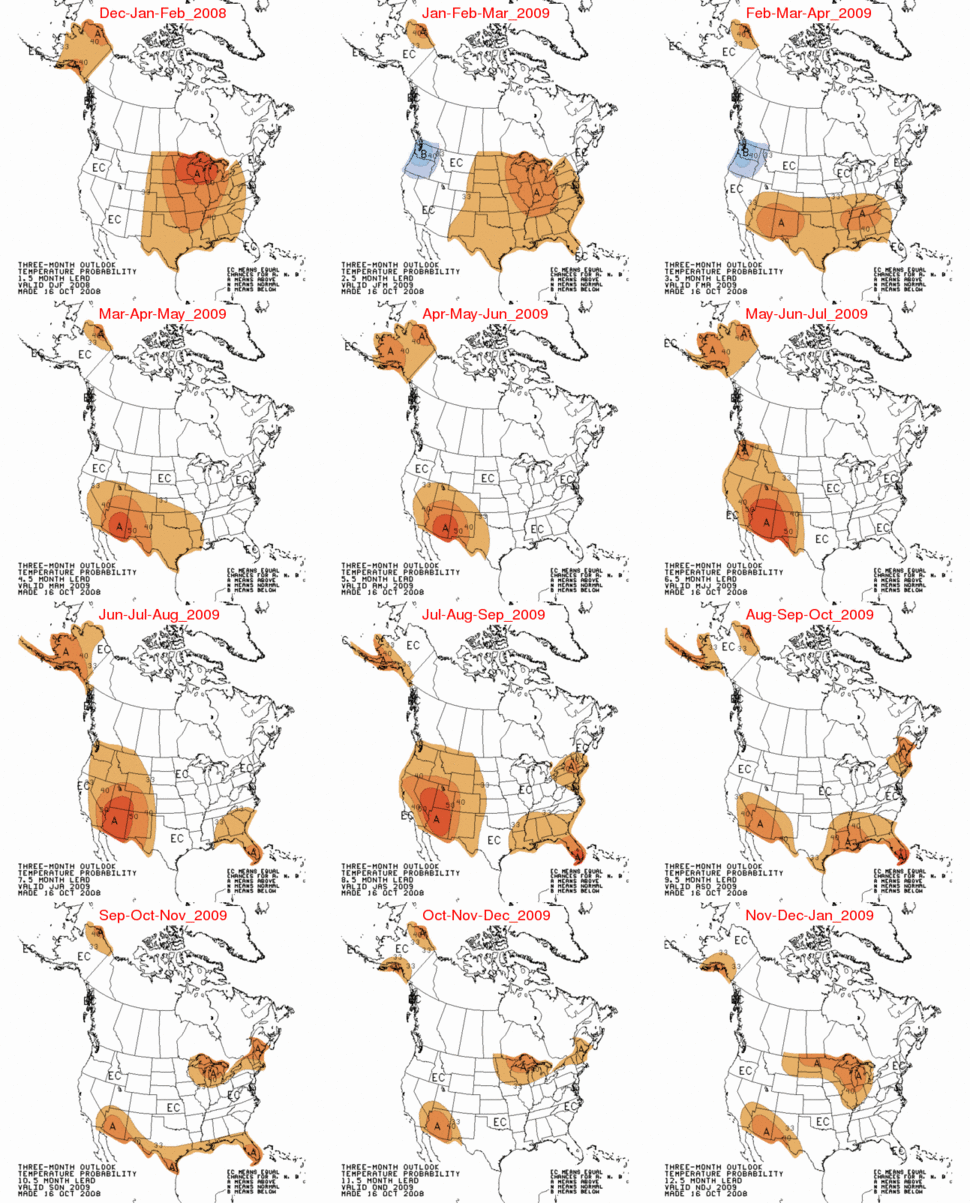
NOAA’s Center for Climate Prediction had incorrectly forecast a warm winter for the region last autumn.
http://www.cpc.ncep.noaa.gov/products/archives/long_lead/gifs/2008/200810temp.gif
Using AGW logic, it all makes perfect sense. The models forecast a warm winter. The models were wrong, and instead it was extremely cold and snowy. All that late melting snow caused a flood, so the flood must be blamed on the global warming predicted by the models. AGW Commandment #1 : Reality must never take precedence over computer models.
Author’s Note : Anthropogenic Global Warming (AGW) is now known as “climate change” because the scientists were just kidding when they gave it the original name.
Obama didn’t say that global warming caused the flooding.
The context was that slightly cooler weather than expected friday or saturday (I forget when precisely) had led to a forecast that the river would crest slightly lower than feared earlier.
Obama’s comment, ‘If you see an increase of 2 degrees, what does that do, in terms of the situation there’ is a perfectly reasonable “what if?” question given that situation. If it were 2 degrees warmer, presumably the river would’ve crested higher as earlier feared, possibly breaching the sandbagged barriers.
2010 Fifa World Cup South Africa
In fact your own post supports his hypothetical “what if?” question when you state:
We do need to be aware that relatively small changes in temperature can have surprisingly significant side-effects.
Temperatures have been running 5-10 degrees below normal all winter. If the temperature was 2 degrees warmer as Obama mused, it would be 3-8 degrees below normal.
Using AGW logic, normal temperatures would cause Noah’s flood.
WWS: Yep, you got it about right! Except for tornadoes and that last bit there (the “anything bad”). Tornadoes I’m pretty sure have not shown any significant increase due to global climate change.
However, the others are all true because climate change rearranges weather patterns. So it makes sense that if some areas are extra-wet, it makes other areas extra-dry!
It should be noted, however, that global climate change does not CAUSE hurricanes, it only makes them stronger.
See how easy it is?
And to all those who say most of Fargo should be wiped off the face of the planet because it’s in the way of the river, does that also mean we should remove everyone who lives on or near a fault line, a volcano, a mountain (avalanches and rock falls and mud slides, oh my!), the ocean (hurricanes and white squalls!), or in Tornado Alley needs to move, too? And might I ask WHERE you propose to put all these people?
Flooding is something that happens every year and we’ve dealt with it since Fargo was established. So why don’t you worry about your own little selves. We’re not asking for your help. We chose to live here, we’ll deal with it.
Just a note to E.M. Smith regarding oxbows: I don’t know if you’ve ever looked at a map of the Red River, but the ENTIRE RIVER is oxbows. That’s what happens when you put a millenia-old river on a flat plane that tilts gently down in a northerly direction. It tends to meander.
Also, “out of the floodplain” is several MILES away from the river. ‘Cause, y’know, it’s flat out here, and water likes to spread out in flat areas. So you’re suggesting that all of Fargo and Moorhead pick up and move about 10 miles away from the river. Smart idea.
Wow. Okay, I’m really not usually this snippy. I don’t mean to be so angry, but it just gets me a little riled up when people who don’t know much about my hometown act like they do.
Wow, okay, don’t mean to be commenting so much, but I just read another comment regarding rain vs. snow (as in the “2 degrees warmer” thing would give us rain, not snow).
I don’t know if most people understand why the Red floods every year, so I’m going to explain it.
Much like the Nile, the Red flows north. With the Nile, it floods because there was spring melt in the mountains and rains to swell it. In the Red River Valley, it’s because the southern part melts first, meaning that extra water gets held up by the still-frozen waters north of it. So even if we didn’t get that extra snow from those two terrible blizzards that shut down the city, the Red still would have flooded. And if that precip had been rain instead of snow, the Red STILL would have flooded, maybe just as bad.
A little rain is not going to melt foot-thick ice on the river. And the Red freezes over every winter because, and let’s be honest, it gets FRICKING COLD up here (-20 temps with -40 windchill were pretty common this past winter).
SO, even if the snow had been rain, it probably would have just pooled on top of the already-saturated ground, covering an already full water table (remember the rain last fall?), making a big mess until the river ice melted and it could all flow north to Lake Winnipeg and then to the Hudson Bay.
So can we PLEASE stop speculating on what MIGHT have happened and focus on the present? It flooded really effing badly because we got a heckuva lot of precip over the fall and winter. Maybe some of that extra precip was worsened by global climate change, maybe it wasn’t. But they call it a 100 year flood for a reason (1897, 1997, hey look! 100 years! Wait, 2009?! That’s only 12!). And for 100 year floods to be happening twice with just over a decade between them, that’s not normal, I don’t care if you “believe” in gloal climate change or not.
And now I’m going to stop ranting.
A check on the randomness of “records” is, first, to list the years sequentially from 1 to the end (if100 years, then 1-100). Next convert the peak flow rate data to a ranking by size also from 1-100 in our example. Treat the first year as a record and then mark each successively larger record and count them. If the numbered arrangement of the peak flows is a random permutation of the numbers 1 to a 100, then the number of “records” should be approximately Ln 100. In the case of Winnipeg flood records from 1875 (first officially measured- earlier were more anecdotal) there are 124 years to 1998 (last major flood 1997). Ln 124 = 4.82, so we should expect about 5 records to have occurred. I count exactly five.
Year Peak flow* (m3/s) Year Peak flow* (m3/s) Year Peak flow* (m3/s)
1826 6371 1919 665 1959 991
1852 4672 1920 1090 1960 1965
1861 3540 1921 629 1961 481
1875 (1042) 1922 821 1962 1688
1876 807 1923 1809 1963 660
1877 1068 1924 654 1964 1002
1878 382 1925 1189 1965 1809
1880 1178 1926 379 1966 2498
1881 1291 1927 1455 1967 1727
1882 (2364) 1928 912 1968 510
1883 1422 1929 912 1969 2209
1884 1345 1930 1042 1970 2280
1885 1008 1931 688 1971 1526
1892 1957 1932 1062 1972 1589
1893 1897 1933 1096 1973 530
1894 1303 1934 442 1974 2718
1895 957 1935 425 1975 1671
1896 1741 1936 1068 1976 1807
1897 1954 1937 219 1977 187
1898 1458 1938 436 1978 1750
1899 345 1939 357 1979 3030
1900 331 1940 498 1980 881
1901 977 1941 1184 1981 159
1902 1405 1942 1291 1982 1458
1903 818 1943 1195 1983 1393
1904 2209 1944 493 1984 1048
1905 614 1945 1487 1985 991
1906 866 1946 1079 1986 1812
1907 980 1947 1039 1987 2339
1908 909 1948 2124 1988 564
1909 578 1949 1362 1989 1390
1910 980 1950 (3058) 1990 396
1911 345 1951 1065 1991 280
1912 586 1952 1008 1992 1399
1913 1277 1953 357 1993 946
1914 442 1954 524 1994 1121
1915 326 1955 1521 1995 1877
1916 (2427) 1956 1974 1996 3058
1917 1124 1957 654 1997 (4587)
1918 405 1958 524 1998 1557
Flood frequency analysis for the Red River at
Winnipeg by Donald H. Burn and N.K. Goel
http://www.crhnet.ca/casestudies/redriver/flood_frequency.pdf
I was surprised that the author’s didn’t appear to know this test. Now there are a number of parameters that make such things not exactly random, of course. For example, if we are going into another cold period, we may expect a bunching up of floods with increasing snow fall because of prolonging winter, harder freezes in the outlet areas of north-flowing rivers, etc. However, if the cooling down and warming up periods are cyclical, then in the long run the Ln N would tend to average out.
And for 100 year floods to be happening twice with just over a decade between them, that’s not normal, I don’t care if you “believe” in gloal climate change or not.
Someone should buy this climate a calender, It’s obviously functioning out of sink with our concept of time and doing all sorts of naturally variable silly things. 🙂
vintagejenta,
No one has any idea what the weather would have been like this winter in Fargo if CO2 levels were 50 ppm lower or higher. It might have been better, it might have been worse.
And, using your logic, those professionals who predicted the flood would crest slightly lower because of slightly cooler than forecast temperatures were wrong, eh?
dhogaza,
My prediction is that AGW promoters will continue to argue in non-sequiturs when rhetorically cornered.
Stephen, is february part of winter?
Stephen, and speaking of non-sequiturs…
Obama didn’t claim that AGW caused the flooding, he only pointed out that a 2 degree change would’ve had a significant impact on THIS SITUATION, which is in total agreement with the statements of those forecasting the cresting height of the flood.
dhogaza,
If the average temperature of the earth was two degrees warmer, “THIS SITUATION” (5-10 degrees below normal) wouldn’t be happening. Read up on chaos theory here:
http://en.wikipedia.org/wiki/Chaos_theory
Glad to help out.
Paul R (13:13:48) :
“And for 100 year floods to be happening twice with just over a decade between them, that’s not normal, I don’t care if you “believe” in gloal climate change or not.”
Paul brush off your statistics primer – randomness doesn’t preclude two close together. If you want to make a climate connection to the “two close” together you are unfortunately faced with matching them with a cooling climate. This is precisely why I suggested the departure from randomness. Incidentally, try Ln N on baseball records and see if a bunching up coincides with steroid and other performance enhancing drugs. And then see if there is another record broken for 50 years after they clean up the sport.
E.M.Smith (09:51:11) :
That ought to have been:
chiefio.wordpress.com/2009/03/09/are-we-quaking/
don’t know why the leading “c” got dropped.
Per the “2 degrees more causes more rain” that was not an absolute +2 from present -x it was an average +2 means you spend more time with rain at the lead in / lead out from the frozen range, so more of your total precipitation ends up on the ‘rain side’ of frozen…
“this situation” obviously referred to the impact of two degrees warming on the cresting level of the river.
And, as was pointed out above, you quote-mined him in the first place.
And it hasn’t been “5-10 degrees below normal all winter” in MN.
dhogaza ,
Obama’s statement indicated a thorough lack of understanding of the science, as do yours.
If the world was two degrees warmer, “the situation” in Fargo would not be happening. Read the paragraph below carefully.
An early pioneer of chaos theory was Edward Lorenz whose interest in chaos came about accidentally through his work on weather prediction in 1961.[14] Lorenz was using a simple digital computer, a Royal McBee LGP-30, to run his weather simulation. He wanted to see a sequence of data again and to save time he started the simulation in the middle of its course. He was able to do this by entering a printout of the data corresponding to conditions in the middle of his simulation which he had calculated last time.
To his surprise the weather that the machine began to predict was completely different from the weather calculated before. Lorenz tracked this down to the computer printout. The computer worked with 6-digit precision, but the printout rounded variables off to a 3-digit number, so a value like 0.506127 was printed as 0.506. This difference is tiny and the consensus at the time would have been that it should have had practically no effect. However Lorenz had discovered that small changes in initial conditions produced large changes in the long-term outcome.[15] Lorenz’s discovery, which gave its name to Lorenz attractors, proved that meteorology could not reasonably predict weather beyond a weekly period (at most).
vintagejenta (12:14:24) : […] the ENTIRE RIVER is oxbows. That’s what happens when you put a millenia-old river on a flat plane that tilts gently down in a northerly direction. It tends to meander.
I know. Where I was born and grew up is 32 FEET of elevation. It’s 20 miles to the really big river on one side and It’s 5 miles from the big river on the other. It is about 250 miles from that point to sea level… in a straight line and the river aint straight. We had 3 foot curbs downtown, 1 1/2 foot in the residential areas, and building lots were about 2 feet higher than that so that WHEN the river flooded it stayed in the streets, not in the house (by about a foot!). I know flat, floods, and rivers spreading out miles…
There is now a nice little flood plain on the really big river, defined and set aside, bounded by dikes. The river can meander inside this plain (called the causeway) and folks regularly farm it, fish there, drive dirt buggies there, etc. Works great. The river on the other side got a dam some years later. Now the town just looks funny with tall curbs… but for over 100 years the simple expedient of being above flood level (even by only 1 foot) worked great.
So you’re suggesting that all of Fargo and Moorhead pick up and move about 10 miles away from the river. Smart idea.
Glad you thought it was smart. Thanks. 😉 BTW, I don’t think ALL should move. What I said was residences ought to be given a 1 year ‘free pass’ to relocate and those who do not, get left alone… very alone. No Federal or State taxes paying for bad decisions by other people, and then I don’t care what you do.
Further, while I didn’t explicitly state it (thinking it pretty obvious) things that need a river, like marinas, restaurants on the marina, fishing docks, cargo docks, etc. have no reason to move and business can decide for it self what makes economic sense (minus my tax money…). Farming in a flood plain works very well too though parking for tractors is a bit dicy. We usually put them on the levee or similar dirt pile. Basically, in a flood emergency everybody can drive away from the restaurant and shopping mall, I don’t see it as a problem; but the home evacuations are a problem (and I’d even add things like nursing homes and maybe even trauma centers…). 90% of the problem is gone if you relocate the residential area higher up.
Also, FWIW, I’d be just as prone to endorsing relocating the houses straight up… Put ’em on pilings so they are above the high flood mark. That, too, has been done and worked. Want to live 10 feet below sea level? Fine with me as long as you are on pilings a couple of feet above flood level or even if the lower story is the concrete block garage and the living area is above flood level. Heck, the dutch have a wonderful design for floating houses where the basement is a steel tub and the whole house floats up on mooring poles!
Just don’t put the residential ground floor below flood level and expect other folks or other folks money to deal with it when you get flooded.
Wow. Okay, I’m really not usually this snippy. I don’t mean to be so angry, but it just gets me a little riled up when people who don’t know much about my hometown act like they do.
You are leaping off a cliff of conclusion… as I said, I grew up in such a river bounded flood plain. I’m speaking from the experience of wading in the flood water more than once… Finally stopped flooding when they put in a giant dam in the mountains (and shipped the water to Kern county and L.A.). Yeah, not exactly your home town, but a very similar geology. I did have to admire the founders of my home town (in 18xx something early) who had the wisdom to dictate the lots be elevated above the flood depth 5 miles from the river (even if ‘newbies’ did hit their car doors on the high curbs ’till they figured it out 😉 and think a very similar solution is a Very Good Idea in your home town (unless you don’t like it and chose to stay below the flood and want to be left alone… very alone.)
M.WHITE
You think that extra record snow and the flooding risk in the ALPS is very real, just note this. With all the extra snow and cold temperatures for the last several years in Canada where the Prairie winter temperatures dropped some 7.1c degrees since 2006 , this just came out of an AGW den http://www.theglobeandmail.com/servlet/story/LAC.20090330.BCGREEN30/TPStory/Environment
You just can’t win sometime.
Sigh. It’s clear he was talking about local conditions. When the forecasters said “slightly cooler weather has led us to reduce our forecast of crest height to under 41 feet” they weren’t saying “slightly cooler global temps …”.
This was the context.
I understand the science perfectly well, thank you, and not only that, I understand English, the context of the quote.
Now, you still haven’t told us why you quote-mined in the first place, leaving the impression that he was blaming the flooding on global warming when he explicitly said one could not.
Quote-mining is a sin.
dhogaza (11:25:20) :
Obama’s comment, ‘If you see an increase of 2 degrees, what does that do, in terms of the situation there’ is a perfectly reasonable “what if?” question given that situation. If it were 2 degrees warmer, presumably the river would’ve crested higher as earlier feared, possibly breaching the sandbagged barriers.
“Perfectly reasonable” by whose reasoning – yours? There is only one reason for asking that “what if” question, and that is AGW alarmism. It’s a completely rhetorical question, based on the false premise that A) we are warming at an alarming and unprecedented rate, and 2) man is primarily responsible via his contribution of C02.
It is also clear that Obama could’ve chosen his words more carefully, since it’s obvious that some people are going to intentionally misinterpret what he says in an attempt to make him look foolish.
Sometimes even stooping to quote-mining, eh, Stephen?
Why haven’t you put the full quote at the top of the page, rather than leaving the quote-mined version up there?
By applying the same logic that slight regional cooling caused the river to crest a foot or so lower than the best estimate made the day before.
Science is known for the promotion of false premises, I agree. That’s what scientists do, sit in their labs, plotting promotion of false premises.