Guest post by Bill Illis
We have often wondered what really causes the El Nino Southern Oscillation (ENSO) climate pattern. It is generally understood and this post will demonstrate that it is really driven by the Trade Winds over the ENSO region.
The Trade Winds blow East to West at the equator. Most of us living in other latitudes expect the wind and the weather to primarily come from the West but, at the equator, the weather comes from the East.
When the Trade Winds are stronger than average for a sustained period of time, the Trades literally blow or drag the warm surface water across the Pacific and it is replaced by colder upwelling ocean water from below. If the Trades are strong enough for a long enough period of time, we have a La Nina.
When the Trades are weaker than average for a long enough period of time, the ocean surface stalls in place and gets heated day after day by the equatorial Sun and we have an El Nino. Sometimes, this stalling even results in warmer ocean water from the Western Pacific moving backwards into the Nino region and this also contributes to El Nino conditions.
Let’s look at the data to see how true this assertion is.
Here is a chart of the Nino 3.4 region temperature anomaly (which is the most consistent measure of ENSO conditions) versus the Trade Winds from 120W to 175W. The Trade Wind data is for 850 MB pressure or about 3,000 feet.

Click for a larger image
To see this correlation a little better, I’ve reversed the sign so that weaker Trade Winds are shown as positive values and stronger Trade Winds are shown as negative values. I’ve reduced the anomaly in meters per second by half as well so the scale is roughly the same as the ENSO.

Click for a larger image
I can’t imagine seeing a better explanation of what drives the ENSO than this.
For some perspective on the Nino regions and the latitude, longitude figures in question here, this is a map of the region produced by the Climate Prediction Centre.

I think you can see this impact in action if you watch an animation of the ENSO region over time. Let this SST anomaly animation load up, then speed it up as fast as your computer will allow and you can see the Nino region waters and temperature anomalies literally move across the Pacific with the Trades.
http://www.osdpd.noaa.gov/PSB/EPS/SST/anom_anim.html
But what drives these Trade Winds? I don’t really have an answer for that question.
The Southern Oscillation Index (SOI) was previously used as an indicator of these winds over the Nino regions. The SOI is a measure of the difference in air pressure between Tahiti and Darwin, Australia. The theory being that high pressure blows toward lower pressure which can provide some indication of the Trade Winds in the Nino region. There is certainly a correlation of this measure to the Nino 3.4 anomaly. In fact, the measure even lent its name to the ENSO.
I’ve found, however, the SOI consistently lags a little behind the Nino region temperatures and the Trade Wind measures so I believe it is more a result of the overall climate pattern rather than a leading indicator. I’ve also found no real correlation to the Pacific Decadal Oscillation or any of the other Oscillation Indices which are sometimes used to predict or measure the ENSO.
There is one leading indicator, however, which provides some predictive power – the Trade Winds just to the West of the Nino area. These Winds are, most often, concurrent with the Nino region Trade Winds but occasionally, they provide a ramp-up which might kickstart the ENSO. The West Trade Winds were a leading indicator of the Super El Ninos of 1982-83 and 1997-98 for example.

Click for a larger image
Unfortunately, I don’t know what drives these Western Trade Winds either, but they are currently pointing to a strengthening of the La Nina conditions which currently exist.
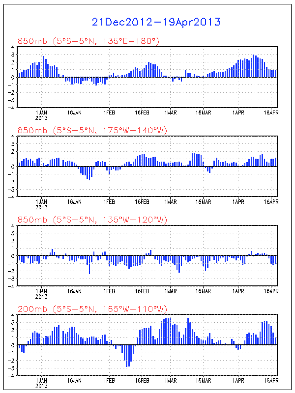
I also wanted to show more closely how the ENSO impacts global temperatures.
The warm or cold ocean conditions of the ENSO eventually impact the Tropics troposphere temperatures and this seems to be quite a direct impact with a lag of 2 to 3 months.

Click for a larger image
The Tropics temperatures then propagate out to the rest of the world with a small lag that may be up to 1 month but is more commonly concurrent with the Tropics anomalies.

Click for a larger image
The Trade Winds drive the ENSO, and the ENSO directly impacts the Tropics temperatures and the Global temperatures.
Who would have thought that Winds in some small region of the Globe could be so important. You can keep track of these Trade Winds on a daily basis at the Climate Prediction Centre.
http://www.cpc.ncep.noaa.gov/products/precip/CWlink/daily_ao_index/zw/zw.obs.gif
So, I think that provides a nice perspective on the ENSO.
The data used in this post can be obtained here.
http://www.cpc.ncep.noaa.gov/data/indices/
http://www.cpc.ncep.noaa.gov/data/indices/sstoi.indices
Tim, you’re right of course. I was just pointing out the origin of the E-to-W winds to Pamela.
Onanym, the thought also occurred to me. Wind strength is a result of pressure differentials, which near the equator in the Pacific would seem to be defined by temperature differentials over open water between the tropics and the equator. So, at a first glance, one might argue that higher temps over the equator would produce higher temp differentials and hence stronger winds. However, the SST anomaly maps illustrate that the situation is far more complex than this simple picture. Ed Zuiderwijk may have a point too. Too easy to jump to straightforward conclusions, although I must admit Bill’s graphs are compelling, to say the least. Good job, as i said earlier.
Thanks Bill for this – nice graphics, though we are still left with the question of what the ultimate driver is – winds respond to pressure differences, and pressure differences can result from warm/cold surface waters or….solar effects in the upper atmosphere. We shouldn’t forget that Landscheidt had a formula for solar timing that enabled him to predict El Nino in 1998 and 2002, as well as the current run of La Nina and neutral conditions.
Glenn – just looked at that paper from the Fluid Dynamics people at Princeton. Their work would repay closer study – wish I had the time! They claim to have a simulation that captures the ENSO oscillation and Walker cell slow-down and that it shows anthropogenic cause – i.e. that their models do not replicated the slow down unless they have an excess greenhouse gas component. From then on, in IPCC-speak, they take this as a proof of global warming theory. Of course the models only have a solar TSI component. The slow down is a century-long phenomenon – it would be instructive to have a break-down of its displacement in time – I bet that it is dominated by the 1980-2000 period and the 1998 super ENSO event – in which case, their explanation of the post-2002 stillstand on ocean heat content and recent la Nina would be interesting – though probably put down to random variability.
There tends to be a focus upon trends rather than cycles. And no talk of teleconnections. There is work on the phase interaction of the PDO and ENSO, with negative phases of the PDO dampening the amplitude of ENSO – which appears to be what we have now. Paleo-ecological studies (tree rings and sediment studies) show centennial cycles of ENSO intensity correlating with, for example, the Medieval Warm Period and Little Ice Age – thus implying a link with solar magnetic cycles.
I share your reaction, Glenn, to the all-too-ready statements that the slowing walker circulation demonstrates AGW when those researchers have no explanation for the obvious low frequency modulation of ENSO and the equally obvious correlation with the recent solar maximum. Their close ties to the IPCC are advertised in the paper. It smacks of self-fulfilling prophetic models.
Bill,
What drives the trade winds?
Like the charts Bill
Clearly the tropical ocean temperatures drive the world temperatures, you see a 2 or 3 month lag for tropical temperatures, I saw about a 6-month lag on world wide temperatures. The miss alignment in the temperature-Nino graph in the 1982 83 time frame is probably due to volcanism. Nothing big in volcanoes in 91 the other big misfit in the data, although this was during a peak in sunspot activity, which should have driven the temperature up a little.
In my last comment I mentioned no volcanism in 91, scratch that I forgot I time shifted by volcano time line by 8 months to align better with global temperatures, there was a peak in optical thickness about the right time frame for the misfit in the curves in the 01, 02 time frame.
Bill,
The 850MB level is closer to 5000ft rather than 3000ft.
Just to add to the correlation confusion, here is a link to an interesting paper from the Chinese Science Bulletin:
“New evidence for possible impact of solar activity on long-term fluctuation of the earth rotation”. LIAO Dechun & LIAO Xinhao
download it here:
http://www.scichina.com:8080/kxtbe/EN/article/downloadArticleFile.do?attachType=PDF&id=313823
and another possibly interesting paper from the same source:
“Movement of earth rotation and activities of atmosphere and ocean”. ZHOU Yonghong, ZHENG Dawei, YU Nanhua & LIAO Xinhao
download it here:
http://www.scichina.com:8080/kxtbe/EN/article/downloadArticleFile.do?attachType=PDF&id=313828
I gather from readings elsewhere that there are Earth processes that significantly lag changes in LOD and others that significantly lead it. It’s even possible to predict el niños from the LOD changes. So the relationship is not strictly one-way cause and effect – as some people like to theorize; it’s a lot more complicated.
OK. Now what drives the trade winds…
Ed Berry’s blog gets into ENSO and what drives the global circulation. It is written for a professional audience so it often reads like code, but one can pick up the gist of his message –
http://weatherclimatelink.blogspot.com/
http://www.lavoisier.com.au/articles/greenhouse-science/solar-cycles/IanwilsonForum2008.pdf
Bill Illis,
Great work! You might be interested in a presentation that I gave
to the Lavoisier Society in July 2008. It can accessed at the link shown above.
Interesteingly, it is titled “which came forst, the chicken or the egg?”
If the Trade Winds really do drive El Nino & La Nina (rather than some third factor), with those in turn driving global temperature, then this would seem to imply that the fluctuations in global temperature are simply caused by whether solar heating gets dragged down into the depths of the ocean or not.
So when the Trade Winds stall, preventing the heated ocean from taking that heat away, then this warms the atmosphere, and global temperature tends to go up. Certainly sounds like a nice, physically plausible mechanism 🙂 rather than say something like CO2 (which needs massively unrestrained & unstable positive water vapour feedback).
As has been pointed out, “correlation does not imply causation”; even if ENSO lagged weakened Trade Winds, that would not imply the weakening of Trade Winds caused ENSO (or vice versa): it would be just as possible that a third (as yet unknown) phenomenon caused both with different lag times. All this just points to something to investigate further, not to any conclusion. Let’s not fall in the same trap most AGW believers do.
On the other hand, I am wondering why ENSO happens in the Pacific Ocean and not in the Atlantic or Indian Oceans; there are Trade Winds in all of them. Maybe the larger East-West size of the Pacific allows for the establishment of an oscillation, which would point to a geographical reason for it. Maybe an East-West temperature oscillation is a natural feature of any body of water with enough East-West equatorial size for it, and it just happens that under the current continental configuration only the Pacific is large enough.
Bill Illis: Thanks for the post and the links to the trade wind data. And to answer your question…
The trade winds are driven by the SST differences between the Pacific Warm Pool and the Eastern Equatorial Pacific, and vice versa. The average annual SST difference between the east and west equatorial Pacific is about 4.5 deg C. Refer to the graph I prepared for an upcoming post.
http://s5.tinypic.com/15mljk3.jpg
The warm air rises over the Pacific Warm Pool, causing an inflow of air from the east where SSTs are cooler. The inflow of air pushes more warm water west and that increases the SST difference. In other words, the temperature difference causes the trade winds and the trade winds cause the temperature difference. Bill Kessler of the NOAA Pacific Marine Environmental Laboratory provides a reasonably non-technical description here:
http://faculty.washington.edu/kessler/occasionally-asked-questions.html#q1
As you said, when the trade winds relax, an El Nino occurs. The Equatorial Counter Current (which flows west to east) increases in volume. Warmer water sloshes east. The warm water doesn’t necessarily have to come from the warm pool because the water to the west (refer to temperature gradient graph above) is warmer than it is in the east and any increase in west to east flow will bring warmer than normal water eastward. This adds to the increase in SST anomaly. I prepared a video of the changes in the equatorial Pacific current flows before, during, and after the 1997/98 El Nino. Refer to:
http://bobtisdale.blogspot.com/2009/02/equatorial-currents-before-during-and.html
Bill, you wrote, “When the Trades are weaker than average for a long enough period of time, the ocean surface stalls in place and gets heated day after day by the equatorial Sun and we have an El Nino. Sometimes, this stalling even results in warmer ocean water from the Western Pacific moving backwards into the Nino region and this also contributes to El Nino conditions.”
The Northern and Southern Pacific equatorial currents slow and the counter current increases during an El Nino. I don’t know that they stall in place. Any temperature rise that would occur due the slowing of the Northern and Southern Pacific equatorial currents (“gets heated day after day by the equatorial Sun”) would be countered by the increase in cloud amount, which would reduce downward shortwave radiation.
http://s5.tinypic.com/2lsd11w.jpg
The Pavlakis et al (2008) paper “ENSO Surface Shortwave Radiation Forcing over the Tropical Pacific” identifies the variations in surface downward shortwave radiation over portions of the Pacific Oceans caused by El Nino-produced cloud cover changes.
http://www.atmos-chem-phys-discuss.net/8/6697/2008/acpd-8-6697-2008-print.pdf
Also, it appears there is flow from the west to east Pacific (and back again) regardless of the strength of the El Nino. This can be seen in the equatorial Pacific Warm Water Volume data here:
http://bobtisdale.blogspot.com/2008/11/equatorial-pacific-warm-water-volume.html
During El Ninos, there are also shifts (major decreases) in cloud cover over the Pacific Warm Pool, which would warm the PWP. Refer to the Pavlakis paper above.
http://i43.tinypic.com/nq73sz.jpg
Discussed in this post:
http://bobtisdale.blogspot.com/2009/02/recharging-pacific-warm-pool-part-2.html
And don’t forget the changes in the thermocline, illustrated in the video here:
http://bobtisdale.blogspot.com/2009/02/cross-sectional-views-of-three.html
The NASA video “Visualizing El Nino” has a great depiction of the changes in the thermocline during the 97/98 El Nino:
http://svs.gsfc.nasa.gov/vis/a000000/a000200/a000287/a000287.mpg
As you know, there are many coupled ocean-atmosphere processes at play during an El Nino. Someday, we may have a handle on all of them, but until that time, predictions of El Ninos will continue to be hit-and-miss.
Glenn, I wouldn’t trust wikipedia on nanything remotely to do with climate – there are people who spend their life fixing the wiki AGW tilt.
Thanks to all the comments so far,
I just wanted to note first that this is generally understood in the research community studying the ENSO. But for some reason, it is just not widely understood by the general public so my post is really just about demonstrating it so we can all understand it this way.
I’ve found that the Trades over the Nino regions and especially the Trades just to the west of Nino regions consistently lead all these other indicators others have mentioned including the Upper Ocean Heat Content and the SOI.
The lead is sometimes only a month or two (or for the western Trades, a few months). At least half the time, they are concurrent as well.
That is why my charts have so many “sometimes” in them. They are consistently ahead or concurrent but never behind or lagged. The climate is variable and a little chaotic and we need describe it more often as “most of the time, ….” and “sometimes … ” rather than the very definitive “it always leads too …”
In terms of whether the ocean temps are, in fact, driving the Winds and not the other way around, I don’t think the data can’t really prove which drives which.
It does show which comes first most of the time however. Secondly, we know wind can move water. Waves are a good example. The same kind of equatorial winds blow across the land as well such as in Africa.
Physically, it is difficult to see how ocean temperatures can cause a consistent pattern of winds high up into the atmosphere while we have a very good physical explanation of how the winds can drive the surface ocean currents and temperature. This is backed-up by the research community studying the ENSO and by the other measures such how the different thermoclines below the ENSO are reacting.
So it seems, it is much more likely that it is the winds which are driving the ENSO rather than the other way around. It might be better to think of it in terms of the winds are reinforcing or mutiplying the natural ocean circulation patterns which exist.
Hmmm… FROM NOAA Feb 17th, SEE page 28:
“The CFS ensemble mean (heavy blue line) indicates La Niña ending during FMA 2009 with El Niño conditions developing by JJA 2009.”
http://www.cpc.ncep.noaa.gov/products/analysis_monitoring/lanina/enso_evolution-status-fcsts-web.pdf
Hmmm… El Nino June-July-August????
:p :p
In terms of how much an El Nino or a La Nina can affect temperatures,
Regression of the two variables using all the data which is available shows that the ENSO can impact …
Tropics temps by up to +/-0.5C with a lag of 2 to 3 months for the impact to occur.
Global temperatures by up to +/-0.2C with a lag of about 3 months.
These are the maximum values. The 1997-98 El Nino, for example, reached these maximum values while neutral Nino conditions will have a neutral impact on temperatures.
The effect seems to be continuous as the tropics and global temp charts shown above seem to continuously follow behind the ENSO.
My feeling at the moment, unless someone has a better idea, is that the initial causation may be a change in net warming or cooling of the air, as a whole, globally.
That would change the air circulation patterns resulting in the observed wind effect on the ocean surfaces but would itself have been caused by changes in the rate of release or absorption of energy from the ocean surfaces.
There seems to be some sort of interaction between the air circulation and the ocean circulation which changes depending on whether the oceans are globally warming the air or globally cooling it.
ENSO would be a major part of that interaction but would be modified in it’s effect by other variables such as solar input and the phases of the cycles in the other oceans.
The global warming trend or cooling trend in the air, initiated by the oceans, then leads on to all the variations in both circulations that seem to be causing so much puzzlement.
The simple answer is that winds are created because of the temperature imbalance in the atmosphere. If the atmosphere were perfectly homogeneous (an impossible situation) there would be no wind. Temperature differences are a product of the sun. So, the sun drives the temperature which in turn drives the wind and it’s the complex details which create such an amazing story. I would look to the temp first then wind second.
In terms of whether the ocean temps are, in fact, driving the Winds and not the other way around, I don’t think the data can’t really prove which drives which.
However, logic can. Sunlight absorbed by the water is the source of energy in the system (explained well by Bob Tisdale above) so it’s ocean temperatures that drive the winds. No doubt there is some feedback from the winds, but since the system is trying to balance an unequal distribution of energy it would make most sense to attribute the “driving” force to the location of the most energy (ocean, not air).
It looks like they have clairified what they man by ‘conditions’ and an actual La Nina episode
By historical standards, to be classified as a full-fledged El Niño or La Niña episode,these thresholds must be exceeded for a period of at least 5 consecutive overlapping 3-month seasons.
CPC considers El Niño or La Niña conditionsto occur when the monthly Niño3.4 SST departures meet or exceed +/-0.5°C along with consistent atmospheric features.
Let me see if I understand this correctly. The Trade Winds are caused by cooler air from higher latitudes moving to replace warmer air in the tropics that is ascending and this is influenced by coriolis force to move the air masses E to W in the Pacific. The result is the Trade Winds movement ‘dragging’ warm surface waters towards Asia, that water being replaced by cooler water from the depths off the coast of South America.
If this is true then would not the Trade Winds decrease in intensity if the temperature differential between the tropic and higher latitudes decrease? If so, if CO2 does heat the atmosphere in the higher latitudes then the result would be weaker trade winds and el Nino conditions?
Steve W,: You wrote, “It would be interesting to know that the ENSO contribution to the global anomaly is. The billion dollar question is: What number of El Nino degrees C were part of the 1998 peak. If the models didn’t include this, then they would have concluded that too much of the warming was man made.”
In the paper “Evolution of El Nino–Southern Oscillation and global atmospheric surface temperatures” (2000), Trenberth et al state on page 4, “The regression coefficient based on the detrended relationship is 0.094 deg C per N3.4 and is deemed more appropriate. The N3.4 contribution is given in Figure 3. It shows that for the 1997–1998 El Nino, where N3.4 peaked at ~2.5 deg C, the global mean temperature was elevated as much as 0.24 deg C (Figure 2)[Their Figure 2], although, averaged over the year centered on March 1998, the value drops to ~0.17deg C.”
http://www.cgd.ucar.edu/cas/papers/2000JD000298.pdf
Unfortunately, regression analyses do NOT pick up the step changes in the East Indian and West Pacific Oceans caused by significant El Ninos that aren’t suppressed by volcanic eruptions. Anthony posted about this “phenomenon” back in January. The original versions from my blog follow. The mislabeling of the graphs have been corrected in mine.
http://bobtisdale.blogspot.com/2009/01/can-el-nino-events-explain-all-of.html
http://bobtisdale.blogspot.com/2009/01/can-el-nino-events-explain-all-of_11.html
And the supplements:
http://bobtisdale.blogspot.com/2009/01/supplement-to-can-enso-events-explain.html
http://bobtisdale.blogspot.com/2009/01/supplement-2-to-can-enso-events-explain.html
The WattsUpWithThat versions are here:
http://wattsupwiththat.com/2009/01/11/can-el-nino-events-explain-all-of-the-global-warming-since-1976-%e2%80%93-part-1/
http://wattsupwiththat.com/2009/01/12/can-el-nino-events-explain-all-of-the-global-warming-since-1976-%e2%80%93-part-2/
Matt: You wrote, “We’ve found that the upper ocean heat content is an even better leading indicator than trade winds. Check it out here:
http://www.cpc.ncep.noaa.gov/products/analysis_monitoring/ocean/weeklyenso/heat-last-year.gif”
A link to the data is here:
http://www.cpc.noaa.gov/products/analysis_monitoring/ocean/index/heat_content_index.txt
It’s not really OHC, which is usually expressed in Joules. NOAA better describes the data as the “average temperature in the upper 300 meters, deg C”. They provide three datasets. They correlate very well with the SST for the same latitudes and longitudes, discussed here:
http://bobtisdale.blogspot.com/2008/11/average-subsurface-temperature-of.html
Frederick Davies: You wrote, “On the other hand, I am wondering why ENSO happens in the Pacific Ocean and not in the Atlantic or Indian Oceans; there are Trade Winds in all of them. Maybe the larger East-West size of the Pacific allows for the establishment of an oscillation, which would point to a geographical reason for it. Maybe an East-West temperature oscillation is a natural feature of any body of water with enough East-West equatorial size for it, and it just happens that under the current continental configuration only the Pacific is large enough.”
Bill Kessler of NOAA’s PMEL discusses that here:
http://faculty.washington.edu/kessler/occasionally-asked-questions.html#q19
Excellent piece of work Bill. Just another very inexpensive but sound piece of research that helps us realise just how much more there is to climate other than AGW. But when will these IPCC ‘scientists’ stop running computer codes and read such work?
Applying socrates´ “mayeutic method” i would ask: What causes these trade winds?, which is their ultimate cause?. Moon tides, coupling moon, planets tides?, Tacoma´s bridge phenomena (resonance), etc. A lot to think about.