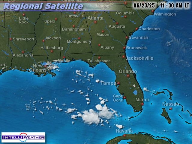
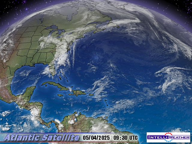
As many of you may know, I produce a variety of weather imagery maps for web and broadcast in SD and HD. Since there is a lot of interest in the path of hurricanes, I thought I’d post a few near-live images, which will update every 30 minutes. Here is TS Hannah:
Click image for full size or animate this image: Click for loop>>> ![]()
Here is a wider view:
Click image for full size or animate this image: Click for loop>>> ![]()
And here are the three tropical storms and hurricane with tracks. The image below is not realtime, but I will update manually a couple of times per day:


Looks like Hanna is being ripped apart by wind shear, Ike is looking like a real storm, and Josephine, too early to tell.
Beautiful! Thank you. 🙂
Something of interest is what is the albedo of all those storms in one place? Just a thought. Energy released and increase albedo.
Ad Melkert, associate administrator of the U.N. Development Program who just returned from Haiti, has admonished international donors to do more.
“The poverty in the rain and mud of Haiti that I witnessed is nothing less than a disgrace,” he said. “Many actors or potential actors try to play their part, ranging from the national government to multilateral and bilateral donors and NGOS. They all need to do more and better.”
Some 250,000 people in the Gonaives region have no water and no food.
If Ike hits haiti the catastrophe will be unimaginably compounded.
Everytime I see these images of hurricanes plowing across the planet’s surface, I am struck by the irony of how much destructive powers these fragile storms possess. If we’re lucky, winds that can’t be seen can shred these storms virtually overnight; if not so lucky, these storms can shred cities, towns, and beachfront vacation homes.
Simon,
Perhaps if the UN were to funnel the billions it spends on the IPCC into real humanitarian aid, the problem would be somewhat solved.
Anthony
Great images – but compare them to sunspots and their trajectories. If it waddles, sounds and looks like a duck, then maybe it is a duck.
🙂
Yes!! — it would be nice to see Haiti reforested. Much good would come from that.
Hmmm, right now it looks like these storms are petering out. Gustav also weakened before landfall, sparing NOLA from the expected damage.
I am glad that the monster storms that the “we can solve it” crowd are expecting, have not been evident.
Keeping my fingers crossed for the remainder of hurricane season,
Mike
As Hanna moved toward the continental US, she took the time to trace a cowboy boot in her track. Funny, but the Weather Channel seems to want to cover that little boot with the banner at the bottom of the screen.
I wonder how many of the computer models predicted the boot-shaped loop?
I’ve never been so interested in hurricane tracks, until my daughter moved to Jacksonville FL. last year. Thanks Anthony.
I wish I had a way to merge all of the spaghetti track changes and predictions for Hanna. They have changed every few hours and sometimes been 180 degrees different from one change to another.
The policy line goes that they cannot predict the weather accurately, but they can certainly predict the long term climate. Well, show me proof! Anyone?
The Weather Channel is showing three possible scenarios for Ike’s path.
1. It could continue straight to Florida.
2. It could turn up the eastern seaboard.
3. It could enter the gulf between Florida and Cuba.
I somehow think that, 4. None of the above, is just as likely as any of the other three.
Living in Washington State is wonderful!
Looks like Hanna is being ripped apart by wind shear….. looks like all that stuff is heading across the Atlantic via the jet stream to little o’ England yet another damp soggy and cold weekend in prospect to match most of August.. I think we’d like a bit of global warming please :o(
It looks like Josphine might be breaking up. It doesn’t look as organized as it did last night.
Hanna looks to be deepening a little as it races in to SC. Lots of rain for the east coast.
[quote]Leon Brozyna (20:02:29) :
Everytime I see these images of hurricanes plowing across the planet’s surface, I am struck by the irony of how much destructive powers these fragile storms possess. If we’re lucky, winds that can’t be seen can shred these storms virtually overnight; if not so lucky, these storms can shred cities, towns, and beachfront vacation homes. [/quote]
And Hansen and Gore tell us that our paltry CO2 emissions make a difference?!
Sheeesh!
Anthony
One of the interesting observations that I noted recently was how much the three hurricanes during the past week raised the temperature of our Troposphere and the Stratosphere right up to 21km. During the period Aug 29, 2008 to Sept 5, 2008, the temperature at 1 km height went from 30.04 F to 30.58 , an increase of 0.54 F degrees in only six days . At 21 km the increase was 0.22 F degrees
SEE http://discover.itsc.uah.edu/amsutemps/amsutemps.html
REPLY: While impressive, this is not unusual. Hurricanes always transport heat from the lower to the upper levels of the atmosphere. It’s what they exist for.