By Steve Goddard

Darkness is returning to the Arctic as the sun moves towards the horizon. In four weeks, the sun will disappear completely at the North Pole.

Solar Energy as a function of latitude and date
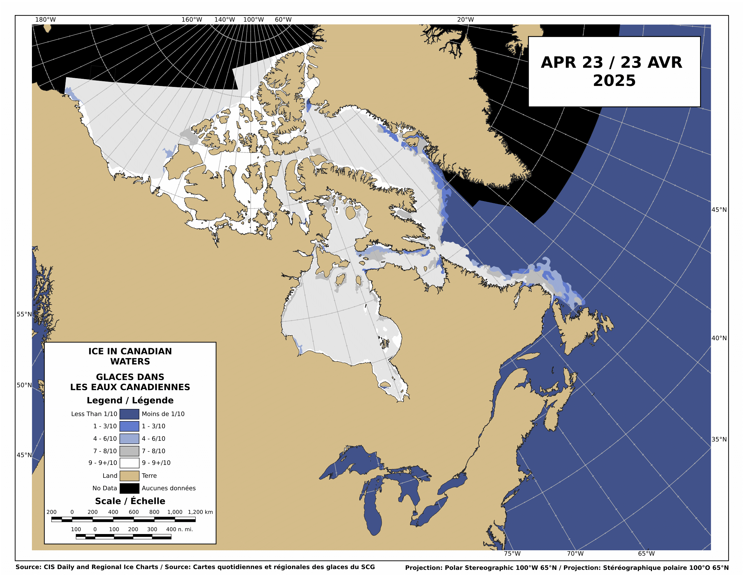
The Canadian Ice Service shows that there is still low-medium concentration ice blocking the Northwest Passage.

http://ice-glaces.ec.gc.ca/Ice_Can/CMMBCTCA.gif
If you owned a ship, would you send it through a route knowing it will face shifting pack ice, possible icebergs, fog, darkness, wind, storms and the possibility of an early freeze?
“The plans that you make can change completely,” he says. This uncertainty, delay, liability, increased insurance and other costs of using the Northwest Passage are likely to deter commercial shipping here. A ship with a reinforced hull could possibly make it intact through the passage. But if it got stuck, it would cost thousands of dollars for an icebreaker like the Amundsen to come to the rescue. So even if the Northwest Passage is less ice-choked than before, the route may not become a shipping short-cut in the near future, as some have predicted.
The Arctic Oscillation was negative for a few days, which allowed colder air to escape from the Arctic and warmer air to invade the Arctic. Note that the period of positive AO starting in early July corresponded to the Moscow heat wave. The cold air was trapped in the Arctic.

The negative dip this week allowed a blast of southerly air to melt and compact the ice during the past week, as we forecast in last week’s sea ice news.
")

http://ocean.dmi.dk/arctic/icecover.uk.php
Ice extent loss has dropped off dramatically in the last few days, as seen in the DMI graph above and the JAXA graph below.

Note that there was little loss in ice extent during 2006, after August 22.

What does the remainder of 2010 hold? Difficult to say. NCEP forecasts freezing temperatures over the broken ice in the Beaufort Sea during the next two weeks.

http://wxmaps.org/pix/temp2.html
If the remainder of the summer follows a path like 2006, 5.5 million is the right number. Another blast of southerly wind during the next few weeks. and it goes below 5.5. All of the ice indexes currently show 2010 ahead of 2008. DMI and NORSEX show it ahead of 2009 as well. JAXA also shows that the ice area curve has flattened. Ice area is always less than extent, and area trends tend to lead extent by a week or two.

There are large areas of low concentration ice which are vulnerable to compaction, spreading or melt.

My forecast remains unchanged. 5.5 million, finishing above 2009 and below 2006. Same as it has been since May.
The video below shows ice movement in the Beaufort Sea this week. Earlier in the week, it was compacting rapidly, now it is slightly expanding.
It all comes down to the temperature and wind over the next few weeks.
PIOMASS forecasts continue to stray further from the mark. Areas in red are places where PIOMASS incorrectly forecast melt. Solid green is the opposite misprediction.

Lindsay and Zhang forecast a minimum of 3.96 million in July.
The modified NSIDC image below shows ice loss during the last week. Mainly in the Beaufort Sea.

The modified NSIDC image below shows ice gain since 2007 in green, loss in red.

I’m not going to make a forecast for the next week, because there aren’t any dominant indicators either way.

Discover more from Watts Up With That?
Subscribe to get the latest posts sent to your email.
JER0ME says:
August 23, 2010 at 4:25 am
How come there is so much ’1st year ice’ in 2008 that was covered by 2nd year or older ice in 2007?
How come there is so much ’1st year ice’ in 2009 that was covered by 2nd year or older ice in 2008?
I’ll bet 2010 will show the same ‘magic’ situation.
* * * * * * * * * * * * * * * * * * * * * * * * * * * * * * * * * * * * * * * * * * * * *
First, it helps if you proof read what you write. You got every one of your three points reversed as to the sequence of events.
Even without the reversal, the last point about “’1st year ice’ in 2009 that was covered by 2nd year or older ice in 2008?” is also illogical. How can you cover a SINGLE years worth of ice growth with more than one year’s worth of growth in the span of ONE SINGLE year?
Finally, that so called “growth” was in surface area only. There was massive loss, for instance between 2007 and 2008 involved a drastic loss of multi-year ice (3-10 years) by about 60%. This happened again from 2008-2009.
Finally, in the winter of 2009/2010, there was also a huge loss of multi-year ice. Not hard to imagine why since temperatures ranged up to 4-7F above average in most regions of the Arctic, when the baseline is 1998-2006 and, with a baseline of 1951-1980 up to 13.5F!
Temperature map for 12/2009 baseline 1998-2006 (Note! These were warm years already, therefore this map underestimates the warm up.)
http://www.climate4you.com/Text/Climate4you%20December%202009.pdf
Ice thickness images for 09/2000 vs 03/2010
http://nsidc.org/images/arcticseaicenews/20100406_Figure6.png
Temperature map for 12/2009 baseline 1951-1980
http://data.giss.nasa.gov/cgi-bin/gistemp/do_nmap.py?year_last=2010&month_last=7&sat=4&sst=1&type=anoms&mean_gen=12&year1=2009&year2=2009&base1=1951&base2=1980&radius=1200&pol=pol
Your last statement betrays the entire structure of thought, not just facts and figures, that makes up some people’s minds. They are short term thinkers. It would be far more meaningful and easier to dedicate ourselves to predicting 3-5 year trends on the basis of the past 30 years of data.
If people don’t know by now how ridiculous it is to fantasize that a thirty year trend automatically goes in another direction because of a two or three year fluctuation then they don’t belong in the game.
They are like a stock-owner who decides to sell off his stock in spite of thirty days of excellent performance simply because it dipped slightly for three days. This in spite of the fact that those dips happen frequently with other stocks that are going in the same direction.
But it’s never about the factual nor the logical with many, it’s about the psychological. From what I’ve seen, avoidance at all costs, of basic principles of analysis, science and common sense.
But why the avoidance in the first place? A substantial number of people who are anti AGW, on this site included, project fantastic 9-11 style conspiracies and disingenuous tax hike schemes (A smart 12 year old could come up with a dozen better excuses to raise taxes than Global Warming).
But do they look into themselves?
JER0ME says:
August 23, 2010 at 4:27 am
mecago says:
August 23, 2010 at 12:17 am
Mecago:
By the way, our galaxy does have a wide range of star concentration. You would not want this planet to be in the dense core.
JERoME:
Especially not since we’d all be dead in seconds, I guess not, no. That would be REAL global warming!
* * * * * * * * * * * * * * * * * * * * * * * * *
Not necessarily JERoME. The heat of each star will contribute nothing to the situation. They are way too far to add heat even that close together.
It has more to do with each star exerting a much greater gravitational pull on each other and throwing their Oort cloud out of whack far more often. It is the Oort cloud, you can call it an iceteroid belt, from which we get our comets. In short, we’ll get enhanced cometary bombardment of planets by orders of magnitude.
stevengoddard says:
August 23, 2010 at 7:37 am
Ice concentration around the Titanic was less than 1%. Think about that.
* * * * * * * * * * * * * * * * * * * * * * *
Actually Steve, it was 100%. Only thing is, the entire 100% had bunched up together because of the wind. Then each individual piece started sliding on top of another and freezing in place due to the cold. Eventually, this process then transformed the chunks of ice into humongous, deep icebergs. Think about that. 😉
PS: Can we possibly get some smileys programmed into the commentary box?
AndyW says:
August 23, 2010 at 9:07 am
Amino Acid is still clinging to his Canadian ice service image even with his own defininition of what “open” is, even if it is at odds with what other peoples is and the boats going through it show…..
* * * * * * * * * * * * * * * * * * * * *
Why don’t we all get together with some refreshments and take a cruise?
Just an update on the Healy, which as of last report was at 79 degrees N, and about 143 degrees W. which is on the western edge of the Arctic basin, just north of the Beaufort Sea. Ice is broken, thin, and scattered, air temp is about 32.9 degrees, and you can see what 80 percent (and under) sea ice concentration looks like:
http://mgds.ldeo.columbia.edu/healy/reports/aloftcon/2010/20100823-2201.jpeg
I find this incredibly awesome (but then again, I’m an Ice Nerd) that we can virtually be in the Arctic this time of year, and it sure is more interesting to look at these constantly new locations from the Healy than the N. Pole web cam where the scenery never changes and you’re always wondering what is just over the horizon– with the Healy, you just have to wait an hour to find out!
A message to R. Gates:
I know it’s somewhat off topic, and I won’t be tempted to turn it into an issue on this thread, but I have as question for you.
I’m assuming that you believe that the Arctic will eventually be ice free seasonally. If so, when do you expect the Arctic to be seasonally ice free, even if for a few days the first year?
R. Gates is still talking up the Sea Surface Temperatures and pointing to a SST anomaly map to show the area is “anonymously warm” while not mentioning the matching non-anomaly SST map which is showing those important SST’s are in reality very cold? Check.
People still complaining about Steve’s methodology, which this time includes Jeff P calling out Goddard for the equivalent offense of a market forecaster who had made a prediction concerning the Dow Jones Industrial Average pointing to the Standard & Poor’s 500 as confirming a short-term upward tick? Check.
People still pointing to the opening of the North West Passage as confirming the coming Arctic Apocalypse (as part of the soon-to-be-upon-us Global Climate Change Cataclysm), with quibbling over how clear the divine indicator really is? “Repent ye sinners, turn away from your conspicuous consumption of fossil fuels and excessive carbon dioxide releases lest the heavens radiate downwards their hot wrath upon us all!” Check.
That’s what I love about these reports, their consistency.
🙂
mecago
You probably shouldn’t post about things which you appear to know little about.
Icebergs are chunks of glaciers which break off, and ice concentration around the Titanic was close to zero.
But you would have to actually understand the definition of ice concentration.
mecago says:
August 23, 2010 at 4:22 pm
A message to R. Gates:
I know it’s somewhat off topic, and I won’t be tempted to turn it into an issue on this thread, but I have as question for you.
I’m assuming that you believe that the Arctic will eventually be ice free seasonally. If so, when do you expect the Arctic to be seasonally ice free, even if for a few days the first year?
_______
I’ve thought a lot about this (big surprise, right). In studying every long term chart I can find, and also taking into account that there may be some positive feedback going on that isn’t fully accounted for in the GCM’s yet (i.e. look how wrong they’ve been about the past 5 years or so), the very latest I think it will be is 2030. It would not, however, surprise me if it happened as early as 2025, as I think there will be long period in the 2022-2030 time frame when the Arctic will be “virtually” ice free during parts of the summer, meaning that the level will fall to 1 million sq. km. or so, clinging mainly to the N. Canadian and Greenland area. It will take several summers of this very low “virtually” ice free range to melt down those last stretches of the oldest and thickest ice, but then one summer, after scanning every sq. km. of the Arctic by high resolution satellite, someone will officially announce that there is not one bit of ice left in the Arctic.
kadaka (KD Knoebel) says:
August 23, 2010 at 4:32 pm
R. Gates is still talking up the Sea Surface Temperatures and pointing to a SST anomaly map to show the area is “anonymously warm” while not mentioning the matching non-anomaly SST map which is showing those important SST’s are in reality very cold?
______
Relating to Arctic Sea ice, when comparing different years, if you want to know how they might differ in their final behavior, you need to know how they might differ in general. Anomalies tell us everything, as they point out the elements that are different. Without SST anomaly comparisons, how would we even talk about events like El Nino or La Nina? It is no different with the Arctic SST anomalies that I put so much emphasis on. The majority of the heat to melt the ice this time of year will come from the water the ice is floating on. If I want to know how this year’s melt will differ from another year, I would sure like to know how the Arctic SST’s are different from other years– hence the anomalies are the best predictor.
Yes, the Arctic ocean (when compared to other oceans of the world) is very cold. but a 3 or more degree positive anomaly, which is what we’re seeing in the Beaufort right now is huge, and has an impact.
Brief Healy Ice Breaker update:
The ship has continued in a NE direction in the western Arctic basin most of the day, and continues to encounter 15-80% ice concentrations. This latest image though, shows an interesting “fog bank” ahead, and I’m wondering from the brownish color of it, if it might not be be a smoke-fog mix, lingering in the Arctic from the Russian fires:
http://mgds.ldeo.columbia.edu/healy/reports/aloftcon/2010/20100824-0001.jpeg
I’ve got an email contact with someone on the Healy. I’d like to see what they think, especially if they can perhaps even smell the smoke (if that’s indeed what it is).
stevengoddard says:
August 23, 2010 at 4:44 pm
mecago
You probably shouldn’t post about things which you appear to know little about.
Icebergs are chunks of glaciers which break off, and ice concentration around the Titanic was close to zero.
But you would have to actually understand the definition of ice concentration.
* * * * * * * * * * * * * * * * * * * * * * *
Mecago: Ahhh, as he scratches his head. It was a joke Steve. You know ha, ha?
Do you really think, based on my previous posts, that I would be so dumb?
Looking at the Long Range GFS/Northern Hem F-cast it shows the Arctic rain free by the 30th of Aug & then staying cold thru the model period…if that Trend plays out (fingers Xed) we could see a flattening in a week & then a Min…By Labor Day?…
mecago
just wondering, are you villabollo?
R. Gates says:
August 23, 2010 at 5:26 pm
I think you’re right…that really looks like an aerosol cloud from biomass burning. Do you know if there are any aerosol samplers on board? Even filter samplers for offline analysis later would do the trick. High levels of potassium or levoglucosan in the particulate would indicate that it came from burns. I doubt one could smell it though, as most of the volatiles would likely be gone from the particles by now, even in the cold air temps there.
Please let us know if you find out more.
-Scott
From: R. Gates on August 23, 2010 at 5:14 pm
Anomalies give us the differences from a baseline.
Do you know what the baseline is of that graph?
Most important is what ice is present. Thick or thin, how much in what concentrations. Once you’ve matched up the ice profiles for comparison, then the differences in Sea Surface Temperatures are useful for comparisons of speed of melt. With the SST’s you can compare directly, or reverse-calculate from the anomalies. For the best precision you’d go straight from the SST’s.
Oh well, not that many weeks left to see if your trust in anomalies will be affirmed by the accuracy of your minimum prediction. Back to the waiting game.
R. Gates says:
August 23, 2010 at 5:14 pm
I agree with you about anomalies being important here, but right now we’re comparing to ice loss in the 2005-2009 time regime. How do this year’s water temps compare to those?
-Scott
Preliminary JAXA number is up for 08/23. Lost just a touch under 30000 km^2, mostly (but not quite) making up for the large loss the day before. This puts us up to ~100000 km^2 above 2008 and ~140000 km^2 below 2009. A similar loss tomorrow will pretty much swap the magnitudes of those numbers. The average loss over the next 4 days for 2008 is ~83000 km^2, so there’s a good chance we’ll see 2010 >200000 km^2 above 2008 by that period.
I’ll post a more complete analysis tomorrow after the final number is posted. The most interesting point is that the best correlation from Aug 1 until now is with 2004, but with nearly 30% less melt this year…interesting, though perhaps meaningless.
-Scott
Interesting, Cryosphere Today shows an increase in area for what I think is the first time this melt season. This correlates well when going through their zone by zone breakdown.
The Arctic Basin which had been seeing a significant loss of area over the previous week is now gaining ice as are a few other zones. None of the other zones are showing loss of area now.
Its a shame DMI temp data seems to be down at the moment.
I’ve also taken a very close look at the high resolution images of the ice around the Fram Strait. Whilst there is some break up going on, it does appear to me there are signs of a refreeze also. I compared 11th August with 22nd August as for both days the area was relatively cloud free. What I couldn’t see was evidence that ice was being transported away. The ice that was there on 11th was still there on 22nd although a little more fractured around the edges.
I think the story for the remainder of the season will be what happens in the Beaufort and East Siberian Seas although were now getting into territory where gains may balance out losses. I think potentially, we could see the first gain in extent any day now.
BTW the North Pole Camera now shows our little melt pond is gone. Either frozen over or covered with snow or both.
I see that I could have chose a better word than blocked for what the 4 spots in the NW Passage show. They are not blocked in all spots.
So, to correct:
There is a concentration in all 4 locations that is likely still being measured by both JAXA and DMi as extent. And I can understand why there is a warning to not travel through them, especially the McClure Straits.
I have a blow up of the McClure Straits, the legend that goes with the colors, and the link to the Canadian Ice Service page that explains the levels of concentration.
McClure Straits from today:
http://img826.imageshack.us/img826/6294/hhcmmbctcacrop.jpg
Legend:
http://img228.imageshack.us/img228/7117/zhhcmmbctcacrop.gif
Page of concentration explanation, scroll down to “Concentration of Ice”, diagrams to help visualize:
http://www.ec.gc.ca/glaces-ice/default.asp?lang=En&n=19CDA64E-1
Far more concentration than many are envisioning I’d bet.
R. Gates says:
August 23, 2010 at 1:18 pm
____
Healy is actually following C2 right now. And if you look at this latest picture, in addition to noticing that the air temp is well above freezing (upper part of the image) you can see a whole lot of open water and it is actually following another ship:
http://mgds.ldeo.columbia.edu/healy/reports/aloftcon/2010/20100823-2001.jpeg
__________________________________________
That is the Canadian coast guard ship Louis S. St-Laurent.
I think there was reported quite a lot of interest between the USA and Canada where the continental boundary of each country is so now they seem to be helping ( making sure no cheating ? 😉 ) each other decide.
Andy
Looking more closely at the colors in the legend I see I labeled a part incorrectly:
http://img843.imageshack.us/img843/3682/corrected.jpg
To be fair, I see some areas now with 90-100% sea ice concentration in the latest webcam images.
IARC-JAXA extent graph (15% concentration) shows extent dropping but their area graph has leveled off, indicating shrinking extent without a matching area loss. The DMI extent graph at 30% concentration shows a “hook” similar to that area graph. The PIPS Ice Displacement Forecasts have been displaying strong movements towards the Nares Strait and Queen Elizabeth Islands recently. The Ice Concentration Forecasts haven’t really gone anywhere, yet.
Might be a bit early to call, but it looks like there is more compaction going on. Not much ice is being lost, but it’s getting pushed together again and taking up less surface area. Eh, might be worth watching the maps for a few days, see if the concentrations go up.
http://mgds.ldeo.columbia.edu/healy/reports/aloftcon/2010/20100806-2001.jpeg