From the Cliff Mass Weather Blog
Cliff Mass
Normally, tropical storms and hurricanes avoid the area of the Hawaiian Islands.
Why? Because the nearby Pacific is usually too cool!
In general, surface temperatures must reach at least 80°F (26.5°C) to sustain tropical storm development.
This year, due to a very strong El Nino, temperatures south and east of Hawaii are 1-2 C above normal (see map of differences from normal for sea surface temperature)


As shown by a more detailed, close-in map, the 27C line just reaches Hawaii. A “warm enough” bath is open.


No wonder tropical storms can approach Hawaii this year!
The effects of the warm water have been dramatic.
Consider satellite imagery from yesterday afternoon…and be prepared to be impressed!
A high-resolution satellite image shows three hurricanes/tropical storms over the eastern Pacific, with a red arrow pointing to the Big Island. Wow.


Here is an infrared image of the storms. Amazing.

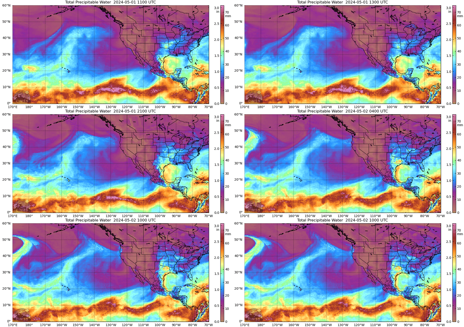
Even more amazing is a series of forecast maps of evolution of the tropical storms. I will show you maps of atmospheric moisture through depth.
Today at 11 AM, the swirls of moisture around three tropical storms are evident. Stunning.


On Saturday morning, they are still there, with one storm passing south of the Hawaiian island


On Sunday morning, the western storm starts moving northeastward towards Hawaii! Some moisture from the eastern storm extends into southern California, which is going to get some rain as a result


Now the most amazing thing. The two eastward storms start to interact on Monday.


Then the combined system starts to move northwest on Tuesday.


The storm’s crazy movement near Hawaii is reflected in the total precipitation over the next 10 days. You can see the northward jog, followed by a turn to the east. Quite unusual!


A great time to visit Kauai if you are meteorologically inclined. 😊
The jet stream, which is steering Hurricane Marie, is bringing heavy rainfall to Southern California and along the Colorado River, which is very beneficial.
Hurricane Lowell remains far from Hawaii, but it could bring heavy rainfall to the islands.
A high-pressure system is forming in the central Pacific.
The eye of Hurricane Lowell is not moving. Strong convection is visible to the east of the hurricane.

It is unlikely that Lowell will pose a direct threat to Hawaii.

Looks like feeder bands well to east of the eye, so Kuai should get fairly good brush of high surf and winds at min tropical storm velocity
The wind driving the storm is located far to the southwest.
Salute!
Somhow how I can’t believe the storm is being driven by “winds”. but more by pressures and intensity by shear, so from NHC earlier and storm now moving more east than NW “The steering
continues to be dominated by a cutoff mid-/upper-level low located about 350 n mi north-northeast of Hawaii, which is forecast to move west-southwestward and cause Lowell to accelerate toward the north and north-northeast through Monday night.
Been thru many as a participant and observer here on Gulf coast. The big ones can surprise you…not the Cat, wind velocity, but the size.
Gums sends…
And ….
” the best time to visit Oahu is during the shoulder season – mainly April, May, September, and October. During these months, there are fewer visitors and prices are considerably lower. It’s also beautiful weather-wise, with warm temperatures and very little rain. “
except this year ….
😉
I honeymooned on Kauai almost exactly a year after Cat 4 Iniki hit the island.
The storm surge damages observable a year later were still stomach churning.
In addition to the direct hurricane damage, the island also lost millions of tourist dollars over the next few years. We would go to nice local restaurants which would only be 1/3 full.
Twice the owners came out and talked to us at our table, and asked if there were any special dishes we would like to try if we would come back later in the week.
(I wished I would have been a millionaire, so we could have left bigger tips.)
Oh my, where to even begin on this one? Heaven help us!
If Meteorologist Cliff Mass, from his home on the Olympic Peninsula of Cascadia, wanted to help us the Desert [sic] Southwest, he could do much worse than to start with NAWAPA [1964], the great North-American Waterworks & Power [Agenda] that was on JFK’s desk and in his speeches right up until that tragic November day in Dallas, A.D. 1963. That’s +63 years of Bad Luck!
The hydrological challenge of the Intermountain West has always been one of distribution, storage & flood-control, all the way from the E.-Alaskan-Yukon frontier in the Sub-Arctic, down thru B.C./Alberta, then E.-Washington / Idaho / W.-Montana to the Great Basin (of NV/UT/CO-W.Slope) and finally Arizona – NW-N.M. – Sonora, just touching upon Alta/Baja-California’s Mojave (true) Desert. Envisioned were a long pearl-necklace chain of reservoirs dwarfing in capacity even the Hoover / Lake Mead & Glen Canyon / Lake Powell complexes finished 6+ decades ago.
The Great Canals & Reservoirs to be built, in accordance to the Parsons NAWAPA plans, were firstly Flood-Control, second Irrigation-Storage, third HydroElectric Power, and fourth Recreational boating / Fish & Game.
Growing up as the Son / Grandson of Arizona Watermen, I could recount the horrific flooding that typically begins in September-October, when the Monsoon season should be winding down but instead launches one Tropical Cyclone after another against the steep mountain terrain. The existing reservoirs have no way to contain the runoff from such deluges, and so release the floodwaters down the river channels, washing out every bridge & road, every industrial site, each farm-orchard-ranch, and even whole communities standing along the banks. And yet we rebuild, every time …
The entire history of the settlement of the Intermountain West, extending even across the Sierra Nevada, into California’s San Joaquin (Central) Valley, has been dominated by water projects: Dams & Levees & Canal networks that build upon a vast pre-historic civilization’s channels.
In 1975, after one set of particularly historic floods, the U.S. Congress authorized construction of new & raised dams [‘Orme’] at the conjunction of the Rivers – Verde & Salt (Salado). But in ’77, President Jimmy Carter struck those from the Authorization (funds). At the time, our local Representative (Rhodes) & Senator (Goldwater) warned: these Projects were necessary, and would have to be built someday, at even greater expense; that our grandchildren will see the day that they are built. And now, here we are, many millions (population growth since then) as dangerously exposed as ever, and with no way to store the runoff and protect the low-lying areas.
You will read from sources that the NAWAPA was a ridiculous fantasy that could never be needed — because Climate-Change! — or afforded, much less completed, or that it would ‘rob’ the Pacific Northwest – Canada – Alaska. Never trust these sources, but rather track down the political roots of their objections, in the regional politics … remembering that the thieving national governments of {CDN, USA, MEX} have never cared a whit for anything but cheaply exploiting the mineral riches & beauty of the Region, turning the peoples against each other across state & tribal boundaries, buying & selling them off separately, in divide-&-conquer fashion. Everything you may read about California’s present troubles are multiplied with distance from the Pacific Coast.
Thanks for reading, and for attempting to comprehend a Problem-in-Scale that defies our Geographical Imagination.
Sincerely, — (signed) RLW, entirely AI-unaided
And these storms will remove huge amounst of heat?
Well. they do in the Gulf….. our water temp goes down after a good storm churns…say a Cat 3 or so. They take energy from the water and thus cool it a bit.
But main thing for we coastal folks are the highs and lows and ridges and fronts.
Th upper level shear winds also play on storm intensity somewhat more than steering the things.
Gums sends…
The only way heat is leaving this planet is via radiation.
When a hurricane transfers amazing amounts of heat energy to the top of the stratosphere, additional CO2 in the atmosphere makes the radiative transfer to space MORE efficient.
Yet again, another negative feedback against the “CO2 will cook us all” models.
Hurricane Lowell has turned northeast and moved a little closer to Hawaii, which could bring heavier rainfall to the islands.

For many days, Hurricane Lowell will emit enormous amounts of thermal radiation into space.

+ moisture into the temperate zones
+ oceanic currents (Japan) upward twd the Bay of Alaska / Aleutians – Beringia
L-storm (Lowell) is rocking, post-K (Karina); they’re now post-peak.
But continuing, with one new Major per week there’s
… the M-storm (Marie, well off Baja-Calif.),
… mid-September’s N-(Norberto)
… autumnal-equinox, the P-storm (Polo, think Marco to Cathay).
At least one of these may wreck havoc in the American Southwest, like the ’70s (c/2-ago)
Lowell is gradually weakening, which is good news for Hawaii.


Lowell will likely remain south of Hawaii, as the ocean’s energy in that region is running out.
Hello. Remind yourselves of the date. Both hemispheres change the location of the cyclones and anticyclones towards and away from the polar latitude annually
The transitions are always more turbulent and the degree of turbulence is quite variable.
What is happening now is simply business as usual in the behaviour of the atmosphere of Gaia
Yes, we hear that:
Peak Season (September+) Tropical Cyclones (N.H.).
Season of Change (Transitions).
Pacific is 10X the Atlantic / Gulf ‘fishbowls)
Good Luck with the Late Winter in your Gold Coast home.
Hurricane Lowell is being cut off by a jet stream loop located northwest of Hawaii.

Hurricane Lowell is approaching Oahu.


Hurricane Lowell is weakening.
Lowell is quickly approaching Oahu.

No,Irene…gasp, just look at the map. Sure, Oahu gonna get good stiff wind gusts, but not nearly as strong, steady and for as long as Kaui.
Only good news is shear is weakening it, but Kauai still getting very stiff wind and storm surge damage should be be worse than originally forecast, mainly due to high waves..sea slope nothing like our Gulf storms we have experienced but expect most surge damage right on the coast.
Gums sends…
Of course, strong, sustained winds will cause damage. Thank you for the accurate information.
Oahu may be subject to strong winds and high waves, but not to heavy rainfall.
The eye of Hurricane Lowell will pass west of the island of Oahu.
Heavy rainfall on the island of Kauai.
