After heavy winter storms, the water level stands just two feet below the new spillway gates – will it work?
When the #CampFire occurred, one of the very best tools out there on the web for tracking progress of the fire came from Peter Hansen, at Chico State University. Now he has a new interactive tool he has shared with me for use in monitoring the level of Lake Oroville as it fills and approaches the top.

You can click the image above to open the interactive tool in a new browser tab.
California’s Department of Water resources provides tabular data, but no comparative visualizations. This interactive tool shows the the five most important variables that most people are interested in monitoring:

With a “full at the top” elevation of 900 feet, the interactive graph also displays the two most important benchmarks:

Right now, as of noon PST today, the lake level is at 810.84 feet, just 2.7 feet from the spillway gates, and rising 2-3 feet daily. At that rate, it will only be less than a day before the new billion-dollar spillway can be used/tested. DWR says there is an 813.6 foot threshold for use, and that is indicated by the orange line in the graph above.

It will be another couple of weeks before the water level makes its way all the way to the top, where the emergency spillway will be used if that happens. Of course, DWR may increase releases, so that may not happen.

Back in early February, DWR said they don’t plan to use the spillway soon, but then later changed their story to say they were making preparations to do so if the water level exceeded 780 feet elevation. That’s already happened.
All eyes are on DWR. Will they, or won’t they?
Already, there are concerns:
Those walls look awfully flimsy.
HotScot
I’m just waiting for Eddie the Eagle to come down that ramp.
Eddie the Climate Scientist?
It is a downhill operation. Intellectually, ethically and economically.
I gave up on the Olympics when they changed the rules to prevent people like Eddie from getting into the Olympics. Eddie needs some snow on that ramp 🙂
They look better suited to be at the US-Mex border.;-)
The spillway is 150 to 200 feet wide. So they look thin, though in the old structure they were 18 inches thick. Though they are around 15 to 20 feet tall, the water only gets around 5 feet deep so there isn’t much sideways force against them.
They are going to backfill the wall with rock. The walls are two stories tall and something like two feet thick with huge rebar structure. The flooring was all extensive rebar and anchor bolts into the underlaying concrete with drain lines under the concrete for seepage that might occur. The floor was very carefully smoothed.
I know this is incredibly important and all that and a big structure, but how does something like that cost a Billion dollars ?? Am I missing something ??
Prevailing wages. Anything Union built always goes over budget.
It was contracted for any by the State of California. What else does one expect?
They’re up to 30 ft tall and 3 ft? thick. Here’s a couple of photo’s to give perspective:
Erecting the rebar/forms for a section of the sidswalls:
Hanging depth chart on one of the sidewalls.
https://pixel-ca-dwr.photoshelter.com/galleries/C0000OxvlgXg3yfg/G00003YCcmDTx48Y/I0000j1Qsr22ZKwI/FL-Oroville-0703-12-06-2018-jpg
The first link was somehow lost; here it is again:
https://pixel-ca-dwr.photoshelter.com/galleries/C0000OxvlgXg3yfg/G00003YCcmDTx48Y/I0000zh0t63lMH6k/KG-oroville-21610-09-26-18-jpg
Wow!!!!!!!!!!!!!!!!!!!!!!!!!!!!!!!
So why aren’t they using all that water to create carbon-free, renewable energy?
There is a hydro plant there, right?
Yes – 4 turbines – 120 MW at full flow of 17,400 cu ft/s (490 cubic meters/s)
Yes, of course. 819 MW (6) hydro generators with the ability to be utilized as a pumped hydro storage in lower water when it isn’t spilling, using 519 MW of electricity on 3 of the 6 pump/generators to pump water back uphill into the dam when there is a surplus of electricity. I would assume they are generating the full 819 Mw as we speak.
https://en.wikipedia.org/wiki/Oroville_Dam#Hydroelectricity
They are not operating at full capacity at the moment because the management plan calls for maintaining somewhere about 840′. The flow through the power plant has been increased since the level reached ~800′, currently around 5000 cfs. So far the precipitation for the season has exceeded last years by ~15%.
A good plot of the levels can be found at: http://oroville.lakesonline.com/Level/
Large scale hydro does not count as “renewable” by California rules.
Please give a link explaining.
https://www.linkedin.com/pulse/20140710135110-294192772-why-hydroelectric-power-isn-t-considered-renewable
Every watt of electricity generated at Oroville does not meet the pump over the mountain//Tehachapi. So = 0- some amount
Inflow exceeds capacity of the power plant.
So instead of wind turbines or solar farms, why not build an additional hydro-power plant or two?
Most of this water will be held and run through the power plant over time. According to the new operating plan, if upstream conditions are wet, DNR will let the water build up to elevation 838. The water level would be drawn down in time from that through the power plant. There will be no need to use the recently constructed spillway. If upstream conditions are dry the bottom of the reserved flood storage will be higher.
Chris, what if the dam is full (like now), and further heavy upstream rain creates an inflow rate that exceeds the outflow thru the power plant? My logic says that they will have no alternative but to spill the excess water down the spillway.
This exact situation has occured in two major dams in Australia recently. In both cases the very high spill rate needed to protect the over-full dam during a major rain event caused heavy flood damage ($ hundreds of millions) to residential and commercial property downstream. I will watch this dam with interest!
caída del río (??) as the Spanish would have claimed. Oroville a few-5 miles below the dam the Feather River meets the valley, where ‘fall’ needed in Hydro Electric generation is nearly too little. Would have been cheaper to invest in 1960 in more hydro capacity, but the Need for Southern California water-swimming pools vetoed the electric generation mode of logic.
And, 2 critical dams were part of the overall Water Project. A governor in the 70’s cancelled these 2 dams on the Yuba River. Now, the outflow of Oroville may not exceed a ?? total volume. These 2 dams would have been empty except during outrageous storms. The Yuba drains into the Feather at Marysville CA. Maximum engineered out flow Oroville would flood Marysville without the 2 cancelled dams.
The operating plans for the Oroville Dam have been revised to accommodate the lack of those two dams. With wet soil conditions upstream they will be reserving 920 million acre feet for flood control, an elevation of 838. They will maintain a smaller flood pool in dryer conditions. They have considered the flood levels downstream in the allowed rates of discharge to determine the storage they need.
Great post. Thanks
Cavitation basically requires the water to boil. Pretty unlikely.
It boils at ambient temperature because of a pressure drop, not by heating. School science classes used to create all three phases under an evacuated bell jar. The water would boil and ice would form from cooling caused by rapid evaporation. Now I guess they teach global warming science and тоталiтагуаи сivics.
Cavitation is pretty common. Boat propellers suffer erosion due to cavitation. example
Submarines try to avoid cavitation because it lets the other side know where they are.
We used to joke that you could hear the Soviet subs before they left port. OK, maybe it wasn’t a joke.
On the other hand, Soviet subs may, or may not, have been pretty good at sneaking into Swedish waters. link
There was a big stink back when Reagan was president. The claim was that someone had sold the Soviet’s state of the art machining tools that they could use to make better propellers that were less likely to cavitate.
Holy Moses! I didn’t remember that. link That explains a whole bunch.
Fire pumper engines are also subject to cavitation and damage should pressures and flow rates not be within design specs, hence always closely monitored.
I don’t see the fish ladder anywhere…. 🙂
Just to set things into perspective, Today, the damn is at 92% of historical average… and 62% to capacity according to: http://cdec.water.ca.gov/reportapp/javareports?name=rescond.pdf
Hard to know what that means as far as danger, but the main spillway is supposed to keep the dam from hitting the full capacity I assume. Then, I ask, why not use full capacity… is that dangerous?
well just dam that damn!! 🙂
Ha! Thought the same thing… I did that once calling my future wife my finance’.
The problem is when the inflow exceeds what the power plant and spillway can handle. If you don’t start using the spillway until the threshold of the emergency spillway has been reached, you run the risk of having to use the emergency spillway.
Right now the managers are bugging all the weather guys in the area trying to get a best guess of how much water is going to fall in the drainage area over the next few weeks. (Not to mention trying to guess now much snow there is and how fast it will melt.)
FYI … CA reservoirs are usually at their highest levels in June-July after MOST of the snowmelt has found its way into the reservoirs. For our reservoirs to be this FULL on Mar. 1 … with the Sierra snowpack >150% of ‘normal’ … suggests an urgent need for dumping our reservoirs. Oops! can’t do that … all the downstream facilities are at capacity. Gonna be a UUuuge flood plain across the Central Valley this year.
In a related story, Jerry Brown was seen pacing – back and forth, back and forth – in his remote CA cabin muttering something about a … “never-ending CA drought”
It’s an earthen dam, so any flow over the top dam is fatal. The flood control spillway should be able to handle all flood situations, but if not, then there is the emergency spillway to left of the flood control spillway.
The original flood control spillway failed in 2017 so the emergency spillway came into use; the water started immediately to undercut the emergency spillway, forcing evacuations below the dam. They were forced to use the failed flood control spillway which gouged a canyon over 150 feet deep under the spillway.
The canyon was filled with roller compacted concrete anchored to the bedrock below. They actually, swept, vacuumed and washed all the way down to bedrock under the new spillway. They called it ‘dental work’ when removing all the debris.
Both spillways are seperated from the main dam by a ridge of rock. No matter how bad the spillways got, they couldn’t undercut the dam itself.
It’s a flood control dam, once you let it fill up you’ve lost control.
Well by Thursday there will be another significant water delivery to the Lake Oroville watershed from the Pacific Ocean.
Weather for Wednesday:
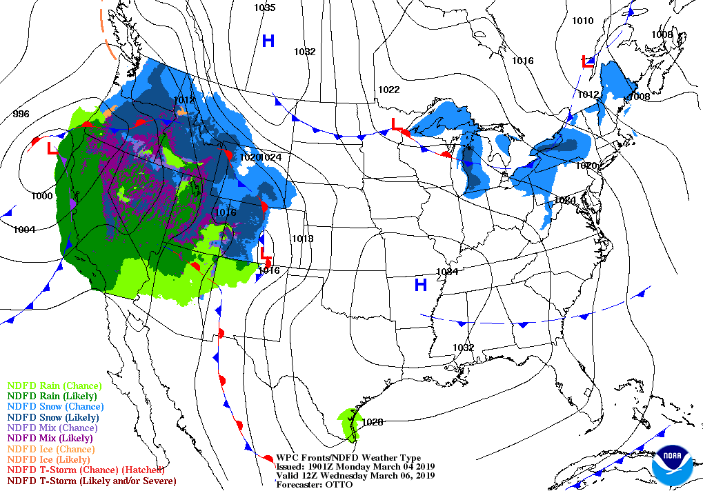
And the rainfall concentration probability by Thursday:

…good grief
First round of rain is moving in tomorrow afternoon and continuing through Saturday.
Looks like the spillway is going to be tested.
“Brace for impact…”
Typo, did not mean to call it dam[n] in the first reference…
Interesting that they actually got it complete so quickly since it was only 2 years ago. But it would be very sad it doesn’t perform.
That concrete is less than 12 months old. So it’s still curing and is relatively week. The bigger obvious problem (as the diagram points out), is the side walls. The comment about cavitation along the inside gutter is especially worrying. Cavitation is well known to occur in large volumes of rapidly moving water – as especially at locations where there will be pressure differentials (ie – in the right angle of that gutter).
90% of full strength at 28 days … and should have a large safety margin .
Expect extra margin due to political concerns .
“Expect extra margin due to political concerns…”
Let’s hope so. But remember this spillway was likely designed by, and construction was supervised by the Army Corps of Engineers. No disrespect intended toward the USACE, as I worked with them for years and know from experience that they’re great guys. But in most cases I discovered that comparing them to real engineers was like comparing public defenders to Johnny Cochran.
If the concrete don’t hold you shouldn’t have sold…
@sweet
I thot the time for a good cure depended upon how thick the concrete is poured, maybe the volume.
Didn’t the Boulder concrete have cooling piping?
Gums asks….
Data I have seen shows that it reaches a plateau after about 90 days. Of course it depends on the type of concrete.
Concrete is designed around the strength it achieves after 28 days of cure. It is plenty strong. The depth of water in this structure will only ever get a few feet deep . The former structure did not fail because of the water inside the structure: it failed because the drainage system below got plugged and the forces of the water underneath displaced the concrete upwards.
Cavitation did not happen with the old structure after multiple uses. There is no reason to expect that it will be a problem with the new structure.
underdrain problem … as I said when it was failing. Although, I don’t really believe in the clog explanation … it appeared to have limited abilities to begin with.
Current weep at joints (now, when dry) is interesting.
I don’t see an adequate underdrain in this design either.
(what is the pipe on the outside of the walls?)
(will they install a 36″ drain at the base of the walls before backfilling?)
They spent a billion dollars for a spillway. The Hoover dam cost less.
Of course, today worker safety rules and environmental impact studies would kill the project by making it vastly more expensive.
I’m all for telling the bureaucrats that they can have just 1/10 the regulations they now have. We need a rule (yeah I know) that makes justifying and creating regulations so burdensome that almost no new regulations happen. Oh yeah, another thing. The bureaucrats shouldn’t be able to burden us by referring to external standards like UL. If they do, the content of the external standard should count against the 10% limit.
They spent a billion dollars for a spillway. The Hoover dam cost less.
The Hoover Dam was finished in five years — two years ahead of schedule — and cost a $49 million, which is worth under $750 million today.
Of course, today worker safety rules and environmental impact studies would kill the project by making it vastly more expensive.
96 workers died constructing the Hoover dam, none died in building the Spillway, perhaps those rules have a purpose?
Juan Brown of Blancolirio youtube fame has covered the disaster and rebuilding of the spillway extensively. There’s plenty of rebar in there now, and a solid base down to good bedrock. The joints might need some work, based on the picture in the post. I suspect that they will operate all the turbines at full flow before letting much water go down the spillway. Although, this is a nice opportunity to test it.
Juan has done the best job of covering Oroville. He’s given solid information without any hype, unlike a lot of news outlets.
http://cdec.water.ca.gov/dynamicapp/QueryF?s=ORO&d=09-Mar-2019+11:41&span=25hours
Consistent inflows between 20,000 and 30,000 cfs … they are operating the hydro power outflows at 5500 to 8,000 cfs (meaning just a couple of the 6 generators operating)… they can outfow as much as appx 18,000 cfs if needed.
They are allowing the reservoir to fill at appx 2.74 feet per day – now at 829.14.
DWR’s target was to stay under 835 for February, and 848 for March.
They are above the 813 foot elevation of the spillway gates, so can release water when/as needed.
At this time of the season they are transitioning to the dams primary purpose – which is to store water for the summer, and as such they are allowing levels to rise. Once they get to 848 they will likely start releasing water … first thru the hydro power plant (up to 17,900 cfs outflow) and then to the spillway, which can accomodate 100,000 cfs – for a combined total outflow capacity of appx 118,000 cfs.
During the failure several years ago, the hydro plant was largely out of service for repairs, and then as debris filled the river it caused levels to rise upstream forcing closure of the hydro plant to protect it.
Just 4 days in the last decade have exceeded 100,000 cfs; 101,000, 108,000, 130,000 and 155,000 cfs, all in the couple day period of early 2017.
http://cdec.water.ca.gov/jspplot/jspPlotServlet.jsp?sensor_no=3382&end=03%2F09%2F2019+11%3A58&geom=huge&interval=1000&cookies=cdec01
Theoretically, with the main spillway and hydro at full outflow, and a starting elevation of appx 849 feet, the dam could sustain the 150,000 cfs rate (which has occurred just one day since 2000) for appx 18 days +/- before reaching the emergency spillway elevation of 901 feet.
http://cdec.water.ca.gov/jspplot/jspPlotServlet.jsp?sensor_no=3382&end=03%2F09%2F2019+11%3A58&geom=huge&interval=7000&cookies=cdec01
Water that central valley, grow food, yes, water for California!
Certainly much, much better than what was there before, and will work great for the next 100 years as it cures. I doubt there will be any issues, if it was engineered to modern day standards. Maybe it isn’t fully finished yet from the looks of things… I don’t know the construction schedule or details of how it was constructed. It appears to be cast in place concrete on bedrock, so as long as they put enough rebar in it, the cement should be cured enough in a year now to withstand a very high flow.
Sure is nice to see the California reservoirs filling to Full Supply levels. Would also be nice to see the Colorado River watershed fill to max and refill all the large dams to full supply, and then the South West states, California and Mexico can weather the next drought that is guaranteed to happen forever. Catch the surplus water when you can! Water is money and life in the desert states, and especially in California.
After removing the old spillway, they chiseled down to bedrock (about 100 feet in one spot), removed about a foot to make sure they were on the good stuff, then used shop vacs and water jets to clean the bedrock. The first layer was a special concrete made to adhere to the rock. Then they added layers or roller-compacted concrete up to about three feet below grade. The top layer is high-quality concrete made to resist water flow and cavitation, bolted down about 20 feet, lots of rebar in two layers, better drainage system, etc. They also rebuilt the emergency spillway and added a wall to prevent erosion from reaching the walls of the emergency spillway. Nice what a lot of money can buy.
I’ve been wondering about the Colorado watershed too. My Boulder brother has said that many of these storms hitting the Pacific coast have been bringing lots of weather towards him. Any links to Rockies snowpack data?
A long, long ways to go to refill Lake Mead:
https://arachnoid.com/NaturalResources/
Nothing says permanent drought like full dams.
I’ve used this site too – http://oroville.lakesonline.com/Level/
Billion – with a “B” – dollars?
Nice tool. Anthony, thank Mr. Hansen for me.
Are the dragons’ teeth at the bottom of the spillway new?
50-50. They recycled the old diffusers by shaving off 18″ old concrete and saved what rebar they could and then drilled/anchored in new bolts to the old concrete and then a whack of new rebar which then had a thick new cap poured of 5000 PSI concrete which also of course is water/wear resistant. The video below at about the 22 minute mark details all this very well. Very Skookum…this spillway ain’t going anywhere for a very long time.
Here is a link to the new Operating Plan.
water.ca.gov/-/media/DWR-Website/Web-Pages/News-Releases/Files/20181221-Oroville-2018-2019-FloodOps-Plan.pdf?la=en&hash=31A6FE44E77AC715FE5AB252D20D68C09AE8D988
Chris, what if the dam is full (like now), and further heavy upstream rain creates an inflow rate that exceeds the outflow thru the power plant? My logic says that they will have no alternative but to spill the excess water down the spillway.
This exact situation has occured in two major dams in Australia recently. In both cases the very high spill rate needed to protect the over-full dam during a major rain event caused heavy flood damage ($ hundreds of millions) to residential and commercial property downstream. I will watch this dam with interest!
First, the reservoir is not full. What I would call full is when it hits the conservation pool level. I’ll call that 838 feet based on the new operating plan. They determined that elevation according to the volume they need to retain the design flood: that is the volume they will have empty above 838 and below the top of the emergency spillway. When elevation 838 is reached, the effort will be to match the outflow of the spillway to the inflows to hold the elevation at 838. The spillway can put out 150,000 cfs (cubic feet per second) but they will limit it to 100,000 cfs because of downstream flooding conditions. So they will let out the minimum of the rate of inflow or 100,000 cfs. If the inflows are higher than 100,000 cfs the excess volume will accumulate in the reservoir above 838: that is what the flood storage is for. When inflows eventually decline below 100,000 cfs they will continue discharging at 100,000 cfs until the water gets down to 838, then they will match inflow and outflow.
They have adopted a more complicated plan wherein they can adjust the Conservation pool to as high as 870 depending on upstream conditions, but that is the basics of flood control. In the summer they will draw down below 838 for power production and irrigation promises.
thanks, Chris. Just for comparison, here is a link to the Townsville (Aust) Ross River dam levels, showing a recent extreme weather pattern that dumped huge rainfall on the catchment:
https://www.townsville.qld.gov.au/water-waste-and-environment/water-supply-and-dams/dam-levels
The dam went from approx 65% full to almost 250% full in a couple of days (100% being the nominal ”full’ level for drinking water, the rest of te capacity (total of 233,000 ML or 190,000 acre-feet) being for flood mitigation purposes. Then they opened the gates at 2 ML/sec / 1.6 acre-feet/sec), which exacerbated the flooding of the downtown area. Could they have done a better job managing this dam? cheers,
People worrying about the new spillway are doing so based on low information, bad information, or misinformation, or a combination thereof. If one has any interest at all on the subject I highly suggest watching Juan Browne’s superb coverage of the project from start to finish on his YouTube channel (blancolirio).
The spillway has been ready for operation since November 2018, but with lake levels as low as they were there was no chance of it being used for several months at the very least. The wall joints and slab joints are designed with a relief so water flows right past with no disturbance/cavitation (referred to as a “high-velocity water joint”). All of these things are clearly detailed in his videos.
https://www.youtube.com/watch?v=v6lus-PXS4k
Go to 11:05 in this second video to see joints:
If anything, they went beyond what was needed. You do that when you are replacing a failed structure.
It’s about time that they recognized the danger potential. There have been 3 times where flooding rains struck that area. The first time was in the winter of 1964/65. That was the winter which filled the empty dam years before it was supposed to fill. So a catastrophic flood was averted and reduced to a disastrous flood for California, Oregon , and Washington.
The next close call was in the winter of 1996/97. An incredible 30+ days of rain for Northern California and Southern Oregon. The last close call was the winter of 2016/17. Thankfully, the rains came to a halt. Those are the last 3 major flood winters for the West Coast. Note the proximity to the solar minimum in each case.
I should have added that the 3 winters mentioned above were all winters in which water came close to going over the spillways at Oroville.
Notice that in each of those events a rather thin film of 12 inches of concrete was sufficient to deal with the forces of the flowing water. What caused the former structure to fail was not the flowing water, it was the failure of the drainage system, which was only coincidentally related to the overflow. Because conditions were generally wet, water pressure built up under the structure at the same time it was needed.
Also the original structure didn’t go down all the way to sound bedrock, something they have done with the current rebuild.
Thanks Greg S
At least they’ve learned from original mistakes
Thanks Greg!
Juan
‘Blancolirio’
If you want to see the current levels, here is the official place: http://cdec.water.ca.gov/dynamicapp/QueryF?s=ORO
That chart is pretty neat. Some of the other charts on the website are pretty slick as well. It looks like the website provides to subscribers tools for charting data. I notice, that on the Oroville Dam chart, there is an option to bring up the next 3 weeks of data. What does that mean?
Juan Browne published an update for those interested.
https://youtu.be/RIOQm7G-GW0
Forget about the rain, it’s the snow pack we need to worry about. March 1 snow measurements up around Tahoe showed the greatest water content ever recorded since they had been taking measurements. As we progress through March, the storms will begin to get warmer. Some of California’s greatest floods have been around Easter time which comes after the spring equinox. If we get a warm wet storm that melts a lot of snow pack in addition to the rain, then it’s “Katy, bar the door!” We’re in for a mess. I recall a year in the 1980s when we had a really bad flood. Levees broke and they were plucking people off of freeway overpasses by helicopter in Manteca, CA. The 150% is an average. It is 200% of normal at Truckee #2 SNOTEL station. The Truckee river into the Reno area is going to flood pretty badly. We really need to hope we have a cool spring or if it does warm up, that it stays dry. What we do NOT need is warm rain.