Last update: 4 February 2011
by Klaus Wolter
The views expressed are those of the author and do not necessarily represent those of NOAA.

El Niño/Southern Oscillation (ENSO) is the most important coupled ocean-atmosphere phenomenon to cause global climate variability on interannual time scales. Here we attempt to monitor ENSO by basing the Multivariate ENSO Index (MEI) on the six main observed variables over the tropical Pacific. These six variables are: sea-level pressure (P), zonal (U) and meridional (V) components of the surface wind, sea surface temperature (S), surface air temperature (A), and total cloudiness fraction of the sky (C). These observations have been collected and published in COADS for many years. The MEI is computed separately for each of twelve sliding bi-monthly seasons (Dec/Jan, Jan/Feb,…, Nov/Dec).
After spatially filtering the individual fields into clusters (Wolter, 1987), the MEI is calculated as the first unrotated Principal Component (PC) of all six observed fields combined. This is accomplished by normalizing the total variance of each field first, and then performing the extraction of the first PC on the co-variance matrix of the combined fields (Wolter and Timlin, 1993). In order to keep the MEI comparable, all seasonal values are standardized with respect to each season and to the 1950-93 reference period. The MEI is extended during the first week of the following month based on near-real time marine ship and buoy observations (courtesy of Diane Stokes at NCEP) summarized into COADS-compatible 2-degree monthly statistics at NOAA-ESRL PSD. Caution should be exercised when interpreting the MEI on a month-to-month basis, since the input data for updates are not as reliable as COADS, and the MEI has been developed mainly for research purposes. Negative values of the MEI represent the cold ENSO phase, a.k.a.La Niña, while positive MEI values represent the warm ENSO phase (El Niño).
You can find the numerical values of the MEI timeseries under this link, and historic ranks under this related link. You are welcome to use any of the figures or data from the MEI websites, but proper acknowledgment would be appreciated. Please refer to the (Wolter and Timlin, 1993, 1998) papers (NOW available online as pdf files!), and/or this webpage.
If you have trouble getting the data, please contact me under (Klaus.Wolter@noaa.gov)

How does the 1998-2000 La Niña event compare against the seven previous biggest La Niña events since 1949? Only strong events (with a peak value of at least -1.2 sigma) are included in this figure. Note that some events last through the full three years shown here (for instance, 54-56), while others revert to “normal” or El Niño conditions by the second or third year (especially in 64-66). The 1998-2000 La Niña does not resemble any previous event in this comparison figure. It started late (about three months later than the previous latest case), and it featured a superimposed annual cycle (peaking around May and troughing around November) that does not match the other events displayed in this figure. However, the weak La Niña period after the 1982-83 El Niño had similar characteristics. Click on the “Discussion” button below to find the comparison of 2010 MEI conditions against several strong La Niña events.
Discussion and comparison of recent conditions with historic El Niño events

How does the 2002-04 El Niño event compare against the seven previous biggest El Niño events since 1949? Aside from 2002-04, only strong events (with a peak value of at least +1.4 sigma) are included in this figure. The 2002-03 El Niño event peaked below that threshold, with just over +1.2 sigma in early 2003. Overall, I would rank it just barely in the top 10 El Niño events of the last half century. In its evolution, it bears some resemblance to the 1965-67 event (highest temporal correlation), but shared with 1991-93 its reluctance to drop below the zero line once it had run its course. The El Niño event of 2006-07 reached a similar peak as the 2002-03 event, but lacked ‘staying power’, and collapsed in early 2007. The most recent event (2009-10) will replace 2002-03 in this comparison figure by the middle of 2011. Click on the “Discussion” button below to find the comparison of 2010 MEI conditions against several strong La Niña events.

The six loading fields show the correlations between the local anomalies and the MEI time series. Land areas as well as the Atlantic are excluded and flagged in green, while typically noisy regions with no coherent structures and/or lack of data are shown in grey. Each field is denoted by a single capitalized letter and the explained variance for the same field in the Australian corner.
The sea level pressure (P) loadings show the familiar signature of the Southern Oscillation: low pressure anomalies in the west and high pressure anomalies in the east correspond to negative MEI values, or La Niña-like conditions. Consistent with P, U shows positive loadings along the Equator, corresponding to easterly anomalies near the dateline. Negative loadings in the far western and eastern Pacific, as well as to the south of the positive loading center, show that westerly anomalies are almost equally pervasive in these regions during La Niña. The meridional wind field (V) features high negative loadings north of the Equator, denoting the northward shift of the ITCZ so common during La Niña conditions, juxtaposed with even stronger positive loadings northeast of Australia.
Both sea (S) and air (A) surface temperature fields exhibit the typical ENSO signature of a wedge of positive loadings stretching from the Central and South American coast to the dateline, or cold anomalies during a La Niña event. They are flanked by negative loadings (warm anomalies during La Niña conditions) to its southwest and, to a lesser degree, to its northwest. At the same time, total cloudiness (C) tends to be decreased over the central equatorial Pacific and on the northeastern flank of the South Pacific Convergence Zone (SPCZ), sandwiched in between increased cloudiness north of Australia and the eastern-most equatorial Pacific.
Now just past its annual peak, the MEI explains 31.6% of the total variance of all six fields in the tropical Pacific from 30N to 30S. Although its temperature components dominate the MEI with over 40% of their possible variance, even P, V, and C join in with about a third, a quarter, and a fifth of their variance, respectively, at or close to their peak values during the year. Thirteen years ago, when the MEI was introduced to the Internet, the explained variance for Dec-Jan 1950/51-1997/98 peaked amounted to 32.7%. This slight drop-off reflects the diminished coherence and importance of ENSO events in the last 13 years, bottoming out just two years ago with 30.9%. The loading patterns shown here resemble the seasonal composite anomaly fields of Year 1 in Rasmusson and Carpenter (1982).

Consistent with full-blown strong La Niña conditions, all of the key anomalies in the MEI component fields that exceed or equal one standard deviation, or one sigma (compare to loadings figure), flag typical La Niña features, while no comparable El Niño-like features reach the opposite one sigma threshold. Significant negative anomalies (coinciding with high positive loadings) denote strong negative sea level pressure (P) anomalies over the Maritime Continent (down to -3.2 standard deviations west of Australia), significant easterly anomalies (U) along the Equator and centered on the dateline, significant northerly anomalies east of Fiji, while both sea surface (S) and air temperature (A) anomalies continue at or above -1 sigma in the central and eastern tropical Pacific basin. Significant positive anomalies (coinciding with high negative loadings) denote significant positive sea level pressure (P) anomalies over the eastern subtropical Pacific, significant westerly anomalies (U) along the Pacific coast of Mexico, as well as over western Indonesia where they reach +3.4 sigma, significant southerly anomalies (V) are found west of Hawaii, and northeast of New Guinea where they reach +2.1 sigma, warm sea surface (S) and air temperatures (S) reach almost two sigma east of Australia and west of Hawaii, and significantly increased cloudiness (C) covers the western Pacific and the eastern-most equatorial Pacific where it reaches +2.3 sigma.
Again, all of these cardinal anomalies flag La Niña conditions. The only missing key anomaly is cloudiness over the central equatorial Pacific (which should be suppressed, but is not).
Go to the discussion below for more information on the current situation.
If you prefer to look at anomaly maps without the clustering filter, check out the climate products map room.
Discussion and comparison of recent conditions with historic La Niña events

In the context of the rapid transition of the MEI into strong La Niña conditions, this section features a comparison figure with strong La Niña events that all reached at least minus one standard deviations by June-July, and a peak of at least -1.4 sigma over the course of an event. The most recent moderate La Niña events of 1998-2001 and 2007-09 did not qualify, since they either did not reach the required peak anomaly (the first one) or became strong too late in the calendar year (both).
The updated (December-January) MEI value has strengthened slightly to -1.62 standard deviations after almost dropping below -2 standard deviations in August-September. Nevertheless, the most recent value ranks 2nd for this time of year, clearly below the 10%-tile threshold for strong La Niña MEI rankings , but slightly weaker than the value recorded in 1974. If one were to take the average of all MEI rankings since July-August (a six-month period), the strongest La Niña half-year periods of mid-55, ’73-74, and late ’75 averaged slightly stronger than the current event, for now (this is means Rank 4 for the current event, up one from last month).
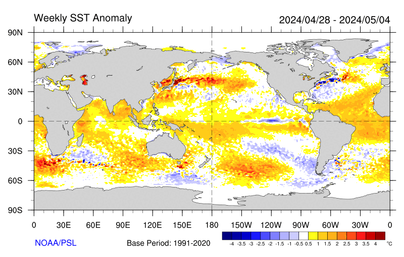
Negative SST anomalies are covering much of the eastern (sub-)tropical Pacific in the latest weekly SST map. Many of these anomalies are in excess of -1C.
For an alternate interpretation of the current situation, I highly recommend reading the latest NOAA ENSO Advisory which represents the official and most recent Climate Prediction Center opinion on this subject. In its latest update (6 January 2011), La Niña conditions are expected to last “well” into the Northern Hemisphere spring of 2011.
There are several other ENSO indices that are kept up-to-date on the web. Several of these are tracked at the NCEP website that is usually updated around the same time as the MEI, not in time for this go-around. Niño regions 3 and 3.4 showed persistent anomalies above +0.5C from June 2009 through April 2010, with a peak of +1.6C for Niño 3 and +1.8C for Niño 3.4 in December 2009, only to drop to about -0.5C or lower in both regions by early June 2010, reaching just shy of -1.0C for the month of July, and near -1.5C since October for both Niño 3 and 3.4 anomalies.
One only has to go back to the La Niña winter of 2007-08 to find seasonal Niño 3.4 anomalies that were lower than this year’s, hence the reluctance of Niño 3.4-based classifications to call this event a ‘strong’ event. Nevertheless, the weekly SST anomalies in January 2011 were consistently at or below -1.5C, so that the three-month average should ‘qualify’ for the strong category based on Niño 3.4 SST. For extended Tahiti-Darwin SOI data back to 1876, and timely monthly updates, check the Australian Bureau of Meteorology website. This index has often been out of sync with other ENSO indices in the last few years, including a jump to +10 (+1 sigma) in April 2010 that was ahead of any other ENSO index in announcing La Niña conditions. After a drop to +2 in June, July rebounded to +20.5, followed by values between +16 (November) and +27 (December), including +20 in January 2011. The last time that this index showed higher values for the average of any six months was during the same half-year in 1917(!), so any SOI-based classification would classify this event as one the second-strongest event of the last century. An even longer Tahiti-Darwin SOI (back to 1866) is maintained at the Climate Research Unit of the University of East Anglia website, however with less frequent updates (currently through March 2010). Extended SST-based ENSO data can be found at the University of Washington-JISAO website, currently updated through May 2010 (which ended up just slightly below the long-term mean value).
Stay tuned for the next update (by March 5th) to see where the MEI will be heading next. While La Niña conditions are guaranteed well into 2011, it remains to be seen whether it can rally once more to cross the -2 sigma barrier, and/or whether it will indeed last into 2012, as discussed six months ago on this page.
I believe the odds for a two-year event remain well above 50%, made even more likely by the continued unabated strength in various ENSO indices.
REFERENCES
- Rasmusson, E.G., and T.H. Carpenter, 1982: Variations in tropical sea surface temperature and surface wind fields associated with the Southern Oscillation/El Niño. Mon. Wea. Rev., 110, 354-384. Available from the AMS.
- Wolter, K., 1987: The Southern Oscillation in surface circulation and climate over the tropical Atlantic, Eastern Pacific, and Indian Oceans as captured by cluster analysis. J. Climate Appl. Meteor., 26, 540-558. Available from the AMS.
- Wolter, K., and M.S. Timlin, 1993: Monitoring ENSO in COADS with a seasonally adjusted principal component index. Proc. of the 17th Climate Diagnostics Workshop, Norman, OK, NOAA/NMC/CAC, NSSL, Oklahoma Clim. Survey, CIMMS and the School of Meteor., Univ. of Oklahoma, 52-57. Download PDF.
- Wolter, K., and M. S. Timlin, 1998: Measuring the strength of ENSO events – how does 1997/98 rank? Weather,53, 315-324. Download PDF.
h/t to WUWT reader FergalR
Like I said, the available evidence is contradictory so you are no more ‘right’ than I am.
What is certain though is that more meridional jets involve a hugely increased length for the air mass boundaries as they loop about between poles and equator with vastly increased areas of mixing and cloud formation.
That is bound to show up in the cloud data and albedo figures once the current data mess has been resolved.
You know, Bob, it could be so much better chatting with you if you could refrain from being so rude and acting so superior.
I said:
“increased cloudiness globally since 1998 ”
Bob said:
” global ocean cloud cover from 1998 to 2007″
Anyone else see what he did there ?
“And the dataset that Klaus Wolter uses for his MEI, COADS Cloudcover, shows a significant decrease in global ocean cloud cover from 1998 to 2007.”
But Klaus is referring specifically to the area where one would normally expect a reduction of cloud cover during a La Nina and is saying that such reduction has not occurred to the extent normally expected so how does your comment help ?
crosspatch said:
“Normally during a La Nina, there are fewer clouds so the ocean actually gains energy but stacks it up in the Western Pacific Warm Pool and Indian Ocean. I noticed a week or so ago that these areas were oddly cool for a La Nina year.”
Given your contention that the recharge is progressing ‘normally’ I wonder whether everyone is comparing apples to apples or apples to pears.
Do you agree with crosspatch or not ?
Stephen Wilde says: “What is certain though is that more meridional jets involve a hugely increased length for the air mass boundaries as they loop about between poles and equator with vastly increased areas of mixing and cloud formation.”
Do you have data that supports this?
You wrote, “You know, Bob, it could be so much better chatting with you if you could refrain from being so rude and acting so superior.”
I’m not “acting so superior,” nor am I being rude. I may be writing succinctly and you may be hypersensitive. As I have noted a multitude of times here at WUWT, without data to support your claims, all you’re doing is speculating.
You wrote, “But Klaus is referring specifically to the area where one would normally expect a reduction of cloud cover during a La Nina and is saying that such reduction has not occurred to the extent normally expected so how does your comment help ?”
Again, have you investigated the ICOADS Cloud Cover dataset used by Klaus Wolter to see if you want to continue pursuing this line of questioning?
You asked, “Do you agree with crosspatch or not ?”
I do not agree with this portion of Crosspatch’s statement, “I noticed a week or so ago that these areas were oddly cool for a La Nina year,” because the SST anomalies for the PWP are precisely where one would expect them for a La Niña.
” all you’re doing is speculating.”
I am extrapolating from known physical principles and observations.
For example as regards more cloudiness from more meridional jets:
i) The air mass boundaries are obviously longer applying basic geometry.
ii) Clouds result from temperature differentials and mixing so more mixing along a longer interface must give more clouds.
iii) More clouds generally give a higher albedo.
iv) There are data sets which show increased cloudiness and albedo since the late 90s.
Call the obvious conclusions speculation if you wish.
Stephen Wilde says: “I am extrapolating from known physical principles and observations.”
What datasets make up your observations?
An interesting question.
Define ‘dataset’.
I think your definition will be unduly restrictive. Hence your inability to see beyond ENSO to a greater truth.
Stephen Wilde says: “Define ‘dataset’.”
http://en.wikipedia.org/wiki/Data_set
Stephen Wilde says: “Define ‘dataset’.”
You used the term in your comment, “iv) There are data sets which show increased cloudiness and albedo since the late 90s,” and I asked you “What datasets make up your observations?”
Why are you asking that I define the term “dataset”, other than to avoid answering the question?
You’re waisting my time.
Good-bye, Stephen.
Stephen Wilde: Oops. I noticed the typo after I hit “post comment”.
You’re waisting my time, should read, You’re wasting my time.
Good-bye, Stephen
Wilde:
“You wrote, “Most likely by solar activity expanding or contracting the polar vortices and shifting all the air circulations so as to affect average cloudiness over ENSO regions regardless of the then current state of ENSO or PDO.”
Tisdale:
“Conjecture on your part. Please present the data that supports this.”
I asked Joe Bastardi about the concept of “blocking.” He replied:
“It is caused when warm air gets trapped in the high levels at high latitudes, where its very stable and tough to disrupt”
Now, is it unreasonable to suppose that at solar max the increased UV creates ozone which absorbs UV and warms the stratosphere, causing increased flow of warm stratospheric air toward the poles and creating a warm-above-cold temperature inversion (known to be stable)? I think Steven Wilde’s “conjecture” makes a lot of sense.
http://www.earthandocean.robertellison.com.au/
“Observation from ships over 60 years show changes in cloud cover in the Pacific over periods clearly associated with the well known modes of Pacific Ocean multi-decadal variability. A change to less cloud in the shift to a warm El Niño dominated Pacific decadal pattern in the late 1970’s and a change to more cloud following the shift to a La Niña dominated cool mode since 1998. ”
and:
During the warming spell global cloudiness decreased as did global albedo (reflectivity as seen from space) which is consistent with poleward shifting jets but the Earthshine project now shows us that both global cloudiness and global albedo are increasing again since the late 90s:
http://bbso.njit.edu/Research/EarthShine/literature/Palle_etal_2006_EOS.pdf
But Bob, you don’t call them datasets, apparently.
Goodbye.
pochas said :
“Now, is it unreasonable to suppose that at solar max the increased UV creates ozone which absorbs UV and warms the stratosphere, causing increased flow of warm stratospheric air toward the poles and creating a warm-above-cold temperature inversion (known to be stable)? I think Steven Wilde’s “conjecture” makes a lot of sense.”
Thanks pochas.
Just one correction, though it doesn’t alter the underlying principles, but oddly the stratosphere gets warmer when the sun is LESS active rather than when it is MORE active.
I’ve made separate proposals to try to account for that and I await more data about stratospheric and mesospheric temperatures since 2007 before I can firm up that aspect.
Steven,
Your comment made me curious, so I stopped by the UAH “Discover” site and collected some data. For Nov 20 of the year given, temps at 25,000 m which is the ozone layer were, in negative deg C:
1998 – 37.07
2000 – 36.98
2003 – 36.90
2006 – 37.52
2010 – 37.84
The year of solar max for cycle 23 was 2000. Current temperatures are almost a degree lower than those at solar max. But this is not a big difference and certainly not the whole story. I encourage you to continue your inquiry.
Thanks pochas but I’m looking at temperature changes across multiple solar cycles and I have to bear in mind this source too:
http://www.jstage.jst.go.jp/article/sola/5/0/53/_pdf
“The evidence for the cooling trend in the stratosphere may need to be revisited. This study presents evidence that the stratosphere has been slightly warming since 1996.”
Any idea as to why they should differ ?
Stephen Wilde: You linked and quoted, “http://www.earthandocean.robertellison.com.au/
“Observation from ships over 60 years show changes in cloud cover in the Pacific over periods clearly associated with the well known modes of Pacific Ocean multi-decadal variability. A change to less cloud in the shift to a warm El Niño dominated Pacific decadal pattern in the late 1970’s and a change to more cloud following the shift to a La Niña dominated cool mode since 1998. ”
Please show me a graph on that webpage that confirms this quote. Please identify the cloud cover dataset which serves as the basis for the quote. Please quote the discussion of the equatorial Pacific cloud cover for the 2010/11 La Nina from the link you provided, which is the topic of discussion here.
You provided a second quote and link, “During the warming spell global cloudiness decreased as did global albedo (reflectivity as seen from space) which is consistent with poleward shifting jets but the Earthshine project now shows us that both global cloudiness and global albedo are increasing again since the late 90s:
“http://bbso.njit.edu/Research/EarthShine/literature/Palle_etal_2006_EOS.pdf”
The Earthshine data in Palle et al (2006) ends in 2004, but our discussion is of the present, the 2010/11 La Niña. You’re assuming the global cloud reflectance has continued to increase since 2004. Big assumption. Please also enlighten us as to how you can determine meridional and zonal changes in cloud cover from Earthshine data.
You wrote, “But Bob, you don’t call them datasets, apparently.”
Correct. I do not.
You have not provided links to the data upon which you are making claims about the present state of cloud cover. Webpages or papers that do not substantiate your quotes and that are outdated for our discussion do not serve as data.
Bob,
Your work is invaluable and I admire it greatly.
My approach differs from yours, clearly. You rely only on specific demonstrable data whereas I look for trends and relationships between bits of data that might not yet be final and conclusive.
I see no good reason for the unpleasant tone that our exchanges have acquired.
If I question certain aspects of your work it is not intended as a personal attack.
You are the expert par excellance on all matters ENSO.
I am looking at the broader and longer term issues and in order to do so I need to draw conclusions from less than perfect data.
You say that the cloudiness over the ENSO recharge area is ‘normal’ and that recharge rates are ‘normal’.
Others say otherwise. On balance I am inclined to believe you rather than them but I reserve my position and await confirmation one way or the other.
The thing is that the issues I address are at the heart of the question as to whether anthropogenic influences are significant or not. Your data does not address that issue either way as far as I can see but it does provide some basic assumptions that I can use as a starting point when I seek to interpret the implications of data from outside the ENSO regions.
So, it is up to you as to whether we can help each other or whether you find my style so different to yours that no integration of our respective approaches is possible.
Stephen Wilde says: “If I question certain aspects of your work it is not intended as a personal attack.”
I do not take them as personal attacks. I view your conjecture as conjecture, and when your conjecture is not supported by data, I advise you. And occassionally, I ask for you to document your claims with data, which you consistantly fail to do.
You wrote, “I am looking at the broader and longer term issues and in order to do so I need to draw conclusions from less than perfect data.”
There is data. You elect not to use it.
You continued, “The thing is that the issues I address are at the heart of the question as to whether anthropogenic influences are significant or not.”
Since you do not rely on data, your speculations can not address whether anthropogenic influences are significant or not.
You wrote, “Your data does not address that issue either way as far as I can see but it does provide some basic assumptions that I can use as a starting point when I seek to interpret the implications of data from outside the ENSO regions.”
I have addressed the rise in temperatures outside of the ENSO regions in a good number of posts for over two years and how much of it are aftereffects of ENSO.
@ur momisugly Steven Wilde,
Here is a plot of solar flux vs arctic oscillation. Nothing is proven, but the plot is suggestive nevertheless. These are 11 year smooths, normalized. Note that the flux curve does not peak at solar max, and this was not intended. The smooth is to average over a given solar cycle and only indicates general level of solar activity. Solar max and min by sunspot counts are indicated. I continue to believe that solar effects on the arctic oscillation may have an important effect on climate. However, much more data is needed and there are many other important factors involved.
http://i279.photobucket.com/albums/kk145/pochas_2008/AOvsFlux.jpg
As for the Li and Weng paper you referenced, one can make of fig 4 what one wishes. I remember being impressed by the rapid cooling of the stratosphere in the ’90s which I thought was the only real observable due to CO2 (more radiating species in the upper atmosphere). The only comment I would make after looking at fig 4 is that the rapid cooling has stopped.
For those still following this thread, there has been a very large switch in the SSTs in the East Pacific off Peru. Temps have increased by 6C in the last month.
The US Navy model NLOM has this warmer water coming in from the Peru-Humbolt current and it looks to me like the La Nina is now very rapidly dissappating. A strong El Nino is on its way sooner rather than later.
http://sharaku.eorc.jaxa.jp/AMSR/elnino/201102/P1AME110212SST000500ANOML.png
The equatorial surface currents are now going west-east over much of the Pacific.
http://www.cpc.ncep.noaa.gov/products/GODAS/pent_gif/xy/pent.anom.xy.uv15m.1.gif
And the Trade Winds are strongly west-east in the east Pacific and mostly normal in the rest of the Pacific (after having reached record east-west levels in December).
http://www.cpc.ncep.noaa.gov/products/analysis_monitoring/enso_update/ua850_c.gif
pochas said:
” I continue to believe that solar effects on the arctic oscillation may have an important effect on climate. However, much more data is needed and there are many other important factors involved.”
Agreed.
I think the main confounding effect is oceanic. Thus when we have a period of La Nina dominating over El Nino as during the mid 20th century cooling period the oceans fail to push the tropics poleward so the AO is able to remain less positive than it otherwise would be from solar influences alone.
The positivity of the late 20th century would then be a consequence of solar activity causing the vortex to intensify from above and the warm ocean surfaces pushing the tropics poleward with both factors supplementing one another.
During the mid 20th century the slightly weaker cycle 20 (but still high in historical terms) led to greater AO negativity than would have been expected from the activity level of cycle 20 alone because the cool ocean surfaces allowed the tropics to contract.
Additionally it isn’t just ENSO/PDO that is the final arbiter but the net state of all the global ocean surfaces combined.
So the pattern varies a good deal so as to disguise the underlying mechanisms on timescales less than the multidecadal.
Bill Illis says:
February 12, 2011 at 5:24 pm
“it looks to me like the La Nina is now very rapidly dissappating. A strong El Nino is on its way sooner rather than later”
That will be interesting if it happens because it would entail the start of a discharge phase much earlier than was expected and before a full recharge has taken place.
It might warm the air up a bit for a while but would deplete ocean heat content prematurely perhaps leading to a downward step in air temperatures between the current La Nina and the next.
It might force a more positive AO too by pushing the air masses poleward against the negative AO trend supplied by the relatively inactive sun.
The 10.7 flux is up a bit from the recent solar minimum so that suggests a little less AO negativity too.
We shall see.
pochas said:
“I remember being impressed by the rapid cooling of the stratosphere in the ’90s which I thought was the only real observable due to CO2 (more radiating species in the upper atmosphere). The only comment I would make after looking at fig 4 is that the rapid cooling has stopped.”
Yes I accepted the stratospheric cooling back then as evidence in support of the CO2 theory.
But since 2000 CO2 levels have continued to rise and the stratospheric cooling stopped which tends to suggest natural causation, possibly solar induced.