…And what we might expect from the GISS, NCDC and UKMO products.
Guest Post by Bob Tisdale
Alarmists from around the globe are awaiting the global temperature product update from GISS, which should be released sometime around the 15th of this month. As a separate listing, see the data page here, GISS provides the annual-average December-to-November data, what is referred to as the “Meteorological Annual Mean”. I thought it would be interesting to see in advance of the GISS release where the RSS and UAH “Meteorological Annual Mean” lower troposphere temperature anomalies came in for 2014. See Figure 1.

Figure 1
As one might expect, due to the additional volatility of the lower troposphere temperature anomaly products, the “Meteorological Annual Mean” values for 2014 are nowhere close to the record highs for the RSS and UAH global temperature products.
WHAT WE MIGHT EXPECT FROM GISS, NCDC AND UKMO PRODUCTS
IF (big if) the December-to-November mean is close to the November-to-October mean, Figure 2, then the “Meteorological Annual Mean” for GISS should be similar to 2010.

Figure 2
The NCDC product for November 2014 will appear a few days later, on the 18th. It should be at record highs, Figure 3, if the December-to-November mean is close to the November-to-October mean.
 Figure 3
Last, toward the end of the month, the November 2014 UKMO HADCRUT data will be published, and based on the same big-if scenario, Figure 4, the December-to-November mean will probably be about the same as 2010.
 Figure 4
So strap yourself in for some alarmism. I suspect we’ll be hearing about global surface temperatures for the next few months.
Of course, we know that the record high global surface temperatures in 2014 are primarily a response to a prolonged weather event in the North Pacific. If this is news to you, please see the post here. Maybe, after the mainstream media get their fill and something else takes the alarmist stage, there will be a report from some agency that provides an open explanation for the 2014 record highs…maybe not.
And our champions will be there to speak for us, like the comedian “Lord Monckton”–mocking the victims:
He only mock people who are “victims” of their own delusions.
Give Roger Horriblebin some time, he’s getting older, and slower to respond.
Sorry, that got put in the wrong place!
So what means: “Land Air + Sea Surface” ?? which seems to be favored by NCDC, HADCRUD, and GISSLOTI.
My limited understanding of the English language, says that is “air over land plus water in the sea.”
So given that John Christy et al showed that air over sea does NOT equal water in the sea, and moreover they do not correlate….
Doesn’t that mean that NCDC, HADCRUD, and GISSLOTI are equivalent to DJIA + mean age of SS retirees.
Both RSS and UAH include only “air in the air” + nada in the water, and even though they don’t both use the exact same “air in the air” they both get about the same result.
There has to be some pithy lesson about doing experiments, in there somewhere.
I would offer a conjecture (without proof; just MY opinion) that Lord Monckton’s RSS algorithm, would yield rather similar results if applied to UAH, but could perhaps (also conjecture) crash and burn on NCDC and chum(p)s.
George e. Smith, Could you give me the Christy et. al. paper reference? I am wondering what HadCRUT4 uses in the areas which are covered by sea ice. If not the the sea water T of -1.8C right underneath the ice what then? Surely they have no thermometers on the shifting sea ice.
Chris, I’m not able to pin point it exactly; but my recollection is that the paper was in the January 2001 edition of Geophysical Letters, or some quite similar sounding Journal.
The gist of it is that around 1980 is when a series of ocean buoys (not the Argo Buoys) were placed in some Pacifica and Indian Ocean regions. Among other data gathered the made simultaneous measurements of ocean water Temps at a fixed depth of -1m MSL, and ocean air Temps at a fixed height of +3m MSL. They reported on about 20 years of monitoring by those buoys, and as I recall the air Temp warming, was only about 60% of the surface water Temp warming (for those 20 years). But the important result was that the two were not strongly correlated, which means that it is impossible to go back and “correct” all the hundreds of years of supposed climate data re Temperatures over the ocean, that were actually read from buckets of water recovered from quite random depths, or later from steam engine room cooling waters taken in from also variable depths on different ships.
The water bucket Temps were typically taken on deck, with winds, and evaporation going on, while the engine room intakes were read inside hot engine rooms, or some other silly sort of installations.
As a result, I consider all oceanic data prior to circa 1980 to be pure junk.
Ships at sea can return to the exact same global GPS positions of previous measurements, and find themselves in completely different waters because of ocean current meanders. Air patterns aren’t stable either.
Why anybody ever believed that ocean water Temps were a valid proxy for ocean air Temps is quite beyond my limited imagination, given that air currents can be a hundred times the velocity of water currents in the ocean, so they aren’t in contact long enough to ever reach equilibrium.
I exchanged e-mails with prof Christy back at the time, and he clarified some things about it.
So I don’t care what they said the global Temperature was in 1852 or wherever their record started.
Mebbe that’s Geophysical Research Letters.
“””””…..
Differential trends in tropical sea surface and atmospheric temperatures since 1979
Authors John R. Christy, David E. Parker, Simon J. Brown, Ian Macadam, Martin Stendel, William B. NorrisFirst Published: 7 December 2012Vol: 28, Pages: 183–186DOI: 10.1029/2000GL011167
Jan 2001 Geophysical Research Letters.
Pot, meet kettle.
Thanks Bob.
there must be some type of climate conference on at the moment perhaps. very little from the BBC but then they are out in the Phillipines reporting on superstorms during an average typhoon.
Give Roger Horriblebin some time, he’s getting older, and slower to respond.
Also no signs of any record warm year in Ryan Maue’s reanalysis product: http://models.weatherbell.com/climate/cfsr_t2m_2005.png
Access Forbidden (403)
Hmm, I don’t have a subscription to Weather Bell myself, so I thought those pages were all free access. Can you see the overview here? http://models.weatherbell.com/temperature.php
(I highly recommend following Ryan Maue on Twitter, tons of interesting weather graphics every day)
just waiting for the spin to be put on making it hot hot hot…regardless of reality
abc aus will have a good bash at it I reckon.
Sea surface temperature depends on the insolation as seen in the graphic.
http://polar.ncep.noaa.gov/sst/rtg_high_res/color_newdisp_sst_160W_95W_15N_65N_ophi0.png
The temperature of the North Pacific.
http://polar.ncep.noaa.gov/sst/rtg_high_res/color_newdisp_sst_140E_155W_15N_65N_ophi0.png
Ren, (and Bob Tisdale:)
Why are the sharp demarcation lines of the surface temperature of the south-ward curving Japanese current not visible in Ren’s graphic plots of the sea temperature off of the Pacific Northwest?
Perhaps this is why.
http://www.opc.ncep.noaa.gov/Loops/GRTOFS/currents/GRtofs_Curr_Pac_03_Day_flash.shtml
http://www.opc.ncep.noaa.gov/Loops/GRTOFS/sst/GRtofs_sst_Pac_03_Day_flash.shtml
BBC were reporting “hottest year eva” a few days ago… citing CET
Which in fairness it probably is – since the Little Ice Age.
Of course, the LIA was not ended by CO2 emissions but as a great journalist once said,
“A good journalists finds the News. A great journalist makes the News.”
The BBC asks……
I asked myself did I notice the 0.2C going up to o,4C? No really. I do notice the massive drop and rise in temperature each day. Just pointing out the absurdity of describing it as “hot”.
So the CET is a good dataset to make comparisons with, except for when it isn’t.
The UK media have already reported that this year the temperature is going to be a “record high”, but they have been distracted by the “weather bomb” that is hitting Scotland – which according to one reporter “is a sign that the climate is changing”. (!)
The waves have been officially classed as “phenomenal” (16metres). Although the wind speeds are not near the high speeds Orkney etc.. can experience – where it is important to ensure your greenhouse can withstand 100+ miles per hour winds. 😎
Amos Mclean
Shell, before installing the Brent Platforms 150 miles off the Shetland Islands in the North Sea,in 1971, had buoys to monitor the weather and wave patterns on site from 1960 – 1970 the air gap of the platforms was designed for the 100 year wave,. In the first year ( 1971 ) the hundred year wave hit the underside of the Brent Delta platform 6 times a fearful experience, 400,000 tons fixed to the seabed trying to float
In 2000 waves some waves off Scotland reached 29.1 m from crest to trough.
I can’t help but think that we simply have better tracking technology. Just like Lamb others have noted INCREASED storminess in Scotland during the LIA.
Many years ago, I was on a Emergency Support Vessel in the North Sea, in the Forties Field.
Stamp collectors may find her at SG 1217.
Owned, operated and [at least part-] designed by a company with many years experience in shipping, world wide, and off the NW corner of Europe, she was designed to ride the hundred-year wave, too [George Tetley, above, refers].
She was a pontoon design, three legs either side, and with her main-block about 15 metres out of the water in deepest draft – she could easily deballast and gain another three or four metres, if I remember correctly. Her main-block was three decks deep – perhaps ten metres, possibly a bit more – with the Bridge and other bits on top. So the top of the Bridge was maybe twenty-eight or thirty metres out of the water (hey, thirty years ago, this).
Rough weather set in, with three separate storm systems chasing each other across the North Sea, with quite short distances between their Lows.
Each system, of course, was the centre of its own set of windwaves, and these fields reached far from the parent Low.
So, of course, they overlapped.
I was on watch when they all rather suddenly arrived at ours, with the troughs coinciding: we fell into a hole in the sea.
Reasonably, the peaks coincided, too.
So, still on the way down, we rammed a wall of water – green water over the top of the bridge.
Fortunately, the peak was short across-waves, so ten or twenty metres later, we were clear, and riding back up.
Now, with the dynamics of the ship plunging, I don’t know how high that wave was – but thinking you’re nearly thirty metres above the water [even if not necessarily true, with the ship’s downward motion – but that was the ‘normal’ height] and a wave has broken clear over the wheelhouse . . .
There are very big waves out there.
This one was a combination of average, winter-to-spring Lows, exacerbated by the short distance between the Lows. Plus adding independent waves.
The very first people out when the weather dropped twelve/eighteen [thirty years ago, remember] hours later, were the naval architects. ‘How could you damage our beautiful vessel? She can ride the hundred-year wave!’ – well, yes, the main-block bottom had been set up by perhaps half a meter – it was never ever even supposed to get wet, ever!
We had about seven folks holding Master Mariner certificates [proof you have earned the right to continue leaning about ships and the sea] on the Bridge trying to explain adding wave-trains to them.
To this day, I am not sure they believed us.
Perhaps they did, but they left with puzzled faces, the little loves.
Auto
Living in Hamburg Germany ( always wet and windy ) I spent some time in a bookshop ( the second largest in Hamburg ) and the manager gave me the answer to just about everything !
He told me that I was the 3 customer to buy a technical book that day ( 1430 hours ) I asked him about the ages of customers, he said that under 30 years of age between 25 to 50 females a month buy a reference book, a good month, male customers 10-15 in that age group,
The temperature of the southern ocean.
http://polar.ncep.noaa.gov/sst/rtg_high_res/color_newdisp_sst_south_pole_stereo_ophi0.png
Due to the strong cloud temperature in the north will quickly fall.
http://www.sat24.com/image2.ashx?region=oc&time=false&index=1
As expected, north Pacific sea surface temperatures are falling fast now. That is because the NCDC is using a climatological average which is lower than the real SST averages over what they state is their base period.
For example, here is the last 10 years of actual measured SSTs in the north Pacific versus the average climatology used and the resulting anomaly (bumped up to show up on the chart). The summer months are always way higher than the average climatology. Not surprisingly, summer months are always high anomalies. The winter months are slightly higher than the climatology as well but not nearly as much as the summer. The Big record SSTs in the summer of 2014 are not really different than they were in 2004 or any other year.
http://s2.postimg.org/4j0rzd9o9/North_Pacific_SSTs_Climatology.png
Is there a problem with the climatology? Well, it is certainly not the SSTs actually recorded over 1981-2010 or 1971-2000 (which they variously state as the climatological base periods used). Again, we see the summer months in these two periods are always higher and the winter as well, just not as much. Someone has screwed up (maybe on purpose).
http://s14.postimg.org/nxfwawgpt/North_Pacific_Climatology.png
http://climate.rutgers.edu/snowcover/images/nhland_season4.png
Rutgers University reports that the 2014 NORTHERN HEMISPHERE fall snow extent was the highest they have ever recorded in 47 years or since 1967 at just over 22million sq km. Somewhere underneath all that snow is global warming and climate change ?
I have been told by climate change extremists that more snow is a sign of global warming. However, they do not give their apologies to Dr. David Viner – the one who claimed children would just know know what snow is any more. It would seem that the science is not yet settled.
Naw, it is just flaky science.
PREDICTION
THAT THING FROM THE PAST
Whoa, that’s just “weather” right there.
Just where are the warm spots that make this the warmest year ever?
Great photo Jimbo. Made my day. Nice throw. Pity about the UK being hit with heavy snow and those winds are just nasty. Stay warm folks.
We’ve got some residence in Buffalo, NY that would like to address the UK’s understanding of what heavy snow looks like.
And we’re talking 1/10ths if not 1/100ths of a degree. Preposterous exercise.
I guess it is time to move to HADcrut5, like what happened in 2010.
jims
The extra snow comes with the colder temperatures . In NORTH AMERICA the fall season has been getting colder since 1998. In UNITED STATES the trend of fall temperature anomalies has been declining at (- 0.44F/DECADE)
There is no doubt that winters have also been getting colder in most parts of the world. According to NOAA, CLIMATE AT A GLANCE data, the trend of GLOBAL( LAND and OCEAN )WINTER TEMPERATURE ANOMALIES has been declining for 17 years or since 1998 at (0.06 C /decade). The trend of GLOBAL WINTER (LAND ONLY )TEMPERATURE ANOMALIES declined at (-0.22C/decade.) So have the NORTHERN HEMISPHERE WINTER LAND ONLY TEMPERATURE ANOMALIES declined at (- 0.35C /decade) since 1998. The trend of WINTER TEMPERATURE ANOMALIES for CONTIGUOUS US declined at (-1.79 F/decade) since 1998.
Hello herkimer:
I have found that climate change extremists are allergic to actual data. So for their benefit, I do not present data to them any more. In fact, I have given up trying to get through to them. I think I will just let the climate speak for itself, on its own behalf.
Judith Curry on the WMO’s latest “warmest year” claim:
http://judithcurry.com/2014/12/09/spinning-the-warmest-year/
She point out….
Global sea ice responds to the HOTTEST YEAR EVAAAAAAAH! This is how they said it would work, didn’t they?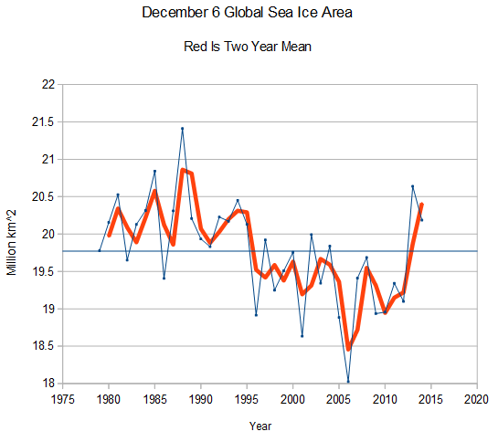
http://arctic.atmos.uiuc.edu/cryosphere/iphone/images/iphone.anomaly.global.png
“Even if 2014 is somehow unambiguously the warmest year on record..” She forgets to add that even if it is, it in no way would prove why “it was the warmest on record.” Which is the whole point. Another pet peeve of mine- the general public never seems the ask the obvious question: What’s the definition of “on the record”? From what I’ve seen, the data to be able to say this or that year is the warmest, or coldest, on record only goes back to 1880 or so when thermometers came into use. So a few warm, or cold, years out of 135 when comparable data for the other 4 billion is missing means….nothing.
JIMs
I agree with you
It has been my observation that the focus of global warming alarmists has been purely on any warming data only . They are completely oblivious to the potential risk of things getting colder instead or major differences in regional happenings . This latest focus on the potential minor higher 2014 global temperatures blip masks the reality of what is happening in our local backyards . Take United States for example . The YEAR TO DATE(January to November temperature trend in 2014 is the 5 th lowest in 17 years and the annual temperature anomaly trend has been declining at( -0.36F/DECADE ) for 17 years now . Yet you never hear about this from NOAA. or any of the other climate alarmists.
Hmmm. Seems to me that RSS and UAH have excellent near planet wide coverage because they use satellites that continuously sweep swaths of the surface. And they show highs in years where large areas of the Pacific exhibit high surface temperatures due to El Ninos. The other data sets apparently are measuring something else. What are they measuring, and what is the proper term for whatever it is?
Starting with the concept of “an index” – something cobbled together to indicate something not really understood (exp: CCI — consumer confidence index), there is from Linguistics,
indexicality, “the variation of meaning of an utterance according to certain features of the context in which it is uttered.”
http://en.wikipedia.org/wiki/Index#Linguistics
I think the following explains the situation:
‘When I use a word,’ Humpty Dumpty said, in rather a scornful tone, ‘it means just what I choose it to mean — neither more nor less.’
‘The question is,’ said Alice, ‘whether you can make words mean so many different things.’
‘The question is,’ said Humpty Dumpty, ‘which is to be master — that’s all.’
To summarize: they are not measuring anything; they create an index; the indexicality is the variation of the word “hot” and the term you are looking for is one of these: hot, hotter, hottest. Choose only one from each column.
This lack of a record is the saddest news I’ve seen in some time.
Coal in the stocking for alarmists hoping for the worst.
It’s almost like a real travesty.
But burning the coal they get in their stockings between Dec 25 and Jan 1 will give them the boost they need to make 2014 the warmest year ever (as they make the needed adjustments by the warmth of their fireplaces).
We see the about 7 year cycle drop-to-drop. The last one was 1997. 2015 should should a 0.2C drop. This natural cycle shows up in most if not all records (can’t recall right this moment). If nature, not CO2 is the dominant, it should show again next year. At a time when the “pause’ is said by warmists to be ending, with their idea that there is a pent-up demand for temperature increases as a result of built-up, but not actted upon, CO2, such a straight-forward drop would be a blow to the Narrative. And if the drop were not 0.2 but 0.3 …. maybe McKibben is getting out at the right time, same as Hansen and Suzuki.
I wonder what Gore’s lecturing schedule looks like for the next year. And his acolytes’ …..
I’ve been trying to make this point for about 18 months now, but allowing temperature to stand in for energy, ever, is an obscene corruption of science. So, taking Bob’s point that the mild, unworrisome spike in GISS springs largely from a single (if vast) pool of anomalously warm water in the North Pacific and running with it:
If I wanted to dial up atmospheric temperatures globally, I could do so if I had control of the wind knob. If I dial down wind over the oceans, they will warm. Why? Because they won’t overturn as much and the insolation-induced warming at the surface will stay at the surface and be able to warm the atmosphere, while cooler water won’t be brought to the surface in the same quantities that it normally does.
This is just to consider a single other variable other than temperature. What should be getting compared, if you want to talk about CAGW, is energy! And if you’re not MEASURING changes in cloud cover, wind, ocean currents, and many other variables, you cannot assess net changes in ENERGY!
The fact that GISS, NOAA and other players will again convince the public that temperature is a reasonable stand-in for energy makes me nuts.
If you hadn’t noticed.
“Of course, we know that the record high global surface temperatures in 2014 are primarily a response to a prolonged weather event in the North Pacific.”
Call it ‘a response to a prolonged weather event in the North Pacific’ if you want. Down here on the surface, where most of us live, it’s been a hot year.
“A rose by any other name would smell as sweet” – The reference is often used to imply that the names of things do not affect what they really are.
The skeptic movement needs to easily communicate the principal issue we are trying to express, which is the basic fact that models and observations are diverging.
So why not do exactly that? Take FAR projections and compare them to observations and for each year show whether the observations are converging or diverging from them. Do it for each IPCC report, do it for the upper bounds, the mid range the lower bound and do it every month for each data set.
There are 5 datasets, 5 AR reports, 12 months a year, upper, lower and middle bounds of each. With this monthly reminder of the very basic information it would be a communications dream that would demonstrate exactly how poorly models are faring vs reality.
There would be no obfuscation about which observations, which models, fuzzy graphics that hide the obvious. Each month would be a simple value of Divergence or Convergence towards the upper, middle lower bound of the 5 reports. A regular, clear and constant reminder to all that demonstrates how well the models, on which governments are being asked to develop policy, are performing.
Heck, I suspect this could be set up in excel, though I do not have that expertise.
The divergence between Tropospheric and surface temperatures seems to be direct evidence that CO2 is not causing the warming.
There isn’t a divergence. Relative to the 1981-2010 base period UAH and GISS anomalies are almost exactly the same (0.27 deg).
The reason 2014 won’t be a record for UAH (and probably will for GISS) is the greater response to El Nino events in troposphere. Basically it’s harder for an non El Nino year to beat the 1998 and 2010 satellite anomalies.
It’s clear from Figs 1 to 4 that RSS is the outlier.