From the British Antarctic Survey comes this press release which really isn’t a surprise to climate skeptics. In Antarctica, not only is the amount of sea ice increasing each year, but an underwater robot now shows the ice is also much thicker than was previously thought, a new study in Nature Geoscience reports.
Underwater robot sheds new light on Antarctic sea ice
The first detailed, high-resolution 3-D maps of Antarctic sea ice have been developed using an underwater robot.

![]() The first detailed, high-resolution 3-D maps of Antarctic sea ice have been developed using an underwater robot. Scientists from the UK, USA and Australia say the new technology provides accurate ice thickness measurements from areas that were previously too difficult to access.
The first detailed, high-resolution 3-D maps of Antarctic sea ice have been developed using an underwater robot. Scientists from the UK, USA and Australia say the new technology provides accurate ice thickness measurements from areas that were previously too difficult to access.
The results, published this week in the journal Nature Geoscience (Monday 24 November 2014), step up the pace of research in the polar regions aimed at understanding the dramatic sea ice changes in the context of climate change.
Scientists use a range of technologies and techniques to measure sea ice thickness. Satellite observations can measure large-scale thickness from space, but interpreting the data accurately can be difficult due to snow cover on the ice. Measurements made on the sea ice by drilling holes, together with visual observations from ships are critical for building a more complete picture, but difficulties in getting access to thicker areas of sea ice leaves gaps in the data. Now, with the Autonomous Underwater Vehicle (AUV) known as SeaBED, scientists have an invaluable new tool to fill this gap.
While most oceanographic survey instruments look down at the seafloor, SeaBED was fitted with an upward-looking sonar in order to measure and map the underside of sea ice floes. The AUV operated at a depth of 20 to 30 meters and was driven in a lawnmower pattern. These lines of data were merged to form high-resolution 3D bathymetric surveys of the underside of the ice.
The yellow SeaBED robot, which is approximately two meters long and weighs nearly 200 kilograms, has a twin-hull design that gives the robot enhanced stability for low-speed photographic surveys.
“Putting an AUV together to map the underside of sea ice is challenging from a software, navigation and acoustic communications standpoint,” says Hanumant Singh, an engineering scientist at the Woods Hole Oceanographic Institution (WHOI) whose lab designed, built and operated the AUV.
“SeaBED’s maneuverability and stability made it ideal for this application where we were doing detailed floe-scale mapping and deploying, as well as recovering in close-packed ice conditions. It would have been tough to do many of the missions we did, especially under the conditions we encountered, with some of the larger vehicles.”
Co-author Dr Guy Williams from Institute of Antarctic and Marine Science adds:
“The full 3-D topography of the underside of the ice provides a richness of new information about the structure of sea ice and the processes that created it. This is key to advancing our models particularly in showing the differences between Arctic and Antarctic sea ice.”
The data from SeaBED, combined with airborne measurements of sea-ice surface elevation, ice coring surveys, and satellite observations, vastly improves scientists’ estimates of ice thickness and total sea ice volume.
Co-author Dr Jeremy Wilkinson from British Antarctic Survey (BAS) says, “The AUV missions have given us a real insight into the nature of Antarctic sea ice – like looking through a microscope. We can now measure ice in far greater detail and were excited to measure ice up to 17 metres thick.”

The team deployed AUVs as part of two Antarctic cruises (IceBell and SIPEX-2) in 2010 and 2012 in the austral spring. First on the British Antarctic Survey’s RRS James Clark Ross and the second on the Australian icebreaker the RSV Aurora Australis. Three locations around the Antarctic Peninsula were mapped – the Weddell, Bellinghausen and Wilkes Land sectors covering an area of 500,000 square metres, the size of 100 football pitches.
The next steps are for the scientists to do large-scale surveys that can be compared to large-scale observations from aircraft and satellites.
“What this effort does is show that observations from AUVs under the ice are possible and there is a very rich data set that you can get from them,” says Ted Maksym, a WHOI scientist and co-author of the paper. “This work is an important step toward making the kinds of routine measurements we need in order to really monitor and understand what’s happening with the ice and the large scale changes that are occurring.”
###
The research was carried out by scientists at the Institute of Antarctic and Marine Science (Australia), Antarctic Climate and Ecosystem Cooperative Research Centre (Australia), Woods Hole Oceanographic Institution (USA) and British Antarctic Survey (UK).
Notes to Editors:
Still images and video of the SeaBED and Antarctica are available here: ftp://ftp.nerc-bas.ac.uk/pub/photo/Antarctic_sea_ice/ NB: to download do not use an FTP client, simply open in any web browser (firefox/IE etc) right click on the filename and select ‘save target/link/file as’ to begin the download or from the Press Offices listed above.
Thick and deformed Antarctic sea ice mapped with autonomous underwater vehicles by G. Williams, T. Maksym, J. Wilkinson, C. Kunz, C. Murphy, P. Kimball, H. Singh is published in Nature Geoscience on 24 November 2014.
The AUV captured extensive deformation, with the underside revealing large ‘rubble fields’ of sea ice, suggesting repeated, multi-directional collisions between ice floes through the winter period. This is in contrast to what scientists previously understood from the Arctic, where larger sections of sea ice, under constant pressure, produce longer linear ‘ridge’ features.
British Antarctic Survey (BAS), an institute of the Natural Environment Research Council (NERC), delivers and enables world-leading interdisciplinary research in the Polar Regions. Its skilled science and support staff based in Cambridge, Antarctica and the Arctic, work together to deliver research that uses the Polar Regions to advance our understanding of Earth as a sustainable planet. Through its extensive logistic capability and know-how BAS facilitates access for the British and international science community to the UK polar research operation. Numerous national and international collaborations, combined with an excellent infrastructure help sustain a world leading position for the UK in Antarctic affairs. For more information visit http://www.antarctica.ac.uk.
The Woods Hole Oceanographic Institution is a private, non-profit organization on Cape Cod, Mass., dedicated to marine research, engineering, and higher education. Established in 1930 on a recommendation from the National Academy of Sciences, its primary mission is to understand the ocean and its interaction with the Earth as a whole, and to communicate a basic understanding of the ocean’s role in the changing global environment. For more information, please visit http://www.whoi.edu.
The Antarctic Climate & Ecosystems Cooperative Research Centre is a unique collaboration between the Australian Antarctic Division, CSIRO, the University of Tasmania, the Australian Government Department of the Environment, the Australian Bureau of Meteorology, the Alfred Wegener Institute Helmholtz Centre for Polar and Marine Research (Germany), and the National Institute of Water and Atmospheric Research Ltd (New Zealand) plus a consortium of 13 other international participants. The Centre’s mission is to understand the crucial role played by Antarctica and the Southern Ocean in global climate, and the impacts of climate change on Australia and the world, and to inform governments, industry, the community and scientists about climate change to guide our future.
Reblogged this on Norah4you's Weblog and commented:
Good reading for all those who either slept, not understood or simply not visited the lessons in 7th grade (sometimes 8th) when teacher taught them the basic facts about our Earth…..
The article seems to indicate a systematic error in existing measurements.
“Measurements made on the sea ice by drilling holes, together with visual observations from ships are critical for building a more complete picture, but difficulties in getting access to thicker areas of sea ice leaves gaps in the data”
So measuremetns will tend to made in the thinner, more accessable areas. Major problem me thinks. And similar to an article earlier on WUWT about a polar bear ( or was it penguin) colony populations study that was used because it was accessable.
How can the science be settled when there still exists large and un-accounted for systemetic errors in the data?
Obviously unaccounted for because the thickness was much greater than expected.
The settled science obviously isn’t. This issue of “un-accounted for systemetic errors in the data” looms ever larger over the discussion. The “inconvenient” truths are piling up:
(1) 50+ (and climbing) screwball theories for why no warming in last 17-20 years;
(2) Multiple unexplained upward revisions to the 20th century temperature record;
(3) Polar bears refuse to go extinct; we may have more than ever before;
(4) 100% of Arctic sea ice did not melt;
(5) Children in the northeast US have been reintroduced to – wait for it – snow;
(6) Selected glaciers recede, exposing previously unknown human settlements;
(7) Extreme weather events are fewer, not more, than in the recent past.
This is exactly what you’d get from a cockamamy fairy tale that in no way represents what’s happening in the natural world. Why anybody espousing this stuff has any credibility is inexplicable.
These are precisely the type of issues the scientific method was created to address. Galileo, Newton, Einstein and Feynman must be spinning in their graves.
A few more searches and they will find the graffiti: “Al was here”
Hahahaha… loved that one, Nik.
Plan on the awarmists saying this isn’t the type of ice they are concerned about but some other type of Antarctic ice is more indicative of global warming. Maybe they should drink more of that Kool Aid using the ice in the fridge, you know, the kind produced by very reliable, coal-fired electricity.
True. And models will quickly discredit the Robot Sub data.
No, that’s not how “science” works. The new data confirms what has been predicted by the models. The situation is expected to get worse in a warming world.
If this was the other way around and warmists had found the ice to be thinner than thought it would be hyped to the heavens. If this were to be hyped in the same way, one would simply say the ice had “jumped” in an “unprecedented” manner from a few feet to 17 meters (say 45 feet) rather than saying these were new measurements and we did not really know how thick it was until now and that the error bars were different between the older and newer measurements.
After reading posts below, I will amend my statement. If the mean is still in same range, there is nothing to be hyped anyway. And if it melts out each year, it does not matter. If there was 17 meter ice that did not melt and was then 18 meters the next year, that would matter.
Surprisingly, NBC News is reporting this story honestly but qualified as ‘puzzling’ in the headline:
http://www.nbcnews.com/science/environment/underwater-robot-makes-puzzling-find-antarctic-sea-ice-thickness-n255211
More like 55 feet than 45. 55.775 or so by my reckonation.
What they could be setting up is a new ‘finding’ that later (than 2012) measurements show that the ice depth is decreasing.
Excuse me for being cynical. Past form is a guide.
These stories always have a big ” however ” or ” but experts say ” .
Didn’t we just read about the “thinness” of Antarctic ice, and the explanation that warmer water due to colder air was melting the Antarctic ice from below?
I can’t keep track of what is or isn’t current. I don’t doubt the scientists’ honest intent. But the contradictions keep telling me that EVERYTHING about global warming is regional or local, not global. The machinations of mathematics and models, which induce and smear observations from a spot to an area appear to create a global situation for public policy and personal importance reasons, when a regional situation is what is true.
Computational, ideological and emotional reality, not representational reality, as I choose to describe CAGW.
” I don’t doubt the scientists’ honest intent.”
Honest intent is not enough. What is needed is competence. These guys still believe in global warming by the greenhouse effect when it demonstrably does not exist. And don’t believe that Hansen proved it to the Senate. He showed gross ignorance of what his data meant.
I do doubt the scientists’ honest intent. They say they work together to deliver research that advances understanding of Earth as a sustainable planet. [my bold]
That shows they start with preconceptions – a bias. In real science, surely the aim is to advance understanding. Period.
That doesn’t make the intent “dishonest,” merely misguided and unscientific. You also want to consider that decades ago, science became a target for distrust. The “mad scientist” became a cultural meme AND scientists and would scientists during the ’60s and ’70s began to about “socially responsible” science, which meant that in addition to the empirical facts one was supposed to at least give a nod to people’s “feelings.” That is, any knuckle head’s “concerns” had to be “acknowledged” by a scientist regardless of how insane those concerns might be. It is totally unacceptable to tell someone, “sir [or mam] you are far more likely to die from crossing the street unwarily while talking on your cell phone than from exposure to escaping radiation from your microwave.”
I do, and until as a group they quit hiding data and lying I will continue to …
Time to get a new robot! Obviously the programming is faulty, it’s giving out actual data!!!
If you look closely, you will see “Koch Brothers” written on the hull…darn, should have got some big bucks from Cook et al. for that idea, insead of giving it for free here….
They have to adjust the data to fit the models. That wasn’t done before the premature release of this information. After that’s done then it will be worse than they thought.
Maybe I missed it, but I don’t see where the presser says they measured “much thicker than expected” ice. All I see is that they were able to measure thicker ice than had previously been possible due to technical considerations.
Exactly. Is the ice thicker than they previously estimated or has it just been measured more accurately? Be very careful of reading more in that’s there – it will come back to bite you!
For that you needed to read the interview at TheDailyBlog:
http://foreignaffairs.co.nz/2014/11/25/expert-reaction-to-research-on-antarctic-sea-ice/
The quote you’re interested in:
“‘Because Antarctic sea ice melts and refreezes every year, we tend to think of it as relatively thin and smooth, a view that was not challenged by the few measurements available up to now. This latest discovery reveals a much richer and more exciting picture, one of a more dynamically active ice pack than previously thought…”
Shackleton could have told them 100 years ago that Antarctic sea ice was frequently compressed and buckled into ridges. Their ship was crushed by sea ice and had to be abandoned. Perhaps AGW is suffering a similar fate in Antarctica?
Here is the abstract. Somehow the press release missed the main finding.
Satellites have documented trends in Antarctic sea-ice extent and its variability for decades, but estimating sea-ice thickness
in the Antarctic from remote sensing data remains challenging. In situ observations needed for validation of remote sensing
data and sea-ice models are limited; most have been restricted to a few point measurements on selected ice floes, or to visual
shipboard estimates. Here we present three-dimensional (3D) floe-scale maps of sea-ice draft for ten floes, compiled from
two springtime expeditions by an autonomous underwater vehicle to the near-coastal regions of theWeddell, Bellingshausen,
and Wilkes Land sectors of Antarctica. Mean drafts range from 1.4 to 5.5 m, with maxima up to 16 m. We also find that, on
average, 76% of the ice volume is deformed ice. Our surveys indicate that the floes are much thicker and more deformed than
reported by most drilling and ship-based measurements of Antarctic sea ice.We suggest that thick ice in the near-coastal and
interior pack may be under-represented in existing in situ assessments of Antarctic sea ice and hence, on average, Antarctic
sea ice may be thicker than previously thought.
I have to agree with some of the responses. Maybe I missed it but I could not find the expression of it being “Much Thicker Than Expected” in the POST itself. If it is on the web then it would be helpful to be in the POST?
Thanks Lance Wallace for the abstract, now let me go onto the web to find it!! Sorry no luck yet. 🙁
Here is the entire article. Really the first ground truth (or undersea truth) measurements of sea ice thickness in Antarctica other than from drilling. The authors point out that there is some bias in the drilling representativeness due to [greater] difficulty in reaching the thicker areas. 10 ice floes were measured, and the mean thickness was closer to 3 m than the 0.8 m estimated from shipboard observations and the 1 m estimated from drilling. Since the authors did not measure in the areas between floes, their results are biased in the opposite direction, toward greater thickness than may actually be the true average. But it still looks as though the true thickness may be twice that assumed by the modelers.
https://dl.dropboxusercontent.com/u/75831381/Williams%20thick%20deformed%20Antarctic%20sea%20ice.pdf
OK, so now I have been shown the abstract here is what I had previously thought! I was going to say.
Is EAST Antarctica sea-ice much thicker than previously thought! So much for the screeches of ‘mass balance’ spiral meltdown.
Look, I never believe any claims from Warmists. It’s my nature and as time goes by we are shown to be nearer the ‘truth’. Next please.
I’ve gotta think the USN and RN sub kids have got some technical insight into this as well but it’s probably classified. I do find it promising that they are actually trying to measure the physical thickness of the sea ice. Hopefully it stays inside of realistic scientific and engineering parameters and for a change we might add some good, valid information to the scientific body.
(It’s got to be better than bouncing a laser off a penguin and comparing the reflections to the output of a model extrapolated from GRACE data to prove we’ve got a bunch of thin sea ’cause the missing heat from the
tropopauseNorthPacificAtlantic has moved under the Antarctic.)nielszoo said
“I’ve gotta think the USN and RN sub kids have got some technical insight into this ”
Well no.
Unlike the Arctic the Antarctic
a) Has a continent at its centre
b) Has no reason for the USN or RN to send its submarines there, nobody is overly concerned that the Russians might attack the indigenous inhabitants (Penguins)
Additionally Submarines have sonar designed to keep them clear of the ice , not to measure it.
Keith W. Do you know of any other, extremely technically competent, organizations that have a half century of experience running around under and analyzing sea ice thickness? I don’t think the technical and measurement expertise becomes invalid because said sea ice is at the other pole.
Joel O’Bryan,
where is the link please for the abstract? Grrrrrrr.
Jimbo:
http://www.nature.com/ngeo/journal/vaop/ncurrent/full/ngeo2299.html
Catherine Ronconi
Thanks.
Prego.
Excellent. Thank you. It is always good to have the source document.
Many thanks for the followups by everybody. It does seem that important information was left out of the press release.
No accident that what gets left out of popular press reports is always supportive of skeptical case rather than the Team.
Let me repeat the juicy bits the press release did not release.
It’s worse than we thought? East Antarctica has endured some extreme snowfalls in recent years. Where are the rovers?!!!
References for East Antarctica snowfall anomalies published between 2012 to 2014.
http://onlinelibrary.wiley.com/doi/10.1029/2012GL053316/abstract
http://onlinelibrary.wiley.com/doi/10.1002/grl.50559/abstract
http://www.the-cryosphere.net/8/843/2014/tc-8-843-2014.html
To paraphrase a familiar complaint, we can send rovers to Mars but not the WAIS!
Hello…Athena from British Antarctic Survey here. Jimmy – you’ve got it exactly right. The release focuses on capturing a more accurate 3D map of the ice from the underwater robot, which wasn’t possible before dues to isses of access and technology. Nobody is saying the ice is getting thicker…
Athena,
It is curious that you handle communications, because I don’t see anything in the OP or anyone stating that the ice is getting thicker. Is this a strawman you’ve decided to throw out?
What I see is the OP, rightfully, restating what the survey has shown, which is that the ice is thicker than expected and the sea ice extent, itself, has been increasing. The expectation of thinner ice is the most important aspect of this, since those assumptions have been used in modeling and the assumptions, themselves, were created by modeling. The is another damning piece of evidence against global warming theory, since global warming theory says the ice should be thinner and the extent of the ice should be shrinking. That is wrong on both counts.
How do you see it?
Athena Dinar, thanks to you and your team for doing real, science based field research in an extremely inhospitable part of the world. Getting the science community real, direct data on Antarctic sea ice is a very good and very welcome thing. It’s great to see a group actually building survey procedures and building the base for some new, real data instead of computer modeled guesses with preconceived outcomes that seems to be the norm these days.
Unless there’s some especially “brilliant” (read: stupid) way of spinning this that I can’t think of, which I admit is a perfectly legit possibility, I can’t see any other option for warmists than to quietly sweep it under the rug.
That is exactly what is going to happen, unless they can find a small phrase somewhere that some media outlet can turn out of context to support their position. In which case they will be quoting it constantly for the rest of the week.
Yet Pat, imagine if the underwater rovers found it to be ‘AS BAD [WE] THOUGHT’ or ‘WORSE THAN WE THOUGHT’? It would be spun as “rover confirms our worst beliefs” or “it’s much worse than we thought!!!!!” For now they will remain mostly silent. The scientists have a get out clause by saying they issued a ‘proper’ press release. This is how the game is played. BS.
I mean
‘AS BAD AS WE THOUGHT’
However experts believe that climate change actually causes thicker Antarctic sea ice, as was predicted in 1988 by so and so.
No, NO it can’t be true. The models can not be wrong, do you hear me. Not wrong.
/sarc
There’s not much that climate models do properly, Man Bearpig. Hmm. On further thought, I can’t think of anything they do do right.
They make my taxes go up and take away my freedoms… they do that very well. They may not have started that way, but that’s what they’re used for now.
They do get the money all right.
Uh…uh…uh…operate in Euclidian Three-Space? Maybe.
Bob –
what they do right is provide an example of how not to model the climate and to their credit they do that very well.
🙂
Wait a minute!
Where is Gavin?
We need to homogenize this data.
Thicker is the new thinner! sarc~
The legitimate thinner ice is hiding deep within the unauthorised thick ice.
The warmunists will be recalibrating the sub soon – with a ball peen hammer adjustment tool.
Sandwiched? Like a Creme-Between or whatever the modern equivalent is?
I see a reanalysis coming
Boy you are good. You are ahead of their game.
“A new re-re-re-analysis finds that sea ice in the Antarctic peninsula is MUCH THINNER than a previous survey found.” WE MUST ACT NOW! It’s all for our grand children and our future funding security. 🙁
Gavin’s busy now that Winston Smith is dead.
It is global warming that has caused this, this is not ice. It is Solid CO2 ask Sou, she knows about this stuff.
Solid CO2 in Antarctica… that sounds familiar.
Ahem.
Somebody better check to see that they did measure the ice thickness in metres, and not feet. We don’t need another Mars crash landing because of a units snafu.
Despite the headline, this has absolutely nothing to do with climate change, climate variability, or even weather. It is a new measurement technique, being compared to an old measurement technique. There is no baseline data (from which to indicate a change) from the new technique. And of course the absolute thickness of the ice floes has no effect on sea level. Just more media sensationalism here.
But the new technique showed the Team’s assumptions yet again false. Antarctic sea ice isn’t all new, thin ice, as the Team kept asserting, but includes thicker, multi-year ice, as in the Arctic. This observation also vitiates a favored excuse of the Team, ie that the more extensive Antarctic sea ice results from melting of land ice, which of course was a false assertion its face in the first place, since most of the Antarctic ice sheet is also growing. A bit in West Antarctica might be losing mass due to volcanic activity.
Did you read the article? It says the Antarctic ice is different than Arctic ice, much of which is not thicker, multi-year ice:
The AUV captured extensive deformation, with the underside revealing large ‘rubble fields’ of sea ice, suggesting repeated, multi-directional collisions between ice floes through the winter period. This is in contrast to what scientists previously understood from the Arctic, where larger sections of sea ice, under constant pressure, produce longer linear ‘ridge’ features.
And where did you get the idea that most of the Antarctic ice sheet (land ice) is growing? Satellite measurements suggest otherwise:
http://onlinelibrary.wiley.com/doi/10.1002/2014GL060111/abstract
The gravity satellites are fatally flawed.
http://www.spaceflightnow.com/news/n1008/29goce/
The East Antarctic Ice Sheet, with the majority of the planet’s fresh water, quit retreating over 3000 years ago, as shown by soil radionuclides around its margins.
Even if you believe CryoSat “data”, only the West Antarctic Ice Sheet is losing more than a negligible amount. And the insignificant loss there is most likely due to volcanism.
It’s simply too cold on the EAIS for it to lose a significant amount, even with slight warming over the past 300 years since the depths of the LIA.
Besides which, other studies find that Antarctica is gaining mass.
http://www.climatedepot.com/2013/09/01/antarctic-ice-sheet-growing-study-mass-gains-of-the-antarctic-ice-sheet-exceed-losses/
“””””…..
Barry
November 24, 2014 at 12:34 pm
Did you read the article? It says the Antarctic ice is different than Arctic ice, much of which is not thicker, multi-year ice:…..”””””
Izzat “different than ” or is it “different from.” ? I wasn’t even aware it was possible to be different than.
Learn something new every day.
Alas, George e. smith, that monstrosity is becoming common, along with “if I would have”/”I wish I would have” in place of “if I had”/”I wish I had”, “based off of/out of” for things that are clearly based on or in, and a ghastly plague of commas placed after subject clauses. The internet has revealed the true, depressing, extent of public illiteracy. It’s worse than we thought.
Not to mention “tow the line”.
Ro Ha, You forgot “would of”. 🙁
This research measured 3 areas: 2 of those are on the West Antarctic side. Not very representative, as the West side gets more energy from ocean currents and volcanic activity. Still that ice was thicker than what they expected.
RoHa I believe you could “tow a line” into a place where it could be “toed” if you can “toe a line” whose use may also be as a sheet or painter. That would be in addition to “toeing” the scribe’s output… just sayin’.
http://stevengoddard.wordpress.com/2014/11/09/death-spiral-update-arctic-sea-ice-volume-up-63/
Sea Ice is up 63 percent. And this is using PIOMASS, as opposed to the more accurate Navy observations.
The Climateers have been whining about sea ice melt causing massive influxes of fresh water and huge increases in ocean heat content because of it. (sorry, I can’t find the link to the paper, it was just a few months ago at most.) They’ve been using the “thin ice” excuse based on wildly inaccurate GRACE ice thickness guesses and are doing so because the extents have been increasing so just like the Arctic, there has to be something found “wrong” with the ice that’s there. This survey and data help to drive another nail in the CAGW coffin.
Yeah, well, skeptics weren’t going around saying that the ice was thinner and melting, therefore action needed to be taken right now to avoid a disaster. Nor were we claiming to imprison (see Robert Kennedy’s recent speech at the UN) anybody for disagreeing with opinions that differed from the officials. There are more than a few articles from peer reviewed supporting the sudden collapse of the Antarctic ice cap. All caused by CAGW. Along with a host of explanations when the actual data was in direct conflict with the models.
It has everything to do with “climate change, climate variability”. They have the OLD thickness assumptions hard wired into their sea ice models. What if the ice thickness was less than previously thought? What do you think the headlines would have said??????????
Good night all.
“This work is an important step toward making the kinds of routine measurements we need in order to really monitor and understand what’s happening with the ice and the large scale changes that are occurring.”
I wonder what “large scale changes” they think are occurring? This is a baseline measurement which might help them understand what is there now, but they have no data on any “changes”. It is a massive leap of faith in CAGW to assume “changes that are occurring”.
If only Chris Turney had known!
The book “Endurance” by Alfred Lansing about Ernest Shackleton’s astonishing escape from Antarctica, is a very good place to learn about the dynamic fast-changing and unpredictable nature of the Antarctic sea ice. They could look out from an ice floe and see miles of empty sea around them, and a few hours later be hemmed in by dense pack ice.
Stranded on Antarctic sea ice with only 1914 technology and no communication with the outside, their jouney to South Georgia without loss of life is a feat of survival against the odds which will quite likely never be surpassed by Homo sapiens.
Exactly.
But then Shackleton was a Merchant Seaman and used to using common sense, currently in short supply.
Shackleton had that and a good bit more. I’ve always loved this quote about the three titans of polar exploration, from a man who served under two of them:
“For scientific discovery give me Scott; for speed and efficiency of travel give me Amundsen; but when disaster strikes and all hope is gone, get down on your knees and pray for Shackleton.” – Sir Raymond Priestly
The chaos is deafening. Whatever shall we do? Perhaps distinguish between science and other philosophies, and return scientific work to the scientific domain. Thanks, Robot Sub. You’re doing the work that the “consensus” does not want to do.
Aw, come on, this seems to me to be new information and so long as no-one “improves” or “adjusts” the data, new information can only be a “good thing”.
Credit where it is due.
What the warmists do with the information is a different thing altogether.
Did they use contractors metres?
Could this be the missing ice from the north pole/ Or maybe this explains the hiatus somehow…hee,hee…think fast Grubers!
Problem, Arctic ice isn’t missing either:
Ok, no image showing. Link to Arctic ice extents as of 11/15/2014.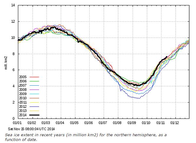
Time to “adjust” the satellite “data” again. There cannot be the most Arctic sea ice in a decade. I mean, there cannot be allowed to be the most.
Well… Looks like I don’t need to adopt a Polar Bear after all!
And this product of the Danish Meteorological Institute (DMI) shows the ice area with 30 % ice coverage unlike the other products on the “market” which are much more wind-sensitive with their 15 % ice coverage. Unfortunately this product has been somewhat hidden since it was replaced by a more AGW-alarming product with 15 % ice coverage as the DMI’s prime product for ice measurement. Equally unfortunate is that Anthony decided to drop this product from his otherwise excellent Sea Ice Resources -page
Useful video covering both the submarine and research helicopters here:
http://www.antarctica.gov.au/news/2014/a-new-way-of-looking-at-sea-ice-thickness
But the BBC says it’s a warming trend line:- http://www.bbc.co.uk/news/science-environment-30177534
Warmist crap alarm:- don’t look at the related stories!
“Three locations around the Antarctic Peninsula were mapped – the Weddell, Bellinghausen and Wilkes Land sectors covering an area of 500,000 square metres”
That is 0.5 square kilometers of (at this moment) 13,000,000 square kilometers of sea ice. Incidentally it seems likely that the thickest ice is in the Wedell sector where the sea ice has not melted in recent years contrary to theory.
Yeah, they mapped less than 1km² in total, less than 1 part in 20 million (at this years peak) and jumped to the conclusion that it’s all the same!
It appears they really were surprised. Notice the “excitement” at measuring ice up to 17 meters thick, when previous studies suggested maximum thickness (in a few spots) of only 5 m:
https://news.yahoo.com/robot-sub-finds-surprisingly-thick-antarctic-sea-ice-161703215.html
Chalk this up to another in a long line of countless nails in the CAGW coffin.
I just read the full article and the authors are to be commended for a good job reporting their results. They thoroughly discuss the measurements they did, the relationship to other measurements and implications for future measurements. As far as I can see, they did not speculate or comment on anything having to do with global warming or climate controversies. A fine job of empirical science. Well worth the money. More is needed in earth observations.
Refreshing, isn’t it.
“…covering an area of 500,000 square metres” = 0.5 sq kilometers. Need a bunch more of these robots I presume. Like about 2 million of them…
and because antarctic ice is caused by global warming ..it is worse than we thought.