First ever study of how North America’s four main weather regimes are affected by polar vortex strength

The four US weather regimes (clockwise from top left): Pacific Trough, Arctic High, Alaskan Ridge, Arctic Low. Red indicates warmer conditions and blue colder conditions
Credit: Simon Lee
Winter weather patterns in North America are dictated by changes to the polar vortex winds high in the atmosphere, but the most significant cold snaps are more likely influenced by the tropics, scientists have found.
A team led by the University of Reading conducted the first ever study to identify how the four main winter weather patterns in North America behave depending on the strength of the stratospheric polar vortex. This is a ribbon of wind and low pressure that circles the Arctic at heights of 10-50km, trapping cold air inside.
It is already well established that the vortex wind strength influences weather in Europe and Asia, and the study revealed it also has a strong effect on three out of the four main winter weather patterns in North America, giving forecasters an additional tool to understand potentially high-impact weather during winter.
The study, published in Geophysical Research Letters, also revealed that, unlike in Europe, the most extreme cold snaps affecting the whole of North America are not most likely to occur after a weak vortex. Instead, the shape of the vortex and conditions in the tropics were identified as stronger influences of these conditions.
Simon Lee, atmospheric scientist at the University of Reading and lead author of the study, said: “Despite the most extreme cold snaps experienced in North America often being described as ‘polar vortex outbreaks’, our study suggests vortex strength should not be considered as a cause.
“We know that a weakened polar vortex allows cold air to flood out from the Arctic over Europe and Asia, but we found this is surprisingly not the case the other side of the Atlantic.
“In fact, our work suggests we should actually look south to conditions around the equator, rather than north to the Arctic, for the causes of these widespread freezing conditions in North America.
“Our results did reveal that the polar vortex strength provides useful information on the likelihood of most weather patterns over the US and Canada further in advance, including some potentially disruptive temperature changes or heavy rain. The more accurate information populations have about upcoming changes in weather, the better they can prepare.”
One of the clearest suggested effects of a strong vortex was a 10-15% likelihood of extremely cold conditions in western parts of North America, including Alaska, but milder conditions in central and eastern parts of the US.
Another weather pattern found to most often follow neutral or strong vortex wind speeds brings temperatures 5°C above normal and wetter weather in the eastern US.
The exception in the results was that the weather pattern associated with the highest chance of the most widespread extreme cold in North America, in which average temperatures in the central US are more than 5°C below normal, was not found to have a strong dependence on a weaker vortex, as it does in Europe.
They found widespread extreme cold is more common when an area of high pressure extends up to Alaska, and the polar vortex stretches down towards North America – pushing cold Arctic air southward in the lower atmosphere.
The scientists say the influence of the stratosphere on weather patterns, as well as how this interacts with long-term weather patterns in the tropics like El Niño, should be studied further and incorporated into forecasts to improve their accuracy.
###
It is the sun, lack of sunspots creates a a lack of magnetic pull, this upsets the polar vortex and jet stream and thus we have weather issues. How do we not all see this. It is so obvious.
In the seventies and eighties, the Netherlands had cold snaps almost each year, you could always ice skating on the canals. There where only a few in the nineteens, ice skating on canals is becoming very rare. The EU will use climate change to destroy democratie and soeverainity. Our only chance is the return of very cold winters that destroys their narrative, but i do not see happened and the msm will not mention the cold in usa.
This year it will be different, because circulation in the Eastern Atlantic is blocking.
Question from a non-meteorologist:
I think it is backward to speak of the “polar vortex “ as the active agent of high latitude weather systems.
It would seem that the distribution and intensity of high and low pressure zones determines areas that are relatively warmer or cooler
The vortex winds are a response to the natural rotation of atmospheric flow around these high/low pressure zones. Stronger vortex winds reflect greater pressure differentials, and vice-versa for weaker winds
Am I on the right track here? If not, I am more than happy to be educated
In winter, the distribution of air masses is determined by the jetstream , which is in the tropopause. Stratospheric waves at high latitudes generate waves in the upper troposphere. This is clearly seen up to a pressure level of 500 hPa.
https://earth.nullschool.net/#current/wind/isobaric/250hPa/orthographic=-341.96,88.89,340
Jim, there are two schools: the altitude one that seems to prevail these days, claiming everything comes from jet stream and other stratospheric little dense air… And the lower troposphere school where denser air masses do control what’s happening in lesser dense altitude.
Marcel Leroux in his key paper https://hacenearezkifr.files.wordpress.com/2018/05/leroux-1993c.pdf
explains what he has observed and measured.
Instead of nullschool.net especially at 500 hPa, read the Leroux paper and then take the time to go to
and observe how MPH are evolving over a year. You’ll quickly realize that polar air masses at all seasons tend to reach the tropics and are in no way limited by THE jet stream…
re: ” there are two schools: the altitude one that seems to prevail these days, claiming everything comes from jet stream and other stratospheric little dense air… And the lower troposphere school where denser air masses do control what’s happening in lesser dense altitude.”
It does seem that most ppl “latch onto” the jet stream as some sort of controlling mechanism, whereas the material I was brought up on showed the jet to be a creature (created indirectly) of (by) interacting high and low pressure systems and their interacting fronts.
Leroux’s take is that the jets are a consequence of the lower tropospheric circulation. And it makes way more sense to me, especially because satellite observation of lower layers circulation does explain the appearance of the jets their development and then their demise. That’s why calling them THE jet stream is abusive by any means.
I personally like this website to monitor the jets. And it does animations to better visualize their evolution. http://squall.sfsu.edu/crws/jetstream.html
For over two decades now (gosh, has been that long now?) I’ve been making use of these folks ‘weather data’ http://weather.rap.ucar.edu and particularly, their satellite imagery webpage: http://weather.rap.ucar.edu/satellite/ and http://weather.rap.ucar.edu/upper/ (upper winds).
Observing for “divergence” in upper level wind patterns has been ‘the clue’ for up-coming severe weather outbreaks, in combination with the necessary moisture (water vapor) in the lower levels.
I think today’s “over reliance” of spotting ‘the jet’ is a product of easily created graphics that the human mind THEN places value on, whether or not that value is ‘true value’, giving the observer that warm-fuzzy feeling one gets from confidence. In reality, its a “foolie”, a step or two away from the actuality of the atmospheric physics/the dynamics of ‘fluid flow’ actually taking place. I’ve raised this point a time or two in the past, and the comment always has been ignored. I’ll take a look at Leroux’s material too, now.
IMO, you’re on the right track Jim. Over the pole the stratosphere has much more mass and molecules than over the equator. This is simply because the tropopause is at ~28,000 ft (defined by the convective humidity level that can get up to about that height and no higher over the pole).
So all above that humidity altitude level is deemed to be in the low humidity ‘stratosphere’. But the stratosphere-proper is defined by its temperature inversion which at present, over the Antarctic is at ~42,000 feet, where the temperature begins to rise again above that. That is where the polar stratosphere really begins, as the air below that T inversion is effectively just like the troposphere with less vertical motion. But there is in fact vertical motion, it’s just more organised within sinking and rising air in weak Lows and persistent weak Highs.
So from 28,000 ft to about 42,000 feet the air keeps cooling with increasing height, just like the troposphere below that alt range does. The only difference between this lower most stratosphere and troposphere under it is, (1) it’s ~1% humidity, (2) it’s even colder than the tropopause below.
Other than that potential pressure isobars and winds in the range 40,000 ft to 28,000 ft show that the lower most stratosphere readily sinks into the tropopause. In fact Highs at 39,000 ft do sink all the way from there to the high altitude icesheet just 15,000 ft below the tropopause. The Highs tend to sink in cohesive columns from just below the inversion level, all the way to the icesheet due to less convection disruption. As they do so they dump colder air into the polar- and mid-latitude Hadley Cells, cooling them.
IMO, if that sinking cooling air increases in rate, via whatever stratospheric relative cooling process near to or above the inversion, then the polar troposphere will NET cool down over several years and the growing coldness transported equatorward by the polar and then sub-tropical jetstream.
Established and fairly stable pressure systems do dominate the lower-most troposphere’s slower more organised vertical and also lateral flows, but it’s disrupted and altered by transient waves.
The last paragraph should say:
“Established and fairly stable pressure systems do dominate the lower-most STRATOSPHERE’S slower more organised vertical and also lateral flows …
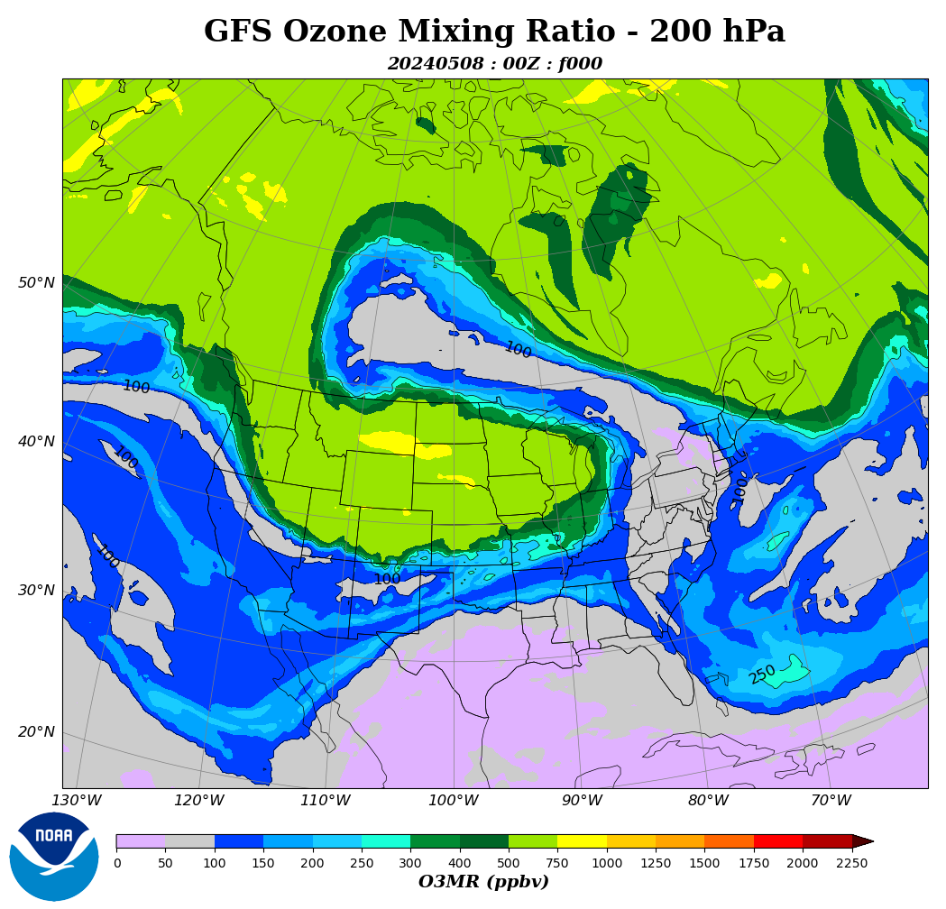
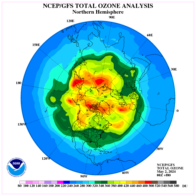
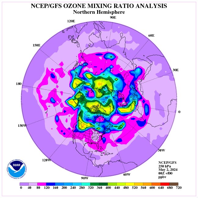
It’s worth seeing how excess ozone over North America affects the stratospheric polar vortex pattern.
https://earth.nullschool.net/#current/wind/isobaric/10hPa/orthographic=-341.96,88.89,340
Don’t you mean, see how ozone rides the stratospheric pattern? How does such a sparse and lofty constituent impose and sustain such large momentum on the lower atmosphere? What is the average distance between ozone molecules, how and why do they move in the various observed patterns and how does that mechanism actually work on the bulk atmosphere many miles below if ozone is driving the pattern?
I see it differently: cold air builds, expands, sinks, and ozone goes along for the ride.
This process occurs every winter from low insolation, some winters more than others.
The outlier winters known for polar vortex expansions such as this and last year, and 2013/14 can be most easily understood in terms one of two solar activity conditions:
1. long-duration solar minimum TSI, or
2. frequent deeper than solar minimum TSI drops winter from high sunspot area in winter.
At the AGU in Dec 2018 I showed this and predicted another early hard winter for 2019:
The snows of the 2013/14 were horrendous and frequent. I shovelled our roof four times.
The 2013/14 larger TSI swings and high range excursions set the extreme conditions for the heavy evaporation and snowfall. The negative-going TSI set up the cold for the tropical moisture blasts that were generated by the positive-going high TSI spikes to clash with and dump heavy snows.
It seems the worst snows come from both extreme tropical and polar conditions, driven by the magnitude and duration of solar extremes.
Ozone sinks because the O3 ozone molecule is very heavy compared to O2 and N2. This is clearly seen as excess ozone falls into the troposphere.
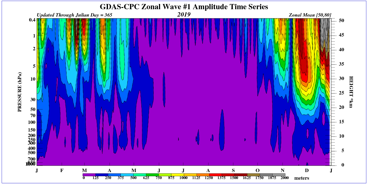
https://www.cpc.ncep.noaa.gov/products/stratosphere/strat_int/
It sinks when its air parcel cools and sinks, taking the ozone with it. The denser ozone collects in its own boundary layer, as observed.
How can such sparse molecules impart and sustain momentum on large parcels? It’s essentially the same question asked about CO2. How can it cause the wind to blow?
Ozone is a diamagnetic, therefore it creates waves in the geomagnetic field.
https://www.cpc.ncep.noaa.gov/products/intraseasonal/temp50anim.shtml
In periods of low solar wind, ozone is also formed in the lower stratosphere as a result of ionization by GCR.
http://sol.spacenvironment.net/raps_ops/current_files/Cutoff.html
Ozone is a rider on the storm…
I do not agree with you.
https://www.netweather.tv/charts-and-data/stratosphere
re: “I do not agree with you.”
How can you disagree with a question?
The distribution of ozone in the stratosphere has a decisive impact on winter circulation.

In winter, the gravitational wave moves from the mesosphere to the lower atmosphere layers.
“The US and Australia have media that balance the debate, but NZ has none. We are now subjected to daily sermons with no means of reply.”
Michael Carter, you ALREADY replied.
Who doesn’t want to hear Must feel: if NZ won’t read NZ gets told another way.
re: “The US and Australia have media that balance the debate”
Ha! That’s funny … coming back from “humour hour” (happy hour to some types) already?
_Jim January 8, 2020 at 10:29 am
re: “The US and Australia have media that balance the debate”
Ha! That’s funny … coming back from “humour hour” (happy hour to some types) already?
____________________________________
Michael Carter December 28, 2019 at 11:46 am
The 2 MSM companies that control 80% of news publications in New Zealand are making big over a warm marine blob centered ~ 2000 km off our east coast. They then go on about tropical fish having been observed further Sth than ever and publish comments from the most extreme alarmist scientist in NZ. They make no mention of the cold trend surrounding the country.
This cold zone has been creeping north and intensifying over the last month. Balanced journalism would surely discuss both phenomenon.
The US and Australia have media that balance the debate,
but NZ has none. We are now subjected to daily sermons with no means of reply.
M
____________________________________
_Jim, wrong answer. Here’s not the post office of Michael Carter.
What’s loose with you. That’s funny … coming back from “humour hour” (happy hour to some types) already?