Guest geological storytelling by David Middleton
You see the story yet? It’s all pretty much here.
In a language you can’t yet understand, but it’s here.
A tale of upheaval and battles won and lost.
Gothic tales of sweeping change, peaceful times, and then great trauma again.
And it all connects to our little friend.
That’s what we are, we geologists.
Storytellers.
Interpreters, actually.
That’s what you gentlemen are going to become.
And how does this relate to the moon? From 240,000 miles away you have to give the most complete possible description of what you’re seeing.
Not just which rocks you plan to bring back but their context.
That and knowing which ones to pick up in the first place is what might separate you guys from those little robots.
You know, the ones some jaded souls think should have your job.
You see, you have to become our eyes and ears out there.
And for you to do that, you first have to learn the language of this little rock here.
–David Clennon as Dr. Leon (Lee) Silver, From the Earth to the Moon, Episode 10, Galileo Was Right, 1998
HBO’s 1998 From the Earth to the Moon miniseries was a sort of follow-on to the great movie Apollo 13… It’s a must see for space program fanatics. I particularly like this episode because my childhood interest in the space program led me toward the sciences and ultimately geology. Future Apollo 17 astronaut Harrison “Jack” Schmitt recruited his former field geology professor to train the Apollo 15 lunar module team and their backup crew how to become field geologists. It reminds me of why I love geology so much. I’ve also had the great honor of meeting Dr. Schmitt at the 2011 American Association of Petroleum Geologists convention in Houston. Shaking hands with someone who not only walked on the Moon, but also got to throw a rock hammer farther than any geologist ever has before or since, was pretty fracking cool.
The late Scott Carpenter, Jack Schmitt and my old friend and former colleague James Reilly were the featured speakers at the All Convention Luncheon. AAPG has a really cool video of their talk.
While we usually aren’t 240,000 miles away from the stories we are trying to unravel. We are often 10,000 to 20,000 feet above the rocks that contain the story. In many cases, these rocks have no surface outcrops. Apart from well cuttings, sidewall cores and occasional whole cores, we never actually see the rocks. We often have to unravel the story from gravity, magnetic and seismic surveys, electric logs of wells that have been drilled into these rock formations, our imaginations and a firm understanding of “the language” of the rocks .
The Jurassic Period (Oxfordian) Norphlet formation is a great example of geological interpretation and storytelling…
In 1979, NASA’s SkyLab was still in orbit; Jimmy Carter was President; the US was suffering from the Second OPEC Oil Crisis; the Sony Walkman was introduced; and Terry Bradshaw’s Pittsburgh Steelers took Super Bowl XIII from the Dallas Cowboys. I was Exploration Manager for Mobil in New Orleans, and the Mobile Bay Field was discovered.Today, Jimmy Carter has been a former President for over 30 years; the Walkman is an antique; and Terry Bradshaw is a 61‐year old actor and sports commentator. However, Mobile Bay is still producing gas and will continue to do so for at least another thirty years.
An oil or gas discovery often comes from a combination of luck, sound technical and management decisions, overcoming legal, environmental, and operational difficulties ‐ and perseverance at critical times. This story of the discovery of gas at 20,450 feet in the Mobile Bay #76‐1 well in 1979 includes all of the above. Located in the very heart of a major Gulf Coast recreational and historical area ‐ an offshore Civil War Battlefield no less ‐ Mobile Bay #76‐1 presented a unique set of technical and environmental challenges. This presentation describes the technical aspects of how this discovery came about, but unlike most such papers, the passage of time allows the author an opportunity to provide a new generation of geologists a glimpse of how the industry and the technical story has evolved. The real story here is one from a personal and human perspective and how the character and experience of some of the individuals involved had such a great impact on the successful and surprising outcome.
Weldon G. Frost. Adapted from oral presentation at forum, History of Petroleum Geology, at AAPG Annual Convention and Exhibition, New Orleans, April 11, 2010
I was a senior in college when Mobil made the Mobile Bay discovery.

Before they could even spud Mobile Bay #76‐1, Mobil had to wage a legal battle with numerous groups opposed to drilling in Mobile Bay. Mobil won its legal battle under the conditions that the well would be totally zero-discharge, including collecting any rainwater that fell on the rig, and had to post a $55 million bond. Then they had to overcome Hurricane Frederic and the challenges of drilling a 20,000′ high pressure-high temperature (HPHT) well in 1979. However, it was worth taking on the challenges. The Mobile Bay #76‐1 encountered a 412′ gas column in the Jurassic Norphlet formation, with an initial test rate of 12.6 million cubic feet of natural gas per day (mmcf/d). It was the discovery well for the Mary Ann Field, 163 TCF (trillion cubic feet) of natural gas from 1979-1994, and the Mobile Bay Norphlet play, 693 TCF from 1979-1994.
Correction, the italicized passage should be:
It was the discovery well for the Mary Ann Field, 163 BCF (billion cubic feet) of natural gas from 1979-1994, and the Mobile Bay Norphlet play, 693 BCF from 1979-1994.
The exploration well success rate was remarkably high, particularly for a Jurassic play, especially since the discovery was “accidental”.
High Exploration Success Rate Seventeen Norphlet wells were spudded between 1981 and 1984, 13 of which became gas discoveries-an extraordinary accomplishment before 3D seismic. Besides Mobil’s Mary Ann discovery, three state Norphlet discoveries and one federal Norphlet discovery subsequently became development projects based on discoveries before year end 1984.
Through year end 1997, 75 Norphlet wells have been drilled in state and federal waters off Coastal Alabama-28 exploration, the balance delineation and development wells. These wells discovered 20 gas fields . Twenty Norphlet discoveries for 28 exploration wells represents a 71 percent success ratio . All but three of discovered fields are producing gas. Mobil abandoned the West Dauphin Island Field as uneconomic . Exxon maintains its 867 Field lease and plans to produce it in 1998 . Chevron and its partners, Conoco and Murphy, have filed a Development and Production Plan to develop Destin Dome. Exxon has drilled the most wells, 20; Mobil has drilled 19.
Mobil amended its original application to change the target from 16,500 to 21,500 feet-changing the target from Smackover to Norphlet-two years after the original application. One wonders what would have happened if Mobil had drilled to Smackover at 16,500 feet in 1970. Mobil’s decision to drill below the Smackover to the Norphlet in their original exploration of Lower Mobile Bay has been a bonanza for State of Alabama coffers and American consumers, even if the prices received for the gas have been sharply lower than operators anticipated . The Coastal Alabama/Panhandle Florida Norphlet trend is one of the most important U. S . gas producing regions.
Wade et al, 1999
The play is still producing, but the most recent Mobile Bay discovery was in 1992 (Seni et al., 1997). It is now well on down the decline curve and the Mobile Bay 76 “A” platform was “reefed” in 2003.

Unfortunately for Chevron, Conoco and Murphy the State of Florida blocked the development of their Destin Dome discoveries.
While the Norphlet formation in Mobile Bay and Destin Dome was too hot for oil (>400 °F), recent deepwater Norphlet discoveries have encountered oil. In deepwater, a shallower geothermal gradient has kept the rocks cooler (~280 °F) since the Jurassic Period (Nadeau, 2015). Shell’s 700 million barrel Appomattox discovery (~7,000′ water depth) is expected to come on production in late 2019 or early 2020. Recent geochemical analyses indicate that the Mobile Bay’s Norphlet gas was actually oil as recently as 120 million years ago (Mankiewicz et al., 2009).

Weldon Frost’s presentation is available online at the AAPG’s Search and Discovery website. It’s a great story and it’s part of a larger story…
“A tale of upheaval and battles won and lost. Gothic tales of sweeping change, peaceful times, and then great trauma again.”
Well maybe not Gothic… but definitely “tales of sweeping change, peaceful times, and then great trauma again.”
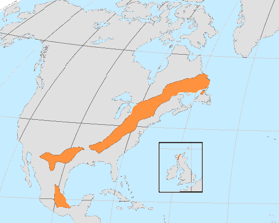
The Norphlet formation was deposited about 150 to 155 million years ago in a salt-filled desert basin that would soon become the Gulf of Mexico. It was a massive complex of sand dunes and interdunal wadis stretching from Ark-La-Tex to M-A-Fla to the deepwater of the Gulf of Mexico. In the Ark-La-Tex (Southern Arkansas, East Texas and North Louisiana) the Norphlet was deposited as alluvium (sediments deposited by rivers, streams, lakes, etc.) In M-A-Fla (Mississippi, Alabama and Florida) and the Gulf of Mexico, it was deposited by eolian (wind-driven) processes. Norphlet production is from massive ancient sand dunes… at depths ranging from 20,000′ to 30,000′ feet below sea level.
This raises two questions:
- How did sand dunes, deposited in a desert, 150 million years ago, wind up buried under 20,000′ of rocks and sediments, under the ocean in water depths exceeding 7,000′?
- How can geologists possibly know these were sand dunes? There are no surface outcrops of the Norphlet formation.
I’ll try to answer the second question first.
How do geologists know that the Norphlet formation was deposited as sand dunes?
We know what modern sand dunes look like.

Figure 4. Great Sand Dunes National Park & Preserve, Colorado. (US National Park Service)
We know how they form.

We also have examples of ancient sand dunes that are exposed in outcrops. The Jurassic Navajo Sandstone in Zion National Park is a magnificent example of the Norphlet’s slightly older Western cousin.

We also have a pretty good idea of what to look for in sandstone to determine its nature of deposition. Steep cross-bedding is a common feature of sand dunes.
Vision Exploration Norphlet cross bedding
The Norphlet sand dunes were so quickly buried by Upper Jurassic Smackover formation, that the geomorphology (land forms) of the dunes have largely been preserved for over 150 million years.

By observing modern geological processes we can usually deduce the depositional environment (paleo-climate and paleo-geography) of sedimentary rocks.

How did the Norphlet sand dunes get buried under 20,000′ of rock under the ocean?
For starters, the Gulf of Mexico (GOM) did not exist 150 million years ago, at least not in anything remotely similar to its current configuration.
The Gulf of Mexico is a small ocean basin lying between the North American plate and the Yucatan block. Following initiation in the Middle Jurassic, sea-floor spreading continued approximately 25Myr. Spreading was asymmetric, creating a broad area of attenuated transitional continental crust beneath the northern basin. Initially, widespread, thick salt deposits accumulated across much of the basin; mobilization of this salt by subsequent sedimentary loading has created a complex suite of gravity tectonic structures. Most salt is now allochthonous, forming extensive stocks and canopies. By the end of the Mesozoic, thermal subsidence had created a deep basin floor, flanked by continental shelves. The resultant basin contains a succession of Late Jurassic through Holocene strata that is as much as 20km thick. Sediment supply from the North American continent has filled nearly one-half of the basin since its inception, primarily by offlap of the northern and northwestern margins.
Galloway, 2008.
During the Late Triassic Period, the North American and South American plates began to pull apart, creating a rift basin where the modern US Gulf Coast and Gulf of Mexico basins exist today (Smith et al., 2018). During the Middle Jurassic Period the basin was intermittently open to the Pacific Ocean and would fill with seawater. When the openings were closed, the proto-Gulf of Mexico would dry out, depositing thick layers of halite (rock salt) and other evaporites, predominately anhydrite (Dribus et al., 2008).
The Gulf of Mexico has always lain in the hot, arid subtropics. As a small ocean basin peripheral to the Atlantic, the Gulf has experienced extended geological intervals when connection to the world ocean was restricted. The first, and most dramatic result of aridity and restriction was deposition of widespread salt, the Louann, over much of the basin floor (Fig. 1B). This salt layer formed the foundation onto which subsequent sediment would be deposited. Salt deposition continued for several millions of years, creating a unit as much as several kilometers thick. Later, the arid tropical climate facilitated widespread deposition of limestone on shallow-water platforms whenever clastic sediment supply to the basin was low (Fig. 2, pdf). Later periods of restricted circulation in the Gulf favored burial and preservation of organic matter in marine sediments, setting the stage for formation of rich petroleum source rocks.
Galloway et al., 2009 Geo ExPro
The Jurassic Louann Salt formation underlies much of the Gulf Coast and Gulf of Mexico.

The Norphlet formation was deposited on top of the Louann Salt. Shortly after Norphlet deposition, a protracted period of sea level rise began. The Upper Jurassic Smackover formation is a carbonate sequence deposited during a marine transgression and high stand across much of the Gulf Coast and Gulf of Mexico. The Smackover exhibits a wide variety of facies ranging from organic-rich mudstones, to oolitic shoals, to patch reefs. It is one of the most prolific oil & gas reservoirs from East Texas to the Florida Panhandle. It is also possibly the most prolific source rock in the entire Gulf Coast/Gulf of Mexico Region (Walkinshaw, Norphlet). The Norphlet is generally only productive where the Smackover lacks porosity (Walkinshaw, Smackover). The Smackover is both the source and the seal for Norphlet oil & gas reservoirs.
Dr. William Galloway, of the University of Texas Jackson School of Geosciences, summarized the depositional history of the Gulf Coast/Gulf or Mexico in this must read paper (I must read it, because he let me have a copy of it)…
Depositional history can be generalized in seven phases: (1) Middle-Late Jurassic evaporite and carbonate deposition in a broad, shallow, restricted to open marine basin. (2) Latest Jurassic-Early Cretaceous sand-rich clastic progradation from the northern margins. (3) Late-Early Cretaceous development of a rimmed carbonate shelf. (4) Late Cretaceous mixed clastic and carbonate aggradation of the continental margins. (5) Resurgent Paleogene clastic progradation and filling centered in the NW basin. (6) Miocene progradation and basin filling centered in the central and NE Gulf. (7) Late Neogene climatically and eustatically influenced progradation along the central Gulf margin. In contrast to the broad, progradational sediment wedge of the northern Gulf, the Florida margin is a primarily aggradational carbonate platform.
Galloway, 2008.

Figure 7 clearly demonstrates the importance of sea level cycles in the depositional history of the GOM. Also note that all of the source rock formations were deposited when atmospheric CO2 was above 1,000 ppm and the Earth was considerably warmer than it is today. The temperature and CO2 plots have 10 million year resolutions; they are highly smoothed.
Sediment loading resulted in a series of down-to-the-basin growth faults, extensive deformation of the Louann Salt and eventual mobilization of the salt into “allocthonous” bodies, which caused compressional features to form where the salt was primarily moving laterally.

This is a generalized Upper Cretaceous paleogeography map of the Gulf of Mexico with an isopach (thickness contours) of the total Cenozoic sedimentary section (Seni et al., 1997).

Even though the high temperature Norphlet gas pays of Mobile Bay and Destin dome are at about the same depth below the seafloor as the lower temperature Norphlet oil pays in Mississippi Canyon and DeSoto Canyon, the overburden is considerably different.

100 million years of generally rising sea level, followed by 50 million years of generally falling sea level… All punctuated by high frequency cycles of rising and falling sea level… Accompanied by down-warping and stretching of thin transitional continental crust and halokinesis (salt movement) buried a 150-million year old desert 20,000′ below the seafloor of the Gulf of Mexico… Unless sea level rise wasn’t related to climate change prior to 1988…
Climate change buried a desert 20,000 feet beneath the Gulf of Mexico seafloor!
How about that, geology fans?
Brett Cullen as Apollo 15 Mission Commander Dave Scott, From the Earth to the Moon, Episode 10, Galileo Was Right, 1998
“A tale of upheaval and battles won and lost.”
Mobil’s battles to drill Mobile Bay #76-1 didn’t end the “war.” The first five deepwater Norphlet wells were either dry holes, filled with solid hydrocarbons or contained insufficient volumes of oil. Even when Shell made their 700 million barrel Appomattox discovery, its development was not a sure thing. During the price crash of 2014-2016, Shell’s Appomattox team was able to innovate, reduce costs and improve efficiencies to the point that the project’s break-even price was less than $50/bbl.

Other battles remain to be fought. Most of the Norphlet play is off limits to exploration and production (E&P) activities because it is in the Eastern Gulf of Mexico (AKA Offshore Florida); as is almost all of the Mesozoic resource potential in the GOM OCS… So, the battle goes on…

Norphlet & Smackover BOEM Assessments PDF
I’ll just close with another space theme and one of my favorite sources for pertinent quotes, Tim Allen… “Never give up! Never surrender!”
Expanded References (the post would have been too long if I covered all of them)
“Areas Under Restriction.” Bureau of Ocean Energy Management, www.boem.gov/Areas-Under-Moratoria/.
Berner, R.A. and Z. Kothavala, 2001. GEOCARB III: A Revised Model of Atmospheric CO2 over Phanerozoic Time, American Journal of Science, v.301, pp.182-204, February 2001.
Chowdhury, Abu. “Salt Geology and Hydrocarbon Plays in the Northeastern Gulf of Mexico.” Search and Discovery Article #10215, AAPG Datapages, Inc., 10 Nov. 2009, www.searchanddiscovery.com/documents/2009/10215chowdhury/index.htm.
Douglas, Scott W. “The Jurassic Norphlet Formation of the Deep-Water Eastern Gulf of Mexico: A Sedimentologic Investigation of Aeolian Facies, Their Reservoir Characteristics, and Their Depositional History.” Baylor University, 2010. (A great master’s thesis… makes me want to go back to college… Except they don’t have keg parties now… So maybe I won’t.)
Dribus, John R., et al. “The Prize Beneath the Salt.” Oilfield Review, Schlumberger, 2008.
Francis, Thomas. “Appomattox: an Energy Project That Defied the Odds.” Shell Global, www.shell.com/inside-energy/an-energy-giant-born-against-the-odds.html.
Frost, Weldon G. “The Somewhat Accidental Discovery of the Mobile Bay Gas Field: A Story of Perseverance and Good Fortune .” Search and Discovery Article #110133 , AAPG atapages, Inc., 16 June 2010, www.searchanddiscovery.com/documents/2010/110133frost/ndx_frost.pdf?q=%2BtextStrip%3Anorphlet+-isMeetingAbstract%3Amtgabsyes.
Galloway, William. (2008). “Chapter 15 Depositional Evolution of the Gulf of Mexico Sedimentary Basin”. Volume 5: Ed. Andrew D. Miall, The Sedimentary Basins of the United States and Canada., ISBN: 978-0-444-50425-8, Elsevier B.V., pp. 505-549. (Special thanks to Dr. Gallloway for sending me a copy of this)
Galloway, William E., et al. “Gulf of Mexico.” GEO ExPro, 2009, www.geoexpro.com/articles/2009/03/gulf-of-mexico.
Hood, Kenneth C., L. M. Wenger, O. P. Gross, S. C. Harrison, 2002. “Hydrocarbon Systems Analysis of the Northern Gulf of Mexico: Delineation of Hydrocarbon Migration Pathways Using Seeps and Seismic Imaging”, Surface Exploration Case Histories: Applications of Geoschemistry, Magnetics, and Remote Sensing, Dietmar Schumacher, Leonard A. LeSchack
Karlo, John F, and Robert C Shoup. “Classifications of Syndepositional Systems and Tectonic Provinces of the Northern Gulf of Mexico.” Search and Discovery Article #30004, AAPG Datapages, Inc., 2000, www.searchanddiscovery.com/documents/karlo/index.htm.
Mancini, Ernest A. & Bearden, Bennett & M. Mink, Robert & P. Wilkerson, Richard. “Norphlet Formation (Upper Jurassic) of Southwestern and Offshore Alabama: Environments of Deposition and Petroleum Geology.” AAPG Bulletin, vol. 69, 1985, doi:10.1306/ad462b14-16f7-11d7-8645000102c1865d.
Mankiewicz, Paul J., et al. “Gas Geochemistry of the Mobile Bay Jurassic Norphlet Formation: Thermal Controls and Implications for Reservoir Connectivity.” AAPG Bulletin, American Association of Petroleum Geologists, Oct. 2009, archives.datapages.com/data/bulletns/2009/10oct/BLTN08171/BLTN08171.HTM.
Mello, Ulisses & D. Karner, Garry & Anderson, Roger. (1995). Role of salt in restraining the maturation of subsalt source rocks. Marine and Petroleum Geology. 12. 697-716. 10.1016/0264-8172(95)93596-V.
Miller, Kenneth & Kominz, Michelle & V Browning, James & Wright, James & Mountain, Gregory & E Katz, Miriam & J Sugarman, Peter & Cramer, Benjamin & Christie-Blick, Nicholas & Pekar, S. (2005). “The Phanerozoic Record of Global Sea-Level Change”. Science (New York, N.Y.). 310. 1293-8. 10.1126/science.1116412.
Nadeau, P H. (2015). Deepwater Horizon Study Group: Lessons learned from the… Deepwater Horizon Study Group 3 Working Paper – January 2011 10.13140/RG.2.1.1447.3125.
Royer, D. L., R. A. Berner, I. P. Montanez, N. J. Tabor and D. J. Beerling. CO2 as a primary driver of Phanerozoic climate. GSA Today, Vol. 14, No. 3. (2004), pp. 4-10
Schoell, Martin & Carlson, Robert. (1999). Diamondoids and oil are not forever. Nature. 399. 15-16. 10.1038/19847. (Nor are diamondoids diamonds. They are hydrocarbons… black gold, Texas tea)
Scotese, C. R., 2001. Atlas of Earth History, Volume 1, Paleogeography,
PALEOMAP Project, Arlington, Texas, 52 pp. Early Jurassic. Late Jurassic.
Seni, S. J., and others, editors, 1997, Atlas of Northern Gulf of Mexico Gas and Oil Reservoirs, Volume 1 – “Miocene and Older Reservoirs”: The University of Texas at Austin, Bureau of Economic Geology, Atlas of Major Oil and Gas Reservoirs, 199 p. (Affectionately referred to as “The Old Testament” around here. Volume 2 – Pliocene and Pleistocene Reservoirs is “The New Testament”)
Smith, Thomas, et al. “New Insights Revealed Into the Hydrocarbon Potential Along the Gulf of Mexico Conjugate Margins.” GEO ExPro, 2018, www.geoexpro.com/articles/2018/12/new-insights-revealed-into-the-hydrocarbon-potential-along-the-gulf-of-mexico-conjugate-margins.
United States, Department of the Interior, Bureau of Ocean Energy Management. “ Oil and Gas Resources as of Jan 1, 2014: OCS Report BOEM 2017-005.” Oil and Gas Resources as of Jan 1, 2014: OCS Report BOEM 2017-005, BOEM, 2017. https://www.boem.gov/BOEM-2017-005/
Wade, W.W., J.R. Plater, and J.Q. Kelley . 1999. History of Coastal Alabama Natural Gas Exploration and Development, Final Report. OCS Study MMS 99-0031 . U.S. Dept. of the Interior, Minerals Management Service, Gulf of Mexico OCS Region, New Orleans, La. 189 pp.
https://www.boem.gov/ESPIS/3/3201.pdf
Walkinshaw, Steve. “ THE NORPHLET FORMATION ARKOSES, DUNES AND AN IMPORTANT RULE OF THUMB.” Vision Exploration, L.L.C. – The Norphlet Formation, www.visionexploration.com/norphlet.htm.
Walkinshaw, Steve. “THE SMACKOVER OF ALABAMA & MISSISSIPPI A PROLIFIC SOURCE ROCK AND RESERVOIR.” Vision Exploration, L.L.C. – The Smackover Formation, http://www.visionexploration.com/smackover.htm.
“Other battles remain to be fought. Most of the Norphlet play is off limits to exploration and production (E&P) activities because it is in the Eastern Gulf of Mexico (AKA Offshore Florida); as is almost all of the Mesozoic resource potential in the GOM OCS… So, the battle goes on…”
Unless the US embarks on a nuclear power build-out campaign, an initial campaign that would last 60-80 years to ensure domestic energy security, then I think it is safe to predict that every last cubic foot of gas and every last barrel of recoverable oil will be drilled in the Gulf. Because without nuclear power, the coming energy desperation will lead to desperate measures, and that would mean no end to drilling for needed fossil fuels.
It is a fascinating story of how the rocks came to be there. But where did the gas come from?
The gas came from the Smackover formation. It was oil when it first migrated into the Norphlet… High temperatures cracked the oil into natural gas. Thermochemical sulfate reduction reactions are slowly destroying the remaining hydrocarbons. Eventually, the only gases remaining in the rock will be H2S and CO2.
I guess this means “get it while you can” still has validity. Thanx for the good read.
We have time… Too bad we couldn’t have drilled this back in the Cretaceous, it would have been a monster oil discovery… And not nearly so deep.
The sweet sorrow of missed opportunities.
I dunno. Cretaceous dinosaurs as offshore drilling crews. With their tiny arms and hands and long tails, it is amusing to envision T. rexes sharing close quarters, working as roughnecks.
What dinos would serve best as roustabouts?
I would go with velociraptors.
Nah, would never work. The T rex would be eaten by the roughnecks as barbeque, then the foremen would fight over who gets the drumsticks.
What about the very stable diamondoids? Are they formed in this process or concentrated by their survival?
Diamondoids are the product of the thermal cracking of oil. While the Mobile Bay gas is extremely dry (less than 0.5 bbl of condensate per mmcf of gas), the condensate is almost entirely composed of diamondoids… which aren’t diamonds.
They’re interesting, have high boiling points but like to sublime.
This has to be one of the catchiest titles ever…
Schoell, Martin & Carlson, Robert. (1999). Diamondoids and oil are not forever. Nature. 399. 15-16. 10.1038/19847.
(Nor are diamondoids diamonds. They are hydrocarbons… black gold, Texas tea)
I have a pdf of this paper somewhere… I’ll try to uplaod it tomorrow.
Melting points.
Very interesting. My younger daughter is a geologist working for a sub of the AA. After she went more than half a mile down one of the S. African mines I got interested in geology. Although she graduated only five or so years ago she spent some time on seafloor dredger in Atlantic and at the edge of Arctic circle at -30C in the far north of Canada and as a contrast some time in the deserts of Namibia. Certainly a geologist’s business can be demanding but also very various and interesting.
I hardly ever leave the office… Real time access to drilling data and logging while drilling make life either easier or a nightmare… depending on how you look at it. When I have a well drilling and it’s approaching the objective or a casing point, I tend to pull all-nighters… because almost every decision point seems to occur between 1 AM and 5 AM.
…and yet, you still find time to educate us all with your great articles
Thank you!
Most of the time, I have to educate myself first. I didn’t know how much I didn’t know about the Norphlet until a couple of weeks ago… 😉
By the way did you see this paper:
https://www.researchgate.net/publication/330992128_Crustal_structure_of_an_extinct_late_Jurassic-to-earliest_Cretaceous_spreading_center_and_its_adjacent_oceanic_crust_in_the_eastern_Gulf_of_Mexico
There are volcanos down there as well as dunes.
I hadn’t seen that one. One of the Geo ExPro articles I cited discusses the same gravity survey and how it delineated the Jurassic rifting.
There’s also Door Point, a buried Cretaceous volcano offshore SE Louisiana…
http://archives.datapages.com/data/gcags/data/026/026001/pdfs/0079.pdf
Shell drilled into it in 1963.
Well, you sure are educating us. Thanks…
I don’t know how you find the time for your articles, but keep them coming!
Don’t they say that nothing good happens after 2 AM? 😉
Fascinating! I’ll examine the links you provided as I have time but this was a ‘great read’ first time through!
David you are the Man:
I wonder how Beto and AOC are going to react to this news from XOM
https://www.bizjournals.com/houston/news/2019/05/02/exxon-oks-2b-baytown-chemical-expansion-project.html?ana=smartbrief
With a 20 year payback it will overrun the 12 year doomsday target and keep producing those wonderful products from God’s gift of petroleum beyond the end of time.
If #ExxonKnew… and they are spending over $20 billion over the next 10 years to expand Gulf Coast petrochemical facilities… Exxon probably knew something other than what the #ExxonKnew folks think they knew.
“HBO’s 1998 From the Earth to the Moon miniseries was a sort of follow-on to the great movie Apollo 13… It’s a must see for space program fanatics. I particularly like [Galileo was right] because my childhood interest in the space program led me toward the sciences and ultimately geology.”
I agree, “From the earth to the Moon” was an excellent miniseries (I still have the VCR tapes of the miniseries I purchased shortly after they were released by HBO). I agree,”Galileo Was Right” is one of the best programs in the series (I also liked “Spider”, the story about the Lunar Module).
Spider might be my #2 episode… especially the use of The Great Escape theme music for the Grumman Aerospace folks… But there are 5 or 6 episodes that are just brilliant. I have the DVD set and a DVD player set up in the same room as my treadmill. If I’m not watching Marvel comics movies, I’m watching From the Earth to the Moon.
From “Spider”, I also liked the fact that they started the episode with the theme from “Fireball XL5” (I watched that show as a kid in the early 60’s) and I love the theme written by Mason Daring for the scenes when the LM is in space (it is also used in some places in ”Galileo Was Right”).
I have the Fireball XL5 DVD set… “I wish I was a spaceman, the fastest guy alive. I’d fly you round the Universe in Fireball XL5…”
😎
Fireball XL5 Theme (enhanced in stereo!)
It really annoys my wife when I sing that song… 🤣
I love these articles, David. I have always been interested in geology, but I wish I were much better versed in the geologic terminology. It is so foreign to my field of engineering that I sometimes have a difficult time following along.
I need to see if there is a “Geology for Dummies” book 🙂
If there are any words or phrases I didn’t clearly define, please point them out. I am always happy to explain them… even the words & phrases I made up… 😉
I think David is quite sparing with jargon. If he had wanted to he could have described fig 9 as a palinspastic reconstruction of a miogeocline.
Wasn’t that exactly what the wording he used? 🙂
It not so much the jargon but rather the nomenclature for the various geologic formations of which I’m ignorant. I’ve been trying to educate myself, but I’m so far behind I get bogged down not only in the terminology but also the various data presentations that I’m not accustomed to seeing.
Not his fault at all…totally on me! I really wish I would’ve taken that geology class in college…
For the Early Cenozoic, Mesozoic and Paleozoic formations onshore, it’s a little easier. The formations are named after places where they either outcrop or where they were first drilled. The Smackover and Norphlet are named after the places where they were first drilled, Smackover Oil Field and the town of Norphlet, both in Arkansas.
The Miocene, Pliocene and Pleistocene “formations” offshore are another story. There are no formations. Every company has a different nomenclature and most companies don’t even have internally consistent nomenclature. They are grouped by “bugs”, micro-paleontology ages. I like to work old Pennzoil and Conoco fields because they at least had nomenclatures that were consistent within individual fields… Two-letter codes, tied to depth ranges…
Trimosina A is Middle Pleistocene, Angulogerina B is Lower Pleistocene.
The sand nomenclature (JD, KE, LF, etc.) is consistent within the EI 330 field… But not elsewhere. In other old Pennzoil and Conoco fields, the J_, K_ and L_ sands could be Pliocene or Miocene… Because the letters are coded to depths, not age.
Navarre,
I took several geology classes in college — about the time Fred Flintstone powered up with foot leather. What I learned in those classes was very basic.
We live near a university and have a special person* that brings together what is now known about various things (we are in the State of Washington) of regional interest.
If you live near a university — get on the e-mail lists.
*Search for: “Nick on the Rocks”
You’re a fan of Nick Zentner too. I went to CWU in the late 70’s-early 80’s (class of ’81). Nick does a great job.
Those short sharp sea-level drops during the Mesozoic is a headache for orthodox climate history, because the only mechanism that can cause tens of meters of sea-level change in less than several million years is glaciation, and there isn’t supposed to be any glaciation in a hothouse world.
But somewhere (presumably inland Antarctica) icecaps were clearly forming and melting, even during the very hot Cretaceous with CO2 >1000 ppm.
Some of the best Miocene reservoirs are in lowstand sequences. There’s pretty good evidence of at least ephemeral glaciation during the Late Jurassic to Early Cretaceous.
Plus 100++
tty
Or, alternatively, the land could have been bobbing up and down, or a combination of both land and sea level changes.
It’s always a combination… even when it’s glaciers. The comings and goings of ice sheets is what usually drives bobbing up and down.
There is no known mechanism that can cause such quick “bobbing” worldwide except glaciation. Tectonic changes of land level can be fast, but they are localized. Most of those mesozoic relative sea-level drops were wordwide, as shown by Vail et al. in a classic paper 1977.
Yep… The long-term (10’s of millions of years) changes are due to plate tectonics and the reshaping of the continents and ocean basins. The high frequency oscillations almost have to be driven by glacio-eustatic processes.
Guys: I lived in South Florida (Palm Beach County) for 40 years during which I was actively involved in skin- and scuba-diving. If one got in a boat immediately east of the Breakers Hotel (on the island where Palm Beach is located) and went due east while looking at the underwater structure, you would see the following reefs. The first reef is a shallow-water reef in 10 to 30 ft. of water. Then, clean sand until the next reef in 60 to 80 ft of water. Clean sand again until a reef at 90 to 120 ft of water. Finally (at least in my experience), clean sand until a reef at approx. 250 ft of water. I have personally dived each of these except the last – too deep for me (I lost a deer friend on the 250 ft reef – bummer). Now, we all know that reefs grow only at selective depths, so these structures show, IMHO, that water levels changed or land “bobbings” occurred…
There are also Eemian (Sangamonian) fossil reefs onshore, some of which are quarries.
The whole of the Florida Keys is essentially a reef from the Eemian when sea level was slightly higher than now.
And whenever sealevel stayed stable for a long enough interval during a glacial period the result would be a (now drowned) reef.
There are also “staircases” where a continent or an island has been rising for a long time and each interglacial therefore results in a new reef/reef flat/coastal dune ridge, lower than the last. The most famous case is the Huon peninsula in New Guinea:
But there are many more examples. Personally I think that the most fascinating is the Coorong coastal plain in South Australia. Here it is not reefs but beach dune ridges that have accumulated during each interglacial in a series that reaches almost 200 km inland and back into the Pliocene:
Incidentally if you measure the age and altitude of the ridges and assume that the tectonic rise of the area has been steady you find that all the interglacials, including the present one, reached much the same sea-level.
God was bobbing for Little Green Apples, causing it to rain in Indianapolis in the summertime?
I’m sure that with the right combination of paleo tax policy, income redistribution, and incentives, ancient man could have prevented this.
What the earth looked like from space 150 mya:
http://dinosaurpictures.org/ancient-earth#150
You can progress it to the present and regress it to 750 mya.
The continental positions are OK, but coastlines are way off. For example most of Australia was shallow seas during Early-Middle Cretaceous. That is not shown at all-
David, thanks for the fascinating geology lesson. And it’s free!
On this side of Atlantic another oil reach sea floor flooded by climate change is a subject of detailed this time archeological research.
“The ancient country, known as Doggerland, which could once have had great plains with rich soils, formed an important land bridge between Britain and northern Europe. It was long believed to have been hit by catastrophic flooding.
Lost at the bottom of the North Sea almost eight millennia ago, a vast land area between England and southern Scandinavia which was home to thousands of stone age settlers is about to be rediscovered.
Marine experts, scientists and archaeologists have spent the past 15 years meticulously mapping thousands of kilometres under water in the hope of unearthing lost tribes of prehistoric Britain.”
https://www.theguardian.com/science/2019/may/08/mapping-begins-of-lands-lost-to-north-sea-during-the-stone-age
I’ve also always wondered why there was oil located in the northern part of Santa Rosa county near Jay, Florida. This article definitely explained that phenomenon for me as well.
There’s oil down south too, in Collier County, right near Naples.
The Sunniland Play also extends offshore too… Where it can’t be drilled.
That play probably extends into the Cuban EEZ and perhaps the Bahaman EEZ too. I wonder what the Florida politicians are gonna do when a Chinese rig starts drilling 50 miles off Miami Beach or Key Largo…..
David,
Well done. Thanks for the fine geological story and creative tie to the global warming debate of our time. You have the talent and do the hard work to communicate a complex, esoteric geologic, engineering and business story for the non-geologist.
In the late 1970s, I had the privilege of listening to Harrison Schmidt talk to a small group of geologists. One professor with an interest in astro-geology asked a question somewhat like: “Do you think we can land a space ship on an asteroid?” Dr. Schmidt’s answer was immediate and striking to me, I had never thought about that idea. His reply: “Of course we can. We know the physics and have the means. It is only a matter of wanting to do that.” And, now, it has been done.
One minor thing regarding: “It was the discovery well for the Mary Ann Field, 163 TCF (trillion cubic feet) of natural gas from 1979-1994, and the Mobile Bay Norphlet play, 693 TCF from 1979-1994.”
I will guess that you mean BCF (billion cubic feet), not TCF.
BR
At the 2011 AAPG, Dr. Schmitt was one of the moderators in the Astrogeology session… Whenever one of the speakers would say something he disagreed with, he would tell them, “I know, I was in the room when that happened.” His book Return to the Moon is basically a business plan for mining 3He on the Moon.
It’s TCF…
The Mobile Bay Norphlet play is YUGE… or was YUGE.
It should have been 693 BCF.
693,245 mmcf = 693 BCF, not TCF.
I’m thinking it is BCF, too.
It should have been 693 BCF.
Hey Steve, I thought I recognized your name as being a CSM alum. Always good to see miners on this forum. Hope Houston is treating you well.
Greg Staff
famstaff@att.net
Excellent article David!!
Solid rational real world observations that present the scales both geological and time required to substantially change climate.
An article that explains why honest geologists and geology students are hard to impress by CO₂ alarmism.
Anyone who researches or studies:
* Deeply buried salt formations from ancient seas;
* The formation of nephrite and jadeite, often termed as jade,
* The formation of anthracite,
* The formation of high quality marble,
* The formation of shale, slate, schist,
* Formation and surface export of diamonds, (Hint; geologists have identified diamonds that formed from life deposited carbon. Carbon that was moved to near the mantle and later carried back to the Earth’s surface as diamonds)
* Gold and silver ore body formation,
* The formation of Iron ore bodies by bacteria,
* Yellowstone magma chamber swallowing a large portion of the Rocky Mountain range in Wyoming and Montana,
* Salt and other formations trapping oil,
* The obvious incredibly abundant deposits of limestone to astonishing depths that hint at yet mask the sheer amounts of buried crustal limestone.
* continental orogenies, mountain building and erosion, rifting,
* The ring of fire coupled with common magmatic caused hot springs and wells that are all active CO₂ emission sites ignored by alleged climate science. Whether it’s a geyser or Arkansas, Nevada, Montana, Wyoming, West Virginia, etc. ad infinitum, or Northern Japan hot springs; they bubble CO₂ constantly 24 hours/ 365 days per year.
etc. etc.
All are sober reminders that the Earth is not stable and constantly recycles the crustal surface.
Assigning the damage of Earth to mankind is sheer hubris. When mankind is compared to underground depths of active Earth or to the sheer size of Earth’s Atmosphere is a claim about inconsequential microscopic dust motes.
Yes, Something like algae converted the atmosphere from CO₂ to high levels of N₂ and O₂.
Yes, bacteria caused water borne iron to precipitate.
Both took many many millions of years.
Mankind’s increasing atmospheric CO₂ may be slightly quicker, but it will still take millions of years and is severely limited by available food and fuel. before long, mankind will have to import methane or learn to burn limestone to change Earth’s atmospheric levels substantially and that will take at least many centuries.
Indeed. I live near one of Earth’s finest marble deposits. Interestingly enough, they keep finding it goes further than “expected”, and it has been producing fine marble for over 300 years. I also live near the spot a meteorite struck and injured a person more than 60 years ago. I saw a sectioned piece of it in a geology museum in Tuscaloosa. My undergraduate degree is in chemistry, a double minor in French and Biology; though my regret is that I didn’t make the second minor one in mathematics. I’ve done spectroscopy. I know about Raman Spectra. I also know that heat is internal kinetic energy and IR is light. Yes, you can convert one to the other; yet the mathematics isn’t as simple as some think (matrix inversion). During my professional life, I did practical application of biology, physiology, mathematics called statistics; and was well paid for it. I am retired now; and what bugs me a lot is the conflation of heat with light.
You’re near Sylacauga? Pretty stuff, that marble is.
On Raman, the capabilities of modern spectrometers are pretty amazing, for instance one can analyze the contents of glass or plastic bottles as they move down a filling line, and I really like that a fiber optic can be used to analyze a sample a hundred meters or so away from the spectrometer.
Local pride is easily forgiven; keeping in mind that Alabama’s marble is very high quality.
During a short search, I didn’t find a description for the formation of Alabama’s marble, but it is possibly a result of the Grenville Orogeny; Grenville orogenic crust of mid-late Mesoproterozoic age (c. 1250–980 Ma):
Contemporaneous marble formation in New Jersey:
Great stuff David. I’m a geologist and geological engineer, MSc in the former and BSc in the latter. Although most of my career has been in mining exploration, and mine development, I did geoligical survey work in Manitoba and Nigeria and have done the entire range of the geological column at one time or another Pleistocene, holocene mapping the shrinking shorelines of lake Aggasiz and I discovered an extension of the ancient Missouri River 150 ft (?? memory) below the Agassiz lakebottom sediments in southwestern Manitoba where it used to flow north to the Arctic (Hudsons Bay?). It was recognizable by the quatz-pebble gravel and pebbles of opalized wood. From there to the 2500My old Archean in the shield. Also measured Ordovician limestone sections in mid norh Saskatchewan and Cretaceous alkaline ring complexes carrying tin, tantalum and rare earths in Nigeria. I love geology too, abd you are the best of the best in telling geological histories
I can’t hold a candle to Dr. Lee Silver… Assuming he was actually like David Clennon’s portrayal of him. The scene where he gives the talk I quoted at the beginning of the post was during the astronauts’ first field trip to the Orocopia Mountains in California.
The astronauts’ geology curriculum up until that point was mostly lectures about igneous petrology… phase diagrams, ad nauseum. Jack Schmitt knew they had to capture the astronauts’ imagination and “bring out their scientific minds.” Dave Scott was totally unenthusiastic at first; but after a couple of field trips, he was hooked on geology.
My GAWD I love me some Dave-Brain!
This sh*t facinates the child still within this old man. (58 feelz old today)
Knowing enough about “science stuff” lets me understand what you’re explaining (along with the fact that you’re damn good at explaining!)…
…which helps me pass the knowledge to the “younglings” in my surround, in a manner and style that they seem to be open to. (Read: Thirst for.)
I can’t thank you enough.
DAMN I’m glad I’ve read this site since 2006! THANK you Mr. Middleton. Again!
Yes. This post makes me happy.
Shutup if sumya can’t figure out why or how.
-Patvann; The Lurker, who reads every word of every post.
Old? I’m 60… and think Avengers: Endgame is the greatest movie ever made… As John “Cougar” Mellencamp said, “Growing up leads to growing old and then to dying. And dying don’t sound like all that much fun to me.”
Or as Jimmy Buffet says:
I’m growing older but not up
My metabolic rate is pleasantly stuck
Let those winds of time blow over my head
I’d rather die while I’m living than live while I’m dead
🙂
58? 60? Punks! I’m 73 and about to register another LLC to explore some more in Nevada. After 60 it’s all about attitude and activity, so go for it! Fascinating geology, David, and you know what? There is copper, vanadium, cobalt, and uranium moving along some of the fluid pathways, looking for a reductant (thermally over-maturated oil does nicely, thank you) to form an orebody.
75! Bunch of young’uns on this site.
John: Ron; David;
Not that any of you are johnny come lately visitors to WUWT.
Patvann just told us that he has been reading WUWT since he was 47. Just as y’all and I were younger when we started visiting WUWT regularly.
And I started reading WUWT before 2009 when a geologist on the Rockhounds BB site suggested that it was a good site to get honest information and updates about climate. I’ve met very few geologists who drink climate alarmism koolaid.
I discovered WUWT in 2007 or 2008 IIRC… Submitted my first post in late 2010… https://wattsupwiththat.com/2010/12/26/co2-ice-cores-vs-plant-stomata/
FASCINATING! I love this kind of article, and such deep sediments are especially interesting. One question, is there coal in the Gulf of Mexico, and more generally, is there coal below sea floors (unrecoverable of course).
Not that I am aware of.
There is lots of coal around the edges of the Gulf Basin in the Wilcox formation, but the lignite and coal are shallow water deposits and the coals no longer exist by the time one gets near the present day coastline. I have a database of coal thickness from Gonzales, Fayette, Lee, and Washington counties in Texas which I made when I worked that area in the mid 1980s.
John B.,
“coal below sea floors” ?
If you expand the thought to include other regions —
search for under sea coal and UK.
It was below the sea floor in the Miocene, but now it is not. There is coal below the sea floor in the UK
Dave, what about the rifting. I cannot see any trace of a hot rift, that must have been there on Fig. 8, or not?
Direct evidence of rifting is hard to find. Recent satellite gravity data probably provide the best evidence…
https://www.geoexpro.com/articles/2018/12/new-insights-revealed-into-the-hydrocarbon-potential-along-the-gulf-of-mexico-conjugate-margins
Sure Football was hard on him, but ‘Ol TB is in pretty rough shape for 61. 🙂
Sure Football was hard on him, but ‘Ol TB is in pretty rough shape for 61. 🙂
I built the last reservoir model for Destin dome, for Murphy back in 2015. Their lease on Destin Dome, which they kept when others sold out, was about to expire and they needed a decision to go or not go. The pay there at Destin was amazing, but the connectivity of the entire reservoir was not good, given data we found on the flow tests. I was sad the answer was no. There was loads of hydrocarbons there.
Quite a fascinating read! Thoroughly enjoyed it.
David
Fascinating review of petroleum geology. At UBC, many decades ago I did mainly hard-rock geology and physics.
Great summer jobs in the field. One was north of Yellowknife on a beryllium-bearing pegmatite. Then it was the “space age” metal, but it did not make for much of a stock promotion.
Then, other jobs in northern B.C. and on Vancouver Island.
David: This retired mudlogger/geologist loves your stuff. It reminds me why I love geology. I wish I had more geophysics in my background. I do the best I can. Even though my first career choice was going to be architecture (which I still love), geology has been good to me. I got to see a lot of different geology in my career and in college. Everything from glacial geology in Northern Michigan, pre-Cambrian in Canada and other places. And nearly everything in between. I even got to walk across the Grenville front south of Sudbury, Ont.
Mudloggers are cool… 😎 They’re my eyes and ears out there… kind of like the Apollo astronauts to the geology backroom at NASA!
Hi Gilbert – always good to see miners on this forum. CSM ’58, right? Hope you are enjoying your retirement. Regards, Greg Staff ’73.
Not all CSM’ers are miners… We have at least one drilling engineer who’s a CSM alum.
Yes (as always) you are correct David – Mines hasn’t been solely a mining engineering school for over 100 years, but Mines grads refer to themselves generically as Miners (maybe I should have capitalized it above).
I am a chemical engineer, and besides Mining Engineering, Mines has legacy programs in Met, GP, Pet Engineering, Engineering Chemistry, Engineering Physics and Engineering Math (these last three are engineering degrees, but more focused on science or applied math). More recently they have added Mechanical, Civil, Electrical, and Environmental – all engineering degrees with a mineral industry focus.
I think I even know a few CSM geo’s.
Oops – I left off the Engineering Geology program we have as well. (Not “just” geology, but a real engineering degree with statics, mechanics of materials, and other engineering-ish stuff.)
Funny story… I took an Engineering Geology and Geotechnics class at “that fine oil school”, Southern Connecticut State University. For one of the tests, the professor gave each of us a New Haven quadrangle topo map and a stack of graph paper. The assignment was to locate a dam that would trap the maximum volume reservoir, with the least impact on culture, and provide a description of how the dam would be built and the dimensions of the dam and reservoir. My dam was perfect, except for the volume of the reservoir. I wrote 103 where I should have written 106. The professor looked at it and said, “This is excellent. You have a fine career ahead of you with the Army Corps of Engineers. You just designed a reservoir 200′ high, 2,000′ long and 20′ across,” Or something to that effect. Funny because in this post I initially described 693,245 mmcf as 693 TCF. Three people had to say, “Don’t you mean BCF?” Before I caught the mistake… LOL!
Haven’t we all been off by a factor of 10^3 at some point? And even with that error we are nearly always closer to the correct answer than government.
The funny thing is that my BOE conversion on the map was right. At some point I had it as BCF.
Very interesting – I like your write-ups. As an old oil man (MS Geop Texas A&M) IMHO you’ve done a great job in putting together large disparate data sets to show both oil/gas geology and earth changes through time. You do drift in to technical nomenclature at times and Geology is rife with naming, not necessarily explaining. As a geophysicist we’d argue for dates of formations, not names. But that’s an old beef. Your point, and IMHO the key to placing today’s climate is understanding the past and the bounds of the past. Kind of a reverse Geology: the key to understanding the climate today is looking at evidence from the past …..
My business card said geophysicist from 1981-2006.
In real rocks, the names have ages. I could glance at a seismic line from almost anywhere in East Texas and pick out the Buda Limestone, the Massive (AKA Ferry Lake) Anhydrite, the Pettet Limestone, the Cotton Valley Massive Limestone, maybe the Smackover Limestone, the top and the base of the Louann Salt.
In the Plio-Pleistocene “kitty litter” of the Gulf of Mexico, there’s just the water bottom, the odd quasi-regional reflector, bight spots scattered in static and, if you’re lucky, a really good top of salt reflector… maybe even a base of salt reflector.