By Steve Goddard

Darkness is returning to the Arctic as the sun moves towards the horizon. In four weeks, the sun will disappear completely at the North Pole.

Solar Energy as a function of latitude and date
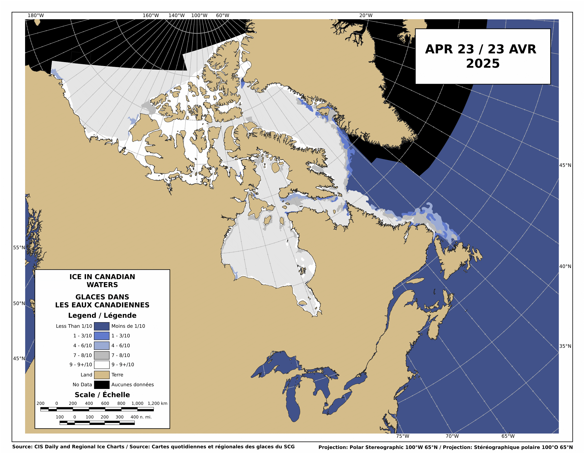
The Canadian Ice Service shows that there is still low-medium concentration ice blocking the Northwest Passage.

http://ice-glaces.ec.gc.ca/Ice_Can/CMMBCTCA.gif
If you owned a ship, would you send it through a route knowing it will face shifting pack ice, possible icebergs, fog, darkness, wind, storms and the possibility of an early freeze?
“The plans that you make can change completely,” he says. This uncertainty, delay, liability, increased insurance and other costs of using the Northwest Passage are likely to deter commercial shipping here. A ship with a reinforced hull could possibly make it intact through the passage. But if it got stuck, it would cost thousands of dollars for an icebreaker like the Amundsen to come to the rescue. So even if the Northwest Passage is less ice-choked than before, the route may not become a shipping short-cut in the near future, as some have predicted.
The Arctic Oscillation was negative for a few days, which allowed colder air to escape from the Arctic and warmer air to invade the Arctic. Note that the period of positive AO starting in early July corresponded to the Moscow heat wave. The cold air was trapped in the Arctic.

The negative dip this week allowed a blast of southerly air to melt and compact the ice during the past week, as we forecast in last week’s sea ice news.
")

http://ocean.dmi.dk/arctic/icecover.uk.php
Ice extent loss has dropped off dramatically in the last few days, as seen in the DMI graph above and the JAXA graph below.

Note that there was little loss in ice extent during 2006, after August 22.

What does the remainder of 2010 hold? Difficult to say. NCEP forecasts freezing temperatures over the broken ice in the Beaufort Sea during the next two weeks.

http://wxmaps.org/pix/temp2.html
If the remainder of the summer follows a path like 2006, 5.5 million is the right number. Another blast of southerly wind during the next few weeks. and it goes below 5.5. All of the ice indexes currently show 2010 ahead of 2008. DMI and NORSEX show it ahead of 2009 as well. JAXA also shows that the ice area curve has flattened. Ice area is always less than extent, and area trends tend to lead extent by a week or two.

There are large areas of low concentration ice which are vulnerable to compaction, spreading or melt.

My forecast remains unchanged. 5.5 million, finishing above 2009 and below 2006. Same as it has been since May.
The video below shows ice movement in the Beaufort Sea this week. Earlier in the week, it was compacting rapidly, now it is slightly expanding.
It all comes down to the temperature and wind over the next few weeks.
PIOMASS forecasts continue to stray further from the mark. Areas in red are places where PIOMASS incorrectly forecast melt. Solid green is the opposite misprediction.

Lindsay and Zhang forecast a minimum of 3.96 million in July.
The modified NSIDC image below shows ice loss during the last week. Mainly in the Beaufort Sea.

The modified NSIDC image below shows ice gain since 2007 in green, loss in red.

I’m not going to make a forecast for the next week, because there aren’t any dominant indicators either way.

Discover more from Watts Up With That?
Subscribe to get the latest posts sent to your email.
By the reference to the 5.5m sq km prediction, I assume this is an update by Steve Goddard? In a few weeks we’ll know for sure who was right, Steve or R. Gates. Fetch the popcorn.
“The Arctic Oscillation was negative for a few days, which allowed colder air to escape from the Arctic and warmer air to invade the Arctic.”
Here are two good animations of that occurring:
http://www.cpc.ncep.noaa.gov/products/intraseasonal/z500_nh_anim.shtml
http://www.cpc.ncep.noaa.gov/products/intraseasonal/z200anim.shtml
A similar story in the Antarctic, i.e. Atmospheric Oscillation driving short term changes in sea ice. A high pressure area penetrated the southern polar vortex;
http://www.cpc.ncep.noaa.gov/products/intraseasonal/z500_sh_anim.shtml
and Antarctic Sea Ice growth ground to a halt:
http://nsidc.org/data/seaice_index/images/daily_images/S_stddev_timeseries.png
Steve
Have you had an opportunity to review the NSIDC’s recent press release?:
http://nsidc.org/arcticseaicenews/
They highlight an “Early clearing in the Northwest Passage” and provide this map and chart:
http://nsidc.org/images/arcticseaicenews/20100817_Figure3.png
Does the chart look accurate to you? Why do you think they used Area instead of Extent?
Whatever happens with the ice, looks my Chelsea prediction is spot on. 6-0 again. MU would have lost today except for a Fulham own goal at 86 minutes.
Vince Causey says:
August 22, 2010 at 9:40 am
By the reference to the 5.5m sq km prediction, I assume this is an update by Steve Goddard? In a few weeks we’ll know for sure who was right, Steve or R. Gates. Fetch the popcorn.
It won’t be Gates. He is blinded by his religion. Maybe somewhere between the two of them. On verra.
You should look at the most recent Pips Ice Drift — or any after the 14th, showing the 2007 Pattern returning (finally), http://www7320.nrlssc.navy.mil/pips2/archive/retrievepic.html?filetype=Displacement&year=2010&month=8&day=23
… and an animation of about a half million breaking off & heading for the Fram Strait Exit http://neven1.typepad.com/blog/2010/08/race-to-fram-strait.html. However, your main point, Steve, is even more impressive in straight DATA (Jaxa):
Daily: ___________2007___ to___ 2010__&__(2009__2010)
Aug19-20_______ -46,563 _____ -15,782___(-40,156__77,344)
Aug20-21_______ -64,469 _____ -31,406___(-34,219__27,343)
Aug21-22_______ -61,091 _____ – ?___?___(-72,500__45,157)
Correction of Steve’s first post
The Canadian Ice Service shows that there is still low-medium concentration ice blocking the Northwest Passage.
Should be
“The Canadian Ice Service shows that there is as a low concentration of ice but it is not blocking the Northwest Passage.”
The northern route is showing less ice than the southern routes for the last 4 years and in those years boats got through.
Having said that the rest of your post is a very good summary of the current situation, good reading.
Andy
Just The Facts
I’ve seen the NSIDC newsletter, and that why I included the NWP discussion. I am looking at it from a practical point of view, rather than an academic one.
AndyW
No it should read exactly what I said. The ice moves around constantly and remains a danger to ships.
If you want to write your own interpretation – fine. Please don’t pretend to be correcting mine.
I really need some comments on my idea that CUBES, not sheets of Ice, is what we got when the Ice that usually sticks to Greenland & Ellsmere spread out this year
— As all cracking in Ice is VERTICAL, we thus got widely scattered 30-foot CUBES, not a sheet of Ice 4 feet instead of 2 feet thick.
This is / may be, doing DIFFERENT things:
1. They LOOK very different in High Resolution Pics, Perhaps the multi-km Satellite Map Resolution is WILDLY mis-(Over??)-estimating the TRUE AREA.
At any rate, it seems responsible for the WILD SWINGS we have been seeing.
2. CUBES melt a LOT slower (5 to 10 TIMES).
3. They may keep Ocean Temp down, even after all the rest of the ice in their vicinity has dissappeared e.g. the wispy “ghost” areas on some Maps: http://www.iup.physik.uni-bremen.de:8084/amsr/arctic_AMSRE_visual.png
4. The VOLUME may have stopped shrinking much — if at all –WEEKS ago (if it, like PIOMAS says, was already below the 2007 minimum) The low air temps would be adding (thin) ice whilst effects #2 & #3 resist the lingering warm waters of the ” late ” EL NINO.
5. FUTURE YEARS — especially NEXT YEAR — may find the CUBES a REALLY FINE FOUNDATION for BIG increases.
Again:
I am a Big Fan of Dr. Roy Spencer’s 60-year Cycle & we have 27 years more of 2 La Ninas (cold) to every EL NINO (hot).
I warned the Canadian Marine Services and another Canadian agency about November of last year that they would begin to feel the effects of global cooling.
I wonder if my research went to the Circular File or was just simply deleted?
Paul
Steve,
Thanks again for the update. The dominant player in melt right now is SST’s (as it has been for several weeks. The extent and area will fluctuate with the passage of each new high or low pressure system, but this fluctuation in extent/area should not be confused with changes in the melt rate as that is pretty well fixed based on SST’s.
These past few days we’ve seen a slow down of the decrease in extent declines for two reasons. First, we had a reversal of the compaction that was going on earlier last week and actually saw some more divergence (as you noted). Secondly, a lot of the ice over the warmer waters has already melted.
What should we look for in the upcoming week? The current divergence is based on high pressure (the same cause as the negative AO index) that was parked over a broad area of the Arctic Ocean. Just as the high pressure forces cooler air south, it also tends to diverge or spread the ice as well.
Here are the factors that are worth watching in the coming weeks, all of which will combine to determine the final extent:
1) The intensity and duration of high and low pressure systems over the Arctic, with the high pressure bringing warmer air temps but a slow down the decline of the extent as high pressure tend to cause divergence. These ultimately can lead to more melting however, as the ice tends to stay further south. Low pressure systems will compact the ice, causing a more rapid immediate decline in the extent, but can force the ice further toward the north and away from the warmer waters, leading to less final melting.
2) Water temps are the key here, as it is not air temps but water temps that are driving the melt, and have been for several weeks. We still got lots of warmer than normal water in the Arctic:
http://polar.ncep.noaa.gov/sst/ophi/color_anomaly_NPS_ophi0.png
And any ice that is diverged into the Beaufort, E. Siberian, Kara, or Barants sea will melt faster than if it stays in the Central Arctic basin. Again, high pressure systems will tend to force the ice toward these areas, and result in lower drops in extent, but ultimately more melting.
I am extremely confident (based on SST’s and the amount of open water we’ve had) that 2010 will end up below 2009. Hence, of course I think that Steve’s 5.5 million s mainly
stevengoddard says:
August 22, 2010 at 10:13 am
AndyW
No it should read exactly what I said. The ice moves around constantly and remains a danger to ships.
If you want to write your own interpretation – fine. Please don’t pretend to be correcting mine.
Why not, by no stretch of the imagination is the NW Passage ‘blocked’, quite the contrary, whether it is a suitable route for commercial traffic is quite another matter.
The La Roche would breeze through the NWP this year, either the N or S route or through Prince of Wales strait. As usual Goddard you are misusing terminology to mislead the unwary.
Part II:
(sorry, I hit the send before I was ready)
Hence, of course I think Steve’s 5.5 million sq. km. forecast is way too high. Will we beat 2008? I said all season that I was looking for 4.5 million sq. km., and I do think that is still possible. Here’s why: I think that the current warm SST’s in the Arctic will play out into a longer than normal end of the melt season. I think we will see the final low more in the area of Sept. 20-25. I think we will drop to the 4.7 to 4.9 million sq. km range in the first few weeks or so of Sept. and then I think durng that last little drop down from Sept. 15 to the 25th or so , we will approach the 4.5 million sq. km. range, before the winter expansion begins. Again, what to watch for here is the SST’s, and the intensity, duration, and timing of high and low pressure systems in the next few weeks.
N Pole buoy indicates
temp drop of 6 Degrees C
in the past 4 days
http://psc.apl.washington.edu/northpole/POPS13_atmos_recent.html
AndyW says:
August 22, 2010 at 10:05 am
What are you waiting for? Sail away, you got 30 days if you are lucky, to be one of those rare boats that gets through the NW passage.
BTW, sunny skies right at the moment at the North Pole, and you can see that the little melt pond right in front of the camera that we’ve watched all winter is now once more clear of snow (it was snow covered last week):
http://www.arctic.noaa.gov/latest/noaa2.jpg
The high pressure over the Arctic right now has brought these sunny skies to our little melt pond:
http://www.meteo.uni-koeln.de/meteo.php?show=En_We_We
Thank you for the update Steve. I appreciate your work on this.
However, finishing like 2006 will not put us at 5.5e6 km^2, we’ll land at 5.41e6 km^2 (JAXA). That said, I think 2010 still has a slight chance to make 5.5e6 km^2, and the details for that reasoning are given in my last comment on your “Did 300000 km^2 rapidly melt” post, and I think the probability of ending that high is similar to ending as low as 2008, though I give the slight edge to 2008.
Overall, I have really enjoyed the sea ice news and the discussion/debate it sparks. I think at this point everyone realizes how dependent the ice extent (and area and volume to an extent) are on WEATHER. Given that the extent lost from here to the minimum ranges from 300000-900000 km^2 this late in the game (in only 8-9 years of the JAXA record) is excellent evidence of that. My interpretation/conclusion from this is that much of 2007’s loss was weather related and it naturally takes considerable time to recover from this. However, part of the loss over the recent years might be due to CO2-related warming, and only time will tell what the answer to this is.
Regardless of the end number (I personally hope we top 2009), I keep reminding myself that this is only 1 year and thus really only 1 data point in the large scheme of things. Since that data point is likely going to end well above 2007’s low, it’s nice evidence against a rapid and immediate “death spiral”.
Thanks again to Steve and
allthe vast majority of commenters on these threads. It’s nice to see many different takes on the same (or very similar) data.-Scott
rbateman says:
August 22, 2010 at 10:49 am
AndyW says:
August 22, 2010 at 10:05 am
What are you waiting for? Sail away, you got 30 days if you are lucky, to be one of those rare boats that gets through the NW passage.
‘Rare’ is an interesting word to use when most of the yachts that attempted it over the last few years have made it.
Temperatures around the North Pole have gotten very cold, ranging from -2 to -10 C.
http://psc.apl.washington.edu/northpole/
“The Arctic Oscillation was negative for a few days, which allowed colder air to escape from the Arctic and warmer air to invade the Arctic. Note that the period of positive AO starting in early July corresponded to the Moscow heat wave. The cold air was trapped in the Arctic.”
Funny, according to CPC AO running mean, the last two-three months have been positive and have reached value of +2:
http://www.cpc.noaa.gov/products/precip/CWlink/daily_ao_index/month_ao_index.shtml
R. Gates says:
August 22, 2010 at 10:56 am
BTW, sunny skies right at the moment at the North Pole, and you can see that the little melt pond right in front of the camera that we’ve watched all winter is now once more clear of snow (it was snow covered last week):
Not at the Pole anymore though, heading towards Fram strait at present.
R. Gates says:
August 22, 2010 at 10:56 am
The snow that fell in our little pond by the pole probably ablated, or was blown into a drift somewhere.
Little Pond froze over about a month ago, the mirrored surface being glassy ice.
Right now, that’s no picture of a day at the beach w/ wife & kids.
The pond is glittering with crystalline growth as the temp goes to Davy Jones Freezer-Locker.
As Joe Bastardi said: “Here comes the cooling, Baby I aint fooling”
stevengoddard says:
August 22, 2010 at 11:09 am
Temperatures around the North Pole have gotten very cold, ranging from -2 to -10 C.
http://psc.apl.washington.edu/northpole/
______
Interesting that the PAWS buoy, which is further north (and right by webcam #2) has higher temps than the other site:
http://psc.apl.washington.edu/northpole/PAWS_atmos_recent.html
Either way, these air temps have little to do with the course of the remaining melt.
stevengoddard says:
August 22, 2010 at 11:09 am
It’s starting. Perfect timing too, a sleeping Sun adds to the legacy, most likely setting up another blocking event to keep the chill confined for a while longer.