Cross Posted from Climate Audit
by Ryan N. Maue, Florida State University COAPS

Figure: Global 24-month running sum time-series of Accumulated Cyclone Energy updated through March 12, 2009.
Very important: global hurricane activity includes the 80-90 tropical cyclones that develop around the world during a given calendar year, including the 12-15 that occur in the North Atlantic (Gulf of Mexico and Caribbean included). The heightened activity in the North Atlantic since 1995 is included in the data used to create this figure.
As previously reported here and here at Climate Audit, and chronicled at my Florida State Global Hurricane Update page, both Northern Hemisphere and overall Global hurricane activity has continued to sink to levels not seen since the 1970s. Even more astounding, when the Southern Hemisphere hurricane data is analyzed to create a global value, we see that Global Hurricane Energy has sunk to 30-year lows, at the least. Since hurricane intensity and detection data is problematic as one goes back in time, when reporting and observing practices were different than today, it is possible that we underestimated global hurricane energy during the 1970s. See notes at bottom to avoid terminology discombobulation.
Using a well-accepted metric called the Accumulated Cyclone Energy index or ACE for short (Bell and Chelliah 2006), which has been used by Klotzbach (2006) and Emanuel (2005) (PDI is analogous to ACE), and most recently by myself in Maue (2009), simple analysis shows that 24-month running sums of global ACE or hurricane energy have plummeted to levels not seen in 30 years. Why use 24-month running sums instead of simply yearly values? Since a primary driver of the Earth’s climate from year to year is the El Nino Southern Oscillation (ENSO) acts on time scales on the order of 2-7 years, and the fact that the bulk of the Southern Hemisphere hurricane season occurs from October – March, a reasonable interpretation of global hurricane activity requires a better metric than simply calendar year totals. The 24-month running sums is analogous to the idea of “what have you done for me lately”.
During the past 6 months, extending back to October of 2008 when the Southern Hemisphere tropical season was gearing up, global ACE had crashed due to two consecutive years of well-below average Northern Hemisphere hurricane activity. To avoid confusion, I am not specifically addressing the North Atlantic, which was above normal in 2008 (in terms of ACE), but the hemisphere (and or globe) as a whole. The North Atlantic only represents a 1/10 to 1/8 of global hurricane energy output on average but deservedly so demands disproportionate media attention due to the devastating societal impacts of recent major hurricane landfalls.
Why the record low ACE?
During the past 2 years +, the Earth’s climate has cooled under the effects of a dramatic La Nina episode. The Pacific Ocean basin typically sees much weaker hurricanes that indeed have shorter lifecycles and therefore — less ACE . Conversely, due to well-researched upper-atmospheric flow (e.g. vertical shear) configurations favorable to Atlantic hurricane development and intensification, La Nina falls tend to favor very active seasons in the Atlantic (word of warning for 2009). This offsetting relationship, high in the Atlantic and low in the Pacific, is a topic of discussion in my GRL paper, which will be a separate topic in a future posting. Thus, the Western North Pacific (typhoons) tropical activity was well below normal in 2007 and 2008 (see table). Same for the Eastern North Pacific. The Southern Hemisphere, which includes the southern Indian Ocean from the coast of Mozambique across Madagascar to the coast of Australia, into the South Pacific and Coral Sea, saw below normal activity as well in 2008. Through March 12, 2009, the Southern Hemisphere ACE is about half of what’s expected in a normal year, with a multitude of very weak, short-lived hurricanes. All of these numbers tell a very simple story: just as there are active periods of hurricane activity around the globe, there are inactive periods, and we are currently experiencing one of the most impressive inactive periods, now for almost 3 years.
Bottom Line
Under global warming scenarios, hurricane intensity is expected to increase (on the order of a few percent), but MANY questions remain as to how much, where, and when. This science is very far from settled. Indeed, Al Gore has dropped the related slide in his PowerPoint (btw, is he addicted to the Teleprompter as well?) Many papers have suggested that these changes are already occurring especially in the strongest of hurricanes, e.g. this and that and here, due to warming sea-surface temperatures (the methodology and data issues with each of these papers has been discussed here at CA, and will be even more in the coming months). The notion that the overall global hurricane energy or ACE has collapsed does not contradict the above papers but provides an additional, perhaps less publicized piece of the puzzle. Indeed, the very strong interannual variability of global hurricane ACE (energy) highly correlated to ENSO, suggests that the role of tropical cyclones in climate is modulated very strongly by the big movers and shakers in large-scale, global climate. The perceptible (and perhaps measurable) impact of global warming on hurricanes in today’s climate is arguably a pittance compared to the reorganization and modulation of hurricane formation locations and preferred tracks/intensification corridors dominated by ENSO (and other natural climate factors). Moreover, our understanding of the complicated role of hurricanes with and role in climate is nebulous to be charitable. We must increase our understanding of the current climate’s hurricane activity.
Background:
During the summer and fall of 2007, as the Atlantic hurricane season failed to live up to the hyperbolic prognostications of the seasonal hurricane forecasters, I noticed that the rest of the Northern Hemisphere hurricane basins, which include the Western/Central/Eastern Pacific and Northern Indian Oceans, was on pace to produce the lowest Accumulated Cyclone Energy or ACE since 1977. ACE is the convolution or combination of a storm’s intensity and longevity. Put simply, a long-lived very powerful Category 3 hurricane may have more than 100 times the ACE of a weaker tropical storm that lasts for less than a day. Over a season or calendar year, all individual storm ACE is added up to produce the overall seasonal or yearly ACE. Detailed tables of previous monthly and yearly ACE are on my Florida State website.
Previous Basin Activity: Hurricane ACE
| BASIN | 2005 ACE | 2006 ACE | 2007 ACE | 2008 ACE | 1982-2008 AVERAGE |
| Northern Hemisphere | 655 | 576 | 383 | 408 | 557 |
| North Atlantic | 243 | 83 | 72 | 142 | 104 |
| Western Pacific | 301 | 274 | 212 | 167 | 280 |
| Eastern Pacific | 97 | 204 | 55 | 83 | 156 |
| Southern Hemisphere* | 285 | 182 | 191 | 164 | 229 |
* Southern Hemisphere peak TC activity occurs between October and April. Thus, 2008 values represent the period October 2007 – April 2008.
The table does not include the Northern Indian Ocean, which can be deduced as the portion of the Northern Hemisphere total not included in the three major basins. Nevertheless, 2007 saw the lowest ACE since 1977. 2008 continued the dramatic downturn in hurricane energy or ACE. The following stacked bar chart demonstrates the highly variable, from year-to-year behavior of Northern Hemisphere (NH) ACE. The smaller inset line graph plots the raw data and trend (or lack thereof). Thus, during the past 60 years, with the data at hand, Northern Hemisphere ACE undergoes significant interannual variability but exhibits no significant statistical trend.

So what to expect in 2009? Well, the last Northern Hemisphere storm was Typhoon Dolphin in middle December of 2008, and no ACE has been recorded so far. The Southern Hemisphere is below normal by just about any definition of storm activity (unless you have access to the Elias sports bureau statistic creativity department), and the season is quickly running out. With La Nina-like conditions in the Pacific, a persistence forecast of below average global cyclone activity seems like a very good bet. Now if only the Dow Jones index didn’t correlate so well with the Global ACE lately…
Notes:
Hurricane is the term for Tropical Cyclone specific to the North Atlantic, Gulf of Mexico, Caribbean Sea, and the Pacific Ocean from Hawaii eastward to the Mexican coast. Other names around the world include Typhoon, Cyclone, and Willy-Willy (Oz) but hurricane is used generically to avoid confusion.
Accumulated Cyclone Energy or ACE:
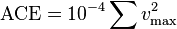
is easily calculated from best-track hurricane datasets, with the one-minute maximum sustained wind squared and summed during the tropical lifecycle of a tropical storm or hurricane.
@Pamela Gray,
So true. Our wildfire season is year-round now, primarily related to high temperatures and low humidity. But, other states (Texas comes to mind) have wildfires in cold months when the air is very dry.
I am wondering if Los Angeles’ cooler air temperatures are due to the colder Pacific waters — as shown by the link below. Our prevailing winds are out of the west, blowing right across the Pacific.
http://www.cdc.noaa.gov/map/images/sst/sst.anom.gif
B Kerr (14:57:29) : “We were in Nokomis Beach ……”
One of my favorite spots. Did you go to the drum circle on Saturday evening when you were there?
Yes, F.Rasmin I was aware of the oil spill, but I wanted to highlight the positive effects of a moderate cyclone/hurricane in increasing surface to deep water circulation.
“You clearly don’t know what the phrase ‘orders of magnitude larger’ means. FYI, it means, at least hundreds to thousands of times larger.”
Here’s Wikipedia:
“Orders of magnitude are generally used to make very approximate comparisons. If two numbers differ by one order of magnitude, one is about ten times larger than the other. If they differ by two orders of magnitude, they differ by a factor of about 100.”
“Tim Clark (12:55:25) :
Len van Burgel (07:13:13) :
Re: westhoustongeo (04:37:57) :
I thought you would never ask! A thunderbox is an old aussie backyard dunny (lavatory). In the outback it wasn’t of the sturdiest construction.
It’s ironic that in the outback you call it a thunderbox, while in the USA we call it an outhouse.”
Interestingly enough, we did have “thunderjugs”…which were bedpans stored under the bed for that mid-night pee, to save one the trip downstairs and outside on those cold, winter nights.
JimB
Len and westhoustongeo
Funny how folks start their own topic and soon there are three or four things being discussed at the same time. That’s the way it was when I was a kid and we had family gatherings. Also, we had a thundermug (metal pan) in the bedroom so we would not have to go out to the thunderbox in the middle of the night.
Anyway, Ryan’s post and all the comments have been really interesting. I always learn something. Thanks.
FRANK MOSHER
I have not done any investigations my self but do you have any numbers on the impact of a negative AMO and PDO on the tornado season in the US . I seem to recall that there were many tornados in the mid1970.s. Is this predicting a similar active tornado season for the next several decades as long as we have a negative PDO?. Again this seems to have very little to do with the rising CO2 levels as these changing PDO patterns are cyclic weather patterns or natural climate variability patterns which were happening well before manmade greenhouse gase started to go up.
FOUND IT!!! There is a little understood relationship between hurricane intensity, frequency, and global warming. The first lesson involves understanding the underlying principles of mathematics, Kentucky style:
The underpinnings of global circulation models evolves from there, with predictable results. (Little OT, but not much…)
I always understood an order of magnitude was similar to the exponent of a number. Two quantities are of the same order of magnitude if one is less than 10 times the other. In other words, if two numbers have the same exponent, they are within the same order of magnitude. If one number has a higher exponent, it can be said to be greater by an order of magnitude.
Smokey (18:58:19) :
To be greater than by an order of magnitude (base 10) simply means one is more than 10x the other. To say two quantities are of the same order of magnitude if one is less than 10 times the other may not be correct. (it could be 1000x less, 3 orders less). Likewise, 2 quantities could have different exponents and still be within one order of magnitude (9.9e0 vs 1.1e1)…
Outhouse: A little house 100 ft. behind the big house. In winter, that is 100 ft. too far, in summer, that is 100 ft. too near. H/T to the Dillards.
Philip_B (15:06:47) :
I am sure there are local conditions making thunderstorms unlikely, like here in the Vancouver and Fraser Valley area where we basically never have thunderstorms, but what I was aiming at is to look at the total number of lightnings on earth for a give year. This energy must also be coming ultimately from the sun. My hypotheisi is that the total number must be proportional to the solar activity somehow.
re: Matt Dernoga (07:33:04) :
Instead of reading a news story about how we’re all going to die tomorrow, check out a report by someone who was there in Copenhagen about how that statement from “nearly 2000 climate scientists” actually came into existence.
http://sciencepolicy.colorado.edu/prometheus/what-was-the-copenhagen-climate-change-conference-really-about-5055#comments
Now that it’s evident that supposed AGW does not increase hurricane activity the alarmist will have to come up with a new slogan. I can see it now. “Hurricane Change. Some hurricanes will be stronger. Some will be weaker. Some places will have more hurricanes. Some will have fewer.”
Ray, they do measure the number of lightning bolts from satellites and there is even a proposal to put a unit on the moon to measure lightning on earth.
All the energy that drives the Earth’s weather comes from the sun. We know with considerable precision how much solar energy we receive and we know it only varies by a small amount on an annual to century basis. Ref Lief Svaalgard’s comments here. I very much doubt lightning frequency has a strong, or any measurable, relationship with solar energy.
Nice graphics of day versus night lightning frequency across the Earth.
http://www.lpi.usra.edu/meetings/LEA/whitepapers/GoodmanLunarWorkshop_SGoodman_Lightning.pdf
From rephelan’s link above,
The rest is all politics. And we should let politics decide without being ambushed by a chimera of political prescriptiveness dressed up as (false) scientific unanimity.
So it seems the science isn’t settled, and at least some scientists object to the false certainty promoted by the politically motivated.
Tom in hurricane prone Florida (15:52:18) :
B Kerr (14:57:29) : “We were in Nokomis Beach ……”
One of my favorite spots. Did you go to the drum circle on Saturday evening when you were there?
No we were there mid week, saw all the expensive houses and red Ferraris.
Take it that was you in the Tessa Rosa.
Thanks for the posting about ACE.
I’ve spent part of the night thinking how messy things would get if the formula actually use 1/2 mv^2.
Yet there is a lot of energy around the outer arms of a hurricane. I was surprised that we were on tornado watch during Gustav or was it Hannah or was it both.
Told you it was an education.
B Kerr (02:09:23) : “Yet there is a lot of energy around the outer arms of a hurricane. I was surprised that we were on tornado watch during Gustav or was it Hannah or was it both.”
There are always tornado watches put out during landfalling hurricanes. Usually they are in the right quadrant. You have strong winds circulating around the eye as the storm moves smoothly over water. When it makes landfall the components and contours of the land create eddies in the wind field which can lead to formation of short lived tornados. Some of the greatest wind damage is done by these. They have also discovered that many short micro bursts appear in or near the eye wall. Hurricanes are amazing acts of nature, as long as they are somewhere else.
During seasonal high energy storms Wallowa County has experienced these short downward micro bursts of tornado like forces that can take a barn out and then disappear but we never see the usual visual tornadic funnel. The barn will just be there one minute and blown to bits the next, almost as if some giant sat on it. I’ve seen big evergreen trees in open forests that look as if a tornado got them but it was just that one tree. Sometimes you can tell that it was probably a lightening strike. But not always. It just looks like it suddenly twisted and then came down from the top, again as if something had sat on it.
Ouch.
Philip_B (23:18:00) :
So if we know the total energy coming from the sun and if all the weather is driven from the sun, then we can do an “energy balance”. The moon stations are interesting but I think they have now a full coverage of land with lightnings detectors.
Here’s a breaking news item, from a stock market site:
“The National Association of Insurance Commissioners voted to require insurance companies to disclose the impact of climate change on their businesses. This action taken on March 17 will compel insurance companies to fully disclose the impact of forecasted climate change along with their actions to manage the risks. The move by the insurance commissioners was reported this morning in The Wall Street Journal and elsewhere.”
Link: http://seekingalpha.com/article/126596-berkshire-hathaway-climate-change-impacts-insurers#comment-430567
I hope these predictions are correct. Another catastrophic hurricane would hurt the economy even further. Although some contractors may benefit from the work…
Regards,
Andy
Hurricane Construction