Guest Essay By Larry Kummer. Posted at the Fabius Maximus website.
Summary: To boost our fear, activists and journalists report the weather with amnesia about the past. Ten year records become astonishing events; weather catastrophes of 50 or 100 years ago are forgotten. It makes for good clickbait but cripples our ability to prepare for the inevitable. California’s history of floods and droughts gives a fine example — if we listen to the US Geological Survey’s reminder of past megafloods, and their warning of the coming ARkStorm.
” A 43-day storm that began in December 1861 put central and southern California underwater for up to six months, and it could happen again.”
— “California Megaflood: Lessons from a Forgotten Catastrophe” by B. Lynn Ingram (prof of Earth Science, Berkeley) in Scientific America, January 2013.

Lithograph of K Street in Sacramento, CA during the 1862 flood. From Wikimedia commons.
One of the key events in California history has disappeared from our minds. For a reminder see this by the US Geological Survey.
“Beginning on Christmas Eve, 1861, and continuing into early 1862, an extreme series of storms lasting 45 days struck California. The storms caused severe flooding, turning the Sacramento Valley into an inland sea, forcing the State Capital to be moved from Sacramento to San Francisco for a time, and requiring Governor Leland Stanford to take a rowboat to his inauguration. William Brewer, author of Up and Down California in 1860-1864![]() , wrote on January 19, 1862, ‘The great central valley of the state is under water — the Sacramento and San Joaquin valleys — a region 250 to 300 miles long and an average of at least twenty miles wide, or probably three to three and a half millions of acres!’
, wrote on January 19, 1862, ‘The great central valley of the state is under water — the Sacramento and San Joaquin valleys — a region 250 to 300 miles long and an average of at least twenty miles wide, or probably three to three and a half millions of acres!’
‘In southern California lakes were formed in the Mojave Desert and the Los Angeles Basin. The Santa Ana River tripled its highest-ever estimated discharge, cutting arroyos into the southern California landscape and obliterating the ironically named Agua Mansa (Smooth Water), then the largest community between New Mexico and Los Angeles. The storms wiped out nearly a third of the taxable land in California, leaving the State bankrupt.
“The 1861-62 series of storms were probably the largest and longest California storms on record. However, geological evidence suggests that earlier, prehistoric floods were likely even bigger. There is no scientific evidence to suggest that such extreme storms could not happen again. However, despite the historical and prehistorical evidence for extreme winter storms on the West Coast, the potential for these extreme events has not attracted public concern, as have hurricanes. The storms of 1861-62 happened long before living memory, and the hazards associated with such extreme winter storms have not tested modern infrastructure nor the preparedness of the emergency management community.”
For an account of the flood from that time see this by J. M. Guinn; an excerpt from Exceptional Years: A History of California Floods and Drought (1890). Red emphasis added.

Flooded area in California: 1861-1862. From The West without Water.
“The great flood of 1861-62 was the Noachain deluge of California floods. During the months of December, 1861, and January, according to a record kept at San Francisco, 35 inches of rain fell, the fall for the season footed up nearly 50 inches {average is 24 inches/year}. As in Noah’s the windows of heaven were opened, and the waters prevailed exceedingly on the face of the earth.
“The valley of the Sacramento vast inland sea; the city of Sacramento was submerged and almost ruined. Relief boats on their errands of mercy, leaving the channels of the rivers, sailed over inundated ranches, past floating houses, wrecks of barns, through vast flotsams, made up of farm products farming implements, and the carcasses of horses, sheep and cattle, drifting out to sea.
“…To the affrighted vaqueros, who had sought safety on the hills, it did seem as if the fountains of the great deep really been broken up, and that the freshet had filled the Pacific to overflowing. The Arroyo Seco, swollen to a mighty river, brought down from the mountains and canons great rafts of drift-wood …{that} furnished fuel to poor people of the city for several years.
“It began raining on December 24, 1861, and continued for thirty days, with but two slight interruptions. The Star published the following local: ‘A Phenomenon – Tuesday last the sun made its appearance. The phenomenon lasted several minutes and was witnessed by a great number of persons.’
“…After the deluge, what? The drought. It began in the fall of 1862, and lasted to the winter of 1864-65. The rainfall for the season of 1862-63 did not exceed four inches, and In the fall of 1863 a few showers fell, but not enough to start the grass. No more fell until March. The cattle were of gaunt, skeleton-like forms, moved slowly of food. Here and there, singly or in small weak to move on, stood motionless with of starvation. It was a pitiful sight. …
“The loss of cattle was fearful. The plains were strewn with their carcasses. In marshy places …the ground was covered with their skeletons, and the traveler for years afterward was often startled by coming suddenly on a veritable Golgotha — a place of skulls — the long horns standing out in defiant attitude, as if protecting the fleshless bones. …The great drought of 1863-64 put an end to cattle raising as the distinctive industry of Southern California.”
For a more detailed account see “California Megaflood: Lessons from a Forgotten Catastrophe” by B. Lynn Ingram (prof of Earth Science, Berkeley) in Scientific America, January 2013 (PDF here). The risk of such megafloods remains today as shown in the video “Central Valley Flood Risk” by the California Department of Water Resources and the Corps of Engineers, July 2011.
Why is flood risk so high in California? This video explores the history, risk and government efforts to reduce flooding with one of the world’s largest flood risk reduction systems.
It will happen again: the ARkStorm Scenario
The ARkStorm scenario was prepared by the US Geological Survey, who gathered a team of 117 scientists and engineers — with contributions from 42 Federal, California, and local agencies and universities. Here is the opening of the introduction to the ARkStorm Scenario. For more information see the press release and the full report.![]()
“The ARkStorm storm is patterned after the 1861-62 historical events but uses modern modeling methods and data from large storms in 1969 and 1986. The ARkStorm draws heat and moisture from the tropical Pacific, forming a series of Atmospheric Rivers (ARs) that approach the ferocity of hurricanes and then slam into the U.S. West Coast over several weeks. Atmospheric Rivers are relatively narrow regions in the atmosphere that are responsible for most of the horizontal transport of water vapor outside of the tropics.
“Using sophisticated weather models and expert analysis, precipitation, snow lines, wind, and pressure data, the modelers characterize the resulting floods, landslides, and coastal erosion and inundation that translate into infrastructural, environmental, agricultural, social, and economic impacts. Consideration was given to catastrophic disruptions to water supplies resulting from impacts on groundwater pumping, seawater intrusion, water supply degradation, and land subsidence.
“…Megastorms are California’s other Big One. A severe California winter storm could realistically flood thousands of square miles of urban and agricultural land, result in thousands of landslides, disrupt lifelines throughout the state for days or weeks, and cost on the order of $725 billion. This figure is more than three times that estimated for the ShakeOut scenario earthquake, that has roughly the same annual occurrence probability as an ARkStorm-like event.”
Conclusions
“We don’t even plan for the past.”
— Steven Mosher (member of Berkeley Earth; bio here), a comment posted at Climate Etc.
The political gridlock on public policy relating to climate change has prevent the most obvious and easy first step — preparing for the almost inevitable repeat of past extreme weather. Events like superstorm Sandy and Hurricane Katrina were warnings, showing our mad lack of preparation for likely weather events. Unless we change soon, we will pay dearly for our folly.
For More Information
This is a follow-up to Lessons learned from the end of California’s “permanent drought”. For more about the great flood see Wikipedia and a brief but eloquent account in the 21 January 1862 New York Times.
For more information about this vital issue see The keys to understanding climate change, and especially these …
- Ten years after Katrina: let’s learn from those predictions of more & bigger hurricanes.
- An eminent climate scientist explains what caused the record rains in Texas.
- Have we prepared for normal climate change and non-extreme weather?
- Let’s prepare for past climate instead of bickering about predictions of climate change.
- Droughts are coming. Are we ready for the past to repeat?
- The bottom line: How we broke the climate change debates. Lessons learned for the future.
- Important: Climate scientists can restart the climate change debate – & win.
Discover more from Watts Up With That?
Subscribe to get the latest posts sent to your email.
I’m in East Malaysia at the moment , a place that I’ve lived in, worked in, sailled in and visited for 35 years now. There has been no sea level change in that time ( I helped put in some flood defences in the early 80’s so I know) and whilst in the tropics is the coldest that I have ever known it to be. I when I normally sweat the night away. slept comfortably in a long house the other night
Call me mean spirited, but I have no sympathy for California or Californians. For example, they continue to spend tens of billions annually (I think this is a low estimate) on illegal aliens, but have neglected their infrastructure. The problem I have is the rest of us are going to be stuck with paying for the damages. Any state this out of touch with reality should be forced to fend for itself. At the very least, the Clinton Foundation and George Soros should get hit with the bill.
California also has strong teachers’ union membership. What was NOT reported is that increases in education funding were not going into schools, but into paying generous retirement benefits to those teachers.
Jay,
“The problem I have is the rest of us are going to be stuck with paying for the damages. ”
Too soon to say who will pay the bills from this. Well worth reading: “Why Trump Should Not Fund an Oroville Dam Fix” by Wayne Lusvardi. Excerpt:
I feel the same way about the rest of the US. Was born in California and have lived here almost my entire life. For years and years when our economy was rolling we sent a lot more of out tax money to Washington DC than what we got back…probably holds true today. And like you I am sick of sending all that money to Washington to support their failed policies (Obamacare, the EPA…etc) and their lack of fixing the rest of the countries infrastructure. California is not the leader in failed infrastructure.
California’s economy is dependent on the rest of the country. The entertainment industry (movies, TV, recording, etc.) and agricultural products, to name a few, support California through sales to the rest of the country. These sales would not be possible without the infrastructure , paid for with all our tax dollars, throughout the country. And not only are tax dollars from D.C. flowing into California, consumer dollars from the rest of the states also flow in. A better comparison would show how many of California’s tax dollars sent to Washington generated through sales outside the country are returned to California. And while we are at it, let’s compare Federal welfare dollars sent to California with those sent to each of the other states.
I read a report a few days ago that had listed some 13 major floods as gauged at Oroville. A few of them are random storms it seems once a decade or so, but there were two sequences of clustered events. One cluster appears from 1902-1909 and another from 1960 -1964. The earlier sequence occurs during a period of elevated precipitation, and the latter within what appears to be a drier time. Its Mandelbrot’s Joseph and Noah effects written in a small table summarizing one small region.
By coincidence I saw Joe Bastardi’s weekend summary from weekend last, and he was speaking of how the analog year for much of this winter has been 1960, but that this analog fell apart within the last couple of weeks as, rather than staying very cold, as 1960 did, it turned suddenly warm out west. I have noted to my wife recently how much the past couple of winters have reminded me of the early 1960s, where we could go from short-sleeve shirts at Christmas to the coldest temperatures ever recorded here in Laramie in about 40 days time. The statistics characterizing weather and climate are nothing if not amazing, and very unlike gaussian models of randomness.
K. Kilty,
Great reminder that while megafloods are rare, heavy storms are typical for this region.
The ARkStorm scenario combines the storm that struck southern California in January 19-27,
1969, followed quickly by the storm that struck northern California in February 8-20, 1986,
Tulare Lake went from non-existent to 130 square miles in about one months time, with a maximum depth of 20 feet.
The difference, imo, between the 1960s and now is that ther 1960s was a cool climate phase, and we are now in a warm phase of climate.
Shades of Lucifer’s Hammer! Who needs sci-fi? The earth can serve up catastrophes on its own quite well, you know. Even without AGW. (Like I said, who needs sci-fi?)
In the below article, the clueless New York times states that “This has been the rainiest year in California’s history….” and of course, “Climate change adds to the challenges. Scientists have said for years that a warming atmosphere should lead to more intense and frequent storms in many regions.”
https://www.nytimes.com/2017/02/14/us/oroville-dam-climate-change-california.html?_r=0
Bruce, the fake news champs are at the NYT, followed closely by WAPO. They are remarkably immune to rational critical thinking and are completely stuck on stupid.
It is fun to bash the fools who staff newspapers, but the average citizen has a remarkable ability to observed deviations from the conventional wisdom, yet organize his thinking to overlook the observations.
I have been giving advice to an Arizona entity on some agricultural projects, and happened to read a blog from a nut-tree nursery. One customer stated that his region of Iowa used to be climate region 4B, but because of “climate change”, is now region 5. However, the pecan trees he planted suffered repeated freezings until they died. This he blamed on the Polar Vortex.
The picture shown is of the St. Francis dam which failed March 12, 1928. Poor siting appears to be the cause
For the collapse. Hundreds died and many were never found. Some washed out to sea.
Barry,
Thanks for the background on that. Fake news strikes again.
barryjo,
Do you know if this is a recent photo of the site?
And there is an excellent book titled “Floodpath” by Jon Wilkman which details the whole mess. The dam blowout was labeled the “Greatest man-made disaster of the 20th century.”
K. Kilty: The photo is seen on Google and was taken sometime after the disaster.
Senate very very boring
While warmunistas often portray floods and droughts as CO2 climate weirding, a strong case can be made for natural oscillations that are simply not fully understood and not incorporated into models. However there is enough of a pattern that some predicted California’s drought would end with this series of atmospheric rivers and resulting flood.
From Dettinger 2013 “Atmospheric Rivers as Drought Busters on the U.S. West Coast”
“When the individual storm sequences that contributed most to the wet months thatbroke historical West Coast droughts from 1950 to 2010 were evaluated, 33%–74% of droughts were broken by the arrival of landfalling AR storms. In the Pacific Northwest, 60%–74% of all persistent drought endings have been brought about by the arrival of AR storms. In California, about 33%–40% of all persistent drought endings have been brought about by landfalling AR storms, with more localized low pressure systems responsible for many of the remaining drought breaks ”
http://journals.ametsoc.org/doi/pdf/10.1175/JHM-D-13-02.1
The ARkStorm setup in 1861/62 was obviously as result of a long-term Jet Stream blocking set up to position a longwave trough just offshore the California coast so the south-east flow was positioned right into California. With this setup, short-wave after short-wave came ashore with it’s moisture & dumped it with rain in the valley & rain/snow in the mountains which washed down in the canyons into the lower valleys. However, even if every valley was dammed, the reservoirs can only hold so much – case in point, Lake Orville is already having to release excess water & the wet season still has about a month to go.
If it happened before, it can happen again.
JKrob, “If it happened before, it can happen again.”
If it happened before, it will happen again! Fixed it.
Didn’t you get the memo? Manmade CO2 caused the ARkStorm. The IPCC has now proven that the effect of manmade CO2 is now retroactive to all past extreme weather events….(sarc).
https://photos.google.com/photo/AF1QipPPCjX6sHJ_v6TTb1FMv1eTArULMvzmLNzcsvcI
Been trying to figure out how to convert this mess into a jpg.
Anyhow it’s a picture of the free board on the feather river levee in Marysville/Yuba CIty.
Long ways to go until it’s spilling the banks.
The winter of 1996/97 was a semi biblical flood year. I was living in Novato, Marin Co. It rained for around 30 days and nights. There was always some level of moisture coming down. That is the longest period of rain which I have ever seen in my 67 years.
At the height of that rain lakes were forming in the valley around Marysville and Yuba City. The Oroville Dam was spilling water at maximum, and the dam still came close to over topping. Note that man seldom learns from the past.
Next to the home which I was renting in Novato was a drainage for a stream. The flow was some 3 or 4 inches of water when I moved in, and the ditch was overgrown with brush and small trees. At the peak of the rain that ten foot deep/15 foot wide drainage ditch filled and overflowed into the surrounding area. That is nature roaring.
But…but…I thought our children won’t know what floods are!
Guess they will now.
With “Climate Change’, what goes around comes around.
Maybe the floods will wash all the Delta Smelt out to sea. It’s an ill wind that blows no good.
The obvious very fat tails of weather distributions makes ascribing any extreme to a minuscule change in the mean willfully stupid .
This post is focused on California along with other areas past major weather events being “forgotten”.
Where I live The Weather Channel’s “Local on the 8’s” routinely included the record high and low temp for the day. It’s been years since they did that. ( I think our local channels also phased that out.)
TWC is quick to report when a record temp somewhere may potentially be broken tomorrow but rarely do they follow up unless a record was broken.
(I wonder how their projections of broken records compares to reality? “Climate Models” might have a better track record.8-)
PS Local record highs and lows have also undergone …adjustments. I know mine have.
(Nothing is new under the sun….but in the dark……)
I thought The Arkenstorm was buried with Thorin?
What’s to worry?
(Unless that was just a fantasy?)
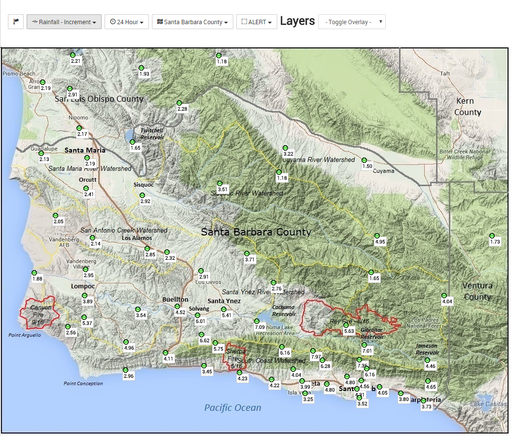
24 hour storm totals for Santa Barbara County! A lot of rain!
Forgot Picture
California and the ArkStorm.
Rain fills valleys and dried lakes.
Well, them lakes are not dry after an ArkStorm. Isn’t that one definition for a flood plain?
Silicon Valley is so going to love an ArkStorm.
All of those eco-vehicles will plug some of the potholes on the road while urban road warriors driving their never-dirty limited edition SUVs find new ways to get stuck in desert muck.
I wonder how all of those windy turbines will fare in storm after storm with water flowing around their bases as the water flows downhill.
Then all of those relatively new fields of solar cells or mirrors. How deep are these sometimes dry lakes?
Then who will clean off all of the mud and bugs off of those things.
I hope they have to clean them without wasting water.
Start blaming guvvy Brown, now.
What I started thinking about is the vibration effect of all that water falling hundreds of feet (300-400? and crashing onto the rocks below.
I am also thinking of the liquefaction effect of an earthquake – you know where hard packed roadways with concrete tops start breaking up, not by the earthquake but by the ground liquefying under the vibration effect?
That waterfall is surely sending vibrations right through that hill under and into the weir on it’s left and into the dam on it’s right.
If the dam face starts cracking due to the continual vibrations water will start to seep into it is my concern, I have heard nobody say anything about this so am I concerned for nothing or has this constant vibration effect been missed/ignored?
Aidan : The dam and the power station were build on bedrock. The main spillway has now soured out down to bed rock and is well below the actual dam. Earlier posts have links to videos that show how it was build, check them out.
Asybot : Thank you for your response, however I have done all that. Your response did not address the issue of constant vibrations travelling through the hillside (including he bedrock) & possibly affecting the dam.
My query was regarding the possible danger of the constant vibration not erosion..
How well did the government solution work for New Orleans before and after Katrina? Good luck with that.
IMHO, the crisis CA is now facing is of their own creation. They have wasted fortunes on this “green” agenda and fighting the war on climate change, and did little to prepare for the inevitable. CO2 caused climate change is pure speculation, the flood is 100% certainty. During the drought did they build desalination plants? Nope. Did they maintain their dams? Nope. Neither makes any sense. If the drought was going to be forever, they should have been building desalination plants. If it was going to end, they should have been maintaining the dams. They did neither, they built wind and solar farms, and spend a fortune on the California Renewable Fuel Standard. Nit wits.
Hey California!!!, Wind and Solar Don’t Work in a Flood
https://co2islife.wordpress.com/
BTW, I hope the editor of the Fabius Maximus Website understand that most people disagree with him and his position on this board, but you will never see Mr Watts censor or “moderate” him. In fact, Mr Watts publishes your articles so that his readers can get all sides of the story. That is the difference between liberals and conservatives. We aren’t afraid of debate or listening to the other side.
http://www.americanthinker.com/articles/2012/05/never_call_socialism_by_its_right_name.html
http://covenersleague.com/images/fabian-socialist-wolf-in-sheep-clothing.jpg
Brisbane capital city of the state of Queensland, Australia floods of 1893.
http://i.imgur.com/0IsmI9z.jpg
Isn’t California a desert??
Most of California is a Mediterranean Climate. The Desert Climates are located in the Southeastern part of the states and the Bakersfield area.
https://upload.wikimedia.org/wikipedia/commons/8/80/CA_koppen.svg
Yes. Lived here all my life and if not for the dams, the north Valley too would be as dry as a fox turd in summer.
If not for dams, the winter water would scour the valley beyond the banks of rivers as the settlers experienced with routine flooding.
Come summer the snow melt run off lasts till mid-summer at which time most of the rivers turn to creeks and vernal pools, leaving behind nothing but desert.
Sure, there were the occasional oasis, but in between was wasteland.
As ARK storms go I’m not impressed. One day of rain. Most of it the straight up and down variety. Not impressed at all. Didn’t need a boat, float, life jacket, hip waders, or even rubber boots, much less a ride from Noah.
This is a very wonderful history lesson that needs to be incorporated into high school history classes.