Via press release. August 6, 2020
Atmospheric and oceanic conditions are primed to fuel storm development in the Atlantic, leading to what could be an “extremely active” season, according to forecasters with NOAA’s Climate Prediction Center, a division of the National Weather Service.
Today, the agency released its annual August update to the Atlantic Hurricane Season Outlook, initially issued in May. The 2020 Atlantic hurricane season has been off to a rapid pace with a record-setting nine named storms so far and has the potential to be one of the busiest on record.
Historically, only two named storms form on average by early August, and the ninth named storm typically does not form until October 4. An average season produces 12 named storms, including six hurricanes of which three become major hurricanes (Category 3, 4, or 5). “This is one of the most active seasonal forecasts that NOAA has produced in its 22-year history of hurricane outlooks. NOAA will continue to provide the best possible science and service to communities across the Nation for the remainder of hurricane season to ensure public readiness and safety,” said U.S. Secretary of Commerce Wilbur Ross. “We encourage all Americans to do their part by getting prepared, remaining vigilant, and being ready to take action when necessary.”
The updated outlook calls for 19-25 named storms (winds of 39 mph or greater), of which 7-11 will become hurricanes (winds of 74 mph or greater), including 3-6 major hurricanes (winds of 111 mph or greater). This update covers the entire six-month hurricane season, which ends Nov. 30, and includes the nine named storms to date.

A comprehensive measure of the overall hurricane season activity is the Accumulated Cyclone Energy (ACE) index, which measures the combined intensity and duration of all named storms during the season. Based on the ACE projection, combined with the above-average numbers of named storms and hurricanes, the likelihood of an above-normal Atlantic hurricane season has increased to 85%, with only a 10% chance of a near-normal season and a 5% chance of a below-normal season. “This year, we expect more, stronger, and longer-lived storms than average, and our predicted ACE range extends well above NOAA’s threshold for an extremely active season,” said Gerry Bell, Ph.D., lead seasonal hurricane forecaster at NOAA’s Climate Prediction Center.
Current oceanic and atmospheric conditions that make an “extremely active” hurricane season possible are warmer-than-average sea surface temperatures in the tropical Atlantic Ocean and Caribbean Sea, reduced vertical wind shear, weaker tropical Atlantic trade winds and an enhanced west African monsoon. These conditions are expected to continue for the next several months.

A main climate factor behind these conditions is the ongoing warm phase of the Atlantic Multi-Decadal Oscillation, which reappeared in 1995 and has been favoring more active hurricane seasons since that time. Another contributing climate factor this year is the possibility of La Nina developing in the months ahead. Indicative of cooler-than-average sea surface temperatures in the equatorial regions of the eastern Pacific Ocean, La Nina can further weaken the wind shear over the Atlantic Basin, allowing storms to develop and intensify. NOAA’s hurricane season outlook is for overall seasonal activity and is not a landfall forecast. Landfalls are largely determined by short-term weather patterns, which are only predictable within about a week of a storm potentially reaching a coastline. NOAA’s National Hurricane Center provides tropical weather outlooks out to five days in advance, provides track and intensity forecasts for individual storms, and issues watches and warnings for specific tropical storms, hurricanes and the associated storm surge.
“NOAA has the most highly trained and dedicated forecasters that serve to protect American lives and property. With improved forecast skill, new storm surge products, and new observations, such as GPS Radio Occultation, we are better positioned than ever before to keep Americans out of harm’s way,” said Neil Jacobs, Ph.D., acting NOAA administrator. “It is now more important than ever to stay informed with our forecasts, have a preparedness plan, and heed guidance from local emergency management officials.”
This hurricane season FEMA encourages residents in hurricane-prone regions to keep COVID-19 in mind when making preparations and during evacuations. Visit https://www.ready.gov/hurricanes for more information. Stay tuned to the National Hurricane Center for the latest about tropical storm and hurricane activity in the Atlantic.
If only I had a penny for all things that are “possible”, I would be the richest person in the world.
… and for all things that are wrong. Is this the same agency that did such a poor job of forecasting the strength and path of Isaias compared witb most other models?
Yeah they could not even get the forecast right for S Florida, 10 hrs in advance. With the same sorts of GCM models the so called experts use to predict climate change 20-50-100 years out!
It would be funny if it were not so dire – the dumbing down of the general population that is.. (so they willfully accept any old propaganda fed to them)
Also of note, the NHC has been routinely inflating the wind speeds of all storms or tropical depressions for several years now. So they can then make “accurate” predictions – because their fingers are on the scale, and causing more depressions to become tropical storms, and more tropical storms to become hurricanes – as the definition is based on sustained wind speed on the ground.
It is easy to call them out on these lies – the real time dropsonde data is visible from the hunter aircraft – and you can document the fact they often use flight level winds as the basis for saying so and so storm has a wind speed on the ground of xx. (wind speed increases with altitude so reporting the speed at 10,000 ft as what happens on the ground, is an outright lie)
They were reporting cat 1 (meaning sustained ground wind of 74+ MPH), when weather stations within the eyewall were at 22, 27, 35, 18 MPH as it came ashore in S and N Carolina last week.
That is at least a 200% inflation of the actual strength of the storm…. They did this for Irma, Maria and Dorian as well as most of the others in the past 3 years. (Irma was supposedly a cat 4 at 130+ MPH as it crossed the keys, but a buoy measured only 90 mph as the eyewall cross it)
Someone needs to document this and call them out on their lying. Yes these and other storms are dangerous and destructive, but none of them were the Categories they are officially labeled as.
So not only do we have “adjustments” of the temperature record towards an agenda, but hurricane strength and numbers are similarly being fudged!
That’s why they put the ‘universal excuse’ word “possible” right in the headline.
I too have noticed this, repeatedly. It goes back to the hurricane “drought”and their desperation to push the whole “global warming makes things worse by x100” mantra. They have to find storms.
Personally, I think that the low sunspot activity and fairly quiet solar wind has allowed our atmosphere to “relax” the upper levels aren’t stirred as much, so heat from the lower atmosphere is more quickly shunted to space. Because of this, cloud tops in T-cells, the main driver’s of inflow winds around a hurricane’s central core, chill faster and collapse sooner. This provides a limit on hurricane windspeed intensity because if you don’t have long-lived updrafts then you don’t have massive ground-level windspeeds.
I believe it can also been seen in AZ too, as the regional dominating “monsoon” high pressure circulation has had a terrible time getting started this year. It’s been a high pressure ridge with the exception of about 5 days last week. Can’t hoover the moisture off of N. Mexico into SoCal and AZ unless that high pressure is cranking in a circle. So… an entirely moisture-free monsoon season in Eastern SoCal has been on tap, which is super-boring for me. From Tuscon into the Mongollon Rim country has seen some storms, but they’ve lacked the ability to propagate out of the mountains and into the desert floor areas because… no moisture… because… no rotating Four Corners High Pressure! And what controls the formation of that? Seasonal high temps over the desert, which quite frankly, haven’t been all that high this year. The upper atmosphere has just been too cool to allow it. With the sun now cranking back southward for winter, and decreasing daylight, I’m starting to think there might not be a monsoon season at all for Eastern SoCal this year.
So let’s sit back with popcorn and watch as NOAA totally ignores upper atmosphere temps and their dampening effect on hurricanes. Remember the phrase “a hurricane moistens up it’s surrounding atmosphere once it has walled off the core”? If you have short-lived t-cells, you can’t wall off a core of low pressure. Dryer t-storm outflow winds just kill off other newly building t-cells. You can even see the bow wave outflow winds on some of the Sat images of recent hurricanes, ripping westward and southward across the ocean, killing the east and southern sides of the eyewalls. Open-sided eyewalls have been plentiful these last 5 years. Dry air has abounded across the Atlantic, which wasn’t an issue several decades ago. Shorten the individual thunderstorm life cycle due to increased upper atmosphere heat transfer efficiency and it all makes sense. I want my name on this theory someday!
Nana is on that hurricane list … think of the poor little future snowflakes and get Nana off the list.
“C’mon kids, we have to leave NOW. NANA’s coming and we have to get out of here. No, no time for the toys … the dog will have to fend for himself. If we don’t leave now it will be too late … Nana’s coming”
No Greta?
DonM ==> “Nana” is what my grandson calls his grandma.
post Nana news….
“After hitting Georgia, Nana killed 28 people, destroyed 500 homes, and left up to 20,000 homes with electricity.”
(Do you have any relatives named Georgia?)
It’s worse than we thought. We’re doomed. OK, that’s an overreaction, but I will adjust, re: when I rent a car for vacation this September in Marco Island, Florida, I will go ahead and pay some extra for the destruction insurance. My wife and I played golf in the backside of a hurricane in Cancun, Mexico, with other golfers (ok, fanatics?), and it was quite the hoot, with max winds around 80 mph and golf balls that went somewhere else. Let’s hope nobody dies in the upcoming main phase of the hurricane season, unless they are a CNN reporter.
Why do you love Sky and the BBC?
Them too.
“My wife and I played golf in the backside of a hurricane in Cancun, Mexico”
Did you at least take the storm out to dinner first?
I believe that largest come from behind victory in a major was when bad winds hit later in the day causing the top of the leader board to shoot poor final round.
“This hurricane season FEMA encourages residents in hurricane-prone regions to keep COVID-19 in mind when making preparations and during evacuations.”
This means that you make sure that there’s room in your hopefully storm-proof garage to park your EV, and that your ICE SUV is gassed up and ready to go.
Well they best get busy, half way through and they are way behind.
Considering that the politicized science at NHC/NOAA has taken to “naming” every squall out or low pressure in Gulf or Atlantic, the only historical metric that matters anymore is Accumulated Cyclone Energy (ACE) for the entire season by tropical cyclone basin. Dr. Ryan Maue tracks that.
Go to this page here:
http://climatlas.com/tropical/
to see up-to-date data, not emotional hype from NOAA.
The data:
Northern Hemisphere ACE (YTD, 6Aug2020) 81.4650 149 54% 568 821.
What that says is the Northern Hemisphere ACE is currently at 54% of the 1981-2010 historical average. Today’s ACE at 81.45 versus the average for this date (6Aug 2020) being 149.
Data not emotional hype. Emotional hype and naming every low pressure that comes along is just pseudo-science garbage from NOAA’s National Hurricane Center staff.
Thanks for the reality check Joel.
I will note that the Atlantic Basin is “high” for this date, but the NH (Pacific + Atlantic) is well below historical average for YTD.
But To this date we are usually only 9/104 ACE or 8.7% of the way through the tropical year. That makes this early season very responsive to noise when the denominator is so low. With the building La Nina in the equatorial eastern Pacific by the Fall, the Atlantic basin tropical season activity will likely plummet as well so that the second half, where the bulk of the ACE occurs will go low.
What cannot be denied is that in recent decades the NOAA/NHC straff has taken to naming every tropical low out in the Atlantic or Carribean or GoM that they can ID. So using [# named TC’s] is a completely erroneous metric now to compare to historical standards, as the politicized staff at the NHC have changed the naming standards.
I was under the impression that La Nina conditions produce less wind shear in the Caribbean making it more favorable to hurricane development
Very true. What’s sad is people see so many “named storms” now that are nothing desensitizes them to the ones that need to be paid attention to. The real story this year was the total absence of typhoons in the Pacific for a month. That’s something that happens probably once in a couple of hundred years or so.
Joel, if you read the fine print…NOAA is basing their prediction on a La Nina forming
…and out of the other side of their mouth they say this
“The current forecast, a 50-55% chance of La Niña, is not a very strong probability. There is still about a 40-45% chance that neutral conditions will remain through the fall and winter, and a smaller but non-zero chance of El Niño—around 5-10%.”
https://www.climate.gov/news-features/blogs/enso/july-2020-enso-update-la-ni%C3%B1a-watch
ENSO is everyone’s catch-all get-out-jail-free alibi when the hurricane forecast flops. It has an effect when it’s strong + or -, just no seems to know what it will be until after the season is nearly over. Then everyone says, “See, I told ya.”
Yes, and also check out the NOAA page with the current season history:
https://www.nhc.noaa.gov/text/MIATWSAT.shtml
Nearly all of the “named” storms are well out to sea and below hurricane strength. Lots of name inflation going on
Considering that weather forecasting is pretty dismal even 24 hours out, and this IS weather forecasting, how do they expect us to believe they won’t do any better than chance at their forecasts?
They must name more high wind events to keep up the global climate narrative, that and it absolves the insurance companies from large payouts. In 2014 there was a windstorm that hit a small area north of Spokane, Wa. Up to 70mph gusts that took down trees, fences and power lines. No insurance company could deny the homeowners claims or limit them as the storm wasn’t named. Now do you get it?
Considering the track record on predicting seasons, I wouldn’t be worried. Of course, if you are prepared as you should be, you don’t need to be worried whatever the season brings.
Do take into account CoViD-19 idiocy in your preparations this year. For instance, if you are in New England, in the event that a storm comes north like in the 1930s, do not plan to evacuate towards New York. They are too likely to quarantine you for two weeks – in a warehouse on the waterfront.
No acknowledgement that increased monitoring detects threshold events that tip Tropical Storms into Cat Hurricanes and so on?
I totally agree.
The US government system has become like the old Soviet Union, where any number could be changed for political reasons.
The changing of the US land temperature record is a cottage industry where past warm periods are cooled to agree with agenda which is to create a hockey stick graph for distribution.
And some of Atlantic tropical storms every year are categorized as Cat Hurricane wind levels ….
Even though the tropical storm, in question, only reached Hurricane level wind speed for hours, not days. When the storm is far from land.
Thanx for what “could be” forecast
It may be an active season. But why would anyone believe NOAA?
Meanwhile the Pacific is silent.
Maybe my memory deceives me but how can this be true, “ongoing warm phase of the Atlantic Multi-Decadal Oscillation, which reappeared in 1995 and has been favoring more active hurricane seasons since that time.” ? How could it be favoring hurricanes when we went through a stretch of over 7 years with no major hurricanes? Or are they talking about the whole globe? was the rest of the world active while the east coast was calm?
“How could it be favoring hurricanes when we went through a stretch of over 7 years with no major hurricanes?”
That was no major landfalling hurricanes. There were still major hurricanes during that time. And I think it was more than 7 years.
Wow, I missed the first 6. Being from Florida, I watch for tropical storms from June onward…. There wasn’t much happening until all the sudden Gonzalo was named…..Yep today there are exactly NO ZERO tropical storms anywhere on earth. 8/6/20 Yep can’t it’s a big year….HYPE
The number of TS and H really doesn’t matter. It is the number Landfalling. And they have no prediction about that except the generalization that more probably means more landfalling. Which is maybe true for the Caribbean but maybe not for the Atlantic. Of the nine named storms so far this year, only two landfalled.
Today, NHC shows nothing. Zip, nada, not even the potential for a tropical disturbance.
What was the prediction at the beginning of the season?
I searched here on WUWT to see the earlier prediction, but the search turned up nothing.
I recall it was going to be an “average” season.
So what changed?
NOAA’s number of named storms is scientifically meaningless the way they are doing it now. They are now merely use it as a propaganda tool to support the Climate Scam agenda.
Independently sourced and verified ACE is the tropical cyclone metric to make any comparisons.
No, the May version of NOAA’s seasonal forecast was “above normal”.
https://www.noaa.gov/media-release/busy-atlantic-hurricane-season-predicted-for-2020
It doesn’t hurt that every well organized squall line gets a name these days.
I guess it could what with the sst and all but the climate change fun begins after it does and if there is sufficient destruction and death to make the case for climate action.
https://tambonthongchai.com/2019/08/01/tropical-cyclones-climate-change/
“Extremely active hurricane system possible”
Translation
An extremely active hurricane season is what we are praying for because we are running out of climate crises.
Correct, Chaamjamal! +100
Alternative Translation
“There’s a good chance this year’s hurricane season will be average or below, so we need to run this story now for all the Doom Scrollers to grieve over before it proves to be false.”
Veery migration dates are historically more accurate predictors if hurricanes than the NOAA. Haven’t seen any 2020 data yet. Veeeies are a thrush that need to jump over the Caribbean as per of their migration. They leave early if it’s a bad hurricane year.
Where do you source your Veery data from? I’m trying to find a source and I am having a lot of trouble.
Netflix show, “Connected,” first episode, “Surveillance” discusses the Veery information from Cornell Lab of Ornithology facility in Newark, Delaware, USA. https://www.netflix.com/watch/81084952?trackId=200257859 from about 3:00 to 10:00 mark. Try Google search for terms Veery Newark Delaware for lots of hits. Do not use website eor.emmft2018 it’s a scam site. I haven’t found much specific for this year, except that someone spotted a Veery at late as July 8, 2020. http://birding.aba.org/mobiledigest/DE. This researcher on Twitter https://twitter.com/madthrush/status/1286047423962533889 and especially this tweet: https://twitter.com/madthrush/status/1286118721992491015 Good luck!
Well, we just got hit with another I storm (wimpy – Isabel in 03 was a dozy, but Irene and Isaias (I love that name the best) were welcome rain.
But then Irene and Isabel were in September, so we have to go through a bunch of fish storms which shows they are right (even though 40 years ago they lacked the technology to find fish storms).
Oh well, I liked Isaias – except for the fact she zapped my AC! Been working from home for 5 months and I had no where to go. But my AC company is champs! We are chillin again!
Lucky you, in NJ many trees down and loads of power outages, associated tornado in Doylestown, Pa.
“This is one of the most active seasonal forecasts that NOAA has produced in its 22-year history of hurricane outlooks.
22 years? LOL.
At least they don’t try to claim that history started 22 years ago.
What’s their accuracy been like?
So, except for the “Named Storms” propaganda, they are just parroting Joe Bastardi’s early March forecast.
Apparently alot of names makes “an extremely active hurricane season”.
I’m a reasonable guy. It’s important to track tropical storms just as it is necessary, nay, essential to forecast and track hurricanes that develop from them. But it’s misleading to release statements where the terms storms, tropical cyclones, tropical storms and hurricanes are used almost interchangeably.
And if you’re going to spend 75% of your time putting out bulletins on tropical storms quit calling yourself the Hurricane Center.
Did they check here?
https://www.audubon.org/news/are-these-birds-better-computers-predicting-hurricane-seasons
On the very old, established, and well used Beaufort scale, a Storm is a force 10, with a wind speed of 55–63 mph.
Hurricane is a force 12.
39 mph is the top end of a High Wind, and the very bottom of a Gale. It really isnt that strong at all. This downgrading of established standards thus eroding their value is typical of today’s left wing mentality.
Matthew Sykes,
I agree completely. And I will add, the sustained wind speed numbers for TS and Hurricanes posted by the NWS/NHC seem to no longer reflect wind speed at ground level. I have been trying to correlate reported ground station wind speeds with the NHC online updates for storms, and they diverge greatly.
I use Windy.com which provides comprehensive ground wind speeds on their website, and their reports agree with both ground station reported speeds, and my local observations at my house.
The NHC TS and Hurricane wind speeds are consistently 10 to 30 kt higher than these observations, with the 30kt discrepancy showing for highest hurricane wind speeds.
What does NOAA have against using storm names beginning with the letters “Q” and “U”?
there’s no yolanda or zeke either.
As solar activity increases, Atlantic activity is likely to increase in September and October.
Point us to that increase, please.
Cosmic ray database since April 1964
https://cosmicrays.oulu.fi/
So, the very quiet, quiescent, inactive Sun does not penetrate your world view, all you see is everything burning up and everyone dying. Got it.
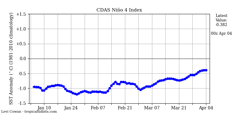
Perhaps the blockage of circulation in the Nino 4 region in the Pacific will end.
These guys aren’t seeing your increase. https://sohowww.nascom.nasa.gov/ Then again they do work for NASA so anything they say is suspect.
I call the some of the depressions “15 minute tropical storms
As a recommendation for future minimum storm damage and after effects, should such authorities also point out that solar panels and windmills are damaged far worse than coal and nuclear power stations? Geoff S
While we have had nine named storms, they have all been relatively short-lived. The two Cat 1 hurricanes were only hurricanes for 24-36 hours. Most of the rest were tropical storms or less. here’s the list from WU:
Arthur – Tropical Depression
Bertha – Tropical storm for 1 day
Cristobal – Tropical Depression
Dolly – Subtropical Depression
Edouard – Tropical Depression
Fay – Tropical Storm for two days
Gonzalo – Tropical Depression
Hanna – Tropical Depression
Isaias – Cat 1 Hurricane for 2 days
In my book, a tropical depression doesn’t deserve a name.
This has been a weak season so far. All these storms had wind speeds in the bottom of their categories. A more accurate measure would be to integrate the area of the storm by wind velocity squared. Even ACE only uses the highest wind speed and does not account for the size of the wind field.
The reason for more named storms are insurance companies. With named storms standard deductables at least in the North East of the US go up. They pay less. Check your homeowners policy to confirm
Richard