Where Rivers Run North

Guest Post by Willis Eschenbach [See updates at the end]

In the continental US, most of the rivers run east, west, or south. But in the Yukon and in Alaska, a number of them run north. The Yukon is a most curious river. The source of the Yukon in Lake Bennett in the Yukon Territory is only about forty miles (65 km) from the ocean … but instead of taking the direct route, it flows a total of almost 2000 miles (3200 km) before it finally gets to the ocean near Nome, Alaska.

Along the way, past Fairbanks in Alaska, the Yukon is joined by one of its many tributaries, the Tanana River. Like the Yukon, the Tanana also flows mostly north.

yukon and tanana.png

You can see the Tanana River noted in blue just to the left of Fairbanks.

And why is it significant that the Yukon and Tanana rivers run north? Well, it leads to a curious condition in the springtime. Over the winter, of course, the rivers tend to freeze up solid. In the spring, the south end of both rivers tend to thaw first … and that makes the breaking up of the ice a sudden event, with the mass of water surging downriver and clearing out the ice as it goes.

This is all of interest to climateers because the nights in the far north are so long. Why is the length of the nights relevant? Well, people get bored when it’s dark most of the time, and back in the day there was no TV up north … and as a result, more than a century ago people took to betting on the exact date and time that the rivers would experience “ice-out”, as it is called. Hey, you gotta do something to keep the megrims away …

So simply because humans like to bet, we have a hundred years or so of records of the exact dates of ice out for both the Yukon and the Tanana Rivers. The betting is a pool, with everyone putting in money, and the winner(s) take all. The betting on the Tanana River ice-out is called the Nenana Ice Classic, after the town where the betting takes place. This year the pool on the Nenana Ice Classic is just under a quarter of a megabuck … serious money.

How close to ice-out is the Tanana River? The precise ice-out date and time is determined by putting a tripod out on the rivers and connecting the top of the tripod by a cable to a clock in a tower on shore. Here’s a photo of the tripod and the tower I took when I visited the Tanana River a few years ago … obviously in the summer.

nenana ice classic

The Yukon river tripod is erected on the ice in the river near to Dawson City, Yukon Territory, and the Tanana River tripod is erected on the ice near to Nenana, Alaska.

And all of this is of interest right now because today the Tanana River is just about, nearly, almost, really close to, right on the edge of, ice-out.

As of this morning, here’s the situation on the Tanana River:

nenana tipping point.png

As you can see, the Nenana Ice Classic tripod out on the river ice has tilted precariously … but it hasn’t moved enough yet to stop the clock. Amazingly, I do believe that this is likely the very first photographic evidence of one of those famous “climate tipping points” that we all get warned about … but I digress.

So the ice in Nenana will likely go out today (May 1st) or tomorrow. And on the Yukon? Predictions are that the Yukon ice-out will occur on May 4 this year.

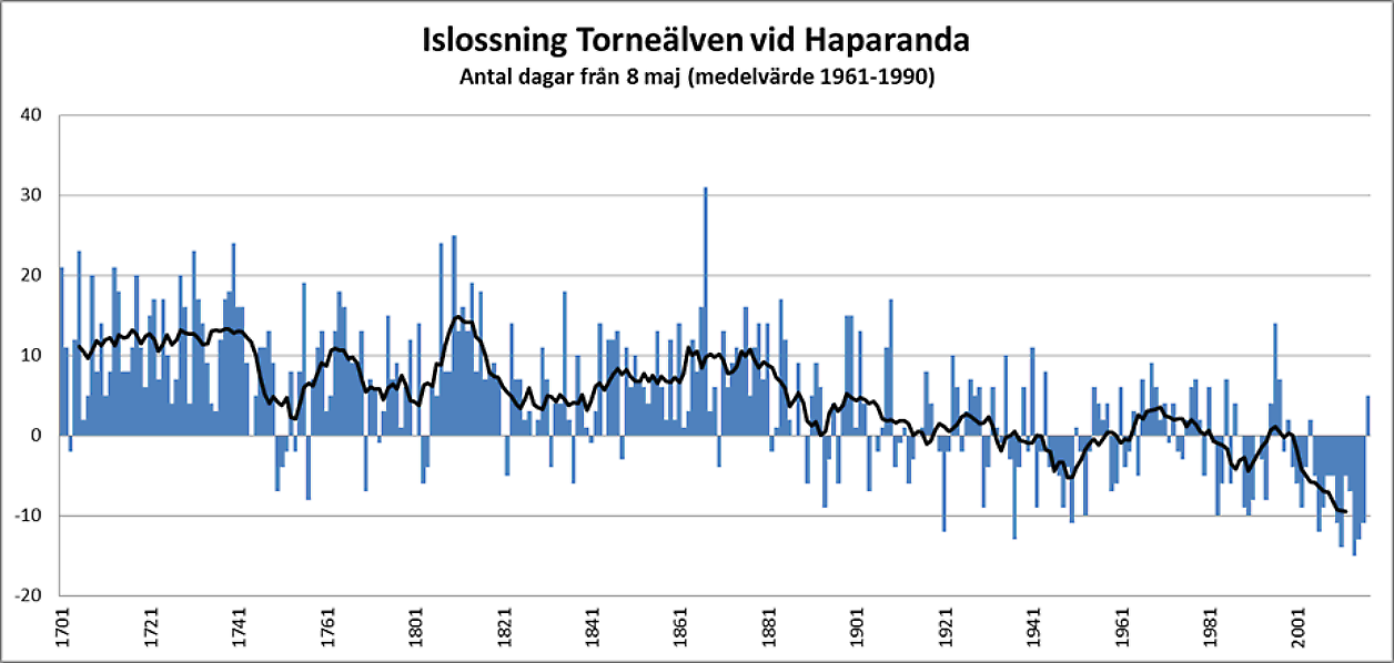
And what does the record of the ice-out dates for the two rivers show? Here you go.

yukon tanana ice out dates to 2017.png

This is a most fascinating record because it is totally unaffected by all of the things that bedevil temperature measurements—changes in station locations, changes in instrumentation, changes in time of observation, urban heat islands, trees growing around the thermometers, parking lots, increases in airport traffic near the station, none of these variables affect the ice-out dates in any meaningful way. It is a pure record of cumulative weather conditions each spring.

You can see the peak of the temperatures about 1940, and the drop in temperature to about 1965. From there, temperatures rise until the 1990s, followed by the infamous plateau in warming up to the present. In fact, it looks a lot like the early GISS global average temperature records, before the drop after the 1940s got mostly erased from the record.

Now, there has been a lot of recent discussion here on WUWT about putative solar effects on the climate. So I thought I’d make a comparison of the temperature as represented by the ice-out dates, and the solar activity as represented by the sunspots.

ice out dates and sunspots.png

I’m sure you can see the problem. The solar activity has generally been decreasing since the peak in about 1958 … but the Arctic has been generally warming since about 1965 up to 1995 or so, and it’s been basically flat since then. Decreasing sunspot activity … increasing temperatures … not a good look for any purported solar influence on climate.

This makes it very hard to argue that sunspot-related variations in solar activity have much effect on arctic temperatures. And this is true even if you believe that there is a decade or so of lag between solar activity and temperature. A lag of a decade is equivalent to moving the black line to the right an amount equal to one of the dotted lines … and that doesn’t improve the fit in any way.

This is another of the many datasets that I’ve looked at that have not shown any sunspot-related signal. Do all of my negative findings show that the sunspot variations don’t affect surface climate datasets? Nope. You can’t prove a negative. It’s just one more in the long list of datasets that do not show any such sunspot-related signal.

Regards to all, spring is here, the ice is melting … well, most places it’s melting …

[UPDATE] My thanks to Dave Burton in the comments, who noted that you can click here for the latest webcam picture …

[UPDATE 2] Here’s how the alarmist Gavin Schmidt, serial failed doomcaster, spins the Nenana data on Twitter …

Gavin Schmidt @ClimateOfGavin · 9h This year will be v. close to trend.gavin on nenana
Unending straight-line warming … who knew? (H/T to Willie Soon)

w.

PS—When you comment on someone’s words, please quote the exact words you are referring to. Misunderstandings are the bane of the intarwebs, and if you quote the exact words we can all understand just what it is that you are discussing.

0 0 votes
Article Rating
168 Comments
Oldest
Newest Most Voted
Inline Feedbacks
View all comments
tty
May 1, 2018 12:14 pm

Here is a similar record for Torne Älv in Northern Sweden, starting in 1701. Not so very different (it must be turned upside down to be comparable):comment image

Alan Tomalty
Reply to  Willis Eschenbach
May 1, 2018 12:23 pm

Willis Can you turn the Swedish chart upside down?

Frederic
Reply to  Willis Eschenbach
May 1, 2018 5:26 pm

Alan Tomalty May 1, 2018 at 12:23 pm Using a spoon to spread peanut butter – click on picture graph, save to a known place on your computer (Windows 10-click on graph click on save image to), go to that place and open the picture-graph with picture program software, rotate picture to the desired view.

tty
Reply to  Willis Eschenbach
May 2, 2018 12:49 am

The diagram is here:
https://www.smhi.se/bloggar/vaderleken-2-3336/den-exceptionellt-kalla-majmanaden-1867-1.120298
And the series is more comprehensively discussed and compared to historical spring temperatures in this paper:
http://www.homogenisation.org/files/private/WG1/Bibliography/Applications/Applications%20(K-O)/KLINGJBERG_and_MOBERG_2003.pdf
Incidentally it correlates better with spring temperatures (R2=0.67) than the famous Torne träsk treering series correlates with summer temperatures (R2=0.60), this despite the Torne träsk being one of very few treering series which is probably predominantly influenced by temperature (close to the treeline, virtually no moisture stress, virtually no human influence).
The data was originally collected by Kajander:
Kajander J. 1993. Methodological aspects on river cryophenology exemplified by a tricentennial break-up time series from Tornio. Geophysica 29(1–2): 73–95.
Available here:
http://www.geophysica.fi/pdf/geophysica_1993_29_1-2_073_kajander.pdf

tty
Reply to  Willis Eschenbach
May 2, 2018 1:03 am

Incidentally Kajanders data actually start in 1693, so the quite exceptionally cold years 1695-97 (the culmination of the “Little Ice Age”) are documented.

Gary Pearse
Reply to  tty
May 1, 2018 12:42 pm

By the latest data, looks like the Swedish one had a late breakup this year!!

Marv
Reply to  Gary Pearse
May 1, 2018 2:41 pm

Stand on your head … or use a mirror.

Phaedrus
Reply to  Gary Pearse
May 1, 2018 11:55 pm

ABBA never broke up! It’s all lies.

tty
Reply to  Gary Pearse
May 2, 2018 12:56 am

The breakup is prognosticated to occur May 8. Northern Sweden had a cold and exceptionally snowy winter.

May 1, 2018 12:14 pm

Latest Nenana image here:
http://12.17.184.131/vid-nenanamega.htm

Alan Robertson
Reply to  Willis Eschenbach
May 1, 2018 4:25 pm

Just checked at 1823 CDT and it’s down and looks to have been down for awhile, by the lack of a crowd.

Reply to  daveburton
May 1, 2018 4:24 pm

7:22PM EST time 5/1/2018 and the tripod is down.
I didn’t find an official time at the site. $225,000 rides on some bets.

Reply to  ATheoK
May 1, 2018 5:05 pm

“ddpalmer May 1, 2018 at 4:34 pm”

Thanks!
The article mentions that 42 people got the date and time right back in 2017. That is still $5200 per winner, if that many again chose May this year.

Tom Halla
May 1, 2018 12:19 pm

The first chart does look like the older, less stepped on, versions of the US temperature record. But doing away with the warm period in the 1930’s makes CO2 levels more of a fit for temperature.

May 1, 2018 12:21 pm

Willis
Have you ever been a mile down into a gold mine here (in South Africa)
What did you notice?
That elephant in the room has been moving. North east. Quite fast in the last 100 years compared to the previous century. That movement is also solar related. Like a magnetic stirrer effect….
Do you know what I mean?
My data set shows no warming in the SH.
Almost all warming is in the NH.
HOW CAN THAT BE?

Reply to  Willis Eschenbach
May 1, 2018 12:30 pm

Well. Quite simple, really.
There are solar cycles.
But there are also other cycles.

Reply to  Willis Eschenbach
May 1, 2018 12:38 pm

Is there a river in the SH with a similar record?

Felix
Reply to  Willis Eschenbach
May 1, 2018 3:06 pm

Henry,
Since there is no land in the SH south of 60 degrees S except Antarctica, there are no candidate rivers.
And the rivers of Patagonia flow W-E, except for some very short ones in Chile flowing E-W:comment image

Reply to  Henryp
May 1, 2018 3:14 pm

Henryp
I’ve never been down a gold mine in ZA, but I’ve been down lots of gold mines, and nickel mines, and uranium mines, and copper mines in Canada and even a coal mine or two in Scotland (back when they did coal mining). I’ve never seen an elephant in any of those mines, either moving north east or static. In fact, elephants wouldn’t fit in most of the shafts I’ve been down.
If you’re talking about the magnetic pole, why can’t you just say so? And you could also try to explain what your point has to do with gold mines.

Reply to  Smart Rock
May 1, 2018 11:14 pm

smart rock
maybe you noticed that as you go lower into the mine, it gets warmer? And the lower you go, the warmer it gets?
Inside the earth there is a very big smart rock. In fact, it is made of molten iron and it is red hot.
by the movement of the magnetic north pole, we know that that smart rock has been moving:
http://wdc.kugi.kyoto-u.ac.jp/poles/polesexp.html
North east, to be exact. Much more movement in the past 100 years compared to the century before.
hence, my finding of little or no warming in the SH. All warming is in the NH.
The movement of that smart rock inside the earth is probably the biggest reason for the arctic melt.
Hope that helps you understand?

Reply to  Henryp
May 1, 2018 6:04 pm

I believe the larger amount of water in the Southern Hemisphere may account for this.

Alan Tomalty
May 1, 2018 12:22 pm

Willis can you put some temp numbers translation to the ice out chart? So that we can compare it exactly to the old GISS anomaly chart.

Alan Tomalty
Reply to  Willis Eschenbach
May 1, 2018 2:50 pm

Willis Thanks very much . Looking at only the scaled Ice Out temp conversion it certainly doesn’t look like any global warming to me. Can you give us what your methodology was for converting scaled out dates to temp anomolies?

Kristi Silber
Reply to  Willis Eschenbach
May 2, 2018 7:19 pm

Willis,
Interesting story. I wonder how many other cultural accidents have resulted in records like this.
There are arguments that it is not necessarily a direct indicator of temperature change, and doesn’t bear tremendous weight in that sense, but it’s another “indicator” – another bit of data that on its own may not be the definitive word, but still adds support to other evidence. There are lots of different types of indicators that the climate is changing. Some phenological records go back a long time:
“The Chinese are credited with keeping the first written phenological records, which date back to nearly 1000 BC. In Japan, accounts of when cherry tree blossoms were at their peak each year have been maintained for the last twelve centuries. Swedish botanist Carolus Linnaeus and British landowner Robert Marsham both kept precise and systematic phenological records in the 1700s.”
(https://phenology.cr.usgs.gov/overview.php)
I haven’t really explored this line of evidence thoroughly, but from what I have seen, it generally supports earlier springs, like so much other evidence.
Lately I’ve been hearing about things that skeptics sometimes say scientists have ignored, but were actually addressed long ago, such as the fact that CO2 change lags temps at the end of glaciations (https://www.youtube.com/watch?v=zQ3PzYU1N7A&list=PL82yk73N8eoX-Xobr_TfHsWPfAIyI7VAP&index=27). Apparently the fact that Antarctica is gaining mass in some areas was predicted (can’t remember where I saw that. There are plenty of assertions I have to track down; others can do the same). The slowing of the AMO was predicted based partly on the addition of freshwater in the Arctic. It baffles me how people can say the predictions made by mainstream climate scientists have not been correct. And you, Willis, what makes Gavin Schmitt a “serial failed doomcaster”? How is his tweet “spins”? And what on Earth is the problem with showing a trend? That is not “Unending straight-line warming “! What an odd, silly comment! You know, you so often make a lot of sense and sound very reasonable, then you come out-of-the-blue with these biased assertions that have nothing to do with any evidence discussed >>>as if you want to send a message.<<<< That is what I object to: so many of the WUWT post END on some (often irrelevant) note of ridicule, disdain or vilification, and that sets the tone for discussion. It's as if the posters don't trust readers to remember to scorn mainstream science. It doesn't matter if it's about Gavin Schmitt alone; he is in the collective "mind" just a representative for the rest of climate scientists, especially if, like me, people don't know why he is singled out. Do you not see what I mean, Willis? Can you, who is obviously intelligent, not see how unprofessional it is from a journalistic and scientific standpoint?
Can you not see how a blog like this has the potential to mask the truth and mislead its readers? If the ideas found in excerpts are so obvious, why are the interpretations so often different from mine? Why is relevant info often omitted? (This doesn't refer to your post – I suppose it's off-topic)
The idea that scientists have not thoroughly explored the relationships between the sun and climate after all these decades of climate science seems very odd indeed. Like so many other assumptions, it suggests that people have very little confidence in scientists to do their jobs (of course, it's true that many people foolishly believe scientists completely incompetent). Are they ignorant of the literature, or do they imagine some key element of the analyses is routinely wrong?
Your temp and ice-out vs year graph is interesting in the way it seems to show some of the general overlap in patterns. However, it's a little hard to know how much of this is an artifact of the method.
It's also hard to know what one is looking at from the graph alone. You only have temperature on the scale.. Is the ice out date here for the combined data set, or for one river?
So what we are seeing here are mean yearly temperature anomalies (base period?? This can't be from the original GISS anomaly data, so what is it?) in blue.and in red something akin to anomalies, but instead of their mean they are based on the mean of what? I'm sorry, I don't quite get what you've done. To get comparable amplitude of variability, you've changed the associated SD (of what?), and that recalculates the data?. Huh. I can't remember ever seeing something graphed like that, and I'm trying to get my head around it. The ice-out data has at more two data points associate with every year – where is the SD coming from? The variance in all the data, regardless of year?
At any rate, readers need to be careful in interpreting what they are seeing, no? The scaling of the ice-out data this way makes it look quite different, and incorporating the two tends to hide some features of each set alone – and possibly gives the illusion of correlation where there is none.
Alan is already interpreting the new graph, "Looking at only the scaled Ice Out temp conversion it certainly doesn’t look like any global warming to me." Has he completely ignored the real ice-out graphs? An excuse to dismiss warming will do; evidence believed is selected based on its ability to support one's ideas.
(By the way, I was reading the analysis of the climategate investigation the other day. It is completely unconvincing to me. The writers seem to think that the absence of a line of inquiry is automatically a fault, even if the investigation wasn't intended to address it. Just because someone (Steve McIntyre) wrote in with a complaint doesn't mean it falls under the purview of the investigation. The emails are (as usual) often interpreted for the reader in a negative light, regardless of context or alternative meanings. I find many of the analysis's "findings" scurrilous, meant simply to cast doubt on the value of the interrogation. It's a typical partisan think tank prop'ganda product. Yet you think it's a good analysis. Why can't you see it as I do? I can see it as you do, but that requires picking out the ideas that support your claims, and some of those ideas are not well-supported themselves. It's ironic that one of the first complaints is about the conflict of interest of one of the investigators, and ridiculous that it's based on the fact that he referred to "skeptics" as "deniers." Climate change "denier" has absolutely nothing to do with the Holocaust, it's about denial of the evidence – the "skeptics" create the straw man in order to avoid dealing with the reality of the assertion. There is not good term for either "side." "Skeptics" is absolutely ridiculous from the perspective of the scientific community. But I digress, once again. A perpetual problem with me.)
Anyway, interesting post. Thank you.

rocketscientist
May 1, 2018 12:25 pm

But what will this do to all the “data free analyses” we have been subject to?

May 1, 2018 12:27 pm

This makes it very hard to argue that sunspot-related variations in solar activity have much effect on arctic temperatures.

It isn’t hard at all.
As you would know if you had researched what others have published about the effect of solar activity on Arctic climate, the effect is opposite. High solar activity drives lower temperatures in the Arctic.
Kobashi, T., Box, J. E., Vinther, B. M., Goto‐Azuma, K., Blunier, T., White, J. W. C., … & Andresen, C. S. (2015). Modern solar maximum forced late twentieth century Greenland cooling. Geophysical Research Letters, 42(14), 5992-5999.
http://onlinelibrary.wiley.com/doi/10.1002/2015GL064764/full
“The abrupt Northern Hemispheric warming at the end of the twentieth century has been attributed to an enhanced greenhouse effect. Yet Greenland and surrounding subpolar North Atlantic remained anomalously cold in 1970s to early 1990s. Here we reconstructed robust Greenland temperature records (North Greenland Ice Core Project and Greenland Ice Sheet Project 2) over the past 2100 years using argon and nitrogen isotopes in air trapped within ice cores and show that this cold anomaly was part of a recursive pattern of antiphase Greenland temperature responses to solar variability with a possible multidecadal lag. We hypothesize that high solar activity during the modern solar maximum (approximately 1950s–1980s) resulted in a cooling over Greenland and surrounding subpolar North Atlantic through the slowdown of Atlantic Meridional Overturning Circulation with atmospheric feedback processes.”
Kobashi is the biggest expert on Greenland climate. Something acknowledged by your pal, Leif.

Reply to  Willis Eschenbach
May 2, 2018 4:49 am

So you’re taking a page from the alarmists and claiming that global warming causes cooling?

I am showing you what real scientists are finding.

And they use the long-discredited Mann et al. 2008 temperature reconstruction?

So what. You think that citing or including Mann et al. reconstruction for comparison contaminates a paper so much that it renders its findings invalid?

Kobashi uses Greenland because he says that Greenland runs opposite to the rest of the Arctic (see his Figure 1) … which means that Alaska should run in parallel with the solar variations, not in “recursive antiphase”, whatever that means

You always insist very much on quoting exact words, and your exact words were:
“This makes it very hard to argue that sunspot-related variations in solar activity have much effect on arctic temperatures.”
Last time I checked most of Greenland was in the Arctic. However most of Alaska it is not, so it appears you are the one with Geography problems.
When somebody points to a work that ties sunspots with some local phenomenon, like river floods or precipitation, you validly raise the objection that finding a correlation between some local phenomenon and solar activity demonstrates nothing. Yet here you are doing the same. Finding a lack of correlation between some local phenomenon and solar activity, then extending it to the wrong area, the Arctic, where according to the map that river is not located, and claiming that the lack of correlation means something.
You have double standards. Too soft with your bad science, too hard with that of others.

finnpii
May 1, 2018 12:28 pm

Shift the sunspot trace 60 years to the right. Then it fits. (Where have I heard that 60-year number before?)

Gums
Reply to  finnpii
May 1, 2018 12:46 pm

Red River of the North goes south to north along the Dakotas’ border with Minnesota and thence to Winnepeg or closeby. My understanding is it is the only river in the contiguous U.S. that flows north. I am sure some streams from the Uintahs in Utah flow north to join the Green, but the Red River is a good-sized river.
During the spring the sucker is frozen up in Manitoba but flowing like crazy thru Grand Forks and Fargo. So floods are common over the years.and one really bad one was followed by fire downtown and no fire trucks could get there. Sad.
They built levees and even figured out how to divert water south of town near Fargo, similar to the Bonne Carre Spillway near New Orleans. It is still a problem, but this year it seems to have been “normal”.
Gums sends..

ScarletMacaw
Reply to  Gums
May 1, 2018 1:10 pm

The St. Johns river in Florida flows south to north, and it’s a pretty sizable river.

rocketscientist
Reply to  Gums
May 1, 2018 1:27 pm

I doubt the St. John’s River in Florida has an “ice-out” day. Although, it might be historic if it ever froze over.

JG Larson
Reply to  Gums
May 1, 2018 1:47 pm

The New River starts in North Carolina, flows north through Virginia and on to Ohio.

Gamecock
Reply to  Gums
May 1, 2018 2:36 pm

There are numerous U.S. rivers that flow north. Just think southern tributaries of rivers running East-West or vice versa.
Like Missouri, Platte, and Ohio.

Felix
Reply to  Gums
May 1, 2018 2:42 pm

Many of the world’s longest and biggest rivers flow north, to include Africa’s Nile, Siberia’s Ob, Lena and Yenisey, the US and Canada’s Red, Canada’s Mackenzie, Oregon’s Willamette (plus Wyoming, Idaho, Oregon and Washington’s Snake for its middle course) and California’s San Joaquin River.

eyesonu
Reply to  Gums
May 1, 2018 2:45 pm

Gums,
The New River begins in NC and flows north thru VA and WV to join the Ohio River and thus the Mississippi River.
The Clinch River begins in VA and flows thru TN into AL and then turns north back thru TN and KY and joins up with the Ohio River and thus the Mississippi River. That one was a hard act to follow but shows up on “nullschool” map. It becomes the Tennessee River ’till Alabama and I’m not sure what it’s called when it goes north thru Tennessee and Kentucky.

Gamecock
Reply to  Gums
May 1, 2018 7:03 pm

An odd one is the Bear River in Utah. It USED to flow north into the Snake, but volcanoes diverted it south to Great Salt Lake.

John F. Hultquist
Reply to  Gums
May 1, 2018 11:23 pm

The Willamette River (150-miles) in Oregon flows north.
Much of the distance of the Snake River is northward; from Mountain Home AFB to Lewiston – in Idaho – about 250mi., crow flies line. More. also north of that.
In Montana, there is the 84 mile Bitterroot River.
None of this has anything to do with the “temperature” or “iceout” aspects of the post.
It is an interesting post.
Sometime back (5, 6, 7 years ?), WUWT had a post on the subject. You can look it up. But I’m not going to.

RWturner
Reply to  Willis Eschenbach
May 1, 2018 1:52 pm

Due to the climate oscillations on this planet, namely the ocean currents, yes.

Nashville
Reply to  finnpii
May 1, 2018 4:48 pm

Tennessee and Cumberland rivers both run north through Tennessee

Felix
May 1, 2018 12:35 pm

The Yukon now suffers from pollution and waste water. Its ice thaw timing has been altered by human activity, to include a dam at Whitehorse, YT, finished in 1958:
https://en.wikipedia.org/wiki/Schwatka_Lake

GordoninVancouver
Reply to  Felix
May 1, 2018 1:05 pm

I can confirm from personal experience that the Yukon River is about as pristine as is possible. The river hosts an annual canoe race (world’s longest, route of the Klondike gold rush) from Whitehorse (just below the dam) to Dawson (the site of the tripod Willis mentions). I paddled it last summer. The reservoir above the dam at Whitehorse is very small relative to the flow of the river and there is roadway or habitation near the river for less than 1% of the distance. The many tributaries downstream of the dam provide most of the flow by the time you get to Dawson. By the way, not sure if this is permitted, but if you are interested in the river or the race my blog is searchable at “Yukon River Quest, can a novice paddle it?”.

Felix
Reply to  GordoninVancouver
May 1, 2018 1:19 pm

The Yukon still suffers from its past history of the “three Ms”: military, mining and manufacturing. Mercury levels are increasing. Urbanization has had an effect as well. But, yes, the Yukon is less polluted than some other big North American rivers, but more than others.
https://archive.usgs.gov/archive/sites/www.usgs.gov/newsroom/article.asp-ID=3012.html
From 2009:
http://www.eosnap.com/tag/yukon-river/
The Yukon River has had a history of pollution from gold mining, military installations, dumps, wastewater, and other sources.
However, the Environmental Protection Agency does not list the Yukon River among its impaired watersheds, and water quality data from the U.S. Geological Survey shows relatively good levels of turbidity, metals, and dissolved oxygen.
The Yukon River Inter-Tribal Watershed Council, a cooperative effort of 64 First Nations and tribes in Alaska and Canada, has the goal of making the river and its tributaries safe to drink from again by supplementing and scrutinizing Government data.
I don’t mind your advertising.

LexingtonGreen
May 1, 2018 12:37 pm

How many dams are on the river and what impact do they have? “Then in 1922, the company decided that a dam on the river just below Marsh Lake would help. The dam would release a rush of water in the spring to break up the lake ice and thus speed up the start of navigation. This system wasn’t all that effective in lengthening the shipping season either. By 1953, it didn’t matter. Trucks could now use the road to Mayo and Dawson and the era of the river boats came to an end.”

Reply to  LexingtonGreen
May 1, 2018 12:58 pm

The natives still haul fuel by boat from Circle to Fort Yukon–at least they were doing it 20 years ago. –AGF

May 1, 2018 12:38 pm

I remember noting once before that Fairbanks is upstream and is a growing town. The Alaska Department of Transportation & Public Facilities (ADOT&PF) there has increased use of brine and chemicals to keep the roads free – see http://www.roadsbridges.com/fighting-ice-last-frontier – I hope there is no run off to pollute the pure water of the river.

May 1, 2018 12:41 pm

Please let us know when the ice in Nenana actually breaks up?

Doug
May 1, 2018 12:42 pm

In the state of MN,
Mississippi River runs South
Red River runs North to Winnipeg
Rainy River runs West
Minnesota River runs East

Mark Luhman
Reply to  Doug
May 1, 2018 1:33 pm

Doug then the Mississippi leaves lake Itasca it running west then it shifts North and east in only turns south past Grand Rapids it traveled over a hundred miles at that point, when it passes through Grand Rapids it starts to turn south. One of the main tributaries of the Red river The Otter Tail starts out going south and again goes South a very long ways before turning west. That water only starts to go north in the it confluence with the Bois De Sioux, which as you know is the start of the Red River. Of course Minnesota is unique since it the only place the US where rain falling on it can go three ways. some of that rain goes north to the Arctic ocean other water goes east to the Atlantic and the other goes south to the Gulf of Mexico. In all the other states with continental divides it a two way split. Oh by the way where the three divides meet is in the iron range, it probable has moved a bit due to mining.

Grey Mouser
Reply to  Mark Luhman
May 1, 2018 9:27 pm

@ Mark Luhman: au contraire there are numerous places where waters flow into three basins or major watersheds. One that I personally know of is in PA. Waters will flow into the Great Lakes-St Lawrence R basin, into the Ohio River Basin thence to GoM, or into the Susquehanna River basin and thence to the Chesapeake Bay.

Kristi Silber
Reply to  Mark Luhman
May 2, 2018 11:50 am

Mark Luhman,
That’s interesting! I’m a Minnesotan and never thought about that – and didn’t know about rivers going to the Arctic.. Pretty strange to have a continental divide in such a flat state. Thanks for the info.

rbabcock
Reply to  Doug
May 1, 2018 2:04 pm

The Auglaize River in NW Ohio runs north. Our house growing up was on the continental divide. Rain falling on our house went south to the Ohio River. Rain falling on the house to our north went north to Lake Erie via the Auglaize.

BCBill
Reply to  Doug
May 1, 2018 5:54 pm

There’s many a river
That waters the land
The fair Angelina
Runs glossy and gliding
The crooked Colorado
Runs weaving and winding
The slow San Antonio
It courses the plains
But I never will walk
By the Brazos again

Marty
May 1, 2018 12:47 pm

do any of the ice break up records also establish riverflows?
Increased rain increased runoff increased river flow increased melting underneath the ice. How does this dynamic play in?

Ian Magness
May 1, 2018 12:47 pm

Thank you for a very interesting analysis on such a basic dataset. I wish we had something similarly simple and fairly unarguable in Britain – not least to counter the stupid “spring has come forward by 26 days since, whenever” meme that’s been doing the rounds in the MSM of late. Those of us that have actually watched and experienced the outside world for a long time know that “data” is complete rubbish, and a simple dataset of the ice-off type would disprove it easily.

Craig Moore
May 1, 2018 12:50 pm

Don’t overlook the Rivière Rouge du Nord.

May 1, 2018 12:53 pm

At least in Siberia the rivers run to the north–maybe has to do with the cyclic flattening and rounding of the Arctic. –AGF

Reid Smith
May 1, 2018 1:03 pm

The Genesee River in western New York state runs south to north

May 1, 2018 1:03 pm

Willis
This is very interesting and another dose of perspective.
Could I ask you to produce a chart with shorter time span to match the satellite era from 1979 to current.
By all means estimate this years.
Arctic sea ice is just a few bus stops up the road, it would be interesting to compare for season trend comparison
Thank you

Gary Pearse
May 1, 2018 1:07 pm

A lot of the rivers run northerly in Canada and one thing that does is when the southern part melts The water has no place to go in a hurry until breakup: the Red River (of the North) coming up from MN and ND not only has the Manitoba end of it frozen but Lake Winnipeg, its final destination is frozen, too. This relatively modest river has caused some of the most newsworthy floods in Fargo, ND and Winnipeg. The 1950 flood led to the construction of the Greater Winnipeg Floodway some 10 years later, a diversion channel around the city that was the second largest excavation in the world in terms of earth moved at the time, after the Panama Canal. It had flood gates to restrict flow in the natural channel and I believe they blasted ice at the lake end.
Working for the Water Branch installing and monitoring observation wells along the right-of-way was my first engineering job. We measured all the farmer’s wells (and advised some on the poor state of repair they were in) so the government could handle claims of damage or failure of wells in the future. During the 1950 flood I was a boy scout and we busied ourselves filling sandbags. The women-folk made sandwiches and coffee and it was the first cup of coffee I had ever had.

Gary Pearse
Reply to  Gary Pearse
May 1, 2018 1:09 pm

Err..its the only floods one gets in Fargo and Winnipeg! I meant newsworthy more far afield.

Felix
May 1, 2018 1:08 pm

Nome is about 125 miles across Norton Sound from the Yukon Delta:comment image

Felix
Reply to  Willis Eschenbach
May 1, 2018 1:53 pm

Akuqtuġikpiñ!

commieBob
May 1, 2018 1:15 pm

This is all of interest to climateers because the nights in the far north are so long.

Breakup happens after the equinox. I’m guessing that the real reason that people bet on the breakup is that people will bet on anything.

Eustace Cranch
May 1, 2018 1:16 pm

New River runs north from NC to VA to WV. I grew up practically on its banks in southwest VA. Pulled many nice smallmouth bass and catfish out of it.
Ironically, it’s one of the oldest (if not the oldest) rivers in North America.

Reply to  agfosterjr
May 2, 2018 6:06 am

I think the issue with the arctic warming is different.
For example: look at the data from the
Elmendorf Air Force Base:
For minima the trend for the past 20 years is -0.0193 K/annum
For maxima the trend for the past 20 years is -0.0137 K/annum
For means the trend for the past 20 years is +0.0075 K/annum
Now what is forcing the means up? It cannot be the sun (maxima) and it cannot be the water/GH gases (minima)?
You see what the problem is?
It must be earth itself that is causing the arctic warming.

Reply to  HenryP
May 2, 2018 6:09 am

ps.
that air force base is near to Anchorage.

May 1, 2018 1:31 pm

Willis,
Being nitpicky….
As noted before by others on this subject,
It’s not a tripod. It’s a double quadrapod.

Reply to  Joel O'Bryan
May 1, 2018 1:32 pm

or double tetrapod, if you prefer.

Felix
Reply to  Joel O'Bryan
May 1, 2018 2:55 pm

Double tetrapods:comment imagecomment image
Ten million years apart.

Felix
Reply to  Joel O'Bryan
May 1, 2018 5:29 pm

comment imagecomment image
About 360 million years apart.

Felix
Reply to  Joel O'Bryan
May 1, 2018 5:44 pm

comment image
OK, these tetrapods aren’t copyrighted.

Felix
Reply to  Joel O'Bryan
May 1, 2018 7:29 pm

Sorry. The photo was supposed to be of a lady and a tiger.

Reply to  Willis Eschenbach
May 2, 2018 9:44 am

To Felix
Download the image to your files and copy from that in order to avoid using Pixabay bandwidth. They won’t give you that rude message.

Felix
Reply to  Willis Eschenbach
May 2, 2018 10:04 pm

Thanks!
I’m a total WordPress rookie.

Steve Zell
May 1, 2018 1:36 pm

“And why is it significant that the Yukon and Tanana rivers run north? Well, it leads to a curious condition in the springtime. Over the winter, of course, the rivers tend to freeze up solid. In the spring, the south end of both rivers tend to thaw first … and that makes the breaking up of the ice a sudden event, with the mass of water surging downriver and clearing out the ice as it goes.”
From the map, the Yukon River flows mostly north or northwest in Canada, but flows more toward the west in Alaska, as does the Tanana River.
But although the source of the Yukon is to the south of Dawson, it is also at higher elevation, so it is not obvious that the surface of the river always thaws earlier at the source than at Dawson.
Also, the date on which a tripod on the ice tips over isn’t necessarily related only to temperature. If there is a relatively warm but dry spring upstream, the water flow will be slower, and the ice downstream may last longer. If there is a very wet spring upstream, the water flow will be faster, and will tend to break up the ice, even if the weather is not warm. The photo of the tripod also showed a lot of waves, probably due to a crosswind on the river. Wouldn’t wind also tend to tip the tripod over, if the ice is thin?

May 1, 2018 1:44 pm

There are some very fun climate information associated with these Arctic River break-ups.
1) HadCrut Northern Hemisphere data shows an increase in warming temperatures of approximately 0.5 degrees C per century. The Tanana River break-up is occurring approximately 7- 8 days earlier over the past century, less than 1 day per decade.
2) The Yukon River break-up overall trendline is slightly lower than the Tanana break-up showing a 6 day per century increase in break-up dates.
3) The 1940 early break-up on the Tanana is coincident with the 1940 instrumental temperature warming period. However, this warm period is more pronounced in the Tanana River Breakup data and occurred earlier than the 2016 break-up.
4) The 1998 and 2016 early Tanana River break-ups are consistent with the strong El Nina events that occurred during the same years.
5) The Yukon River typically breaks up 2 to 4.5 days later than Tanana. The Tanana River is the largest tributary of the Yukon River from the south. It appears spring thaws arrive here earlier than in the Yukon River at Dawson.
https://www.linkedin.com/pulse/arctic-river-break-ups-record-climate-variability-renee-hannon/

Felix
Reply to  Renee
May 1, 2018 1:59 pm

Is it bad form here to correct an obvious typo?
El Niño, not La.

Felix
Reply to  Felix
May 1, 2018 2:00 pm

I mean not Niña.

Reply to  Felix
May 1, 2018 2:13 pm

Yes, saw the typo. Should be El Niño.

Felix
Reply to  Felix
May 1, 2018 3:00 pm

comment image
It’s a boy!

Reply to  Felix
May 1, 2018 3:35 pm

Are you sure?

Reply to  Felix
May 1, 2018 4:18 pm

This is all Javier’s doing. In his last post he claims that instead of La Nina meaning cooling and El Nino meaning warming, it’s just the opposite.

Felix
Reply to  Felix
May 1, 2018 4:32 pm

Renee,
I know it’s hard to tell from the statue, but I have it on infallible authority that that figure represents the Christ Child. Of course, if He really were born parthenogenetically, He’d have been a little girl.
Javier has it right with regards to ultimate effect, but in terms of original water temperature on the South American coast, the Christ Child is warm and his sister is cold. El Nino’s warm water hitting Peru releases heat to the air, eventually cooling the water.

May 1, 2018 1:47 pm

Willis,
What your ice out day vs sunspot graph shows is there is a possible ~30-35 year lag in the ice out day to detrended ice-out day 17 year Gaussian averages. Not enough ice-out data of course. We need about 200-240 years more data on that.
Essentially, it may be a delayed phase response (ice out day) is a result of climate responding as in d(sin x)/dt = cos x. The time derivative of the periodic input function is a pi/2 phase shift forward response.
And 2X (30 to 35) years is 60 – 70 year cycle. Examining “Pacing” involves the first derivative wrt time in Earth’s climate.

JimG1
May 1, 2018 1:47 pm

Gets much colder in winter in the interior of Alaska and much warmer in the summer due to the moderating influence of the ocean along the coast. Should tell folks that this is a clue as to the most powerfull thermostat on the planet, for whatever effect that might have on your data and conclusions.
Also, rivers run north where I live in Wyoming. They run downhill everywhere that I know of, even in the Wind River gorge, where it looks like they run uphill.

Shanghai Dan
May 1, 2018 1:56 pm

Willis,
Excellent post! But I do have a question: have you validated your data via a model? We all know that without a model to confirm your data, your data is suspect. So get to modeling first, then we can talk about whether or not the ice-out date is valid for climate change studies!

ChrisW
May 1, 2018 2:05 pm

Hi Willis,
Just to be clear, there are hundreds of rivers in North America that flow to the north. The Great Lakes Watershed is full of them!
Water doesn’t pay much attention to compass directions, but it does pay attention to gravity!

J Mac
Reply to  ChrisW
May 1, 2018 3:52 pm

True dat!

Felix
Reply to  Willis Eschenbach
May 1, 2018 4:26 pm

Willis Eschenbach May 1, 2018 at 4:09 pm
The longest river in North America is Canada’s Mackenzie, at 2,635 miles, longer than the Missouri (unless you combine the Mighty Mo with the lower Mississippi from its confluence). The Yukon, St. Lawrence, Nelson (considering its source in the Rockies rather than Lake Winnipeg) and Slave Rivers are longer than the Columbia.
Many NA rivers, like the Yukon, change direction during their trip to the sea, lake or salt flat. The Yukon flows north, then generally west. The Columbia flows north, then south, then west. The Mississippi system generally flows south, but its Missouri arm aims SE, while the Ohio runs from east to west. California’s Central Valley system has the Sacramento flowing south, the San Joaquin north and the two join to empty into SF Bay.
As you note, thanks to the Mississippi, probably the largest volume of river water ultimately heads south (as in general do the Colorado and Rio Grande), but the north-flowing NA rivers are no slouches.

May 1, 2018 2:14 pm

An earlier spring river breakup does not evidence a warming average climate without other data. It is evidence of an earlier spring warming in that area. As such it is only interesting and mostly to local residents.
It has been quite noticeable to most of us oldtimers that spring has been coming earlier and the growing season has been getting longer in our part of Canada.
We have also noticed less hot days in summer and less cold days in winter which indicates a moderating climate but not necessarily an average warming.
Anecdotal, I know, but as much value as river breakup dates which may have many explanations as do our observations.
None of this indicates that the trends will continue and none shows a connection to CO2, in spite of the ridiculous assertion by some that there is no other possible explanation.

taxed
Reply to  Rockyredneck
May 1, 2018 2:40 pm

Rockyredneck
The recent warming of the springtime has been happening right across the NH and not only in Canada, which the spring snow extent has shown up clearly.
Any changes during this important time of year has a big role to play within climate overall.

Reply to  taxed
May 2, 2018 9:40 am

There is no argument that our climate (North America or less than 5% of the earth’s surface) ishas changed. The point is that it is not an indication of a warmer global average and that it is actually a beneficial change in most ways.

tty
Reply to  Rockyredneck
May 2, 2018 3:32 am

As noted above the ice-breakup dates for Torne älv correlate rather well with spring temperatures (R2=0.67) for the period where thermometer data is available (from 1802 on).

taxed
May 1, 2018 2:16 pm

The 50 year record of the NH spring snow extent tells much the same story, of a steady warming during the all important springtime.

Alan Tomalty
Reply to  taxed
May 1, 2018 5:28 pm

As usual you alarmists will jump to the next statistic as soon as all your other statistics show no warming. So the latest alarmist stat that argues their case is spring snow extent. See the following
https://climate.rutgers.edu/snowcover/
I will quote from the site
“Annual snow cover extent (SCE) over Northern Hemisphere lands averaged 25.8 million square kilometers in 2017. This is 0.7 million sq. km more than the 48-year average, and ranks 2017 as having the 8th most extensive cover on record… ”
Sure the graph has a downward linear trend since 1967 but given enough years and the trend line will go up. The only thing that global warming alarmists have for evidence is short range linear trend estimates of snow extent and fake surface temperature measurements. Basing trillion $ tax policies on this is fraud on the grandest scale. I dont understand greenies. Do they want us to go back to living in caves?
We need more CO2 NOT less

Alan Tomalty
Reply to  Alan Tomalty
May 1, 2018 9:59 pm

Also see this
http://climate.news/2018-04-19-scientists-have-underestimated-how-much-snow-accumulates-in-north-america.html
“The report from the researchers said that earlier estimates of snow volume for the continent needed to be revised, mainly due to the fact that snow accumulation per year is 50 percent higher than official figures.”

LouMaytrees
Reply to  Alan Tomalty
May 3, 2018 8:34 am

Alan, just wondering, what ‘trillion $ tax policies’ do you claim are happening b/c of this fraud?

May 1, 2018 2:34 pm

Furthermore, I would submit that your assumption:
“fascinating record because it is totally unaffected by all of the things that bedevil temperature measurements—changes in station locations, changes in instrumentation, changes in time of observation, urban heat islands, trees growing around the thermometers, parking lots, increases in airport traffic near the station, none of these variables affect the ice-out dates in any meaningful way. “
Is invalid.
Consider the City of White Horse, as most assuredly its population has increased since 1920 and it has built a modern waste water treatment facility to accomodate growth, including a nice golf course along the River’s edge.
and its sanitary sewage system deposits treated waste water to the adjacent Yukon River.
Read more here:
http://www.cbc.ca/news/canada/north/whitehorse-discharges-treated-sewage-into-yukon-river-annually-1.3226024
A Google Maps view of the White Horse sewage lagoon, the Yukon River, and the nice golf course:
http://i63.tinypic.com/xqiba0.png
Although they don’t release treated lagoon water in winter-spring months, it is held in large lagoons to be released in the summer and fall months, those annual alterations in amount of winter ice build-up from the fall month’s warm lagoon water release to the river is likely significant in its impediment to winter ice accumulation downstream. Essentially the warmer fall water releases show up as a delayed response many hundreds of miles downstream. i.e. earlier ice break-up. It’s an anthropogenic effect like UHI to be sure, but nothing to do with increasing levels in the atmosphere of TheMagicMolecule.
.
Similarly for Fairbanks and the towns around it to the Chena River, which feeds into the Nenana River.
So like White Horse, Fairbanks has an increasing population over the last 100 years and the addition of modern waste water treatment facilities that dump the warmer lagoon waste water into the Nenana River.
http://www.akwater.com/i/photos/wastewater_treatment_plant.jpg
The Golden Heart Utilities Wastewater Treatment Plant serves as the regional treatment plant for the greater Fairbanks area.
Cheers,
Joel

Reply to  Joel O'Bryan
May 1, 2018 3:01 pm

In addition there has been a substantial build-up since late 1990’s at Fort Greely and the surrounding town of Delta Junction to support construction and now operations at the National Missile Defense site there.
http://thelivingmoon.com/45jack_files/04images/Greely_Alaska/006.png
The missile silo complex is the large white area in this image. North is to the Left, the Nanana-Delta River runs along the perimeters of the installation. The Delta River feeds the Nanana River
http://thelivingmoon.com/45jack_files/04images/Greely_Alaska/Interceptor_Missile_a.jpg
NMD Interceptor missile being loaded into a silo at Ft Greely, AK.

Kristi Silber
Reply to  Joel O'Bryan
May 2, 2018 12:58 pm

Joel,
“Essentially the warmer fall water releases show up as a delayed response many hundreds of miles downstream. i.e. earlier ice break-up”
Isn’t this simply your assertion? You’ve presented no evidence supporting it, and nothing that invalidates Willis’s assertion.
I agree with Willis. It seems extremely unlikely the water release would have the effect you envision unless through some weird complex interaction between nutrients and biota and albedo or something, but that’s sheer fantasy.

JD
May 1, 2018 2:42 pm

Looks like the tower fell fully and the clock is stopped, the rope is down.

May 1, 2018 2:59 pm

It looks like the latest Nenana ice-out was May 20th, 2013 at 2:41 PM, not really that long ago:
https://public.tableau.com/views/NenanaIceClassicWinningDatesTimes1917-2016/NenanaIceClassicWinningDatesTimes1917-2016?:embed=y&:display_count=yes&:showVizHome=no

Bruce of Newcastle
May 1, 2018 3:11 pm

Looks like a fairly tight correlation with the PDO, which means the ~60 year cycle.

Felix
Reply to  Bruce of Newcastle
May 1, 2018 3:44 pm

Which correlates well with temperature series, to the extent that those artifacts can be believed. That said, here’s an outdated HadCRUT:comment image
1850-80: Warming
1880-1910: Cooling
1910-40: Warming
1940-70: Cooling
1970-2000: Warming
2000-2030: Cooling (except for the recent El Nino spike).
The 30-year cycles aren’t exact, but close enough for government work.
The past PDO cool phase ended in 1977, for instance.

May 1, 2018 3:56 pm

The Yellow River (Huang He) in China has a long northward loop into colder zones that often ice up in the winter, which in the past caused bad flooding when the ice dams collapsed in the spring. This from Wikipedia: “Another historical source of devastating floods is the collapse of upstream ice dams in Inner Mongolia with an accompanying sudden release of vast quantities of impounded water. There have been 11 such major floods in the past century, each causing tremendous loss of life and property. Nowadays, explosives dropped from aircraft are used to break the ice dams before they become dangerous.”
https://en.wikipedia.org/wiki/Yellow_River

Felix
Reply to  Willis Eschenbach
May 1, 2018 4:51 pm

Thanks!
The double tetrapod data before 1940 can’t be trusted, so the trend is actually toward worrisome cooling!

barryjo
May 1, 2018 4:38 pm

Interesting. I seem to recall that back in the 40’s or 50’s, various service clubs in northern Wisconsin would put a junked auto on the ice, attached by a cable, and sell chances on ice out. Probably verboten by the EPA now.

RicDre
Reply to  barryjo
May 1, 2018 6:21 pm

The last time I was in Mauston WI in the winter (about 5 years ago) they were still putting a junk card on the Lemonweir river and betting on the day it would fall through the ice.

RicDre
Reply to  RicDre
May 1, 2018 6:22 pm

oops, I meant “…putting a junk car on the iced-over Lemonweir river …”

May 1, 2018 4:54 pm

Here are the historical ice out dates for Nenana Ice Classic:
Which establish that a May 1, date as not unusual.
April, 30 1917 11:30 A.M.
May, 11 1918 9:33 A.M.
May, 3 1919 2:33 P.M.
May, 11 1920 10:46 A.M.
May, 11 1921 6:42 A.M.
May, 12 1922 1:20 P.M.
May, 9 1923 2:00 A.M.
May, 11 1924 3:10 P.M.
May, 7 1925 6:32 P.M.
April, 26 1926 4:03 P.M.
May, 13 1927 5:42 A.M.
May, 6 1928 4:25 P.M.
May, 5 1929 3:41 P.M.
May, 8 1930 7:03 P.M.
May, 10 1931 9:23 A.M.
May, 1 1932 10:15 A.M.
May, 8 1933 7:30 P.M.
April, 30 1934 2:07 P.M.
May, 15 1935 1:32 P.M.
April, 30 1936 12:58 P.M.
May, 12 1937 8:04 P.M.
May, 6 1938 8:14 P.M.
April, 29 1939 1:26 P.M.
April, 20 1940 3:27 P.M.
May, 3 1941 1:50 A.M.
April, 30 1942 1:28 P.M.
April, 28 1943 7:22 P.M.
May, 4 1944 2:08 P.M.
May, 16 1945 9:41 A.M.
May, 5 1946 4:40 P.M.
May, 3 1947 5:53 P.M.
May, 13 1948 11:13 A.M.
May, 14 1949 12:39 P.M.
May, 6 1950 4:14 P.M.
April, 30 1951 5:54 P.M.
May, 12 1952 5:04 P.M.
April, 29 1953 3:54 P.M.
May, 6 1954 6:01 P.M.
May, 9 1955 2:13 P.M.
May, 1 1956 11:24 P.M.
May, 5 1957 9:30 A.M.
April, 29 1958 2:56 P.M.
May, 8 1959 11:26 A.M.
May, 2 1960 7:12 P.M.
May, 5 1961 11:31 A.M.
May, 12 1962 11:23 P.M.
May, 5 1963 6:25 P.M.
May, 20 1964 11:41 A.M.
May, 7 1965 7:01 P.M.
May, 8 1966 12:11 P.M.
May, 4 1967 11:55 A.M.
May, 8 1968 9:26 A.M.
April, 28 1969 12:28 P.M.
May, 4 1970 10:37 A.M.
May, 8 1971 9:31 P.M.
May, 10 1972 11:56 A.M.
May, 4 1973 11:59 A.M.
May, 6 1974 , 3:44 P.M.
May, 10 1975 , 1:49 P.M.
May, 2 1976 , 10:51 A.M.
May, 6 1977 , 12:46 P.M.
April, 30 1978 , 3:18 P.M.
April, 30 1979 , 6:16 P.M.
April, 29 1980 , 1:16 P.M.
April, 30 1981 , 6:44 P.M.
May, 10 1982 , 5:36 P.M.
April, 29 1983 , 6:37 P.M.
May, 9 1984 , 3:33 P.M.
May, 11 1985 , 2:36 P.M.
May, 8 1986 , 10:50 P.M.
May, 5 1987 , 3:11 P.M.
April, 27 1988 , 9:15 A.M.
May, 1 1989 , 8:14 P.M.
April, 24 1990 , 5:19 P.M.
May, 1 1991 , 12:04 A.M.
May, 14 1992 , 6:26 A.M.
April, 23 1993 , 1:01 P.M.
April, 29 1994 , 11:01 P.M.
April, 26 1995 , 1:22 P.M.
May, 5 1996 , 12:32 P.M.
April, 30 1997 , 10:28 A.M.
April, 20 1998 , 4:54 P.M.
April, 29 1999 , 9:47 P.M.
May, 1 2000 , 10:47 A.M.
May, 8 2001 , 1:00 P.M.
May, 7 2002 , 9:27 P.M.
April, 29 2003 , 6:22 P.M.
April, 24 2004 , 2:16 P.M.
April, 28 2005 , 2:01 P.M.
May, 2 2006 , 5:29 P.M.
April, 27 2007 , 3:47 P.M.
May, 6 2008 , 10:53 P.M.
May, 1 2009 , 8:41 P.M.
April, 29 2010 , 9:06 A.M.
May, 4 2011 , 4:24 P.M.
April, 23 2012 , 7:39 P.M.
May, 20 2013 , 2:41 P.M.
April, 25 2014 , 3:48 P.M.
April, 24 2015 , 2:25 P.M.
April, 23 2016 , 3:39 P.M.
May, 1 2017 , 12:00 P.M.

Steven Fraser
Reply to  ATheoK
May 1, 2018 5:23 pm

The official website now says that ‘Ice went out’ at 1:18 p.m.
Its too bad that Gavin does not account for the variety of timezones, and the various dates/times of the Vernal equinox through the year.

Steve Fraser
Reply to  Steven Fraser
May 1, 2018 5:58 pm

….and, the last 30 years are trendless.

Felix
Reply to  Steven Fraser
May 1, 2018 6:00 pm

And pronounced cooling since 1940.

Intelligent Dasein
May 1, 2018 5:48 pm

It would appear from the ice-out data that people in the ’60s and ’70s could legitimately have worried about global cooling, while in the ’90s it was at least not unreasonable to speculate about global warming. I am no warmist myself, but I have to admit to being a little irritated by the kind of attitude which blithely insists that everything if fine and always will be fine. Sometimes bad things really do happen, so not every concern should just be casually dismissed.

Felix
Reply to  Intelligent Dasein
May 1, 2018 5:59 pm

ID,
Nothing the least bit out of the ordinary is happening with Earth’s climate. Minor fluctuations in temperature don’t make much difference, except that cooler is worse than warmer.
Earth has been cooling for over 3000 years, since the Minoan Warm Period, heading out of the Holocene interglacial into the next glaciation. That’s what should worry us, although the NH ice sheets probably won’t begin expanding again for thousands of years.
During that long-term cooling, there have of course been warmer, centennial-scale intervals, like the Roman and Medieval WPs, followed by cooler phases, like the Dark Ages Cool Period and Little Ice Age. We are now in the Modern WP, but so far it has been less hot than the Medieval, with was cooler than the Roman, which was cooler than the Minoan. The trend is not our friend.
Within the Modern WP, there have so far been warm and cool cycles on decadal time scales as well. We might be leaving the late 20th century warming for the early 21st century cooling, which would be a bad thing. The first warm cycle of the Modern WP was in the mid-19th century, followed by the late 19th century cooler interval, followed by the early 20th century warming, followed by the mid-20th century cooling, followed by the late 20th century warming.
There is no detectable global human signal in the late 20th century warming, although our activities have definitely had local effects. So, no worries on a planetary basis.

Reply to  Felix
May 1, 2018 7:06 pm

There is no detectable global human signal in the late 20th century warming, although our activities have definitely had local effects. So, no worries on a planetary basis.

Although its not down to CO2 or any other man made effect, the climate is changing and always has.
And climate change has always had massive impacts on humanity.
So it s a cause for worry. Its just that since we didn’t cause it, attempts to stop it are futile.

John Harmsworth
May 1, 2018 7:21 pm

Too many confounding factors on the Yukon. Looks to me like the Mackenzie is more relevant
, from April 9, 1875 breakup to May 9, 1958. Back to April dates in more recent times.

Felix
Reply to  John Harmsworth
May 1, 2018 7:28 pm

I agree that its drainage has been less affected by development.

John Harmsworth
May 1, 2018 7:25 pm

Sorry, those dates are quite far South, but dates are available all along the river as it flows North.

Roger Knights
May 1, 2018 8:01 pm

There’s a book from the 1950s called The Rivers Ran East about an adventurer’s search for a hidden stash of gold in the Amazon basin. A page-turner.

May 1, 2018 8:32 pm

The Truckee River is the only exit out of Lake Tahoe and winds its way North and a little East ending at Pyramid Lake in Nevada where much of the water from snow melt on the Eastern side of the Pacific Crest around Lake Tahoe just evaporates away.

J.H.
May 1, 2018 10:09 pm

Ice dams forming also tend to confound things for the Ice Out… if just the right conditions occur and large segments of ice reach certain bottlenecks along the river’s course, very large and long lasting ice dams can form…. Which cause infrequent but very devastating floods for those unfortunate to be up river of them… It also delays the ice breakup monitor’s verdict.

J.H.
Reply to  Willis Eschenbach
May 1, 2018 10:59 pm

Yep… You can pretty much say with complete confidence that the river will break up somewhere between April 20th and May 20th…. . 😉

Alan Tomalty
May 1, 2018 10:46 pm

A New Estimate of North American Mountain Snow Accumulation From Regional Climate Model Simulations
http://www.newswise.com/articles/how-much-snow-accumulates-in-north-america-each-year%3F-more-than-scientists-thought
Abstract
“Despite the importance of mountain snowpack to understanding the water and energy cycles in North America’s montane regions, no reliable mountain snow climatology exists for the entire continent. We present a new estimate of mountain snow water equivalent (SWE) for North America from regional climate model simulations. Climatological peak SWE in North America mountains is 1,006 km3, 2.94 times larger than previous estimates from reanalyses. By combining this mountain SWE value with the best available global product in nonmountain areas, we estimate peak North America SWE of 1,684 km3, 55% greater than previous estimates. In our simulations, the date of maximum SWE varies widely by mountain range, from early March to mid‐April. Though mountains comprise 24% of the continent’s land area, we estimate that they contain ~60% of North American SWE. This new estimate is a suitable benchmark for continental‐ and global‐scale water and energy budget studies.”
The key word here is that they used “simulations” ; code for climate models to discover that there was more snow in the mountains than they thought there was. So do we believe them? The whole point of the study was to plead for money for a special satellite that would just measure snow. I think the skiing industry should kick in a little bit. Maybe some of the trillion $ that is spent on global warming each year could be diverted. This one big global warming hoax plus the Ozone hole hoax has set back science 30 years or more. Not only halted real science research but actually has corrupted it to a point where I muse about its ability to undo all the bad conclusions in all the bad reports that site previously bad reports to justify their conclusions. It pyramids to the point that the whole house of cards could fall. Medical science and the social sciences are in the same boat because of adherence to 2 sigma stats instead of 5 sigma stats.

LouMaytrees
Reply to  Alan Tomalty
May 5, 2018 6:46 am

Alan, total US federal taxes last year were a little over $3 Trillion so it is NOT possible that ‘trillions’ are taxed for AGW. Even when you add state and local taxes in it comes to $6 trillion. According to your ‘trillions’ that would equal 67% of federal taxes or 33% of all taxes, and thats at the low end. So your claim that ‘trillions are spent’ is pure baloney. And the US GDP was a little over $18 Trillion so if you’re claiming trillions are spent in the economy well that’s just business that people participate in and that keeps our economy going. So your claim is just ideological bullshit and completely false.

Gerald the Mole
May 2, 2018 2:19 am

Willis, Fantatstic. Real science. Shows that you can see a lot by just looking. 73 de

David Sims
May 2, 2018 4:36 am

I don’t really see the value in plotting just the melt time. A more insightful approach might be to plot thickness over the season for each yearcomment image
If anyone wants the data to do something better with it let me know

Farmer Ch E retired
May 2, 2018 4:41 am

Wasn’t AK warmer during the LIA and much of AK devoid of ice fields during the last ice age?

Frederik Michiels
May 2, 2018 4:52 am

“I’m sure you can see the problem. The solar activity has generally been decreasing since the peak in about 1958 … but the Arctic has been generally warming since about 1965 up to 1995 or so, and it’s been basically flat since then. Decreasing sunspot activity … increasing temperatures … not a good look for any purported solar influence on climate.”
Willis the latest papers about lower solar activity is that the temperature is not going down, but that the jet stream is more subjective to create blocking patterns. these blockings can be warm or cold. but the weather should rather become more volatile. To have a general rise or fall of the average temperature depends the totally on random factors as of where, when and at which side of those blockings a region is. For example if more “omega blocks occur over europe and we have the “west leg” then we will see gentle rainy winters, but if we get the east side it is blasting cold. same in the summer but then with the heat. so if we are “lucky” we even will see a rise in temperature if it is averaged.
this means that in europe, we can see or mild winters or very cold winters, same with the summers or wet cool summers or heatwaves. the perfect example of this was our holiday weather: In belgium we were just 0.2 degrees shy of the april record of 31.4 degrees C, while in southern france where we were they saw a near cold record with only 1.5°C with melting snow and gallons of rain. These are situations that will become normal with low solar activity. as that’s what these blockings do create.
but likewise this also means that if you average this out over whole Europe, or even the region, you still can see warming or cooling… so in the whole the influence of the solar acivity won’t be visible… The best example was this last winter in Belgium: it was normal as average, but december and the first half of january was very mild, but February was pretty brutal with very late deep freezes to minus 16°C. this cold did go through the whole month of March with then a sudden peak of heat making March warmer then normal. April was very similar: cold start but the week with that heat made it the second hottest April since records began, and now the temperature plunged again 7-10 degrees below normal. All it took was just the same pattern as in april 2007: A blocking high at the right spot with winds from the southeast. A year ago we were on the “cold” side of the blocking and then fires had to be lit to protect the fruit blossoms from frost damage.
in short i would not expect a sudden drop of temperature, but rather more volatile weather patterns. What global temperature will do will depend on how these events will link to each other
Here’s the link to that paper and honestly that also may explain why the LIA did occur on different time episodes depending on the regions
http://www.climatedepot.com/2014/04/30/new-paper-finds-solar-activity-related-to-the-polar-vortex-jet-stream-variability-published-in-journal-of-geophysical-research-atmospheres/

Don B
May 2, 2018 5:15 am

Tanana River (Nenana ice classic) breakup was at 1:18 pm AST , May 1, 2018.
Tenana ice broke up earlier in
1940, 1998, 1993, 2016, 2012, 1990, 2004, 2015, 2014, 1926, 1995,1988, 2007, 1943, 1969, 2005, 1939, 1953, 1958, 1980, 1983, 1994, 1999, 2003, 2010, 1917, 1934, 1936, 1942, 1951, 1978,1979, 1981, 1997, 1932, 1991, 2000, and 2017.
http://www.nenanaakiceclassic.com/2018%20Brochure.pdf

eyesonu
May 2, 2018 5:34 am

Just a note of curiosity, about 30 – 40 years ago I read about a frozen jamb in a river in Alaska of Canada caused by caribou. Seems that hundreds drown trying to cross a swollen river and created a river blockage of frozen carcasses that had to be broken up with explosives to prevent flooding. So we need to get to the meat of the issue on frozen river blockages. Bears further investigation into causes and remedies?

eyesonu
Reply to  eyesonu
May 2, 2018 11:27 am

For what it’s worth on the caribou, this may be related to what I remember. 22,000 dead at one time? https://www.nytimes.com/1984/10/04/world/thousands-of-caribous-die-in-quebec-rivers.html

May 2, 2018 5:58 am

Willis writes

This is all of interest to climateers because the nights in the far north are so long.

Are you looking for solar effects in a region and at a time where the sun is nearly non existent?

Roy
May 2, 2018 6:09 am

Are there similar “ice out” records for the great Siberian Rivers and if so do they display the same pattern as the Alaskan rivers?

Reply to  Roy
May 2, 2018 7:29 am

The pattern in the big Siberian rivers is the same as that of Torne Älv on the Finnsih/Swedish border, i.e. about 10 more icefree days per century since 1800. Proves something about the ekding of the LIA but not much about sunspots? I am posting on an iPad and my computer literacy is not good enough to insert link but try googling elib.sfu-kras.ru or just Yenisei ice cover or something similar.
Claes Ehrnrooth

Reply to  claesehrnrooth
May 2, 2018 7:58 am

Oops! Not only computer illiterate, but too thick fingers – should be ending of the LIA.
Claes

Reply to  claesehrnrooth
May 2, 2018 9:19 am

Ekding? =

MarkW
May 2, 2018 7:13 am

Given the development in the region, it’s not that surprising that the rivers have gotten warmer. It also has nothing to do with climate or sunspots.

Reply to  MarkW
May 2, 2018 8:33 am

This is a good point. Is this true?

Steven Fraser
May 2, 2018 8:20 am

I checked the cam website again this morning. The tipped-over ‘Tripod’ has moved with the ice downriver about 0 yards, as of 7:10 am local time. Large areas devoid of Ice, now.
http://www.nenanaakiceclassic.com/index.htm

Steven Fraser
May 2, 2018 8:30 am

I did my own analysis of the last 30 years, as follows:
1) Converted the date and time of the equinox to minutes after 00:00 January 1 of the year, local time Yes, its not always on the same day or time.
1) Converted the time of ‘ice out’ to minutes after the local time of the equinox that year.
2) Subtracted the Equinox value from the ‘Ice out’ value, to get the ‘ice out’ in minutes after the Equinox.
3) Graphed the result, years horizontal, minutes vertical.
The result is trendless.

Steven Fraser
Reply to  Steven Fraser
May 2, 2018 8:31 am

Sorry about the numbering.

ES
May 2, 2018 10:00 am

There more than one location for start of the Yukon River. From yukoninfo:
The generally accepted source of the Yukon River is the Llewellyn Glacier at the southern end of Atlin Lake in British Columbia. Others suggest that the source is Lake Lindeman at the northern end of the Chilkoot Trail. Either way, Atlin Lake flows into Tagish Lake, as eventually does Lake Lindeman after flowing into Lake Bennett. Tagish Lake then flows into Marsh Lake. The Yukon River proper starts at the northern end of Marsh Lake, just south of Whitehorse
https://www.yukoninfo.com/yukon-river/

Editor
May 2, 2018 12:55 pm

“Decreasing sunspot activity … increasing temperatures … not a good look for any purported solar influence on climate.”
Uh oh Willis, I may have to add you to my long list climate scientists who suggest that it is the rate of change in forcing, not the level of forcing, that drives temperature change.
Would you agree with this: “Decreasing solar insolation … increasing temperatures … not a good look for any purported solar influence on continued afternoon warming.”

John Bills
May 2, 2018 12:55 pm

Since 1988 the mean of the Nenana Ice Classic is 120 days.
That’s when the winds changed; look at the AO.

Editor
May 2, 2018 12:58 pm

The meme that warming should track the trend rather than the level of forcings was started by Mike Lockwood and Claus Frohlich in their 2007 paper: “Recent oppositely directed trends in solar climate forcings and the global mean surface air temperature”
Their peculiar method for smoothing solar cycles placed the peak of the 1920-2000 grand maximum of solar activity in about 1987, not in 1958 as you do, but the mistake is the same. It’s not the peak that matters.
If when the peak in forcing is reached the heated object has not yet warmed up enough to throw off as much heat as is coming in, the object will continue to warm. With the diurnal cycle it typically isn’t until late afternoon that back-radiation rises enough to offset the (falling) solar insolation and the day stops warming. With longer-term and smaller-magnitude changes in forcings the analysis remains the same.
When I confronted Lockwood and others over this, suggesting that they seemed to be making unstated assumptions of rapid ocean equilibration, they responded with various arguments as to why ocean equilibration should be thought of as rapid, but these were highly contentious, off the cuff, and ultimately untenable arguments THAT THEY NEVER MADE when they stated their claims. They just asserted the wrong-science relationship that warming is driven by trend, not level, in forcings. Crazy. Don’t get pulled in Willis.
My final take down of the consensoids’ half-baked rapid ocean equilibration arguments:
https://wattsupwiththat.com/2012/11/15/isaac-helds-2-box-model-another-failed-ocean-equilibration-excuse-for-dismissing-solar-warming/

Davis
May 2, 2018 4:22 pm

Most of the rivers in Canada run north, via the Arctic Ocean watershed, or the Hudson Bay watershed. The water from Jasper and Banff Alberta flow into Hudson Bay, in northern Manitoba.

philsalmon
May 2, 2018 9:49 pm

The great rivers in Siberia also flow north into the Arctic sea – the Lena, the Ob and the Yenisei.