Guest essay by Jim Steele
Director emeritus Sierra Nevada Field Campus, San Francisco State University and author of Landscapes & Cycles: An Environmentalist’s Journey to Climate Skepticism

In a 2002 paper, what is frequently referred to as “Munk’s enigma”, Scripps Institution of Oceanography’s senior researcher bemoaned the fact researchers could not fully account for the causes of sea level rise. He lamented, “the historic rise started too early, has too linear a trend, and is too large.” Early IPCC analyses noted about 25% of estimated sea level rise was unaccounted for. Accordingly, in 2012, an international team of prominent sea level researchers published, Twentieth-Century Global-Mean Sea Level Rise: Is the Whole Greater than the Sum of the Parts? (henceforth Gregory 2012). They hoped to balance struggling sea level budgets by re-analyzing and adjusting estimates of the contributions from melting glaciers and ice caps, thermal expansion, and the effects of dam building and groundwater extraction. However, a natural contribution from any imbalance in groundwater re-charge vs discharge was never considered. Yet the volume of freshwater stored as groundwater, is second only to Antarctica’s frozen supply, and 3 to 8 times greater than Greenland’s.
At the risk of oversimplifying, the effects of groundwater storage can be differentiated between shallow-aquifer effects that modulate global sea level on year to year and decade to decade timeframes, versus deep aquifer effects that modulate sea level trends over centuries and millennia.
Researchers are increasingly aware of natural shallow groundwater dynamics. As noted by Reager (2016) in A Decade of Sea Level Rise Slowed by Climate-Driven Hydrology, researchers had determined the seasonal delay in the return of precipitation to the oceans causes sea levels to oscillate by 17 ± 4 mm [~0.7 inches] per year. Reager (2016) also argued decadal increases in terrestrial water storage driven by climate events such as La Nina, had reduced sea level rise by 0.71 mm/year. Likewise, Cazenave 2014 had published according to altimetry data, sea level had decelerated from 3.5 mm/yr in the 1990s to 2.5mm/yr during 2003-2011, and that deceleration could be explained by increased terrestrial water storage, and the pause in ocean warming reported by Argo data.
Improved observational data suggest during more frequent La Nina years a greater proportion of precipitation falls on the land globally and when routed through more slowly discharging aquifers, sea level rise decelerates. During periods of more frequent El Niños, more rain falls back onto the oceans, and sea level rise accelerates. In contrast to La Nina induced shallow-aquifer effects, deep aquifers have been filled with meltwater from the last Ice Age, and that water is slowly and steadily seeping back into the oceans today.
Munk’s “Too Linear Trend” Enigma and Deep Groundwater Discharge
Hydrologists concerned with sustainable groundwater supplies and drinking water contamination, have been in the forefront of analyzing the volume and ages of the world’s groundwater, providing greater insight into deep aquifer effects. Gleeson (2015) determined, “total groundwater volume in the upper 2 km of continental crust is approximately 22.6 million cubic kilometers, twice as much as earlier estimates. If all 22.6 million cubic kilometers of freshwater stored underground reached the oceans, sea level would rise 204 feet (62,430 millimeters). Via various isotope analyses and flow models, Jasechko (2017) estimated that between 42-85% of all groundwater stored in the upper 1 kilometer of the earth’s crust is water that had infiltrated the ground more than 11,000 years ago, during last Ice Age.
Clearly the earth’s groundwater has yet to reach an equilibrium with modern sea levels. With deep aquifer discharge primarily regulated by geological pore spaces (in addition to pressure heads), the slow and steady discharge of these older waters affects sea level rise on century and millennial timeframes. And, although freshwater discharge from deep aquifers may be locally insignificant relative to river runoff, deep aquifer discharge when integrated across the globe could account for the missing contribution to the sea level rise budgets.
Unfortunately quantifying the groundwater discharge contribution to sea level rise is extremely difficult, suffering from a low signal to noise problem. That difficulty is why natural groundwater contributions are often ignored or brushed aside as insignificant. Although GRACE satellite monitoring of gravity changes offers great promise for detecting changes in terrestrial groundwater storage, GRACE cannot accurately separate the relatively small discharge of deep aquifers from large annual changes in shallow groundwater. In periods of heavy rains, groundwater increases will mask deep aquifer discharge. And during a drought, any deep groundwater discharge will likely be attributed to the lack of rain.
However, estimates of groundwater re-charge via isotope analyses can provide critical information regards rates of groundwater re-charge and discharge.
Using the abnormal levels of tritium released during nuclear testing in the 1950s, plus carbon14 dating, researchers have categorized the time since groundwater had last left the surface into 25, 50, 75 and 100-year old age classes. As expected, the youngest water is concentrated in the shallowest aquifer layers and the proportion of young water decreases with depth. The estimated volume of 25-year-old or younger groundwater suggests global groundwater is currently recharging at a rate that would reduce sea level by 21 mm/year (0.8 inches/year). Water cycle researchers (i.e. Dai and Trenberth) have made the dubious assumption that the amount of water transported via precipitation to the land from the ocean is balanced each year by river runoff. But if the tritium derived estimates are valid, balancing water cycle and sea level budgets becomes more enigmatic. Clearly a significant amount of precipitation does not return for decades and centuries.
Intriguingly, comparing the smaller volume of ground water aged 50 to 100-years-old versus the volume of water 50-years-old and younger suggests 2 possible scenarios. Either ground water recharge has increased in recent decades, or if recharge rates averaged over 50 years have remained steady, then as groundwater ages a significant portion seeps back to the ocean at rates approaching 1.7 mm/year, a rate that is very similar to 20th century IPCC estimates of sea level rise.
Groundwater discharge must balance recharge or else it directly alters global sea levels. When less than 21 mm/year seeps back to the ocean, then natural groundwater storage lowers sea level. When discharge is greater than 21 mm/year, then groundwater discharge is raising sea level. Without accounting for recharge vs discharge, the much smaller estimates of all the other factors contributing to sea level rise are simply not well constrained.
Higher rates of discharge could account for the enigmatic missing sea level contributions reported by the IPCC and other researchers (i.e. Gregory 2012). More problematic, if discharge proves to significantly exceed recharge, then estimates of contributions from other sources such as melting ice and thermal expansion may be too high. What is certain, the current estimates of contributions to sea level from melting ice and thermal expansion only range from 1.5 to 2.0 mm/year, and those factors by themselves cannot offset the tritium estimated 21 mm/year of groundwater recharge. So, what is missing in our current water cycle budgets?
The Importance of Submarine Groundwater Discharge (SGD)
The recharge-discharge imbalance can be reconciled if water cycle budgets included the difficult-to-measure rates of prolific submarine groundwater discharge (SGD). Freshwater springs bubbling up from coastal sea floors have long been observed. To reliably replenish drinking water, Roman fisherman mapped their occurrences throughout the Mediterranean. Moosdorf (2017) has reviewed the locations and many human uses of fresh submarine groundwater discharge around the world.
Recent ecological studies have measured local submarine groundwater seepages to determine contributions of solutes and nutrients to coastal ecosystems. But those sparse SGD measurements cannot yet be reliably integrated into a global estimate. Rodell (2015) notes that most water cycle budgets have ignored SGD due to its uncertainty, so Rodell’s water cycle budget included a rate of SGD equivalent to 6.5 millimeters/year (~0.25 inch/yr) of sea level rise. However, that estimate is still insufficient to balance current recharge estimates.
However, with improving techniques, researchers recently estimated total submarine groundwater (saline and fresh water combined) discharges suggesting a rate 3 to 4 times greater than the observed global river runoff, or a volume equivalent to 331 mm/year (13 inches) of sea level rise. Nonetheless more than 90% of that submarine discharge is saline sea water, most of which is likely recirculated sea water, and not likely to affect sea level. Only the fraction of entrained freshwater would raise sea level. To balance the 21 mm/year ground water recharge, between 6 and 7% of total SGD must be freshwater and that amount is very likely. Local estimates of the freshwater fraction of submarine discharge range from 1 to 35%, and on average just less than 10%. If fresh submarine groundwater discharge approaches just 7% of the total SGD, it would not only balance current groundwater recharge, but would steadily raise sea level by an additional 2 mm/year, even if there was no ocean warming and no melting glaciers.
A Sea Level Rise “Base-flow” and Paleo-climate Conundrums
Hydrologists seek to quantify the aquifer contributions to river flow, otherwise known as the “base flow”. During the rainy season or the season of melting snow, any groundwater contribution is masked by heavy surface runoff and shallow aquifer effects. However, during extended periods of drought hydrologists assume the low river flow that persists must be largely attributed to supplies from deeper aquifers. Streams that dry up during a drought are usually supported by small shallow aquifers, while reduced but persistent river and stream flows must be maintained by large aquifers. Using a similar conceptual approach, we can estimate a possible “base flow” contribution to sea level.
When the continental ice sheets began to melt as the earth transitioned from its Ice Age maximum to our present warm interglacial, sea level began to rise from depths ~130 meters lower than today (see graph below). Melting continental ice sheets drove much higher rates of sea level rise than seen today, ranging from 10 to 40+ mm/year. Approximately 6,000 years ago, a consensus suggests the last of the continental ice sheets had melted completely, the earth’s montane glaciers had disappeared, and Greenland and Antarctic ice sheets had shrunk to their minimums. The earth then entered a long-term 5000-year cooling trend dubbed the Neoglaciation. Although sea level models forced only by growing glaciers and cooling ocean temperatures would project falling sea levels, proxy evidence enigmatically suggests global sea level continued to rise. Albeit at reduced rates, global sea level continued to rise another 4 meters (Figure 1 below). Although there is some debate regards any continued contribution from Antarctica and “ocean siphoning”, according to Lambeck 2014 about 3 meters of sea level were added between 6.7–4.2 thousand years ago. That continued sea level rise could be explained by aquifer discharge, suggesting a minimal “base flow” of ~1.2 mm/year from groundwater discharge.

Similarly, during the Little Ice Age between 1300 and 1850 AD, montane glaciers as well as Greenland and Antarctic ice sheets, grew and reached their largest extent in the last 7,000 years. Ocean temperatures cooled by about 1 degree. Yet inexplicably, most researchers estimate global sea level never dropped significantly. They report sea levels were “stable” during the Little Ice Age, fluctuating only by tenths of a millimeter. That stability contrasts greatly with the recent rising trend, that has led some to attribute the current rise to increasing CO2 concentrations. However Little Ice Age stability defies the physics of cooling temperatures and increasing water storage in growing glaciers that should have caused a significant sea level fall. However, that seeming paradox is consistent with a scenario in which a “base flow” from groundwater discharge would offset any transfer of waters to growing Little Ice Age glaciers.
Once the growth of Little Ice Age glaciers stopped, and groundwater base flow was no longer offset, we would expect sea levels to rise as witnessed during the 19th and 20th centuries. Such a scenario would also explain Munk’s enigma that sea level rise had started too early, before temperatures had risen significantly from any CO2-driven warming.
Interestingly, assuming a ballpark figure of a 1.2 mm/year groundwater base flow, unbalanced groundwater discharge could also explain the much higher sea levels estimated for the previous warm interglacial, the Eemian. Researchers estimate sea levels ~115,000 years ago were about 6 to 9 meters higher than today. That interglacial has also been estimated to have spanned 15,000 years before continental glaciation resumed. Compared to our present interglacial span of 11,700 years, an extra 3,300 years of groundwater discharge before being offset by resumed glacier growth, could account for 4 meters of the Eemian’s higher sea level.
Recent glacier meltwater contribution to sea level is likely overestimated?
In addition to a groundwater base flow driving the current steady rise in sea level, meltwater from retreating Little Ice Age glaciers undoubtedly contributed as well. But by how much? Researchers have estimated there was greater glacial retreat (and thus a greater flux of meltwater) in the early 1900s compared to now. So, current glacier retreat is unlikely to cause any acceleration of recent sea level rise. Furthermore, we cannot assume glacier meltwater rapidly enters the oceans. A large proportion of meltwater likely enters the ground, so it may take several hundred years for Little Ice Age glacier meltwater to affect sea level.
How fast can groundwater reach the ocean? Groundwater measured in the Great Plains’ Ogallala Aquifer can flow at a higher-than-average seepage rate of ~300 mm (~1 foot) in a day, or about the length of a football field in a year. For such “fast” moving groundwater to travel 1000 kilometers (620 miles) to the sea, it would require over 10,000 years! Most ground water travels much slower. The great weight of the continental glaciers during our last ice age, applied such great pressure that it forced meltwater to into the ground at much greater rates than currently observed recharge. And that Ice Age meltwater is still slowly moving through aquifers like the Ogallala.
(However, its release to the ocean has been sped up by human pumping. Recent estimates suggest that globally, human groundwater extraction currently exceeds rates of water capture from dam building, so that groundwater depletion is now accelerating sea level rise.)
How much of the current meltwater can we expect to transit to the ocean via a slow groundwater route? That’s a tough question to answer. However, thirteen percent of the earth’s ice-free land surface is covered by endorheic basins as illustrated by the gray areas shown in the illustration below. Endorheic basins have no direct outlets to the ocean. Water entering endorheic basins only return to the sea via evaporation, or by the extremely slow route of groundwater discharge. Any precipitation or glacial meltwater flowing into an endorheic basin could require centuries to thousands of years to flow back to the oceans.
For example, in 2010-2011, researchers reported that a La Nina event had caused global sea level to fall by the equivalent of 7mm/year (~0.3 inches/year). That dramatic drop happened despite concurrent extensive ice melt in Greenland and despite any base flow contribution. As described by Fasullo (2013), GRACE satellite observations detected increased groundwater storage caused by higher rates of rainwater falling on endorheic basins, primarily in Australia. Although satellite observations suggested much of the rainwater remained in the Australian basin, sea level resumed its unabated rise as groundwater base flow contribution would predict.

To balance their sea level budgets, researchers assert melting glaciers have added ~0.8 mm/year to recent sea level rise. The 20th century retreat of most glaciers is undeniable, but we cannot simply assume all 20th century glacier meltwater immediately reached the oceans. The greatest concentration of ice, outside of Greenland and Antarctica, resides in the regions north of India and Pakistan, in the Himalaya and Karakoram glaciers. Most melt water flowing northward enters the extensive Asian endorheic basins. Likewise, some of the Sierra Nevada meltwater flows into Nevada’s Great Basin, and some Andes meltwater flows into the endorheic basins of the Altiplano and Lake Titicaca as well as the Atacama Desert. It is very likely much of the current glacial meltwater will then take decades to millennia to reach the ocean and has yet to impact modern sea levels. If the glacial melt water contribution to sea level is overestimated, then, the unaccounted–for contribution to sea level rise becomes much larger than initially thought.
Accurate Attribution of Groundwater Discharge and Recharge Will Constrain Sea Level Contributions
Using a combination of GRACE gravity data that measured changes in ocean mass, altimetry data that measured changes in ocean volume and Argo data that measured heat content, Cazenave (2008) used 2 different methods and both estimated the contribution from increased ocean heat to be about 0.3 to 0.37 mm/year. Jevrejeva (2008) calculated a similar heat contribution. Other researchers suggest thermal expansion contributes 1.2 to 1.5 mm/year (i.e. Chambers 2016). Such large discrepancies reveal contributing factors to sea level rise are not yet reliably constrained.
One of the great uncertainties in sea level research are glacial isostatic adjustments.
Researchers have subjectively adopted various Glacio-isotatic adjustment models with recommended adjustments ranging from 1 to 2 mm/year. For example, although GRACE gravity estimates had not detected any added water mass to the oceans, Cazenave (2008) added a 2 mm/year adjustment, as illustrated from her Figure 1 below. Other researchers only added a 1 mm/yr adjustment.

In the Gregory (2012) paper Twentieth-Century Global-Mean Sea Level Rise: Is the Whole Greater than the Sum of the Parts? researchers suggested the sea level budget could be balanced and the IPCC’s unaccounted for contribution to sea level rise could be explained by making 5 assumptions:
1) Assume the contribution from glacier melting was greater than previously estimated.
But greater melting rates were documented for the 30s and 40s, and the likelihood that some glacier meltwater is still trapped as groundwater, suggests the glacier meltwater contribution has been overestimated.
2) Assume an increased contribution from thermal expansion.
But Argo data suggests the contribution from thermal expansion has been decreasing and plateauing.
3) Assume Greenland positively contributed to sea level throughout the entire 20th century.
Greenland has undoubtedly contributed to episodes of accelerating and decelerating sea level changes, but the greatest rate of Greenland warming occurred during the 1920s and 30s. Previous researchers suggested Greenland glaciers have oscillated during the 20th century but had been stable from the 60s to 1990s. Although there was increased surface melt in the 21st century, culminating in 2012, that melt rate has since declined. And according to the Danish Meteorological Institute, Greenland gained about 50 billion tons of ice in 2017 which should have lowered sea level in 2017. Clearly Greenland cannot explain the enigmatic steady 20th century sea level rise.
4) Assume reservoir water storage balanced groundwater extraction.
But net contributions from groundwater extraction vs water impoundments and other landscape changes are still being debated. For the period 2002–2014 landscape changes have been estimated to have reduced sea level by −0.40 mm/year versus IPCC estimates of contributing 0.38 mm/year from 1993–2010 to sea level rise.
5) Assume the remaining unaccounted contribution to sea level rise is small enough to be attributed to melting in Antarctica.
Debatably, Antarctic melting is too often used as the catch-all fudge factor to explain the unexplainable. Furthermore, there is no consensus within the Antarctic research community if there have been any human effects on Antarctica’s ice balance. Regions that are losing ice are balanced by regions that are gaining ice. Claims of net ice loss have been countered by claims of net ice gain such as NASA 2015. Additionally, unadjusted GRACE gravity data has suggested no lost ice mass and all estimates of ice gains or loss depend on which Glacial Isostatic Adjustments modelers choose to use. We cannot dismiss the possibility that unaccounted for groundwater discharge has been mistakenly attributed to hypothetical Antarctic melting?
A better accounting of natural groundwater discharge is needed to constrain the range of contributions to sea level rise suggested by researchers such as Gregory 2012. The greater the contribution from groundwater discharge, the smaller the adjustments used to amplify contributions from meltwater and thermal expansion. Until a more complete accounting is determined, we can only appreciate Munk’s earnest concern. How can we predict future sea level rise if we don’t fully understand the present or the past?
In other words we know just enough to know that we know almost nothing about our planet.
damn.It’s worse than we know.
Exactly. Now…who among the great scientific minds that drive our climate change alarm has the integrity to say it?
How come they failed to take land rebound into account in this report?
Ice/snow melt. Land rebounds. Water boundary retreats, ocean beach boundaries are extended. (Where so far? Greenland and Norway, for starters.)
Just thought I’d ask. But do we really know what we know, or do we know less than we know? That is the real question.
Isostatic rebound is mentioned:
“One of the great uncertainties in sea level research are glacial isostatic adjustments.
Researchers have subjectively adopted various Glacio-isotatic adjustment models with recommended adjustments ranging from 1 to 2 mm/year.”
Attribution to emissions on the basis of acceleration alone not supported by the data
https://ssrn.com/abstract=3023248
data? who need data, when you have a computer model?
Great stuff as always Jim. Thanks a bunch. Going to have to re-read it later.
When I fill a cup to the brim with water and then put half a teaspoon of sand in it then cup overflows. I have yet to see sensible papers explaining the contribution of continental erosion to sea level rise. Yet living by an estuary, next to the ocean I see this happening all the time.
The work described above is excellent and helps understanding of the groundwater processes.
Brent Walker – March 3, 2018 at 3:24 pm
It is MLO that the above published commentary would be a poor choice for anyone wanting to acquire a “better understanding of the groundwater process”.
Excerpted from article:
SO WHAT, …… artesian water sources exist in many, many places on planet earth …… and they are the result of the “underground flow of water” due to a gravitational “pressure” difference between the water “source” and its “outflow” destination point. And it matters not a twit iffen said “destination point” is on the land surface, on the bottom surface of a lake or on the bottom surface of a bay, gulf, sea or ocean.
So “DUH”, the mountainous region around the Mediterranean Sea is the “source” of the afore noted “freshwater bubbling springs”.
Water flows down hill. Rain water or river/lake water soaks into the ground. If some of that soaks into the ground at a higher elevation and gets under a layer of rock or other impermeable layer then, it will be under pressure. Cracks in that layer might produce a spring if the pressure is enough to push the water up to the surface. If you drill into that layer, the water will rise in the bore hole. Even if it doesn’t reach the surface, you still have an artesian well.
PS If a product is claiming it is better because it uses “artesian” water, that well’s recharge area could be the hog farm up the hill 3 miles away. Dig a little deeper into the claim.
Right on, ……. rainwater, meltwater, or groundwater DOES NOT percolate or flow “out of” or “off of” soil and/or rocks …… and into stream, rivers, lakes and then into the ocean just because the oceans are the primary “collection” basin for earth’s water. The aforesaid water flows “downhill” into the oceans due to the force of gravity.
The source of artesian water can be one (1) mile away or several hundred miles away from its outflow point.
Sam, Not sure what you are arguing about.
We agree that submarine discharge is coming from inland sources. I am on our community workgroup for sea level rise adaptation and you would be amazed how many people are totally unaware that freshwater can spring up from the ocean floors.
That said the issue presented here is not whether those freshwater springs exists but “what is the rate of submarine discharge?”
Given the source of submarine discharge is largely ancient water that took centuries and millennia to reach the sea, how much is that ancient water raising sea level today?
Jim Steele – March 5, 2018 at 9:02 am
Jim, one (1) of the things that I was extremely displeased with, ….. thus my inferred argument, …. is your above “statement-of-fact” concerning the “source of submarine discharge” being ancient water that has been resident underground prior to the past glacial maximum or whatever your “time scale” is.
Thus, it is my learned opinion that your ancient water claim is nothing but “blue sky” conjecture on your part because I do not think it possible for you to provide actual, factual scientific evidence for “dating” water that is flowing from an underground source.
But, I think the BIG question for you is, ……. iffen said “submarine discharge” you speak of, is in fact ancient water, …….. why didn’t it “outflow” from its underground entrapment prior to and/or during the Post-glacial Sea Level Rise of 130 meters (450 feet)?
And Jim, ……. Florida is just one locale that is well noted for their abundance of “artesian springs”, but not so well noted for their submarine discharge springs, …… and I don’t think the former is “modern” water and the latter is “ancient” water. Read more @ http://edis.ifas.ufl.edu/sg060
Jim, there are several Bible Believing Creationists that are absolutely convinced that the “rain water of Noah’s biblical flood”, …….. is now trapped somewhere underground. Do you know any of those “believers”?
And Jim, there was still plenty of rainwater and glacial meltwater flowing into the ocean basin during the glacial/post-glacial era of say, pre-20,000 years ago when sea levels were at a minimum, ….. with factual proof of said being the Hudson Canyon, which resulted from erosion due to the “outflow” of water from the Hudson River watershed, to wit:
http://www.nefsc.noaa.gov/press_release/2010/SciSpot/SS1003/HudCanFinderMap.jpg
Sam,
You say, “Thus, it is my learned opinion that your ancient water claim is nothing but “blue sky” conjecture”
My ancient water claim is based on isotope analyses, that deeper aquifers are thousands of years old.There are also papers suggesting some coastal aquifers were filled by rainwater thousands of years ago when sea level was 400 feet deeper. I do not claim any exact amount of submarine discharge is ancient ancient water only that is likely to be largely so. What is your “learned opinion” that submarine discharge is mostly young water, say less than 100 years?
Sam you say “ffen said “submarine discharge” you speak of, is in fact ancient water, …….. why didn’t it “outflow” from its underground entrapment prior to and/or during the Post-glacial Sea Level Rise of 130 meters (450 feet)?”
Never said that it didn’t. In fact suggested just the opposite of what you complain about, thatt there is a base flow that is always affecting sea level. When glaciers are growing that base flow is masked.
Sam you say, “Jim, there are several Bible Believing Creationists that are absolutely convinced that the “rain water of Noah’s biblical flood”, …….. is now trapped somewhere underground. Do you know any of those “believers”?”
Sam now you are just getting weird and off topic. Such comments make me distrust your integrity and that you are throwing out whatever to deflect the discussion.
“HA”, why are you talking 100 years now when you were previously talking 23,000+ years?
Anyway, my “learned opinion” concerning young water is based on the following, to wit:
Excerpted from published commentary:
Jim, just what caused those “deep aquifers” you speak of, to be emptied of their H2O content prior to them being recharged via your stated glacial “meltwater” from the last Ice Age? Is there not always a little “meltwater” underneath glacial ice?
Would not the lowest (base) part of those “deep aquifers” be restricted to a maximum depth of somewhat less than 120 meters below current sea level …… iffen they were emptied of their H2O contents prior to the last glacial maximum? Iffen the “aquifer” is at or below sea level, what magic property would cause its H2O volume to flow “uphill” into the ocean?
And Jim, iffen those “deep aquifers” you speak of, were recharged (thousands of years ago) via the meltwater of de-glaciation, ……. just what scientific reason, principal or law prevents those same “deep aquifers” from continuously being re-charged via rainfall or springtime “meltwater” events during the past 8,000 years? And don’t be citing the Ogallala Aquifer as an example of natural NON-recharging by precipitation events.
and I will offer my “learned opinion” on a few more of your comments as I get time.
Mr. Cogar: Any chance you can state your disagreements with respect? I don’t see any basis for your tone, and your comments on Noah’s flood water show that you are simply being insulting, and not getting any point across to a reader such as myself. Hope that you can find some manners, and if not, please don’t find the time to comment further. Steele answered your question, and said nothing to justify your mocking tone.
March 6, 2018 at 6:53 am
Shur nuff, isotopes are what your claim is based on, to wit:
Excerpted from published commentary:
So, Jim Steele, what caused it and just how long ago was it …… that rainwater infiltrated the ground on the Yucatán Peninsula as denoted here, to wit:
Jim, have you checked any of the above “% portion” of the estimated 42% or 85% (pick a #) of the total estimated (pick another #) underground water for your favorite isotopes …….. and/or ….. why hasn’t that water outflowed from those caves and back into the ocean? Is the rainfall amount magically compensating for outflow amount or what?
Estimations, guesstimations, insinuations, percentageations, etc., do not translate into actual factual scientific evidence or literal proofs. Well, ….. maybe they do for the “isotype searching” neo-science, …… but not for the old school science.
So complainith: paul courtney – March 7, 2018 at 10:07 am
Paul C, …. I guess “hurt feelings” due to whatever you want to claim is “insulting” is as good of an excuse as anything for the reason one has for their miseducation.
Paul Courtney, me thinks Jim Steele ……. “wants his cake and eat it too”, …. As denoted in the following, to wit:
So stateith: Jim Steele – March 6, 2018 at 6:53 am
Well “DUH”, Jim originally claimed it was “ancient water” that was trapped underground, …… then he claimed that there was a base flow of “ancient water” that is always affecting sea level.
So, iffen there has been a continuous base (out)flow of underground entrapped “ancient water” during the past 30,000 or 40,000+ years, ….. then it musta been a Noah “class” rain event to generate that “ancient water”.
Paul Courtney, I talk actual factual science and I am too damn old to be worrying about the easily “hurt feelings” and “bruised egos” of the “snowflake” generation whenever replying to commentary I disagree with.
Cheers
Samuel, your questions and insults suggest your “learned opinion” has many gaps that has caused you to unwittingly indulge in uneducated rants.
You have repeatedly asked why doesn’t ancient water flow out during the Ice Age, and I replied that it always did. That is why my essay talks about a groundwater “base flow”. “Base flow” is a concept that all hydrologists understand. So apparently you have no background in hydrology.
Although I politely answered your first question regards base flow, you have repeated the question in your “lovable” snarky manner. Perhaps you forgot your question had already been answered, and so your snark is forgivable. My grandfather also suffered from dementia that reduced is memory.
You asked “Is the rainfall amount magically compensating for outflow amount or what?” Again you seem to have forgotten that is the very question the essay is asking. The essay simply stresses that we need to evaluate if and when groundwater re-charge balances discharge. Instead of repeating the same question in your “lovable” snarky manner, it would be more productive if you present evidence that would help answer the very question my essay raises.
In your “lovable” snarky manner you also asked “Iffen the “aquifer” is at or below sea level, what magic property would cause its H2O volume to flow “uphill” into the ocean?”
That reply again suggests that your “learned opinion” is gravely lacking in knowledge. Every hydrologist knows that the flow of groundwater is due to head pressure and the outflow is regulated by the geological strata’s porosity. Thus groundwater flow varies according to local geology. If the head pressure is located at an elevation that overcomes the pressure of sea water depth, then freshwater will “spring” out. There Is nothing magical. It is basic hydrology physics. I suggest you read up on Darcy’s Law. It is easily investigated on the internet. If your care giver cannot assist you in navigating the internet, I will gladly answer any of your hydrology questions.
As in the well known phenomena of artisan springs, many confined aquifers are under increasing pressure as the weight of sediment accumulation increased. The sea floor overlays many such confined aquifers, such that when tectonic movements create breaks in the confining strata, freshwater can spring out through the sea floor, just as it does for an artesian well. Again if you have trouble understanding this basic hydrological concept I am glad to answer your questions.
Finally in your “lovable” snarky manner you railed, “Well “DUH”, Jim originally claimed it was “ancient water” that was trapped underground, …… then he claimed that there was a base flow of “ancient water” that is always affecting sea level”
I apologize for your gross misunderstandings, but such rants are not intelligible to my scientific mind. Surely you understand that there is an immense amount of freshwater trapped below the surface. I reported from the most recent research that there is the equivalent of 203 feet of sea level rise in the upper 2 kilometers of the earth surface. And surely you understand that trapped freshwater is continuously seeping bad to the ocean. So your suggested contradiction makes no sense!
It is not clear why you would rant that the ancient water stored underground conflicts with the concept of a base flow of ancient water. Perhaps your re-characterization of the concept of stored ancient water that you transposed into your personal idea of “trapped” ancient water is the root of your gross misunderstandings. Indeed there may be locations that water is trapped but most ancient water is simply flowing back to the ocean very slowly. Typically the pore space that allows ancient water to return to the ocean decreases with depth, so that the water is not trapped, ts return to the ocean is simply retarded.
I hope this clarifies all your misconceptions.
Jim S, here following is a prime example of why I consider a big part of your written commentary to be little more than “tripe n’ piffle” consisting of disassociated “facts” and chock full of ….. associations, correlations, estimations, guesstimations, percentageations, insinuations and/or confusionations …… that will surely bedazzle most any science miseducated individual or those individuals who are incapable of “remembering” what they read or stated from one (1) sentence or paragraph to the next one, ….. to wit:
Jim, you stated in your commentary, to wit:
Now remember what you stated, Jim, ….. “deep aquifers have been filled with …. [land based glacial] …..meltwater from the last Ice Age”
And Jim, in response to your above “statement of fact”, I ask you the following, to wit:
“DUH”, said “uphill” flow of ancient meltwater into the ocean WILL NOT OCCUR unless there is “downhill” pressure exerted by the force of gravity on a source of modern land based meltwater, …… or the forces associated with an earthquake or tectonics subduction causes a collapse of the water retaining cavity(ies).
Thus, adding insult to your injury, …… if as you stated, ,,,,, your claim to finding ancient meltwater isotopes …. in samples of modern meltwater extracted from deep aquifers.
Cheers …… and have a good day tomorrow.
Sam C, …… AB Degree in both Physical and Biological Science, …. circa 1963, GSC
Mr. Cogar: Then talk factual science (BTW, what facts led you to tag me snowflake generation? The fact that “hurt feelings” came from you, old man? Seems like you invented that quote from whole cloth). Guess us miseducated snowflakes will just have to wonder why your “factual science” swings away and no chips fly. Evidently, you don’t wonder about it.
paul courtney – March 8, 2018 at 8:28 am
“HA”, the fact that you testified (posted) that you were “insulted” due to my comment ……. and the FACT that you can’t be “insulted” without the emotional suffering of “hurt feelings”, … to wit, …. your emotional testimony:
paul Courtney also cryith this:
Well “DUH”, ….. surprise, surprise, ……that is exactly what “original thinkers” do, …….. they invent things.
But iffen the “quote” you were referring to as being my invention was “snowflake generation”, ….. then I fear your misnurtured, miseducated mind-set has reared its ugly head again, ……. to wit:
Here, Paul, ponder this quote in your spare time, to wit:
BW: “. I have yet to see sensible papers explaining the contribution of continental erosion to sea level rise.”
But erosion is eternal yet the continents remain. By your reasoning there should be no land left. As the Colorado River cut through and washed the Colorado Plateau into the sea, the (floating) continent rose in an effort to keep the earth more or less round. The river cut right through some mountains as they slowly rose, and the meandering of its tributaries is now preserved in deep meandering gorges.
You’ll never see your “sensible papers.” –AGF
Mr. Cogar: I have enough spare time, have considered your quote of Mr. Pope and find it off topic. Your miseducation on the use of quotes is apparent, but striking out a portion of a quote to change the meaning can’t be blamed on miseducation. Could be old age, but I’m guessing this condition has been plaguing you since our youth (yeah, I wasn’t that young in 2010 either). Steele says that some water moving into the sea by underground passage is “ancient” water. You seem to disagree with that, but can’t restrain from mocking and insulting Steele (when did I say you insulted me? Oh yeah, if you strike out a passage, there it is!) long enough to explain your position, even with those marvelous advanced degrees (if one was Communications, you could work for CliSci Inc.). So here’s your chance to save this poor snowflake- did all glacier melt flow to the sea in short order 10k yrs ago? Or did some of it soak in and take 10k yrs to migrate to the sea? Iffen you can quote A. Pope on that, you’ll at least be on topic.
Excellent presentation, Jim Steele!
I found it an interesting ‘read’, with a balanced presentation of assumptions, known and potential variables, and an intellectually ‘digestible’ thesis of land based aquifer discharge into the oceans supplying a greater proportion to sea level rise than previously considered.
As for the title question posed “Will Advances in Groundwater Science Force a Paradigm Shift in Sea Level Rise Attribution?”, I would have to answer “No!”, as it doesn’t support the politically driven consensus that the environmental sins of mankind are the source of all evil on Mother Gaia, including sea level rise.
“researchers could not fully account for the causes of sea level rise.”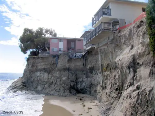
Of course not….ground water….claim it rained enough in Australia to lower sea levels….
..and yet quadrillions of tons of sediments are washing into the oceans every day…everything from rivers to eroding coastlines…..and mud doesn’t displace water??…..erosion is more constant
http://peakwater.org/wp-content/uploads/2012/04/gulf_bloom.jpg
Available immediately: Beach front property, with included diving platform….
Diving platform?
Maybe at high tide.
But probably only good for 1 dive. 😎
Without personally having any knowledge whatsoever in this field I can only say that you appear to have provided an understandable and seemingly comprehensive roundup of what is known, what is guessed at and what is yet to be determined. Excellent article. Thank you.
Water is only one factor. There are several factors, to meet the growing population under high tech needs, we are extracting from the earth, we are destroying the coastal zones, natural disasters like earthquakes, volcanoes, testing of nuclear devices, etc. play the role in the changes of sea level. Is there a way to differentiate the impacts of all such events?
Dr. S. Jeevananda Reddy
Appreciate the great article and links. Submarine discharge has been mentioned (mostly in ignoring the possibility) in all these worries about nitrogen pollution (fertilization). Barrier islands often have a potable water lense which makes one wonder about non-point seepage.
Would you expect submarine discharge to have any effect on sea level? Ground subsides, but is still replaced with seawater.
Another source of subsurface water is oil production. In some worst case oil fields 99% of the production is water with 1% being oil. In western countries, onshore most of this water is reinjected. Offshore and in third world countries it is frequently discharged on the surface. As a wild guess I would say that 4 times more water is produced in any given year than oil. Onshore reinjection of water became more common in western countries in the 70’s.
Oh, the infamous sea level budget. The sea level budget as determined from the adjusted satellite sea level rise estimate. They only way the budget is balanced from the satellite numbers is that glaciers are melting.
If one uses the tide guages instead, there is essentially no melt from glaciers.
Obviously, there is truth and there is an AGW theory adjusted data explanation. Just like there is in every single facet of this debate. Nobody wins when the data is adjusted and made-up.
+1
“Greenland gained about 50 billion tons of ice in 2017 which should have lowered sea level in 2017.”
How do we know that the volume of the 50 billion tons that was extracted from the sea level wasn’t compensated for by a nearly equivalent amount of sea level rise being isostatically displaced by Greenland itself? What effect do earth’s contents have on sea level as they all float on the molton mantel?
Time.
It takes time for any isostatic movement, either up or down to occur, therefore with that logic, the snow may well accumulate in the short TIME but the effect of the addition (or subtraction) has a significant TIME lag component.
GIA has both elastic and inelastic components, the one being instantaneous and the other slow.
As an example of this, N. America is still adjusting to the melting of the ice caps, which ended thousands of years ago.
Having been the liaison between my agency and the South Florida Water Management District off and on for a couple of years I found this essay very enlightening. South Florida suffering from saltwater intrusion and Miami Beach flooding both because of sea level rise are now preached as gospel. Both totally bogus! I served as liaison during one of the worst droughts to hit Florida. The SFWMD was down to considering rules that would restrict how many showers people would be allowed per week. Yet their real concern was saltwater intrusion due to the excessive withdrawals taking place at the time. They worried that even with their extensive coastal canal system would not function as they hoped. Besides draining wetlands the canals directly adjacent to the coast were constructed to mitigate saltwater intrusion. Meanwhile off shore along the West Florida Shelf there are lots of well known freshwater springs. In the Panhandle that water appears to come from as far away as Georgia and Alabama.
Very interesting article and many thanks for writing it. I will be revisiting it and the references myself. I do wonder as to the estimates of aquifer volume since they don’t match my Freeze and Cherry textbook (1979), which estimates in Table 1.1 that at least 60 million km^3 of fresh water resides in the world’s shallow aquifers (equivalent depth of 150 m). When brine and saline aquifers are included, that estimate is likely in my opinion at least double. The residence time estimates are consistent between that reference and your article. I’m going to share with some of my fellow hydrogeologists. I do doubt the arguments that El Nino can account for groundwater fluctuations globally, since it doesn’t account for river fluctuations globally or even for most regions. But I’ll look at the references more closely.
El Nino fairly clearly influences sea level.

The current take on this from Boeining et al (2012) is that Ninos cause more rain to be dumped back into the ocean, while Ninas cause rain to fall over land (in spite of causing drought in the Amazon and Congo).
Their mass balance looks like this:
Thanks gymnosperm. Interesting, but what is the reference for the first image? Regarding the equally interesting Boening et al. article, if I haven’t glossed too quickly, the mass balance image is only cited to attribute for a small fraction of the terrestrial landmass. A later figure in that paper does compare changes in terrestrial water storage (TWS) to changes in sea level over time, but again only uses a small fraction of the continental areas. And it doesn’t compare that to any flavor of ENSO. My comment was that ninos don’t likley correlate with global groundwater fluctuations. Also, there is no direct mention of groundwater in the Boening et al. paper. I still appreciate and will read more but would like to know the reference for your first chart even if not peer review.
The first image is from the University of Colorado sea level group. http://sealevel.colorado.edu/content/2015rel4-gmsl-and-multivariate-enso-index
The mass balance is from GRACE, and various versions can be found online. The general idea is that most of the water gets dumped on Australia and northern South America, a small fraction of the land surface.
I’m not completely convinced, but if it is true that Ninas divert rainfall onto land to the extent that sea level falls, TWS would surely be affected in some way.
https://www.google.com/search?q=enso+sea+level&source=lnms&tbm=isch&sa=X&ved=0ahUKEwj02sqph9PZAhVX1IMKHYFyDI0Q_AUICigB&biw=1360&bih=588#imgrc=XyRxWww4gDyjeM:
Humans don’t just pump water from aquifers into the ocean. We cycle it. Much goes to the atmosphere through agricultural evaporation and transpiration. In desert urban areas, golf courses, landscaping, and swimming pools add to evaporation and transpiration to the atmosphere, as well as evaporite basin groundwater recharge.
A complicated subject that very much needed bringing forward. Thanks.
Considering that the moisture in the air during an El Niño event comes from evaporation of the ocean, how exactly does that evaporated ocean water raise sea level when it falls back where it evaporated from?
Sounds to me like claiming that if I take a bucket of water from the ocean, then pour it back into the ocean, I am contributing to sea level rise.
Ha ha, good question. I believe Jim Steele means that “more slowly discharging aquifers” are for all purposes storing that water for a time. Groundwater hydrologists are gainfully employed around the world factoring in the rates of recharge to, the rates of transport through, and the rates of discharge from aquifers. Along with that they actually factor in “aquifer storage” which represents the capacity of the porous aquifers to store and release water according to expansion and/or contraction of the matrix (not to mention simple rising and falling of the water table). Many aquifers don’t even discharge to the oceans but rather directly to the atmosphere via “atmospheric sinks” exemplified by desert lakes and playas such as at Devil’s Hole Nevada. Those are captured in this post by the reference to endorheic basins but the discharge to the atmosphere does not appear to be factored and in any case it may be minor in the big picture. Also, another minor blip would be the contemporary artificial coastal groundwater recharge efforts to prevent “seawater intrusion”. This activity is due to groundwater levels that are dropping along high population coastal regions due to extraction. They pump water out of the ground and (nature abhorring a vacuum and all) the sea water rushes in to fill the void. The municipalities respond by aggregating their treated sewage and other wastewater and re-injecting that cocktail along the boundary between saline seawater and “fresh” groundwater, A never ending and costly battle that nonetheless can pay dividends.
Evaporation in terminal lakes renders ground loss negligible. –AGF
The Aral Sea is just a fraction of their former self 100 years ago due to diversion of inflowing fresh water to irrigation. The Caspian Sea is immense and makes Utah’s Great Salt Lake tiny in relative comparison.
“Will Advances in Groundwater Science Force a Paradigm Shift in Sea Level Rise Attribution?”
No. No money in it.
As interesting as all the articles are on this site, this rates right up there with the best.
Whats more, I could actually follow along for the most part, something not always possible when knowledgeable people share that knowledge.
Well done Jim.
Very interesting and informative post.
Smith et al 2014 suggested that without evaluating the subglacial processes the models could be overestimating the Greenland supraglacial meltwater contribution to SLR. I wonder if the groundwater dynamics could be a part of that equation.
http://www.pnas.org/content/pnas/112/4/1001.full.pdf
Until we have a much better handle on isostatic continental and sea floor adjustments, and how those may be changing over time, we will be at best guessing when trying to figure this to mm per year changes. I suspect that that the oceanic basins are always in a state of flux depending on the amount of water that has been in them historically, and not knowing the time delay to isostatic adjustment from less water (ice age condition) to a more full supply level (such as our interglacial modern era), we may still be responding to oceanic crustal conditions from not that long ago ice house conditions. We still see significant continental isostatic uplift from the missing weight of continental glaciers, and therefore we should assume that the additional water inflow to the ocean basins is also causing isostatic subsidence due to the weight of the excess water as compared to just 15,000-20,000 years ago when that water was locked away as ice on (thicker crustal) continental land masses. As always, it appears this is a multidisciplinary area of study.
It is a fascinating subject, and a very well written post that helps all us better be able to understand our own area of knowledge better. There sure is a lot to know about a lot of things, if one if to be able to even begin to fully understand how our planet really works in detail. One thing is certain throughout all of this study and debate, and that is how important it is to collect accurate and truthful data without a preconceived bias as to how that data should be interpreted. If we collect honest data and preserve that, I am sure in 10, 20 and 50 years from now, that we will be able to piece this information together much more accurately than now.
There are so many factors involved in sea level; that attributing any one factor as being the most important is folly. Based on just the fact that all major rivers flow to the sea would lead one to think that of course the oceans are rising but then you have precipitation, tectonic plate movement, earthquakes, volcanoes, surface melt, groundwater leeching ,measurement error…………………….. etc
I forgot evaporation and maybe even the sun causes sea levels.
The lunar nodal cycle is almost never mentioned in sea-level studies.
The dominant cycle is 18.6 years and the average amplitude is about 22 mm, about 1,2 mm per year at the Netherlands.
Baart, et al. (2012) The Effect of the 18.6-Year Lunar Nodal Cycle on Regional Sea-Level Rise Estimates
https://tinyurl.com/ybmwbsey
From your link: “Although the nodal tide does not affect the true global mean
sea level, it can affect global mean sea level estimates.” As I understand it, the issue is with sampling frequency, like a 2kh sampling rate of a 10kh frequency. –AGF
Earth is a cold planet
Saturday, January 13, 2018
To know WHAT the human being DOES NOTHING CHANGE THE CLIMATE! NOTHING !
The climate is what? It is global cold that receives two heat sources: The sun (seasonally) and the volcanoes (continually). It is these millions (billions?) Of submarine or oceanic volcanoes that warm ocean and ocean currents in perpetuity. The GolfStream takes these degrees to Iceland, England and the Brittany coast (among others) where they go back to the beaches and soften the atmosphere.
Without these hot springs several thousand meters deep we would be ALL FREE!
It is these heat discharged back to the surface that are carried away by the JetStreams far off the land and not the sun’s rays of the equator transported to the poles for thousands of kilometers! Hahahaha!
It is not the sun that has momentarily gone out when our globe has experienced long icy periods, but only a lesser or absent global volcanic activity, because the sun was not farther away than before, veiled or masked by another planet!
In addition to these magmatic ‘mood movements’ are the planetary cycles. Currently we are in the cooling cycle. Colder and longer winters and shorter summers.
For millions of years there are billions of km³ of fresh water (from rains, rivers & rivers) that have poured into the seas & oceans … WITHOUT WHERE THEY DO NOT UP !! ! That’s it! Quite simply because water continuously seeps into the ocean and sea floors to the magma where this poisonous soup (the fish shit in the sea!) Is heated / boiled and goes up (as in a coffee maker) to the sources (hot or cold depending on the altitude) and towards the water tables it fills.
It is the same for expelled hydrocarbons that can be burned without loss (like those of volcanoes) because, ALL gases are recycled. ALL! (If it was not the case, the animals would not have even appeared on Earth!).
https://huemaurice5.blogspot.fr/2017/12/est-ce-que-40-000-volcans-sont.html
https://huemaurice5.blogspot.fr/2015/03/les-volcans-sous-marins-finalement-pris.html
https://www.ventusky.com
https://huemaurice5.blogspot.fr/2018/01/la-terre-est-une-planete-froide.html
Can these be assumed negligible?
The weight of water in recent increased vegetation growth and water content?
Pulses of rock metamorphism either releasing or containing deep pore water?
The Russian super-deep borehole on the Kola peninsula found unexpected free water to depths of several km, but I cannot recall volume estimates. Geoff.
Thank you Jim Steele.
The history of sea level change provides yet another tragic example of the misuse of accuracy and precision in climate studies. If proper bounds of these had been put on the various contributory parameters from the start, the lack of closure would have been evident. Responsible workers would or should have then refrained from damaging advice that led to policies that should not have been considered. Geoff.
Interesting that the Gregory abstract ends with this sentence:
“Semiempirical methods for projecting GMSLR depend on the existence of a relationship between global climate change and the rate of GMSLR, but the implication of the authors’ closure of the budget is that such a relationship is weak or absent during the twentieth century.”
I know that this must be true, for the Bible tells me so.
“a river had come up from the earth and watered the whole face of the ground —”
— Genesis 2:6 (trans: Richard Elliott Friedman)
So, you’ve never heard of artesian wells? Or freshwater springs? Huh. Oh, well.
I think the real issue is not groundwater’s contribution to sea level this/that, but rather the minute measurements involved.
A millimeter is one thousandth of a meter. A meter is 3.3 feet. Which brings me to the measurement of 0.0## millimeter, a nearly microscopic level that is invisible to the naked eye without the use of a magnifying glass.
To use the term ‘budget’ in regard to water levels and then refer to measurements in thousandths of a millimeter, something that is next to invisible, is drivel..
I simply cannot take this sort of thing or those researchers seriously.
Referring to that picture of the groundwater level, trees and stream, one thing that recently surprised me about groundwater was that when lake Superior was 3 feet below normal around 2012, maple trees within a couple hundred yards of shore started drying out and dropping leaves in July. The maple tree roots must barely touch the top of the water table and any significant and fast water table drop left them high and dry. Here we were on the shore of Superior pumping water to several trees on the property to keep them from dying of thirst …. water, water everywhere and not a drop to drink.
Now the lake is a few feet above normal and everything is getting plenty of water.
This is a very interesting article. Many thanks.
The Cazenove 2014 paper is problematic. Her goundwater explanation for the sat alt deceleration is geologically impossible: not enough rain in Australia, and the Amazon and Congo basins are seasonally saturated and cannot store more groundwater. Most likely explanation is just Jason 2 instrument drift. Illustrated a d explained in essay PseudoPrecision,
That said, a terrific post on yet another unsettled corner of climate science.
I enjoyed the essay but as a skeptic I have to ask so what?
So what?
I started out my engineering career using a slide rule. So what is an important question. Small changes in water temperature can have a large affect on pressure inside a pipe or the power level of a water moderated nuclear reactors.
Humans have populated every corner of the world by wearing animal skins and rubbing two sticks together to create fire. We have adapted to large fluctuations in temperature and water levels of a matter of hours. Very small changes over a long period of time is not significant.
The proper response to various forms of the precautionary principle is BS. For example, some say we do not know how to handle spent nuclear fuel, my response is we have spent billions to show how to do it. They say the Colorado River and the drinking water for millions will be contaminated. Science says ground water flows to death valley and will take a couple of ice ages to get there (hundreds of millions of year) and will not change background radiation.
There are people who make a living fear mongering. Not only do they waste billions but they distract from those who point out legitimate concerns.
Hi Kit P, I worked as a groundwater hydrologist and hydroclimatologist on that “spent nuclear fuel” project (Yucca Mountain Project).. and learned a lot in the process as well. I don’t know about the 100s of millions of years, but you are certainly right that the groundwater cannot ever naturally reach the Colorado River, but rather flows from the site to Death Valley, an endorheic (closed) basin. By the way much of the Colorado River is artificially diverted towards Southern California purely for the purpose of injection into coastal aquifers to delay/retard sea water intrusion. When PP (Precautionary Principle) types moan about about climate change and Lake Mead’s bathtub rings, they fail to disclose how they are the ones who are draining that bathtub, not for irrigation, not for human consumption, but simply to pour into the ocean at the Los Angeles region, rather than to allow it to reach the Sea of Cortez in Mexico.
Well that, and to keep Long Beach from sinking into the ocean. Not much water really, compared to irrigation runoff flowing into the Salton Sea, which is drying up anyway. –AGF
‘I don’t know about the 100s of millions of years’
Mike is correct and I should be more precise when using geological events instead of years for a time scale. The time scale in 100s of thousands of years.
So what you ask? The purpose of using geology to isolate fission products from people is to protect them from harm. This takes about 300 years.
Another solution is to bore a hole in such a location that the ground water carries fission products into the ocean.
The point is that there are many solutions to even difficult problems. Adapting to small changes over long periods of time is not a difficult problem.
All that water down there, under pressure. and leaking out into the sea. Wonder how much CO2 is it giving out?
An interesting complement to this work might be to factor in the so called global meteoric water line, which attempts to address residence times of moisture which pass across giant continental land masses. As the water precipitates and evaporates often multiple times across those trajectories, the isotopic enrichments play their role.
Has anyone considered the effect of the millions of tons of sediment transported to the oceans by rivers? I know the oceans are large but every piece of solid added to the ocean will raise the sea level, albeit microscopicaly.
Repeating, if I may:
But erosion is eternal yet the continents remain. As the Colorado River cut through and washed the Colorado Plateau into the sea, the (floating) continent rose in an effort to keep the earth more or less round. The river cut right through some mountains as they slowly rose, and the meandering of its tributaries is now preserved in deep meandering gorges. –AGF
Oops. Should have read deeper into the comments and article. My bad.
Always good stuff, Prof. Steele. I’d offer a few points:
1. Modern glacier behavior differs from ice cap melting in several respects relevant here:
2. Glacier melt flows underneath and around the glacier, and reaches the ocean as rapidly as
rainwater. Temperate glaciers (especially Patagonian) have high flow rates; ice has turnover
rates of one or two centuries. That is, they behave much like rivers.
3. As you note, great ice caps depress the land enough to alter drainage basins: earlier the
the Great Lakes flowed into the Mississippi; the Caspian may have once flowed into the Arctic.
4. Ground injection of melted ice under glaciers would of course be constrained by the rate of
ice melt, which would be a function of ground heat flow, not hydrostatic pressure. Naturally
ground surface geology would remain important, as we see in the basin lakes under the Antarctic
Ice Cap, where even with 2 miles of pressure the water has nowhere to go.
5. Endorheic lakes depend on evaporation to send their water to the ocean rather than deep
groundwater, at such disparate rates as exhibited between Lake Titicaca and the Dead Sea.
I have no comprehension of subterranean salt water contribution to the ocean, other than the
negative regional effect of post glacial rebound conceivably sucking up seawater. Could you elaborate?
Thanks, –AGF
What is the normal variance of Antarctic precipitation, and do El Nino events cause a significant increase (or decrease) in ice accumulation? I certainly recall reading a claim a few years ago that unusually large individual weather events/systems in Antarctica deposited amounts of sufficient magnitude such as to be relevant to global sea-level changes.
That doesnt change that ice is still melting and oceans are getting warmer due to anthromorphic global warming. Both of which cause sea level rise.
Anthropomorphic even.
So,if you stop attributing human characteristics to global warming it will stop?!?!?
What about the effects of islands, such as Guam, that are sinking (at risk of even capsizing) due to the deployment of military forces and their equipment on them? Surely we should account for this issue.
I’m surprised that such learned member of Congress wouldn’t see the obvious solution.
Forget Guam.
Freeze a bunch of water with some tree-based carbon (maybe sawdust?). Place all of our military assets on top of and on the bottom of these floating bastions.
That way, if they capsize, we’ll still have our assets in the air!
(That might make sense to this guy. I sure hope it doesn’t make sense to anybody else!)
I have a question about the Gregory paper. Near the end they talk about making an adjustment to the GMSLR for the first half of the 20th century due to “long-term volcanic forcing”. What exactly are they talking about? It seems to me that any volcanic forcing is always short-term, on the order of a couple of years, as the sulfate aerosols and other chemicals and dust get shot into the sky and then slowly get cleaned out. So what exactly is long-term about that? Thanks.
My opinion, any suggestion of a volcanic effect extending more than 2 years is another example of employing a fudge factor to explain what they cannot explain.
Thank you Jim for an excellent article. I recall my geology professor some 45 years ago speaking of ‘new water’ associated with volcanism, water that has never been discharged before as surface water,that is produced by deep geochemical processes. Fossil water. Perhaps this is what is referenced here?
Thanks! Stuff like this always reminds me of dark matter and dark energy–it makes the theories work, but it just screams fudge factor. One wishes they would just come out and say, “there’s something else at work here, but we just don’t know what it is.” And if I was in charge of the money for grants I would feel better about giving money to people who had honest doubts about their level of knowledge in the face of uncertainty…
The discussion here is largely invalid because of a fundamental lack of understanding of the difference between the response time of outflow of aquifers to changed input and the travel time of water through aquifers to the discharge point. For confined aquifers the effect (of changes in input to or pressure conditions surrounding the aquifer) is transmitted to the outlet at the speed of sound as a pressure wave. The speed of sound in water is 1500 m/s so the response at the outlet of an aquifer 100 km away from the recharge site would occur about 0ne minute after the change at the recharge point occurred.
It is quite correct, but quite beside the point, that the water entering the aquifer might take 10,000 y to reach the outlet what is at issue is how quickly do changes at the sources of water for the aquifer show up in changes in discharge – the answer, for practical purposes, is that the changes occur simultaneously.
I should note that for unconfined aquifers the response time is somewhat slower than in confined aquifers because of the effects of the filling or emptying of pores as the watertable rises or falls but the response time is still nearly simultaneous as compared to the trevel time from recharge site to outlet.
Hugh Whiteley
Hi Hugh, I’m glad you decided to weigh in. We are both basin scale hydrogeologists in part at least. I admire the author Steele for exploring this because to my knowledge most groundwater hydrologists have either disregarded (often for good reasons) or distorted ( never for a good reason) and GRACE is a big topic for distortion-discussions some day. For sea levels to fluctuate due to groundwater as you describe, the confined waters would have to raise the bottom of the sea. Or the confined waters would need to stop being confined and then contribute to the overlying water column. Your comment pointed to both. I don’t disagree, but with unconfined of course the actual movement of the water is a factor and then thousands of years or more really must come into play as the “residence” time. Having said that, for unconfined groundwaters to meet the sea, the water would largely have to transition to “surface water” first. That results into widely observed and most classic “free surface” in the water table – groundwater – sloping land surface formulation. And that really shortens (by streamflow) and attenuates (by evapotranspiration) the residence times.
For my part, I’ve drifted a little bit outside of Toth and M.K. Hubbert classical basin aquifer theory. I like to think of the continental masses of groundwater as a more intrinsic part of the ever circulating global hydrosphere. In that perspective, continental masses of groundwater are still impacted by the classic hydraulic head potential, but also are perhaps influenced by Hadley circulation (at least regarding recharge) and by the Coriolis effect. If that could ever be proven (isotopes are a candidate), one would see interesting groundwater motions that may include a vortical effect over a continental scale. Ivory tower thinking and not practical, but perhaps relevant to this guest post by Steele.
All system analysis considering storages and processes of hydrological cycle in toto then only different components and processes and storages share and its effect can be seen…