Guest post by David Middleton

Science News
Fossil site shows impact of early Jurassic’s low oxygen oceans
Date: July 15, 2017
Source: University of Texas at Austin
Summary:
Using a combination of fossils and chemical markers, scientists have tracked how a period of globally low ocean-oxygen turned an Early Jurassic marine ecosystem into a stressed community inhabited by only a few species.
Using a combination of fossils and chemical markers, scientists have tracked how a period of globally low ocean-oxygen turned an Early Jurassic marine ecosystem into a stressed community inhabited by only a few species.
The research was led by Rowan Martindale, an assistant professor at The University of Texas at Austin Jackson School of Geosciences, and published in print in Palaeogeography, Palaeoclimatology, Palaeoeconology on July 15. The study was co-authored by Martin Aberhan, a curator at the Institute for Evolution and Biodiversity Science at the Natural History Museum in Berlin, Germany.
The study zeroes in on a recently discovered fossil site in Canada located at Ya Ha Tinda Ranch near Banff National Park in southwest Alberta. The site records fossils of organisms that lived about 183 million years ago during the Early Jurassic in a shallow sea that once covered the region.
The fossil site broadens the scientific record of the Toarcian Oceanic Anoxic Event, a period of low oxygen in shallow ocean waters which is hypothesized to be triggered by massive volcanic eruptions. The Oceanic Anoxic Event was identified at this site by the geochemical record preserved in the rocks. These geochemical data were collected in a previous research project led by Benjamin Gill and Theodore Them of Virginia Tech. The oxygen level of the surrounding environment during the Early Jurassic influences the type and amount of carbon preserved in rocks, making the geochemical record an important method for tracking an anoxic event.
[…]
Unsurprisingly…
About 70% of the total world petroleum resources are concentrated in the Tethyan realm, the Mesozoic deposits being the most prolific source rocks of these oil and gas reserves. To understand the depositional controls of these organic-rich facies at the scale of the Tethys is a challenging problem. A recent set of paleoenvironmental maps for the Tethyan realm allows integration of source-rock mapping with other mappable geologic information. This integrated approach is attempted here for three short time intervals of the Mesozoic: Toarcian, Kimmeridgian, and Cenomanian, all of which were periods of good source-rock deposition.
[…]
The Tethys Sea couldn’t have been a better place for petroleum source rock deposition even if it had been designed for such a purpose. The “Tethyan realm” encompassed much of the Jurassic and Cretaceous periods…

It’s hard to believe that Earth experienced over 100 million years of anoxic oceans and greater than 1,000 ppm CO2 without human agriculture and SUV’s! It’s a good bet that Chicken Little of the Sea (ocean acidification) was rampant back then too.

Its even harder to believe that life flourished under such conditions!
Note how biodiversity metaphorically exploded during the Jurassic and Cretaceous periods…

Of course… critters living at the bottom of the Tethys Sea right before the Toarcian Oceanic Anoxic Event probably didn’t flourish so well.
As usual, any and all sarcasm was purely intentional.

“globally low ocean-oxygen turned an Early Jurassic marine ecosystem into a stressed community inhabited by only a few species.” And yet somehow we have seen a regrowth of diverse species. Nature ebbs and flows. The alarmists would do well to understand this.
Volcanos do not cause anoxic ocean conditions. A surplus of organic matter ‘raining’ from the aurface, plus a lack of sufficient ocean currents to sir thing up, does. Black Sea is a modern example. Anoxic conditions are necessary for source rock deposition.
Volcanic activity is not a requirement, however, there is ample evidence that volcanic activity can lead to anoxic events.
The volcanic driver is indirect…
http://www.nature.com/ngeo/journal/v3/n3/abs/ngeo743.html
Thanks.
I mention OAE2 and its possible volcanic connections below.
I don’t buy any research that claims any “dead zone” event was global without a lot more data sites analyzed. Show me an extensive dead zone with evidence of extensive water circulation and I’d be willing to change my mind. The study of source rocks really changed my way of thinking on this.
“Hey, look at this wide spread source rock, it’s awesome!”
“Yes, but look at the wide spread deposits above that. Here it’s still a source rock, but 400 kilometers over there, it’s just a normal stratigraphy sequence of sand, shale and limestone!”
— me, arguing with myself over Gulf Coast/East Texas oil accumulations
In other words, dead zones can be local, regional, and yes, perhaps global. Trying to project the research in one to the other requires a lot of data points.
It wasn’t global…
http://oxfordindex.oup.com/view/10.1093/oi/authority.20110803103251494
It wasn’t continuous either. The Tethyan realm is marked by a series of roughly 1 million year long anoxic events over a roughly 100 million year period.
My penchant for sarcasm may have been misleading.
What was the location of the Yellowstone hot spot at the time of these events? If it bordered on a shallow sea it could have leaked sulphur into the water periodically without it ever being airborne (ie. Global)
I don’t think the Yellowstone hot spot can be traced back that far in geologic time.
14 million years ago, it was in the SW corner of present-day Idaho…
http://geology.isu.edu/Digital_Geology_Idaho/Module11/calderas.jpg
I don’t know where it would have been 200-140 million years ago.
One source – http://www.scotese.com/jurassic.htm – shows the location would have been a thin Baja Gulf shallow water. Later pushed up – http://www.scotese.com/late1.htm
Far cry from all the oceans.
The “Tethyan Realm refers to a type of faunal province during the Jurassic and Cretaceous. This faunal province was mostly, but not exclusively, associated with the Tethys Sea. This faunal province was associated with anoxic events.
This particular fossil site is just one example of the Toarcian Oceanic Anoxic Event. It’s not the sum total of it.
The hotspot stays in the same place, as plates move over it. Same for those such as Hawaii and Reunion Island.
That’s correct. It’s just that the Yellowstone hotspot’s trail goes cold at the west end of the Snake River Caldera Chain. As the North American plate drifted west, the calderas moved eastward.
And… Definitely… A formation can be a source rock in one part of a basin and a reservoir in another part of the same basin. My recollection from old East Texas days was that the Woodbine transitioned from reservoir-quality sandstone to deep marine shale (Tuscaloosa).
The location was the inland Sundance Sea at the time.
No Rocky Mountains yet but island arc volcanoes are forming off the coast as North America is getting pushed away from Africa and South America. North America will over-ride these island arcs and the Pacific plate and the Rockies will get pushed up over the next 150 million years.
This shallow inland sea would have been pretty warm, and perhaps subject to very high salinity from run-off depending on exchange with the ocean. Not hard to imagine it would been on and off either jam-packed with life and/or have very little at all because of the geologic conditions.
http://4.bp.blogspot.com/-eetzs87jHNI/UCbl6KZ5XOI/AAAAAAAAFQs/tBK1xGe76pU/s1600/MiddleJurassicMap.jpg
Hence the Jurassic-Cretaceous hydrocarbon “kitchen”…
http://www-odp.tamu.edu/publications/113_SR/VOLUME/CHAPTERS/sr113_15.pdf
The Atlantic was a narrow rift sea at that time (think Red Sea). It isn’t surprising that the deeper basins would periodically have become anoxic.
There are many references associating volcanism with Oceanic Anoxic Events (OAE’s) eg Kuroda et al 2007, EPSL 256:211; Turgeon, Creaser 2008, Nature 454:323, Palfy, Smith 2000, Geology 28 (8): 747 whether they are Mid Cretaceous or Toarcian
David,
I wish you wouldn’t dignify the use of the misnomer “ocean acidification” by using it in your writings. Call the phenomenon what it is, a lowering of pH, or decreased alkalinity. Ocean acidification probably took place in the geologic past, but that isn’t what the situation is today. The invention of the misnomer to describe today’s situation was intended to scare the scientifically illiterate and your use of the term ends up having you carry water for the alarmists. [Nick Stokes: Don’t bother!]
My bad Clyde. I should have used ocean neutralization. At least I did put it in parentheses after calling it Chicken Little of the Sea.
It’s perfectly OK to call it Ocean Acidification if you are willing to say that distilled, chemically pure, water is orders of magnitude more acidic than Ocean water!
Thanks for posting on ocean oxygen depletion zones. It is another example of how activists take a real environmental issue, and then twist it to serve the “fight against climate change.” In the process, attention and resources are diverted away from an issue that can and should be managed (and already is to some extent). I posted some background on this at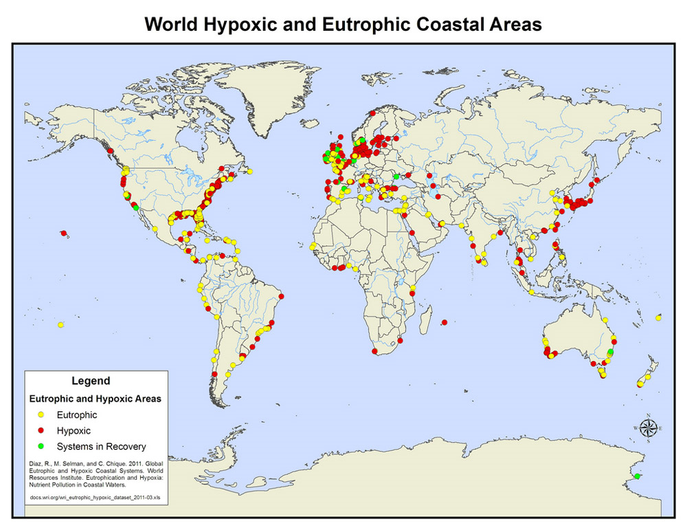
https://rclutz.wordpress.com/2017/02/19/ocean-oxygen-misdirection/.
There is a pollution issue, but nothing to do with CO2.
Just controlling agricultural runoff would go a long way toward reducing the anthropogenic component of hypoxic events.
I believe that controlling agricultural runoff, as well as actions to reduce overfishing, are the primary reasons for improvements in the quality of the Chesapeake Bay. (I live where the South River enters the Bay.)
Good article, but one that tended to need the commentary to clear it up.
OAE (Ocean Anoxic Events) happened periodically during the Mesozoic. Some of them were quite widespread, but probably not global, and the reason they happened is still very uncertain. There seems to be a linkage to the eruption of oceanic LIP (Large Igneous Provinces), i. e. large submarine basalt plateaus, such as the Ontong Java plateau, but the link is unclear.
OAE:s never last very long geologically speaking. They require stable oceanic stratification, i e the bottom water must be denser than the overlying layer and this can’t last for very long. If nothing else geothermic heat will warm the bottom layer enough to cause overturning in a few million years.
The three major OAEs of the Mesozoic do seem associated with volcanism. Naturally, CO2 is generally fingered as the culprit, but other volcanic gases and processes are more likely.
There was also a number of minor OAEs during the Mesozoic, such as this one and others from the Late Jurassic, and many possible in the Cretaceous:
https://www.nature.com/articles/srep01889
The three biggies are described below.
1) The Early Jurassic Toarcian OAE (~183 Ma) is associated with the global Toarcian Turnover extinction, which hit ammonites hard.
https://en.wikipedia.org/wiki/Toarcian_turnover
The Karoo-Farrar eruptions in South Africa and Antarctica have been implicated in this event.
2) OAE1a: The Aptian event (~120 Ma) was preceded (~130 Ma) by eruption of the High Arctic Large Igneous Province (HALIP), which continued long after the OAE. It’s not immediately obvious how the HALIP might have affected the Tethys region. The mighty Ontong Java Plateau eruption also started around 120 Ma.
As with the later Cenomanian event, dating the Aptian event isn’t precise yet.
http://www.sciencedirect.com/science/article/pii/S0012821X08002215
3) OA2: The Cenomanian-Turonian boundary event (c.93-94 Ma, but possibly a bit earlier) was followed eruption of the Caribbean large igneous province, which has been fingered as a possible culprit. During this OAE, marine reptiles, ie pliosaurs and possibly ichthyosaurs, went extinct in the seas and the semi-aquatic spinosaurs, the largest theropod dinosaurs ever, on land. Other animal groups lost some diversity as well. Whatever the cause, much if not all of Earth’s oceans were starved of oxygen for nearly half a million years, causing the extinction of approximately 27% of marine invertebrates.
These associations could just be coincidental, since during the breakup of Pangaea, there were liable to be submarine flood basalt eruptions happening most of the time.
The HALIP seems a bit weak for a LIP. True there is a lot of dyke swarms, but not a trace of a basalt plateau like other LIPs.
I also wondered why it’s called a LIP, but there it is right there in its acronym.
The Ontong-Java eruption seems a likelier culprit for the Aptian OAE.
Very interesting. When Forbes postulated his Azoic Zone, it seemed reasonable absent the mechanism to get oxygen to the deeps. There is little oxygen that can be dissolved in seawater under the best of conditions. The anaerobic area off Louisiana also has a small rapidly growing and reproducing anaerobic tolerant dwarf surf clam, Mulinia lateralis, which is an important food for offshore bluebills (scaup). It is a temporary area, principally a function of stratification, quantitative aspects dependent on input of nutrients and organic matter and a complex of bottom metabolism.
Shrimpers, confirmed by a couple of studies, long ago knew that shrimp and fish concentrated close to the area, probably obtaining nourishment, especially when conditions, such as storms, or turnover from northers in the fall, provided a little oxygen. The fungal/bacterial (and even some animal types like nematodes, not sure about tardigrades) anaerobic community is not very attractive looking, but apparently a little studied source of food for fish and crustaceans. It probably selects more for pelagic types, is not at all dead, but can kill fish when trapped close to shore by upwelling, which ironically can increase bottom oxygen.
This makes me wonder about something I’ve observed when fossil hunting. I enjoy the hobby along the banks of the Trinity River in Tarrant County (Fort Worth), where the Austin Chalk is the surface formation. The Austin Chalk is well known throughout the state, where it is usually found much deeper, and it is one of the most prolific mezosoic producing formations in the state. (cretaceous, iirc)
The Austin Chalk is an extremely thick formation, in places 1000 feet thick or more, but when it is on the surface and you can look at it in an exposed river bank, there are hundreds of small dividing layers that can be picked out. What I have found is that most of these are relatively fossil poor – the odd snail shell here and there, other things. And then you will find a layer only about 2 feet thick which seems almost plated with ammonites and other lifeforms of the time. (ammonites being the most common) It’s as if the sea bed for the period of time to make up that sub-strata was just covered with dead ammonites a couple feet thick or so, plus other stuff. (some really awesome mosasaurs have been found in this formation near Dallas) and then, a little bit up, the chalk goes back to the plain old rather dull formation without much to find in it. There isn’t just one of these sublayers, there are several.
It makes it fun as a fossil hunter to spot these, because once you figure out the relative location of this sub layer, you can figure out where it will be in other locations and you’re always guaranteed a good find or two. But I wonder if these layers are related to what’s being discussed in this post.
The layering is due to changes in depositional environment over geologic time. In this sense, they are highly related.
http://northtexasfossils.com/fieldtrips/2008-05-24/05-24-2008-023-800.jpg
http://northtexasfossils.com/austin.htm
In most of Dallas County, the bedrock is Austin Chalk, with lots of outcrops…
In Las Colinas/Irving, the Eagle Ford shale is often the bedrock. More foundation problems there than in Dallas.
The famous little mosasaur fossil Dallasaurus turneri is found in rocks a few million years older than the Austin chalk (~85-89 Ma). It’s important in understanding the history of mosasaur evolution.
https://en.wikipedia.org/wiki/Dallasaurus
It’s possible that mosasaurs evolved in the Late Cretaceous Western Interior Seaway of North America, from land lizards.
test
This Post made me wonder about something I’ve observed when fossil hunting. I enjoy the hobby along the banks of the Trinity River in Tarrant County (Fort Worth), where the Austin Chalk is the surface formation. The Austin Chalk is well known throughout the state, where it is usually found much deeper, and it is one of the most prolific mezosoic producing formations in the state. (cretaceous, iirc)
The Austin Chalk is an extremely thick formation, in places 1000 feet thick or more, but when it is on the surface and you can look at it in an exposed river bank, there are hundreds of small dividing layers that can be picked out. What I have found is that most of these are relatively fossil poor – the odd snail shell here and there, other things. And then you will find a layer only about 2 feet thick which seems almost plated with ammonites and other lifeforms of the time. (ammonites being the most common) It’s as if the sea bed for the period of time to make up that sub-strata was just covered with dead ammonites a couple feet thick or so, plus other stuff. (some really awesome mosasaurs have been found in this formation near Dallas) and then, a little bit up, the chalk goes back to the plain old rather dull formation without much to find in it. There isn’t just one of these sublayers, there are several.
It makes it fun as a fossil hunter to spot these, because once you figure out the relative location of this sub layer, you can figure out where it will be in other locations and you’re always guaranteed a good find or two. But I wonder if these heavy fossil layers are related to a low-oxygen die-off in the shallow ocean that covered the area at the time.
Interesting word Euxinic. It specifically means “pertaining to the Black Sea” since the current Black Sea below a certain depth is anoxic -presumably due to restricted circulation. Now Euxinic has come to mean anoxic The word Euxinic in Greek means hospitable referring to the natives of that region in Greek times. Curious how the word can change its meaning by 180 degrees. Just like Skepticalscience.com I suppose
The meaning has changed even more than that. The original Greek name for the Black Sea was the “Inhospitable Sea”, but after colonization, local Greeks started calling it the “Hospitable Sea”, ie Eúxeinos Póntos (Εὔξεινος Πόντος). It’s also possible that the original name came from a Hellenization and corruption of the Iranian name, which meant “dark-colored”.
In antiquity, the four directions were associated with colors, ie black or dark for the north, red for the south, white for the west and green or light blue for the east (many ancient languages don’t distinguish among green, blue, gray, etc). Hence, Black or northern Sea and Red or southern Sea.
The Ottoman Turks called it the Black Sea.
Not only restricted circulation. There is a lot of big rivers draining into the Black Sea (Donau, Dnestr, Dniepr, Don, Kuban…) which means that the surface layer is considerably freshened which strengthens stratification.
The Baltic is a somewhat similar but less extreme case. Incidentally parts of the Baltic was anoxic during the Eemian interglacial too, so it is a natural phenomenon.
The Baltic is shallow, lacking even tides.
During the Eemian however, it was bigger and connected to the Arctic Ocean.
http://1.bp.blogspot.com/-UlTrmvsmScg/TlPAT4mTV8I/AAAAAAAAAyA/Oz1js8NE2Z8/s1600/EemianGlobe.jpg
I always assumed that source rock facies deposition depended on an anoxic environment . I assumed that in most of my areas of study as an oil and gas explorationist these were locally constrained. The Kimmeridge Shale ( Upper Jurassic Kimmeridgian in age) in the North Sea where deposition is Mainly confined to the N Sera rift proper. However it does spread beyond that into the Weald and Wessex Basins of South England, and .Presumably Tethyan intrashelf basins. The main oil source rock in Saudi is the Callovian to Kimmeridgian Tuwaiq Mountain Formation, another Tethyan Intrashelf basin, as is North and West Australian pil source rock. Do these then comprise a set of coincidentally local restricted basins or is there a global driver? The Lower Jurassic Toarcian source rock -The Posidonia shale is also well represented as an oil source rock in Europe and is a target for fracking in the Wessex and Weald basins as well as the Paris and Netherlands basins. AS regards Cenomanian to Turonian sources in the South Atlantic, I have always assumed them to be global phenomena as I think the Atlantic by then was well enough developed to be somewhat more than a rift basin. U Cret shales of similar age are source rocks for giant oil fields in the Persian Gulf Kuwait, and Iraq fields supporting a more global explanation for this
Good article David.
Real environmental issues always put in perspective the chicken little alarmist scams.
Don’t they use the term “ventilation” to describe the transport of oxygen to the deep ocean by overturning circulation? This is one positive aspect of a glacial world with iced up poles, that powerful cold downwelling at the poles provides oxygenated bottom water and ventilates the world’s deep oceans.
I guess that’s why whales recently evolved following the formation of Antarctica, and grew to their current massive size only during the Quaternary. The cold driven vertical circulation and nutrient upwelling fuels the vast krill zooplankton swarms that whales chow down on.