A new study from USGS by Keven Gallo and George Xian verifies what we’ve already learned and published on via the Surface Stations project; that concrete and asphalt (aka impervious surfaces) have increased near weather stations that are used to monitor climate. In this case, it is the much studied USHCN, that climate network I presented a poster on at AGU 2015. Details here.
What is most important about this paper is that it quantifies the percentage of stations that have had increased amounts of impervious surface area getting closer to the stations. As I have long since maintained, such things act as heat sinks, which increase the night-time temperature when they released the stored energy from the sun that was absorbed during the day as infrared, warming the air near the thermometer, and thus biasing the minimum temperature upwards.

In this study, they have observed over 32% of the USHCN stations exhibited an increase in impervious surface area of ⩾20% between 2001 and 2011. When the 1000 m radius associated with each station was examined, over 52% (over 600) of the stations exhibited an increase in ISA of ⩾20% within at least 1% of the grid cells within that radius.
What this suggests, is that like Las Vegas, which has had huge infrastructure boosts in the last 50 years, that the minimum temperature is creeping upwards, and that biases the mean temperature used to look for the “global warming signal”. NOAA would do well to remove stations that have been encroached upon like this, but they stubbornly hold onto this flawed data, insisting they can “adjust” it to be accurate. I say bollocks to that. Since the USA is so highly over-sampled with thousands of weather stations, it is far better to discard noisy and imperfect data, and use only those stations that have not been biased by infrastructure increases, but retain only the best stations with pristine data.
This is what you get when we did exactly that, and found a statistically significant lower 30 year trend.

Here is the new paper:
Changes in satellite-derived impervious surface area at US historical climatology network stations
Kevin Gallo, George Xian
Abstract
The difference between 30 m gridded impervious surface area (ISA) between 2001 and 2011 was evaluated within 100 and 1000 m radii of the locations of climate stations that comprise the US Historical Climatology Network. The amount of area associated with observed increases in ISA above specific thresholds was documented for the climate stations. Over 32% of the USHCN stations exhibited an increase in ISA of ⩾20% between 2001 and 2011 for at least 1% of the grid cells within a 100 m radius of the station. However, as the required area associated with ISA change was increased from ⩾1% to ⩾10%, the number of stations that were observed with a ⩾20% increase in ISA between 2001 and 2011 decreased to 113 (9% of stations). When the 1000 m radius associated with each station was examined, over 52% (over 600) of the stations exhibited an increase in ISA of ⩾20% within at least 1% of the grid cells within that radius. However, as the required area associated with ISA change was increased to ⩾10% the number of stations that were observed with a ⩾20% increase in ISA between 2001 and 2011 decreased to 35 (less than 3% of the stations). The gridded ISA data provides an opportunity to characterize the environment around climate stations with a consistently measured indicator of a surface feature. Periodic evaluations of changes in the ISA near the USHCN and other networks of stations are recommended to assure the local environment around the stations has not significantly changed such that observations at the stations may be impacted.
http://dx.doi.org/10.1016/j.isprsjprs.2016.08.006
Kevin Gallo is the Corresponding author at: USGS, Earth Observations and Science (EROS) Center, 47914 252nd Street, Sioux Falls, SD 57198-0001, USA.
Note from Anthony: Full disclosure, I was an invited reviewer for this paper, and I submitted reviews that caused improvements (according to the editor) to the paper.
Oops! Surprise!
That now defuncticated UAT “weather” station is what I use for my desktop wallpaper. It reminds me that that there is nothing wrong with urban heat islands, or measuring the Temperature there, so long as you don’t use that Temperature to represent some place 1200 km away from there as Jim Hansen seems to think is ok.
One Yamal Charlie Brown Christmas tree, does not a climate map make.
Same goes for thermometers on air field runways, used to measure the air Temperature over the runway. That’s what pilots want to know to determine if it is safe to take off with their current plane load. The don’t give a hoot about global climate; they just want to know the weather around their intended flight path.
G
And congratulations Anthony for finally being recognized as a Citizen Research Scientist.
When grass roots are replaced by concrete blocks (literally), crap happens.
G
Good! An attempt to quantify UHI.
Better late than never!
Credit to Tony where credit is due for beating the drum on this stuff.
A case can be made that it is the reason for the difference between satellite / balloon and surface temps. But since the people who “own” the surface stations are also the same people “homogenizing” the data they will NEVER acquiesce. NEVER!
The road to hell is paved.
No wonder it’s so hot eh?
And how does this affect the bible story? maybe it’s not so bad down there after all, is the heat actually an example of the IIE (Inferno Island Effect) created by paving the Road to Hell?.
Not the same. Good intentions are not impermeable. 😉
(It’s not from the Bible, Jon.)
“The road to hell is paved with good intentions”
The expression is often attributed to the Cistercian abbot Saint Bernard of Clairvaux (1090 – 1153).
Well it’s not so bad there now anyway.
You can’t get that close to the fire, because of all the lawyers there.
g
You need good intentions to pave the road to hell. I seriously question whether the Watermelons have good intentions.
…I agree, most are just trying to buy atonement for their past and present personal sins by making everyone else pay the cost, while they still fly around in jets, drive their SUV’s and party on their 100 ft. yachts in exotic locations….! The liberal Elite have no moral ground to stand on…
SMC — You win best comment. — Eugene WR Gallun
+1000, SMC.
The road to hell is paved with collectivist intentions.
I always thought the road to hell was paved with lawyers?
[No. No. The road to should be paved with lawyers. (But they wear out too fast under traffic.)
Good intentions never wear out, never fall apart, and are infinitely renewable. And infinitely costly. .mod]
A 100 ft. yacht is passe these days.
You need about a hundred metres to be in contention.
g
Warmists need it paved. Easier and faster to get there when they die.
As far as I am concerned, legitimate temperature recording stations used for temperature data purposes, should all be rural.
But there’s no Starbucks near rural stations.
There’s always a Denny’s, and an Arco Gas station, and a Burger King at any legitimate weather station.
g
Verdamnis ! I forgot the Motel 6.
g
If not a Denny’s it’s a Waffle House.
Dunkin Donuts in New England.
Dairy Queen or nothing. The Texas Stop Sign.
Sole problem – rural areas getting ever more plastered with windelecs.
Although it is not as widely discussed, even rural stations have their issues. Intense farming changes in land cover can have effects that are just as serious as UHI when you are attempting to understand weather changes. Shifts from sod to plowed land, from grazing to crop land, from dry crops to irrigated crops are all problems.
Excellent point duster! And even micro climate changes occur. Our station witch was wide open just a few years ago now has changed because in our area farms have disappeared and housing with new landscaping have changed wind patterns ( Not by a lot but changes can happen even in rural areas).
Can station witches control the climate?
And ONLY rural!
There have been many changes in rural practices that have an arguably large an effect on local temperatures as urban changes. Increases in irrigation, changes in irrigation practices (eg flood to drip), field drainage, hedgerow and tree removal, double cropping to name some. Only pristine locations far from buildings and agriculture can give an accurate picture of temperature changes due to the global climate, and the reality is there are very few such locations.
Will the Watts study be published?
It’s published here and there are a lot more real scientists AND reviewers here I am sorry to say! Hell, I cite it in all of my presentations cause I trust the source more than any hockey stick, spaghetti or not 🙂
So, they verified (and somewhat quantified) something that was already known to anyone that was paying attention.
Maybe co2islife finally got to them.
How did we get so far along with the climate stations without any reasonable standards?
We had very reasonable standards. The problem was that few people were following them.
Do they “Compensate” for the fact that some stations are no longer in the complete open. On a recent trip I noticed a station near a rural airport that had trees that were about 25 years old within about 100 yds. Would not these trees reduce airflow around the station and affect the data?
They “compensate” by adjusting the current temperatures upward and older temperatures downward.
Ha ha, Duh!
They don’t even compensate for the fact that some stations are no longer.
Since 1850, the number of weather stations in the arctic (north of 60 deg. N Lat.) has gone from a few up to many and back down to not so many.
No wonder the surface numbers are rather worthless.
G
Good on you Mr. Watts. You’ve been pointing this out for quite some time. I wonder how the Watermelons will react to this… or will they conveniently ignore it?
I’ll take Door #2, SMC.
Well, it is faster than the Vatican at responding to Captain Obvious Science. I guess the little agencies and outposts did not get the memo and required training sessions from the political agents.
I was involved in CRD (climate-responsive design) research 20+ years ago. We found that a 200mm thick masonry block wall adversely exposed to the sun at 19°S,eg from early afternoon onwards, would continuously re-radiate heat on the reverse side of the wall (a residential interior) for seven months.
A) is your 19 deg. the same secret as Richard C. Hoagland’s magic 19 deg. or izzit something else ??
B) How do you stop the sun from coming around again tomorrow, so you can track the re-radiation for the next seven months ??
g
Why was the USCRN created in the first place? Simple, previous weather network stations fail to pass citing criteria/standards. Aggregated data are so poor that no amount of “correction” is possible. That is why the US Climate Reference Network was created to provide the kind of long term surface temperature data that are needed to assess climatic changes over time.
The same observation applies to Europe, most data are bad. When you eliminate the corrupt data then the long term “global warming” vanishes. There are a few good surface stations. They show no warming.
http://hidethedecline.eu/pages/ruti/europe/western-europe-rural-temperature-trend.php
Another example are the Antarctic science stations that have good quality data since 1958, they also show zero warming. Eg. Amundsen-Scott, Vostok, Halley and Davis.
This is also why temperature measuring satellites and ARGO flouts were funded.
Unfortunately, this more accurate data proved embarrassing to the political party propaganda line, and was at first ignored, then later discredited and attacked.
See: Karl, et al.
It does seem to be a while since we had any update on the progress of USCRN here at wuwt Anthony.
Well the global Temperature has remained between 12 deg. C and 22 deg. C for the last 600 million years, so why do we continue to measure it at all ? That is a perfectly comfortable Temperature range.
g
“so why do we continue to measure it at all”
It gives climate scientists something to do.
Yet even with this know encroachment that drives the measured temperatures only up, they still feel it’s necessary to adjust those temperatures even higher???
Here in Houston the “official” temperature is taken at Bush Intercontinental Airport. Temperature is always 5-10 degrees higher than where I live in Webster.
…If NASA only used the daytime highs for calculating “GloBull Warming”, there would be none to see ! How can warmer nights be bad ? ( I acknowledge that I live in Canada, so my opinion may be a little bias)
Its the same as the old USSR adoption of the data ? from Lysenco regarding the growing of wheat. Being Green is now Big Business, with the taxpayers money being used to keep it going.
Perhaps Trump if elected will close it down ?
Michael Elliott
“ts the same as the old USSR”
There is actually a climate version of this: as a centrally controlled economy, the amount of coal a city would get was determined in Moscow. So, if your city was thousands of km away…you goosed the temps down a bit to get more coal….
Good analogy. The Soviets were masters of beating the system until it collapsed. A lesson many of learned but not enough.
This time it’s going to work, because better people are going to be in charge.
Or so I’ve been told.
It’s the concept of some people being in charge that worries me !
I don’t have a need for anyone to be ” in charge ”
G
Wow, someone actually did the scientific thing and examine (and replicated) someone else’s results. Congrats to you, Anthony.
Unleash the adjustment teams in Asheville and instruct the legions of bias to just ignore it.
The adjustment teams in Asheville will find a way to adjust the temp trend “up” again as a result of this study. This is what they do with any new information.
Well, duh.
If only some private party had researched this years ago! Oh, wait . . . .
White Knight Anthony Watts get an armor polish. — Eugene WR Gallun
this ole hillbilly live in downtown of a town of 5000 in appalachia, it didnt require study to notice it was cooler out in the hills around town than it was in town………the heat island effect is likely most all of the land based increases found…..
No S**t Sherlock
I would think it would be basic science to make sure your instruments are calibrated before doing an experiment. Don’t scientists know about stuff like that anymore?
The network was designed to provide basic information that could be used to make short term weather forecasts. It was never designed to provide long term data on the climate.
“I do not think that word means what you think it means.” Calibration is a process that either corrects instrument readings against a known standard or adjusts the instrument to provide the correct output against a know standard.
In the first case, if I have a liquid-in-glass thermometer I might do a 3-point calibration against the freezing and boiling points of water at standard pressure and say, the melting point of gallium (0F, 85.58F, and 212F). My LIG reads -0.5, 92, and 210 respectively. I make a chart or create a curve to correct my thermometer readings. This assumes the deviation of my thermometer is well-behaved over the interval of interest and can be represented by a smooth function, but that’s a discussion for another day. When my thermometer reads -0.5, I know the temperature is really 0, etc.
For a digital instrument I might adjust the zero and span so that I get 32 on the readout for freezing water and 212 for boiling water, again assuming that the instrument response is linear over this interval.
What you’re talking about is trying to determine what the temperature would be if we converted the asphalt parking lot into a woodland meadow, or something similar. That is a much more problematic undertaking. You would have to first define the ideal measuring environment (“an open field with a radius of 1,000m covered with red fescue to a height of not more than 4″ receiving the equivalent irrigation of 2.5” of rain per week, said field having a slope not greater than 0.25%, etc, etc, etc) and then model the deviation of the actual measuring environment under each condition of measurement; day, night, rain, fog, overcast, sunny, snow and for each time of measurement. Daunting to say the least.
On a similar note…what is happening to the USCRN data.
I saw a post here recently that our pristine unadjusted data was being damaged by dropping stations that showed cooling.
Has anyone investigated that claim?
But Steve Mosher, the English/Philosphy major student has explained how all this. After all, as he told us, he took “Diffy Q” taught by the master mechanics at Jiffy Lube. There is Differential Equations, shown in computer-printout class listings as Diff EQ, but “Diffy Q” you have to be “Daffy Duck” to take that one.
Don’t be a jerk.
At first I thought these people were fools. But then when I saw a meteorologist for NOAA explain on a weather show that he was fully aware of the problem and his unit would record the data from a neutral site, but report as official the compromised asphalted site, I knew it was simply fraud.
Thanks Anthony.
The key word here is “encroached” but encroaching might be used. The land use changes continue, although at some point there may be no in-filling left to do.
On the other hand: A local weather station was moved from a graveled area next to a fire station to a newly constructed and landscaped sewage facility. The weather instruments were installed on the far side of the driveway from the office. Grass and trees were planted. The trees have grown and provide much more shade than when they were planted. During mid-day the site gets full sun. Early morning in the summer and much of the afternoon hours are shaded.
This station was in the gallery. It is here: 46.969254, -120.539979
In the list at surfacestations, the coordinates put the station in a field near where the treated water dumps into the Yakima River (840 yards west). I think that’s from a State Department of Ecology list of sewage outlets.
Congratulations in order for the authors and for you. Knowledge is often gained painfully slowly at personal cost. You can be assured that this community knew you were trying to shed light. TY
Professor Obama, the greatest human and scientist ever to be born to Earth.
Quote from Michael Savage. “Obama’s legacy. Hatred of white people and violence.”
Truly, truly his legacy!
In regions with a real winter, the amount of water running in the sewer could increase the ground temperature several meters away.
Whoa. A journal reached out to you, but your not a credentialed climate scientist.
While Sydney has had higher average temps lately my own region on the mid-coast of NSW was hottest between 1910 an 1919 going by mean monthly max. Both facts being utterly trivial, of course.
If you can find a rural site with a long and continuous record in static environs and which is dry and cloudless (cloud being the biggest scrambler of all) you might get some trivial indication of trivial warming or cooling at that site. That’s if your into trivia.
Maybe when old seaports like Birka, or Port-Royal, or Deal, or Ostia, or Ephesus are no longer land-locked…maybe then, wake me up and I can show some trivial concern.
It is amazing that the raw data drawn from flawed sites which do not reflect true, natural temperatures due to nearby constructions, all has to be adjusted upwards by the government. Those programmers in their air-conditioned offices are so good at knowing the outside temperatures, I wonder why they even bother having weather stations when they are unrepresentative of “reality”. Shut those lying thermometers down & save the money.
Ray Boorman said:
“It is amazing that the raw data drawn from flawed sites which do not reflect true, natural temperatures due to nearby constructions,”
That is the true natural temperature. What ever the temperature at at a give location is, is the true natural temperature. If you want to know about temperatures you have to include these places too. Just you have to allow for their relative size. If you want to look at how much warming goes on minus the effect of these regions, then you exclude them, but then you are measuring something different.
If the satellites keep telling the truth, they’ll not last.
========
Why does the graph end at 2008?
The alarmists are likely to portray this finding as irrelevant, on the basis that urban areas – and therefore UHI – are a tiny proportion of the total surface and therefore have negligin
ble effect on measured global temperature. But this argument is incorrect, because the effect of each station is spread over surrounding areas in the averaging process, and the majority of stations are urban. Some time ago, on WUWT, I suggested a method of ensuring that UHI does not affect other areas in the averaging process, but none of the temperature organisations use it or anything like it. (Nevertheless, I tend to agree with those who say the whole surface temperature system is fubar).
It has often been observed that the trend should be adjusted downward because of UHI. Instead, it is always adjusted upward. From the graph:
Compliant stations: 0.204 deg. C per decade
Non-Compliant stations: 0.319 deg. C per decade
Adjusted: 0.324 deg. C per decade
This story from 2010 shows a small long term trend from 1900 for rural stations using raw data. (using end points 0.6 deg. per century, 0.06 deg. per decade) Naturally, the adjusted trend is about twice that.
By considering much longer records, the 2010 study by Long engages the fundamental question of UHI effects much more incisively than the work featured here. It shows not only the effect upon century-long trend, but also the rapidly growing discrepancy between raw urban and rural records in the last five decades–the unmistakable consequence of urbanization.
The shortcoming of that study is the meager set of records considered: only one station per state in the contiguous USA. But in 2006, I found very similar discrepancies between urban and non-urban records using a larger set of records, more geographically representative of the contiguous USA. Expressed in terms of the deviations from the 20th-century mean, the discrepancy looks like this: http://s1188.photobucket.com/user/skygram/media/Publication1.jpg.html
Quite in line with Long’s findings, it shows a 20th-century increase of ~0.7 degrees in urban records not found in the corresponding non-urban set.
Well don’t forget the Berkley earth research on whether the urban heat effect is skewing warming data.
They say:
The Urban Heat Island effect is real. Berkeley’s analysis focused on the question of whether this effect biases the global land average. Our UHI paper analyzing this indicates that the urban heat island effect on our global estimate of land temperatures is indistinguishable from zero.
http://www.scitechnol.com/2327-4581/2327-4581-1-104.pdf
Griff – That’s BEST being biased in favour of BEST. I say that they are a victim of circular logic, because the algorithms that they use for dealing with UHI are based on the same principles that they use for assessing the impact of UHI on results. You only have to see the BEST documentation to understand that each station influences a wide area, including neighbouring stations, and that UHI is therefore spread through their results. As I said, on WUWT I proposed a method for ensuring that no station could influence any other station and that therefore UHI did not spread through results, but the thinking behind that method (or anything like it) is absent from BEST and from the other surface temperature organisations. BEST is riddled with cross-station contamination.
Well then I look forward to sometime seeing your methodology applied to the station data.
For the moment, well, at least somebody relatively unbiased looked…
Turning it around – its unlikely that, even if there were a bias, the UHI effect is the entire explanation for surface temp trends, isn’t it?
Griff–the alleged global warming is only on the order of ~1degree C, not an implausible level of UHI effect.
Someone who lies about his beliefs, as the director of this study did, is not to be trusted.
Griff,
It’s not that the “UHI effect is the entire explanation” it’s that we have had about 1 C of warming since 1880. That’s 130 years and 0.076 C per decade. Even if the UHI isn’t the entire explanation for the surface trend, it doesn’t need to be that large to seriously skew the results of the warming trend and, as a result, greatly diminish the role of carbon dioxide, and by extension “man”, in atmospheric warming.
Who can forget the Berkley earth researchers when ya read stories like this ….
Cow farts can now be regulated in California
http://www.foxnews.com/science/2016/09/20/cow-farts-can-now-be-regulated-in-california.html
Of course the BEST study has been thoroughly refuted.
> … UHI paper …
To wit:
“Influence of Urban Heating on the Global Temperature Land Average using Rural Sites Identified from MODIS Classifications”,Wickham C, Rohde R, Muller RA, Wurtele J, Curry J, Groom D, Jacobsen R, Perlmutter S, Rosenfeld A and Mosher S
Willis Eschenbach wrote an interesting post on this paper, a while back, which identified some critical issues in the siting of the urban and rural sites, with numerous rejoinders from one of the coauthors (Moser).
https://wattsupwiththat.com/2013/04/04/berkeley-earth-very-rural-and-not/
My own view on UHI, in light of ever increasing planetary urbanization, is that we should stop thinking of UHI as some kind of ‘anomaly’, which needs to be discarded, corrected or ignored. Instead we should start thinking of UHI as just one of the many natural processes which affect weather and climate. Yes, natural, because cities and urban areas exist in nature.
To see this, let’s do a little thought experiment. Imagine a “UHI Control Knob”, which can change the ratio of urban/(urban + non-urban) land use. If I turn the Knob to zero percent then the urban areas disappear completely. But at one hundred percent, the whole planet turns into one big wall-to-wall city/airport etc. (In nature, currently, the Knob is set to about 0.5%)
Also assume that oceans are not affected by Knob, but continue to react to the land mass changes, according to the laws of nature. (We might change that assumption, in the future, if ocean areas somehow become “urbanized”)
Interesting research questions to investigate, using Knob simulations:
1) How much does urbanization affect global climate? For example what are the mean global temps as the Knob is advanced from zero to one hundred? I think (but can’t prove yet) that a fully urbanized world would be warmer than the fully rural world. But how much warmer? We need to formally quantify this, so a sub-model which predicts temperature given urbanization-knob coefficient can be developed.
2) At what minimal setting of the Knob does the UHI effect (warmer/colder etc) become detectable?
Maybe someone has already done this kind of modeling, but I’m not aware of the results. I think it is, at least, a useful way to think about quantifying and understanding the possible effects of man-made activities on the earth’s climate.
Johanus – You are basically on the same track as me. I proposed that all temperatures should be used as measured, and that the global average temperature would therefore include UHI (but the UHI would be confined to its urban areas, not spread). However, the method would also allow for the contribution from UHI to be estimated. Because urban areas are a small part of the globe, and because UHI would not be spread, the UHI part of the global average would likely be very small. I doubt that any temperature organisation would ever do it, because it would involve a lot of work, but for anyone interested I do have a much simpler method now which I think would be pretty good (as good as any method could be, given the very low quality of much of the data).
I know that anecdotal information ought to be viewed with some suspicion, but I have a rather accurate environmental thermometer on several of my vehicles. I keep track of how temperature varies near the cities that I drive around and through. Almost always, summer and winter, day and night, the temperature is slightly higher downwind and in the city–nearly always lower upwind and out in the countryside.The only exceptions I have noted are periods during a strong inversions–outbreaks of arctic air which may fill low-lying areas and then makes towns and cities in a valley colder. During -20F weather one time I sat in my car waiting to pick up someone after an evening class on a college campus separated from town, and the temperatures on campus were 1-2F higher, probably heat loss from structures, than on the road back to the city. This was even true during the extreme heat even in Tucson last June where within Tucson city limits and east of downtown along Houghton Road the temperatures were 112F, but just a few miles east of town it was 109F.
Another interesting example is from the automatic reporting system at our local airport. Last spring I noted a temperature of 20F at one hour and 21F the next, but the maximum during the hour was 27F and this showed up as the TMAX for the day. During that hour there was a jet that landed, idled at the terminal, then took off. The thermometer is well located pretty far from a taxiway, but I think the data is contaminated.
UHI seems to me obvious and substantial.
That people can claim it does not affect temperature time series, especially in cities in which the city has grown to absorb the airport and monitoring stations is simply mind boggling. CommieBob shows the best indication that it does, in fact, matter–the difference between the compliant stations and the non-compliant is significant.
‘weather stations that are used to monitor climate’
Weather stations monitor weather. Climate is the product of analysis of weather data.
It takes a long time (if ever) for bureaucratic entities (especially government ones) to admit error and there’s lots of money to be earned based on incompetence in the meantime.
If the past is prologue, any adjustments will be to make rural, pristine stations so that they better match the urban, contaminated stations.
Anthony, I’m surprised, but delighted, that you were asked to review the paper. The editor actually showed some intelligence (and probably courage) by asking an expert to contribute to it’s outcome.
Anthony: glad that you’re getting some well-deserved respect.
Glad that this isn’t yet another example of one side saying “hey, we think you should look at this, appears to be important”, the other side saying “know your place, uneducated peasant, we know what we are doing”, then eventually saying “look, we totally found this issue all by ourselves first, nobody else thought of it, and its at least a bit important, but it certainly doesn’t change our paradigm through which we get our funding”.
See: IPCC’s first report re: the Sun…
Here’s my front grass, concrete sidewalk, and asphalt driveway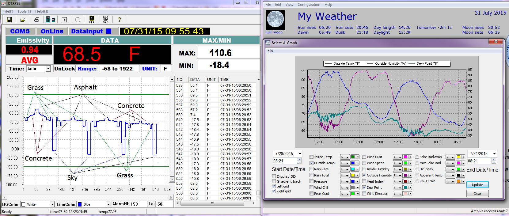
The slope in the concrete temp is due to the sidewalk becoming shaded starting about noon, and it is all the way to the driveway by 5 or 6.
More than 20 years ago, California State Climatologist Goodridge plotted California temps binned in three boxes: those from counties with populations more than one million; those from counties with populations between 100,000 and 1,000,000 and those from counties with populations less than 100.000. His results, plotted in a single chart, illustrated both the UHI effect (differing starting temperatures) and differing warming trends. The “less than 100,000” data showed very little warming over time, while the “more than one million” counties showed the highest rate of warming. I have no doubt that this result would be duplicated globally.
Congrats on more confirmation of something that you were on top of a decade ago………and more confirmation of the science misinformation site “Skeptical Science” being fraudulent……….often blatantly and intentionally :
http://www.skepticalscience.com/WattsandBEST.html
“It seems likely that the average reader of Watts’ articles will have gaps in his or her knowledge of how scientists handle weather station data. Arguments which rely on those knowledge gaps will fail to impress anyone who has read articles like this SkS series on how weather station data is handled.”
That graph starts in 1979. Was that an outlier yea? Colder than previous years?
Anthony,
I overheard a conversation in the university cafe a couple of days ago about some office in NOAA being interested in the weather data being collected by the Wyoming Department of Transportation (WDoT) along the interstate highways. It is real-time data telemetered to WDoT throughout the day (used in a very awkward way to decide on variable speed limits and closures–I mentored a graduate student using this data), and according to the two characters having the conversation it is the real-time aspect of the data and its density across the state in two dimensions that makes it of interest (for what purpose, climatological or forecasting, I never learned); but the issue never mentioned in this conversation is that it is data contaminated by being along a concrete/asphalt highway full of over-the-road trucks and cars.
I stayed out of the conversation as I now hate to even talk about climate or weather related matters with people I don’t know. But it is interesting how people get very excited about large quantities of “data” without much regard to its quality or suitability for purpose.
Like the airport data, this WDoT data is useful for the purpose that it designed for. That being determining the status of these roads.
It has little use in other areas.
“But it is interesting how people get very excited about large quantities of “data” without much regard to its quality or suitability for purpose.”
Indeed. While quantity has a quality all its own (say, the number of Sherman tanks in the Allied arsenal), with data, smaller and better is usually better.
I’ve mentioned the Oklahoma Mesonet before …. https://www.mesonet.org/index.php/weather/local/okcn
The link is to one of the stations in the OKC area. There is at least one station in each county in OK . You can also check out the site location, with photos. The website is used by the public, farmers, and public safety folks. There is even a K-12 education section.
Can temperature be measured absolutely or only relatively , the relativists say that temperature can only be measured in relation to past temperatures and with respect to the time of year the met. office keep these records and use them to lead people to see certain temperatures as warm or cold or mild. the British national health service advises that room temperatures should not drop below 18 degrees centigrade for people who are in ill health and yet the recent heat wave in September in the UK did not rise much above this level at night in my flat. The room temperature advised by the national health centre should be seen as the baseline for judging temperatures not relative near surface temperature differences.
The bad news is that a re-education camp will now be constructed in Sioux Falls. The good news is that the VA will be in charge of the construction project and it will take three times longer to build.
Is there evidence that undeveloped areas show less warming in recent years than more rapidly developing areas? That might help quantify how much UHI is affecting temperatures. Of course, that only works if the temperatures in undeveloped areas are not being estimated from urban areas.
Here is a photograph that clearly shows the locales where North America’s near-surface average temperatures have been increasing during the past 200+ years.
http://www.rlrouse.com/pic-of-the-day/northamericaatnight.jpg
Where I live in Victoria, Canada, and for as long as I can remember (I am 68), the daily weather reports are taken from the local international airport. Fifty years ago the airport was quite small with only a few flights per day. Today it is much larger with many flights, more tarmac and very large parking areas. Obviously it is a greatly expanded heat island and we now regularly get reports of ‘record’ high temperatures although as I far as I can tell the weather has remained pretty consistent for decades.
In July last year the UK Met Office excitedly announced yet another “record” temperature. The location? Heathrow Airport. A supposedly scientific organisation is trumpetting a claimed record from a thermometer located right next to the runway at one of the world’s busiest airports. What nonsense.
.
After criticisms they were forced to release the graph showing the temperature record. The “record” was caused by a sharp spike that lasted just a few minutes. They claimed the spike happened because the sun came out from behind the clouds. What utter, shameless drivel.
.
The only question is whether the record was caused by a passing 747 or A380.
Chris
“After criticisms they were forced to release the graph showing the temperature record. The “record” was caused by a sharp spike that lasted just a few minutes. They claimed the spike happened because the sun came out from behind the clouds. ……”
As a meteorologist that has actually worked at airfields and watched a temp readout on hot days – that indeed does happen.
On such days – A day of stable air where a low level inversion inhibits convection, pockets of heat can rapidly form and build up before the convective *bubble* rises.
Comparison with Kew gardens shows no bias at Heathrow….
“On any one day they can differ from each other by wider margin than recorded on 1 July, with Kew being warmer than Heathrow nearly as much as the other way around.”
https://www.carbonbrief.org/met-office-wind-data-dispels-doubt-about-cause-of-heathrow-high-temperatures
Check the airport for these new fangled devices, jets…actually all engines generate considerable heat
http://surfacestations.org/images/lovelock_mig480.jpg
Sadly, in the progressive post-rationality world, the desired progressive narrative trumps (no pun.. ok a little) mere facts and reality.
“Kevin Gallo is the Corresponding author at: USGS, Earth Observations and Science (EROS) Center, 47914 252nd Street, Sioux Falls, SD 57198-0001, USA.”
What are the odds he won’t be working there after publishing this paper?
I live in Sugar Land, TX one of the most rapidly growing areas around Houston. At the Sugar Land airport an official weather station is located. In the early 1970’s the airport was located in a rural area, surrounded by fields and ag land of the local prison, the surrounding roads were 2 lane blacktop with very little traffic and the airfield was basically a small, light plane airfield. Today the roads surrounding are 4-6 lanes, heavily traveled, the airfield now serves both commercial and heavy business jets flying into Houston. The surrounding area has been converted into housing and business developments -Texas moved the prisons to a more rural environment as. the land became very valuable for development. I would guess that the resulting UHI has caused the average or median temp to drift upward over the years but have no data nor way to estimate. A fun thing I do-I have something like 6 different thermometers (none that get direct sun) in my tiny back yard that contains a pool, now I know these are not calibrated to a single standard but it is fun to see the difference between the temps both during the day and night and how that difference changes depending on the time of day – just my own little UHI experiment! Also, I grew up in the Appalachia area-used to be amazed at the very thick fog in the river and creek valleys and how it ceased to be near the ridge tops-finally got to a high school science class where the reasons became clear and understandable.
WMO admit the problems back in 2006 –
“Microscale – every surface and object has its own microclimate on it and in its
immediate vicinity. Surface and air temperatures may vary by several degrees in
very short distances, even millimetres’
even millimetres- so much for accurate temp data!
“At the same time meteorological services have difficulty in taking urban
observations that are not severely compromised. This is because most developed sites
make it impossible to conform to the standard guidelines for site selection and
instrument exposure given in the Guide to Meteorological Instruments and Methods of
Observation (WMO 1996) [hereinafter referred to as the Guide] due to obstruction of
airflow and radiation exchange by buildings and trees, unnatural surface cover and
waste heat and water vapour from human activities”
https://www.wmo.int/pages/prog/www/IMOP/publications/IOM-81/IOM-81-UrbanMetObs.pdf
‘What is most important about this paper is that it quantifies the percentage of stations that have had increased amounts of impervious surface area getting closer to the stations. As I have long since maintained, such things act as heat sinks, which increase the night-time temperature when they released the stored energy from the sun that was absorbed during the day as infrared, warming the air near the thermometer, and thus biasing the minimum temperature upwards.’
The significance of impervious surfaces is that water runs off, and therefore there is limited evaporative cooling at the surface, causing higher temperatures in the adjacent air.
Asphalt, because of its low albedo does store daytime heat, which gets released at night. However, concrete because of its high albedo (in the region of 0.4 to 0.5) does the opposite. It remains relatively cool during the day. Go and touch a concrete surface on a hot day, it will feel cool.
My asphalt driveway is still warm the following morning. And while my concrete sidewalk is cooler, it’s still nearly 20 more than my grass yard which is near air tenp.
“Go and touch a concrete surface on a hot day, it will feel cool”
Go and stand barefoot on the sidewalk in Phoenix around 3pm in June. Cool will be the last adjective that comes to mind.
In the concrete industry, it’s dubbed thermal mass & it’s recognized in the energy & building codes as a way to even out temperature in buildings and lessen the need for heating/cooling: http://www.pci.org/design_resources/sustainability_resources/building_envelope/
From the abstract:
Over 32% of the USHCN stations exhibited an increase in ISA of ⩾20% between 2001 and 2011 for at least 1% of the grid cells within a 100 m radius of the station.
From Anthony Watts:
“In this study, they have observed over 32% of the USHCN stations exhibited an increase in impervious surface area of ⩾20% between 2001 and 2011.”
If you don’t find the difference I would suggest Math 100.
Doesnt fit the narrative, you know that any adjustment will be say -0.01 degree due to the large concrete expanse and +0.05 for an open area with wind providing a cooling as opposed to treed area before the parking lot was put it, Correction to measurements NET add(+0.05-0.01= +0.04) degrees for parking lots..