Plus a Few Freebees at the End of the Post
Guest Post by Bob Tisdale
The sea surface temperature anomalies of the NINO3.4 region of the equatorial Pacific are bordered by the coordinates of 5S-5N, 170W-120W. They are used by NOAA and other meteorological agencies to define when an El Niño event is taking place. According to the most-recent weekly satellite-enhanced data, the temperature anomalies for that region have dropped below the +0.5 deg C threshold between El Niño and ENSO-neutral phases, the latter of which is the “normal” phase of the tropical Pacific when neither El Niño or La Niña are taking place.
The weekly NINO3.4 region sea surface temperature anomaly data for Figures 1 and 2 are from the NOAA/CPC Monthly Atmospheric & SST Indices webpage, specifically the data here. The base years for anomalies for the NOAA/CPC data are referenced to the WMO-preferred 30-year period of 1981-2010.
Figure 1 includes the weekly sea surface temperature anomalies of the NINO3.4 region. They start in January 1991. The weekly NINO3.4 sea surface temperature anomalies for the week of May 18 were +0.2 Deg C.

Figure 1
And for Figure 2, the evolutions of the NINO3.4-region sea surface temperature anomalies in 2015/16 are compared to 1997/98, another very strong El Niño. Recall that 2015 started the year at or near El Niño conditions, where that was not the case in 1997.

Figure 2
Figure 3 is yesterday’s sea surface temperature anomaly map from CMC Environment Canada. During this early phase of the transition from El Niño conditions, the negative anomalies are focused solely along the equator in the eastern tropical Pacific…east of about 150W. In other words, the sea surface temperature anomalies for the eastern tropical Pacific (24S-24N, 180-80W) as a whole are still elevated. Assuming the tropical Pacific will continue to transition to La Niña, and there’s a good chance of that happening, it will take a number of months before the rest of the positive anomalies depart in the eastern tropical Pacific.

Figure 3 (Source here.)
And for those interested, Animation 1 includes the last two months of sea surface temperature anomaly maps from CMC.

Animation 1
I’ll provide a full ENSO update in a week or two.
SOME FREEBEES FOR READERS
Toward the end of most of the posts included in the 2014/15 El Niño series and the 2015/16 El Niño series, I’ve advertised my ebook Who Turned on the Heat? – The Unexpected Global Warming Culprit, El Niño Southern Oscillation. I thank all of you who have purchased a copy of that very-detailed discussion of (1) the fascinating processes that drive El Niño and La Niña events and (2) the aftereffects of sunlight-fueled strong El Niños that cause global temperatures to rise naturally.
My ebook Who Turned on the Heat? – The Unexpected Global Warming Culprit, El Niño-Southern Oscillation IS NOW FREE. Click here for a copy (23MB .pdf).
ALSO
Climate Models Fail is another of my ebooks. Published back in 2012, it discussed the poor performance of climate models. It is also free. Click here for a copy.
Those of course are now added to my most-recent ebook On Global Warming and the Illusion of Control – Part 1, which was originally offered free of charge. Click here for a copy.
It looks like WordPress is showing the just updated ENSO meter, yay.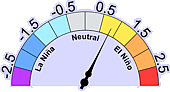
http://wermenh.com/wuwt/elninometer-current.gif
Heh – I see the correct nav bar image, I see last week’s above.
Here’s a HTTPS link that pretty much has to work here, and one I want to get some exposure, as I’ve asked Anthony to use it in the nav bar:
Source be willing, I update it at 0400 PDT on Monday from weekly data at http://www.bom.gov.au/climate/enso/nino_3.4.txt
Thanks, Ric. And for those wondering why BOM and NOAA have slightly different values from the weekly data, NOAA uses 1981-2010 for base years for anomalies, while BOM uses 1961-1990 I believe.
ENSO weather patterns shall once again shift, and they’ll still scream ‘climate change!’ ‘Cause ya know they will be working furiously to explain how warming causes a cooling cycle.
Good bye El Nino 2015/16, and thanks for those beautiful months of November and December in 2015. These months are usually dull, dreary and cold, but you made them warm, sunny, and clear. And that is about all you did for us in southern Ontario, but nevertheless, it was fun while it lasted. Now go kick that nasty sister of yours, La Nina, on her butt and tell her to stay away from us.
Today, May 23, 2016, I saw a sun dog in southeastern Washington State. I never did see one here during the recent El Nino. Are their frequency correlated with the comings and goings of El Ninos and La Ninas?
Goodbye “global warming” and hello “climate change”. Nice to see you again. How’s tricks? I guess the heat will be hiding in the deep oceans again, huh? Funny how it does that.
I dunno, the Arctic is looking rather red towards the end.
That’s where all the polar bears hunt.
The Arctic area is far too large in this map projection. But I’m happy with some mild local weather for a change.
I expect it to get redder.
Here’s a hypothesis: I don’t think as much heat was transferred to the atmosphere this year compared to 98. I think the el Nino remnants will break north and south (raising the PDO index, IIRC) and produce another northern pacific warm blob. With warm northern pacific and weak polar vortex/wavy jet stream, I expect this fall and winter we’ll see winds and storms move heat into the arctic troposphere. This will produce and breakup lots of ice (breakup of ice will expose more waters and cause thicker ice as it is pushed away and piles up in other locations). The latent heat release will keep artic atmospheric temps high.
How about these temperatures for the Arctic?
Left out the link, darn!!
http://ocean.dmi.dk/arctic/meant80n.uk.php
I always wonder about how that is calculated, most of the arctic is ocean,It also seems to never dip below 247K, as if there is some sort of limit stop
Only the part that gets warmed by the gulf-stream.
I don’t know about that; seems to me this will give plenty of ammunition for the heat crowd:
Yes, and if el Nino remnant warm waters reinforce the remnants of the warm blob and winds transfer that heat to the northern atmosphere this fall and winter, we’ll see huge winter atmospheric temp anomalies. If winds and storms enter the arctic and break up ice and cause it to concentrate (thicken) regionally, we’d also have very low ice extent, but actually increasing mass. Very low 2016 ice, but high 2017 sea ice.
I’m sure the subsequent recovery a la 2012 will quickly shut them up
Jon Anderson
I have found that most people, even “warmistas”, understand and accept the impact of an El Nino event. I use it as an example of natural variability.
Then there is a rejoinder that, served up calmly and with a smile, will cause a good number of folks to do a second take: we’re in May and there’s some 12 million sq. km of ice [that’s 1.5 x Canada’s land area..] and even the way things are going, in September there will still be some 6-7 million sq. km [ think Australia]. Hardly the ice free Arctic as foretold by Gore & Co, McKibben, Suzuki and other professional fear mongers.
And if they do the ” maybe, but….” thing, ask them how CAGW/CACC explains the increases in Antarctic ice – since it’s probably not runaway warming, maybe another example of natural variability.
The latent heat release from that snow and ice forming will keep temps from falling, making for very high winter temp anomalies.
Yes, they love to talk about graphs and how they show the climate catastrophe. The actual climate, aka reality, doesn’t scare anyone, so they hope the graphs will.
I’m also a little skeptical of the actual data of that graph since the satellite went down in April. If you look at the good sea ice extent and temperature maps, e.g. Naval Research Lab, you see that the low sea ice max was real because of warm currents in the Barents Sea. But now you can look and for the most part the only ice that has melted at this point in the season is the very thin sea ice at the margins and that the melt has slowed considerably now that it has reached sea ice of a meter thick. It looks to me like the sea ice anomaly should be moving towards average already, if not then it should very soon.
http://www7320.nrlssc.navy.mil/hycomARC/navo/arcticsst_nowcast_anim30d.gif
http://www7320.nrlssc.navy.mil/hycomARC/navo/arcticict_nowcast_anim30d.gif
In an average year, would sea ice in the Barents Sea not have melted considerably by this time? Is there are archive of sea ice extent maps for any given day available?
P.S. Take a look at the sea ice concentration maps comparing 2007 to 2016. You can quickly see why sea ice minimum in 2007 reached its low point, the ice on the Asian side of the Arctic was anomalously low that winter and easily melted or was pushed by winds. The sea ice is much thicker now than it was.
As the worlds weather and climate turns. The probability of a major hurricane (CAT III or higher) striking the continental US shores for the first time in over 10 1/2 years has just gone up. There are advantages an disadvantages to each change it seems.
But only the disadvantages are blamed on man.
Just as sure as the sun rising and setting the next big hurricane to hit here will be blamed on human caused climate change by the more ignorant or dishonest among the alarmists and press.
Thank you Bob! Will be very interesting to see what happens over the next 5-10 years with the changing water temperatures and the corresponding influences on the weather patterns.
I guess you won’t have to worry about material as we flip from one phase to another, both in the tropical Pacific as well as the Atlantic.
Maybe not just the tropical pacific. Let us see what happens with the NH pacific as the blob continues to dissipate.
What I have noticed starting last year was that there has been more spring rainfall since the Blob started its breakup. This spring has seen weekly rainfalls, along with more cloud cover. Last summer there was some rainfall in every month of the summer, after 3 years of zero summer rain. I expect that there will also be more summer rainfall this year as compared to last year. This reminds me of the 1950s and 1960s, even down to the scent of the air.
Looks a great deal like the 1997-8 cycle on El Niño temperature cycling. Now if someone will give a good explanation for the cycling. . .
Brief explanation, Tom: Chaotic coupled ocean-atmosphere dynamics that are tied to the seasonal cycle.
Cheers
Make that: Chaotic coupled ocean-atmosphere dynamics and ties to the seasonal cycle.
Chaotic? Or quasiperiodic?
Or it could be Lunar Standstill , tide effect which takes place every 18.6 years, the range of the declination of the Moon reaches a maximum.
Vuk – when are you going to notice that climate does not run like clockwork?
Hi Ptolemy
Your namesake from Alexandria has a lot to answer for.
http://weather.unisys.com/surface/sst_anom.gif
It looks like a spatial propagation oscillation (6 cycles along 60 degrees of equatorial longitude) or could be moiré pattern generated by data processing.
I’ll try again
http://weather.unisys.com/surface/sst_anom.gif
W.rdpress image caching is hopeless. Click on the image and you’ll see it.
click on the image to see what I meant, new image caching is hopeless
Leave it to you, Vuks, to “throw a wrench,” in the already complicated mess. But I like it. chuckle chuckle
Adding to Bob’s list below: Rotation (+core), Lunar/solar tides, tectonics, undersea volcanism and some yet undefined unknowns. That the fruit and nuts like us work with.
Plus Bob’s comment below.
Bob Tisdale May 23, 2016 at 5:50 am
Make that: Chaotic coupled ocean-atmosphere dynamics and ties to the seasonal cycle.
And thank you Bob for making your publications Free…
Care to play with some lightening Vuks?
Lightning as a space-weather hazard: UK thunderstorm activity modulated by the passage of the heliospheric current sheet
http://onlinelibrary.wiley.com/doi/10.1002/2015GL066802/full
M. Lockwood, R. G. Harrison, A. J. Bennett, S. R. Thomas, C. J. Scott, M. J. Owens, M.M.Lam
19 November 2015
Lightning flash rates, RL, are modulated by corotating interaction regions (CIRs) and the polarity of the heliospheric magnetic field (HMF) in near-Earth space. As the HMF polarity reverses at the heliospheric current sheet (HCS), typically within a CIR, these phenomena are likely related. In this study, RL is found to be significantly enhanced at the HCS and at 27 days prior/after. The strength of the enhancement depends on the polarity of the HMF reversal at the HCS. Near-Earth solar and galactic energetic particle fluxes are also ordered by HMF polarity, though the variations qualitatively differ from RL, with the main increase occurring prior to the HCS crossing. Thus, the CIR effect on lightning is either the result of compression/amplification of the HMF (and its subsequent interaction with the terrestrial system) or that energetic particle preconditioning of the Earth system prior to the HMF polarity change is central to solar wind lightning coupling mechanism.
Vuk
Hi Ptolemy
Your namesake from Alexandria has a lot to answer for.
Like you, for example? You’re the one bearing the torch for epicycles 🙂
Carla, all I can say is it seems very lucky this science is as settled as it is, else you and Vukcevic would need swords.
I would rather we figure out how this happens:
http://cdiac.ornl.gov/trends/temp/domec/epica2d.jpg
Me too. It seems obvious to me that the climate cycles with the oceans and that something else cycles more significantly on a longer timescale. That may be the sun-Milankovic tie may not. Does anyone know ?
Pamela that is arguably the holy grail of climate questions. (As an aside, I can’t help but wonder if some of our proxies might be misleading us though–does a large presence of ‘x’ always mean ‘y’? Are we misinterpreting some of the evidence?) Meanwhile, the AGW crowd are crying bloody murder/end of the world about a tiny nudge in temperature, wholly ignorant to how the bottom can fall out (and surely will again). You are calling out the truly big question, not the nitpicker’s folly of the current time.
At a guess – weakly forced nonlinear oscillator
Interesting graph but in general I’m sceptical of all ice core proxies. If + & – 5% error bars are incorporated (which may not be unreasonable for the ice core data hundreds of thousands years old) most of the information would disappear.
Pamela;
I seems to me the X axis is atypically reversed in this graph? I’m used to the right side being the present, moving towards the past, so it took me a second to read it right.
I’ll assume this is a graph of hydrogen isotopes discovered in ice cores, maybe the 800,000 year Antarctic record?
If so, I’ll stand up and take a guess; solar activity.
Sorry, no need to guess. Dome C. Antarctic.
“Interesting graph but in general I’m sceptical of all ice core proxies. If + & – 5% error bars are incorporated (which may not be unreasonable for the ice core data hundreds of thousands years old) most of the information would disappear.”
No, it’s not that simple. You get very much the same cyclic pattern from both deep sea sediments and long terrestrial vegetation records. Google “LR 04 Benthic Stack” and “Tenaghi Philippon” for example.
Yes, I did.
The most recent 1.5Myr show good periodicity but then it fizzles out.
Spectral peak is at exactly 100 Kyr, good old Milankovic.
http://www.vukcevic.talktalk.net/d18O.gif
y-axis divisions are at 3, 3.5, 4, 4.5, 5 & 5.5
So, the el Nino is one dead baby and the new babe on the block is that Ice Princess, la Nina!
Surely Elsa?
[Benefits of grand-daughters! And, I suppose, the Diznee blockbuster.]
Auto
Well, bring in the kittens and bust out the mittens…right after this humdinger of a hurricane season we may well be in for.
Bob- any thoughts about the “blob” dissipating?
Jake: The sea surface temperature anomalies for the region NOAA was using for The Blob are back toward the high end of the “normal” range:

That graph is from the April SSTa update:
https://bobtisdale.wordpress.com/2016/05/09/april-2016-sea-surface-temperature-sst-anomaly-update/
There are still positive subsurface anomalies in the region, according to the most recent T300 maps from the GODAS reanalysis:
We’ll have to wait for the La Nina to progress to see how the waters there react; leaving us with the question: Has The Blob caused an upward shift in the SSTa of the Extratropical North Pacific or the East Pacific?
Cheers
Bob- Thanks, I was looking at the time progression map and the water temperatures there seem to be very stubborn in terms of returning to “normal”. Land temperatures in parts of Alaska seem to be impacted by this phenomenon, and it would be beneficial for that region to return to typical conditiions.
Bob Tisdale:
SO, will the “Blob” – the loosely defined regional mass of a warmer water up to the northwest Pacific near Japan – cause even more melting of the Sea Ice in the Sea of Oskotch these next few months? That really is the only Arctic sea ice region that has been significantly below average the past many months?
RAC, I’m just some guy with a computer and an internet connection, but here’s what I think might happen. We have low summer sea ice extent, el Nino remnants reinforce the blob, winds and storms move moisture into the pacific-arctic and break up ice regionally, inhibiting ice extent. Precipitation releases latent heat keeping temps high through winter, very high temp anomalies. We have low sea ice extent, but big increases in ice mass over the winter.
The Sea of Okhotsk has already almost completely melted out and this winter’s extent was about average every month. As far as regions that are below average this melt season are the Beaufort Sea, Barents Sea, Kara Sea, Baffin/Newfoundland Bay, Chukchi Sea, Central Arctic Basin and Hudson Bay. The ice anomaly this spring is approximately negative 1.4 million sq. km.
Regional Arctic sea ice extent graphs: http://bit.ly/1Th8Mbd
Saul,
As you stated, the Sea of Okhotsk (lower right) is completely normal.
That means there is regional variability, no?
But aside from natural fluctuations, what’s the obsession with Arctic ice? I recall the predictions made by Algore and others, saying that polar ice would disappear within X number of years. But when it became clear that Antarctic ice was actually increasing, the predictions and discussions morphed/deflected into the current Arctic ice scare.
Even if Arctic ice cover dwindled to nothing, so what? On balance, that would be a net benefit: transit times would be greatly reduced, along with much less fuel being necessary.
The “ice” scare is just like every other climate alarmist scare. There is nothing good that the alarmist crowd can ever bring themselves to admit to. Everything must be viewed as a ‘glass half empty’, never a ‘glass half full’.
The scare comes down to the rise in CO2; the origial climate alarm. But in retrospect, more CO2 has been an unmitigated benefit. We have observed no global damage or harm due to more CO2 — thus, the rise in CO2 has been “harmless”. QED
It has also been entirely beneficial. The planet is measurably greening as a direct result of the rise in CO2 (which anyway has been only one part in 10,000). Agricultural productivity has increased along with the greening of the planet, a major benefit to the one-third of humanity that subsists on less than $2 a day. It means the difference between malnutrition/starvation, and getting enough to eat to those people.
The rise in CO2 has been entirely beneficial. It outweighs any imagined downside, which has never been proven, measured, or otherwise quantified. Anyone who is not emotionally invested in the “carbon” scare knows it was a false alarm. One of the problems in science is the effort required to keep emotions out of observations and conclusions.
Those who still argue that more CO2 is a problem have been proven wrong. Those who now admit that they were wrong about the rise in CO2, and all the other failed climate alarmism predictions, are true scientists. They admit it when they’re wrong. But the rest — those who still perpetuate the climate scare — are not only doing a disservice to science, they are trying to force a large part of humanity to do without the benefits that fossil fuels and electricity have provided for the rest of us. That’s not only self-serving; it’s morally wrong.
Looking at the surface and deep circulation oceans patterns it appears that it can take many (15+) years for specific areas of water to circulate around the Pacific. The impingement on the west coast of America and circulation south on the California Current and North on the Alaskan Current plus all the gyres, sub-gyres, short circuits and dispersion – we can see anomalies for years. My guess is it is not well studied though I keep looking. I think this circulation has a big impact on the weather in north western North America.
+++++++++++++++++++++++++++++++++++++++++++++++++++++++++
Yet the weather in my region remains fairly stable in spite of claims to the contrary – almost every May long weekend (Victoria Day in Canada) we get snow somewhere in the foothills for all my 69+ years. Low temperature at my house was -1 C this weekend and 200 mm of rain and wet snow since Thursday.
http://globalnews.ca/news/2716992/2016-to-be-one-of-the-coldest-may-long-weekends-in-40-years-in-calgary/
http://www.cbc.ca/news/canada/edmonton/snow-alberta-warnings-1.3591556
Weather.
dbestealy writes:
That’s sure to be true DB, but I’ll argue the greatest problem is change itself; “change gives me a hairball” (hat tip to Tom Van Vleck). Although science records change, it certainly can’t be held responsible. In terms of climate science, objectivity is clearly an issue, but the cultural response is to change itself, without regard to the question of whether the change is objectively good; the alarm comes from the idea that things might be changing at all.
Change is bad for most folks and the older you are the more difficult it is. I have problems with “kids these days” who don’t understand change is the nature of our universe; when I was a kid “times they were a changin'” and we celebrated it. Now it seems our youngest generation abhors change.
Interestingly, things do not even seem to be changing as much as could be considered “normal”.
So the alarmism is triply ridiculous, when you include the notable downturn in severe weather in the recent past.
The Sea of Okhotsk is nowhere near the Arctic and the current Arctic sea ice anomalies in the reality based universe are so large only someone living in a weird alternate reality would call them normal regional variability.
You need to read outside of the bubble you inhabit.
Some preliminary May 2016 showing where we are likely going with Nino 3.4 based on the East (180W to 100W) Equatorial Temperature Anomaly (which is the best predictor of near-term ENSO conditions that there is – a little extrapolation on how the ocean currents work in this area can provide a reasonably good medium-term prediction).
http://s33.postimg.org/a7mfl6gcv/EUOTA_vs_Nino_3_4_p_May16.png
Data at:
http://www.cpc.ncep.noaa.gov/data/indices/wksst8110.for
http://www.cpc.ncep.noaa.gov/products/analysis_monitoring/ocean/index/heat_content_index.txt
“Equatorial Upper Ocean Heat Anomalies” link on this page (tends to take up too much space when linked directly so find it on this page).
http://www.cpc.ncep.noaa.gov/products/precip/CWlink/MJO/enso.shtml
Very interesting Bill. So it looks like the 3.4 Index should be down to about -1.0 in just a couple of months and could easily bottom out in the -1.5 to -2.0 range. The next question is how long will the index remain negative? That is more difficult to foretell, but if this event is anything like 1983 and 1998, it could stay negative for two or three years.
Any chance of this graph being added to the right-hand side, so that we can see it progress? Anthony?
It’d be really nice to see figures like three for the comparable months (+1, since it looks like it broke a little later) for 98. The intensity of the blue and westward extent look striking. Are wind anomalies more intense than usual.
What may intensify or inhibit future la Nina conditions? I’ll continue to put forward that remnants of the warm blob, the weaker transfer of heat to the atmosphere during this el Nino, and the weak polar vortex/wavy jet stream may produce some unexpected outcomes.
A reader at Judith Curry’s pointed out a couple of years ago that warm blob sea surface temperature patterns happened in the late 50s and early sixties (our recent northern pacific temps barely beat them). The follow up was a large ice gain in the arctic in the 60s and 70s.
aaron – We seem to focus on the equator as that is where things form. But I have been intrigued for several years by the formation of the blob in the north eastern Pacific, the anomaly maps of its formation along with the surface and deep currents as they appear to have a big effect on the RRR and weather in north west North America. I have read a lot of papers on the currents and circulation. What would be really interesting would be surface currents, deep currents and temperature anomaly time lapse. Bob Tisdale has given some hints at what this might look like with some of his animations as have others. The argo floats are also have interesting movements but it would take someone with computer skills I don’t have to plot out the float tracks and temperature anomalies. However that is still a problem given we know that sometimes the surface currents and deep currents run counter to one another. My reading so far on this subject tells me we don’t have a lot of published data. There may be restricted data but not public information – or I just haven’t used the right searches yet. Someone sometime will get to it and generate some insights.
More extreme climate change according to NOAA
Interesting way to miss-inform the public
(sarcasm)
“Update, April 14: On Thursday, the National Oceanic and Atmospheric Administration has issued an official “La Niña Watch”, meaning conditions are now favorable for La Niña to emerge over the next six months. Writing for Climate.gov, atmospheric scientist Emily Becker said “almost all of the computer models we use for predicting climate are anticipating a transition to La Niña during the second half of this year.” Also out on Thursday is the first 2016 seasonal forecast of Atlantic hurricane activity from the closely-watched team at Colorado State University. Meteorologist Philip Klotzbach and his team expect “approximately average activity” with a 50 percent chance of at least one major hurricane landfall somewhere along the U.S. coastline. The original post follows below:
With a monstrous and record-setting El Niño on the wane, the implications of its disastrous worldwide consequences are starting to settle in. But there’s new evidence that, on its heels, a potentially strong La Niña could emerge later this year—bringing with it a renewed stretch of extreme weather.”
El Niño : Climate
La Niña : Weather
Well, they certainly do keep to the script.
“almost all of the computer models we use for predicting climate” cannot predict La Niña or el niño
One thing that’s been bothering me for the past couple of months is the SST map shows the Gulf Stream “dying” once it gets east of the Grand Banks. Is that now normal? Way back when I took Oceanography 101 the Gulf Stream went all the way to the British Isles and then north along Norway.
Lordy I do hope not or our lovely windmills are going to have a very hard job keeping up with base load.
Are you looking at anomaly maps? Or actual temps?
Based on eyeball analysis…
During the last 60 years there were 3 strong El Nino’s prior to the current one. Each of those was immediately followed by La Nina or near La Nina conditions, each of which lasted longer than the preceding El Nino.
If history repeats, then the next two years are likely to be ones of below average precipitation for the US Southwest, and activists such as Hayhoe can then claim they were right all along – climate change causes drought. 🙂
Don B
May 23, 2016 at 7:09 am
Based on eyeball analysis…
During the last 60 years there were 3 strong El Nino’s prior to the current one. Each of those was immediately followed by La Nina or near La Nina conditions, each of which lasted longer than the preceding El Nino.
If history repeats, then the next two years are likely to be ones of below average precipitation for the US Southwest, and activists such as Hayhoe can then claim they were right all along – climate change causes drought. 🙂
————————————
Hello Don B
Most probably what you say is correct, but I think there is still a slight chance and a slight probability to consider and contemplate…………the relation and the effect of El Nino and La Nina respectively on the precipitation in a given area during a climatic warming trend can be different and probably the opposite during a cooling trend…….some thing that should not be ignored I think.
Just a thought.
cheers
“Eyeball analysis”?
Doesn’t work — you’ll just assume history will repeat.
Real analysis requires a PhD and a SuperComputer — needed for those bold predictions that get attention and scare people — the predictions are never right but that doesn’t matter once people are scared about the CO2 boogeyman … if its not here yet, then its coming !
My question to you:
Why is it necessary to make predictions of the future climate … that are unlikely to be more accurate than flipping a coin (based on climate predictions made in the past 40 years)?
The current climate seems very pleasant … but the climate is always changing … so the future might be gradually colder, or warmer — does it really matter?
We get more climate change from sunrise to 10am every day than we did in the past 150 years.
Would many people have noticed the climate change in the past 150 years if not for leftists bellowing incessantly about how climate change was going to end life on Earth as we know it?
It’s also interesting to compare SSTA across all the oceans for 2016 and 1998 as can be seen in the maps from the University of Maine below.

This comparison updated every two or three days here:
https://oz4caster.wordpress.com/enso/
At present there are two glaring large cold anomaly areas, one in the central North Pacific south of the Aleutian Islands and the other between South America and Antarctica that are more intense than any of the cold anomaly areas in 1998. We may have a new “blob” in the North Pacific, but this time a cold one. There is also a weaker cold anomaly area that has persisted for many months now in the North Atlantic between Europe and Canada. All three of these large cold anomaly areas were warm anomaly areas in 1998. This just goes to show every event is different and global patterns are also important. What it means for future weather this year, I’m not sure.
Another note of interest in comparing the maps above is that the estimated global SSTA for 2016 May 23 is only 0.07C higher than for 1998 May 23, which is easily in the uncertainty range of the estimates. This gap has been declining during May, so it will be interesting to see if the global SSTA falls below the 1998 estimates soon.
Which may indicate the warmer SST gets the greater the negative feedback, the more warming we have the more evaporation occurs which is usually of a greater order than the warming given the hydrological cycle moves more heat from the surface than radiative forcing warms the surface, then the clouds, did I mention the clouds from water evaporation.
Obviously I am just speculating here.
This balancing act might be why there appears to be no trend in water vapor, and why we cannot “cook” the planet with any GHG at relatively low levels. I suspect the water cycle dominates everything else by orders of magnitude which would suggest radiative forcing will always create a greater negative feedback, unless we run out of water to evaporate.
So arid land, in this line of thought would be a contributor to warming rather than arid land and drought being manifested by warming, possibly they have the tail wagging the dog here again
Mark, arid land has been decreasing with increased CO2 according to satellite estimates over the last 20 years or so. So this may reduce the land warming over time. It’s all so complicated, but my suspicion is that water in it’s various forms ocean/water vapor/clouds/ice/snow plays a dominant role in climate variations and we have yet to explain with any confidence what has triggered each of the last glacial cycles. The current GCMs are worthless in that regard and dealing with the onset of the next glacial period is likely to be a major challenge for humanity in the upcoming centuries (or at most a few thousand years if this interglacial turns out more like the fourth one back).
Water vapor also influences nightly cooling
This is for a warm humid day, and you can see how early in the morning the rate of cooling drops by about 75%,
on the second day from the 6:00 pm peak, it drops 20F in 6 hours, and while the temperature of the sky gets colder the next 6 hours it drops maybe 5F, and the rate slows as rel humidity get into the higher percentages.
Even ignoring weather, the Atmosphere is dynamic, every day it get rung like a bell.
The mechanics of what is occurring is more important than anomalies, anomalies appear to be a red herring
Anomalies for daily, monthly, and even yearly periods are probably more weather related and should be more useful in relation to understanding weather patterns and their effects. Looking at anomalies for 30-year periods versus previous periods and longer should be more useful for climate. But unfortunately, we don’t have enough high quality historical climatic data to make anything but crude and fairly uncertain comparisons for longer time periods. In a few hundred years our descendants will have a much better perspective.
oz4caster, thanks! Can you post graphics for a couple weeks or a month later. It looks like this el Nino is breaking earlier than in 98. It would be good to see how 98 played out when it finally did break. Maybe someone could produce an animation.
aaron, the University of Maine has daily and monthly SST and SSTA maps back to 1979 here:
http://cci-reanalyzer.org/
Look at the “Daily Reanalysis Maps” (where I got the 1998 May 23 map) and the “Monthly Reanalysis Maps”. The daily maps can be animated for a selected month.
Thanks again. Hopefully I’ll have time to and feel healthy enough to dig into these in the near future.
They have different baseline. Do you realize?
Javier, yes I have noticed they have slightly different baselines. However, I am not sure if the 1971-2000 baseline label for the current map is correct since they use 1979-2000 for all other anomaly maps. It might be a typo. I would like to see the OISST V2 data back to 1971 if it is correct.
Regardless, I don’t think adding a few years to the baseline should make a big difference. The sources of the sea surface temperature data are also different on the UM historical maps than on the current maps and that could also cause some differences, but I again I suspect these are probably minor compared to overall uncertainties in the comparisons.
I’ve wondered if the different baselines actually help make them more comparable over time given the secular trend from the end of the mini ice age and the greenhouse effect.
Depending on what a person is analyzing for, a drifting baseline (moving average) may well be best studying dynamics. Absolute value may also provide valuable insights. Comparing absolute value and anomalies as well.
The change in the surface currents over the last several months through Drakes Passage is causing quite a change. Note the difference in ssta temps on the lower eastern side of South America. That represents a substantial change from the the last 4 years, where there is typically a large hot spot in that location. Now there are some cold spots and a long stretch of cold waters running up the coast line.
Here’s a closer more detailed look at the ocean currents overlaid on SSTA in the budding La Niña area of the eastern equatorial Pacific:
https://earth.nullschool.net/#current/ocean/surface/currents/overlay=sea_surface_temp_anomaly/orthographic=-116.09,0.90,1123
If the depiction is accurate, it looks like there are strong eddies associated with the colder SSTA. I’m guessing these are associated with up-welling of cooler water.
Along with the decreasing ENSO numbers in May, the anomalies at the following site also show a huge decrease so far in May:
http://moyhu.blogspot.ca/p/latest-ice-and-temperature-data.html#NCAR
Up to May 21, indications are that most anomalies will end up being between those of September and October of 2015 where many data sets showed a huge spike.
David Hart May 23, 2016 at 6:54 am said “One thing that’s been bothering me for the past couple of months is the SST map shows the Gulf Stream “dying” once it gets east of the Grand Banks. Is that now normal? Way back when I took Oceanography 101 the Gulf Stream went all the way to the British Isles and then north along Norway.”
That was the case when I was at school. But I think that it has been decided to call it the North Atlantic Drift when it gets away from the US coast and loses its intensity. The water does not know that and still reaches the West of England, Ireland and Norway.
[And Pluto, discovered by an American using an American telescope, has been demoted to a non-planet (with two moons!) by the Eu-centric community. .mod]
OK, but what about the warm water that’s heading up the Denmark Strait and the warm water in the Barents Sea, where did it come from? And for a chuckle: look at the May 22 Unisys SST Anomaly map, there’s a big cold chicken about to gobble up the British Isles…
Dudley, take a look at this map of the ocean SSTs including a simulation of ocean currents for today:
https://earth.nullschool.net/#current/ocean/surface/currents/overlay=sea_surface_temp/orthographic=-39.57,45.80,414
The globe can be re-positioned by clicking and dragging and you can zoom in and out with the roller on the mouse. This map shows the Gulf Stream is very narrow and concentrated in the western North Atlantic but becomes very wide and diffuse in the northeastern Atlantic. However, notice that SSTs are much warmer near western Europe than at the same latitude near North America. The same is true on either side of the North Pacific and is the result of ocean circulation. Also, the SSTs are much colder on the southeastern side of the North Atlantic than at the same latitudes on the southwestern side of the North Atlantic. This same pattern also holds true in the North Pacific and is associated with ocean circulation.
By the way, the map linked above can be configured to show SSTA as well as surface air temperatures and other parameters by clicking on the “earth” label in the lower left corner and making selections.
In looking at the ocean SST and currents around the globe I noticed something interesting that I have not heard about previously. There is a strong current running from west to east in the equatorial Indian Ocean, which runs in the opposite direction of the equatorial currents in the Atlantic and Pacific. I’m guessing the reason for this difference is that the Indian Ocean does not extend northward into Arctic latitudes and therefore the geography forces a different pattern in the ocean currents. Here is the map view of the Indian Ocean with SST and currents:
https://earth.nullschool.net/#current/ocean/surface/currents/overlay=sea_surface_temp/orthographic=-286.82,-9.66,682
The narrow east-setting equatorial current in the Indian Ocean has been known by sailors for centuries. Oceanographers call it the Wyrtki Jet; it waxes and wanes with the Indian Ocean Dipole. The highly limited extent of that ocean north of the equator prevents the development of major anticyclonic gyres, thereby emphasizing equatorial counter-flow.
Bob, just one question: when you look at the ENSO-Page the first graph still shows a value of 1.25 for the ENSO 3.4 region and this value is there at least for 3 or 4 weeks.
Are you referring to the Oceanic Oscillation reference page at https://wattsupwiththat.com/reference-pages/ocean-page/oceanic-oscillation-page/ ? If so, then you need to read https://wattsupwiththat.com/2016/05/21/wuwt-housekeeping-ongoing-issues-updates-fixes-and-polls/ . It’s a must read page for everyone here.
Many of the images at WUWT with HTTP URLs (as opposed to HTTPS) are stale, cached, relatively ancient data. In general, click on the image to see it at the source which has a much better chance of seeing the right image.
You may be referring to this image, first the link used in Ocean Oscillation page, then from the BOM source, if I can coax it not to use the cache:
http://bom.gov.au/climate/enso/monitoring/nino3_4.png?foo=0.png
Well done, it is difficult to tell what might happen until it’s too late. The image I posted above (tried twice) is cached 15 July 2015, I suppose it might be there for the next 10 years.
I have posting rights – that lets me edit comments. It took more tries than I expected, I should have done it at https://wattsupwiththat.com/test/ and left notes for people!
I wasn’t surprised by the temperature spike. Joe Bastardi has been forecasting the coming spike (and the following drop-off) in global temperatures for a year.
I expect we won’t see drops in global average temp as analysis will incorporate more arctic data and push global temps higher. The use of sea surface temps might introduce additional bias, we might be in a climate regime more similar to the the 50s/60s but using 80s/90s dynamics to calculate atmospheric temps from sea surface temps.
Expanding observation network and timing of satellite era presents problems for infilling.
Good bye El Nino. Hello La Nina.
If you look carefully at the animation, its not only the formation of la nina, but the cooling of the worlds ocean especially in the cooler waters in conjunction with la nina formation. surmising.
Time for Willis E. to enter the fray and use his theories about the climate thermostat to explain why the warmth accumulates in the ocean and at what temperature point an El Nino forms and then at what lower temperature point the La Nina sets in etc. as it goes on and on. There must be some quantitative measures somewhere that sets up the “sea-saw”. NOAA should know and maybe someone reading this could explain where to find it. If they don’t know, I ask modestly: What are they doing?
interesting possibilities relating to amo in this recent paper highlighted over at jo nova’s blog.
http://joannenova.com.au/2016/05/the-solar-wind-may-be-changing-the-surface-temperature-of-the-north-atlantic/
True blues in stunning come-back against the dirty yellows …
http://gbtimes.com/life/cinemas-greatest-ever-football-match
[citation: Bedknobs and Broomsticks]
Tonight’s main event: SST covers Free Fallin’ by Tom Petty.
(y) The Gore Future avoided (voided) again! Back To Zero.
Ha ha
Slightly OT – I’m reading “the first three minutes” by Steven Weinberg. In it he comments that you cant define a temperature for a system that is not in equilibrium.
https://en.wikipedia.org/wiki/The_First_Three_Minutes
Most of you probably (a) read this book and (b) realised this fact about temperature a long time ago. I’m just catching up.
So – when discussing climate – the atmosphere and ocean that are both way far from equilibrium at all times – how come people talk about a temperature?
“- how come people talk about a temperature?”
Because talking about sex is considered rude and inappropriate. So the next thing that comes to mind is the weather.
“the atmosphere and ocean that are both way far from equilibrium at all times – how come people talk about a temperature”
Nothing is ever at equilibrium. But the concept of temperature is useful. Climate scientists didn’t invent it. Your body is not at equilibrium, but fever is worth measuring.
In the atmosphere, the concept you need for temperature is local thermodynamic equilibrium, which applies in the atmosphere until you get to high stratosphere.
Thank you for more free reading materials.
I assume the quality will be just as high as the more recent “On Global Warming”,
which I previously downloaded and read.
You are the most generous climate skeptic in the world.
So far I have noticed your writing contradicts the beliefs of the most famous climate “scientists” in the world:
Al Gore, President Obama, and the Pope — three noted “scientists” who tell us “the science is settled”, and are sometimes affectionately known as the Moe, Larry and Curly of climate science.
Al Gore took two science courses in college, and he almost got a B in one of them.
President Obama can read really well from a Teleprompter.
And the Pope once worked as a chemist, before he switched fields and became a Pope.
These three men are obviously highly qualified to make accurate predictions of the climate 100 years into the future.
Do you have any climate predictions for the next 100 years?
It’s not about prediction accuracy or science, it’s who you know.
Actually, I think its how much attention you get from the mass media.
Today I was at a car dealership buying a new car.
It was about 70 degrees, with pure blue skies that are not that common in Michigan, and there was low humidity and a small breeze.
To me the weather could not get any better today.
If I called the local newspapers and told them today was the best weather since I moved to Michigan in 1977 — and 2016 so far has been the best climate year in Michigan since the 1970s — they’d just hang up on me.
But if I told them I was a climate scientist, and my new study proved conclusively that climate change is positively correlated with the libido of women over 40, and negatively correlated with the crime rate in Detroit, reporters and cameramen would be knocking at my door.
A good story told well — politicians are good at that — and repeated frequently — becomes a headline, and headlines are the “truth” to many people (once a leftists knows the “truth”, you can’t pry it out of his brain with any logical argument, or even with a crowbar).
Sensible weather in Nor Cal is already like La Nina. We are having a cold spring.
What are the odds of a cold winter within A) one year later and B) two years later? (At least in the aftermath of major El Ninos and declines)
here the weather is not knowing what to do swapping from late spring to chilly fall moods.
Thank you, Bob, I’ve taken advantage of your generous offer.
A question to Mr. Tisdale.
What is the role of Lightening Strikes, across the equatorial pacific, on ENSO?
What is the role of Lightening Strikes on water in general?
See this:
http://www.nasa.gov/centers/goddard/news/topstory/2006/space_weather_link.html
In this image
http://www.vukcevic.talktalk.net/mb1.jpg
the plasma bands follow geomagnetic equator, while the three of the bright plasma pairs are areas with lots of thunderstorm activity, in this case were located over Africa, Indonesia and coastal region of South America.
Thanks for the image Vuks. Very good.
Check out the huge null point in the middle of the Pacific. Lots to see when you already have a few clues as to what you are looking at.
Uses a click and hold to move the map around.
http://maps.ngdc.noaa.gov/viewers/historical_declination/
Now if Dr. S., would provide a few ring current tips, the next adventure will begin..
So much new info pouring in.. and my brain has to get focused and disciplined elsewhere for a while. Develop good habits to help keep myself safe on the road.. under the new conditions..
http://oceantoday.noaa.gov/lightning/
When Lightening Strikes
Lightning is a rapid discharge of electrical energy in the atmosphere. Each spark can span over five miles in length, reach temperatures hotter than the surface of the sun and contain 100 million volts of electricity.
Lightning strikes are not only dangerous; they can be deadly.
The electrostatic discharge occurs within a cloud, between clouds, or between a cloud and the ground.
Lightning doesn’t strike the ocean as much as land, but when it does,it spreads out over the water, which acts as a conductor. It can hit boats that are nearby, and electrocute fish that are near the surface. …
Temperatures HOTTER than the sun?
Well I do see that NOAA is not in compliance “yet” with the https.
Why not go one step further? on Earth day let’s all leave the fridge door open for and hour. See it’s easy!
Well the Mediterranean isn’t the Pacific Ocean (equatorial region) but this is interesting none the less…
Lightning in the Mediterranean and its relation with sea-surface temperature
V Kotroni and K Lagouvardos
Published 1 March 2016
OPEN Access
Abstract
Here we present the analysis of lightning activity over the Mediterranean, based on a 10 year long dataset (2005–2014) provided by the ZEUS long-range lightning detection system. The major hot-spots of lightning activity are identified, with a clear predominance during the warm period of the year over land in the vicinity of the major topographic features of the area. Special emphasis is also given on the discussion of the seasonal distribution of lightning. In addition, we investigate the relationship of lightning with sea-surface temperature, obtained by high-resolution satellite measurements and we conclude that
the number of lightning strokes is positively correlated with the sea-surface temperature during autumn when also the maximum lightning activity over the sea is depicted.
We suggest that higher sea surface temperature further destabilises the lower tropospheric layers, enhancing thus convection and therefore lightning.
http://iopscience.iop.org/article/10.1088/1748-9326/11/3/034006/meta
Hi Carla
Sorry about your job, Dr. S lives in Petaluma Ca, don’t know if that would have been a +.
Thanks for the link. I often spend end of August and early September in the area (first map, red coloured area) just across the lower part of Italy. Thunderstorms in the hillsides are an experience not easily forgotten, we have to unplug all electric appliances, switch off all lights; there are frequent sparks and loud cracks on the wall sockets and neon lights momentarily light up. My daughter, when she was little, use to hide in a wardrobe.
Several interesting studies on the effects of lightning on SST.
The recent BARREL (Balloon Array for Radiation-belt Relativistic Electron Losses) experiment you may find very interesting, not just for the update on how reconnection is occurring, but on the bonus they discovered in being able to differentiate between, solar energetic electrons and radiation belt electrons. Which should be of interest also to the GCR community….
NASA mini-balloon mission maps migratory magnetic boundary
May 19, 2016 by Sarah Frazier
…….”Scientists have known that the open-closed boundary moves, but it’s hard to pinpoint exactly how, when, and how quickly it changes – and that’s where BARREL comes in. The six BARREL balloons flying during the January 2014 solar storm were able to map these changes, and they found something surprising – the open-closed boundary moves relatively quickly, changing location within minutes.
BARREL was designed to study how electrons from Earth’s radiation belts – vast swaths of particles trapped in Earth’s magnetic field hundreds of miles above the surface – can make their way down into the atmosphere. The BARREL campaign is primarily tasked with supplementing observations by NASA’s Van Allen Probes, which are dedicated to studying these radiation belts. However, solar energetic electrons happen to be in the same energy range as those radiation belt electrons, meaning that BARREL can see both.
“The scientists used balloon observations of solar particles entering Earth’s magnetic field to locate the outer boundary of Earth’s magnetic field, many tens of thousands of miles away,” said David Sibeck, a space scientist at Goddard and mission scientist at NASA for the Van Allen Probes. “This isn’t what BARREL was intended for, but it’s a wonderful bonus science return.”
http://phys.org/news/2016-05-nasa-mini-balloon-mission-migratory-magnetic.html#nRlv
Those electrons are becoming about as pesky as the GCR. CIRs and inbound waves to suns corona come to mind here, also….hee hee
Only joking about CA. Did notice 3 courier positions open in Pet.. and lots more in CA than any other state? odd
DOT physical and Drug screen tomorrow, for local FedEx ground here, nice country route in a newer vehicle.
Very interesting reading the forecasters in this thread and warmly comforting in the same way that listening to BBC Radio 4 shipping forecasts late at night is comforting.
The general synopsis at 23:00
High Bailey 1026 expected just northeast of Faeroes 1032 by 1800 Tuesday
The area forecasts for the next 24 hours
Viking
Northerly 5 to 7, occasionally gale 8 later in east. Moderate or rough. Fair. Good
North Utsire
Northerly 6 to gale 8. Moderate or rough. Fair. Good
South Utsire
Northwesterly 5 to 7, occasionally gale 8 at first in west. Moderate or rough. Showers at first. Good
Forties
Northerly 5 or 6, occasionally 7 in east. Moderate or rough. Fair. Good
Cromarty, Forth, Tyne
North or northeast 4 or 5, occasionally 6 later. Slight, becoming moderate. Fair. Good
Dogger
Northerly 5 or 6, occasionally 7 in east. Moderate or rough. Fair. Good
etc.
Unlike the shipping forecast which is good for a few hours only I have little faith in any of the longer term forecasts based on ocean temperature states. I don’t know that I am in fact justified in my disturbing lack of faith because I’m not a forecaster but would be interested in the forecasting track records of those who purport to have knowledge of these things. Or is it more a case of weather-beaten old sea dogs in oilskins and sou’westers sucking on pipe stems and saying ‘aaaarh’ a lot?
Many charts show a slight step increase in mean global temp after the 98 El Nino. It will be interesting to see if this is the case this time round.
Dear Bob
I found if I cut and pasted the Figure 1 Nino 3.4 SST anomalies at about 2009 -present and superimposed that over 1990 – 1998 so the major peaks match, then the two are virtually identical in terms of timing of max and mins. What I found particularly intriguing was the duplication of the little shoulder on the two first semi-major peaks viz approx. 1992- and 2009+ even concurred to appear as virtually identical. Perhaps this is accidental but coupled with the overall synchrony, me thinks such apparent fine detail may deserve a more careful explanation that mere coincidence.
I for one am glad El Niño is fading. We got about four inches of El Niño overnight here in south Texas….
Figure 1 shows twenty five years with no SST warming in the ENSO area. In the meantime atmospheric CO2 has risen about 10% from ± 360ppm to ±400ppm.