When I got this press release from NOAA a few minutes ago, the first thing I did was check the NOAA NESDIS sea surface temperature map for the tell-tale El Niño pattern signature, because NOAA didn’t include any SST graphic in the press release. I sure don’t see an El Niño pattern in today’s SST product. Now, compare today’s product to the one from August 27th, 2009, when there actually was an El Niño, something they reference in the press release.
 Source: http://www.ospo.noaa.gov/data/sst/anomaly/2009/anomnight.8.27.2009.gif
Seems like a reach to me, especially when the report referenced in the PR says:
Overall, these features are consistent with borderline, weak El Niño conditions.
Update: Confusion anyone? AP’s Seth Borenstein got this quote from the NOAA staffer quoted in the PR and tweeted it:
@afreedma Halpert acknowledges: "What we've learned from this event is that our definition is very confusing and we need to work on it."
— @borenbears (@borenbears) March 5, 2015
Update2: It seems there is a decision flowchart for calling an El Niño, I wonder if they followed it this time?

Source: http://www.climate.gov/news-features/blogs/enso/decembers-enso-update-close-no-cigar
Here’s the PR:
 NOAA: Elusive El Niño arrives
Forecasters predict it will stay weak, have little influence on weather
and climate
Contact
Maureen O’Leary, maureen.oleary@noaa.gov, 202-578-5257
March 5, 2015
The long-anticipated El Niño has finally arrived, according to forecasters with NOAA’s Climate Prediction Center. In their updated monthly outlook released today, forecasters issued an El Niño Advisory to declare the arrival of the ocean-atmospheric phenomenon marked by warmer-than-average sea surface temperatures in the central Pacific Ocean near the equator.
Due to the weak strength of the El Niño, widespread or significant global weather pattern impacts are not anticipated. However, certain impacts often associated with El Niño may appear this spring in parts of the Northern Hemisphere, such as wetter-than-normal conditions along the U.S. Gulf Coast.
“Based on the persistent observations of above-average sea surface temperatures across the western and central equatorial Pacific Ocean and consistent pattern of sea level pressure, we can now say that El Niño is here,” said Mike Halpert, deputy director, NOAA’s Climate Prediction Center, and ENSO forecaster. “Many climate prediction models show this weak El Niño continuing into summer.”
Forecasters say it is likely (50 to 60 percent chance) that El Niño conditions will continue through the summer.
The last El Niño, in 2009-2010, was a moderate to strong event. Other recent El Niño’s took place from 2002-2003 (moderate), 2004-2005 (weak), 2006-2007 (weak to moderate). The last very strong El Nino was 1997-1998 and was known for providing heavy rainfall in the West, especially California. As for this year, “this El Nino is likely too late and too weak to provide much relief for drought-stricken California,” added Halpert.
NOAA scientists will continue to monitor the situation and will issue its next monthly update on April 9.
![]()
NOAA’s mission is to understand and predict changes in the Earth’s environment, from the depths of the ocean to the surface of the sun, and to conserve and manage our coastal and marine resources. Join us on Twitter, Facebook, Instagram and our other social media channels. Visit our news release archive.
http://phys.org/news/2015-03-el-nino-weak-weird-late.html
I agree with Prof Allen Clark at Florida State, after a year they had to call it. Just like the solar magnetic reversal, they finally had to call it. No wonder I disbelieve the Higgs claim, after the hype they had to call it. And its useful because if they do actually find something, there is the priority claim.
Yup. With you on the Higgs too.
Same here.
What do you mean re: Higgs? I thought it was found – over and done at mass 125. Are you saying “calling it” is the same as making it up?
They are having a niño?!?! These people should not be allowed to reproduce!! I am afraid it will be a miscarriage this time
Well I’m not a weather / climate guru or geek, but I always thought that “El Nino” originated off the coast of Peru, when all the rookery birds starved, along with the coastal fishing communities, because the bait fishes took off for cooler waters.
So Aug 2009 looks classic to me (what the hell do I know) but today ??
I’d say nyet on el Nino this morning.
g
They are changing the definitions George. It is what they always do.
According to the WHO (Geneva 1999) document “El Niño and Health” http://www.who.int/globalchange/publications/en/elnino.pdf it is stated, “There are differences between climatologists in the definition of El Niño and in the designation of individual events. For example, some researchers have suggested that the 1991 El Niño spanned three calendar years 1991–3, others have suggested it continued into 1995 (Glantz 1996a). The definition of La Niña is even less clear, partly because there have been fewer events.” … “As there are no universally agreed criteria for an El Niño (or La Niña) event there is some disagreement between climatologists whether some weak events should be “counted”.”
Does this still apply or have new definitions supplanted those of 1999?
The climate ‘scientists’ have tuned what they want their models to show about ‘El Nino’ in the warm PDO. It recently changed after about 60 years to a cold PDO. All their model tuning and clever boxes and atmospheric pressure gradients etc etc are set up for the warm PDO.
Now their models don’t work.
It will take them some time to change the models and the clever clock face dials and temperature boxes etc etc. That is if they accept that they are wrong. From previous experience of their behavior they are more likely to carry on making nonsensical claims and massage the data to fit what they are saying.
George – it’s slipped from Peru to Chile.
Lots of confusion among the would-be experts and yes they keep changing the definition of El Nino and so the confusion predominates.
The term El Nino referred originally to the Christmas season, from Peru (El Nino = boy child = Christ child). This euphemism referred to the seasonal fluctuations of upwelling offshore
S. America, upon which the fishing industry depended (the greatest fishery on the earth, in tons of catch).
Now, none of the self-appointed experts can tell you what an El Nino is nor why they occur.
They are due to the fluctuations of upwelling (See Humboldt Current) off that coast.
By the way, Peru recently put a restriction on fishing because of the faltering of the upwelling.
I should add that the upwelling, or fluctuations thereof, has nothing to do with CO2, but how the alarmists love it when there is a temperature rise due to El Nino. Screeches galore!
The minx! She must be dealt with most severely!
El NoNo?
La Nada.
El Ninito
🙂
Elle Neenyo
El Nee-naw, Nee-naw – call the waaambulance, it’s another bust for the warmies!
El ninito, mas o menos
Limp Nino
Q: El Nino?
A: ‘Ell No!
God: “El neener neener neennerrr”
I defer to the higher authority!
Apparently they are following Dr Mann’s lead by redefining what an El Nino is to declare this an El Nino (“Based on the persistent observations of above-average sea surface temperatures across the western and central equatorial Pacific Ocean and consistent pattern of sea level pressure”). As far as I recall that is not a definition of an El Nino. True the 3.4 area is in El Nino range (barely), but it was that way in the fall and NOAA did not declare an El Nino. Also I don’t think the Trade Winds are exhibiting behavior consistent with an El Nino either.
My geographic skills must be lacking because it doesn’t look to me like there are ‘persistent’ above-average sea surface temperatures in the western equatorial Pacific. Maybe I don’t understand where that is exactly (the 2009 graph appears to show above average sea surface temps in the Western Equatorial Pacific tho)?
My guess would be that the ‘weak’ El Nino drops back to neutral in a few weeks, I highly doubt the 50-60% ‘prediction’.
So I don’t figure just where the Western Pacific gets into PeruChile fishing foibles ?! Maybe they mean Philipine Phishing Phoibles.
DC, not only is the West Pacific pool cool, as per the SST map above, but it is also a hole.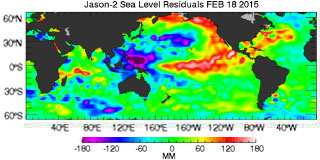
IIRC from Bob, El Nino’s are hot water flowing from the west to east. Not only is the water cool, but is now going to flow up a 200 mm hill.
Sounds a bit like the Southern Oscillation Index used by BoM.
Well we already knew boringstein would be confused…..
Warmer than normal water is now moving in through the equatorial under-current. Unlike last year, there is much less cool water in the eastern pacific to cool it off / moderate it. Probably heading toward an El Nino this year but lots can still change.
I await with baited breath Bill and i hope it comes off so we can move into the next La Nina at strength.
But i fear it will dissipate as it did last year and be another neutral, unless this next WWB can then start the wheels in motion for colder water to start to follow the warm pool westwards in the coming months.
At this current rate the warm sub surface still looks well out in timing, will be all over by August.
Here in Oz the weather def has been behaving like the 2009-2010 El nino, lots of humidity and troughiness.
My question is: “Did someone put some questionable chemicals in their morning coffee before they sat down to write this PR?”
It’s quite obvious there’s an El Nino on the map. However, due to global warming, it has been moved north a bit, up around the Baja. Or, is that it up around Seattle… Maybe both?
Oh, Mr. Crawford, come one. What is obvious is you did not read the flow chart above… (or much else about ENSO).
Hm. I just wonder what operates “up around Seattle.”
Please see this comment for links to two WUWT posts with much helpful info.:
http://wattsupwiththat.com/2015/03/05/noaa-claims-elusive-el-nino-arrives-the-question-is-where/#comment-1875829
I mean, “Come ON!
lolololo
Ha! Thanks for the good laugh. PS: You forgot you sarcasm tag.
Well, Tim, I certainly hope so… . Good for you to give Mr. C. the benefit of the doubt. I took him for a troll (just that perfect combination of ignorance, feeble-mindedness, and over-confidence).
Janice, you lovely woman, he was pulling your skirt§ Lol
Monsieur Richards! YOU have been in Paris too long… 😉
(but, (blush)
merci… you watered a very parched flower).
Yes, indeed, Joe Crawford’s dry humor was a brilliant imitation of a troll.
And… I’m wearing Levi’s… if anyone tugs on them….. I’ll….. oooooh…… I’ll YELL AT HIM, “KNOCK — IT — OFF!… then, let my German Shepherds bite him, heh, heh.
@janice, will the first shepherd leave enough for your second one? or do they “share” (found work? good luck btw )
It is well known that man-made global warming changes geography. And cartography. And stenography. And….
and pornography!
The El Nino is hidden deep below the surface.
El Niño????
Where and when?
I guess: The answer my friend, is blowing in the wind…..
Niño arrives’ – the question is, ‘where’?
In Australia when someone needs to achieve the impossible we say “You will need to pull that out of your a####”
Or….
“Tell him he’s dreaming”.
It has been a different set of events. Back in August the 3.4 region went below threshold (.5) which was the big reason for no El Nino call last fall. However, at the time the 1-2 region was quite warm and fit the El Nino pattern much closer.
Overall satellite data showed added warmth in the tropics consistent with an El Nino. Now, the latest satellite data (Feb) shows the tropics being much cooler even as the 3.4 region has warmed.
I can see why they are confused. This year has made it very clear that we only have a poor understanding of the El Nino phenomena. Any predictions are pretty much useless at this time.
“I can see why they are confused.”
Fine, but why change the definition? It’s the same thing with making adjustments to historical temperature records based on different methodologies, etc. and making new adjustments to bring things into an alignment via proxies.
There is a reason anything electrical must conform to USP standards, why there is a NIST agency, why computers follow(ed) standardization – to keep things uniform. When an agency like NOAA decides that the historical definition of an El Niño is inadequate to confirm or deny, will they now go back in time to look at the historical record and make adjustments to the frequency of El Niño in years past? Honestly, it’s providing no usefulness going forward other than to promote an environment where their operating budgets are maintained or increased.
Yeah, but that is the whole purpose of the climate change meme – Increase government power and budgets!
Yes, the N Pacific is in an odd pattern. Warm water in the northeast Pacific off N America, but the core area of El Nino off equatorial S America is avg or slightly below average. And a warm spot along the equator in the mid-Pacific.
Lately the warm NE Pacific area seems to have been “pushed” eastward and bifurcated a bit — north to southern Alaska and southwest toward Hawaii. The ITCZ area off S America, that will show significant convection during an El Nino, shows almost no activity right now. So the typical westward winds off equatorial S America seem to be blowing as usual.
The warm water off southwest California is providing the southwest US w/some precip, but not much.
Is this all the “missing” heat that the Pacific can belch up?
Well, the BBC reckoned the “scorching El Nino” might be responsible for wrecking England’s chances in last summer’s Football World Cup.
http://www.bbc.co.uk/news/science-environment-27343057
England are now doing badly in the Cricket World Cup, so, by BBC logic, I reckon that must be prima facie evidence of a continuing El Nino. Some where.
I’d like to hear from someone who is well-informed about the PDO…
Looks to me like THAT is what is shifting into “warm” gear.
Some background:
1. “The Pause that Cools: No More Warming Until 2015?
{nice call, there Anthony … as it is appearing….!}
http://wattsupwiththat.com/2008/04/30/a-look-at-hadcrut-global-temps-and-pdo-with-hodrick-prescott-filtering-applied/
2. 2014/15 — Part 5 — The Relationship Between the PDO and ENSO
by Bob Tisdale
“A strong positive PDO index value indicates the sea surface temperature anomalies of the eastern extratropical North Pacific are warmer than the western and central portions,… .”
http://wattsupwiththat.com/2014/04/21/the-201415-el-nino-part-5-the-relationship-between-the-pdo-and-enso/
Well! I found Mike Maguire (well-informed about PDO meteorologist) addressed PDO:
*** The PDO in the last year has spike positive(+PDO).
Either we are prematurely switching back to a +PDO regime(10-15 years early) with the possibility of a pattern change which will favor milder Winters again or the +PDO spike higher will be short lived, similar to the late 1950’s, in the middle of the previous -PDO regime, when the +PDO only lasted briefly and was followed by another 15 years back to a -PDO, along with more modest global cooling(until that ended in the late 1970’s).
http://research.jisao.washington.edu/pdo/PDO.latest
http://research.jisao.washington.edu/pdo/
Maguire 10:10am, 3/5/15 comment here: http://wattsupwiththat.com/2015/03/05/state-of-the-sea-ice-february-2015/#comment-1875936
Thank you, Mister Weatherman 🙂
They’re still hedging a bit by saying El Niño conditions, not El Niño event.
From the NOAA site: http://www.cpc.ncep.noaa.gov/products/analysis_monitoring/lanina/enso_evolution-status-fcsts-web.pdf
could these enigmatic conditions be the result of the global oscillations no longer being phase-locked?
http://i60.tinypic.com/6z0tvo.jpg
Oh, man, Dawtgomis — GREAT graphic. LOL, what a bunch of clowns.
IPCC: “Well, …. uuuuuh….. they sometimes were and …. they sometimes weren’t in phase and ……. duh…….. sometimes they ….. aaaaaaaaaa YOU KNOW WE ARE RIGHT: 97% of scientists agree!!!.”
What any genuine scientist at NOAA will now be wearing to work:
http://ts1.mm.bing.net/th?&id=HN.608053810662016189&w=300&h=300&c=0&pid=1.9&rs=0&p=0
Truly appropriate headwear for anyone on the govt. payroll, that’s for sure. I just thought maybe I was on to something in my absent minded prof-hoosier way.
We ought to photoshop a tassel onto that graduation cap!
@ Dawtgomis — lol. GREAT idea. #(:))
(thanks for acknowledging my photo)
@janice, now I know where all the brown paper bags in the grocery stores went, thanks the tassel is a great Idea (Donkeys tails?)
There is an El Nino because they say there is, ok ?
🙂
Guess they must have had something in the water or what?
March 3 ’15 Multivariate ENSO Index (MEI):
http://www.oarval.org/ts3Mar2015Opt.gif
See ESRL-PSD: Multivariate ENSO Index (March 3 ’15, Klaus Wolter, NOAA), at http://www.esrl.noaa.gov/psd/enso/mei/
There is an approximately 50-60% chance that El Niño conditions will continue through Northern Hemisphere summer 2015.
See http://www.cpc.ncep.noaa.gov/products/analysis_monitoring/enso_disc_mar2015/ensodisc.html
From 1976 to 1998, any prediction of an El Nino might have been easier simply because the El Ninos were typically so much stronger in that period. Now we’re in a cooling PDO, El Ninos are likely to be weaker and perhaps less frequent and perhaps much harder to predict???
El Nino. Beginning in March?
With the posting of the Dec-Jan-Feb ONI number, there have now been 4 readings of 0.5 or greater. The rule was that 5 readings above 0.5 were required before an El Nino call, so they must believe Nino3.4 will be warm in March.
http://www.cpc.ncep.noaa.gov/products/analysis_monitoring/ensostuff/ensoyears.shtml
they must believe Nino3.4 will be warm in March.
=======
ve haf veys to make it varm.
Was looking at the unusual levels of warmer than normal water around the W and SW Pacific yesterday, lots of it:
http://earth.nullschool.net/#current/ocean/surface/currents/overlay=sea_surface_temp_anomaly/orthographic=-214.12,-21.73,748
I checked it because a worrying system has been consistently shown to form and come toward next week. Fairly big, symmetric, lots of humidity, plently of warm water. It’s just a bit cooler where Marcia’s tracked to coast:
http://earth.nullschool.net/#2015/03/10/0600Z/wind/surface/level/orthographic=-214.12,-21.73,748
The wet-season has been a bit of a non-event in QLD due to mid and upper level southerly air intrusions through the continent’s center reducing interior humidity level so we have had almost only to coastal margin rainfall in the East and dry heat in the interior. So drought does appear likely to deepen this year.
Other than that, SSTA show no El Niño apparent, there’ way too much warm water still, and just southerly continental air that’s spoiling the humidity levels for a decent wet dump, the chances of which are rapidly fading now … except for the projected westward moving storm next week.
Our rain has seemed like a weak El Niño year here in So Cal.
Quite an ample rainfall though in the desert southwest this fall and winter season and into West Texas.
Compare January 2015 to January 2014.
http://www1.ncdc.noaa.gov/pub/data/cmb/sotc/drought/2015/01/zin-201501.gif
http://www1.ncdc.noaa.gov/pub/data/cmb/sotc/drought/2014/01/zin-201401.gif
And looking ahead, here is what the NOAA CPC thinks:
….rolling the chicken bones, viola!!
http://www.cpc.noaa.gov/products/predictions/30day/off15_prcp.gif
That’s what I mean. We’ve been getting regular little showers, which is unusual. No deluge, but definitely wetter than average.
“NOAA’s mission is to understand and predict changes in the Earth’s environment, from the depths of the ocean to the surface of the sun…”
Why do the stop at the surface of the sun? Why not go deep into the sun? Or right out to the edge of the solar system, or to the edge of the event horizon? All that is in the Earth’s environment if you’re going to define it so broadly. Are they really understanding and predicting what’s going to happen on the surface of the sun? Or even of Venus? They can’t even predict the bottom of the atmosphere correctly so I do wonder why they’re worried about stuff millions of miles away.
That’s because no one can yet rule out the interplay of cosmic radiation and heliospheric conditions with Earth’s climate. The NOAA is correct to pursue an ‘all-inclusive’ perspective to research. There are assuredly staff members who also have asked “Why not go deep into the sun?, how can we devise a method?” That would be the best way to understand and predict potentially civilization-disrupting coronal mass ejections.
To not be a “Flat-Earth Society” we must set our perspectives on the totality of the environment that our relatively tiny planet journeys through.
“This is the first El Nino since spring of 2010.”
The 09-10 El Nino was followed by a back to back double La Nina’s (10-11, 11-12) in which more than compensated for the El Nino -’10 bump-up in temp anomalies.
This weak Little Boy one will almost certainly be followed by a Little Girl this fall or next winter.
Light up the cigars.
Yes, and 2011 was a record snow year for the Sierras, despite the La Nina.
The traditional definition of El Niño is 5 seasons of the Niño-3.4 index at or above +0.5. So far, it has only been 4 seasons: +0.5, +0.7, +0.7 and +0.6. NOAA appears to be jumping the gun a bit.
If indeed, this is an El Niño, then it will be the latest arriving and weakest on record. NOAA’s records go back to 1950:
http://www.cpc.ncep.noaa.gov/products/analysis_monitoring/ensostuff/ensoyears.shtml
Which was about the start of the warm PDO which was replaced by the current cold PDO around 2005 – 2010
And they wonder why their models tuned for a warm PDO do not work,
The PDO is neither warm or cold, but refers to the location of the warm cold in the n pacific. BTW, the PDO recently turned what you call warm again. Warm eastern pacific.
The biggest reason for the difference between this event and previous ones has been the lack of atmospheric coupling. All we’ve had is the waves of warm water upwelling in the East Pacific but no major change in the trade winds to let the warm surface water in the West Pacific slosh back into the Nino 3, 4 regions. As one can see in the following charts there have been a few warm waves and a new one is just starting to up well up as we speak. However, only the first one was strong and until we get some kind of atmospheric coupling, I don’t see this becoming a strong event.
http://www.cpc.ncep.noaa.gov/products/intraseasonal/tlon_heat.gif
What? Where? 30 day SOI went positive (read: POSITIVE SOI) on March 2nd. bwahwhathuh?
https://www.longpaddock.qld.gov.au/seasonalclimateoutlook/southernoscillationindex/30daysoivalues/
According to NOAA’s MEI Index, we have has El Nino since last April!
http://www.esrl.noaa.gov/psd/enso/mei/table.html
Something is wrong here. As mentioned above in comments, previous definition is 5 consecutive months of 3-month ONI averages of 0.5 or higher. So far we have 3, perhaps 4 since it is the beginning of March and NOAA may have ONI for DJF now. We have ASO=0.2, SON=0.5, OND=0.7, NDJ=0.7, DJF=?? (>0.5?). But if so this is still only 4. Perhaps DJF went up, and so they are assuming JFM will also be >0.5?
But they should wait until they actually have the data until they call it. This smacks of activism, not science.
In the NOAA ENSO diagnostic discussion linked above, ONI for DJF=0.6. If I were in NOAA, I would be concerned that ONI for JFM will fall to 0.4 (since it is now dropping), and I would wait. But I’m not a climate activist. So I guess I know what to think of think of these NOAA people. Ever heard of Jonathan Gruber?
El Niño: characterized by a positive ONI greater than or equal to +0.5ºC.
La Niña: characterized by a negative ONI less than or equal to -0.5ºC.
By historical standards, to be classified as a full-fledged El Niño or La Niña episode, El Niño: characterized by a positive ONI greater than or equal to +0.5ºC.
La Niña: characterized by a negative ONI less than or equal to -0.5ºC.
By historical standards, to be classified as a full-fledged El Niño or La Niña episode, these thresholds must be exceeded for a period of at least 5 consecutive overlapping 3-month seasons.
These thresholds have exceeded for a period of only 4 consecutive overlapping 3-month seasons. The ONI Index being SON 0.5, OND 0.7, NDJ 0.7 & last DJF 0.6 . If JFM =>0.5 then an El Nino can be declared, so we have one more month to monitor before an El Nino can be confirmed or there is a washout !
They know there is an El Nino out there somewhere and it’s a travesty that they can’t find it.
Reblogged this on Norah4you's Weblog and commented:
As I written in my comment below:
El Niño????
Where and when?
I guess: The answer my friend, is blowing in the wind…..
Re the Higgs – they had to find it. After all, the alternative was to tell Europe’s politicians they had just spent billions on the promise of spectacular results and actually “sorry, we haven’t found anything”. Non-starter really. Anyway, think of the positive aspects – the Swiss now have the world’s most spectacular 20 mile diameter microwave oven on their doorstep, with no one living more than a few minutes drive away of being able to warm up a tasty pop tart or pasta. Always a bright side if you look for it.
The Swiss can always do with a boost to their cooking skills….
I am asking a question here. This project to find this singular “Higgs/Boson” particle in this massive “machine” at CERN ( and I do not doubt the Russians and Chinese have similar projects and I remember one was cancelled in Canada about 10-15 years ago) will lead to what? Is there a place I can find out .other than the PR btw, what is being sought after?. For a lay person the amount of money spend is staggering. Is there a practical solution at the end? such as fusion?, an energy force to be used in space? or whatever. This (great) site many times leads me to answers and I realize this is away from Climate but if someone can point me? Thanks beforehand!
Well, here’s a flow chart:
[Start Here] Are many states in the midst of one of the coldest periods in north America on record? [If yes, proceed to next] Has Antarctic ice (despite our assurances) exceeded all warmist predictions? [If yes, proceed to next] Has snow accumulation across the U.S. exceeded all our wildest denials, snarling traffic, and forcing us to redefine “warming”? [If yes, cover one eye and proceed to next] Do we at NOAA look like ignorant, elitist buffoons with an agenda? [If still yes, cover both eyes and put your feet over your ears, then proceed to next] Haven’t we told you so about every winter and spring? [Still yes? Cover both eyes, both ears, and your mouth, then curl your tail in a manner suitable to protect your hindquarters and proceed to the coup de grace] Yep, that little monster’s a-comin’ and it’s called… “Summer”.
You head it here.
lol. 🙂
I call your attention to a recently published paper.
The Sun is the climate pacemaker I. Equatorial Pacific Ocean temperatures
by D. H. Douglass and R. S. Knox [Physics Letters A. Vol 379 p823-829 (2015)]
Abstract
Equatorial Pacific Ocean temperature time series data contain segments showing both a phase-locked annual signal and a phase-locked signal of period two years or three years, both locked to the annual solar cycle. Three such segments are observed between 1990 and 2014. It is asserted that these are caused by a solar forcing at a frequency of 1.0 cycle/yr. These periodic features are also found in global climate data (following paper). The analysis makes use of a twelve-month filter that cleanly separates seasonal effects from data. This is found to be significant for understanding the El Niño/La Niña phenomenon.
In this paper El Ninos are identified with the maxima of segments showing phase-locked oscillation, which can have periods that are exactly 2-years or 3-years.
In the conclusions we state:
“The climate system is presently (June 2014) in a phase-locked state of periodicity 3 years. This state, which began in 2008, contains a maximum (El Niño) at about 2010 followed by a minimum (La Niña) followed by a maximum (weak El Niño at about 2013). If the climate system remains in this phase-locked state, the next maximum will not occur until about 2016 – i.e., no El Niño before that date. On the other hand, if a maximum occurs before then, it will signal the end of the phase-locked segment (and therefore a climate shift).”
I just checked the latest SST3.4 data (though Feb 2015). Analysis of this updated data set indicates that the climate system is still phase-locked in a 3-year state with the next maximum (El Nino) predicted to occur at about Dec 2015/Jan 2016).
David Douglass
Department of Physics and Astronomy
University of Rochester
Rochester, New York
Simple enough to confirm or falsify. Ask the Peruvian anchovy fishermen. They know if there is an El Nino before anyone else by their catch.
Rah – according to undercurrent news Peruvian anchovy stocks are set to fully recovered. This means renewed upwelling bringing nutrients to the surface, as evidenced by the strong juvenile year class:
http://www.undercurrentnews.com/2015/03/04/peru-to-set-southern-anchovy-biomass-as-fishing-season-could-be-moved-forward/
For a while I have been predicting a significant La Niña this year. So far this is not happening due to a continued – but weakening – series of Kelvin waves trying to keep the El Nino show on the road. When these finally sputter out we could still have a La Niña in the first half of this year.
BTW it would be nice to have the spot price of prime fish meal added to the WUWT Ocean and/or ENSO data pages.
lol, here ya go, Phlogiston! 🙂
http://research.investors.com/quotes/nyse-omega-protein-corp-ome.htm
@David Douglass
Above in your comment concerning your paper you say “…both locked to the annual solar cycle.” But there is no “annual solar cycle”. The revolution of the earth about the sun is a terrestrial cycle. So it’s not the sun. It’s the revolution of the earth about the sun.
I’m not saying there isn’t such a phase locked phenomena, just that it shouldn’t be claimed that the sun is causing it.
Coaldust
Hi. Everbody knows that in a coordinate system with the Sun at the origin the Earth goes around the Sun in an ellipse. However, the climate system of the Earth is best described with the Earth at the origin. As we point out in our paper in section 3.2, in this coordinate system, the Earth experiences a sinusoidal Solar Irradiance of amplitude 11.3 W/m2 at 1.0 cycles/year.
David Douglass
“Update2: It seems there is a decision flowchart for calling an El Niño, I wonder if they followed it this time?”
If it doesn’t fit you must acquit!
While there IS a bit of a trade wind anomaly west of about 170W (from about 170W to about 160E), the eastern half trades are nominal to stronger than usual. Once you get west of 160E it goes close to nominal again. This is still looking like a protracted “La Nada” to me or maybe some kind of weird modiki modiki. Based on recent behavior, my gut tells me this is a short term local trade wind anomaly. We’ve seen this a couple of times over the past 12 to 18 months. Both times people called for a nino, both times it went bust.
So — we have stronger than normal trades in the eastern Pacific, slack trades in the mid-western Pacific and nominal trades in the far western Pacific. You can’t have a real EN Nino without slack trades and the western Pacific warm pool is empty — the water there is cool. So this isn’t any Nino event I have ever seen and doesn’t look likely to produce one in my opinion.
@ cross,”So — we have stronger than normal trades in the eastern Pacific, slack trades in the mid-western Pacific and nominal trades in the far western Pacific. You can’t have a real EN Nino without slack trades and the western Pacific warm pool is empty — the water there is cool. So this isn’t any Nino event I have ever seen and doesn’t look likely to produce one in my opinion”
That is where I get really confused. How and where and when do all these air flows equalize? To me you cannot have a weak flow in the Western Pacific coupled with a strong one in the Eastern Pacific otherwise would it not leave “a vacuum”? Air has to come from somewhere. Does it flow in from the tropics (warmer) or from the (colder) air mass in the Northern Pacific to fill these voids? And how and by what are these two influenced?
To me ??? Interesting but a Chaos.
El pendejito jajajaj
On the flowchart, the second decision box labeled, “[Do you] think the Niño-3.4 SST will stay >=0.5C for the next several seasons.” is subjective. If NOAA can call an El Niño based on “what they think”, then any official El Niño is meaningless. It should be based on measurements. If the Niño-3.4 SST drops below 0.5 for the JFM average, will they call back the El Niño? Because if it does, they should.
Down Under we should call it the ‘Wenju Cai’ factor:
http://econews.com.au/news-to-sustain-our-world/csiro-ocean-data-points-to-strong-el-nino/
http://www.climatenewsnetwork.net/warming-will-double-extreme-el-ninos/
this guy would stagger out of Las Vegas with not a stitch on him….
It must be nice to be able to have a range of verifying sources to choose from to substantiate your message.
In the commercial world, having numerous sets of books to produce to the authorities would get you a gaol sentence. In the climate world, this is apparently acceptable.
It looks like the missing heat hiding in the oceans is hiding pretty well….
El Ninja?
Call me a conspiracy theorist, but I can’t help but thinking that they wanted to wait on any official proclamation of an El Nino until after they proclaimed 2014 as the hottest year ever. That way none of those pesky deniers could blame 2014 on an El Nino. And just like Ashby Manson, it feels to me like a mild El Nino weather-wise here in Southern California: there’s been rain every month since November, a bunch of rain in December (mild version of 2010 El Nino) and then late season winter storms in February and March (mild version of 1998 El Nino).
It’s a Justin El Nino, the one have just-in-case it really is one, is really going to be one or could be an eensy teensy one … or your keyboard slipped and said it was one.
Not according to the BoM, Australia. But then again, they use an 0.8 variation for neutral, not an 0.5.
http://www.bom.gov.au/climate/enso/#tabs=SOI
NOAA’s gone nuts!
Cold water all along the equator in the
Eastern Pacific is developing “La Nina”.
El Nino? I don’t see it.
here is what wikibible has to say it should look like:
http://en.wikipedia.org/wiki/El_Ni%C3%B1o#mediaviewer/File:1997_El_Nino_TOPEX.jpg
here is what we have today:
“http://earth.nullschool.net/#current/ocean/surface/currents/overlay=sea_surface_temp_anomaly/orthographic=-153.22,-2.03,414”
if anything it is an anti el nino
wow.
I look at the two charts at the front of this post, here.. ?w=1400&h=764
and the one below it, and I do not see how they claim record SST , or have the global SST cooled a lot since a few months ago?
Has anyone archived the demise of NOAA’s 3-Month Outlook “Official Forecasts”? As of today, there are NO Below Normal Temperature Probabilities beyond the current 0.5mn MAM 2015 Forecast and NO Above Normal Precipitation Probabilities beyond 3.5mn JJA 2015 Forecast made February 19, 2015. These Probabilities were functioning in December 2014 out to 6.5mn.
http://www.cpc.ncep.noaa.gov/products/predictions/long_range/seasonal.php?lead=1
Locally in California, there have been some El Nino characteristics: (1) a warm winter because of more tropical air, (2) several warm drenching Pineapple Express storms (unfortunately sporadic due to a lack of storms generated in the Gulf of Alaska because of the shifted polar jet), and (3) sea lions starving because cold-water fish have moved to deeper, cooler water. The beaches have been comfortably swimmable all winter in SoCal. But scientifically speaking, no true El Nino, but we can hope!
Joe Ybarra,
“Comfortably swimmable??” Where are these beaches? I visited San Diego in late June (this was around 2002 but it isn’t THAT much warmer this year) which is about as far south as you can go in CA …. and the water was as cold as it feels in Puget Sound (Washington coast). It would have to have been TWENTY degrees warmer to have been “comfortable” to me.
Are you especially warm-blooded?
Really wondering!
Janice
There is a weak Modoki enso event occurring, and as such, you see the kind of major cold winter in the east that we saw in 02-03 and many of the winters in the late 50s-70s. Even the JAMSTEC site, which along with SCRIPPS are the best low latitude centers ( I watch both of them extensively and even though they disagree with my ideas on AGW, their work on enso events is fantastic) says so, right on their front page.
February 19, 2015
ENSO forecast: The SINTEX-F model prediction and present observations show that an “El Niño Modoki”condition prevails in the tropical Pacific. As per the model predictions the warmer than normal SST anomalies are expected to continue in the central Pacific through the boreal summer.
I dont understand what is so hard to see about that, given the weather behaved very close to what those type of enso events produce. There is no super nino as was opined, but the reason we had the brutal winter idea was because of the idea this event would evolve. So I am having trouble understanding the resistance to the idea their is a weak event occurring. Whats the big deal? Its the very warm n Pac that is the reason for the warm global temps and fighting over whether this is weak enso event or not seems to me to be a waste of time. Its happening, the sensible weather is similar to such occurrences, and was mentioned back in the preseason as a reason for why we had another brutal winter with plenty of snow. One of the problems is we seem to want to box these into some kind of neat package. The atmosphere is never neat but there is enough to substantiate the weak enso classification.
Joe, any idea when the California drought will break?
My guess is next winter. Then the year after that, 2016/17, I see as having a good chance of turning into a flood year, similar to the winter of 1996/97.
No need to wait for actual rain – spray your plants with re-analysis water.
Can wishing make it so? http://www.slate.com/blogs/the_slatest/2015/03/05/el_ni_o_it_s_here_and_it_will_boost_global_warming_to_record_highs.html
Slate went to Columbia Univ (home to NASA GISS) for a comment.
Somehow, I’m having trouble warming up to his comments, though I’ll agree Modoki El Niños deserve study. Or this from the author, that suggests (my twisted interpretation) that snowy winters presage El Niños:
I wondered why the needle on the ENSO meter jumped up. Is the map perhaps old or something? It doesn’t seem to justify the needle’s position.
As keeper of the ENSO meter, I should know but I don’t except that it sure looks like a bunch of people want an El Niño.
I get the data currently from Australia’s Bureau of Meteorology which says at http://www.bom.gov.au/climate/enso/ :
remain warmer than average, but within the neutral range,
nice example of double dutch!!
BoM doesn’t feel confident.
‘All international models surveyed by the Bureau indicate that central tropical Pacific sea surface temperatures (SSTs) are likely to remain warmer than average, but within the neutral range, until at least May. By mid-year, six of the eight models indicate SSTs will exceed El Niño thresholds. However, accuracy of forecasts made at this time are lower than those at other times of the year, and hence some caution should be exercised. ‘
Speaking of the Californis drought, it might be worth mentioning that the reservoirs are in much better shape than they were a year ago — about 1-2/3 last year’s level when I added up the numbers about a week ago.
http://cdec.water.ca.gov/cgi-progs/reservoirs/RES
I realize that reservoirs are only part of the picture. The level and moisture content of mountain snowpack, and soil moisture content, and the Colorado River watershed conditions, are also keys. But it seems like the CA drought bottomed out a year ago, and that the state is recovering.
Cliff Mass, a professor of atmospheric science and a moderate warmist (believes in AGW but condemns the alarmists), was one of the first to diverge from the “strong El Nino” crowd a year ago. Here’s what he wrote about it a couple weeks ago.
http://cliffmass.blogspot.com/2015/02/whatever-happened-to-el-nino.html
Forecasters predict it will stay weak, have little influence on weather
and climate…
Since El Nino is a part of the climate, wouldn’t a weak one have as much effect as a strong one, only the effect is different?
Since El Nino is a part of the climate, wouldn’t a weak one have as much effect as a strong one, only the effect is different?
I understand that El Nino and La Nina pull the weather away from the climactic averages.
It is a marginal Modoki Type II.
http://econintersect.com/pages/weather/weather.php?post=201503094543