Guest Post by Willis Eschenbach
As at 2 PM Pacific time, here’s the current position of Sandy and the projected path.
 SOURCE: National Data Buoy Center
I had said a couple of days ago, when Sandy was a hurricane, that it would not be a hurricane when it hit the coast. How did that go?
Well, as of the time that this location and projection of the path was done, the NDBC has shown all the nearest stations. Not one of the actual observations is showing sustained winds over 50 knots, and that’s a long ways from the 72 63 knots that marks a hurricane.
Please note that the big damage from such storms is the flooding, so I am not minimizing the likely extent of the damage. It will be widespread. However … not a hurricane.
w.
Addition by Anthony:
Harold Ambler has a photo of storm surge in Rhode Island here
Flooding in the subway in Newark, NJ (via FirstHand Weather on Facebook)

Well done, Willis! Right again! Thanks for reporting!
Has anyone noted any MSM reporting this? As far as I can tell it is still hurricane Sandy, and will be for all time.
The MSM downgraded it immediately after landfall. Just check CBS or any of the others.
I cannot find a photo or video that looks like a major storm surge. In New York City, all I see are events of water sloshing over seawalls. Wind damage seems all but nonexistent, though one crane happened to collapse. I just do not see the major storm that has been hyped for two days. Sorry, but the MSM are demented. Given the MSM’s propensity for unbridled hype, they should not be allowed to play with computer models.
Yep, It’s no hurricane…..There’ll be damage and flooding. Any big storm arriving during a full or new moon is going to have exacerbated flooding over the 12-24 hours it takes to arrive, cross and pass…. and the news teams which are nothing now but glorified info-tainment purveyors, with the emphasis on hype, catastrophe and propaganda, will be whooping it up for all it’s worth… sigh.
I long for the days when people just got on with the job of making the best of the day and went about their lives with a bit of decorum….;-)
Up here in northernmost Vermont we were told to expect 80 mph gusts… It’s 9:25 and as far as I can tell, no one, anywhere, is getting 80 mph gusts.
Note to self, this is a good thing.
It did look frightening for a while there so I don’t blame the fear mongering msm too much, and I’m glad that I didn’t get to experience tree smashing, power outage causing, food rotting winds… But if this is an example of Climate Chaos, bring it on!
P.S. How many days since a hurricane has made landfall in the USA?
The flooding is bad now in and around NYC (high tide). Here’s a link to a site with lots of photos, breaking news tidbits, and wild/fringe commenters:
http://www.zerohedge.com/news/2012-10-29/postcards-underwater-new-york
Weather Channel calling ‘record storm surge’; beating 1892 (I think it is) … water to Wall street … 3′ of water on floor of exchange …
Watch live? http://www.weather.com/tv/tvshows/live-stream
(Note to mods: trim link out if it is undesired)
.
I’m in central Ohio and we’re getting 5o mph gusts. We’re about 400 miles from NYC.
This will turn out to be another MSM over-reaction. The worst case was going be a Cat 1 huuricane. There was never any chance of it making land fall as anything stronger than that.
Thanks Theo Goodwin October 29, 2012 at 6:25 pm. I should have rechecked. I was too cynical there, and too optimistic about the storm surge it seems.
Don’t you wish everyone would admit it when they make mistakes?
Frankenstorm downgraded to Frankenfart?
Willis,
Thanks, I found a lot of confusion from the media re the landfall location and time for Hurricane Sandy. Based on what I saw it looked like Cape may but the media is all over the place. even up to central NJ 70 miles north.
I dont care if it is still a hurricane or an ex tropical storm, what I really want to know is if the west side highway is under water or not?
Article on the effects of subway flooding. Note the picture of Hoboken station and the lame attempt at flood control (a few sandbags). The station is now flooded. Questions should be asked, as to why no proper flood barrier.
http://online.wsj.com/article/SB10001424052970204840504578087113950736132.html
We’re in eastern MA (Framingham). A tall 30-y/o spruce at the corner of the house was uprooted by fierce wind gusts (maybe 60 mph?) this afternoon, and now rests at about a 20º angle on the power and other cables running to the pole. Surprisingly, we have not (yet) lost power, and the wind and rain have diminished considerably (c. 10 PM), but I’m mighty nervous about this tree resting on the power line.
In Dedham, SE of here, No. Two Son had an old oak tree in front of his house come down and take out power for the whole street. There are reportedly a lot of trees and branches down in the region, so the power companies (mainly NStar and National Grid) are plenty busy. We’re in the queue, but as we have power, I don’t expect we’re high up.
Hurricane or no, it’s pretty impressive to have a cyclonic storm hitting New Jersey blow down trees here in Massachusetts at the same time. I’m impressed.
/Mr Lynn
Don’t see the purpose of this post except for self-aggrandizement. Whatever it’s precise nature on impact, it was and still remains, a terribly destructive storm. And not just flooding. Wind a major factor as well.
Hurricane/T.S. Irene related posts on WUWT concerning sub-Hurricane damage.
http://wattsupwiththat.com/2011/09/01/tropical-storm-irene/
http://wattsupwiththat.com/2011/08/29/even-the-tv-news-community-is-asking-if-irene-was-overhyped/
It is now quite clear that saltwater is in the NYC underground. At least part of it. How much won’t be known until about 10 am after the next high tide passes. The storm surge may still be rolling up Long Island Sound as I right this. The precautions MTA took with Irene were the same (or less) than they took with Sandy. It will be interesting to see how the MTA and ConEd (and the City Government of NY) prepared for this storm surge after the Irene dry-run.
If it takes 2 days to get the subway running and power on to lower Manhatten, the civil engineers and electricians will deserve a year’s pay and a key to the city.
If it takes 2 weeks to get everything back running, they will have done a HEROIC job. NYC might be under a foot of wet snow in 48 hours, the public will be coming unglued with impatience, but the guys doing the dirty jobs will be outright heros in my view.
If it takes 2 months to get everything back running… well, it wouldn’t surprise me. There are only so many spare parts, spare transformers, and spare man-hours on hand. System failures have very non-linear dynamics.
At least the MTA got the subway cars out of harms way. New Orleans ruined 800 buses by parking them in a place to flood.
http://www.nhc.noaa.gov/text/refresh/MIATCUAT3+shtml/300101.shtml claims 80 mph sustained winds at 9 pm EDT = 0100 GMT. So, there still are hurricane-force winds despite Sandy’s current designation as a post-tropical cyclone. http://www.nhc.noaa.gov/news/20121027_pa_sandyTransition.pdf has a discussion of post-tropical cyclones.
Note that the NHC had no hurricane warnings up at the coast, only offshore. They were forecasting it would be an extratropical low at the time of landfall (personally, I though I saw an eye was still mostly intact at landfall.) I think I saw a NHC reference to substantial temperature differences near the center, an extratropical trait.
A hurricane is a tropical cyclone with sustained winds of 64 kt (74 mph) or more, but point taken.
The central pressure at landfall was 28.02″ Hg from some random source I read. That’s 949 mb, which is more typical of a strong Cat 3 storm ( http://geography.about.com/od/lists/a/hurrcategories.htm ). I think the huge breadth of the wind field is what kept the central wind speeds down – it’s blowing like crazy up here in central New Hampshire. Heck, my pressure is now 29.27″ (991 mb).
To have a strong wind, you need closely packed isobars. Like Camille, not like Sandy.
Got a friend up new Green Bay. I’m assuming by the time it gets that way it’ll be spent. Right?
DaveE.
Oops, that’s near Green Bay.
DaveE.
There’s a story in SciAm about Sandy being the biggest storm ever.
http://www.scientificamerican.com/article.cfm?id=sandy-vs-katrina-and-irene
What is their criteria? Seems a bit suspect to talk about storm diameter when the storm seems to have ingested the Frankenbaby. The seaward expression of Sandy seems, well, meh…just a mundane deteriorating storm. They talk about the lowest barometric pressure EVER, whereas other sources say it ties the New England Clipper of 1938. Again, the largest diameter storm [since imagery could determine that].
http://mashable.com/2012/10/29/hurricanes-irene-vssandy-compared/
Compares Sandy & Irene….and you can see the great big chunk of storm being absorbed.
Ugh on that WSJ article.
“…The potential for a once-in-a-century subway flood has been a growing cause for concern as sea levels have risen.
‘We never had a weather condition as adverse as this, but we always knew that as the water warmed, there’s a great deal more energy to these storms,” said former Lt. Gov. Richard Ravitch, who led the MTA in the 1980s…'”
Yeah, that’s it. It’s an unprecedented storm due to warmer water and rising sea levels, all because of climate change.
_Jim says:
October 29, 2012 at 6:51 pm
Maybe my standards are too high. I thought that storm surge meant tidal surge; that is, the whole darn ocean comes up on land and stays a while. When it retreats there are ocean going vessels on the beach. That is what happened in the big ones on the Gulf coast. My best memories are of Camille. What we are seeing in NJ and NYC I would call storm slosh. For the most part, the flooding does not reach the top of wheels on vehicles. Those vehicles are undamaged and can be driven as soon as the water recedes just a tad.
I see no wind damage at all. That screams “not a hurricane.”
Was anyone killed by wind or storm surge? I believe not and I hope not. Stepping on a live wire does not count.
After hyping this storm as if it were Katrina, everyone associated with weather in the MSM should resign. The MSM needs to get a life.
A comment I read from Seeking Alpha:
“Bob – my gma called. she’s 95. she was worried the flooding would get her on the 6th floor of her condo. thanks TWC for scaring her.”
Water level in Battery Park has come down a couple feet from its peak and is still receding … high tide occurs at 12:10 AM EDT … on-site report per CH 4 reporter in NYC …
Old record in 1821 beat by a couple feet, new record now 13.8 ft …
.
Never post an I told you so when people are suffering.
Over time as oceans warm and air temperatures rise these kinds of major weather events will be more common. Its all about the shape of the curves on the Psychrometric chart, as air gets warmer, it’s ability to absorb water increases at an increasing rate.
The weather channel reports are pathetic: the reporter from Newburyport had his feet barely covered by water around a wharf surge of debris. It was as if he reported a tsunami…
In Battery Park water receeds and the reporter estimates the wind at 70mph… just holding her baseball cap…
The comment are contradictory: one reporter says water level receeding quickly… meanwhile the main anchor talks about slow recess of water…
Let’s not forget that The Weather Channel is a Rothschild property
http://zen-haven.com/rothschilds-weather-channel-buys-weather-underground/
And is serving their global warming alarmism…
Meanwhile on Yahoo:
http://news.yahoo.com/sandy-unlikely-damage-us-economy-analysts-164120917–finance.html
Yes the storm surge and tides contributed to strong flooding, winds were strong but Frankenstorm is yet another staging of meteo for political purpose.
Let’s wait and see how Atlantic City and area did tomorrow morning … getting people OUT of harm’s way is part of planning and preparation in events like this, so lives DO NOT require police and fire responders when water levels climb (where do you seek shelter when your house floods and the ‘dry’ spot is the roof BUT the storm is still raging? One must avoid the physical conditions that might cause one to perish from ‘exposure’ or hypothermia) …
As with Katrina, the big problem is the destruction the storm reeks on infrastructure in ‘slow motion’ (i.e. storm surge/flooding and continued hours of wind damage) which works to erode formerly functioning (1) potable water (purification and pumping) systems, (2) electric switching yards, (3) distribution systems in the neighborhoods and (4) and up and down the main drags (streets), and (5) operating/operating of waster-water (sewage) systems for quite literally ***MILLIONS**** of people … at the moment, in five of the states affected 4 *million* customers show to be without power; note: 1 ‘customer’ may represent an entire family or a single person, I don’t know if that includes businesses or not.
.
Ric Werme says:
October 29, 2012 at 7:25 pm
“it’s blowing like crazy up here in central New Hampshire. Heck, my pressure is now 29.27″ (991 mb).”
Ric – where are you?? I’m in the upper valley and the wind is indeed blowing but NOT like crazy! Maximum gusts at the local airport haven’t exceeded 32 mph:
http://www.intellicast.com/Local/Observation.aspx?location=USNH0123
Irene was worse!
JM Sute, may I suggest this link:
http://www.ems.psu.edu/~fraser/BadMeteorology.html
Keep playing the guitar and enjoy the read.
Thanks, Willis. A voice for sanity!
Theo Goodwin … I don’t know what inspires your need to downplay this whole thing, but this is a serious piece of weather and the MSM rightly (this time) have told it how it is. It was always going to downgrade once it hit landfall. That’s how hurricanes work.
So far 10 dead and rising. 3 million people without power and a record 4 metre storm surge is battering NY….and this is just the start.
Perhaps it would be prudent for you to consider resigning your comments until the full scale of the damage is known.
[snip – nothing to do with hurricane Sandy – way off topic -mod]
“Old record in 1821 beat by a couple feet, new record now 13.8 ft …”
Almost 200 years to beat that record… and NYC now is no NYC 1821…
_Jim says:
October 29, 2012 at 7:42 pm
“Old record in 1821 beat by a couple feet, new record now 13.8 ft …”
There are pictures of water flowing into Ground Zero, the 9/11 memorial. Isn’t that rain water? It seems to be that the path from the harbor to the memorial is up quite a slope, one that I recall is considerably more than 13 feet. (After topping the slope, the water runs down into the memorial.)
The same for Wall Street. The flooding in the streets must be from rain water. Wall Street is way farther up the hill beyond the memorial.
Psychometric chart? OK, an MSM hurricane forecaster.
They are calling it Superstorm instead of hurricane.
Theo Goodwin says:
October 29, 2012 at 7:40 pm
I think people have gotten better at getting boats out of the way. (The Bounty replica excepted.) Comes from better satellite imagery and track forecasts so that pilots can figure out a safe heading.
Despite the better communications we have now, I suspect any areas damaged like that may not have good coverage until the storm passes. For example, http://www.shipbottomfireco.com/ hasn’t updated their page in at least 8 hours, I was hoping they would have pre-sunset photos.
Don’t forget Camille was Cat 5….
Mr Lynn says:
October 29, 2012 at 7:18 pm
You tell a lovely store and paint a vivid picture. I have been in your situation but in central Florida. Do not notify the authorities. They will turn the power off. Maybe try to hide the tree until the repair crews show up.
pokerguy says: Don’t see the purpose of this post except for self-aggrandizement. Whatever it’s precise nature on impact, it was and still remains, a terribly destructive storm. And not just flooding. Wind a major factor as well.
You know, its the global warming alarmism that fosters posts like this. Everything everything is blamed on global warming and for rational people, it gets tedious. Claims of “unprecedented storm due to warmer water and rising sea levels, all because of climate change.” If you poke around in the history here at WUWT and look at some recent (within the last 3 months) topics, you can find many references to weather being LESS, not more severe at this time. Everytime the weather sneezes is not a reason to exaggerate in order to support a failing alarmism agenda. So posts like this help me maintain perspective when the media doesn’t. Not saying the flooding won’t be a real problem, but weather has caused problems for humans since the beginning. So why is a great big honking storm nothing but normal?
Pokerguy, I like hearing that this is a “normal” big honking storm that will cause normal and predicatble damage as has been the case forever and certainly nothing new. I enjoy these types of posts for my sanity.
My only experience of this storm was when it was 200 miles from the NE coast of Florida. It was annoying as I was forced to spend my time searching for shells rather than playing in the water. There were some impressive waves even at low tide and the beach was basically inaccessible at high tide unless one was prepared to dodge large logs which came up with the extreme waves and storm surge.
What I’ve noticed about weather reporting now is that it has become far too driven by ideology. Rather than just report facts, it seems necessary to report worst case scenarios. I have to admit that the Florida TV reporting, while alarmist, didn’t mention anything about CAGW. Given that Sandy was 200 miles away from me at its closes approach, it made me wonder why so much was made of the mere 40 mph winds experienced locally? There was a local weather underground weather station and the very low barometric pressume recorded as Sandy passed made me regret that I’d chosen not to pack along a barometer with a USB interface for this trip.
Unless it affects my ability to book a flight back to Kamloops, I’d have to consider this hurricane to be an enhancement of my vacation rather than a negative effect. Noticed some very interesting wind effects on sorting of sand grains by size and weight and the shells dredged up by the high seas were definitely of greater variety than what I’m used to. Also, got into studying seeds carried by ocean currents given the large number of washed up tropical seeds that were present on the beach over the last few days.
However, had the storm headed west instead of north, I probably wouldn’t be posting this.
Ric Werme says:
October 29, 2012 at 8:24 pm
My argument is with the MSM. They hyped it as if it were Camille. CBS and others published that it had tropical storm force wind 465 miles from the center. Preposterous. The totality of their hype was Preposterous. They should have told the truth that it would become a tropical storm at landfall or soon after. Tropical storms push around some water and they are excellent at knocking down lots of trees that are more than seventy years old. That causes power outages. But none of that takes place at the level of a hurricane. Tropical storms are tree killers. Hurricanes kill trees, buildings, streets, and everything.
Four NY hospitals being evacuated because their backup power failed/is failing, including NICU units. 5′ water in lower Manhattan. Alert issued for Oyster Bay Nuclear Facility. I don’t think it matters what the heck you call this storm, it is the damage that is the problem not the official designation.
Four NY hospitals being evacuated as their backup generators are failing or have failed, including NICU units and one hospital on fire that cannot be reached due to flooding. Does it really matter what the heck you call this storm?
The remnants of Sandy seem to be left spinning just a bit east of D.C.
This link live… it won’t last long…
http://radar.weather.gov/radar.php?rid=DOX&product=NCR&overlay=11101111&loop=yes
I’m starting to agree with the “MSM beat-up” claims.
http://www.abc.net.au/news/linkableblob/4341760/data/infographic-how-hurricane-sandy-compares-irene-katrina-yasi-data.png
Yes it’s a bad storm, but it’s not really a BAD storm.
[snip – flame bait – mod]
Mitsouko says:
October 29, 2012 at 9:06 pm
Of course bad things happened because of the storm. But they are the kinds of bad things that happen in a tropical storm. At no time did the MSM say (or admit) that Sandy would be something like a tropical storm at landfall. They talked constantly about storm surge that could be expected from hurricane Sandy. As I said above, a dangerous storm surge is a tidal surge and the ocean comes on land for a while. That simply did not happen.
My argument is with the MSM. I am not calling New Yorkers cry babies. Having trees knocked down by a tropical storm and losing power for a week or two is immensely painful but it is not the kind of pain that the MSM led us to expect. They led us to expect a hurricane pushing a true tidal surge.
mitsouko jhwebster… same post… 3 minutes apart…
And Simon, no one says it is not an important weather event. But the media staging is not innocent. The conjunction of high coefficient tides with the storm surge explains what happened in Battery and it took about 200 years to get there from 1821… and water is already receding in NYC. So let’s keep some perspective here.
Theo says.. “Psychometric chart? OK, an MSM hurricane forecaster.”
Nice strawman, but FAIL. As I said last time, the chart demonstrates why rising temperatures in the ocean and rising temperatures in the atmosphere will lead to a higher rate of incidence of extreme weather like what we are seeing unfold now.
Hearing the winds here in Central Ontario and my river has whitecaps. Will see in the morning if we have power. If they hadn’t told me this was Frankenstorm, I would have thought it was an ordinary rainy windy day.
Sharks in N.Jersey Subway https://twitter.com/odiomistweets/status/263129592628400128/photo/1
I waiting for it to flame out. The MSM made it out to be a storm like none we have ever seen. And they want us to believe they can forecast the weather decades out? I am now totally suspect of all weather forecasters.
It is not going to be easy getting the power back on when stuff like this happens…
video as 14th Street Con Ed power station transformers explode. Four “light the sky” explosions at a power plant within about 3 minutes. These aren’t your off-the-shelf pole transformers.
Links to NYC now seem to be unconnected.
Frank K. says:
October 29, 2012 at 8:00 pm
Ric Werme says:
October 29, 2012 at 7:25 pm
I’m just north of Concord. I think the airport had some gusts around 50, my tree and building sheltered weather station has only seen up to about 28.
Unitil provides electricity to the Concord area, currently 26.6% of the customers have lost power.
I forget about the wind, but Irene brought more rain, we’ve only had 1.15″ today. Keep in mind Irene’s path was nearby, this storm is so far away that being affected by anything more than some cirrus clouds is amazing.
No! It doesn’t matter what the heck WE call it. Nor does it matter what the heck YOU call it. However it does matter whether you or others tell lies about it!
Here is a photo of sea-water flowing down into underground parking garage. I thought for a moment those were cars moving through standing water. No it’s water rushing past standing cars! (no tail lights, no head lights).
This is what made 2001-Allison such a terrible storm for Houston. The bayous overflowed their banks and water got into underground garages, then inter-building tunnels, and building facilities. In Houston we were dealing with fresh water.
For those interested, you can have real time video from Earthcam via this link. It still shows activity in Timesquare, a little wet but quite a few cabs running about.
http://www.earthcam.com/network/
Beaufort Scale 12, Hurricane Force, 64 knots and above, Huge waves. Sea is completely white with foam and spray. Air is filled with driving spray, greatly reducing visibility.
‘Who biddest the mighty ocean deep
Its own appointed limits keep;
Oh, hear us when we cry to Thee,
For those in peril on the sea!’
Around midnight here in central Pennsylvania, had 28.22 in-Hg on the old barometer. It’s now rising, up to 28.26 at 2AM. And the wind shifted direction, hitting the house more. Lights are going out for a few seconds at a time.
And Ric Werme is only down to around 29.3 north of Concord?
I’ve only been in an airplane once, brief ride around a local airport. Never been on a jet.
But I swear this is making my sinuses drain and my ears ache. If this is how my body responds to just this much of a pressure change, I better cancel my plans to climb Everest.
The New Yorker’s ‘expert’ Elizabeth Kolbert is writing the usual spurious nonsense about Sandy being all the fault of climate change: http://www.newyorker.com/online/blogs/newsdesk/2012/10/watching-hurricane-sandy-ignoring-climate-change.html
Call it what you like – the news coming through and the images on the tv newsfeeds are bad enough. Over six million without power is bad, thirteen US dead to date is twelve too many
It’s impossible to second guess a vast and abnormal weather system like that, and the MSM and the authorities would have been crucified if they had downplayed it. Even with all the whipped up fear, it was impossible to persuade many residents of the necessity of evacuation, and even though most did evacuate when ordered to, first responders are already overwhelmed
October 29, 2012 at 10:06 pm | Juanse Barros says: “Sharks in N.Jersey Subway”
————————
An old faked picture of what was supposed have been a burst public aquarium … LOL !
CNN lying about Sandy
http://stevengoddard.wordpress.com/2012/10/30/cnn-lying-about-sandy/
Business Insider : The New York Stock Exchange Is Not Flooded And It Looks Beautiful Right Now http://www.businessinsider.com/the-new-york-stock-exchange-floor-is-not-flooded-2012-10#ixzz2AlNRL8Pb
.
Did anyone else see Michio Kaku on CN, spreading doom and gloom that the world would end? If you can find a Youtube clip of that, it is worth seeing, to see how far from scientific principles he has strayed.
.
First piece of climate change nonsense is now up at smh.
http://www.smh.com.au/environment/weather/leviathan-how-sandy-links-to-a-warming-planet-20121030-28gg8.html
.
The 24hr news media are still trying to talk this up as something really devastating, to justify their hysteria, but frankly I cannot see it. It all looks like hype to me. Nothing like that 1938 storm that Anthony posted a few articles back.
.
Five Major Results of Sandy:
5. Al-Qaeda will declare it a victory for their cause, as this was an Act of Their God, not yours.
4. NYC Mayor Bloomberg will take credit for clearing the homeless out of lower Manhattan.
3. There will never be another episode of The Jersey Shore, as that Jersey shore no longer exists. There will be an attempt at a revival, but The New Jersey Shore will prove to be too confusing a title for the previous viewers, who can’t tell what is supposed to be new.
2. President Obama will appear presidential by staying at the White House “monitoring the situation” while watching football games and downing White House beer.
1. Many great deals on unused and slightly-used generators, just in time for Christmas!
I suppose the environmentalists will blame climate change, and the Republicans will be desperately trying to find a way that Obama can be blamed. Whatever the prediction, it looks pretty bad in New York City and the warning to evacuate specific areas were a wise move. It’s been called a superstorm on most of the UK media output, but for most of us living on small islands in the North East Atlantic a 60 mile an hour wind is a typical autumn breeze. Maybe the weather is not the problem, it’s the city.
J M Sute (@71LesPaul) says:
October 29, 2012 at 9:42 pm
As I said last time, the chart demonstrates why rising temperatures in the ocean and rising temperatures in the atmosphere will lead to a higher rate of incidence of extreme weather like what we are seeing unfold now.
The obvious problem being that temperatures aren’t rising in the ocean or atmosphere, and haven’t been for years.
FAIL.
My printer toner ran out, need to get some today … then I read about the horrific incident with a lady being Killed by a staples sign http://news.nationalpost.com/2012/10/30/ontario-braces-for-superstorm-sandys-worst/ – makes it kind of personal.
But I watched a broadcast showing a night scene of office blocks with lights on. The tone of the voice clearly indicated that I should see how “horrific” it was by the scene. It took some time to click that it was not normally this “bright”. The fact there was enough light to see all the office blocks and even in the middle of the night many people had lights … was a sign of a complete catastrophe.
Just to add to the story about the lady killed by a staples sign. I read this comment on the above link which puts a very different complexion on the story:
“This same brand-sign also dislodged during a lesser windstorm at the Staples store on Woodlawn Rd. East, Guelph. The sign blew across a 4-lane road and lodged high in the branches of a tree on the lawn of the white apartment building across the street. Many Guelphites observed this event which may have happened about a year ago. Staples should address this problem immediately before it happens yet again. Such a tragedy.“
Super hot US summer, super low arctic sea ice minimum, and now a super storm. It could all be coincidence, or there could be some other explanation…
Hmmm, bad they let the transformers blow out. They had plenty of warning of the storm and should have taken the power down. The area was evacuated and hospitals have UPS. That’s what they did in the UK during the storm of ’87 and they had hardly any warning at all. Secured the power stations until the damaged lines could be isolated from the system.
Somebody really needs to kick ass at the electricity suppliers. This is hardly the first time they have screwed up in New York area. Seems like the whole system is creaking under the strain – probably Team AGW has something to do with that, making sure the spare capacity isn’t there.
Re. my comment on taking the eleccy system down. FT in the UK has a nice picture showing how one of the suppliers did indeed take the lectric down but others didn’t . I’m guessing that the transformer blow-outs were more likely in places where the electric wasn’t taken down? Just a thought.
Any pictures showing sharks, seals, scuba divers, Pamela Anderson, giant cats, the Statue of Liberty in the eye of the storm are all FAKED (H/T FT Alphaville again). Some have been faked using images from “the day after tomorrow” – agenda, much?
Ric Werme says:
October 29, 2012 at 10:32 pm
OK. We were much better than you up here in western NH. Not much wind. There is some local flash flooding in Grafton county. Some power outages, but nothing big. We did not lose power one time last night. Kids have school on schedule this morning.
If this was such a minor storm, why can’t I find any stories about Long Beach Island, a barrier island off New Jersey, since yesterday afternoon? I suspect there are stories to be told.
I dislike it when there are reports of cattle dying in the cold and warmists immediately show graphs and say no its not cold look its a record warm year.
Unfortunately, it appears many here are falling into the same trap – so it was only storm force 11 and not severe storm force 12…. tell that to the people on Breezy point whose houses burned down as the fire trucks couldn’t get through the floods from the storm surge, tell it to the people in Atlantic City and other flooded towns in New Jersey… and we haven’t yet seen the destruction in daylight. Sixteen people dead at the last count — and people are saying see!! see these readings!! it was 10 knots lower so its not a hurricane! That’s really good news want to go to Breezy point and tell them?
Theo Goodwin says:
October 29, 2012 at 7:40 pm
_Jim says:
October 29, 2012 at 6:51 pm
Check out Staten Island, at least news stories are coming from there.
http://abcnews.go.com/blogs/headlines/2012/10/tanker-run-aground-by-superstorm-sandy/
Not very big, and only a water tanker, not oil, but very definitely aground, though most of the ship has water around it. 🙂
Natural variability, maybe? The human tendency to link random events to some imagined cause with no evidence is magical thinking, not science.
You mean the police? I already called NStar (our power company). I really don’t like the big tree resting on the power cable, even though it’s wrapped around a steel cable. It’s pulling the near pole toward the house. So I hope they get here soon and deal with the situation.
/Mr Lynn
I guess I can say, “I survived Hurricane Sandy” in western MD.
The center is almost right on top now, but winds are light. More like a typical low now than a hurricane. I got about 4″ rain — not as bad as expected & the resulting flooding isn’t unusual. But the neighbor’s huge, old barn 150 yards from my house is a pile of rubble! Stood for 90 yrs.
Somehow, tho the lights flickered constantly w/transient shorts, it never went out. That’s almost as amazing as the storm.
What will be interesting is how long it takes to get the subways, the subterranean generators and transformers, and other flooded electrical thingies working again. Salt water and electrical components don’t mix, and the age of much of the wiring won’t help.
Ric Werme says:
October 30, 2012 at 6:01 am
“If this was such a minor storm, why can’t I find any stories about Long Beach Island, a barrier island off New Jersey, since yesterday afternoon? I suspect there are stories to be told.”
Ric – what’s up with you? No one is downplaying this as a “minor” storm! Please calm down…
Again, as far as my corner of New Hampshire is concerned: some power outages (soon to be resolved), some flooding, no major business or school closures – life goes on. Again, from my perspective, Irene was MUCH worse…
John Brookes says:
October 30, 2012 at 3:47 am
“Super hot US summer, super low arctic sea ice minimum, and now a super storm. It could all be coincidence, or there could be some other explanation…”
Yes – it’s called “nature”. The things you mention have happened before and they will happen again. The history of the world is much, much longer than the 10 or 20 years of recent history that you identify with. I hope you’re not thinking that you can control the weather…and I hope you’re not being misled by CAGW “scientists” with agendas…
The BBC’s “The Wright Stuff” presenter was carping on about how climate change and human CO2 emisions were behind “Hurricane” Sandy and how climate scientists predictions were coming to fruition. This show is particularly malevolent, designed soley for the purposes of mind control. Discussions are only allowed within the scam paradigms in which we live e.g. “obesity is caused by over eating”. Yuk! You can have any opinion you like so long as the lie is reinforced.
Willis deserves some criticism here. His analysis to declare this “not a hurricane” just so he could write an “I told you so” article is laughable. Wind gusts of over 70-80 MPH were reported inland from 5-9pm ET last night. It’s reasonable to assume there were sustained hurricane force winds over ocean at that time. Just because 2 buoys at one single point in time did not report hurricane force winds does not mean that this was not a hurricane. Heck, this buoy near New York Harbor buoy was reporting SUSTAINED winds of around 50 kts from 5pm to 9pm.
http://www.ndbc.noaa.gov/station_page.php?station=robn4
If it was not a hurricane at landfall, it was really, really close to hurricane strength. Why write a post to split hairs, especially one with such a shoddy analysis? It just makes WUWT look bad after what looks like one of the most expensive natural disasters occurred in the US.
James says:
October 30, 2012 at 7:07 am
I agree with you James. Sandy was likely a hurricane when it hit, but it really doesn’t matter. We will be dealing with the aftermath of the storm surge, power outages, flooding, and wind damage for months.
What incenses me, however, is the use of a natural disaster like Sandy to further the perverse political agendas of government and academic CAGW climate scientists.
(By the way, has everyone noticed that most in the lame-stream media are NOT referring to “hurricane” Sandy but “super-storm” Sandy? Why do you think that is??).
The 1893 “West Indian Monster” was alleged to have had a 30 foot storm surge in NYC devastating structures in Queens and Brooklyn (A Cat 2 storm) or twice that claimed for Sandy. I don’t know what tide the 1893 storm made landfall but the eye passed over what is now JFK with severe flooding in much of the area.
The 1893 storm, amazingly, was “forgotten” until about a decade ago when a dredging project near JFK turned up artifacts (building stone etc) that later research found to be the remains of the “forgotten” Hog Island – an inhabited island that totally disappeared in fact and memory following the storm. (The research into this forgotten storm required a rewrite of the hurricane return history for NYC)
It is INCORRECT to say Sandy caused little damage in the area- however it is equally incorrect for the media to sell a message that this storm’s damage was unusual or as bad as it can get. It is the unique geography of the NYC area that makes surge so very dangerous. (coast makes a right angle between NJ and Long Island with the Hudson, East and Raritan Rivers smack in the middle) Additionally, NYC must consider with the much higher wind speeds hitting the upper floors of skyscrapers and the consequences of windows being sucked out starting a cascade of flying glass and furniture. We were fortunate that Sandy’s wind speeds were not near hurricane strength (although media continually described gusts as evidence of a hurricane and misstated surge levels).
NYC and the Jersey shore barrier islands IMHO are still woefully unprepared for a direct hit Cat 2 or 3 and for the Media to communicate to the Public a narrative that Sandy defines a worst case scenario does a great disservice.
I’m about 25 miles west of NYC and while the winds did not seem too bad- was surprised to find at least fifteen 100 year old Linden trees down within a 1/4 mile of the house. (Oaks and Pines seemed to have been left intact) Thankfully relatively little rain. (Ya gotta love generators!)
I’ll leave it to the experts to declare what, exactly, Sandy was, and when, but I was monitoring the Mount Holly, NJ, radar on my computer at the apex. As the storm center came ashore near Atlantic City, the winds abruptly shifted from east>west to south>north, and a distinct eye (precipitation-map) formed about 30 minutes later, just east of Philadelphia, moving WNW. I was hoping to do a screen-capture showing the eye over my location on the map, but the power failed while we were in the eye-wall. Most areas in Phili’s north suburbs lost power around this time.
George V said on October 30, 2012 at 6:49 am:
New from the Obama administration: The Hurricane Stimulus Plan! It has EVERYTHING. Infrastructure spending, as the subways need be rebuilt. Lots of shovel-ready jobs ready to go (mainly storm debris that needs be shoveled away).
Over TEN MILLION JOBS will be created or saved, which is primarily all the jobs in NYC and half of those in New Jersey.
Low interest loans to business owners (your voluntary contributions to the Obama campaign will be verified). Free assistance for the needy, just show a Democratic Party membership card as proof you’re an eligible US citizen, preferably your own. Hiring starting soon, show your union card to be ushered to the front of the line.
And all for a mere $200 billion (pre-election estimate), a true bargain! Peanuts!
Due to the immediacy of the situation, the plan will be enacted by Imperial Decree, er, Executive Order. Before November 6, so the grateful fawning adulation of the media outlets won’t interfere with their election coverage.
I agree with other sentiments reflected here – once again Willis’ smug attitude in the face of what is clearly a very rare and severe storm will only help turn more people off from WUWT. When facing danger and real hardship, I doubt that many will care that a smart alec thinks it is all a big hullabaloo about nothing.
The more things change the more they stay the same.
Years ago this storm would have been seen as a case of God punishing New Yorkers for their sinful ways. Today, this storm is seen as a case of God punishing New Yorkers for the sins of the rest of the world. Has New York become the new Christ, dying to save the rest of us from our sins?
John Brookes @ 3:47 am on the 30th of October 2012:
“Super hot US summer, super low arctic ice minimum, and now a superstorm.
It could all be a coincidence, or there could be some other explanation…”
__________________________________
Indeed?
Super cold Australian winter, super high Antarctic sea-ice maximum, and a storm the like of which has been seen at various times in the past (see previous threads in WUWT), not to mention less rather than more hurricane and tornado activity lately.
Not only that…we’ve had a rather cool, damp and cloudy ‘summer’ here in the UK. Don’t you think that, on the whole, the planet balances itself out? I’m also inclined to think that that rather bright item up in the sky, that we see occasionally, might have a fair bit to do with any changes that do take place.
The major storm / minor storm controversy here is a replay of what happened last year with Irene. The downplayers were / are focused on criticizing the hyped-up or wildly inaccurate (wind-speed-focused, track-focused) scenarios put out by forecasters and the media. In both cases these storms caused about as much damage as the alarmists predicted, but it was due to other effects (rain or storm surge). The downplayers are making their case because the warmists have predicted “fewer but stronger (windier) storms,” and they want to scotch this claim. We should keep this in mind.
============
Here’s a collection of photos of NYC this morning:
http://www.zerohedge.com/news/2012-10-30/east-coast-pictures-morning-after
“Up here in northernmost Vermont we were told to expect 80 mph gusts… It’s 9:25 and as far as I can tell, no one, anywhere, is getting 80 mph gusts.”
Here in Colorado, we get those almost every year. We call it spring. Kind of rough on kites.
My thought too. Con Ed seems incapable of being proactive.
“Article on the effects of subway flooding. Note the picture of Hoboken station and the lame attempt at flood control (a few sandbags). The station is now flooded. Questions should be asked, as to why no proper flood barrier.”
Those questions would have been asked eight years ago. They were asked during Katrina. Wondering why the silence now?
Frank K. says,
“What incenses me, however, is the use of a natural disaster like Sandy to further the perverse political agendas of government and academic CAGW climate scientists.”
Being incensed is pointless – if we are exposed to stronger North Atlantic storms because of AGW, then we need to focus our efforts on taking measures to reduce the anthropogenic aspects in short order. Too many people here have been straining to not swallow a gnat, and are ending up having to eat crow. This is truly embarrassing for the WUWT crowd…
Not a power plant; if anything, a substation. (Word I saw said it was a steam production plant)
Take a GOOD look at the color of those arcs … that ain’t transformer oil going up, that’s product of arcing! Notice the color? Blueish … **** Oxygen **** … component of air …
While a transformer may have been damaged, more likely something else ‘went up’ … jumping to a conclusion on the basis of the slimmest of evidence is pure speculation, too.
.
Theo Goodwin says:
October 29, 2012 at 9:28 pm
Mitsouko says:
October 29, 2012 at 9:06 pm
Of course bad things happened because of the storm. But they are the kinds of bad things that happen in a tropical storm. At no time did the MSM say (or admit) that Sandy would be something like a tropical storm at landfall. They talked constantly about storm surge that could be expected from hurricane Sandy. As I said above, a dangerous storm surge is a tidal surge and the ocean comes on land for a while. That simply did not happen.
BS it certainly did by several feet!
My argument is with the MSM. I am not calling New Yorkers cry babies. Having trees knocked down by a tropical storm and losing power for a week or two is immensely painful but it is not the kind of pain that the MSM led us to expect. They led us to expect a hurricane pushing a true tidal surge.
Well up here (NJ) all the weather programs were saying that it wouldn’t be a hurricane at land fall because of the merger of the weather systems but that the wind speeds would still be around 80mph. They also explained the storm surge and said it would be slightly more than Irene, well they underestimated by a couple of feet! The damage caused to the NY subway system will likely cost $billions to fix. Around where I live there are trees down, road closures and power outages (80% according to PSE&G). I lost power last night at 5pm so haven’t seen TV coverage but the radio reports indicate that Atlantic City (v close to landfall) has been devastated.
Will S.:
Your post at October 30, 2012 at 8:52 am is silly. In total it says
Only you needs to be embarrassed, and that is by your post.
There is no evidence that “we are exposed to stronger North Atlantic storms”. In fact, what evidence there is indicates the opposite.
Sandy was a storm of a kind that has happened before and will happen again.
If the risk of such storms warrants defences against them then the defences are needed whatever the cause of the storms. Anything to assuage AGW is irrelevant.
And AGW is bunkum.
Richard
A wide-spread assumption propagated by an uninformed and assuming public.
Most all of ‘what’ you’re seeing in the way of arcs and sparks during a high-wind event like yesterday are LINE-SLAPS among short slack span power line runs … this removes the necessity of guying a short span usually when that short line span is used as a jumper between two taut (pulled tight) sets of lines …
Take a look at the lines in your area, not most lines are taut (pulled tight, with guys at the end or termination poles, where used) but you will also see loosely-hanging spans every so often usually running from the taut lines running up and down the street to a ‘spur’ line onto a side street.
Storm chasers see this all the time, and also falsely attribute the ‘arc’ or flash to a ‘transformer’ blow when in actuality it is debris coming across charged lines or line-slap on slack spans (as the twister imparts non-linear, circular winds).
.
Are you at all familiar with lower Manhattan?
Topographically speaking, and specifically how this relates to elevations above MSL (Mean Sea Level)?
Do you know what Wall street and Canal street were named for?
.
Fortunately, most of the generation was moved out of ‘the city’ decades ago (and esp lower Manhattan!) …
.
Pat Moffitt says:
October 30, 2012 at 8:10 am
“ . . . consider with the much higher wind speeds hitting the upper floors of skyscrapers and the consequences of windows being sucked out. . .
Hurricane strength winds carry debris and water with sufficient force to break glass (and demolish structures). There is no need to invoke “sucking” from a Low versus High pressure difference.
Wow quite a few posts on here panicking that it must be AGW because of one bad storm when it reached landfall was not a hurricane. Hurricanes have hit the coasts of Northern America before numerous times, but this is just a tropical storm compared. Bad as it is it could have been much worse and still been at least a cat 1 hurricane.
James says:
October 30, 2012 at 7:07 am
A hurricane is determined by the mean wind speed of at least 75 mph, gusts don’t come in to it. The range from cat 1 to cat 5 are all determined by mean wind speeds.
Phil. says:
October 30, 2012 at 9:17 am
I bet the subways in NYC are back online faster than people expect…
Sun is shining up here in New Hampshire…
Jeremy says:
October 30, 2012 at 8:24 am
“I agree with other sentiments reflected here – once again Willis’ smug attitude in the face of what is clearly a very rare and severe storm . . .”
I think you have put words and attitude to Willis that he has already disputed. My interpretation is that discussion of this storm should be based on what it was and what it did – considerable – and not on having the bizarre words, phrases, and theories of the CAGW crowd stick to the interpretation.
For example, there is a photo of cars on a NYC street with headlights on and people in them with water up to the door handles. With 3 or 4 days of hype and the mayor, governor, and President all saying “get out” – ask me if I care that some fool’s car got salt water in it? Facts are important.
James says:
October 30, 2012 at 7:07 am
Whoa, James, you mean the buoy had SUSTAINED winds of 50 knots? How did I miss that? Be still my beating heart …
James, you need to open your eyes for long enough to realize that for a hurricane, you need sustained winds of greater than 63 knots. Not 50 knots. Greater than 63 knots. So your sustained winds of 50 knots are nothing but a tropical storm.
My point was simple, my friend. The hurricane would die back to a simple storm before it hit the coast, but the MSM would keep hyping it as a hurricane … which is exactly what happened. Not only is the MSM hyping a storm as though it were a hurricane, you’ve been so sucked in and fooled by their BS that now you want to come here to scream about how there were “SUSTAINED wind speeds of around 50 knots” … color me unimpressed. I’ve sailed in 50 knot winds. And while 50 knot winds are scary, hurricane force (64 knot) winds have about twice the force as a fifty knot wind, and that’s a whole ‘nother ball game.
My advice? Don’t try to lecture a sailor about storms until you know what you’re talking about …
w.
PS—My claims were not about “two buoys”. The link showed all of the nearby buoys, every one of them. The storm was still well out to sea, and not one buoy was recording hurricane force winds.
Jeremy says:
October 30, 2012 at 8:24 am
Oh, please, go be a concern troll somewhere else. The only smugness here is yours. I quite clearly said:
I am just objecting to the MSM casting every storm that comes down the pike as a hurricane. This was a severe tropical storm by the time it hit land. Now, a severe tropical storm is a big problem, and I never said anything else than that this was not a hurricane. It continues our long period with very few landfalling hurricanes.
And if you don’t like me pointing out that the damage will be widespread but that Sandy was not a hurricane when it made landfall, my smug friend … sorry.
w.
W.E. said this:
> Well, as of the time that this location and projection of the path was done,
> the NDBC has shown all the nearest stations. Not one of the actual
> observations is showing sustained winds over 50 knots, and that’s a long
> ways from the 72 knots that marks a hurricane.
For one: Threshold of hurricane is 64 knots, not 72.
For two: The storm only has to achieve this average for 1 minute anywhere
in order to be classified as a hurricane.
If the National Hurricane Center (NHC) determines that’s probably occurring,
even if doing so by extrapolation from “hurricane hunter” aircraft data
indicating that’s probably occurring at surface or whatever is “officially treetop
level”, that counts.
This data gets reviewed a lot, and gets reviewed a lot in comparison to past
storms.
********
Where I see Sandy getting wierd in terms of wind patterns: Ever since
Sandy started turning from northeast to a more northerly direction, or even a
little before, strongest sustained winds were in the SW quadrant. (Until at
most a few hours before landfall). This wierdness is probably related to the
extratropical wierdness that caused Sandy to take such a strange course.
That caused Sandy to show some extratropical signs more than a day
before landfall – which is common in hurricanes getting north of around 30
degrees N, especially outside peak and early-peak season.
******
Sandy *did not* officially landfall as a hurricane – but as a post/tropical
extratropical cyclone determined to have otherwise-hurricane-qualifying
winds somewhere.
Also, Sandy may get downgraded by post-season analysis the way Irene
of 2011 was. Irene was downgraded from bearing down on NYC as a
hurricane, to losing hurricane status when getting over cooler waters after
being over land in extreme SE Virginia.
Hurricane Allen of 1992 was upgraded from Cat-4 to Cat-5 about a decade
afterwards.
For those unfamiliar with the New York City/Jersey City area, underground construction has been going on for centuries now. There is literally no way to plug all the holes, because many do not “exist” on paper. The lay of the land (unlike New Orleans) is the first line of defense, and the pumps are the second. Anything else is cosmetic at best, and therefore a waste of time and effort.
Forgot to add the link showing the Saffir-Simpson Hurricane Wind Scale and wind damage illustration.
http://www.nhc.noaa.gov/aboutsshws.php
Ric Werme says,October 29, 2012 at 7:25 pm:
>Note that the NHC had no hurricane warnings up at the coast, only offshore.
>They were forecasting it would be an extratropical low at the time of landfall
Or, it could be that this storm was only showing “good signs” of “hurricane-
qualifying wind” offshore.
If the storm makes landfall with hurricane-force-qualifying-winds confined to
offshore, then the storm still officially landfalls as a hurricane. (Unless the
storm transitions to extratropical-type first, which Sandy appears to me to
have officially done.)
> (personally, I though I saw an eye was still mostly intact at landfall.)
“Eye-like features”, such as “eyes with overcast”, are a little common in
stronger extratropical cyclones around peak to half a day to a day after peak,
especially over ocean.
Also, it is at least a little common for landfalling hurricanes and stronger
tropical storms to “show an eye on radar” after landfall, until they are down to
maybe 45 MPH max-sustained.
> I think I saw a NHC reference to substantial temperature differences near
> the center, an extratropical trait.
NHC did officially declare this cyclone to have transitioned to extratropical
type when approaching landfall. They predicted about 1 day in advance
that Sandy would be “post-tropical / extratropical” (“my words”) in final
approach to landfall, as of their “forecast discussion 27”:
http://www.nhc.noaa.gov/archive/2012/al18/al182012.discus.027.shtml?
How about 1.5 days in advance? They were predicting the storm to be
landfalling near Atlatntic City, and to be transitioning from a hurricane to
an extratropical cyclone around or not much after landfall. While they
were reporting signs of the storm intensifying a little as a hurricane as of
~1.5 days before landfall.
That’s the #25 forecast discussion:
http://www.nhc.noaa.gov/archive/2012/al18/al182012.discus.025.shtml?
@_Jim 9:16am: Take a GOOD look at the color of those arcs …
Yes, they are BIG Electrical Arcs. Repeated and long lasting.
Now, you take a GOOD look at the orange light that flickers like a fire visible between the blinding arcs.
You are only half right that it is a sub-station and a steam generation plant. 14th Street is a Co-generation (i.e electrical power) plant.
REGARDING CRANE BENT in STORM-
why this particular n,y crane and not the hundred others?engineers r investigating.
yes extreme winds BUT this buidling site has been sited for dodgy work before.
One idea:i wonder if the crane was made with inferior chinese welds or steel?.
Remember in 2008, there was another crane collaspe in new york that killed 2 workers,
the investigation found out crane It had cracked metal at base stand & had big re welding job done by chinese company that did it for 1/6 of the price of the going u.s rate!
p.s re this mega storm, what r the odds of this happening again in n.y-hopefully it is a 1 in 100 years type scenario.peace.
An interesting article in the NYTime on damage. Noteworthy is that in addition to the photo, they have a thumbnail of where the picture was taken and indication of elevation / flooding on the map.
http://www.nytimes.com/interactive/2012/10/30/nyregion/hurricane-sandys-aftermath.html
Look at the map in the article. The only reason this tropical storm is getting all this publicity is due to its path. Otherwise, it is not unusual. It is certainly not due to “climate change”.
Hi Willis,
Now after Sandy is gone, can you please compare the actual path and the actual wind data with the predictions? I have feeling it will be large discrepancy; however, I can’t find the actual path and the actual data on the wind easily.
Theo Goodwin says:
October 29, 2012 at 7:40 pm
It’s not the beach, but a railroad track, does that count?
http://www.facebook.com/photo.php?fbid=10151112885146130&set=a.443444786129.234228.18468761129&type=1
“Please note that the big damage from such storms is the flooding”
According to news reports in the UK, many of the deaths have been due to trees falling caused by high winds. I’m sure it’s of no comfort to their families to know that they are the exceptions rather than the rule w.r.t this storm.
Stephen Rasey says:
October 30, 2012 at 11:13 am
Could the orange colour come from the Sodium in the air in the form of salts?
DaveE.
James said:
“Willis deserves some criticism here. His analysis to declare this “not a hurricane” just so he could write an “I told you so” article is laughable. Wind gusts of over 70-80 MPH were reported inland from 5-9pm ET last night. It’s reasonable to assume there were sustained hurricane force winds over ocean at that time. Just because 2 buoys at one single point in time did not report hurricane force winds does not mean that this was not a hurricane. Heck, this buoy near New York Harbor buoy was reporting SUSTAINED winds of around 50 kts from 5pm to 9pm.
http://www.ndbc.noaa.gov/station_page.php?station=robn4
If it was not a hurricane at landfall, it was really, really close to hurricane strength. Why write a post to split hairs, especially one with such a shoddy analysis? It just makes WUWT look bad after what looks like one of the most expensive natural disasters occurred in the US.”
I see that Willis responded to that, but I’d like to note that there have been a lot of speculations but very few facts. So here are some, gleaned from the NWS site, and their XML records of hourly observations for 2 days. They are the maximum of sustained winds and gusts during the height of the storm.
Wind Gust Place
53 79 Kennedy airport
38 52 Atlantic City airport
30 58 NY Central Park
36 47 Hartford airport CT
25 48 Ft Meade/Tipton MD
Only one of those places even recorded sustained tropical force winds (>40mph), and that was Kennedy, which is very exposed. Admittedly, I haven’t covered all possible stations. But the Atlantic City data are telling, as that is supposedly near the ingress of the storm. So, whether before or after official landfall, there were no sustained hurricane winds over land, and Willis has spoken to the buoy data separately.
The rainfall totals at most of those sites were modest too, Tipton had zilch, but the exception, Atlantic City, had 3 inches.
I describe this storm as “big surge, moderate winds”, and I am very sorry for the trouble that those good ‘ol New Yorkers are going through from the massive surge.
Rich.
Exactly! I wrote the same post earlier which was snipped.
Last I saw 30 people had died (death toll now 39), 6+million were without power, damages were expected to be in the many billions, storm surges were far far above records. By all measures this was exactly what it was projected to be – a very likely once in a lifetime superstorm.
I watched closely and it saw it noted most of the week that it would cease to become a true hurricane at or near landfall. Which is exactly what occurred – midday yesterday it was downgraded and hurricane status was dropped. .Yet most of the characteristics of the storm were still very hurricane-like including a 940mb or less central core pressure – comparable to a Cat 3,
Willis writing a told you so post – which in my opinion said nothing useful whatsoever, especially considering people were in harms way, was simply wrong and does not stand up to the standards I expect here at WUWT.
The same goes for the many people attempting to minimize the severity of this storm. As near as I can tell Hurricane Isaac’s death toll was 7 and its damage toll at one point was estimated at appx $2 billion. Sandy’s death toll is now reportedly 39 and growing and is reported to be in excess of $25 billion in damages.
Sandy was predicted to – and did – score a pretty much direct hit on one of the most heavily populated areas of the US, and an area with significant flooding danger. The storm surge broke records by a large margin as forecast.
This was – as hyped – an extremely dangerous and serious superstorm. It behaved as far as I can see almost exactly as predicted – and yet we still have 39 deaths, huge damage, and millions without power. This storm was so large and significant it has largely shut down the Eastern seaboard and in many ways has shut down much of the country.
The media always has and always will hype disaster. But in doing so here they also saved many lives. I can only imagine the impact had they adopted the – its just another Noreaster – nothing to worry about attitude displayed by some here. What would have been the impact on deaths and injuries had they done just that.
How anyone can minimize the impact of this storm is simply beyond me – – but starting with Willis and his told you so, and on to a number of others that is exactly what is occuring here.
Willis – you did not tell me anything I didn’t know already – as noted it was always forecast that this storm would lose hurricane status when it made the warm to cold core shift, predicted to be as it approached landfall. As I an others have noted this was still a serious and extremely strong storm – with many hurricane characteristics as it made landfall – regardless of what it was called. Your comments in my opinion do a strong disservice to WUWT and its readership.
This storm WAS exactly what it was described as – a hurricane – until almost the very end.
And as I and others have noted, the characteristics even at landfall had many characteristics of a hurricane even then. It has done far more damage than Hurricane Isaac – in deaths and destruction both.
This was an extremely dangerous storm on a direct collision course with the most highly populated parts of our country. Even WITH the hyped coverage there are still 39 deaths and climbing.
The media reported it would be a record breaking superstorm with extensive, widespread, significant damage – and it was. It had recordbreaking storm surge, extreme low pressures, and massive size.
It had sustained 50-60 mph winds over a large area – and I read several reports that winds aloft were much higher with this storm and were a significant concern when those winds reached the many tall structures on the coasts.
In my opinion you put your agenda ahead of the facts here – and it came off as a boorish “told you so” – which even if true – was grossly inappropriate when people were in harms way. While the media DOES over-hype stuff like this, and did to some smaller extent here, in this case their reporting was largely accurate and any over-hyping – in this case – probably helped save lives.
Mike Bromley the Canucklehead says October 29, 2012 at 7:30 pm:
>There’s a story in SciAm about Sandy being the biggest storm ever.
>http://www.scientificamerican.com/article.cfm?id=sandy-vs-katrina-and-irene
> What is their criteria? Seems a bit suspect to talk about storm diameter
> when the storm seems to have ingested the Frankenbaby. The seaward
> expression of Sandy seems, well, meh…just a mundane deteriorating storm.
> They talk about the lowest barometric pressure EVER, whereas other
> sources say it ties the New England Clipper of 1938. Again, the largest
> diameter storm [since imagery could determine that].
I have some doubts of tropical storm wind field exceeding that of the late
October 1991 “Perfect Storm”, or the March 1993 “Storm of the Century”,
or the January ~25th 1978 storm in eastern and midwest USA. And certainly
little over half that of the “frankenfreaky” Typhoon Tip of 1979 – freaky huge
for a tropical cyclone.
It was noted above but here you go Willis – type “Sandy loses hurricane status” in Google and see your claims debunked. Both the various weather services AND the national media across the country, accurately reported the downgrading of Sandy prior to landfall … and for the weather service it was predicted days ago.
I like some of your work, even when controversial, but there simply was no reason for this post, not to mention it is an incorrect assertion.
It’s the main item of news here in England, and our thoughts are with our cousins in and around New York.
On our main TV news last night we were treated to this gem from the main news reporter (an English woman, I hasten to add).:
“This unprecedented storm is a once-in-a-generation event”.
FWIW, a friend sends this:
/Mr Lynn
A. Scott says:
October 30, 2012 at 12:45 pm
It was a hurricane just not when it reached the coast, these are the facts without your spin. It was no worse than many before, but spin is always added when it reaches a high populated area. In this sense it is very bad for the population in the region, but nothing unusual apart from the track it is currently going. Although hurricanes in the past have made this track before.
•Force 10 — Storm conditions, damage to freestanding buildings and trees uprooted would indicate a 55-63 mph or a Storm Wind Condition when measuring wind speed.
•Force 11 — Widespread damage to structures, uprooted trees and flooding of waters from storm surge breaching barriers would indicate a 64-72 mph or a Violent Storm Wind Condition when measuring wind speed.
“It had sustained 50-60 mph winds over a large area”
That is not a hurricane, it is between force 10 and force 11 depending on how the regions fit in that range.
Theo Goodwin says, October 29, 2012 at 7:40 pm,in part:
“After hyping this storm as if it were Katrina, everyone associated with weather
in the MSM should resign. The MSM needs to get a life.”
Except, MSM at-worst “hyped-up” this storm as an especially large Cat-1.
There is not much argument that Katrina was an especially bad and especially
large-size Cat-3 hurricane at landfall, and even when it halfway destroyed New
Orleans. Katrina was the worst Cat-3 hurricane to hit USA, in large part due
to large size. (Little over half as large as current record-holder Typhoon Tip
of 1979).
I am seeing no signs that “the MSM” considered any contest between
Sandy and Katrina.
Also, I am not even seeing “the MSM” comparing Sandy to Ike of 2008 –
arguably the worst Cat-2 hurricane in USA history due to large wind field,
arguably record-large Cat-2 wind field, and resulting wide stretch of damage
and lots of places getting several hours of Cat-2 winds, with some of the
damage more typical of Cat-3.
Ike was no Katrina, and Sandy was no Ike. And “The MSM” did not claim
otherwise.
A. Scott said “It had sustained 50-60 mph winds over a large area”. If you look at my posting, which gave maximum recordings from the NWS for 5 locations from Maryland to Connecticut, that claim is very doubtful. Only Kennedy, which saw 58mph sustained, exceeded 40mph (excluding gusts). 40mph is Beaufort Gale Force 8, to which we are well accustomed in the British Isles. But even with severe depressions in the North Sea, I don’t think we’ve ever (for some suitable value of “ever”) seen a storm surge like Sandy’s at New York.
So A. Scott’s statement is just the sort of hype that Willis and others are trying to push back, in the best possible taste of course since the winds and surge still caused disproportionate damage.
Rich.
OK, there is one other thing, and I’m not sure that Willis has mentioned this. Given the recorded wind speeds on land an at buoys near the coast, the discrepancy between those readings and what the NHC claim in their advisories and discussions, usually based on aircraft passes and radar, must make one highly dubious of the NHC’s accuracy.
In turn, that makes one wonder how many of the NHC recorded hurricanes actually are, if they were measured at 30 feet above the waves at the eyewall. And thence to doubt the Categories assigned to those hurricanes…
Rich.
Ric Werme says:
October 30, 2012 at 6:08 am
Thanks for the opportunity to recall Camille again. The situation there was a little different. There were two ocean going freighters that were anchored some few miles out to sea when the storm hit. After the storm, one was within a hundred yards of the beach highway and the other was about two hundred yards farther out. They were about a mile from water deep enough to float them. Both were turned into scrap metal.
Day By Day says in part: October 29, 2012 at 8:29 pm:
>okerguy, I like hearing that this is a “normal” big honking storm that will
>cause normal and predicatble damage as has been the case forever and
>certainly nothing new. I enjoy these types of posts for my sanity.
How ’bout my favorite jokes about American weather?
Q1: What is “Normal American Weather”?
A1: Do just enough to lull Americans into thinking there is such as “normal
American weather.”
Q2: What parts of America get wierd American weather?
A2: Mostly, the parts of America (with nearby parts of Canada) that are
east of the Pacific Ocean. (It gets even worse towards central/northern
USA Great Plains and nearby parts of the Midwest [likely to Indiana] and
to nearby parts of Canada.
Q3: What are the “Temperate Zones”?
A1: That is 2 extrartropical zones where the weather is “temperant”.
I like to say that “temperant” has the same meaning as “intemperant”,
comparing “flammable” to “inflammable”.
As I like to say, “weather has a temper”, especially in the latitude
zones named after weather “having a temper”.
I consider these as good descriptions of weather in the “Temperate Zones”,
especially the northern one.
After participating in this forum, I have no idea what the phrase “storm surge” means. I had thought that it meant that the water level in New York harbor would rise by thirteen feet and hold that level for some time. I say “hold it for some time” because it is a tidal surge, right?
Did it happen? Did the water level in New York harbor rise thirteen feet and stay at that level for some time, behaving as a tidal surge?
Rain of Terror (Revisited)
By Mark Steyn
http://www.nationalreview.com/corner/331991/rain-terror-revisited-mark-steyn
superstorm
The word you’ve entered isn’t in the dictionary. Click on a spelling suggestion below or try again using the search bar above.
http://www.merriam-webster.com/dictionary/superstorm
Theo,
Storm surge generally refers to the rise in water level during a low pressure system, typically a tropical storm type system, due to the winds ‘piling up water’ inward toward the shore, as well as the low pressure gradient pulling water up (to a small extent). This is often exacerbated by ‘cone’ shaped areas like Long Island Sound, where water can be funneled up into a small area, as well as continental shelf attributes. A steep shelf will produce (typically) lower surges than a long shallow shelf will.
The surge is additive to any tidal activity, and as such, media specifying a ’14 foot storm surge’ is really somewhat inaccurate, as the surge is any tide level ABOVE the normal astronomical tide. Yes, the levels at Battery Park were somewhere around the 13.5′-13,8 level or thereabouts, which blew out the previous record by a foot and a half or so (depending on the source of the previous record), but the attributable ‘storm surge’ was somewhat less than that.
I think the expected high tide at Battery was something like 4′, but it peaked at just under 14 feet, so you’d have a 10 foot +/-, storm surge surge. IMO NYC is luckily the storm came in so early as the peak of the storm hit more or less near low tide. It could have been much worse IMO. For reference Katrina had something like a 30′ surge if I recall correctly. This was nowhere near as bad as it could have been if the storm hadn’t had half of its convective activity torn off by the jet stream and tossed off toward Spain 😉
It was pretty amazing to see how fast it came up, at times — for a bit it was coming in about a foot every 30 mins. You can see the levels, and projected levels here: http://tidesandcurrents.noaa.gov/data_menu.shtml?bdate=20121028&edate=20121030&datum=6&unit=1&shift=g&stn=8518750+The+Battery%2C+NY&type=Tide+Data&format=View+Data
For additional reading, see here: http://www.nhc.noaa.gov/surge/
See – owe to Rich says:
October 30, 2012 at 1:38 pm
“A. Scott said “It had sustained 50-60 mph winds over a large area”. If you look at my posting, which gave maximum recordings from the NWS for 5 locations from Maryland to Connecticut, that claim is very doubtful. Only Kennedy, which saw 58mph sustained, exceeded 40mph (excluding gusts). 40mph is Beaufort Gale Force 8, to which we are well accustomed in the British Isles. But even with severe depressions in the North Sea, I don’t think we’ve ever (for some suitable value of “ever”) seen a storm surge like Sandy’s at New York.”
http://en.wikipedia.org/wiki/North_Sea_flood_of_1953
A combination of a high spring tide and a severe European windstorm caused a storm tide. In combination with a tidal surge of the North Sea the water level locally exceeded 5.6 metres (18.4 ft) above mean sea level. The flood and waves overwhelmed sea defences and caused extensive flooding. The Netherlands, a country that is partly located below mean sea level and relies heavily on sea defences, was mainly affected, recording 1,836 deaths. Most of these casualties occurred in the southern province of Zeeland. In England, 307 people were killed in the counties of Lincolnshire, Norfolk, Suffolk and Essex. 19 were killed in Scotland. 28 were killed in West Flanders, Belgium.
Sorry for the double post, not sure how that happened.
The North Sea Flood of 1953 occurred during 31st January 1953 and 1st February 1953.
http://www.wetterzentrale.de/pics/archive/ra/1953/Rrea00119530131.gif
http://www.wetterzentrale.de/pics/archive/ra/1953/Rrea00119530201.gif
The charts above show the lows movement down the North sea. Force 10/11 winds blew down the western areas of the North sea.
How any one can downplay the impact of this storm is beyond me. Some posters (e.g Theo)-made the very early call (as people in the path of the storm were still ducking for cover) it was all a MSM beat up. They would have since seen the pictures of the massive damage coming out of NY/ NJ. This was no beat up. It happened as predicted.
MJK
A. Scott says:
October 30, 2012 at 12:31 pm
A. Scott, you desperately need to learn to read. As I said,
I minimized nothing, and I specifically said that I was minimizing nothing, and that the damage would be widespread. Now you come along and make up total fantasy claims to attack me … and you stick your nose up in the air like you have the moral high ground?
Pathetic.
w.
A. Scott says:
October 30, 2012 at 12:57 pm
Thanks, A. Scott. What you seem to not have noticed is that much of the media certainly did not downgrade Sandy from a hurricane. I watched it in real-time, and there were lots and lots and lots and lots of claims about “Hurricane Sandy” long after it made landfall.
w.
mjk says:
October 30, 2012 at 4:58 pm
How you can make accusations like that, without a citation to anyone’s actual words, is beyond me … if you have a beef with what someone said, QUOTE THEIR WORDS EXACTLY. Then they, and I and all the rest of the folks reading, will know exactly who and what you are talking about.
Because as it stands, I don’t have a clue who it is that you think is “downplay[ing] the impact of this storm”. I said that the damage would be widespread. I also said that the mainstream media would hype the event.
As it unfolded, I’d say that the media did a better job than they did last year with Tropical Storm Irene. However, by focusing on the “hurricane” aspect, people are led to expect wind damage. But tropical cyclones (hurricanes) do most of their damage, not with wind, but with the torrential rains that accompany the storm. And that is true whether it is a hurricane or just a huge tropical storm. So I felt that the media did an OK job, but they still were talking about wind when they should have been warning about rain.
w.
Hype? No … I think not … gust from 76 to 94mph – across the region
http://blog.weathernationtv.com/wp-content/uploads/10.30.12-wind-gusts.jpg
“The significant wind field that showed up on previous model runs as Sandy was running ashore. The blue coloring over southern New Jersey would indicate the calm nature of the winds near the “Eye”. Note also the easterly fetch to the winds on the northerly side of the eye, this would indicate a worse case scenario for New York , Long Island and surrounding areas in terms of wind and storm surge.”
Very high winds over a significant area and even evidence of an eye wall:
http://apps.startribune.com/blogs/user_images/10_29_12_RPM_winds.jpg
Willis Eschenbach says:
October 30, 2012 at 5:26 pm
Amen! The one thing that the Northeast could do to prevent the main kind of damage caused by tropical storm Sandy, loss of power, is remove all trees that are next to power lines and that are old enough to be knocked down by sustained winds in the 55 mph range with gusts to 65. Also, pass ordinances that sheds and similar items must be “fixed to the ground” so that they are stable in gusts to 65.
NYC needs to find that rare engineer who can design entrances to subway stations that can be closed and withstand flood waters. (Why this has not been done is beyond human understanding.)
Maybe the federal government could help in this endeavor. It would save a lot of money in the long run.
Buddy E says:
October 30, 2012 at 3:40 pm
Thank You for your excellent explanation of “storm surge” and your reference to the tide tables.
Now I believe that a storm surge of ten feet occurred and lasted about two hours. I find it strange that the MSM have published no video of that surge given that there are an abundance of tall buildings to use as platforms. Do you know of any such video?
At 11PM EDT yesterday – well after landfall – the NWS still had hurricane force winds warned and noted:
http://www.nhc.noaa.gov/text/refresh/MIATCPAT3+shtml/292058.shtml
“Theo Goodwin says:
October 30, 2012 at 5:41 pm
NYC needs to find that rare engineer who can design entrances to subway stations that can be closed and withstand flood waters. (Why this has not been done is beyond human understanding.)”
The problem with NYC is not the subway entrances. The original power stations in NYC were designed so that leftover steam could be used to heat nearby buildings, and power lines were run under the streets as well. The subways are a relatively recent addition to the underground city few people ever see. There is simply no way to plug every hole. Like an anthill built next to a river, once the water reaches certain heights, nothing will stop the area underground from flooding.
Willis,
Are we looking at the same thread? You asked meto identify who has downplayed the impact of this storm? Let me name just a few. Theo in numerous posts. Look at post at 6.25 pm as prime example; ggm at 7.00pm; DJ at 7.06 pm; Tom Rude at 7.54 pm. …etc etc.
Mjk
MJK writes:
“mjk says:
October 30, 2012 at 4:58 pm
How any one can downplay the impact of this storm is beyond me. Some posters (e.g Theo)-made the very early call (as people in the path of the storm were still ducking for cover) it was all a MSM beat up. They would have since seen the pictures of the massive damage coming out of NY/ NJ. This was no beat up. It happened as predicted.”
Look again at what I wrote:
“Theo Goodwin says:
October 29, 2012 at 6:25 pm
The MSM downgraded it immediately after landfall. Just check CBS or any of the others.
I cannot find a photo or video that looks like a major storm surge. In New York City, all I see are events of water sloshing over seawalls. Wind damage seems all but nonexistent, though one crane happened to collapse. I just do not see the major storm that has been hyped for two days. Sorry, but the MSM are demented. Given the MSM’s propensity for unbridled hype, they should not be allowed to play with computer models.”
To this moment, I still cannot find a photo or, preferably, a video that looks like a major storm surge. I am not impressed by pictures of flooded streets. I am especially not impressed by pictures of cars in flooded multistory parking garages because one does not know where the water came from. Maybe all this is because I lived a long time in central and southern Florida where flooded streets are commonplace. For me, a major storm surge is one that removes all the houses on the beach. There is no photo of a beach highway that has collapsed because all the earth beneath it is missing. That is commonplace in hurricanes that I have experienced. Maybe my standards are a bit high.
I would like for someone to produce photos or, preferably, a video of major wind damage. That would be something like a house or large, expensive hotel that has been peeled apart, layer by layer, by winds. There is no such video because no such thing happened. That kind of damage requires something more than 80 mph winds. However, a category 3 is not required to do it.
I could go on forever about the details. I see many photos of water splashing across little concrete sea walls. In a major hurricane, the sea wall would be missing. I have sat on a Florida beach and calmly watched a first rate commercial pier totally disappear into the waves. Do you have a video of some such thing in NJ or NY?
Finally, my argument is with the MSM. They should not have called Sandy a “Superstorm.” Such terminology should be reserved for a major hurricane. They could have called Sandy a dangerous Category 1 hurricane and I would not have complained. They should have called it a Category 1 hurricane that is unusually extensive and that will become a dangerous tropical storm shortly after landfall. They should have said that the main dangers are from downed trees and flooding. (Downed trees kill people as do the live wires that they sometimes bring down.) They should have warned that millions would likely be without power for two weeks and maybe explained that the wise will get out of town.
Okay, I’ll summarize. This was a major storm and it did major damage. However, it was not the Big One. Post-storm analyses should include this simple fact.
Willis – it is my opinion making a wholly un-necessary post that served no other real purpose than to say “told you so” … while people were at peril, was minimizing the storm.
I believe this post of yours, pretty much solely to say you were right, damages the reputation of WUWT. I have been supportive of some of your other controversial posts because they at least offer interesting discussion value but that was not the case here.
Further, as I’ve shown there most certainly were hurricane force winds continuing after landfall. The NWS 11pm statement above said just that.
Media will always over-hype – it is what they do. That said – it is my strong opinion in this case, that “hype” was beneficial. I think there is a real problem that needs to be addressed with a storm like this, despite its size, energy and level of danger, ceasing to be called a hurricane because it ceases to have a tropical/warm core. I think many people could easily have been confused when the “its not a hurricane any longer” downgrade stories appeared. This had little to do with the force of the storm and almost everything to do with the nature” of the storm – that it was no longer tropical.
Seeing the damage, comparatively high loss of life and the number who still failed to heed warnings I think the media got it right in this case. While standing out in a puddle in the wind and rain for hours is a bit silly, overall they reported what the NWS/NOAA etc were distributing.
This was a “super storm” and was every bit as devastating as any similar hurricane in the area – more so in many ways.
A. Scott says:
October 30, 2012 at 12:31 pm
James says:
October 30, 2012 at 7:07 am
Willis deserves some criticism here. Willis writing a told you so post – which in my opinion said nothing useful whatsoever, especially considering people were in harms way, was simply wrong and does not stand up to the standards I expect here at WUWT.
Willis – you did not tell me anything I didn’t know already – as noted it was always forecast that this storm would lose hurricane status when it made the warm to cold core shift, predicted to be as it approached landfall. As I an others have noted this was still a serious and extremely strong storm – with many hurricane characteristics as it made landfall – regardless of what it was called. Your comments in my opinion do a strong disservice to WUWT and its readership.
*****************
A. Scott,
I agree completely with the above. I am a strong skeptic of CAGW and supporter of WUWT, but Willis’ articles have left me stopping by WUWT less and less. His thoughts lack depth and he makes too many mistakes that require later correction. Anthony would do well to employ Willis less often.
Tucker,
I very much enjoy Willis Eschenbach’s articles. You know, if you don’t, you can always skip them.
Tucker, again to be clear, I generally like Willis posts even if I disagree with them. In this case I disagree – for the reasons stated.
Willis — I know that 50 kts is not hurricane force. I also no that there was an east and south side of the storm with no buoy coverage, and there was also enormous gaps in coverage on the other sides of the storm. 50 kts does not mean that there were hurricane force winds, but it does suggest that there was a decent chance that somewhere in the storm there was.
Just looking at a couple buoys and concluding “not a hurricane” is just really sloppy and naive analysis.
Like the post and the photos. Today I posted a photo of the sunshine in Florida on Friday to help lift our spirits. Stay safe.
A. Scott says:
October 30, 2012 at 6:54 pm
“Media will always over-hype – it is what they do. That said – it is my strong opinion in this case, that “hype” was beneficial. I think there is a real problem that needs to be addressed with a storm like this, despite its size, energy and level of danger, ceasing to be called a hurricane because it ceases to have a tropical/warm core. I think many people could easily have been confused when the “its not a hurricane any longer” downgrade stories appeared. This had little to do with the force of the storm and almost everything to do with the nature” of the storm – that it was no longer tropical.”
You are doubling down on the MSM’s mistake. Do you really want the following:
Tropical Storm = Superstorm
Category 1 Hurricane = SuperSuperStorm
Category 2 Hurricane = SuperSuperSuperStorm
Category 3 Hurricane = SuperSuperSuperSuperStorm
Category 4 Hurricane = SuperSuperSuperSuperSuperStorm
Category 5 Hurricane = SuperSuperSuperSuperSuperSuperStorm
What good is that? Hype trivializes everything it touches.
A. Scott continues:
“Seeing the damage, comparatively high loss of life and the number who still failed to heed warnings I think the media got it right in this case. While standing out in a puddle in the wind and rain for hours is a bit silly, overall they reported what the NWS/NOAA etc were distributing.”
So, the media should report that a storm is more or less serious depending on “the number who failed (might fail) to heed warnings?” You really do not care about the actual characteristics of the storm. What you care about is what you perceive as the effectiveness of the warning. Your approach has everyone running from every storm. Your stance is against learning and adapting. If you move to Florida you will want to learn the important differences among the different categories of storms; otherwise, you will find life there intolerable.
You should encourage the MSM to learn and report the actual characteristics of storms. You should encourage citizens to learn the actual characteristics of storms and to adapt to them. What is the value of encouraging the citizenry to remain uninformed and to depend on an MSM that worships hype?
Jeff says:
October 30, 2012 at 6:05 pm
“The problem with NYC is not the subway entrances.”
You need to tell the MSM. I am just repeating their complaint about the subway entrances. If you are correct in the remainder of your post there is no point in improving the entrances because the subways are wet from many other natural sources.
Theo Goodwin – contrary to your claims – which don’t seem to be supported with any data – there is plenty of evidence it was a hurricane offshore and remained a hurricane after landfall.
I presented the evidence above – from NWS … both weather statements and historical observations.
And I don’t give a rats backside about anything but saving lives.
Theo – you pretty clearly seem NOT to have looked at any of my links as to post landfall windspeeds. Willis made the same mistake IMO.
As I suspect a static image will be ignored by you here is the live interactive source:
http://www.wrh.noaa.gov/sgx/kml/lsr.php?cwa=okx&lsr=Marine%20Thunderstorm%20Wind,Non-Thunderstorm%20Wind%20Gust,Thunderstorm%20Wind%20Gust&start=201210290000&end=201210300531
There are widespread readings from 60-90+ mph from Virginia thru New York and up to Rhode Island … this storm was a super storm – and did have hurricane force winds PER THE NWS data – both before and AFTER landfall.
And Theo – as to my “learning about storms” – I have been a trained weather spotter and directly involved in emergency preparedness (civil defense) since I was 16. Please don’t lecture me on identifying severe weather.
A. Scott says:
October 30, 2012 at 7:32 pm
Yeah. That and Willis taking a page from Mosher with a post and run article.
I’ll agree with some of the criticism of “superstorm,” a rather vacuous term. Instead of focusing on the wind speed, the central pressure (typical for cat 3 at landfall) and breadth of the storm (tropical force winds simultaneously at North Carolina and Bermuda is really remarkable.
Even now, while my air pressure is still only 29.48″ Hg, the winds in Toronto were strong enough to break lose a commercial sign the struck and killed a woman walking by. I don’t think of the storm as “super,” but it is pretty incredible!
Theo Goodwin says:
October 30, 2012 at 6:50 pm
…
Here I’ll agree with using “superstorm.” It wasn’t a major hurricane before landfall (cat 3,4,5), it wasn’t even a tropical cyclone. For the national media, “nor’easter” just don’t reach Toronto, so the lame “superstorm” isn’t so bad. I’m not sure what your media talked to, but New Hampshire and Massachusetts media got the spokepersons for the utility companies on the air to ask about preparations (some crews came here from San Diego!) and were things going to be as badly handled as they were for Irene and the October snowstorm last year. The utility companies got a lot of flack for weeklong power outages then.
On TV news, the news directors are the main culprits when it comes to hyping a storm – it’s good for ratings. On WMUR in NH they’re calling it the “Perfect Storm,” which is a tad annoying, I thought that name was “retired” 20 years ago. 🙂 At least that fits on the screen or newspaper headline better than “a Category 1 hurricane that is unusually extensive and that will become a dangerous tropical storm shortly after landfall.” (And not just because it was never forecast to become a dangerous tropical storm, it was forecasted to become a dangerous post-tropical storm.)
And finally, exactly how do you recommend that people who should evacuate learn that perhaps it would be a good idea? While I hate the Steven Schneider style of hyping CAGW, there are a number of people who discovered that perhaps that the risk of losing electricity might suggest they leave while the leaving’s good. Too many people stayed behind in places that were clearly not going to be good places to be during a long-duration storm.
The reason Sandy got so “massive” is that it hit lots of colder air masses that made it pick up or delay loss of speed and increase size/mass?
Hurricanes are made and kept alive by energy/temperature difference between sea and atmosphere, mostly around both sides of equator.
Closer to the poles the storms are mostly made and kept alive by air masses with energy/temperature difference.
This storm ended up being both in the end?
The cold air masses it met was made by global warming?
A. Scott at 6.00pm said “At 11PM EDT yesterday – well after landfall – the NWS still had hurricane force winds warned and noted:
http://www.nhc.noaa.gov/text/refresh/MIATCPAT3+shtml/292058.shtml ”
Sorry, sir, but we do need to distinguish between wind gusts and sustained wind. In the text of that advisory, rather than the (deliberately?) misleading headline, it refers to hurricane force _gusts_.
Second, we should bear in mind that these are statements rather than data. In earlier postings I have shown data as recorded on the ground, of hourly maximum sustained and gust winds. I didn’t see any hurricane gusts after 2200 EDT, but I wasn’t looking everywhere. Here are the data, still available in the 2-day window at http://w1.weather.gov/data/obhistory/KJFK.html , from JFK airport, the windiest location I was able to find. The _only_ hurricane gust reading was at 19:51, and presumably that gust occurred some time between 18:51 and 19:51. By 22:51 the highest gust there was 53mph, while the sustained wind was Force 9 Severe Gale 46mph.
29 22:51 S 46 G 53 5.00 Fog/Mist and Windy OVC017 60 56 86% NA NA 28.89 978.4
29 21:51 SE 46 G 58 3.00 Fog/Mist and Windy BKN017 OVC025 60 56 86% NA NA 28.81 975.6
29 20:51 SE 52 G 68 3.00 Light Rain and Windy BKN017 OVC025 60 55 84% NA NA 28.71 972.2
29 19:51 E 53 G 79 3.00 Light Rain and Windy BKN017 OVC025 60 55 64 59 84% NA NA 28.63 969.5 0.01 0.32
29 18:51 E 49 G 72 3.00 Light Rain Fog/Mist and Windy FEW009 OVC012 61 58 90% NA NA 28.54 966.3 0.02
Unfortunately in these sad days, sceptics ask for data rather than statements or opinions or forecasts. There might be some data to support your assertions – so find a friendly NWS guy to trawl through all the data and then get it posted here.
Rich.
Here’s another thread from the Zero Hedge site, this one citing a study from a few years back estimating the cost of a flooding equivalent to the one we’ve just seen at $50 to $100 billion. This is mostly from the indirect economic effects of people not being able to get to work. (Making the case for more telecommuting, IMO.) It also estimates the time needed to get the subways back to 90% operation at three weeks.
http://www.zerohedge.com/news/2012-10-30/sandy-total-loss-estimate-100-billion
The term originally used was “Frankenstorm,” implying that it would combine with two other approaching storm systems to form a huge hurricane that would dump massive rainfall inland. That was hype (IIRC–which I may not) and is a valid target for critique.
oops–I indented those last two paragraphs when I meant to outdent them (I forgot to insert the slash).
Here’s a direct link to the catastrophic-impacts study of NYC I alluded to above:
http://www.scribd.com/doc/111610145/NYC-Worst-Case
Here are things I’d order if I were NYC’s mayor:
1. Office buildings must be flood-proofed with sealable doorways, windows, shafts, etc.
2. Where it is practical, flood-proofing measures should be implemented for residential buildings.
3. Instead of focusing primarily on evacuation to shelters, except as a fallback measure, superintendents of low-lying residential buildings should be required to stockpile some emergency rations for residents. These could be stored in newly added lockers or sheds on the roof, paid for by the city.
4. They must also stockpile hammocks to accommodate residents of ground-level apartments. Attachment posts for such hammocks must be installed in the hallways of such residences.
5. A bulletin board and/or whiteboard should be installed on the second floor where residents could post requests for help, or offers of assistance, for other residents to read.
6. Local-area (two-block square?) phone booklets should be printed and distributed to superintendents for distribution to residents in case of emergency, so inter-building cooperation could be organized. Ditto for booklets of the e-mails of local-area residents.
7. The general population should be encouraged to stockpile food for the hurricane season, such as canned corned beef, tuna fish, etc.
PS: The storage lockers on the roof should be resistant to break-ins and accessible only by a sophisticated locking system by the superintendent. And they should contain emergency supplies, like lanterns, as well as food.
PPS: 8. Buildings would be required to install whole-building surge protectors to guard the sensitive electronics inside (even on appliances that are nominally “off” like TVs and microwaves) from being fried from surges preceding a blackout. And all residents and businesses should be encouraged to acquire HEFTY Uninterruptible Power Supplies for their computers.
PPPS: 9. All buildings must have emergency lighting systems installed in their hallways and stairways.
10. Superintendents, and perhaps “floor captains” in large apartment buildings, would be given bullhorns, stored in lockers, with which they could reach many residents at once.
They called it hurricane Sandy – and New Jersey streets get covered in sand. I’d hate to be around for hurricane Rocky.
“Theo Goodwin says:
October 30, 2012 at 8:40 pm
If you are correct in the remainder of your post there is no point in improving the entrances because the subways are wet from many other natural sources.”
Well, my ancestors helped build the original NYC power grid, and it is easy enough to confirm. What I am generally attempting to explain is the seemingly pointless placing of short walls of sandbags at subway entrances. It is simple math. If, for instance, you know the system is going to flood at 12 feet, no matter what you do, and the door is at 11.5 feet, there is little point to building a wall more than 6 inches high.
Theo,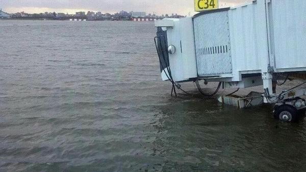
A few photos showing surge or surge after affects:
This neighborhood in queens burned down because of high surge cutting of FDNY. You can see some remnants of the surge over to the right:
http://imageshack.us/photo/my-images/18/firerr.jpg/
Twin towers rebuild area flooding:
http://i.huffpost.com/gadgets/slideshows/259321/slide_259321_1700140_free.jpg?1351566825038
East Village (I screamed at the moron in the water first time I saw this):
http://static.businessinsider.com/image/508f1d90ecad04bc50000012-915/new-york-cars-float-through-the-east-village.jpg
Lindenhurst:
http://static.businessinsider.com/image/508eff0069bedda85400001c-915/new-york-people-wade-and-paddle-down-a-flooded-street-in-lindenhurst.jpg
Brooklyn:
http://www.americanwx.com/bb/uploads/monthly_10_2012/post-32-0-42964100-1351600072.jpg
http://www.americanwx.com/bb/uploads/monthly_10_2012/post-32-0-86617400-1351600087.jpg
South Merrick, Long Island:
http://www.americanwx.com/bb/uploads/monthly_10_2012/post-963-0-83217400-1351610612.jpeg
More random photos from around the area:
http://images.nationalgeographic.com/wpf/media-live/photos/000/607/cache/how-rats-fared-superstorm-hurricane-sandy-street_60743_600x450.jpg
http://images.nationalgeographic.com/wpf/media-live/photos/000/607/cache/hurricane-superstorm-sandy-hits-shops_60730_600x450.jpg
http://www.americanwx.com/bb/uploads/monthly_10_2012/post-32-0-01078400-1351628446.jpg
http://www.americanwx.com/bb/index.php?app=core&module=attach§ion=attach&attach_rel_module=post&attach_id=76806
“Roger Knights says:
October 31, 2012 at 3:37 am
Here are things I’d order if I were NYC’s mayor:”
Roger, This website often addresses the question of prevention versus mitigation.
1 & 2: There is no such thing as a flood-proofed building, especially in a city where most equipment connects underground; and even if it were possible, you would then have buildings which would try to float.
3 & 4: Assuming you could devise a rat-proof, bug-proof, weather-proof, and theft-proof locker with permanently imperishable food (yum!), you are dependent on the superintendant not losing the key, stealing the contents, or fleeing the building in the face of an impending disaster.
5: They have these things called walls….
6: People complain about census-takers (10 years), and you expect them to cooperate in maintaining a detailed neighborhood census?
7: Hurricane season? How often do hurricanes strike NYC? (Sandy was a tropical cyclone trying desperately to become a nor-easter.)
8: Not possible in rent-controlled apartments. Outside rent-control, you’d give the building-owners a say in what electronics you could have.
Ric Werme says:
October 30, 2012 at 11:34 pm
I appreciate your efforts to make sense of newly coined terms such as “SuperStorm” and “Frankenstorm.” I cannot disagree with anything you have said. Other questions remain:
What is a “SuperStorm?” Is a Category 5 hurricane a SuperStorm? How about a Category 2?
My point here is that the use of terms such as “SuperStorm” is a kind of semantic piracy in which news media take us away from the science of hurricanes and put us in a kind of Al Gore lalaland of global warming or whatever. Science must win the semantic battles or lose everything.
In scientific terms, what made Sandy special? The one thing that you mention is the unusually large area of tropical storm force winds that Sandy produced. I agree. That is special. But it does not merit the name SuperStorm. A larger tropical storm is not more dangerous than a smaller tropical storm except in the rare case that the larger storm means more flooding in a given area.
I am especially offended by those who make so much of the size of the cloud cover generated by Sandy. As I explained in an earlier post in WUWT’s forum on that topic, the example of Hurricane Floyd shows that size of cloud cover tells us nothing about where damage will occur or how bad it will be.
As regards the claim that “SuperStorm” is justified as an appropriate warning, what are news media to tell New Yorkers if a Category 5 approaches New York City? Will “MegaStorm” work? What about “AsLargeAsOurNationalDebtStorm?”
buddyellis says:
October 31, 2012 at 7:45 am
Thanks much for the images you referenced. I am looking for video of the storm surge. Apparently, it does not exist. I wanted the video so that I could compare Sandy’s storm surge in New York Harbor with other storm surges that I have seen.
A. Scott says:
October 30, 2012 at 10:51 pm
Then why don’t you use the standard terminology when attempting to describe a hurricane?
A. Scott says:
October 30, 2012 at 10:48 pm
“There are widespread readings from 60-90+ mph from Virginia thru New York and up to Rhode Island … this storm was a super storm – and did have hurricane force winds PER THE NWS data – both before and AFTER landfall.”
Please see:
“See – owe to Rich says:
October 31, 2012 at 12:40 am”
He explains the difference between sustained wind speed and gust speed. He gives you the all important sustained wind speed readings. Sandy was a tropical storm not a hurricane.
@ A Scott, Tucker, Werme, and a couple others. You guys need to get a grip on reality.
As noted by observations listed by “See – owe to Rich says: October 31, 2012 at 12:40 am ” and providing weather observations by the NWS, your arguments are a fantasy. I use that term rather than a less inflammatory one as you have attacked Willis Eschenbach and Theo Goodwin for simply stating the objective facts and basing their discussions on those facts. Now you can put me in the same camp, it will be an honor.
I provided documentation of NWS current local conditionsat appropriate locations that I recorded in comments in an earlier WUWT lead post http://wattsupwiththat.com/2012/10/28/hurricane-sandy-is-making-the-turn-towards-the-north/#more-73235
I don’t have the time now to prepare a written essay to show the fantasy produced by the NHC reports on Sandy but it is order of the hype produced with regards to Irene.
If anyone would like to use the “copy and paste” NWS current local conditions that I recorded in the previous article as linked above please fell free to do so. My spare time is limited this time of the year.
Fact vs Fantasy. There is a place for both. The media are going to use fantasy. The NHC should not.
see – owe to Rich:
The first link I posted was to the NWS Weatehr Statement at 11:00pm EDT well after landfall – it included both advisory’s and this weather OBSERVATION:
I then provided the following link – where you can look at all parameters of the storm yourself – I pulled in the wind measurements:
http://www.wrh.noaa.gov/sgx/kml/lsr.php?cwa=okx&lsr=Marine%20Thunderstorm%20Wind,Non-Thunderstorm%20Wind%20Gust,Thunderstorm%20Wind%20Gust&start=201210290000&end=201210300531
NWS weather observations show max sustained winds at 75mph hours after landfall. And the mapped observations show a very large number of reported winds from the 60’s well in to the 90’smph range
I could not care less if you call it a hurricane or not – the FACTS are it was a highly dangerous storm with hurricane force winds well after landfall. The death and destruction supports that statement.
Theo,
Few clips in this abc video:
http://abcnews.go.com/Video/playerIndex?id=17596261
FWIW, I object pretty strenuously to the hype myself. If this was a storm that hit in the gulf, with the same characteristics, its just another day in the life of living on the coast. Its location, really, that makes this a ‘big’ thing, but I really wish they’d put it in context. This storm had a 10′ surge. Katrina had a surge that ranged from 25′ to 45′ depending on location. Same with Camille. As strength of storms goes, this really wasn’t anything extraordinary. It WAS a very large storm, size adjusted, though, and it’s kinetic potential was very high as a result, however it was no katrina, or camille, or andrew, or charlie.
Personally I think the classification of storms on the Saffir-Simpson scale is outdated, and a new methodology needs to be utilized. There are several in ‘test’ (IKE, ACE, etc). Wind speeds alone don’t tell me much until you get into the upper levels (winds over 120mph are a cluster anyway you look at it), and SURGE is the biggest cause of destruction generally.
A. Scott says:
October 31, 2012 at 10:50 am
see – owe to Rich:
“I then provided the following link – where you can look at all parameters of the storm yourself – I pulled in the wind measurements:
http://www.wrh.noaa.gov/sgx/kml/lsr.php?cwa=okx&lsr=Marine%20Thunderstorm%20Wind,Non-Thunderstorm%20Wind%20Gust,Thunderstorm%20Wind%20Gust&start=201210290000&end=201210300531”
All the wind measurements that you pulled in are for gust speed.
How ridiculous – he does no such thing – he provided a ling to ONE SINGLE SITE – JFK airport.
On the other hand I provided a link where – if people were not so lazy – they could view wind speeds for the entire region – and zoom to any area. And that NWS/NOAA data clearly shows a large number of readings from the 60’s to well over 90mph.
Once again you provide ZERO support for your claims and position. And refuse to look at any data which does not support your undocumented claims.
Once again – I do not care what the storm was called … it was for a FACT, beyond a shadow of a doubt, an extremely dangerous storm. At last count 50 U.S. deaths and damages of $50 billion, both still climbing – and folks like you still ridiculing the strength of the storm.
Truly Amazing …
I know. I’ve been posting here regularly for over four years. If you’re implying that my suggestions have been addressed here previously, you’re wrong.
If the only water intrusion came from seepage around a few incoming pipes and cables in the basement, a sump pump could pump it into a hose and out a first-floor window, perhaps with the assistance of an occupant.
Not in Manhattan. Or Brooklyn. Their buildings aren’t made of wood. And even wooden buildings don’t float when flooded, unless swept off their foundations by running water or powerful waves. In NYC, few buildings are exposed to wave action, only those on the waterfront.
For the first three, it would have to be made of sturdy metal, and waterproof. That’s no problem. As for theft-proof, a loud alarm that sounds when it’s opened, even by the person with the key, would do the trick. This is the technique used to prevent misuse of emergency exits.
Such tucker was deemed sufficient for civil defense shelters. Survivors won’t worry about tastiness much. If necessary, it could be donated to food banks and replaced after every three (say) years. MRE meals for the military are OK for two years, and the military’s surplus finds eager buyers.
OK, give out multiple keys to certain residents, and allow the back-up alarm as a fallback protection. Of course, this wouldn’t be 100% foolproof either, but that’s not a good argument against my proposal. Instead, it’s a demand for uunobtainable perfection, which is listed as a fallacy in a book by Madsen Pirie (How to Win Every Argument: The Use and Abuse of Logic, p. 171). He wrote, “The fallacy of unobtainable perfection is committed when lack of perfection is urged as a basis for rejection, even though none of the alternatives [‘including making no change at all’ he adds later] is perfect either.”
So why then are bulletin boards or whiteboards ever used anywhere? Why don’t people just write on the walls instead? In addition to avoiding defacing the walls, and being erasable and reusable for additional messages, and providing an appropriate writing implement, such communication aids invite people to make requests for assistance and offers of help, which bare walls don’t.
The phone company already has the data and already prints borough-wide phone books. Its computers can easily produce neighborhood-wide phone books.
The hurricane season runs from June through October (five months). (I don’t recall any Nor’easters hitting NYC in the decades when I lived there. If there are any, they wouldn’t cause severe flooding.) If stockpiling food for such a long period seems impractical, then residents should be urged to do so at least when a major storm threatens, as Sandy and Irene did. That would be better advice to give residents not living on the ground floor than urging them to evacuate, which is the current mayor’s advice. If, after the storm, the power is likely to be out for a week or more and evacuation seems desirable, such residents could evacuate on the day after the storm, or the next day, when the waters have receded.
But such apartments have had to install smoke detectors and garbage cans devoted to recyclable material, so I doubt that you’re correct that they couldn’t be required to install surge-protectors too.
The landlord would only have a valid concern about the renter’s total wattage exceeding what the surge protector could handle—and each renter’s fuse box prevents overload there already.
Buddy E says:
October 31, 2012 at 11:04 am
Very well said. Those people who seem to be distraught about the storm because of the damage it created should change their focus to measures of adaptation.
(I could go on forever about the details – just one more. If you look at the West coast of Florida, you will find that sea level is 3 to 4 feet lower than the top of the beach and that the beach ends in a wall that is 3 to 10 feet high. Switch to New Jersey and the buildings on the beach are barely above sea level, including hotels, and are protected by a concrete wall that might be two feet high.)
A Scott – welcome to the real world
“Once again you provide ZERO support for your claims and position. And refuse to look at any data which does not support your undocumented claims.
Once again – I do not care what the storm was called … it was for a FACT, beyond a shadow of a doubt, an extremely dangerous storm. At last count 50 U.S. deaths and damages of $50 billion, both still climbing – and folks like you still ridiculing the strength of the storm.
Truly Amazing …”
Theo: All the wind measurements that you pulled in are for gust speed.
So what? A gust is as or more damaging than a sustained wind. 50 people are dead and $50 billion in damages – both climbing.
A Scott, you are a bleeding heart liberal. From your point of view; damn the facts, I’m a liberal and negative viewpoints are all that count unless it’s so-called sustainability by burning food. Get a grip. You are a product of media hype. Go have a beer or two and then respond. Relax, the truth will prevail whether you want it to or not.
mjk says:
October 30, 2012 at 6:30 pm
Thanks, mjk. Yes, we are looking at the same thread. All I asked was that you identify who you were talking about. Now, I see from your response that you weren’t talking to me, so I’ll let others answer. See how easy it is when I know what you are talking about?
w.
A Scott , it’s obvious that you do not like observed data. It was a big storm but was hyped up the Yazoo. So was IRENE. IRENE hype killed 50 people in Sandy? Your call. When you can’t believe the NHC, who can you believe?
Sergeant Joe Friday says: Just the facts, mamm, just the facts.
A. Scott,
What is your point, it was not a hurricane it was a dangerous storm. Your arguing against someone saying this fact yet when shown these are gusts, spin your way into saying gusts are worse. Stop with this nonsense, we know a severe storm is very dangerous just the wind gusts don’t support a hurricane and neither do the mean winds. The winds on the scale were roughly force 9/10/11 over a wide area which cause dangerous sea surges and mass flooding to regions most prone. This happened worse across Europe in 1953 and that was not a hurricane either. Thousand of people died during this event, with a sea surge up to over 5m high. Nobody is saying it is not a very dangerous storm just that it is not a hurricane. Cat 1 to cat 5 hurricanes are even worse, so thats why people have been questing why is it a super storm? I do see why you or anybody could call it this because a storm doesn’t imply an hurricane and therefore a storm with force 10//11 winds is the worse kind of it’s type without being a hurricane.
Theo Goodwin says:
October 31, 2012 at 11:23 am
Pardon my brain f*art. I meant the Atlantic coast of Florida. The Gulf Coast, “Nature’s bath tub,” is another matter. The area around Tampa has some structures that are barely above sea level.
eyesonu:
First … re: whats going on is the station reports – the readings from:
http://w1.weather.gov/data/obhistory/KGED.html
… are HOURLY, not continuous, readings. And I found a number with sustained winds in the mid 20’s and gusts in mid 40’s MPH. It is definitely possible that for some period between the hourly observations
Second, NWS has access to the continuous data. I sincerely doubt that the NWS would purposely and intentionally lie about things like wind speeds in official government reports – regardless of the fact the data is all there and can be checked.
LAST and most importantly – if you read the advisory you posted and the statement you are comparing to closely you would find the NWS made clear the data for those two stations they commented on was from WEATHERFLOW stations – not the simple NWS stations you are trying to compare against.
http://www.weatherflow.com/datascope-open-for-tropical-cyclone-sandy/
And as Weatherflow has graciously opened their premium paid product to the public for the Hurricane Sandy event you can go directly to their hi-rez Lewes DE data and find that max sustained speed were a bit above 50 and max gusts almost 70mph – exactly as reported by the NWS.
And the Tuckerton Weatherflow station shows max sustained of 65 and peak gusts of 90mph.
You simply did not understand what you were claiming, and were comparing two different products
A. Scott says:
October 31, 2012 at 11:57 am
“Theo: All the wind measurements that you pulled in are for gust speed.
So what? A gust is as or more damaging than a sustained wind. 50 people are dead and $50 billion in damages – both climbing.”
Gusts at 75 to 80 mph, which is what you show, are typical of a tropical storm with sustained winds of 65 mph. Sustained winds cause 99% of damages.
Please stop citing body count and damage costs when the topic is the physical characteristics of the storm itself. You are jumping from apples to oranges to coconuts. I am interested in the physical phenomenon that was the storm, not in the damages that it caused.
And a quick check of several of their other premium stations along the coast show sustained speeds well into the 60’s and peaks from 70-90mph – at and after landfall.
[snip – this is NOT your blog, enforcement is not your sandbox, and I don’t like you making threats to other posters – stop it. – Anthony]
Anthony,
Sorry, it was just a post. I withdraw from all discussion with regards to ” Sandy”. 😉
You have made it quite clear you do not care about the damage or loss of life – only in defending your silly, and proven false, claims about whether it was an actual “hurricane” or not.
The families of those dead and injured, and the others dealing with billions in damages could not care less about your concerns.
I’ve proven you wrong at every point – with documented, sourced, data. You have provided zero data or support for your positions and claims.
I’m done – call it whatever the heck you want – the direct FACTS are it was a massive, record breaking storm that caused historic and large scale damage and loss of life. The damage and loss of life dramatically exceeds that of Isaac earlier this year that was most certainly a full fledged and powerful hurricane.
The media LARGELY reported this storm accurately. It was a hurricane for a considerable period of its life. They accurately noted the likely strength and severity all along. They accurately reported it would lose hurricane status as it approached landfall and they again reported correctly when it did just that, despite that the NWS direct observations and plenty of other data showed it still maintained hurricane force winds – both gusts and sustained – well after landfall.
Con Ed has stated they prepared for the worst – and it was far worse yet.
You go ahead and argue the silly semantics all you want – it won’t bring those who died back, nor roll back the clock on the $50 billion in damages.
.
A. Scott says:
October 30, 2012 at 6:54 pm
OK, thanks, your opinion is noted. I find it hard to understand, since I specifically said in the head post that I was not minimizing the storm and the damage that it would (and in the event did) do. I’m a blue-water sailor. When one storm covers the whole East Coast, that’s a dangerous storm.
No, this post was not to “say [I was] right”. I was right, but the point was the unending hype of the media, which turns any storm into the hurricane of the century and any lack of rain into some huge drought. Yes, this was a big storm, a huge storm, and as I said in my post, “I am not minimizing the extent of the damage”. But it was not a hurricane.
To their credit, as you point out, the NWS call downgrading it to a tropical storm was reported by some of the media. Overall, a\ better job was done than on last year’s Irene.
Part of the problem for me is that when the media hypes a storm as a hurricane, people think about wind. They shouldn’t be warning about the wind, they should be warning about the rain.
There is a difference between “hurricane force winds” and a hurricane. You can have hurricane force winds without having a hurricane. They are called “gusts”. Certainly, they are dangerous, sometimes even lethal … but gusts alone do not a hurricane make.
Look, A. Scott, I’m sorry you (and others) think I was minimizing the storm. I thought I had covered that by explicitly stating that I was NOT minimizing the storm … but obviously that wasn’t clear enough. It certainly was not my intention to minimize anything.
w.
James says:
October 30, 2012 at 7:56 pm
Thanks, James. I was looking at the question of the strength of the storm at landfall. For that we need to know the winds blowing at the coast as the storm approaches, particularly in the dangerous quadrant. The buoy system is one of the best and most comprehensive systems for looking at coastal winds. None of the dozens and dozens of buoys in the area recorded hurricane force winds. Not one, as far as I know, including those in the dangerous quadrant. Gotta go with the data …
And in the event, the NWS agreed with my analysis, downgrading Sandy to a tropical storm before it made landfall.
So my analysis might have been “sloppy and naive” as you claim … but in the event, it was also right.
Regards,
w.
Ric Werme says:
October 30, 2012 at 11:34 pm
So if I don’t post on your schedule, I’m posting and running? Patently false. I’m here. I also have a day job, a host of other responsibilities, and many interests. So please, cut me some slack. I spent yesterday out on the water instead of behind a keyboard, so sue me.
If you have a scientific beef with my thoughts and analysis, spell it out.
w.
A. Scott says:
October 31, 2012 at 1:30 pm
“You have made it quite clear you do not care about the damage or loss of life – only in defending your silly, and proven false, claims about whether it was an actual “hurricane” or not.”
Aha! You now realize that you are not discussing what we are discussing! Great! If you had read carefully you could have saved yourself a great deal of time.
Those who do analysis of claims about weather systems, climate, and similar scientific matters are doing immensely important work. They should make no apologies for not taking up other topics that are of greater interest to others.
Someone upthread was asking about the storm surge. Here’s a graph from the tide station at The Battery in NY City, showing predicted tide, actual tide, and the difference (storm surge):

SOURCE: NOAA Tides and Currents
Note that the values on the left axis are the difference from Mean Higher High Water (MHHW). The actual storm surge was about 9 feet at The Battery. It was the highest of anywhere I’ve looked (check the link for more tide gauge locations). Most places had a storm surge of 4 to 6 feet, still dangerous. It’s a question of coastal geometry. The Battery is at the tip of a natural funnel, an inlet in the coast where the waters pile up.
w.
Willis – thanks for the reasoned reply … as I’ve spent a lot of time the last couple days researching to respond to this I’ve ended up with I think a pretty good understanding of the media response and the data.
I understand the technical description of a hurricane is wind based – on max sustained winds – but in the case of this storm, and in the eyes of a growing number – the current wind based measurements are not necessarily a good measure of a storms danger. Its pressure was characteristic of a CAT 3 hurricane, and its mass/size was close to unprecedented. Isaac was about the rain as it all but stalled, and winds were not a huge issue.
After my research and with benefit of hindsight – I still disagree with you – for this storm I believe the media in very large part accurately reported the storm. Very early reports may have been somewhat over-hyped – bit neither Frankenstorm or SuperStorm proved inaccurate.
The media was largely accurate in describing why it was a “Frankenstorm” – telling us a lot of useful and interesting info on its “hybrid” status. They were also very good IMO at getting the word out days early that it would lose its hurricane status when it reached colder waters, but warned and informed that would NOT necessarily be because of a change in strength – rather it is largely semantics between tropical and non tropical – warm vs cold core – storms. Letting people know it would still be a very dangerous and potentially deadly storm.
To me that education was extremely valuable in preventing more loss of life. Making sure people realized NOT to assume it was safe when they heard it lost hurricane status.
The media AND the NWS continued to work very hard to make sure people knew just how dangerous and huge this storm was even without hurricane status. As Anthony noted the NWS warnings were pretty much unprecedented, all but begging people to treat this storm very seriously.
As I researched this the last day or so its become clear this could IMO have been called a hurricane well past landfall. There is plenty of evidence of sustained winds in the 60’s. The record storm surge was accurately reported and every bit as devastating as expected.
You can argue wind gusts are not a measure of hurricane strength but I disagree. You will pretty much never see 70 to 90mph gusts if your sustained base speeds are in the 20’s and 30’s. A review of data from many of the hi rez stations clearly confirms this – max sustained speeds typically track about 20-25mph lower than peak gusts. Regardless – from a damage standpoint gusts in the 70-90mph range are dangerous no matter how you call it.
In the end the reporting on this storm was, with a few exceptions, largely accurate. It informed people of the danger and educated them on why. It made sure people knew what to expect – IMO extremely important considering this was a “hybrid” storm, that people don’t know as much about.
Absent the increased coverage too many people would have written this off as just a strong N’oreaster, which notwithstanding the unsupported claims from some here, it most certainly was not. Con Ed said the prepared for the worst – and it was far worse than that. That should tell all of us something.
On the whole I believe the NWS and the media largely got this one right. And if ever there were a storm to be overly cautious with, this storm was IMO the one.
Willis: “I was looking at the question of the strength of the storm at landfall. For that we need to know the winds blowing at the coast as the storm approaches, particularly in the dangerous quadrant. The buoy system is one of the best and most comprehensive systems for looking at coastal winds. None of the dozens and dozens of buoys in the area recorded hurricane force winds. Not one, as far as I know, including those in the dangerous quadrant. Gotta go with the data …”
This is incorrect. As the NWS Storm Report I linked above shows there were many gusts in the 70-90mph range after landfall. As I noted above you don’t get that kind of gusts without a sustained speed in the 50-60+mph range.
But more importantly I suggest you visit the Weatherflow site links I listed. Their private, high quality reporting stations most certainly did show hurricane force sustained winds as I noted above – both upon and in some areas well after landfall.
Weatherflow apparently is used by NWS. Regardless it is a really interesting network of high quality private stations.
A. Scott says:
October 31, 2012 at 1:30 pm
Oh, please, stop with the pearl-clutching and being all offended at what you fantasize about me. I am none of the things you claim, I’m not some uncaring monster unconcerned about the loss of life, that’s all you.
w.
PS—Since the NWS came to the same conclusion I came to, and downgraded Sandy to a tropical storm before it hit the coast, just as I had said, how is my claim “proven false”? If you believe the NWS, my claim (which I made two days before landfall) is proven true.
For me, science is all about testable predictions. I predicted on the 27th that Sandy would not be a hurricane at landfall. According to the NWS, I was right. If I had been wrong, lots of folks would have been very happy to publicly point that out.
“Roger Knights says:
October 31, 2012 at 11:15 am
If you’re implying that my suggestions have been addressed here previously, you’re wrong.”
– I implied nothing. My comments referred only to the quoted post.
“a sump pump could pump it into a hose and out a first-floor window”
– So your definition of “flood-proof” assumes the first floor window will not be under-water. It also (presumably) assumes an uninterruptible power supply for the pump.
“wooden buildings don’t float when flooded, unless swept off their foundations by running water or powerful waves.”
– No, wooden buildings don’t float because they are not air-tight. Once the building collapses, however, the wooden components will float quite easily. That was not my meaning, however. Hydrostatic pressure is constantly working on any building with a basement, trying to level the water-table by either forcing itself into the basement, or lifting the basement like a boat. The more water-tight the structure, the greater the lifting pressure. One presumes that a “flood-proof” structure will be water-tight above ground as well as below, and a flood will only increase the lifting pressure. Water pressure DOES lift concrete. The reason that concrete buildings don’t float is that the concrete cracks during the process, and the structure is no longer water-tight (and therefore no longer “flood-proof”).
“The fallacy of unobtainable perfection is committed when lack of perfection is urged as a basis for rejection, even though none of the alternatives [‘including making no change at all’ he adds later] is perfect either.”
– No, my rejection of your ideas are that the presumed benefit will be unlikely to offset the cost. (I could quote Plato’s ideas about assumptions, but I won’t bother.)
Willis Eschenbach says:
October 31, 2012 at 2:18 pm
It’s a bit pedantic, but in the day or so before landfall, there were no hurricane or tropical storm warnings posted on land. There were some posted for offshore areas, and the hurricane warning stayed up through landfall, IIRC. The NHC was predicting that the storm would be extratropical (or postropical, whatever that is) by landfall. I don’t believe they downgraded it to tropical storm status between hurricane and posttropical.
All in all, it really doesn’t matter much, as parameters like tides, breadth, topography, land use, and population are all important factors in determining storm severity in addition to the “all important” wind speed and “no so important these days” core pressure.
Willis writes:
“It’s a question of coastal geometry. The Battery is at the tip of a natural funnel, an inlet in the coast where the waters pile up.”
Thanks. Glad to have my idea confirmed.
Willis – that comment was directed at Theo – NOT you …
You and many others predicted the storm would lose its hurricane status before landfall as much s several days before. It wasn’t even much of a prediction – it was a fact – that once it went extra tropical … transitioned from a tropical warm to an extra tropical cold core … it would no longer be considered a hurricane. Which is exactly what happened – and was reported by the majority of media.
I heard many times that regardless of whether it still met hurricane standards it would not be called a hurricane after its cold core transition. I think this is extremely confusing and dangerous – and think the NWS/NHC and the media did a good job of making sure people were educated and aware of this unusual situation. This is something I think needs to be addressed for the future.
And as I’ve noted – the NWS and NHC advisories continued to report observations (not forecasts) of 75mph sustained winds even at landfall – and the Weatherflow station data does provide support for that – that not only were there gusts up to the 90mph, but that sustained winds were well into the 60’s mph range before, at and after landfall. There is plenty of evidence that wind speeds were there that would have supported calling it a hurricane if one desired even at and after landfall. That however would have confused people even more, after they;d been told it would not be called a hurricane once it transitioned to the cold core.
A. Scott says:
October 31, 2012 at 1:30 pm
——————————————————————————————————————
“You have made it quite clear you do not care about the damage or loss of life – only in defending your silly, and proven false, claims about whether it was an actual “hurricane” or not.”
“The families of those dead and injured, and the others dealing with billions in damages could not care less about your concerns.”
———————————————————————————————————————
What has this go to do with whether it is a hurricane or not?
———————————————————————————————————————–
“I’ve proven you wrong at every point – with documented, sourced, data. You have provided zero data or support for your positions and claims.”
————————————————————————————————————————-
I have used the same data and it shows no hurricane once reached landfall, gusts between 70 and 90+ mph are not high enough for a cat 1 hurricane. Sustained winds 60+ mph are from storm force 10/11.
———————————————————————————————————————
I’m done – call it whatever the heck you want – the direct FACTS are it was a massive, record breaking storm that caused historic and large scale damage and loss of life. The damage and loss of life dramatically exceeds that of Isaac earlier this year that was most certainly a full fledged and powerful hurricane.
———————————————————————————————————————
Not surprised you’ve done your spin is getting you no-where. Nobody likes to see severe storms that are life threatening. It was only because it hit a highly populated region.
————————————————————————————————————————
The media LARGELY reported this storm accurately. It was a hurricane for a considerable period of its life. They accurately noted the likely strength and severity all along. They accurately reported it would lose hurricane status as it approached landfall and they again reported correctly when it did just that, despite that the NWS direct observations and plenty of other data showed it still maintained hurricane force winds – both gusts and sustained – well after landfall.
————————————————————————————————————————
It did lose it’s hurricane status until it reached landfall so why are you arguing with me?
None of the sustained wind observations show values above 73 mph and hurricane force gusts above 73 mph do not determine an hurricane.
—————————————————————————————————————–
Con Ed has stated they prepared for the worst – and it was far worse yet.
—————————————————————————————————————–
It has been the worse to hit the New York area for a long time.
———————————————————————————————————————
You go ahead and argue the silly semantics all you want – it won’t bring those who died back, nor roll back the clock on the $50 billion in damages.
———————————————————————————————————————
Again this has nothing to do whether it was a hurricane or not when it reached landfall, This is about being scientifically correct and finding out the true information. NOAA will do the same thing and give its status and track once all the information has been put together. So because people died we should forget about the science part and not record what it was? Science helps greater understanding in preparing for future events that prevent further loss of life.
I will remind you that New York is not alone despite these terrible events.
http://en.wikipedia.org/wiki/North_Sea_flood_of_1953
Now that is about the funniest thing I’ve ever heard – me a “liberal” – LMAO … I am as conservative as they come. I am however a realist – call them as I see (and can support) them. I don’t take sides – I base my positions and claims on reproducible, supportable facts.
No – I like the observed data just fine.
However I take the time to make sure of what I am observing and then research to find the data noted and actually look at it.
In your case you failed to note the NWS clearly stated the data they referred to was from the WEATHERFLOW system, not from the NWS stations you cited. And when I visited the private subscription only WEATHERFLOW system and looked at the station data for Sandy they have graciously made freely available it matched the NWS statements you were challenging. You attacked without understanding what you were claiming, and as a result your claims were wrong. The NWS and NHC accurately reported, contrary to your insinuation otherwise.
The Weatherflow data shows you are wrong – both in your challenges towards NWS/NHC and regarding the strength of sustained winds before, at, and after landfall. There were a number of stations reporting hurricane force winds prior to, and after landfall … and Weatherflow also shows that sustained winds directly track gusts – if you have 70-90mph gusts you will have sustained winds in the 50’s and 60’s.
I encourage you to visit Weatherflow and look at the data – they do a great job.
A compilation of the various links to supporting data I have posted in this thread:
http://blog.weathernationtv.com/wp-content/uploads/10.30.12-wind-gusts.jpg
http://apps.startribune.com/blogs/user_images/10_29_12_RPM_winds.jpg
http://www.nhc.noaa.gov/text/refresh/MIATCPAT3+shtml/292058.shtml
http://www.wrh.noaa.gov/sgx/kml/lsr.php?cwa=okx&lsr=Marine%20Thunderstorm%20Wind,Non-Thunderstorm%20Wind%20Gust,Thunderstorm%20Wind%20Gust&start=201210290000&end=201210300531
http://www.weatherflow.com/datascope-open-for-tropical-cyclone-sandy/
Sorry should read,
“It did lose it’s hurricane status when it reached landfall…….”
A. Scott,
Sorry if you were not referring to me, but I wasn’t sure either way.
Matt G. – was not – was directed at Theo …
http://tidesandcurrents.noaa.gov/data_menu.shtml?bdate=20121028&edate=20121030&datum=6&unit=1&shift=g&stn=8518750+The+Battery%2C+NY&type=Tide+Data&format=View+Data
Following up on what Willis just posted, the above link takes you to the tabular data for Battery. Row 1 is predicted, row two is measured. 9.23 was the surge at the ‘peak’, and Battery held an 8ft or greater surge (over 13 feet total tidal level) for some 2 hours and 20 minutes.
List of station extremes:
http://tidesandcurrents.noaa.gov/data_menu.shtml?extremetype=station&bdate=18000101&edate=20121031&unit=1&format=Apply+Change&stn=8518750+The+Battery%2C+NY&type=Extremes
Rank Highest Highest Date Zone Lowest Lowest Date Zone
—- ——- ————– —- ——- ————– —-
1 13.30 19600912 13:00 LST -1.00 19760202 16:30 LST
2 12.99 19921211 14:00 GMT -0.91 19780110 16:12 LST
3 12.80 20110828 12:42 GMT -0.50 19660109 04:24 LST
4 12.09 20100313 23:42 GMT -0.24 19800316 02:06 LST
5 12.01 19911031 03:36 LST -0.23 19800316 00:00 LST
6 11.81 19840329 08:12 LST -0.19 19850208 17:24 LST
7 11.73 19921212 02:18 GMT -0.15 19710127 15:36 LST
8 11.66 19870102 10:30 LST -0.13 19690102 01:12 LST
9 11.64 19930314 05:00 GMT -0.10 19760317 15:42 LST
10 11.62 19681112 10:42 LST -0.01 19800315 13:36 LST
I’d seen numbers bandied about all over the place (for the record I don’t think the 13.88 is verified yet, so its not in the above list) but the previous record was indeed 1960 @ 13.30 (of which the actual surge number is somewhat lower than that but I’ve been unable at this point to located the data for that time frame), so that shows us that this storm didn’t beat 1960 (Hurricane Donna) by much, and Donna had 105MPH sustained winds with 115MPH gusts.
What this tells us is location and direction are much more important, to some extent, for a surge event than raw wind speed. A Donna type event hitting exactly where Sandy did would have been significantly more devastating, I’d guess. What made this event special is location, not that sandy was some sort of ‘superstorm’.
A. Scott says:
October 31, 2012 at 2:55 pm
Warm and cold cores don’t determine whether a given storm is considered a hurricane. All that counts is sustained wind speed. If the wind in a cyclonic storm is over 63 knots sustained, you have a hurricane.
Finally, hurricanes have made landfall along the Northeast Coast in the past, including in New York. Sandy might have been one of them. From listening to the media beforehand, you’d have thought it would be a hurricane at landfall. I thought not, and I made a public prediction to that effect. Hey, I took a chance. Easy for you to look back now and claim it was obvious … I didn’t see your prediction at the time, although I might have missed it.
w.
Interesting to see how many commenters here have put on the record how they no idea at all about integral calculus.
Willis,
When there is a typo in the first line, I could tell it was …… rushed ?
So, here we are days later.
You have obviously been missed 🙂
A Scott, I’m still here, just not responding with regards to Sandy. Good for you.
Willis – I didn’t need to make a “prediction” – I already knew what to expect. I had followed the progress all along and kept up on advisory’s and information.
That the NHC would cease reporting it as a hurricane and refer to it as an extra-tropical – or more officially a “Post-tropical” cyclone – was known days in advance. The NHC educated people thru various sources, including this release 2 days before landfall:
http://www.nhc.noaa.gov/news/20121027_pa_sandyTransition.pdf
The National Hurricane Center noted that when they determine Sandy became post-tropical they would stop reporting on it as a hurricane. Their hurricane advisory’s never extended beyond NC, on 10/27 they were already transitioning to the NWS which does the reporting on non-Hurricane events …
They clearly note the strength may not change, and may even increase, yet they will not report as a hurricane and will transition to the NWS side once it goes post-tropical. They had already started that transition 2 days before expected landfall – acknowledging the confusion that dropping hurricane status, despite that strength may remain the same or increase could cause.
Those NWS advisory’s DID include terms such as “Hurricane Force Winds” to acknowledge the hurricane like strength – but as it stands today, they would not call it a hurricane after it transitioned regardless of the strength.
You may well be correct about the past, but at present once it makes the extra-tropical transition it is no longer reported as a hurricane.
The readings NWS observed and reported even well after landfall – “hurricane force” winds, sustained at 75mph or above – would have been sufficient to call this a hurricane again. But all that would have done is confuse the issue
FWIW I just learned this as well, as I watched and listened to the coverage and did some research into “hybrid” storms.
Here is a reader comment about the transition and naming change that shows the concern quite well:
“I honestly thought the storm had been downgraded when I first read the headline earlier today – but now that I read the whole story I’m glad I did. Nothing has changed about the storm but the name……..”
There are eyesonu.
Willis
Great work. I bracketed & I down loaded the nearest buoy data from the landfall around Atlantic City, NJ, at the following sites and sources:
Station JCRN4 – Jacques Cousteau Reserve (The inland weather station not the buoy)
(www.ndbc.noaa.gov/station_page.php?station=jcrn4)
Station SJSN4 – 8537121 – Ship John Shoal, (www.ndbc.noaa.gov/station_history.php?station=sjsn4)
Station 44009 (LLNR 168) – DELAWARE BAY 26 NM Southeast of Cape May, (www.ndbc.noaa.gov/station_page.php?station=44009)
Station 44065 (LLNR 725) – New York Harbor Entrance – 15 NM SE of Breezy Point , (www.ndbc.noaa.gov/station_page.php?station=44065)
As per your post, none of the historical data showed sustained hurricane force winds over the landfall period. Moreover, the graphs obtained clearly showed Sandy’s eye. So, I managed to capture a fair idea of Sandy’s progress relative to each site.
Note: To get each graph I simply went each websites, looked at the lower end of the web site, and select the graph icon for ” Wind Speed (WSPD)”. This gave me a graph of the historical data.
I also obtained a copy of the NJ Weather and Climate Network’s Atlantic City Marina, NH site at
http://climate.rutgers.edu/njwxnet/images/containerTop.jp
This site did not record sustained winds; but, did to show the maximum winds recorded were 70 mph at 16:52 on Oct 29, 2012.
I can’t say how much I appreciate your efforts. As recent contributor to the U.S. National Climate Assessment, I used data obtained from WUWT to push-back on EPA propaganda in that report. The quality of climate change data I found here was so good that the EPA was forced to delayed publication of their conclusions on the Southeast… for a year… when they were unable to refute the sources cited.
I have no doubt the EPA is using the time to find way to bypass the flood of skeptical opinions they received from a number a independent agencies (including my own). But, again, I would like express my appreciation of the efforts of you and your colleagues… and let you know you are have a positive impact.
Regards, Kforestcat
Kforestcat – check this link:
http://www.weatherflow.com/datascope-open-for-tropical-cyclone-sandy/
There are a number of stations that show sustained speeds in the 60’s and max gusts up to 90mph. This is the data NWS was referencing with some of the specific station comments.
Its normally a premium service but Weatherflow made the Sandy data public
Willis Eschenbach says:
October 31, 2012 at 4:48 pm
Sorry, cold core – not a hurricane, tropical storm, or tropical cyclone. Over 63 knots – hurricane if it’s warm core and not a baroclinic storm with fronts hanging off of it. The NWS will refer to things like “hurricane force winds” in big extratropical storms like nor’easters, they never, ever referred to the Blizzard of ’78 as a hurricane. (They did for the 1991 “Perfect Storm” because a tropical cyclone developed in it, but it was short lived and the NHC didn’t bother to name it. Weird storm, almost as weird as this one but very different.)
The NHC discussion even explained how they were going to share reports with the NWS and (I think) the Hydrological Prediction Center (HPC) after Sandy’s conversion to maintain continuity in reporting the storm. The NHC really doesn’t like to deal with extratropical storms.
Your remark below, to which I was responding, implied that I was uninformed about something, but it didn’t spell out what. I made a best-guess about what you had in mind:
Actually, this website often addresses the question of adaptation versus mitigation of CO2. Some adaptive measures are “move away.” Others are sit-tight-and-cope tactics of the sort I proposed. The consensus here is that mitigation is too expensive–and is a hopeless strategy anyway, given the unlikelihood of Asia adopting it, which is a requirement for it to work. But you didn’t explain what that had to do with what I wrote. It doesn’t seem at all relevant. So it seemed to me you were implying something else: that I was uninformed.
If necessary, the hose’s outlet could be positioned on the second floor.
Technically, I should have said, “flood resistant.” But, practically speaking, “flood resistant” means “flood-proof” in NYC, where most future storm surges are unlikely to exceed Sandy’s, which overtopped very few first-floor windows in NYC, AFAIK. Even if the surge did overtop the bottom of the first-floor windows, they wouldn’t necessarily collapse or leak severely, since few would be exposed to battering waves. And the windows in lower Manhattan office buildings are fairly sturdy.
(In Hoboken, NJ, where some buildings are only a couple of feet above sea level, many first floor windows would have been overtopped. But it would still make sense to flood-proof them, given that it would protect against most future storm surges, which will be lower.)
Not necessarily. Power wasn’t lost in most of lower Manhattan until after the flood crest had passed, IIRC. Anyway, it would make sense to provide a back-up generator or battery pack for the pump in an expensive office building, which could afford one. Not so much in a residence, although having one might make sense there too, if other threats to the power supply are considered.
You should have been explicit.
It’s doubtful that there’d be much increased hydrostatic pressure on a basement in NYC, because it would be hard for water to get into the ground around the basement quickly. The surface around the buildings is impermeable. And the office buildings in lower Manhattan have basements whose floors are well below sea level already, and whose walls abut bedrock. They thus presumably are already withstanding considerable hydrostatic pressure. A little more shouldn’t make enough difference to crack them.
This should be easy to determine in the post mortem of Sandy. A survey could be made of a sample of buildings to determine how many basements actually did crack.
The basement is flood-proof even if it has a few leaks and seeps from no longer being water-tight. A pump can keep ahead of them. Or, if the leaks aren’t too bad, the basement can be bailed out later, after the storm surge’s waters have receded. A little water on the basement floor isn’t catastrophic. What’s catastrophic is allowing salt water to get into the electrical equipment higher up.
That’s what you say now. Here’s what you said then:
Nothing about cost-benefit was mentioned in that paragraph. Therefore, the implication of its intemperate fault-finding was that those faults were either insuperable (false, as my response delineated) or that the mere possibility of their existence doomed my proposal. The latter amounted to a demand for unobtainable perfection.
(BTW, if I were mayor, I wouldn’t necessarily have advocated more than a pilot program for a year or two to see how many keys got lost, food got stolen, rats and insects penetrated the locker, etc. I’m a big believer in “try before you buy.” This cautious, testing attitude should have been adopted by the legislatures that “bought” renewable power.)
Other demands for perfection were your implications that my flood-proofing proposal was worthless because 1) it wouldn’t protect against a flood above the first floor windows (how often would that occur, and to how many buildings?), and 2) that it wouldn’t prevent water-incursion into basements (how fast would that be if it occurred, and how likely would it be to occur in Manhattan?). The nuances I just mentioned in these situations were ignored by you and nothing like a balanced cost-versus-benefit approach was taken. Rather, the method was a sneering, sweeping dismissal of my suggestions based on a superficial analysis.
Other sneering, superficial, captious criticisms were:
***********************
You take the cake. FWIW, here’s a look at costs vs. benefits:
The benefit of flood-proofing an office building is immense. Citigroup has just announced that it won’t be able to return to its headquarter building in NYC for at least two weeks, peresumably because the electronics and electrical equipment associated with its elevators and control systems were compromised by being flooded by salt water. That interruption of business is going to cost them tens of millions—and other occupants will be similarly impacted.
On the other hand, the cost of flood-proofing the ground-level openings (and the first-floor windows, too, if need be) of such a skyscraper would (I guess) be well under a million. And it could be amortized against more than one expected storm surge. It would still be a worthwhile expenditure even if there were some chance of total or partial failure, or if it wouldn’t work in a worst-case scenario. If most buildings will be protected against most of the damage from most storm surges, the expense is justified.
Dear A. Scott
Referring to your comment A. Scott says: October 31, 2012 at 9:21 pm; where you say:
“Kforestcat – check this link:”
Son, I checked your data from prior comments. As many commenter’s have stated above, wind gusts are not the proper metric – sustained winds are. Nor are model simulations based on near real time inputs a proper metric. I deal in policy and prefer to use hard data from weather sites who’s data is readily available and visible to the public.
The buoy data provides enough of a contrast to NOAA’s public statements to start asking tough questions.
Regards, Kforestcat
I dropped by to see if some commenters here had developed the grace to feel a little sheepish about reactions posted here on the 29th, now that it’s clear that Sandy has crippled New York, and that the reported death toll is currently at 74. (Perhaps some have; clearly, not all.)
It will be interesting, in a grim sort of way, to see what the final tab turns out to be. But it’s not too early to say that if we go by the scale of loss inflicted, Sandy well deserves the term “superstorm.”
But it doesn’t deserve the term Frankenstorm, which is what it was being hyped as. We were being warned that it would combine, ala Frankenstein, with other oncoming storms, to wreak havoc in the interior from winds and precipitation. That prediction has been a 90% fizzle, although there’s been lots of snow in WV, and the warnings had the effect of misdirecting attention. Instead, the havoc impacted the shoreline, from the storm surge plus new moon. There’s sheepishness to go around on both sides.
Kevin McKinney says:
November 1, 2012 at 6:53 am
Well, gosh, Kevin, thanks for checking up on us. Now if you’d just have the grace to feel sheepish about not quoting the remarks you are talking about, we could all join in the discussion.
Because as it stands, so far all you’ve done is kvetch and whine about some vague unspecified something that The Great Kevini didn’t like, as if people would just go “well, I don’t know what or who Kevin’s talking about but he must be right” …
Put up or fly away, Kevin. What do you think people should be feeling sheepish about, and which people are you referring to? Because I certainly don’t feel sheepish. I said that Sandy would not be a hurricane at landfall, and it wasn’t. How does the number of deaths affect that at all? Why should I feel sheepish about saying it wouldn’t be a hurricane at landfall?
Of course, you may not be referring to me at all. But that’s the recurring problem with folks like you. You are more than willing to go all moralistic and lecture us for doing what The Great Kevini doesn’t like … but you’re not willing to tell us who has done what to get you all huffy and moralistic, you’d rather just make vague insinuations and data-free claims.
w.
Kforestcat … it would appear then you did not actually check the data at the link I provided you, as you claim..
Since BOTH max gust AND sustained average wind speeds are noted in the Weatherflow data.
Hard data, not models. the same hard data used by the NWS and reported (and specifically identified as from Weatherflow) in their regular advisory’s. NWS advisory’s … which reported sustained winds in excess of 75mph even well after landfall
And when you review that data you can clearly see the relationship between average sustained speeds and wind gusts. It remains fairly uniform across all data and sites You will rarely if ever find 70-90mph gusts when sustained speeds are at low levels.
The link takes you to the Weatherflow Sandy data page.
http://www.weatherflow.com/datascope-open-for-tropical-cyclone-sandy/
Select any station, scroll down and you’ll find the data archive graph, click on 10/29 segment to blow it up. (You’ll also find a map with other stations below the praph).
Here is the Tuckerton Station reading referenced in the NWS advisory I posted above:
http://ds.weatherflow.com/spot/45700
Here is the Image link for the Tuckerton 10/29 data – please note that landfall was appx 4:00PM – and at that point this station had a 90mph gust, 60+mph avg wind speeds and 50+mph “lull” windspeeds. Please also note the relationship between gust wind speeds and sustained wind speed – usually 20-25mph, with max 30mph difference at peak gusts. So it really is quite easy and useful to look at a peak gust map as provided earlier and max a useful and reasonably accurate estimate of sustained speeds :
http://api.weatherflow.com/wxengine/rest/graph/getGraph?spot_id=45700&time_start=2012-10-29%2000:00:00&time_end=2012-10-29%2023:59:59&units_wind=mph&wf_apikey=1d10f490-991c-11e1-a8b0-0800200c9a66&wf_token=29e47310552f9e85e6728a414e5a5d86&wind_speed_floor=30&graph_height=250&graph_width=720&type=line3&fields=wind&format=raw&v=1.1
Dear A. Scott
While I had previously looked at the Weatherflow site, at face value, it looked as if only a limited amount of data was available. Using your detailed instructions I was able to glean the average wind speed data your had previously referred to.
Thank you for your detailed instructions on the use of that site. I stand corrected regarding the nature of the data available at that there.
With respect to the Willis original proposition that Sandy was not a hurricane; or more accurately, did not have wind speeds consistent with a hurricane at landfall. The Weatherflow data, at the Tucker site appears to support that Willis conclusion, I’d come back to this in a second.
However, the Weatherflow “average wind speed”, in my view, has an “issue”. A detailed explanation is in order.
My understanding is the Saffir-Simpson hurricane scale is based on wind speed measurements averaged over a 1-minute period at 10 m (33 ft) above the surface. [Noting, as an aside, that the definition of sustained winds recommended by the World Meteorological Organization (WMO) that of a 10-minute average at a height of 10 m (33 ft)]. (See: http://en.wikipedia.org/wiki/Tropical_cyclone_scales)
The Weatherflow site appears to be reporting “average” wind speeds over a five minute period. Consequently, it is not all that clear the Weatherflow “average wind speeds” can be used as an accurate proxy for gauging the “sustained wind speeds” needed for the Saffir-Simpson scale. And I would be reluctance to use Weatherflow figures – particularly in policy setting – without having had a pretty through discussion with a professional meteorologist.
Consider, for example, the data for the Tucker Site you listed. The average winds at that site reached a maximum five-minute average wind speed of 63.8 MPH (55.4 Knots) in the period from 19:30 to 19:35 hours on 10/29/2012.
By the Weatherflow definition of “average wind speed”, the speed did not reach the 74-95 mph (64-82 kt) level required to classify Sandy as a Class I hurricane on the Saffir-Simpson scale. So, Willis proposition is generally supported by both the buoy data set and the data you presented for the Tucker site.
However, with the Tucker site, I still have the issue of the Weatherflow’s “average wind speed” not being the one minute standard upon which the Saffir-Simpson scale is based… I think you can see why I prefer to use NOAA’s buoy data as a starting point.
Please note that I am assuming the NOAA buoy data is reporting one-minute sustained winds. This may or may not be the case. This assumption would require verification before one could come to a firm conclusion.
Regards, Kforestcat
New York Post: Nov. 2, 2012 9:03 am
About the 14th Street substation / co-gen station explosion.
Kforestcat … NWS uses Weatherflow – and specifically notes this, in some of their advisorys.
tThis advisory s- at 11pm EDT 6 hours after landfall – was still reporting “hurricane force” winds – excerpts here.
And this NWS report at 9pm EDT shows max sustained winds at 80mph w/gusts up to 90mph
I don’t think the NWS is in the habit of making up numbers.
I think the 1, 5 or 10 min averaging is really picking nits – the Weatherflow is more conservative at 5 min than the 1 min averaging, which would makes it easier for gusts to affect the avg speed.
Sandy ceased being called a hurricane as noted several times above, regardless of the data on the storm, regardless of whether it met hurricane numbers or not. NWS dropped hurricane status and began reporting as a “post-tropical” storm at a fixed point and time.
They do not revert back to hurricane status regardless of the storm data once designated “post-tropical” … they DID continue to note “hurricane force winds” in their advisories, until well after landfall.
It could, based on the weather service reported numbers, have been reported as a hurricane at landfall. There are important implications to this.
I suspect the loss of life – now approaching 100 in the US – could have been reduced if this had been more actively reported as a hurricane, but we’ll never know. I do think people had more than adequate warnings about the strength and severity. I do not think, in hindsight, the storm was excessively hyped.
There is another short term benefit to residents by not calling it a hurricane – Gov. Cuomo has issued an edict that homeowners do NOT have to pay the “Hurricane Deductible” on their insurance (1-5% of the insured value) becasue it was not technically listed as a hurricane at landfall.
Sounds like a great deal huh – screw those nasty old insurers … and it will be a big benefit to the current policyholders. But it doesn’t reflect the reality – that this damage was from a hurricane event. The insurers must and will recover those lost funds – which were factored into the rates paid. And as a result the premium will skyrocket even further.
And they will go up more yet as the insurers will now realize that even IF they are hurricanes they will not be called so going forward.
But that’s what was done with Irene last year, and as a result we reaped the unintended consequences of that alarmism this year. I.e., in the aftermath of Irene’s failure to justify Bloomberg’s evacuation orders, portions of the public in NYC & nearby were less likely to obey his orders this year.
Sandy’s damage has been concentrated on the coast, the reverse of Irene’s. Now a different portion of the public has been disillusioned with official and media alarmism–those living in the interior. And both coastal and interior residents will have a general distrust of such forecasts, which got it wrong on twice on what the major threat was. (IIRC, the Frankenstorm was supposedly going to be a high-speed merged hurricane ravaging the interior–that was the main warning until the last couple of days.)
Here’s what I posted on August 29 or 30 last year:
====================
I don’t think we critics of the NHC are implicitly calling for less “alarm” on the part of the public. The public could have been warned repeatedly by the media that a large tropical storm will drop lots of rain, leading to flooding, and that its winds can drop lots of trees, particularly since there’s been no similarly large windstorms for years, meaning that weak, vulnerable trees near power lines haven’t been thinned. There could be an in-depth explanation of why evacuation is a good policy, even if ones home isn’t vulnerable to flooding or tree-fall: because electricity and phone service can be lost for many days, causing a crisis situation in unreachable isolated homes if emergency service (e.g., medical, fire) is needed by them.
There is plenty of time available on the media for this sort of educational material—a fraction of the time they spent on Irene. I suggest the government prepare a half-hour educational video for TV stations–and make it available on the Internet as well. (It should contain hints that local power companies should thin trees near their power lines as routine maintenance.)
But it’s very bad for just-the-facts reporters like the NHC to spin their reporting even slightly in order to produce these desired effects, due to the loss of credibility that can result, not just among the public (the crying-wolf effect) but among people who are suspicious of what the government has to say. It gives them a case-study with which to convince others that official predictions and “facts” aren’t trustworthy, but are mostly propaganda.
I think the NHC put its thumb on the scale just before and after landfall in NC:
Shortly before landfall, it predicted it would occur as a Category 2 storm, when it barely qualified as a Category 1.
Just after landfall, it claimed that hurricane force winds (of 75 MPH, maximum) extended for hundreds of miles, when the number couldn’t have been more than half that.
And it predicted at that time that Irene would still be a hurricane as it progressed far to the north–i.e., to NJ, NY, and NE.
It should have been impartial about reporting such matters, regardless of what it perceived their public impact to be (complacency) and regardless of how much it would have made their previous predictions look bad. In the long run, this would have been the better course. If it wanted to make the case for the public’s Taking Precautions, even against a mere tropical storm, it should have done so in a separate section of its Advisories.
But residents of the interior would differ. To many of them it was a fizzle that was excessively hyped in regards to its effect on their area. So next year they may be more complacent than they should be.
PS: Here are a couple of other posts I made last year:
————-
If politicians want to be responsible and precautionary, they should make sure that electricity providers trim back overhanging limbs and cut down weak trees alongside their power lines in advance of storm season. Failure to do so is what causes the widespread power outages just seen. (In Cleveland, when a new owner took over the power company, it cut back sharply on this routine maintenance, resulting in a sharp increase in outages a few years later.)
Bloomberg News, and other MSM outlets, are emphasizing the large number of outages as a way of implying that their alarmism was justified, and that the storm was a monster. What these outages really indicate is that politicians and regulators were asleep at the switch. Outages shouldn’t be used as a proxy for a storm’s destructiveness.
————
I suggest that the NHC categorize storms on two scales: wind speed and damage potential. The latter would take into account factors like:
* Storm surge potential (is it approaching land rapidly? perpendicularly? at high tide?)
* Tree knock-down and electric outage potential (is the ground saturated? does the storm cover a wide area? is it moving slowly? are the trees in full leaf? have there been few recent big windstorms (to thin weak trees)? have the electric utilities been lackadaisical about trimming branches over their power lines?)
* Flood potential (is the ground saturated? does the storm cover a wide area? is it moving slowly? are the rivers high? are the dams full?)
The public should be warned primarily on the basis of the damage potential estimate, not current wind speed. It could easily be educated into taking this figure more seriously than the hurricane category. (For instance, the public already has been educated to take warnings of “black ice” seriously, even though it isn’t something that can be based on any particular number.)
I suggest that the NFC call it the Threat Index, on a scale of 1 to 5, paralleling hurricane categories. An Index like that would not contaminate the wind speed classification; such contamination will lead to cynicism and disregard of their crying-wolf in the future.
Such dual-mode measurement are already commonly used: i.e., the wind-chill factor and the discomfort index (I’m guessing about the name, but it includes both heat and humidity). The public takes these measurements seriously. A third one is needed for these cyclones.