By Steve Goddard

Darkness is returning to the Arctic as the sun moves towards the horizon. In four weeks, the sun will disappear completely at the North Pole.

Solar Energy as a function of latitude and date
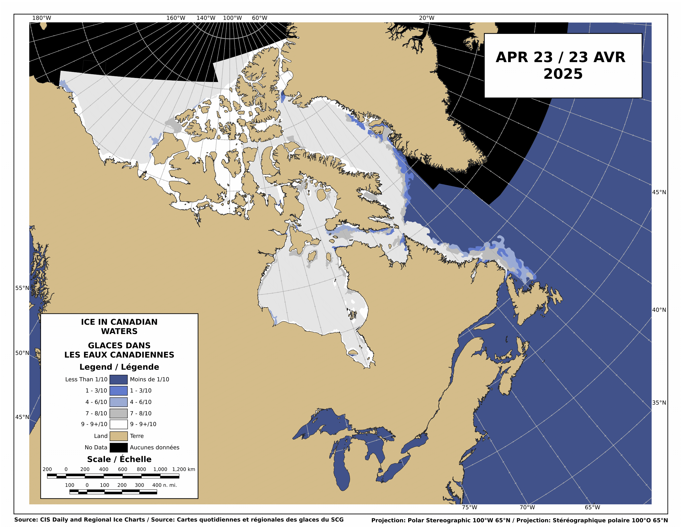
The Canadian Ice Service shows that there is still low-medium concentration ice blocking the Northwest Passage.

http://ice-glaces.ec.gc.ca/Ice_Can/CMMBCTCA.gif
If you owned a ship, would you send it through a route knowing it will face shifting pack ice, possible icebergs, fog, darkness, wind, storms and the possibility of an early freeze?
“The plans that you make can change completely,” he says. This uncertainty, delay, liability, increased insurance and other costs of using the Northwest Passage are likely to deter commercial shipping here. A ship with a reinforced hull could possibly make it intact through the passage. But if it got stuck, it would cost thousands of dollars for an icebreaker like the Amundsen to come to the rescue. So even if the Northwest Passage is less ice-choked than before, the route may not become a shipping short-cut in the near future, as some have predicted.
The Arctic Oscillation was negative for a few days, which allowed colder air to escape from the Arctic and warmer air to invade the Arctic. Note that the period of positive AO starting in early July corresponded to the Moscow heat wave. The cold air was trapped in the Arctic.

The negative dip this week allowed a blast of southerly air to melt and compact the ice during the past week, as we forecast in last week’s sea ice news.
")

http://ocean.dmi.dk/arctic/icecover.uk.php
Ice extent loss has dropped off dramatically in the last few days, as seen in the DMI graph above and the JAXA graph below.

Note that there was little loss in ice extent during 2006, after August 22.

What does the remainder of 2010 hold? Difficult to say. NCEP forecasts freezing temperatures over the broken ice in the Beaufort Sea during the next two weeks.

http://wxmaps.org/pix/temp2.html
If the remainder of the summer follows a path like 2006, 5.5 million is the right number. Another blast of southerly wind during the next few weeks. and it goes below 5.5. All of the ice indexes currently show 2010 ahead of 2008. DMI and NORSEX show it ahead of 2009 as well. JAXA also shows that the ice area curve has flattened. Ice area is always less than extent, and area trends tend to lead extent by a week or two.

There are large areas of low concentration ice which are vulnerable to compaction, spreading or melt.

My forecast remains unchanged. 5.5 million, finishing above 2009 and below 2006. Same as it has been since May.
The video below shows ice movement in the Beaufort Sea this week. Earlier in the week, it was compacting rapidly, now it is slightly expanding.
It all comes down to the temperature and wind over the next few weeks.
PIOMASS forecasts continue to stray further from the mark. Areas in red are places where PIOMASS incorrectly forecast melt. Solid green is the opposite misprediction.

Lindsay and Zhang forecast a minimum of 3.96 million in July.
The modified NSIDC image below shows ice loss during the last week. Mainly in the Beaufort Sea.

The modified NSIDC image below shows ice gain since 2007 in green, loss in red.

I’m not going to make a forecast for the next week, because there aren’t any dominant indicators either way.

By the reference to the 5.5m sq km prediction, I assume this is an update by Steve Goddard? In a few weeks we’ll know for sure who was right, Steve or R. Gates. Fetch the popcorn.
“The Arctic Oscillation was negative for a few days, which allowed colder air to escape from the Arctic and warmer air to invade the Arctic.”
Here are two good animations of that occurring:
http://www.cpc.ncep.noaa.gov/products/intraseasonal/z500_nh_anim.shtml
http://www.cpc.ncep.noaa.gov/products/intraseasonal/z200anim.shtml
A similar story in the Antarctic, i.e. Atmospheric Oscillation driving short term changes in sea ice. A high pressure area penetrated the southern polar vortex;
http://www.cpc.ncep.noaa.gov/products/intraseasonal/z500_sh_anim.shtml
and Antarctic Sea Ice growth ground to a halt:
http://nsidc.org/data/seaice_index/images/daily_images/S_stddev_timeseries.png
Steve
Have you had an opportunity to review the NSIDC’s recent press release?:
http://nsidc.org/arcticseaicenews/
They highlight an “Early clearing in the Northwest Passage” and provide this map and chart:
http://nsidc.org/images/arcticseaicenews/20100817_Figure3.png
Does the chart look accurate to you? Why do you think they used Area instead of Extent?
Whatever happens with the ice, looks my Chelsea prediction is spot on. 6-0 again. MU would have lost today except for a Fulham own goal at 86 minutes.
Vince Causey says:
August 22, 2010 at 9:40 am
By the reference to the 5.5m sq km prediction, I assume this is an update by Steve Goddard? In a few weeks we’ll know for sure who was right, Steve or R. Gates. Fetch the popcorn.
It won’t be Gates. He is blinded by his religion. Maybe somewhere between the two of them. On verra.
You should look at the most recent Pips Ice Drift — or any after the 14th, showing the 2007 Pattern returning (finally), http://www7320.nrlssc.navy.mil/pips2/archive/retrievepic.html?filetype=Displacement&year=2010&month=8&day=23
… and an animation of about a half million breaking off & heading for the Fram Strait Exit http://neven1.typepad.com/blog/2010/08/race-to-fram-strait.html. However, your main point, Steve, is even more impressive in straight DATA (Jaxa):
Daily: ___________2007___ to___ 2010__&__(2009__2010)
Aug19-20_______ -46,563 _____ -15,782___(-40,156__77,344)
Aug20-21_______ -64,469 _____ -31,406___(-34,219__27,343)
Aug21-22_______ -61,091 _____ – ?___?___(-72,500__45,157)
Correction of Steve’s first post
The Canadian Ice Service shows that there is still low-medium concentration ice blocking the Northwest Passage.
Should be
“The Canadian Ice Service shows that there is as a low concentration of ice but it is not blocking the Northwest Passage.”
The northern route is showing less ice than the southern routes for the last 4 years and in those years boats got through.
Having said that the rest of your post is a very good summary of the current situation, good reading.
Andy
Just The Facts
I’ve seen the NSIDC newsletter, and that why I included the NWP discussion. I am looking at it from a practical point of view, rather than an academic one.
AndyW
No it should read exactly what I said. The ice moves around constantly and remains a danger to ships.
If you want to write your own interpretation – fine. Please don’t pretend to be correcting mine.
I really need some comments on my idea that CUBES, not sheets of Ice, is what we got when the Ice that usually sticks to Greenland & Ellsmere spread out this year
— As all cracking in Ice is VERTICAL, we thus got widely scattered 30-foot CUBES, not a sheet of Ice 4 feet instead of 2 feet thick.
This is / may be, doing DIFFERENT things:
1. They LOOK very different in High Resolution Pics, Perhaps the multi-km Satellite Map Resolution is WILDLY mis-(Over??)-estimating the TRUE AREA.
At any rate, it seems responsible for the WILD SWINGS we have been seeing.
2. CUBES melt a LOT slower (5 to 10 TIMES).
3. They may keep Ocean Temp down, even after all the rest of the ice in their vicinity has dissappeared e.g. the wispy “ghost” areas on some Maps: http://www.iup.physik.uni-bremen.de:8084/amsr/arctic_AMSRE_visual.png
4. The VOLUME may have stopped shrinking much — if at all –WEEKS ago (if it, like PIOMAS says, was already below the 2007 minimum) The low air temps would be adding (thin) ice whilst effects #2 & #3 resist the lingering warm waters of the ” late ” EL NINO.
5. FUTURE YEARS — especially NEXT YEAR — may find the CUBES a REALLY FINE FOUNDATION for BIG increases.
Again:
I am a Big Fan of Dr. Roy Spencer’s 60-year Cycle & we have 27 years more of 2 La Ninas (cold) to every EL NINO (hot).
I warned the Canadian Marine Services and another Canadian agency about November of last year that they would begin to feel the effects of global cooling.
I wonder if my research went to the Circular File or was just simply deleted?
Paul
Steve,
Thanks again for the update. The dominant player in melt right now is SST’s (as it has been for several weeks. The extent and area will fluctuate with the passage of each new high or low pressure system, but this fluctuation in extent/area should not be confused with changes in the melt rate as that is pretty well fixed based on SST’s.
These past few days we’ve seen a slow down of the decrease in extent declines for two reasons. First, we had a reversal of the compaction that was going on earlier last week and actually saw some more divergence (as you noted). Secondly, a lot of the ice over the warmer waters has already melted.
What should we look for in the upcoming week? The current divergence is based on high pressure (the same cause as the negative AO index) that was parked over a broad area of the Arctic Ocean. Just as the high pressure forces cooler air south, it also tends to diverge or spread the ice as well.
Here are the factors that are worth watching in the coming weeks, all of which will combine to determine the final extent:
1) The intensity and duration of high and low pressure systems over the Arctic, with the high pressure bringing warmer air temps but a slow down the decline of the extent as high pressure tend to cause divergence. These ultimately can lead to more melting however, as the ice tends to stay further south. Low pressure systems will compact the ice, causing a more rapid immediate decline in the extent, but can force the ice further toward the north and away from the warmer waters, leading to less final melting.
2) Water temps are the key here, as it is not air temps but water temps that are driving the melt, and have been for several weeks. We still got lots of warmer than normal water in the Arctic:
http://polar.ncep.noaa.gov/sst/ophi/color_anomaly_NPS_ophi0.png
And any ice that is diverged into the Beaufort, E. Siberian, Kara, or Barants sea will melt faster than if it stays in the Central Arctic basin. Again, high pressure systems will tend to force the ice toward these areas, and result in lower drops in extent, but ultimately more melting.
I am extremely confident (based on SST’s and the amount of open water we’ve had) that 2010 will end up below 2009. Hence, of course I think that Steve’s 5.5 million s mainly
stevengoddard says:
August 22, 2010 at 10:13 am
AndyW
No it should read exactly what I said. The ice moves around constantly and remains a danger to ships.
If you want to write your own interpretation – fine. Please don’t pretend to be correcting mine.
Why not, by no stretch of the imagination is the NW Passage ‘blocked’, quite the contrary, whether it is a suitable route for commercial traffic is quite another matter.
The La Roche would breeze through the NWP this year, either the N or S route or through Prince of Wales strait. As usual Goddard you are misusing terminology to mislead the unwary.
Part II:
(sorry, I hit the send before I was ready)
Hence, of course I think Steve’s 5.5 million sq. km. forecast is way too high. Will we beat 2008? I said all season that I was looking for 4.5 million sq. km., and I do think that is still possible. Here’s why: I think that the current warm SST’s in the Arctic will play out into a longer than normal end of the melt season. I think we will see the final low more in the area of Sept. 20-25. I think we will drop to the 4.7 to 4.9 million sq. km range in the first few weeks or so of Sept. and then I think durng that last little drop down from Sept. 15 to the 25th or so , we will approach the 4.5 million sq. km. range, before the winter expansion begins. Again, what to watch for here is the SST’s, and the intensity, duration, and timing of high and low pressure systems in the next few weeks.
N Pole buoy indicates
temp drop of 6 Degrees C
in the past 4 days
http://psc.apl.washington.edu/northpole/POPS13_atmos_recent.html
AndyW says:
August 22, 2010 at 10:05 am
What are you waiting for? Sail away, you got 30 days if you are lucky, to be one of those rare boats that gets through the NW passage.
BTW, sunny skies right at the moment at the North Pole, and you can see that the little melt pond right in front of the camera that we’ve watched all winter is now once more clear of snow (it was snow covered last week):
http://www.arctic.noaa.gov/latest/noaa2.jpg
The high pressure over the Arctic right now has brought these sunny skies to our little melt pond:
http://www.meteo.uni-koeln.de/meteo.php?show=En_We_We
Thank you for the update Steve. I appreciate your work on this.
However, finishing like 2006 will not put us at 5.5e6 km^2, we’ll land at 5.41e6 km^2 (JAXA). That said, I think 2010 still has a slight chance to make 5.5e6 km^2, and the details for that reasoning are given in my last comment on your “Did 300000 km^2 rapidly melt” post, and I think the probability of ending that high is similar to ending as low as 2008, though I give the slight edge to 2008.
Overall, I have really enjoyed the sea ice news and the discussion/debate it sparks. I think at this point everyone realizes how dependent the ice extent (and area and volume to an extent) are on WEATHER. Given that the extent lost from here to the minimum ranges from 300000-900000 km^2 this late in the game (in only 8-9 years of the JAXA record) is excellent evidence of that. My interpretation/conclusion from this is that much of 2007’s loss was weather related and it naturally takes considerable time to recover from this. However, part of the loss over the recent years might be due to CO2-related warming, and only time will tell what the answer to this is.
Regardless of the end number (I personally hope we top 2009), I keep reminding myself that this is only 1 year and thus really only 1 data point in the large scheme of things. Since that data point is likely going to end well above 2007’s low, it’s nice evidence against a rapid and immediate “death spiral”.
Thanks again to Steve and
allthe vast majority of commenters on these threads. It’s nice to see many different takes on the same (or very similar) data.-Scott
rbateman says:
August 22, 2010 at 10:49 am
AndyW says:
August 22, 2010 at 10:05 am
What are you waiting for? Sail away, you got 30 days if you are lucky, to be one of those rare boats that gets through the NW passage.
‘Rare’ is an interesting word to use when most of the yachts that attempted it over the last few years have made it.
Temperatures around the North Pole have gotten very cold, ranging from -2 to -10 C.
http://psc.apl.washington.edu/northpole/
“The Arctic Oscillation was negative for a few days, which allowed colder air to escape from the Arctic and warmer air to invade the Arctic. Note that the period of positive AO starting in early July corresponded to the Moscow heat wave. The cold air was trapped in the Arctic.”
Funny, according to CPC AO running mean, the last two-three months have been positive and have reached value of +2:
http://www.cpc.noaa.gov/products/precip/CWlink/daily_ao_index/month_ao_index.shtml
R. Gates says:
August 22, 2010 at 10:56 am
BTW, sunny skies right at the moment at the North Pole, and you can see that the little melt pond right in front of the camera that we’ve watched all winter is now once more clear of snow (it was snow covered last week):
Not at the Pole anymore though, heading towards Fram strait at present.
R. Gates says:
August 22, 2010 at 10:56 am
The snow that fell in our little pond by the pole probably ablated, or was blown into a drift somewhere.
Little Pond froze over about a month ago, the mirrored surface being glassy ice.
Right now, that’s no picture of a day at the beach w/ wife & kids.
The pond is glittering with crystalline growth as the temp goes to Davy Jones Freezer-Locker.
As Joe Bastardi said: “Here comes the cooling, Baby I aint fooling”
stevengoddard says:
August 22, 2010 at 11:09 am
Temperatures around the North Pole have gotten very cold, ranging from -2 to -10 C.
http://psc.apl.washington.edu/northpole/
______
Interesting that the PAWS buoy, which is further north (and right by webcam #2) has higher temps than the other site:
http://psc.apl.washington.edu/northpole/PAWS_atmos_recent.html
Either way, these air temps have little to do with the course of the remaining melt.
stevengoddard says:
August 22, 2010 at 11:09 am
It’s starting. Perfect timing too, a sleeping Sun adds to the legacy, most likely setting up another blocking event to keep the chill confined for a while longer.
R. Gates says:
August 22, 2010 at 10:56 am
Looks like the snow has just blown around and isn’t on the melt pond to my (untrained) eye. This seems to make sense to me, as I assume the refrozen melt pond surface is smoother/flatter than the surface of the older ice.
-Scott
R Gates says:
“We still got lots of warmer than normal water in the Arctic:”
“I think that the current warm SST’s in the Arctic will play out into a longer than normal end of the melt season”
I note the colour anomaly map but the talk of warm arctic SSTs is somewhat misleading, what is the present Arctic SST average temperature? The anomaly is about one degree but given the low SST then a single degree is hardly likely to melt sea ice as you claim and the DMI SST map is showing around -1 to +2 degrees C and I dont know about you but I think its over egging your pudding to state Arctic SSTs are “warm” I can assure you that zero to two degrees C is very very cold indeed and is not likely to melt gigantic areas of ice. Try dropping an ice cube into water cooled to one degree C and see how long the ice cube takes to melt, then try to do the same with water cooled to 2 degrees C and note how long the ice cube takes to melt. The water is 100% warmer but the ice will not melt measurably quicker will it? So you could say the water is much warmer but that would be disingenuous to say the least.
Can you clearly show actual temperatures and show exactly how much ‘warmer’ they are from ‘normal’?
The use of the word “warm” is misleading I think. BTW the DMI SST map shows no red whereas the NOAA map has lashings of the stuff, with red being only a very small rise in actual temps, a cynic might come the conclusion that NOAA is trying to scare us with the old paint it red for danger trick.
Jarmo says: August 22, 2010 at 11:13 am
“Funny, according to CPC AO running mean, the last two-three months have been positive and have reached value of +2:”
The chart you linked to is “The standardized 3-month running mean value of the AO index”;
http://www.cpc.noaa.gov/products/precip/CWlink/daily_ao_index/month_ao_index.shtml
whereas Steve highlighted the Daily AO Index, which supports his assertion:
http://www.cpc.noaa.gov/products/precip/CWlink/daily_ao_index/ao.sprd2.gif
Jarmo, a 3 month running mean is useless when comparing week to week.
Here is the observed AO the past few months.
http://www.cpc.noaa.gov/products/precip/CWlink/daily_ao_index/ao.sprd2.gif
stevengoddard says:
August 22, 2010 at 9:57 am
> Whatever happens with the ice, looks my Chelsea prediction is spot on. 6-0 again. MU would have lost today except for a Fulham own goal at 86 minutes.
Odd, at http://wattsupwiththat.com/2010/08/20/giss-shaping-up-to-claim-2010-as-1/#comment-462132 you note “Why are so many people intent on changing the subject?”
http://wermenh.com/runnings_2010.html 🙂
BTW, there’s no significant news I see about the boats poking around the Arctic, see http://www.explorersweb.com/oceans/
For context and perspective, could someone reprise the correlation-correspondence (if any) of La Ninas in conjunction with 30-year PDOs as affecting Arctic sea-ice area and extent? On a global basis, major cycles ought somehow to cancel or to reinforce, lending a quasi-predictive aspect to one component or another.
As a side note, I find it quite interesting to watch the Northern Passage 2010 expedition (to go through both the NW and the NE passages in the same season) these days…
http://www.ousland.no/category/northern-passage-2010/
Cassandra King says:
August 22, 2010 at 11:41 am
Regarding Arctic SST anomalies: “The use of the word “warm” is misleading I think.”
_____
When looking at longer term climate changes, anomalies are really all that matter. Otherwise you’re just talking about the weather, and when talking about anomalies, saying something is warmer than average or cooler than average is exactly the right choice of words. Also, 1 degree C makes a very big difference, especially in regards to Arctic water temps, as it water can be right at the “tipping point” for where ice floating in it will melt or not.
Now in regard to some human standard of warm or cold, I sure would not take a dip in the Beaufort sea right now, even though it is running well over 3 C above the longer term normal for this time of year.
Ric Werme says: August 22, 2010 at 11:55 am
“BTW, there’s no significant news I see about the boats poking around the Arctic”
The last significant update appears to be Aug 1st;
http://www.explorersweb.com/oceans/news.php?id=19550
which includes links to most of the expeditions poking around the Arctic:
RX 2 (Norwegian) with Trond Aasvoll, Northwest Passage West to East
http://trondaasvoll.seilmagasinet.no/
Issuma (Canadian) Northwest Passage East to West
http://www.sailblogs.com/member/rhudson/
Sarema (Finnish) Northwest Passage West to East
http://www.northwestpassage2010.blogspot.com/
Peter 1st (Russian) with Daniel Gavrilov and six other young Russians, Northeast and Northwest Passage
http://rusarc.ru/
Northern Passage (Norwegian) with Børge Ousland og Thorleif Thorleifsson Northeast and Northwest Passage
http://www.ousland.no/blog/
JOTUN ARCTIC (Norwegian) with Knut Espen Solberg, climate research East Greenland
http://fotspor.org/
Saxon Blue (UK) with Harvey Jones and Andrea Stokes sailing the West coast of Greenland.
http://blog.mailasail.com/saxonblue
Teleport (Australian) with Chris Bray and Jess Taunton are doing the Northwest Passage in two stages and are sailing their 29 foot junk-rig boat to Conception Bay this season.
http://www.yachtteleport.com/
ARIEL 4 (Sweden) – Northwest Passage East to West
Alaska (Norwegian) with Espen Paulsen, Northwest Passage East to West
FIESTA (Norwegian) with Wollert Hvide, East Greenland
R. Gates says:
August 22, 2010 at 11:31 am
Temperature Anomalies have little meaning in such icy conditions.
It’s a windy crapshoot in a given year.
Now, the big factor is the Arctic/Antarctic Sea Ice Paradox.
Will they continue on thier 3-year increase bent, hopscotching from hemisphere to hemisphere, blasting away at hapless and uniformed masses from the Polar Ice Machines as winter descends?
The available supply of moderating heat energy in the Pacific is spent, and the North Altantic is the last defense.
The anomalous warmth in the N. Atlantic is not exactly in the best place as the sun sets south, so open to radiating out into space.
We’ll have to deal with the cards that are now on the table.
R. Gates says:
August 22, 2010 at 12:26 pm
Then choose your winter coat anomaloulsy.
Will you take the same anomalous coat for an Alaskan Winter that you would for a Texas Winter, or would you take an absolute coat?
R. Gates says:
August 22, 2010 at 10:40 am
The majority of these anomalies seem to be +0-1 C, which potentially could be significant. But what really matters is how do these anomalies compare to this time of year in 2005-2009? I don’t care if they’re slightly above normal compared to a baseline from several decades ago if we’re comparing to the last 5-6 years and I don’t know what those anomalies were.
-Scott
Here is a chart showing all the years since 1979 (using the NasaTeam Algorithm prior to the years that Jaxa became available). It requires a few adjustments to match up the two series and is not perfectly compatible but at least it is something to review (which one assumes the NSIDC could provide if it weren’t for all the important global warming functions they have to promote/do).
http://a.imageshack.us/img843/1189/day233aug21sei.png
Ric,
My mother used to tell me “If you don’t have anything nice to say, then don’t say it.”
Vince Causey says:
August 22, 2010 at 9:40 am
In a few weeks we’ll know for sure who was right, Steve or R. Gates
One can already tell R. Gates is wrong. But you’re right, it will be conclusive at minimum.
SSTs in the Beaufort Sea are far below normal. It doesn’t make any sense to consider SSTs in regions where there is no ice.
http://weather.unisys.com/surface/sst_anom.html
NEWS: Nunavut August 10, 2010 – 10:59 am
Northwest Passage still hard to navigate
It would be nice if we had an article, about on site observations, that was less than 12 days old.
Ice concentrations:
http://arctic.atmos.uiuc.edu/cryosphere/NEWIMAGES/arctic.seaice.color.000.png
stephen richards says:
August 22, 2010 at 10:02 am
It won’t be Gates. He is blinded by his religion. Maybe somewhere between the two of them. On verra.
I am forever amused by the pot as he calls the kettle black. If it’s somewhere in between, stephen, then where is the influence of religion? You may as well flipped a coin.
The paradox (Irony?) of these forecasts is that long term climate is a bit easier to predict than short term events whether they be considered weather or climate. So while many have their heads stuck in the frigid Arctic waters, hoping that they will quickly freeze up [;-) it’s becoming obvious that all these Sea Ice Reports are magical attempts to thwart off the LONG TERM picture.
The Arctic Sea will be ice free during the summer; for a few days initially and progressing to weeks then months; between the years 2020-2030.
Of course, as that becomes so obvious that even the Media imbeciles catch on to it, you will go back to??? Ah, yes! “It’s been open before, it’s been open before!”
Sure we are all watching “The Race”..but has anybody noticed the thin-er ice from the NEastern point of Greenland on out aways?…Being an AGW denier & Pro Ice supporter this particular aspect of the Ice has bothered me more than the Extent.
http://igloo.atmos.uiuc.edu/cgi-bin/test/print.sh?fm=08&fd=20&fy=2009&sm=08&sd=20&sy=2010
The Northwest Passage is not open at just the McClure Straits but a 3 other locations
http://img682.imageshack.us/img682/5820/cmmbctca.gif
Northwest Passage
http://img13.imageshack.us/img13/7373/arcticr.gif
animation of Northwest Passage over last 10 days
http://www.ec.gc.ca/glaces-ice/default.asp?lang=En&n=CE69E4DD-1
PS..A little Birdie (Penguin) just told me that Mondays Extent will show little Ice loss.
Some interesting info about the NW passage from Vilhjalmur Stefansson’s 1947 book “Great Adventures and Explorations” page 537 and onwards–
He describes how during the 2nd and 3rd decades of the 20th century the Hudson Bay Company had greatly expanded its trading posts in the Arctic which required the RCMP to also establish outposts both along the mainland and as far afield as Victoria and King William islands. He says this “necessitated the development of shipping along the Northwest Passage.” To service their outposts they sent one ship from the Atlantic side and one from the Pacific side which met at the Bellot Straits at Fort Ross, then each returning by the way it had come.
So to me it sounds like the NWP was actually navigated many times and regularly so prior to actually being navigated all the way through in one trip by the St. Roch. I would love to hear more about the HBC resupply trips from anyone who has studied this. TonyB?
Thanks again Steve. I follow your reports with interest.
But I hope they are better balanced than your sports ones. You failed to mention that United would have been out of sight, if Nani hadn’t had his late penalty saved!
R. Gates said at 12:26 pm
When looking at longer term climate changes, anomalies are really all that matter. Otherwise you’re just talking about the weather,……
So… positive climate anomalies melt ice? So if I’m standing on an Arctic ice berg and the SST (although that particular WEATHER component is not all that relevant to melting ice bergs) where I am is -.5C and the SST 1,500km over “there” in the Arctic is say +2.5C and when we add in all the points and do our averaging it makes for an anomaly, in our mythical moment in time and space, +1C, and because of our calculation the ice where I’m standing is melting? Reminds me of the old Thermos jug joke. How does it know?Maybe you could explain that, WITHOUT using any weather terms, of course because we know it’s the CLIMATE that drives weather – – in the models.
Oh, and – as it(s) water can be right at the “tipping point” for where ice floating in it will melt or not. Wow! There’s a real interesting “scientific” statement if I ever heard one. Obviously true, there is a theoretical “tipping point” for ALL negative/positive processes. BUT what is that point? Is it JUST SST temp.? How about: Air temp.? Water flow? Wind speed? -direction? Humidity? Barometric pressure? Sun angle? Surface condition? -contamination level?
Anyone care to add any more WEATHER conditions would change that point? That’s all I could think off the top….
Phil says
‘Rare’ is an interesting word to use when most of the yachts that attempted it over the last few years have made it.
They might find it a little harder to travel the passage if it was 1906 and they were doing it without any modern navigation technology. I don’t think the area was even mapped back then.
mecago says:
August 22, 2010 at 1:28 pm
From the Trend without End, Amen Dept:
One could have easily made a convincing case that the Bull Stock Market (in 2007) was headed for 20,000 by 2020.
Right up until the week of the Big Bust, it was carefree and endless. Bubbles had popped before, but statistics were carefully crafted and managed, so they thought this time it was different. The warning signs were there, but few could read them, or cared to.
So, like the Investigator, they sailed right into it.
Anomaly Maps:
NOAA Arctic http://polar.ncep.noaa.gov/sst/ophi/color_anomaly_NPS_ophi0.png
DMI Arctic http://ocean.dmi.dk/satellite/index.uk.php
Unisys World EXCLUDES ARCTIC http://weather.unisys.com/surface/sst_anom_inv.gif
All 3 Differ ENORMOUSLY. Both Arctic Maps have a VERY HOT Alaska but Unisys is Cold off East Alaska.
Note Unisys’s MAP projection makes this area appear Huge but the Map edge is SOUTH of the Beaufort Sea Ice.
Spitzbergen has a +8oC blob in NOAA North of where an off-Norway Cold Spot is in Unisys (but all 3 do agree on THAT, the 2 that continue North of the Arctic Circle, show it gets Warmer to the North of that()
DMI has a BIG hot spot where 2007’s was, at the New Siberian Islands (East Central Siberia) where NOAA is only a bit Warm.
NOAA has a HOT area West of Novaya Zemlya – – DMI is BELOW NORMAL there ! (N.Z. is the extension of the Urals that divide Siberia & Europe).
.. And NONE of them go back much (DMI a month). TOPAZ went back into 2008, but ALL the Northern (Roos, Nansen, Topaz) sites are either Down or I cannot load them.
Another:
#4 Global, but Arctic squeezed =hard to see:
– – mostly COLD. Except Alaska. And off Norway, where it is the ONLY Warm one of the 4:
http://www.weatherzone.com.au/climate/indicator_sst.jsp?lt=global&lc=global&c=ssta
I would assume the 2 that Specialize in the Arctic are best at it – – & they do track together (if an off-scale +8 oC spot for one, may find the other at just +2)
mecago says:
August 22, 2010 at 1:28 pm
[emphasis mine]
The only thing I’ve seen in this thread that seems “magical” is your prediction of how the “ice free” summers are going to progress 10-20 years from now. Did you see it in a crystal ball?
-Scott
fishnski says:
August 22, 2010 at 2:02 pm
Are you just joking around or do you know someone who works with the data analysis that told you almost no ice loss is happening today? I’m always interested to get the newest results ASAP.
-Scott
Hey Scott,
I don’t know what it is that you’re smoking, but; can I have some please?
miket
Looked to me like Fulham deserved the win.
Cassandra King says:
August 22, 2010 at 11:41 am
“Try dropping an ice cube into water cooled to one degree C and see how long the ice cube takes to melt, then try to do the same with water cooled to 2 degrees C and note how long the ice cube takes to melt. The water is 100% warmer but . . .”
While I agree with the argument you make in the comment, the statement quoted is not correct because C is an interval, not a ratio scale. Convert the two numbers you have chosen (1 & 2) to the F scale and you will get a different answer. K, a ratio scale, gives a very different answer that is what you need, but it is no way near 100%.
Amino Acids in Meteorites says:
August 22, 2010 at 1:54 pm
“The Northwest Passage is not open at just the McClure Straits but a 3 other locations”
I don’t find the maps at this resolution good enough to answer this qustion:
Is the NW Passage open completely from one end to the other?
Your comment implies that it is not.
R. Gates, both daily absolute temps and temp anomalies are data, not information, IE not cause and effect, not correlation, and not mechanism. So I heartily disagree with you that anomalies are all that matter. If that were truly the case all the climatologists, along with all the journals they publish in need to get another job, and Anthony needs to re-assign his web page to something like, I don’t know, fashion changes over the years?
When looking at long term climate trends, I accept anomalies as a reasonable measure of what’s been happening. However, when you talk about a possible “tipping point” then you need to use temperatures.
The ideal would be to give the anomaly and and the base that anomaly is from. eg. A +1C anomaly over a base temperature of -5C. That shows that the temperature is above ‘normal’, but also shows that despite that the temperature is still well below freezing. In the example above, it’s when the anomaly is approaching +5C that we need to b e worried. If it stays less than +3C then it’s not really a significant concern.
Matthew Bergin says:
“They might find it a little harder to travel the passage if it was 1906 and they were doing it without any modern navigation technology. I don’t think the area was even mapped back then.”
Of course there were maps. They were made with dog sleds.
In the summer!
Oh and the 1903 expedition finished in 1906.
But, of course, it’s all normal today isn’t it?
William says:
August 22, 2010 at 3:16 pm
Which of my posts appears to be from a drugged up individual?
-Scott
a reader says:
August 22, 2010 at 2:13 pm
Some interesting info about the NW passage from Vilhjalmur Stefansson’s 1947 book “Great Adventures and Explorations” page 537 and onwards–
He describes how during the 2nd and 3rd decades of the 20th century the Hudson Bay Company had greatly expanded its trading posts in the Arctic which required the RCMP to also establish outposts both along the mainland and as far afield as Victoria and King William islands. He says this “necessitated the development of shipping along the Northwest Passage.” To service their outposts they sent one ship from the Atlantic side and one from the Pacific side which met at the Bellot Straits at Fort Ross, then each returning by the way it had come.
So to me it sounds like the NWP was actually navigated many times and regularly so prior to actually being navigated all the way through in one trip by the St. Roch. I would love to hear more about the HBC resupply trips from anyone who has studied this. TonyB?
This happened in 1937 (and possibly 1938) when the Aklavik, based in Cambridge Bay, undertook this journey and met the Nascopie which reached the east end of the Bellot strait from the east. In subsequent years this was not possible and the station at Fort Ross on Bellot was abandoned. Note that these were travels within the NWP not traverses of the whole NWP.
It is not enough to ask “is the NWP open?” You have to also include information about the equipment.
It is one thing to attempt a passage with modern navigational equipment, satellites, radar etc.
It is an entirely different matter to attempt a passage in a wooden boat in fog with 30 foot visibility at night, having no idea what you are facing in the way of ice, or how it may have shifted.
A few days from now is when 2008 took it’s dip. If this year doesn’t follow that then it looks like it will end near the JAXA average.
An important factor to the minimum ice extent is the date that refreeze starts exceeding melt. The sooner it happens, the higher the minimum. In a comment on last week’s sea-ice news #18 http://wattsupwiththat.com/2010/08/15/sea-ice-news-18/#comment-458213 I pointed out that the date of the minimum seems to occur a bit over a week earlier in even-numbered years than in odd-numbered years, using IARC-JAXA data.
I also notice that an even-numbered year always seems to have an earlier minimum-date than the preceeding odd-numbered year…
2003 Sep 18 => 2004 Sep 11
2005 Sep 22 => 2006 Sep 14
2007 Sep 24 => 2008 Sep 09
Note that 2007 was a “double-dip” minimum. There was a local minimum at Sep 16. You can optionally use that date if you want to be conservative. Sep 24 makes the trend even more powerful, but Sep 16 makes it more consistant, i.e. almost exactly a week.
The obvious question is… 2009 Sep 13 => 2010 Sep ??
The above pattern indicates that the 2010 minimum should occur around Labour Day, i.e. September 6th. I’m in a position similar to Livingston and Penn. This is “merely a statistical approach”, and I have no explanation for the underlying drivers. QBO maybe?
Per NSIDC:
“However, today’s conditions in the Northwest Passage would likely astonish 19th century explorers such as McClure, Franklin, and Amundsen. In upcoming decades, the passage will be increasingly likely to open during summer.”
==========================
What does “increasingly likely” mean?
Other than it is likely, that my tax dollars are increasingly needed, to continue fiction written by bad authors.
Talk of the NW passage being “open” is at the same level of importance as climbing Mt. Everest.
Open season is limited.
Hey, here’s a fun-filled idea: Plot the tonnage by year shipped thorough the NW Passage.
Here’s a more recent update on the progress of this season’s Arctic explorers:
http://explorersweb.com/oceans/news.php?id=19590
Looking at the referenced “Solar Energy as a function of latitude and date” it reminded me of a model I built years ago for a set of projects that I can’t talk about. The “customer” was worried about ground observers seeing visual and IR glint of of deployed air vehicles. They needed to know where the sun was at any daylight moment on any day of the year, and the (Az,El) bearing angle to the sun from the ground observer, so that missions could be planned with minimum risk. A colleague suggested we use solar system geometry and I went from there. I checked the modeled predictions against the Farmers’ Almanac for the year I developed the model, and the variance from observed data was minuscule.
It anyone would like to have the”Where is the Sun?” (WITS) model (for free), let me know and I’ll email the source code to you.
Scott:
A thousand apologies to you. That’s what I get from reading too fast. I was referring to the person you quoted as stating that the Arctic would be ice free in 20 years. Again, I’m sorry. I’ll have to be more careful being a wise acre in the future.
stevengoddard says:
August 22, 2010 at 4:21 pm
================================
Steve, you’re exactly right.
You can’t compare the NWP being open now, to being open in the past.
In the past, they didn’t even have a way to know if it was open or not until they got there, just a hunch.
Then they more than likely spent every day just trying to find it.
Before satellites, GPS, radar, even radios, I’m amazed that anyone found it at all.
Now they can look at it ahead of time, have things that tell them 5ft to your port side and you are here, and people are a lot more brave and adventurous, to the point of being reckless and irresponsible, knowing that they can call for help.
Look at all the bozos that have gone up there, in their private boats, because of those reasons.
That does not mean the NWP is “open for the first time”.
It means that people are just as stupid as they have always been.
I don’t get the obsession with hanging on to global warming. It’s not happening. Try to come to terms with that.
John F. Hultquist,
Umm, huh? I don’t follow.
Walter Dnes says:
August 22, 2010 at 5:21 pm
An important factor to the minimum ice extent is the date that refreeze starts exceeding melt. The sooner it happens, the higher the minimum. In a comment on last week’s sea-ice news #18 http://wattsupwiththat.com/2010/08/15/sea-ice-news-18/#comment-458213 I pointed out that the date of the minimum seems to occur a bit over a week earlier in even-numbered years than in odd-numbered years, using IARC-JAXA data.
The Bremen analysis of the same data shows no such variation which is interesting.
http://iup.physik.uni-bremen.de:8084/amsr/ext_rates_n.png
I know, let’s play a game. It’s called let’s pretend the Northwest Passage is open and global warming is real! What a great way to spend our time!
William says:
August 22, 2010 at 5:59 pm
No prob, sounds like you apologized 999 times too many. 🙂
I’ll forgive you since you found the certainty of the predictions 10-20 years in the future just as absurd as I did. 😉
-Scott
Amino Acids in Meteorites,
So when satellite imagery shows us that the NWP is open, and we have people traversing it on the water, your suggestion is what, exactly – that the satellites are wrong and that the people supposedly traversing it are in reality sitting at home in air-conditioned comfort?
It seems to me that any pretence here is not occurring on my side of the discussion …
http://arctic.atmos.uiuc.edu/cryosphere/NEWIMAGES/arctic.seaice.color.000.png
Walter Dnes says:
August 22, 2010 at 5:21 pm
I think that your observation is probably more chance than anything. However, you’ll be interested to note that I used that observation as a possible way for the ice to stay above Steve’s 5.5e6 km^2 prediction. See my comment at this time:
August 22, 2010 at 2:56 am
at the posting at:
http://wattsupwiththat.com/2010/08/18/arctic-toolbox-did-300000-km2-of-ice-suddenly-melt/#comments
And how do I directly link to comments on other threads?
-Scott
latitude says:
August 22, 2010 at 6:01 pm
We lose a few of those beyond-daring adventurers each year on Mt. Rainier and Mt. Shasta.
Sailing the NW or NE passages is in the same vein. There will be casualties, just give them enough time and volunteers.
Amino Acids in Meteorites says:
August 22, 2010 at 6:21 pm
How about a more adventurous game?
Let’s say that the Arctic Sea Ice Anomaly will keep dropping and the Antarctic Sea Ice Anomaly will keep rising.
Then predict when the Antarctic Current will get shot up the coast of S. America when the ice bridges the last gap, and what will the resulting change mean.
Bill Illis says:
August 22, 2010 at 1:22 pm
Hmm, I noticed in your link that the trace from 1980 shows a very flat late August/early September. It even looks to reach its minimum in the last week of August. What date was the minimum extent in 1980? Does anyone else want to weigh in on this?
Would it be possible to have a late August minimum this year?
-Scott
Cassandra King says:
August 22, 2010 at 11:41 am
@ R Gates
The use of the word “warm” is misleading I think. BTW the DMI SST map shows no red whereas the NOAA map has lashings of the stuff, with red being only a very small rise in actual temps, a cynic might come the conclusion that NOAA is trying to scare us with the old paint it red for danger trick.
==============================
Exactly!
Chris
http://seaice.alaska.edu/gi/observatories/barrow_webcam
Who lives in that white house….and why??
Quick, the Kara Sea is 34dF and only 40% sea ice! It is open… All the Russia cargo ships must go through the NWP NOW! PIOMAS has given the all CLEAR! Nevermind the next Siberian blockage, it will be like 2007!
http://home.comcast.net/~ewerme/wuwt/cryo_compare_small.jpg
Always staining my sense of humor.
Scott says:
August 22, 2010 at 6:52 pm
http://wattsupwiththat.com/2010/08/22/sea-ice-news-19/#comment-463838
> And how do I directly link to comments on other threads?
Note that grey field in your comment that says “August 22, 2010 at 6:52 pm”. It’s a link. With Firefox, I right-click on it, and select “Copy link location”, then paste it into a comment. If nothing else works…
* click on the comment date, i.e. “August 22, 2010 at 6:52 pm” which takes you to the page
* and then copy the URL from the URL bar at the top of your browser
* you can then paste it into a comment
John F. Hultquist says:
August 22, 2010 at 3:49 pm
I don’t find the maps at this resolution good enough to answer this qustion:
Is the NW Passage open completely from one end to the other?
Your comment implies that it is not.
If you have FireFox you can right click on the image and click ‘view image’. Then press “CTRL” and “+” and hold them down. The image will blow up and you will easily see the Northwest Passage is not open.
http://img682.imageshack.us/img682/5820/cmmbctca.gif
David Gould says:
August 22, 2010 at 6:45 pm
So when satellite imagery shows us that the NWP is open, and we have people traversing it on the water, your suggestion is what, exactly – that the satellites are wrong and that the people supposedly traversing it are in reality sitting at home in air-conditioned comfort?
It seems to me that any pretence here is not occurring on my side of the discussion …
It seems to me that the true nature of the NW passage is not the pretty picture of simplicity thusly painted:
http://exploreourpla.net/explorer/?map=Arc&sat=ter&lon=0&lat=89,9&lvl=4&yir=2010&dag=234
and your supposition that discussion is non-existant might be true in other forums, but not this one.
I hold no pretense save one: that the Arctic is a brutal reality where few dare tread or sail, and it’s reputation for rewarding the mistaken is grim.
David Gould
You’ll have to link the satellite image that shows it open. Cryosphere Today does not show it open. There is not good enough detail. So are you meaning a different image? Canadian Ice Service from today shows it blocked in 4 places.
David Gould,
I’m not including you in what I’m saying next because I don’t know what you opinion of Cryosphere Today was in the past. But I still remember how some commenters downplayed Crosphere Today when it didn’t line up with their global warming paradigm. But this week they love Cryospere Today. In both instances they didn’t know what they were talking about.
David Gould,
In case you mised the link I’ve posted here it is again. I hope you have either FireFox or image software that allows you to blow up images. You’ll see the Northwest Passage is not open.
http://img682.imageshack.us/img682/5820/cmmbctca.gif
Maybe ‘open’ has become a relative term, relative to whatever some people need it to be.
William says:
August 22, 2010 at 3:16 pm
Hey Scott,
I don’t know what it is that you’re smoking, but; can I have some please?
William also says on August 22, 2010 at 5:59 pm
Scott:
A thousand apologies to you. That’s what I get from reading too fast. I was referring to the person you quoted as stating that the Arctic would be ice free in 20 years. Again, I’m sorry. I’ll have to be more careful being a wise acre in the future.
* * * * * * * * * * * * * * * * * * * * * * * * * * * * * * * * *
Here, let me pass it to you once more. This time, inhale slowly and deeply.
http://nsidc.org/images/arcticseaicenews/20091005_Figure5.png
Just that one drag starts giving you the picture, heh? Doesn’t that feel good? That stuff I just hooked (linked) you up with, is called research. It gets me high all the time. Try it someday. 🙂
To: R. Gates,
You might think that my comment is picky, but I believe that it is misleading to say that you have always been at 4.5 million. I will grant you that 4.5 million is the first and only quantitative # that I have heard from you, but earlier in the season you described your anticipation that the 2010 minimum would be at or in the vicinitiy of the 2007 minimum — without putting a # on it. So 4.3 million is more descriptive of your first guess –and that is when I sent you a note asking whether you would be around in September because that was a brave estimate. You certainly are free to change your estimate, and wise people do change their opinion when “facts change,” but your initial estimate did make an impression on me.
mecago
Look for a significant increase in MYI next year.
Mecago,
My apologies for being slow, but how does the image you linked to prove that the Arctic will be ice free in twenty years?
Hey Scott, That Birdie (Penguin) comment was just a naked Eye Obs of mine using the latest Sat obs that comes out around 430 to 530 on the NWS /Nat Ice center site. Now sitting here at 1152pm on the 22nd, Jaxa/Ijis shows a figure of 5635313 which is a significant drop of about 73,000….I have seen that get adjusted by up to 25,000 before but lately the adjustments have been no more than 10,000 so if this figure stays close There are going to be some ruffled feathers!…(I still cannot see where all this ice has gone..been staring at the Sat pic for awhile now(confused funny face)..)
mecago says:
August 22, 2010 at 8:11 pm
Actually, I try research every day. I have seven first-author papers in peer-reviewed journals, a few second-author papers, and a few patents currently pending. If you don’t believe me, Anthony has access to my e-mail address and could use that to get my real name (hidden here so I can get a job when I finish school) and confirm what I’m saying. Note that I’m not even done with graduate school yet and will be in the double digits in published first-author papers within a year, so I’m fully aware of what research is. And I’m well aware that the vast majority of hypotheses are wrong and that extrapolation of a trend is a very easy way to make errors. So how does your one link prove that we’ll see no ice in 2020?
Am I flaunting my credentials to try to put me in some place of authority? No, but I do it to defend myself against your weak insults as well as to show that real scientists DO seriously question CAGW.
As to your references to drugs, that’s not even worth addressing.
-Scott
fishnski says:
August 22, 2010 at 9:00 pm
Darn, you beat me to it. The preliminary loss of 73437 was indeed painful to see. Today coupled with the next two was by far the best time window to gain ground on 2009. Instead, this was the largest Aug 22 loss in the JAXA record.
-Scott
Amino Acids in Meteorites,
My opinion of cryosphere today is a good one, apart from me thinking that there is an issue with their comparison images, something that I have mentioned here a couple of times. I have been told that this problem is because of changes in the colour scheme that they use for differing concentrations, plus some differences in resolution, but I am not convinced that those explanations completely cover everything.
As to the image you posted, I may be reading it wrong, but it appears that at no point is there blocking ice of 100 per cent concentration. This may be simply a difference in definitions, however.
And, yes, it would be a difficult and dangerous trip into the Arctic and – perhaps paradoxically – probably more dangerous with the kinds of ice that is there at the moment rather than solid ice. I wouldn’t take the trip. 🙂
rbateman,
I was not saying that *discussion* is non-existent; I was saying that the *pretending* that Amino Acids in Meteorites was talking about was non-existent.
An Inquirer says:
August 22, 2010 at 8:16 pm
To: R. Gates,
You might think that my comment is picky, but I believe that it is misleading to say that you have always been at 4.5 million. I will grant you that 4.5 million is the first and only quantitative # that I have heard from you, but earlier in the season you described your anticipation that the 2010 minimum would be at or in the vicinitiy of the 2007 minimum — without putting a # on it. So 4.3 million is more descriptive of your first guess –and that is when I sent you a note asking whether you would be around in September because that was a brave estimate. You certainly are free to change your estimate, and wise people do change their opinion when “facts change,” but your initial estimate did make an impression on me.
_______
With all due respect, you are wrong. My 4.5 million sq. km. forecast has been well established here on WUWT since at least March of this year. I have never altered it up or down, much like Steve’s 5.5 million sq. km forecast, though I think he put that out there a bit later. I remember one post commenting how disappointing it would be if the extent hit 5.0 million exactly– as that would mean a “tie”. I found this to be very funny.
stevengoddard says:
August 22, 2010 at 8:38 pm
mecago
Look for a significant increase in MYI next year.
* * * * * * * * * * * * * * * * * * * * * * * * * * * * * * * * * * * * * * * * * *
Maybe, maybe not Steve. With all the loop de loops that the complexity of the Arctic ice cap can throw at us I am amazed by the consistency it’s shown in radical thinning and substantial shrinking.
I personally would have expected something like 3 years of shrink/thin then 1 or 2 of expand/thicken or something along those lines. Of course, it would have taken a much longer time to be seasonally ice free. It would also have implied a much lower rise in temperatures.
Nevertheless, note the basic and incontrovertible temperature rise as seen in Roy Spencer’s UAH temperature chart. Note the quick jump in La Nina from late 1995 and El Ninos from 1998 where both jumped about 1/3F over the previous 16-18 years. Furthermore, the warmth tends to double in proportion in that area.
http://www.drroyspencer.com/latest-global-temperatures/
That temperature rise is notgoing away no matter how many “short term ‘trends'” (Read, frivolous fluctuations) go zig and zag. It’s no different than the stock market. You don’t focus on 1, 2 or 3 days of activity but rather on monthly trends. One day in the stock market equals one year of Arctic activity.
The trend Steve, the trend.
I will just add that I have locked into My Favs 9 weather Stations around the Arctic fringes that I moniter everyday….other than the more central Arctic Bouy Temps which hold some promise of a cool down my Temps haven’t seemed to impressive which now is shown by the uptick in temps above 80N…Still keeping hope Alive since the Arctic is the Cold factory that is needed to bring me & Me alikes that white stuff to the West virginia Alpps!..(256 inches to Canaan Valley,WV last year)
Scott says:
August 22, 2010 at 9:09 pm
As to your references to drugs, that’s not even worth addressing.
MY REFERENCE TO DRUGS? It never ceases to amaze me how posters on this and similar sites lose track of their own conversations. It was this guy who started the amusement not I:
William says:
August 22, 2010 at 3:16 pm
Hey Scott,
I don’t know what it is that you’re smoking, but; can I have some please?
To which you responded:
Scott says:
August 22, 2010 at 4:09 pm
William says:
August 22, 2010 at 3:16 pm
Hey Scott,
I don’t know what it is that you’re smoking, but; can I have some please?
Which of my posts appears to be from a drugged up individual?
-Scott
I thus assumed you had the humor and common sense to realize that I was defending myself, with self caricature, from YOU GUYS who first brought up the reference to drugs.
David Gould says:
August 22, 2010 at 9:20 pm
And, yes, it would be a difficult and dangerous trip into the Arctic and – perhaps paradoxically – probably more dangerous with the kinds of ice that is there at the moment rather than solid ice. I wouldn’t take the trip.
I wonder what Happened to that guy in a kayak? It could he ends up in a dangerous situation and will have to be rescued. But I think he’d make his money anyway.
Ohhh, terrible news from the Arctic. Hide the children before watching.
😉
FWIW, there’s a handy map showing the main courses for the Northwest Passages is at
http://en.wikipedia.org/wiki/File:Northwest_passage.jpg . Might be good for a future post on them when there are several boats stuck along the way or in port.
Galvanize says:
August 22, 2010 at 8:49 pm
Mecago,
My apologies for being slow, but how does the image you linked to prove that the Arctic will be ice free in twenty years?
* * * * * * * * * * * * * * * * * * * * * * * * * * * * * * * * * * * * * * * * * * * * *
My apologies if I was too sarcastic, but I have a tendency to be biting when I run into certain situations that I’ve encountered in the past and have frustrated me.
That link shows 30 years of ice thickness reduction. It shows dramatic reduction in the green MYI which represents three all the way to ten year old ice. Even when there is a recovery in surface area like 2008 there was loss of ice because of the drastic reduction of that thickest of ice.
Unfortunately, those images only include a statistical average between 1981-2000. The most dramatic effect of this ice loss, is impressed upon us when we take a straight series of four images from 1980 to 2010 representing each decade (I know 2010 is not quite over yet).
It is this inexorable decline in volume as well as the fact that temperatures ARE NOT NOR HAVE THEY EVER BEEN DECLINING that allows for a simple time estimate.
I did not make the prediction, Arctic Experts did. Yet it makes intuitive sense. Far more sense then when the IPCC, notorious for gross underestimations of practically anything, predicted the year 2100. Others, with far more sense but still unable to include all the feedback loops, predicted 2050 then 2040.
This brought out the joke, amongst those trying to making the prediction, that the only thing they could accurately estimate is that they would underestimate.
Of course, there is more involved in making these predictions than the ice thickness images I provided, but that is a good start. Roy Spencer’s satellite temperature chart, linked below, should also help in ascertaining what the temperatures are not likely to do.
Just take a look at the last three La Ninas (Down curves-our cool phases) from late 1995 to shortly before this year. They are much warmer than the ones from 1979-1995 as well as the El Ninos of 1998 onward compared to the previous ones going back to 1979.
http://www.drroyspencer.com/latest-global-temperatures/
Any ways, I apologize again for my sarcasm.
Amino Acids in Meteorites says:
August 22, 2010 at 8:04 pm said
David Gould
You’ll have to link the satellite image that shows it open. Cryosphere Today does not show it open. There is not good enough detail. So are you meaning a different image? Canadian Ice Service from today shows it blocked in 4 places.
____________________________________
No, the Canadian ice service does not show it blocked, it shows 4-6th ice coverage in a couple of places, this does not mean it is blocked. Someone provided the link to the modis image from a few days ago and you can see this clearly
http://rapidfire.sci.gsfc.nasa.gov/subsets/?mosaic=Arctic.2010229.terra.1km
So your statements it is blocked is incorrect. It might be more difficult than no ice, and more dangerous, but it is not unnavigable.
Andy
Amino Acids in Meteorites says:
August 22, 2010 at 10:00 pm
Ohhh, terrible news from the Arctic. Hide the children before watching.
😉
—
LOL! Thanks, AAM, that always makes me grin, thinking about the Arctic Death Spiral!
AndyW
Ice moves continuously in the wind. Any ship running through the NWP is at risk of hitting the ice, particularly in darkness and/or fog.
stevengoddard says:
August 22, 2010 at 11:13 pm
AndyW
“Ice moves continuously in the wind. Any ship running through the NWP is at risk of hitting the ice, particularly in darkness and/or fog.”
* * * * * * * * * * * * * * * * * * * * * * * * * * * * * * * * *
Steve, it’s obvious that it’s dangerous for certain vessels and the inexperienced to rashly go. Yet, there are others who know what they’re doing.
The whole point of the Northwest Passage being open this early is that it will be safer a couple of weeks from now. If you still hesitate to accept that, there remains the obvious implications for the future (Time for Mr. Trend to hold hands with Ms. Big Picture.). Which implications are . . .?
http://movieclips.com/watch/the-wizard-of-oz-1939/im-melting/
Although northern-sea-ice related, this is definitely off-topic, as it deals with “olds” rather than “news”.
I have noticed a graph in Cryosphere Today which shows seasonal northern hemisphere sea ice extent since 1900. What brings my attention is not the end point (the graph has not been updated since summer 2008), but the fact that it has information on sea ice extent since 1900. The satellite measurements started in 1979.
Even more important, if you draw a line in 1979, it seems that the summer sea ice extent had already dropped 2 millon square kilometers by the time satellite measurements began, with respect to the 1900-1950 average.
I definitely don’t buy it. But I am curious about how the h*ll they have calculated average summer sea ice extent for the years 1900-1950. Does anybody know?
Cassandra King says: “Try dropping an ice cube into water cooled to one degree C and see how long the ice cube takes to melt, then try to do the same with water cooled to 2 degrees C and note how long the ice cube takes to melt. The water is 100% warmer but . . .”
John F. Hultquist says: “While I agree with the argument you make in the comment, the statement quoted is not correct because C is an interval, not a ratio scale. Convert the two numbers you have chosen (1 & 2) to the F scale and you will get a different answer. K, a ratio scale, gives a very different answer that is what you need, but it is no way near 100%.”
It’s conventional to compute enthalpy relative to water at 0°C. Thus the enthalpy of water at 2°C is twice that of 1°C, i.e., has 100% more heat. The important thing when doing ice-melting calculations (in liquid media) is the dT between the ice and the water. Cassandra King is correct.
CRS, Dr.P.H. says:
August 22, 2010 at 11:12 pm
LOL! Thanks, AAM, that always makes me grin, thinking about the Arctic Death Spiral!
* * * * * * * * * * * * * * * *
Spirals start slowly, you know. Then they pick up speed. Eventually, the vortex swallows everything.
How old are you, by the way? See you in 20 years.
Nylo says:
August 23, 2010 at 12:03 am
I definitely don’t buy it. But I am curious about how the h*ll they have calculated average summer sea ice extent for the years 1900-1950. Does anybody know?
* * * * * * * * * * * * * * * * * * * * * * * *
I could give it an educated guess. Probably the same way they count the stars in our galaxy, even nowadays with advanced technology. They take a multitude of different small segments throughout the expanse of the galaxy(Sea?) and count there. The other 99.999999+% that remains uncounted, is surmised through statistical averages.
By the way, our galaxy does have a wide range of star concentration. You would not want this planet to be in the dense core.
“Jarmo says: August 22, 2010 at 11:13 am
“Funny, according to CPC AO running mean, the last two-three months have been positive and have reached value of +2:”
The chart you linked to is “The standardized 3-month running mean value of the AO index”;
http://www.cpc.noaa.gov/products/precip/CWlink/daily_ao_index/month_ao_index.shtml
whereas Steve highlighted the Daily AO Index, which supports his assertion:
http://www.cpc.noaa.gov/products/precip/CWlink/daily_ao_index/ao.sprd2.gif”
Just The Facts, I have no problem with Steve’s assertation. I just took a look at the graphs and wondered how AO running mean can show such a high value (+2), when daily AO has not reached +2 during 2010 (as far as I know).
Steve Goddard
Do you know if any sort of study has ever been done on the effects of using modern ice breaking ships on extent/thickness of ice? This must be especially relevant in certain places-perhaps including part of the NW passage.
tonyb
The Sarema, a Finnish sailing yacht is now halfway through her journey down the NWP from Alaska. They indicate the ice is melting rapidly as they are about to enter the most difficult part of their journey. They will be able to negotiate ice up to 3/10 if need be (colours blue and green on the Canadian map).
http://northwestpassage2010.blogspot.com/
Nylo
I wrote an article on Historic variations in sea ice (something that happens with surprising regularity throughout history)
http://wattsupwiththat.com/2009/06/20/historic-variation-in-arctic-ice/
Towards the end of that article are a series of references concerning measured extent-some going back to 1860. I take modern measurements with a very large pinch of salt so would not vouch for the accuracty of the older ones, but they are ceretainly interesting
tonyb
There is a “barycentric” hypothesis that states that the climate is influenced by oscillation of the solar system “centre of gravity” due to planetary alignment and the influence of this on the sun. A recent paper on this:
http://meetingorganizer.copernicus.org/EGU2010/EGU2010-9559.pdf
includes the quote:
Ian Wilson et al. (2008) presented evidence that claimed that changes in the Sun’s equatorial rotation rate are synchronized with changes in the Sun’s orbital motion about the barycentre of the Solar System. This paper showed that the recent maximum asymmetries in the Solar motion about the barycentre have occurred in the years 1865, 1900, 1934, 1970 and 2007. These years closely match the points of inflection in the Earth’s LOD.
Its interesting that 2007 is identified as an inflection of LOD (length of day). What causes LOD to change? One probable candidate is polar ice. Increased polar ice moves water mass poleward and closer to the rotation axis, thus faster rotation (as with a spinning ice skater drawing in arms to accelerate rotation).
This is of course speculative but it would be consistent with 2007 being a minimum of polar ice mass.
At least, British s/y Young Larry seems to be missing from the above list of boats sailing the NW passage this year:
http://www.sailblogs.com/member/nw_passage/?xjMsgID=140781
Ariel 4 from Sweden sailing in the same direction:
http://www.arielfyra.se/blogg/
tonyb,
Yes, I am a long time lurker and occasional commenter here and I remember your article very well, a great one. I thought that I had commented on it at the time but I see that I didn’t. It is your article, among other things, that makes me “not buy” the 2M km2 loss that CT pretends us to believe that quickly happened in only 25 years between a supposedly “normal” level shown to be nearly constant between 1900-1950 and that of 1979-onwards.
Scott says:
August 22, 2010 at 6:52 pm
just click on the date & time below the name for the URL (or R-Click & copy)
Neymar snubbed Chelsea. Crazy !!!!!!!!!!!!!!!!!
mecago says:
August 22, 2010 at 8:11 pm
Ummmm…. Nope, not high. I reckon it’s catnip, mate, you got burned!
How come there is so much ‘1st year ice’ in 2008 that was covered by 2nd year or older ice in 2007?
How come there is so much ‘1st year ice’ in 2009 that was covered by 2nd year or older ice in 2008?
I’ll bet 2010 will show the same ‘magic’ situation.
in the 70’s people were claiming a massive Global Cooling scare. Even Hansen had models proclaiming it to be true. I wonder why the ice is slightly less now? Could it be because we’ve warmed up again? Hmmm…. now that may make more sense than a panic in the opposite direction a few decades later, especially hen said panic is based on the same bloke’s models. But that’s just my opinion. As with the catnip.
mecago says:
August 23, 2010 at 12:17 am
Especially not since we’d all be dead in seconds, I guess not, no. That would be REAL global warming!
Phil
Do you have a citation for your info on Fort Ross, Bellot Straits, and the number of resupply trips taken by the HBC? Thanks in advance.
Nylo
On Cryosphere Today click on “Download historical sea ice data here”. That will take you a page where you can download historical grids and documentation for 1870-2008. Data is ascii text. William Chapman has his contact info for questions.
For later presatellite data there is a report called “Climatic Atlas for Arctic Sea Ice Extent and Anomalies 1953-1984” by D.K. Manak & L.A. Mysak, CRG Report 87-8 Sept. 1987. You can find it by google (I think I found it at Magill University). The resolution of presatellite data is pretty darn sparse.
I notice that the NSIDC compare current sea ice extent to the MEDIAN of 1979-2000, yet they describe the outline as the “average”.
I’m trying to get my head around the relevance of the median. Obviously it would be difficult for them to create an outline of a mean extent.
Presumably NSIDC look at the extents on any particular date from each of the years from 1979-2000, line them up in order, and compare the current day to the median. It strikes me this could be very different to the mean. eg. the median of 3 large circles and 2 small ones would be one of the large ones.
Also, if this is what NSIDC do, then it may be helpful if they could state the year with which they are comparing current extent, eg. today the 1983 extent could be the median, yet tomorrow the extent in 1993 could be.
What conclusions can be drawn from such comparisons?
The final days of the 2010 melt season are here and the horse race is on.
2010 is the 9th year in the JAXA record. How will it place?
Today 2010 has the 2002 minimum beat. Let’s look at the standing.
2003 Min.: 6,041,250: Busted 8/14/10
2004 Min.: 5,784,688: Busted 8/19/10
2006: Min.: 5,781,719: Busted 8/19/10
2002: Min: 5,646,875: Busted Today!
Goddard Min,:5,500,000: ????
This puts 2010 in the top five lowest sea ice extents in the JAXA record.
Next up is the Goddard Minimum at 5.5 Million K^2. Following that is 2005.
David Gould says:
August 22, 2010 at 6:45 pm
the people supposedly traversing it are in reality sitting at home in air-conditioned comfort?
Nah, they were watching Brett Favre.
Jeff P
Given that there are only eight years in the JAXA record, being “in the bottom five” could also be described as “above average.”
LOL
How far to get to the PIOMASS 3.9 forecast, or Mark Serreze “Possible record minimum?”
Amino Acids in Meteorites says:
“Nah, they were watching Brett Favre.”
He is a Viking after all! That should be no problem for him.
While we are playing that game, COI has 2010 in the “top three highest extents ever recorded for the date.”
http://ocean.dmi.dk/arctic/icecover.uk.php
If the comparison to 2006 is right then flattening is ready to start
http://img841.imageshack.us/img841/107/yamsreseaiceextentl22cr.jpg
Here’s some open areas. This is what I consider ‘open’ because it’s…….open.
http://img841.imageshack.us/img841/4745/zcmmbctca.gif
Ice concentration around the Titanic was less than 1%. Think about that.
stevengoddard says:
August 23, 2010 at 7:06 am
While we are playing that game, COI has 2010 in the “top three highest extents ever recorded for the date.”
——-
Steve,
It’s a little late in the game to be changing data sets, isn’t it? Changing the measuring stick when you don’t like the results is for people who are more committed to their narrative than the truth. I’d like to think that isn’t you.
You chose JAXA so it’s only fair to stick with JAXA.
Jeff P
Please …. I have been discussing all the ice data sets all year, and will continue to do so. They all provide different information.
Why are you so desperate to prove that my forecast might not be exactly perfect? In target shooting competition, closest to the bullseye wins. People rarely hit dead center, nor do they expect to.
Jeff P says:
August 23, 2010 at 6:08 am
The final days of the 2010 melt season are here and the horse race is on.
2010 is the 9th year in the JAXA record. How will it place?
Today 2010 has the 2002 minimum beat. Let’s look at the standing.
2003 Min.: 6,041,250: Busted 8/14/10
2004 Min.: 5,784,688: Busted 8/19/10
2006: Min.: 5,781,719: Busted 8/19/10
2002: Min: 5,646,875: Busted Today!
Goddard Min,:5,500,000: ????
This puts 2010 in the top five lowest sea ice extents in the JAXA record.
Next up is the Goddard Minimum at 5.5 Million K^2. Following that is 2005
________
Wow Jeff, you are really are watching this closely. Really though, as I said last week, the only race left if whether or not it falls below 2008’s level, and as has been pointed out, that will be based on how low pressure and high pressure systems cross the Arctic in this final phase of the summer melt season. I’ve projected we’ll just nudge under 2008 by virtue of a later final low date then we had in 2008. 2008’s low was set on Sept. 9, and I think this year we’ll see a later final low (similar to 2007 or 2005) and it will be hit during the period of Sept. 20-25.
And besides which, DMI is at 4 million. Why would I even consider comparing my 5.5 forecast (15% concentration) vs DMI’s 30% concentration?
stevengoddard says:
August 23, 2010 at 8:05 am
Jeff P
Please …. I have been discussing all the ice data sets all year, and will continue to do so. They all provide different information.
Why are you so desperate to prove that my forecast might not be exactly perfect?
———————————————
LOL, I feel no desperation, are you projecting?
I’ve been following along for a while and you have consistently been using JAXA data as the numbers to compare your prediction against. It seems odd to start using a data set that is half the size so late in the game.
To be clear: I’m NOT calling foul on using new data for a more robust analysis, I AM calling foul on using new numbers to measure your prediction against.
stevengoddard said:
August 23, 2010 at 7:37 am
Ice concentration around the Titanic was less than 1%. Think about that.
______________________________________
Well given that and yours and Amino Acids in Meteorites definition it means the Atlantic was blocked in that year, and all years subsequently when any iceberg has been in the north Atlantic :p
Amino Acid is still clinging to his Canadian ice service image even with his own defininition of what “open” is, even if it is at odds with what other peoples is and the boats going through it show…..
Andy
The webcam on this US Coast ice breaker is showing what 90%-100% sea ice concentration looks like: http://mgds.ldeo.columbia.edu/healy/reports/aloftcon/2010/20100823-1601.jpeg
Right…
I think this would make for a very good What’s Up With That article, wouldn’t you? Because something is wrong somewhere.
I’m beginning to think 2010’s story line may turn out to be “revenge of the consensus”, with extent minimum more or less splitting the “establishment 16” predictions in reasonable range of dead center.
Which would still leave Zhang and PIOMAS with some ‘splaining to do.
Günther Kirschbaum,
Thanks for the pic of snow on ice. You should write an article about it.
Uhhhh… so that’s why Antarctic ice is increasing – 6 solid months of black, and 5 months of mixed/light. Whereas the Arctic is 5 solid months of black, and 6 months of mixed/light. It certainly seems there is a bias that is not 50/50 there. My point is the Antarctic is darker longer according to the chart.
Which would still leave Zhang and PIOMAS with some ‘splaining to do.
They will have some ‘splaining to do if their model deviates enormously from CryoSat-2 data.
Thanks for the pic of snow on ice.
You really don’t see it, do ya? 😀
Günther Kirschbaum says:
August 23, 2010 at 9:55 am
The webcam on this US Coast ice breaker is showing what 90%-100% sea ice concentration looks like: http://mgds.ldeo.columbia.edu/healy/reports/aloftcon/2010/20100823-1601.jpeg
Right…
I think this would make for a very good What’s Up With That article, wouldn’t you? Because something is wrong somewhere
______
Why do you think something is wrong? The Healy is currently traversing an area of sea ice that is of mixed concentration, ranging from around 80% down to 15%. This map shows the area (they are currently in the general area of where C1 and C2 cross).
http://www.icefloe.net/cruisetrack.html
This area is somewhat near where David Barber was last year when he found his famous “rotten ice”. If you look at the webcam photo, and imagine this ice didn’t entirely melt by the time the winter freeze started, you can well imagine how that “rotten ice” would form, as this partially melted ice with lots of open water, melt ponds, and leads get frozen over with a top layer of snow. A satellite image might then show this as solid area of older ice, but it would take an actual trip to the ice, as David Barber did, or CryoSat 2 data to show the true nature of the “rotten ice” underneath.
BTW, the Healy is on a very interesting science mission to study the condition of the ice during the later stages of the 2010 melt season. You can follow that mission here:
http://www.icefloe.net/reports_healy.html
Just a followup to the Healy cruise track data. This is a better link:
http://www.icefloe.net/hly1002/tracklines_21Apr10.jpg
Günther Kirschbaum says:
“You really don’t see it, do ya? :-D”
What, the flying saucer? Has it finally arrived?
Does snow lay on top of open water on your planet?
Earlier in the thread here I made a crack at mecago’s assertion that the Arctic ice would be gone in 20 years and even worse I aimed it at the wrong person, Scott. I’ve already said I was sorry and I meant it. I shouldn’t have done it. It was not productive or mature of me to bring the comments down to that low level. After all this is not the Real Climate site. Now that I have said that, I must address the motivation behind it. It may be off topic, but; I believe it is relevant. Hopefully the moderators will allow it.
I find the rabid belief in Man made Global Warming or the belief that all the ice will melt away to be absurd on its face. Even the proposition of these beliefs are ridiculous and that’s what they are beliefs with the attempts to dignify them with,”Science.” While the argument of how many Angels can dance on the head of a pin rage on here and else where, it is important for me to understand why and how these people have gotten such a sway on the body politic at large and the stature of legitimacy that they have acquired. This view must be fought on a serious academic level and also mocked in order to bring a little humour to this fight. That’s why I made the remark.
I believe with all my heart that they must be stopped and all this Climate Astrology shown as the fraud it really is.
What is truly frightening to me is the influence that these terror mongers have over the media and the public at large.
I don’t understand the self hatred, guilt and loathing they have for their very humanity and the repugnance they have for the very Spirit Of Man and its age old struggle to climb up out of the mud and dispel darkness from our minds and from the Earth. I’ve always thought that great Spirit was our greatest gift and is what makes us Human.
If one wants to hate ones self, fine; go ahead. But when public and economic policy is made on the basis of this self hatred which is masked in, “Climate Science,” then something has to be done.
When these people talk about mass extinctions, the, “culling” of the Human Race and their desire to see mass death, starvation and oppression of Humanity at large, it is truly frightening. It is a scary trend today, you see all of the National Geographic shows about life after Human extinction or dramas about how one form of Man made Apocalypse or another is going to wipe us all out. This stuff is becoming main stream now, its not just some idiot professor living in a grass hut wishing for the mass destruction of Civilisation.
It one thing to destroy yourself or desire to. It’s quite another to obtain enough power to exact that hatred on the World at large.
Again, I don’t understand where this malevolence comes from. I’d like to though it’s very important to me.
That’s all I have to say and any posts I make in the future will be more appropriate.
Okay now back to fighting over the ice extent.
Thanks,
William
Why do you think something is wrong? The Healy is currently traversing an area of sea ice that is of mixed concentration, ranging from around 80% down to 15%.
R. Gates, my point is that Cryosphere Today and Uni Bremen sea ice concentration maps show this area as containing sea ice concentrations of 90-100%. I’m not sure about CT, but Uni Bremen has grid lines.
Maybe I should wait until they cross 80N and see what the images look like over there.
Does snow lay on top of open water on your planet?
Ah, so you are seeing the open water? You do learn fast.
R. Gates:
Regarding your anticipation that 2010 minimum would approach 2007’s:
I do understand that one can conveniently forget past “forecasts,” but this age of the internet helps other people remember. Here are your words from May 23, 2010:
“Another strong reason for the likelihood of a lower summer arctic sea ice minimum is the fact that January to April 2010 was the warmest first 4 months of any year . . .
I honestly just don’t see how we can’t have another summer arctic sea ice minimum that approaches 2007′s low, and certainly falls below 2008 and 2009.”
In addition, I also remember your comments on May 23rd that this summer the “PIOMAS model [will be] proven once more as very solid. . .”
We can also quote your projection (immediately made after 2010 crossed 2007) that 2010’s line would “parallel” 2007’s. I trust that you do not feel picked on. Mr. Goddard is getting similar examination.
Correction on the current mission of the Icebreaker Healy. The current mission has nothing to do with the study of the ice (though there may be a few scientists on board doing this). The current primary project until Sept. 6 is:
“The mission of the U.S. Extended Continental Shelf Project is to establish the full extent of the continental shelf of the United States, consistent with international law. Since 2003, the United States has been gathering and analyzing data to determine its extended continental shelf, following the criteria contained in Article 76 of the United Nations Convention on the Law of the Sea.”
It was the just prior mission of the Healy (Nasa’s Arctic Voyage 2010) that was a ice science mission.
Jarmo says: August 23, 2010 at 12:49 am
“Just The Facts, I have no problem with Steve’s assertation. I just took a look at the graphs and wondered how AO running mean can show such a high value (+2), when daily AO has not reached +2 during 2010 (as far as I know).”
I see your point, when you look at the monthly data;
http://www.cpc.noaa.gov/products/precip/CWlink/daily_ao_index/monthly.ao.index.b50.current.ascii.table
none of the last three months comes close to the 3 month running mean show at the end of this chart:
http://www.cpc.noaa.gov/products/precip/CWlink/daily_ao_index/month_ao_index.shtml
I’m not sure why this is, could be their graphing software outputting garbage when 3 months of data isn’t available, could be a result of the standardization technique they are using, “The departures are standardized using the 1950-2000 base period statistics.” or it could just be erroneous data.
If so inclined, you might want to contact the Climate Prediction Center (CPC);
http://www.cpc.noaa.gov/comment-form.html
http://www.cpc.noaa.gov/information/personnel/contacts.shtml
to get their thoughts on the matter.
Günther,
When you’re deep in a hole, it’s best to stop digging. If you want to insist that snow drifts lay atop open water, you’re making it too easy for me. In fact, the picture you posted claiming to show open water actually shows snow laying on ice.
And you never did answer my question: doesn’t “Kirschbaum” translate as “cherry-tree”?☺
R Gates said;
“This puts 2010 in the top five lowest sea ice extents in the JAXA record.”
The Jaxa record being extremely short of course when measured against historic or geological time. Quite what it is supposed to prove other than sea ice has been dropping for the proverbial blink of an eye I don’t know.
Tonyb
In fact, the picture you posted claiming to show open water actually shows snow laying on ice.
My dear, dear Smokey. I didn’t claim the picture was showing open water, that was your confirmation bias filter (this is a great opportunity to learn something about yourself, something that is invisible to you yourself and you do not wish to see).
I said: “The webcam on this US Coast ice breaker is showing what 90%-100% sea ice concentration looks like”.
At least that is what the University of Bremen sea ice concentration map (which sadly doesn’t get much airplay here, just like the MODIS satellite images of the Northwest Passage for instance) is saying should be there. In the upper part of the image from the Healy webcam you can see their position.
Maybe I didn’t look right, I tried to follow the Uni Bremen grids. That’s why I posted it here, because people love puzzling things here. Well, I would think it rather puzzling that 90-100% sea ice concentration still shows – in my opinion – quite a bit of open water.
R. Gates himself, one of the smarter guys in this room, said: “an area of sea ice that is of mixed concentration, ranging from around 80% down to 15%.”
So WUWT?
a) I made a mistake and the Healy is not in the purple-pink area on the Uni Bremen map.
b) The Uni Bremen grid lines are not where they should be.
c) The position of the Healy is not displayed correctly in the webcam image.
d) The ice concentration is lower than the one the Uni Bremen sea ice concentration map is showing.
e) Coincidentally just this small area had a lower sea ice concentration. We will see 100% concentration once the Healy moves North a bit more.
doesn’t “Kirschbaum” translate as “cherry-tree”?☺
It does indeed. I have come to the right place, haven’t I? 😛
R. Gates, which track is the Healy now following? C1?
In response to William:
Being one of the few “warmists” here on WUWT, I would like to comment on your previous length post regarding your misperception that those who think that AGW is likely happening as having some sort of desire to see the destruction of the human race, or as you put it, “wishing for the mass destruction of Civilization.”
I do not deny that there may be some small fringe minority (very small minority) who may feel this way or something close to this. But this is not the motivation of the majority of dedicated scientists who study the science of climate change every day. They are seeking to understand and are driven by natural curiosity about the systems of the earth, not animosity toward their fellow humans. If the science leads them to believe that humans are affecting the planet in diverse ways that could lead to serious issues for humanity, then that is where the science has led them. Very very few, (and probably exactly 0) of the professional science community wishes any thing catastrophic to happen, even though a few might suggest that something could.
In regards to the non-professional scientists, such as myself, who are “warmists” in the sense that we think that AGW is likely happening, I can only speak for myself, when I say that I am far more interested in the truth behind what is happening, and far less focused (currently) on the implications for the survival of humanity. I have faith in our future. Humans have been successful as a species because we are adaptable and able to use our large brains to figure out how to survive. If it turns out that AGW really is happening (as I think is likely) then I have no doubt that we’ll find a way to deal with it in an appropriate manner. Other “warmists” obviously believe that time is now, and that our carbon based civilization needs to shift now, in order to avert the worst impacts of AGW and climate change. Even in these sorts of “warmist” thoughts, I don’t see a wish for the destruction of civilization, but quite the opposite, they feel the urgency to do whatever it takes to ensure the future of that civilization. So in all these cases, from the professional scientist studying climate change, to those like myself who study it as “armchair” scientists, to others who feel that enough is already known and we need to take action now, I don’t see the dark and hateful motivations that you described in your post. There well may be that very rare and unbalanced person who says, “the worlds going to hell in a hand basket, and it’s won’t be too soon for me…” but this sort of psychotic personality has nothing to do with the mainstream “warmist”.
R. Gates says:
August 23, 2010 at 8:08 am
Million K^2. Following that is 2005
________
“…I’ve projected we’ll just nudge under 2008 by virtue of a later final low date then we had in 2008. 2008′s low was set on Sept. 9, and I think this year we’ll see a later final low (similar to 2007 or 2005) and it will be hit during the period of Sept. 20-25.”
You’ve written of this late melt ending date a few times now, but never explained your reasoning for expecting the melt to continue for so long. Lacking an explanation, it’s tempting to assume that your reasoning revolves around “that’s how long it will have to melt for my prediction to have any hope of coming close.”
So, do you have a reasonable explanation for expecting an unusually late end to the melt season? Warmer waters persisting longer, warm southern breezes, winds pushing ice out of the Arctic, converging ice, diverging ice melting faster? Or just hoping?
While I have little actual knowledge of the situation, it would seem to me that the relatively cold summer and the late start to the melt season last spring would both argue for an early end, rather than a late one, much as Steve G. has been expecting, for reasons of his own.
Rod
tonyb says:
August 23, 2010 at 11:43 am
R Gates said;
“This puts 2010 in the top five lowest sea ice extents in the JAXA record.”
The Jaxa record being extremely short of course when measured against historic or geological time. Quite what it is supposed to prove other than sea ice has been dropping for the proverbial blink of an eye I don’t know.
Tonyb
______
Actually Tony, that was not me who said that but rather Jeff P. You must have read one of my posts where I quoted Jeff P. I agree with the short term nature of the JAXA data, and so of course, look the longer term Cryosphere Today data as being more suitable for speaking about longer term trends.
As it stands now though, I look for 2010 to give 2008 a good run for the 2nd lowest spot on JAXA data, and certainly the AGW skeptics will be needing to find some reason why their recovery of Arctic Sea ice, (which really wasn’t a recovery anyway) didn’t happen this year as planned, and will I suppose need to be called a “Recovery Spiral”.
Smokey says:
August 23, 2010 at 11:35 am
Günther,
When you’re deep in a hole, it’s best to stop digging. If you want to insist that snow drifts lay atop open water, you’re making it too easy for me. In fact, the picture you posted claiming to show open water actually shows snow laying on ice.
The picture posted was supposed to be of ~90% extent
Günther Kirschbaum says:
August 23, 2010 at 9:55 am
The webcam on this US Coast ice breaker is showing what 90%-100% sea ice concentration looks like: http://mgds.ldeo.columbia.edu/healy/reports/aloftcon/2010/20100823-1601.jpeg
Perhaps you should stop digging?
Also can you confirm that your name translates as ‘one who blows smoke’?
Has Gunther been cherrypicking photos? Hmmm, let’s see….
http://mgds.ldeo.columbia.edu/healy/reports/aloftcon/2010/
Rod Everson says:
August 23, 2010 at 12:30 pm
R. Gates says:
August 23, 2010 at 8:08 am
Million K^2. Following that is 2005
________
“…I’ve projected we’ll just nudge under 2008 by virtue of a later final low date then we had in 2008. 2008′s low was set on Sept. 9, and I think this year we’ll see a later final low (similar to 2007 or 2005) and it will be hit during the period of Sept. 20-25.”
You’ve written of this late melt ending date a few times now, but never explained your reasoning for expecting the melt to continue for so long. Lacking an explanation, it’s tempting to assume that your reasoning revolves around “that’s how long it will have to melt for my prediction to have any hope of coming close.”
So, do you have a reasonable explanation for expecting an unusually late end to the melt season? Warmer waters persisting longer, warm southern breezes, winds pushing ice out of the Arctic, converging ice, diverging ice melting faster? Or just hoping?
While I have little actual knowledge of the situation, it would seem to me that the relatively cold summer and the late start to the melt season last spring would both argue for an early end, rather than a late one, much as Steve G. has been expecting, for reasons of his own.
Rod
______
Rod, I have in fact given my reasoning before, but in a nutshell, it all has to do with water temps and the amount of open water. Water temps are, and have been anomalously warm across the Arctic and they are what primarily drive the late season melt and dictate when the final low will be set. Added to this of course will be the timing, duration, and intensity of high and low pressure systems, which will contract or diverge the ice in different places and different ways– but water temps set the stage. Also, the Arctic has not been unusually cool this summer, despite what Steve et. al. seem to be indicating. I look for 2010 to reach the bottom around Sept. 20-25, following a similar trend shown in 2005 and 2007.
Günther Kirschbaum says:
August 23, 2010 at 11:57 am
R. Gates, which track is the Healy now following? C1?
_____
Healy is actually following C2 right now. And if you look at this latest picture, in addition to noticing that the air temp is well above freezing (upper part of the image) you can see a whole lot of open water and it is actually following another ship:
http://mgds.ldeo.columbia.edu/healy/reports/aloftcon/2010/20100823-2001.jpeg
No doubt about my estimate of being in a 15 to 80% concentration area. Nice to know my “armchair” science skills are still sharp!
jorgekafkazar says:
August 23, 2010 at 12:04 am “enthalpy”
You and Cassandra King are correct. I interpreted her phrase “100% warmer” as referring to the temperature reading rather than the available energy. Thanks for the correction.
No doubt about my estimate of being in a 15 to 80% concentration area. Nice to know my “armchair” science skills are still sharp!
R. Gates, I never doubted your estimate. In fact, I agree with it.
My question is: Why is the Uni Bremen sea ice concentration map saying there should be 90-100% sea ice concentration there?
Steven,
You may be right (about Fulham)). I have nearly 55 years of bias in my viewing of any match involving MU!
Just cked my weather stations from Barrow around thru the canadian Islands to the tip of greenland over to Svalbard & over to some russian Islands on the other side..they average out to 77.7 north & have an average temp of 39…not good…I also do not see much if any cool down in next 7 days..I’m bumming..
Sean Peake says:
August 23, 2010 at 12:58 pm
Has Gunther been cherrypicking photos? Hmmm, let’s see….
____________________
In other news a dog bit a man, cat coughs up a hairball, and Global Warming occurs in the summer season every year.
Günther Kirschbaum says:
August 23, 2010 at 1:45 pm
No doubt about my estimate of being in a 15 to 80% concentration area. Nice to know my “armchair” science skills are still sharp!
R. Gates, I never doubted your estimate. In fact, I agree with it.
My question is: Why is the Uni Bremen sea ice concentration map saying there should be 90-100% sea ice concentration there?
______
Ah, good question, now I see. But I rarely use the Bremen map as I think CT’s has much better fidelity:
http://arctic.atmos.uiuc.edu/cryosphere/NEWIMAGES/arctic.seaice.color.000.png
I couldn’t begin to tell you about the difference in approach, but I’ve noticed that CT’s usually corresponds closely with ground based observations. (as our example of the Healy shows), and so I go with it as I like the higher fidelity.
JER0ME says:
August 23, 2010 at 4:25 am
How come there is so much ’1st year ice’ in 2008 that was covered by 2nd year or older ice in 2007?
How come there is so much ’1st year ice’ in 2009 that was covered by 2nd year or older ice in 2008?
I’ll bet 2010 will show the same ‘magic’ situation.
* * * * * * * * * * * * * * * * * * * * * * * * * * * * * * * * * * * * * * * * * * * * *
First, it helps if you proof read what you write. You got every one of your three points reversed as to the sequence of events.
Even without the reversal, the last point about “’1st year ice’ in 2009 that was covered by 2nd year or older ice in 2008?” is also illogical. How can you cover a SINGLE years worth of ice growth with more than one year’s worth of growth in the span of ONE SINGLE year?
Finally, that so called “growth” was in surface area only. There was massive loss, for instance between 2007 and 2008 involved a drastic loss of multi-year ice (3-10 years) by about 60%. This happened again from 2008-2009.
Finally, in the winter of 2009/2010, there was also a huge loss of multi-year ice. Not hard to imagine why since temperatures ranged up to 4-7F above average in most regions of the Arctic, when the baseline is 1998-2006 and, with a baseline of 1951-1980 up to 13.5F!
Temperature map for 12/2009 baseline 1998-2006 (Note! These were warm years already, therefore this map underestimates the warm up.)
http://www.climate4you.com/Text/Climate4you%20December%202009.pdf
Ice thickness images for 09/2000 vs 03/2010
http://nsidc.org/images/arcticseaicenews/20100406_Figure6.png
Temperature map for 12/2009 baseline 1951-1980
http://data.giss.nasa.gov/cgi-bin/gistemp/do_nmap.py?year_last=2010&month_last=7&sat=4&sst=1&type=anoms&mean_gen=12&year1=2009&year2=2009&base1=1951&base2=1980&radius=1200&pol=pol
Your last statement betrays the entire structure of thought, not just facts and figures, that makes up some people’s minds. They are short term thinkers. It would be far more meaningful and easier to dedicate ourselves to predicting 3-5 year trends on the basis of the past 30 years of data.
If people don’t know by now how ridiculous it is to fantasize that a thirty year trend automatically goes in another direction because of a two or three year fluctuation then they don’t belong in the game.
They are like a stock-owner who decides to sell off his stock in spite of thirty days of excellent performance simply because it dipped slightly for three days. This in spite of the fact that those dips happen frequently with other stocks that are going in the same direction.
But it’s never about the factual nor the logical with many, it’s about the psychological. From what I’ve seen, avoidance at all costs, of basic principles of analysis, science and common sense.
But why the avoidance in the first place? A substantial number of people who are anti AGW, on this site included, project fantastic 9-11 style conspiracies and disingenuous tax hike schemes (A smart 12 year old could come up with a dozen better excuses to raise taxes than Global Warming).
But do they look into themselves?
JER0ME says:
August 23, 2010 at 4:27 am
mecago says:
August 23, 2010 at 12:17 am
Mecago:
By the way, our galaxy does have a wide range of star concentration. You would not want this planet to be in the dense core.
JERoME:
Especially not since we’d all be dead in seconds, I guess not, no. That would be REAL global warming!
* * * * * * * * * * * * * * * * * * * * * * * * *
Not necessarily JERoME. The heat of each star will contribute nothing to the situation. They are way too far to add heat even that close together.
It has more to do with each star exerting a much greater gravitational pull on each other and throwing their Oort cloud out of whack far more often. It is the Oort cloud, you can call it an iceteroid belt, from which we get our comets. In short, we’ll get enhanced cometary bombardment of planets by orders of magnitude.
stevengoddard says:
August 23, 2010 at 7:37 am
Ice concentration around the Titanic was less than 1%. Think about that.
* * * * * * * * * * * * * * * * * * * * * * *
Actually Steve, it was 100%. Only thing is, the entire 100% had bunched up together because of the wind. Then each individual piece started sliding on top of another and freezing in place due to the cold. Eventually, this process then transformed the chunks of ice into humongous, deep icebergs. Think about that. 😉
PS: Can we possibly get some smileys programmed into the commentary box?
AndyW says:
August 23, 2010 at 9:07 am
Amino Acid is still clinging to his Canadian ice service image even with his own defininition of what “open” is, even if it is at odds with what other peoples is and the boats going through it show…..
* * * * * * * * * * * * * * * * * * * * *
Why don’t we all get together with some refreshments and take a cruise?
Just an update on the Healy, which as of last report was at 79 degrees N, and about 143 degrees W. which is on the western edge of the Arctic basin, just north of the Beaufort Sea. Ice is broken, thin, and scattered, air temp is about 32.9 degrees, and you can see what 80 percent (and under) sea ice concentration looks like:
http://mgds.ldeo.columbia.edu/healy/reports/aloftcon/2010/20100823-2201.jpeg
I find this incredibly awesome (but then again, I’m an Ice Nerd) that we can virtually be in the Arctic this time of year, and it sure is more interesting to look at these constantly new locations from the Healy than the N. Pole web cam where the scenery never changes and you’re always wondering what is just over the horizon– with the Healy, you just have to wait an hour to find out!
A message to R. Gates:
I know it’s somewhat off topic, and I won’t be tempted to turn it into an issue on this thread, but I have as question for you.
I’m assuming that you believe that the Arctic will eventually be ice free seasonally. If so, when do you expect the Arctic to be seasonally ice free, even if for a few days the first year?
R. Gates is still talking up the Sea Surface Temperatures and pointing to a SST anomaly map to show the area is “anonymously warm” while not mentioning the matching non-anomaly SST map which is showing those important SST’s are in reality very cold? Check.
People still complaining about Steve’s methodology, which this time includes Jeff P calling out Goddard for the equivalent offense of a market forecaster who had made a prediction concerning the Dow Jones Industrial Average pointing to the Standard & Poor’s 500 as confirming a short-term upward tick? Check.
People still pointing to the opening of the North West Passage as confirming the coming Arctic Apocalypse (as part of the soon-to-be-upon-us Global Climate Change Cataclysm), with quibbling over how clear the divine indicator really is? “Repent ye sinners, turn away from your conspicuous consumption of fossil fuels and excessive carbon dioxide releases lest the heavens radiate downwards their hot wrath upon us all!” Check.
That’s what I love about these reports, their consistency.
🙂
mecago
You probably shouldn’t post about things which you appear to know little about.
Icebergs are chunks of glaciers which break off, and ice concentration around the Titanic was close to zero.
But you would have to actually understand the definition of ice concentration.
mecago says:
August 23, 2010 at 4:22 pm
A message to R. Gates:
I know it’s somewhat off topic, and I won’t be tempted to turn it into an issue on this thread, but I have as question for you.
I’m assuming that you believe that the Arctic will eventually be ice free seasonally. If so, when do you expect the Arctic to be seasonally ice free, even if for a few days the first year?
_______
I’ve thought a lot about this (big surprise, right). In studying every long term chart I can find, and also taking into account that there may be some positive feedback going on that isn’t fully accounted for in the GCM’s yet (i.e. look how wrong they’ve been about the past 5 years or so), the very latest I think it will be is 2030. It would not, however, surprise me if it happened as early as 2025, as I think there will be long period in the 2022-2030 time frame when the Arctic will be “virtually” ice free during parts of the summer, meaning that the level will fall to 1 million sq. km. or so, clinging mainly to the N. Canadian and Greenland area. It will take several summers of this very low “virtually” ice free range to melt down those last stretches of the oldest and thickest ice, but then one summer, after scanning every sq. km. of the Arctic by high resolution satellite, someone will officially announce that there is not one bit of ice left in the Arctic.
kadaka (KD Knoebel) says:
August 23, 2010 at 4:32 pm
R. Gates is still talking up the Sea Surface Temperatures and pointing to a SST anomaly map to show the area is “anonymously warm” while not mentioning the matching non-anomaly SST map which is showing those important SST’s are in reality very cold?
______
Relating to Arctic Sea ice, when comparing different years, if you want to know how they might differ in their final behavior, you need to know how they might differ in general. Anomalies tell us everything, as they point out the elements that are different. Without SST anomaly comparisons, how would we even talk about events like El Nino or La Nina? It is no different with the Arctic SST anomalies that I put so much emphasis on. The majority of the heat to melt the ice this time of year will come from the water the ice is floating on. If I want to know how this year’s melt will differ from another year, I would sure like to know how the Arctic SST’s are different from other years– hence the anomalies are the best predictor.
Yes, the Arctic ocean (when compared to other oceans of the world) is very cold. but a 3 or more degree positive anomaly, which is what we’re seeing in the Beaufort right now is huge, and has an impact.
Brief Healy Ice Breaker update:
The ship has continued in a NE direction in the western Arctic basin most of the day, and continues to encounter 15-80% ice concentrations. This latest image though, shows an interesting “fog bank” ahead, and I’m wondering from the brownish color of it, if it might not be be a smoke-fog mix, lingering in the Arctic from the Russian fires:
http://mgds.ldeo.columbia.edu/healy/reports/aloftcon/2010/20100824-0001.jpeg
I’ve got an email contact with someone on the Healy. I’d like to see what they think, especially if they can perhaps even smell the smoke (if that’s indeed what it is).
stevengoddard says:
August 23, 2010 at 4:44 pm
mecago
You probably shouldn’t post about things which you appear to know little about.
Icebergs are chunks of glaciers which break off, and ice concentration around the Titanic was close to zero.
But you would have to actually understand the definition of ice concentration.
* * * * * * * * * * * * * * * * * * * * * * *
Mecago: Ahhh, as he scratches his head. It was a joke Steve. You know ha, ha?
Do you really think, based on my previous posts, that I would be so dumb?
Looking at the Long Range GFS/Northern Hem F-cast it shows the Arctic rain free by the 30th of Aug & then staying cold thru the model period…if that Trend plays out (fingers Xed) we could see a flattening in a week & then a Min…By Labor Day?…
mecago
just wondering, are you villabollo?
R. Gates says:
August 23, 2010 at 5:26 pm
I think you’re right…that really looks like an aerosol cloud from biomass burning. Do you know if there are any aerosol samplers on board? Even filter samplers for offline analysis later would do the trick. High levels of potassium or levoglucosan in the particulate would indicate that it came from burns. I doubt one could smell it though, as most of the volatiles would likely be gone from the particles by now, even in the cold air temps there.
Please let us know if you find out more.
-Scott
From: R. Gates on August 23, 2010 at 5:14 pm
Anomalies give us the differences from a baseline.
Do you know what the baseline is of that graph?
Most important is what ice is present. Thick or thin, how much in what concentrations. Once you’ve matched up the ice profiles for comparison, then the differences in Sea Surface Temperatures are useful for comparisons of speed of melt. With the SST’s you can compare directly, or reverse-calculate from the anomalies. For the best precision you’d go straight from the SST’s.
Oh well, not that many weeks left to see if your trust in anomalies will be affirmed by the accuracy of your minimum prediction. Back to the waiting game.
R. Gates says:
August 23, 2010 at 5:14 pm
I agree with you about anomalies being important here, but right now we’re comparing to ice loss in the 2005-2009 time regime. How do this year’s water temps compare to those?
-Scott
Preliminary JAXA number is up for 08/23. Lost just a touch under 30000 km^2, mostly (but not quite) making up for the large loss the day before. This puts us up to ~100000 km^2 above 2008 and ~140000 km^2 below 2009. A similar loss tomorrow will pretty much swap the magnitudes of those numbers. The average loss over the next 4 days for 2008 is ~83000 km^2, so there’s a good chance we’ll see 2010 >200000 km^2 above 2008 by that period.
I’ll post a more complete analysis tomorrow after the final number is posted. The most interesting point is that the best correlation from Aug 1 until now is with 2004, but with nearly 30% less melt this year…interesting, though perhaps meaningless.
-Scott
Interesting, Cryosphere Today shows an increase in area for what I think is the first time this melt season. This correlates well when going through their zone by zone breakdown.
The Arctic Basin which had been seeing a significant loss of area over the previous week is now gaining ice as are a few other zones. None of the other zones are showing loss of area now.
Its a shame DMI temp data seems to be down at the moment.
I’ve also taken a very close look at the high resolution images of the ice around the Fram Strait. Whilst there is some break up going on, it does appear to me there are signs of a refreeze also. I compared 11th August with 22nd August as for both days the area was relatively cloud free. What I couldn’t see was evidence that ice was being transported away. The ice that was there on 11th was still there on 22nd although a little more fractured around the edges.
I think the story for the remainder of the season will be what happens in the Beaufort and East Siberian Seas although were now getting into territory where gains may balance out losses. I think potentially, we could see the first gain in extent any day now.
BTW the North Pole Camera now shows our little melt pond is gone. Either frozen over or covered with snow or both.
I see that I could have chose a better word than blocked for what the 4 spots in the NW Passage show. They are not blocked in all spots.
So, to correct:
There is a concentration in all 4 locations that is likely still being measured by both JAXA and DMi as extent. And I can understand why there is a warning to not travel through them, especially the McClure Straits.
I have a blow up of the McClure Straits, the legend that goes with the colors, and the link to the Canadian Ice Service page that explains the levels of concentration.
McClure Straits from today:
http://img826.imageshack.us/img826/6294/hhcmmbctcacrop.jpg
Legend:
http://img228.imageshack.us/img228/7117/zhhcmmbctcacrop.gif
Page of concentration explanation, scroll down to “Concentration of Ice”, diagrams to help visualize:
http://www.ec.gc.ca/glaces-ice/default.asp?lang=En&n=19CDA64E-1
Far more concentration than many are envisioning I’d bet.
R. Gates says:
August 23, 2010 at 1:18 pm
____
Healy is actually following C2 right now. And if you look at this latest picture, in addition to noticing that the air temp is well above freezing (upper part of the image) you can see a whole lot of open water and it is actually following another ship:
http://mgds.ldeo.columbia.edu/healy/reports/aloftcon/2010/20100823-2001.jpeg
__________________________________________
That is the Canadian coast guard ship Louis S. St-Laurent.
I think there was reported quite a lot of interest between the USA and Canada where the continental boundary of each country is so now they seem to be helping ( making sure no cheating ? 😉 ) each other decide.
Andy
Looking more closely at the colors in the legend I see I labeled a part incorrectly:
http://img843.imageshack.us/img843/3682/corrected.jpg
To be fair, I see some areas now with 90-100% sea ice concentration in the latest webcam images.
IARC-JAXA extent graph (15% concentration) shows extent dropping but their area graph has leveled off, indicating shrinking extent without a matching area loss. The DMI extent graph at 30% concentration shows a “hook” similar to that area graph. The PIPS Ice Displacement Forecasts have been displaying strong movements towards the Nares Strait and Queen Elizabeth Islands recently. The Ice Concentration Forecasts haven’t really gone anywhere, yet.
Might be a bit early to call, but it looks like there is more compaction going on. Not much ice is being lost, but it’s getting pushed together again and taking up less surface area. Eh, might be worth watching the maps for a few days, see if the concentrations go up.
http://mgds.ldeo.columbia.edu/healy/reports/aloftcon/2010/20100806-2001.jpeg
Updated 7-day chart. Looking as sweet as a nut, hugging the line nicely.
http://img828.imageshack.us/img828/2764/7day20100823.png
Not much danger of a latent dip now, the equinox whip-lash has nearly taken over. From the 28th the outcome will be locked and loaded. If melt slows slightly at the end and the 7-day average crosses stasis early on the 7th, we’re on target for 5.39 x 10^6 +/- 0.10. The optimum for max winter freeze is the 11th, which would give us 5.19 x 10^6 +/- 0.10 as this year’s minimum. The variance is low (though it has picked up a bit in the past week). It therefore now looks more likely we’re headed for the 11th if conditions remain fairly stable.
I am becoming convinced the last minute dips in 2005/2006 are indeed a function of ice melt hysteresis and would appreciate input from ice experts. In order to change fully from melt to freeze it seems the influx of energy needed to satisfy the latent heat of state change has a time lag. If the deceleration of melt is not synchronized with the decline in energy coming from the sun as we head for equinox, a ‘correction’ takes place. That flux in effect reverses and causes an increase in melt at the surface, producing the characteristic last minute dip. I imagine there must be an energy gradient within the ice which penetrates deeper (and therefore stores more energy) depending on the internal/external temperature differential.
The same thing appears to be true the other way around. Melt is slowed at the March equinox if it commences too early. There is also a less defined effect, dependent on the freeze performance beforehand, in late May. While looking for evidence of these effects, it also became apparent (to me anyway) that the entire ice sheet and cycle exhibits pronounced hysteresis (i.e. the outcome of one year depends to a large degree on the behaviour of the previous one and possibly more). I regard the implications of that as immense.
http://img291.imageshack.us/img291/7015/pinballmachine.png
Günther Kirschbaum says:
August 23, 2010 at 11:45 pm
To be fair, I see some areas now with 90-100% sea ice concentration in the latest webcam images.
I’m struck by how thin the ice is. Living at the Baltic Sea, I’ve of course looked at the ice from a ship very often. This ice may well be less than a meter thick practically all over. There is no sign of significantly thicker ice of considerable extent anywhere in the images. And you can also see that the dark surface in some images isn’t really open water but thin overnight type of ice, like 5cm or so. Refreezing is taking place and that is the reason why all the area looks like high concentration ice in the satellite images.
Günther Kirschbaum,
The web cam location is north and west of the the Northwest Passage.
http://mgds.ldeo.columbia.edu/healy/reports/aloftcon/2010/20100824-1401.jpeg
This is the closest Google Map would allow. It wouldn’t give exact, but it’s near, less then 1 degree both ways.
http://www.findlatitudeandlongitude.com/
David W,
You wrote “Interesting, Cryosphere Today shows an increase in area for what I think is the first time this melt season. ”
Actually, CT data showed an increase in ice area over the previous day on July 2, 12, and 20 and on August 1, 5, 12, 14 and 15 before the most recent two days of increasing area on August 21 and 22 (see data posted at http://arctic.atmos.uiuc.edu/cryosphere/timeseries.anom.1979-2008). Obviously, it will at some point increase and continue to do so for more than two days but it’s hard to say when.
I don’t know how to embed Youtube movies, but here’s one that shows the melting season so far:
>Amino Acids in Meteorites says:
>August 22, 2010 at 6:10 pm
>I don’t get the obsession with hanging on to global warming. It’s not happening. Try >to come to terms with that.
It depends on what your definition of the word “is” is…
I don’t know if anybody will read this, but it seems the best place to post this now that the mid-week update is closed to comments.
Preliminary JAXA numbers for 08/25 are up today. Both today and yesterday lost above average ice extent. The only good news to get from the numbers is that we caught up with 2009 a bit for both days and left 2008 decently on both days. At ~206000 km^2 ahead of 2008 now with 2008 still losing the most between now and the minimum, I hope all the claims of 2010 being in a race with 2008 (relative to races with other years) have come to an end now. There is still a slight chance of reaching that level, but it’s lower than finishing above 2009.
It really looks like we’ll finish between 2008 and 2009 now with the highest probability of crossing a year going to 2009. Using the current extent to predict final extent puts us at 5.02e6 km^2 at the minimum. Another statistical method I’m playing with puts the best minimum guess at 5.08e6 km^2.
-Scott
AndyW says:
August 24, 2010 at 3:44 am
http://mgds.ldeo.columbia.edu/healy/reports/aloftcon/2010/20100806-2001.jpeg
Giant flies blocking Arctic sun to boost albedo – a bioengineering solution to global warming.
I guess this is the latest arctic ice thread now, I hope people are still reading apart from the mods !
A few things to mention
1) I don’t think the Norwegian circumnavigators will make it this year, they have too far to go.
2) The Canadian sea ice service is now showing less ice in the NW passage Northern Route, down from 4-6th tenths to 1-3 !
http://ice-glaces.ec.gc.ca/prods/WIS56CT/20100823180000_WIS56CT_0005155071.gif
http://ice-glaces.ec.gc.ca/prods/WIS55CT/20100823180000_WIS55CT_0005155058.gif
3. The Antarctic took a big hit on the Cryosphere area graphs this week and looking at Bremen you can see why if you look to the right!
http://www.iup.uni-bremen.de:8084/amsr/antarctic_AMSRE_nic.png
Why is the coast ther so fragmented, a few days ago it was solid? Is this just spurious one off result from the sensor? Strange.
Andy
mecago says:
August 23, 2010 at 5:30 pm
Mecago: Ahhh, as he scratches his head. It was a joke Steve. You know ha, ha?
Do you really think, based on my previous posts, that I would be so dumb?
__
Steve… hmmm… this has a familiar occurrence history mecago, don’t feel alone.
BTW: If you have regular PC, you can hit Alt-1 (keypad 1) for a simple smiley, just noticed it this morning while searching for another shortcut key sequence. ☺
Preliminary JAXA number for 08/26 posted today…lost just a touch below average today, putting us ~254000 km^2 above 2008 and ~114000 km^2 below 2009 for 08/26 in their years. Current extent predicts us going to a 5.04e6 km^2 minimum now. Won’t go into any more detail than that since it’s doubtful many people are paying attention to this thread now.
-Scott
Scott said:
August 26, 2010 at 10:07 pm
Preliminary JAXA number for 08/26 posted today…lost just a touch below average today, putting us ~254000 km^2 above 2008 and ~114000 km^2 below 2009 for 08/26 in their years. Current extent predicts us going to a 5.04e6 km^2 minimum now. Won’t go into any more detail than that since it’s doubtful many people are paying attention to this thread now.
-Scott
___________________
Well I am still.
This is not the first time Goddard has screwed up with incorrect statements, thinking back to the CO2 freezing out in the Antarctic for instance. I like Steve putting up Arctic posts but he needs more control from the editors of this blog. Anthony is normally spot on and play it down the line where as Steve needs to stop the sound bites that impresses the masses but then gets ripped apart by the the scientifically biased folk on this forum.
Andy
AndyW says:
August 27, 2010 at 1:16 pm
My interpretation is that Steve’s analyses often have decent merit (though sometimes are blatantly wrong) but come across with too much “triumphalism” as another commentor(s) noted. He’s consequently rubbed a lot of people the wrong way.
After the blow up in the mid-week update (from multiple parties), there seems to be almost no interest in the sea ice…otherwise people would post here I think. It makes me wonder if a lot of the apparent interest was basically just interest to see if the 5.5e6 km^2 number would be right, and by that update it was clear it was too high. And honestly I’m shocked that no one has been on here today harping that the most recent JAXA extent is below 5.5e6 km^2…
Frankly, I’m more interested in the numbers of the sea ice than in the politics and arguing and am fascinated to find out where it goes this year. The statistics have been pointing towards it finishing in the 4.95-5.10e6 km^2 for quite a while, not too far off from your 4.9e6 value. However, I think anything in the 4.75-5.30e6 km^2 range is still fair game and would love to see it stay at or above 5.20e6. As long as it finishes within 100000 km^2 of last year, it’ll be hard to say it’s really that different than 2009 (at least wrt extent) given the uncertainties.
Maybe I should try to see if anyone is interested by posting some of the statistical models I’ve been working with on this topic. They’re very simplistic, but they may make for decent discussion with people who are too busy to look into the numbers themselves (which should be me, but I’m too interested to let it go and thus lose sleep instead 😉
-Scott
Yeah post them up Scott.
Two big losses for this time of year on a row, 78 and 53k, so 90k to go to match 2009. The high on the Alaskan side is now replaced by a low. Winds from Siberia blowing on the other side.
There is still quite a lot of tenuous low concentration ice it seems
http://www.iup.uni-bremen.de:8084/amsr/arctic_AMSRE_nic.png
so winds and the remaining heat may nibble that down.
Andy
I am very interested. It looks as though it will be around 5 million, but if the ocean is as warm as it seems and the ice as fractured as it looks the season may go on longer than average and another 100,000 plus may go.
AndyW says:
August 28, 2010 at 11:40 pm
Yeah post them up Scott.
I’ll second that. Maybe we can continue a quieter conversation. At least looks like we’re not going to undershoot and dip again as in 2005/2006. Being convinced hysterisis is a big factor in all this, I’m wondering if we’re beginning to see the playback of early July when it took on a lot of latent heat for not much melt. No need to panic just yet though, it’s still running close to the 7-day mean.
How wonderful, this post isn’t too dead to use it to get in some more potshots against Steve.
Yup, takes real courage to tell everyone in the room how wrong your opponent is, days after they and virtually everyone else has left.
😉
kadaka (KD Knoebel) said:
August 29, 2010 at 4:51 am
How wonderful, this post isn’t too dead to use it to get in some more potshots against Steve.
Yup, takes real courage to tell everyone in the room how wrong your opponent is, days after they and virtually everyone else has left.
😉
___________________________________
I think that is a bit unfair. Steve on his 5.5 is still doing quite well compared to the people at Search who said 4.5. He is more than welcome to come back and defend his case. Perhaps the quiet people should just book mark this page and get on with it. Smoking our pipes and listening to the clock on the mantlepiece chiming….
What I disagree with is stating it is just down to one cause, winds compacting, rather than a combination of causes, such as wind compacting, warm southerly winds melting in situe, SST anomolies and generaly heat left over that is slowly disapating (spelling?) and generally very late “nibbling” that happens every year this time.
There’s only one year recently that had a spurious late melt and that is 2005. What happend there?
Andy
Google Maps accepts Lat / Long inputs e.g.
80 28.7N 138 34.0W
http://maps.google.com/maps?f=q&source=s_q&hl=en&geocode=&q=80+28.7N+138+34.0W&sll=37.0625,-95.677068&sspn=32.610437,56.162109&ie=UTF8&ll=78.116408,-124.892578&spn=8.636908,56.162109&t=h&z=4
Sorry to not post sooner. I’ve been busy and running short on sleep. So I’ll discuss three ways simple statistical ways to try to predict the minimum extent. I’ll give the pros and cons and let you guys give your opinions on these approaches.
First is probably the most common: generate a calibration with minimum extent on the y-axis and the current date’s extent on the x-axis. With the JAXA data this gives a 7-point calibration without 2002 and an 8-point one with 2002 included. Now, like I said, this is a common approach and current extent doesn’t do well in predicting final extent early in the season. As a reference, I get an R^2 of only 0.2916 on July 1. However, by Aug 1 that increases to 0.6632, Aug 15 is 0.9091, and Aug 31 is 0.9895 (someone noted on WUWT months ago that the extent rankings on Aug 31 perfectly match the final rankings in the JAXA record). This method has the advantage of being simple/easy to compute, but it clearly is a purely statistical measure that doesn’t take recent ice performance or conditions into consideration. This method currently predicts 4.96e6 km^2 for the minimum.
The second method I’ve worked with DOES consider recent performance and uses that coupled with the “future” performance of previous years to predict this year’s future performance. What I’ve done is to use the string of previous years’ extents starting on Aug 1 (an arbitrary start date) and going to the current date as the y-axis data and plotted it versus this year’s extents. From this plot I get a slope (essentially the percentage loss this year relative to previous years). I then use this slope/percentage and the remaining performance for the comparison years to predict this year (assuming the same relative performance through the minimum). Slopes current range from 0.741 (2004) to 1.242 (2006) with R^2 of 0.9601 (2003) to 0.9943 (2008). The currently predicted extents range from 4.81e6 (using 2005) to 5.20e6 (using 2004) km^2. Avg = 5.00e6 and Std Dev = 0.12e6. Note that I really need to test this method out to see how well it works using previous years’ data.
For the final method, I was looking for an approach that wouldn’t need previous years’ data to work. As a first shot, I tried plotting daily loss on the y-axis with date on the x-axis. I then used a linear fit to this to predict future performance, extrapolating to the minimum. Again, I arbitrarily started the plot on Aug 1. When I first did this, the method seems to give reasonable results. However, the dreadfully high loss the last two days makes this method give unreasonable results currently…it’s predicting a minimum of 4.52e6 km^2 on Oct 6, which I think we can all agree is unreasonable. The over-reliance on the plot end point makes this method unreliable at best.
So what are your thoughts on all this? Sorry I didn’t get into more details…just don’t have the time right now.
-Scott
I think your second method is likely to be closest this year,
First increase today, just slightly, not sure if it provisional.
Andy
AndyW says:
August 29, 2010 at 11:18 pm
Yep, increased by 9844 km^2…probably too little too late to give us a good shot at 2009, but we’ll see.
Seems like most years don’t pass the minimum until at least their 4th day of gain, though 2008 was on the 2nd gain day and 2009 was the 3rd day of gain. Don’t know if that means anything though.
-Scott
With Sea Ice News #20 closed to comments, this appears to be the place to discuss actual sea ice news. We’re in the critical final week or two of melt, so I’d really like to discuss the ice daily. Is anyone else checking this thread now?
-Scott
I hope people are still paying attention to the ice, because the JAXA preliminary number for Sept 1 shows a 313 km^2 gain. If this gain sticks (unlike the one from Aug 30, which was revised to a 4219 km^2 loss), it’ll be the second day of gain this year. Note that in 2008 the second day of gain marked the day after the extent minimum. In 2009, it was the third day of gain. Now don’t get excited, because I believe for all the others years in the JAXA record it was at least the 4th day of gain.
Current extent is predicting a final minimum of 5.083e6 km^2, the highest since Aug 9. My alternative method is predicting an average of 5.100e6 km^2 with a std dev of 99,800 km^2. Probability of staying above 2009 has jumped to 6.7% according to this method. 🙂
I’m glad people stopped comparing this year to 2008 a few days ago, because we’re now a whopping 372032 km^2 ahead of it and it still loses an above average amount between now and the minimum. At only 94062 km^2 behind 2009 now, we’ll still need to set a record minimum loss (<79844 km^2 to be exact) between now and the minimum to stay above 2009. This amount can be lost in as little as one day potentially…but we'll see.
And as a final note, using my admittedly poor "3rd method" given above, a prediction of 5.263e6 minimum on Sept 9 is acquired.
Any comments, if anyone is even listening?
-Scott